
Tudor Steyning and Bramber
By Ian Mulcahy
This article first appeared in the October 2020 edition of Tudor Life, the magazine of the Tudor Society.
Old Britain Home | Historic curiosities of Horsham
|
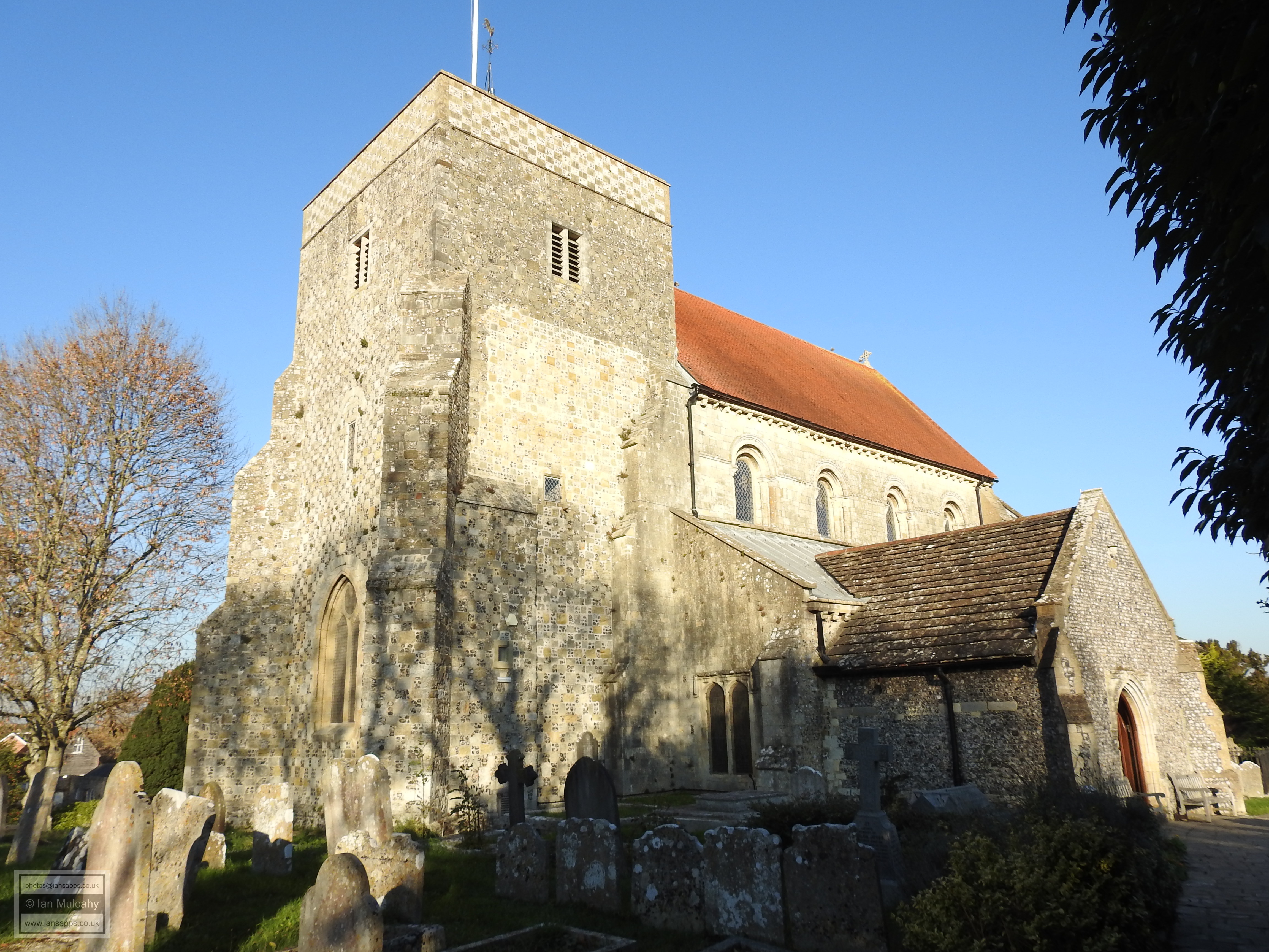
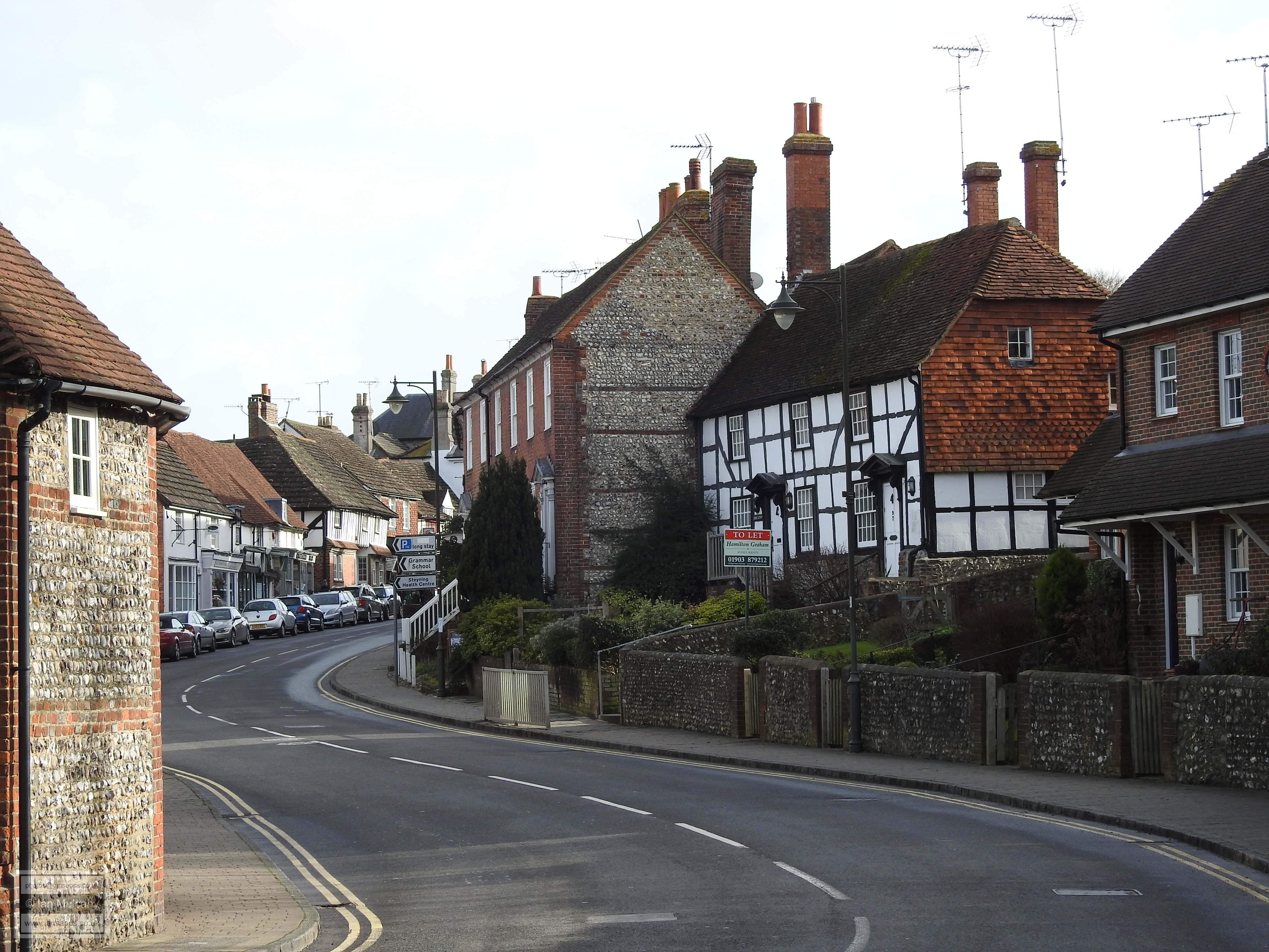
Steyning is a small market town of approximately 7,000 residents situated at the foot of the South Downs in the valley of the River Adur. The name means places characterised by stones though to which stones this name refers remains unknown. The town has been the subject of many excavations and this has enabled archaeologists to confirm that the area saw substantial pre historic activity. Finds include Bronze Age spearheads, pottery and ditches, Iron Age metalwork and numerous Roman artefacts. Steyning began to develop as a settlement in the 7th or 8th century when St Cuthman founded a Minster Church and was subsequently buried here, making Steyning a place of pilgrimage. By 850 Steyning had become a town of regional importance, shifting from an ecclesiastical centre to a royal centre and King Æthelwulf of Wessex was buried here in 858, though his remains were later exhumed and transferred to Winchester. A stone grave cover discovered in the 19th century and kept in the porch of the modern church is believed to be his. It is known that Æthelwulf’s son, Alfred the Great, owned Steyning and his will of 899 left the church and lands to his nephew, Æthelwold. In 1047, Edward the Confessor gave the Church and manorial lands of Steyning to the Abbey Church of the Holy Trinity at Fécamp in Normandy in recognition of the sanctuary provided by them during his exile, and this brought the church under the direct jurisdiction of the Pope. This state of affairs didn’t last long however as in 1052, Earl Godwin (father of King Harold) expelled the monks from Steyning and took the estate for himself. On the Earls death in 1053, Harold didn’t rectify the situation, giving William of Normandy another reason to invade and, in 1066, the church and lands were repossessed and returned to the monks of Fécamp by William, with whom it remained until the dissolution.
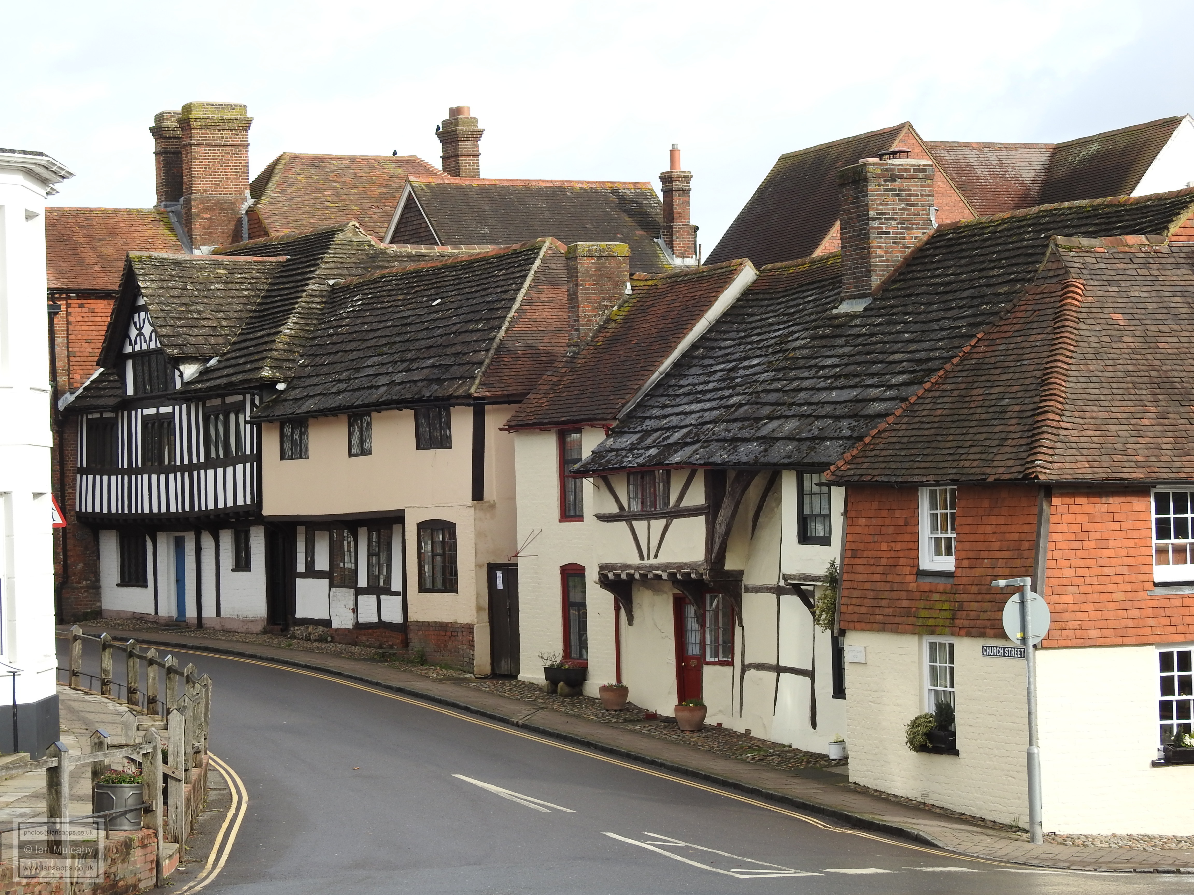
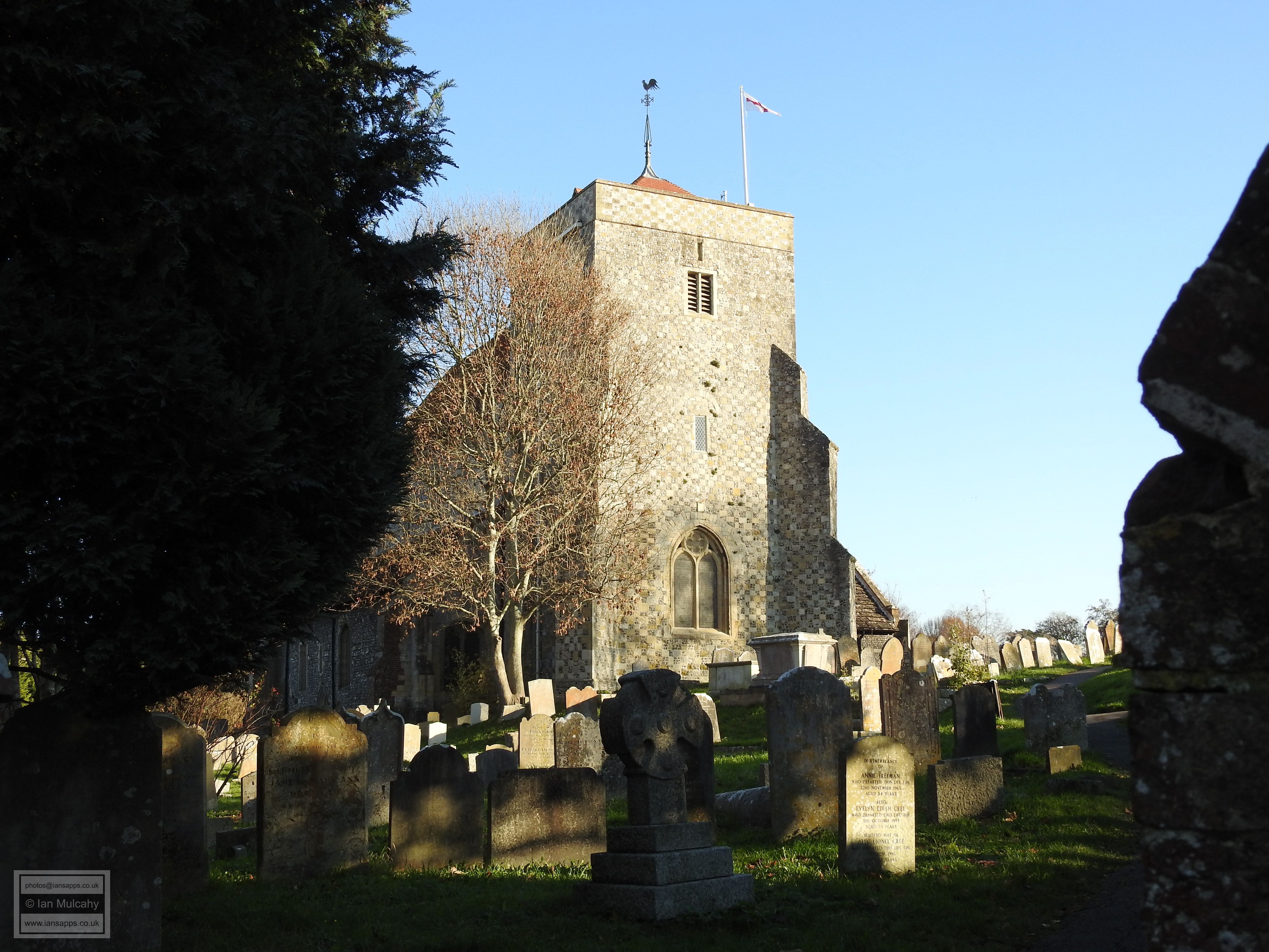
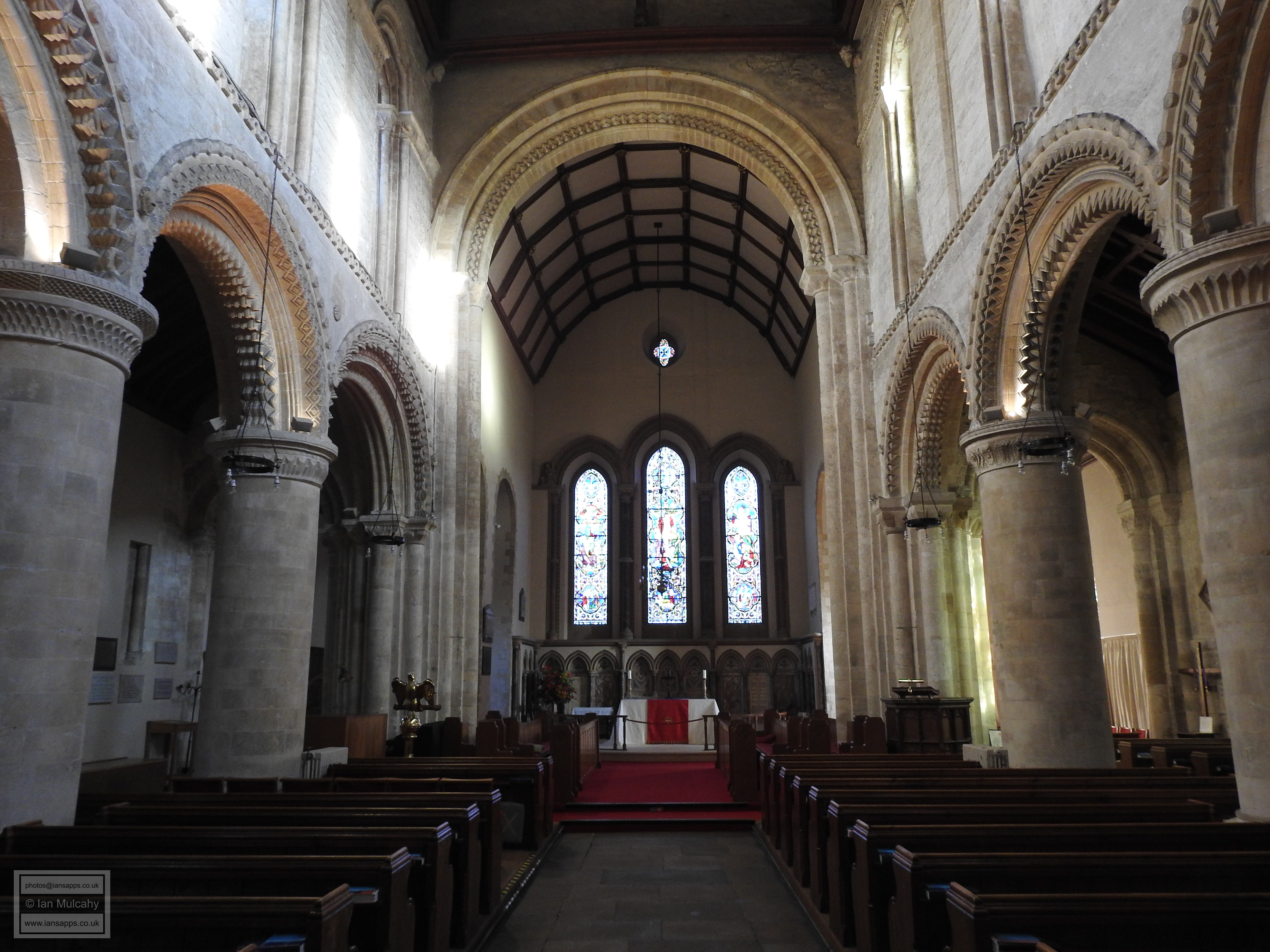
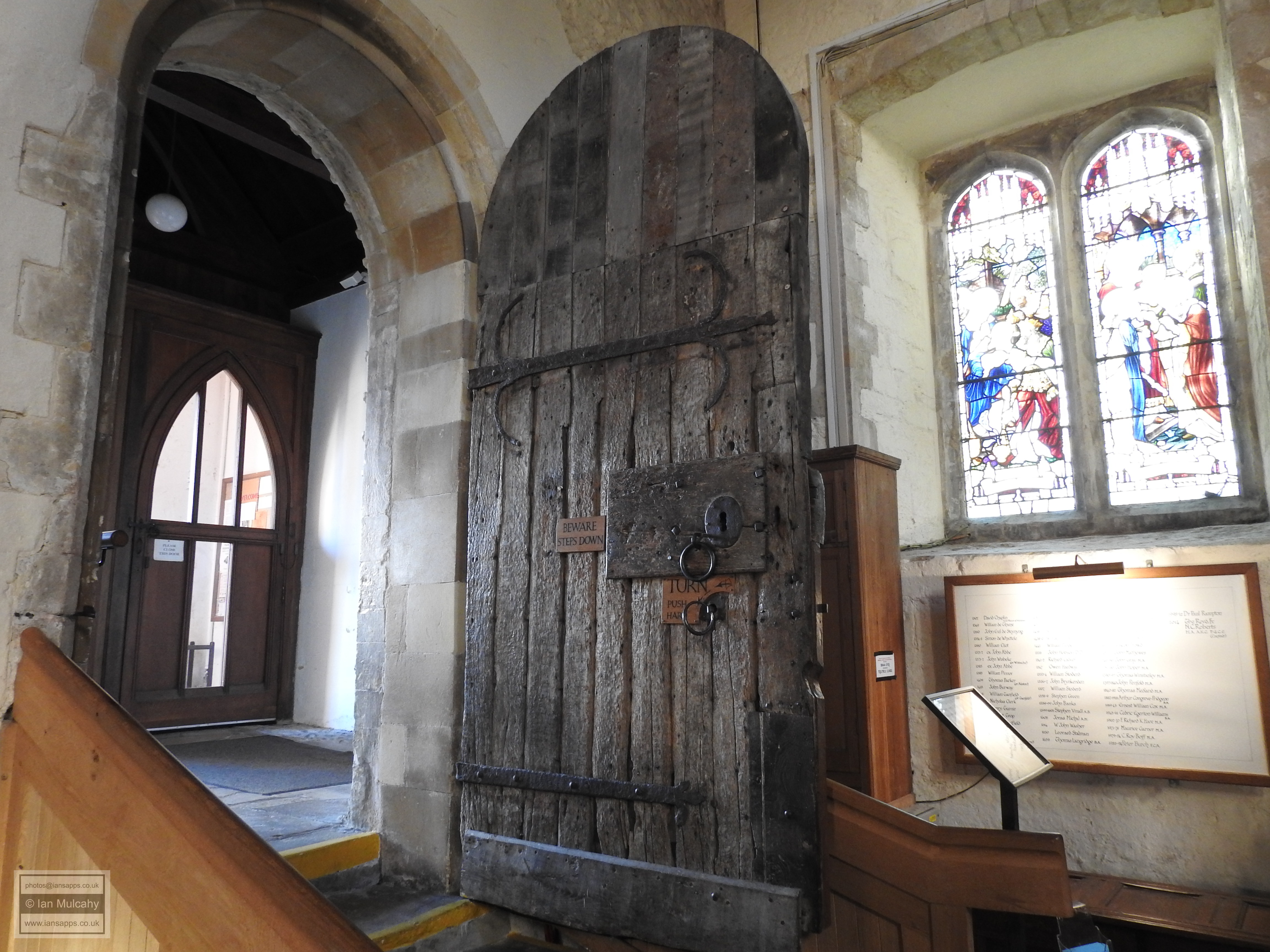
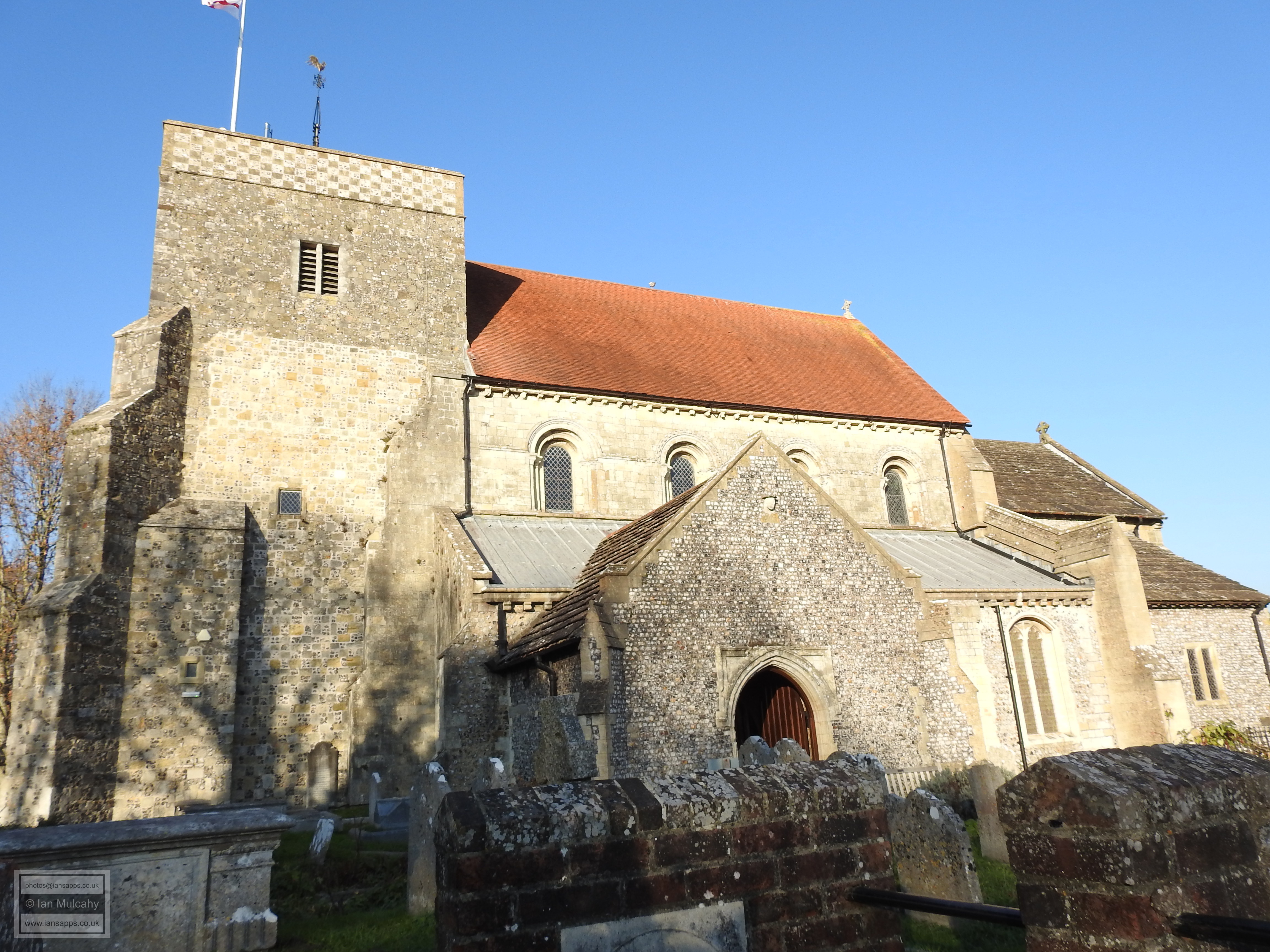
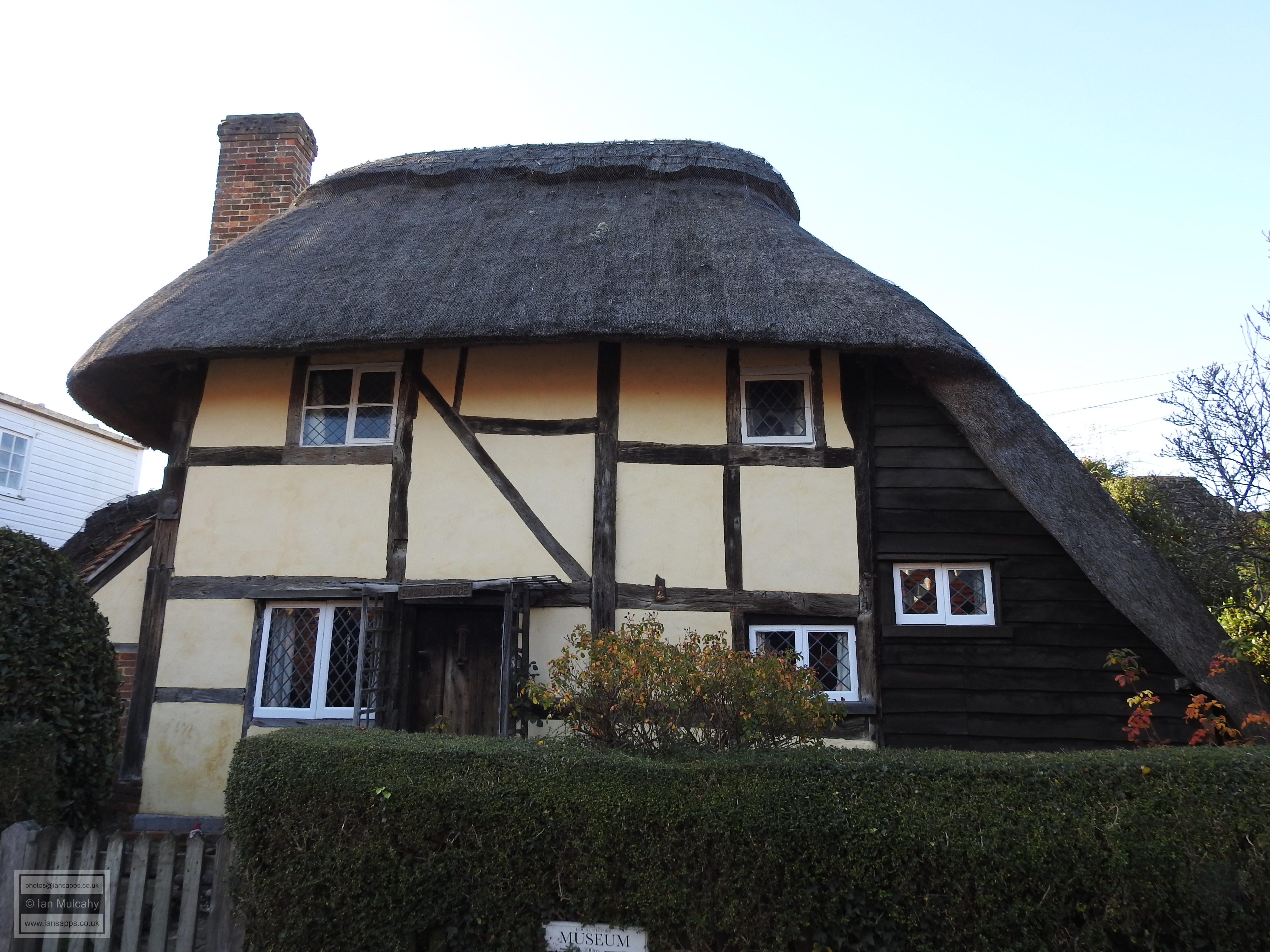
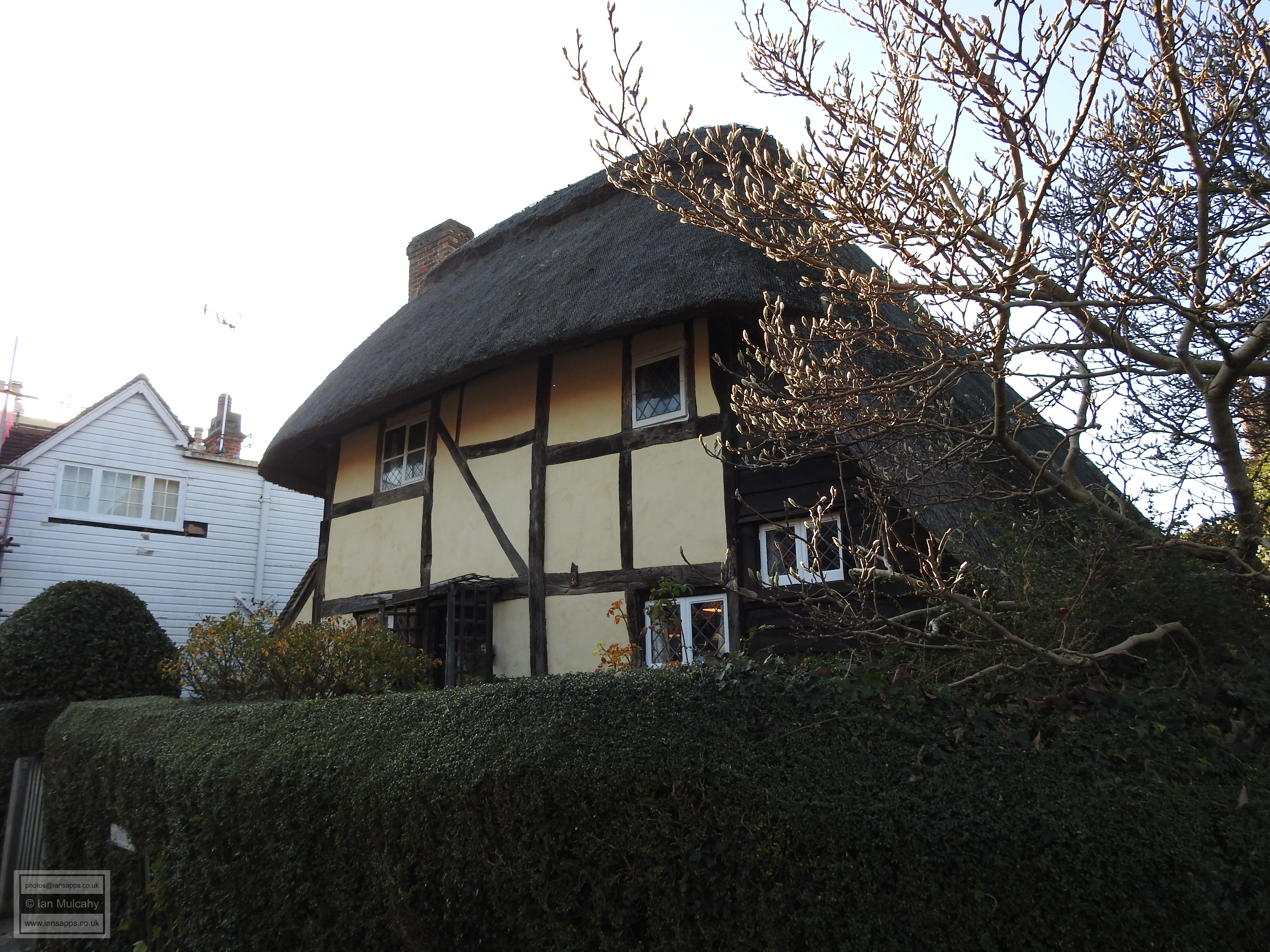
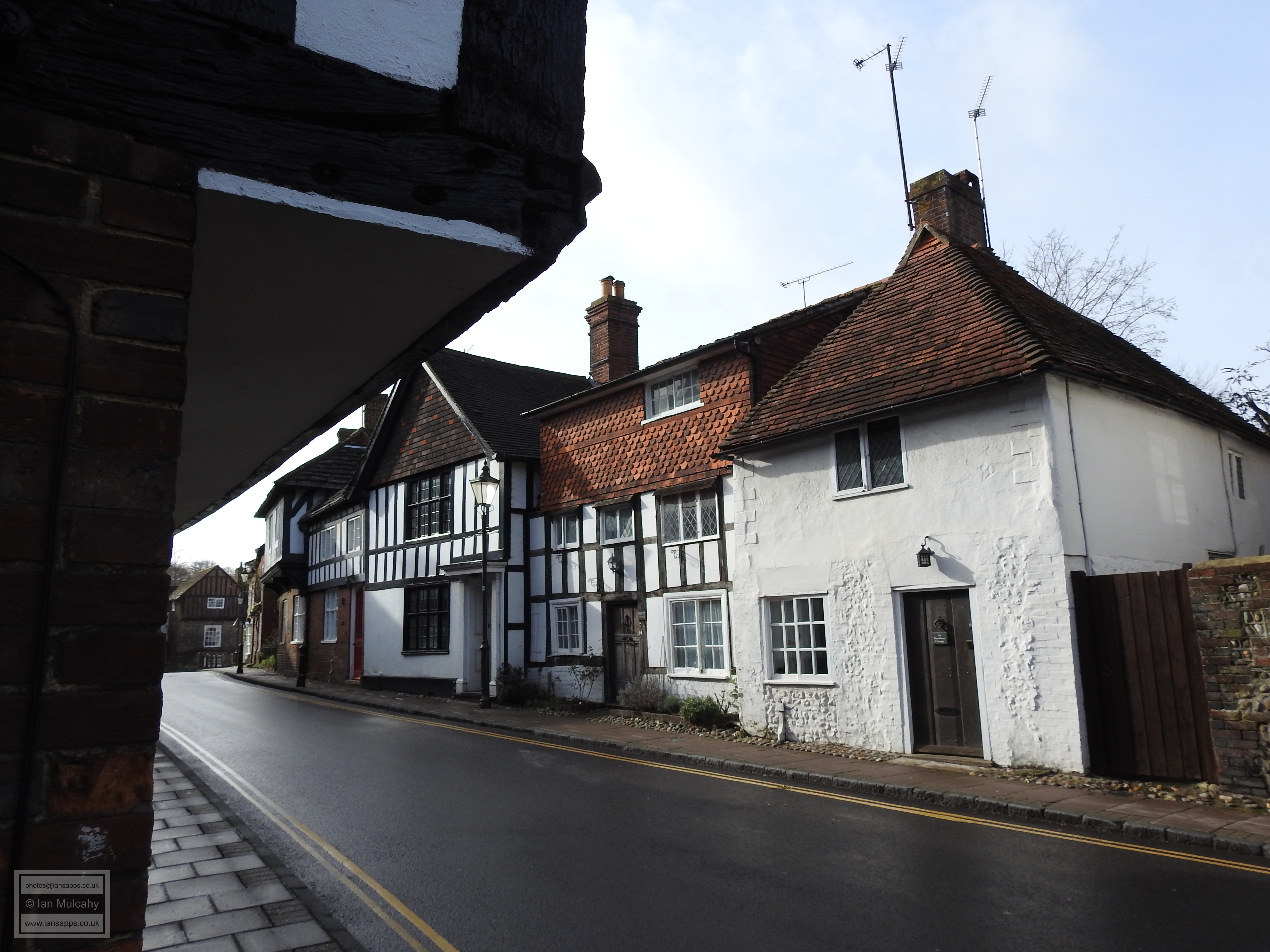
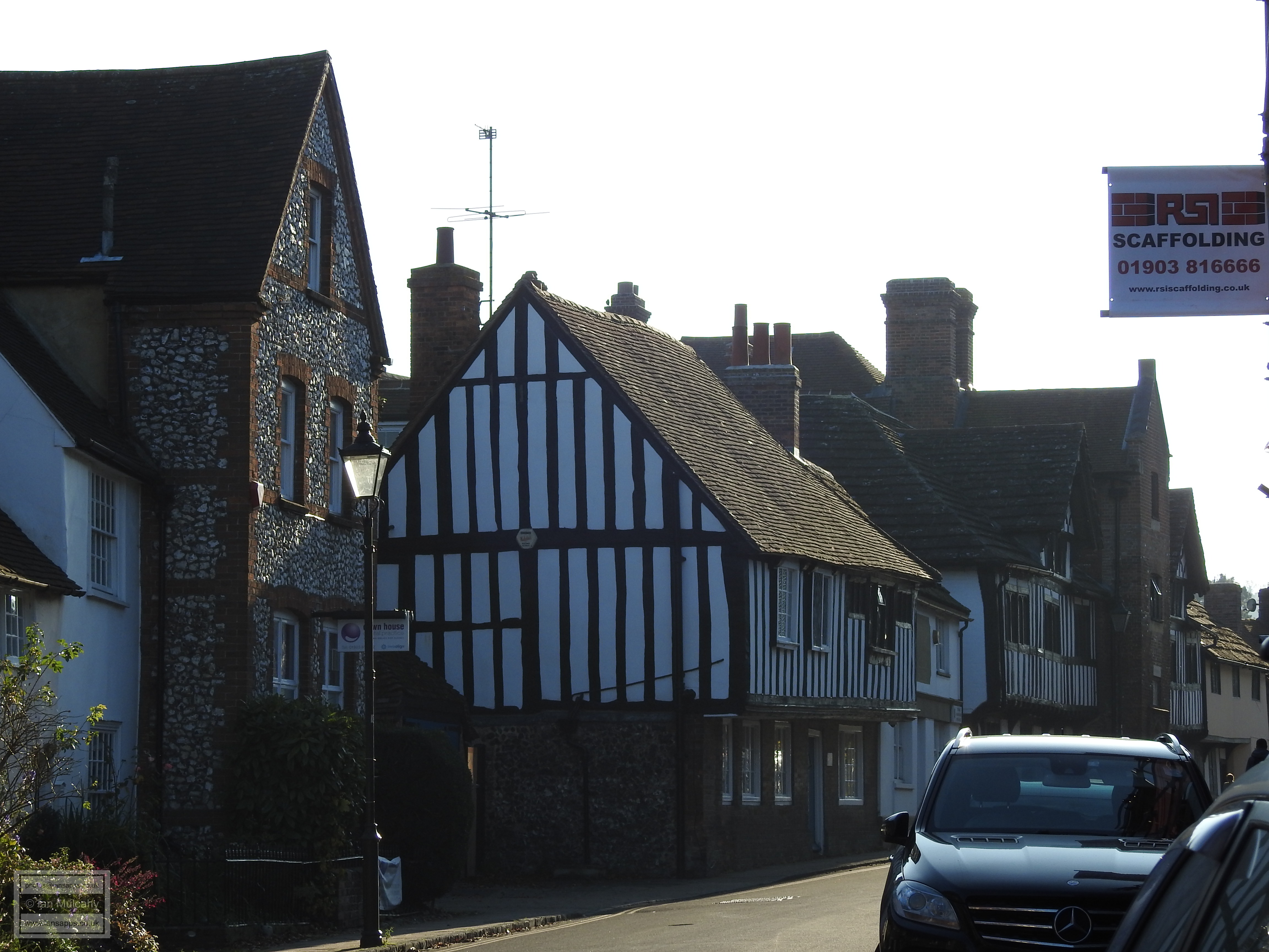
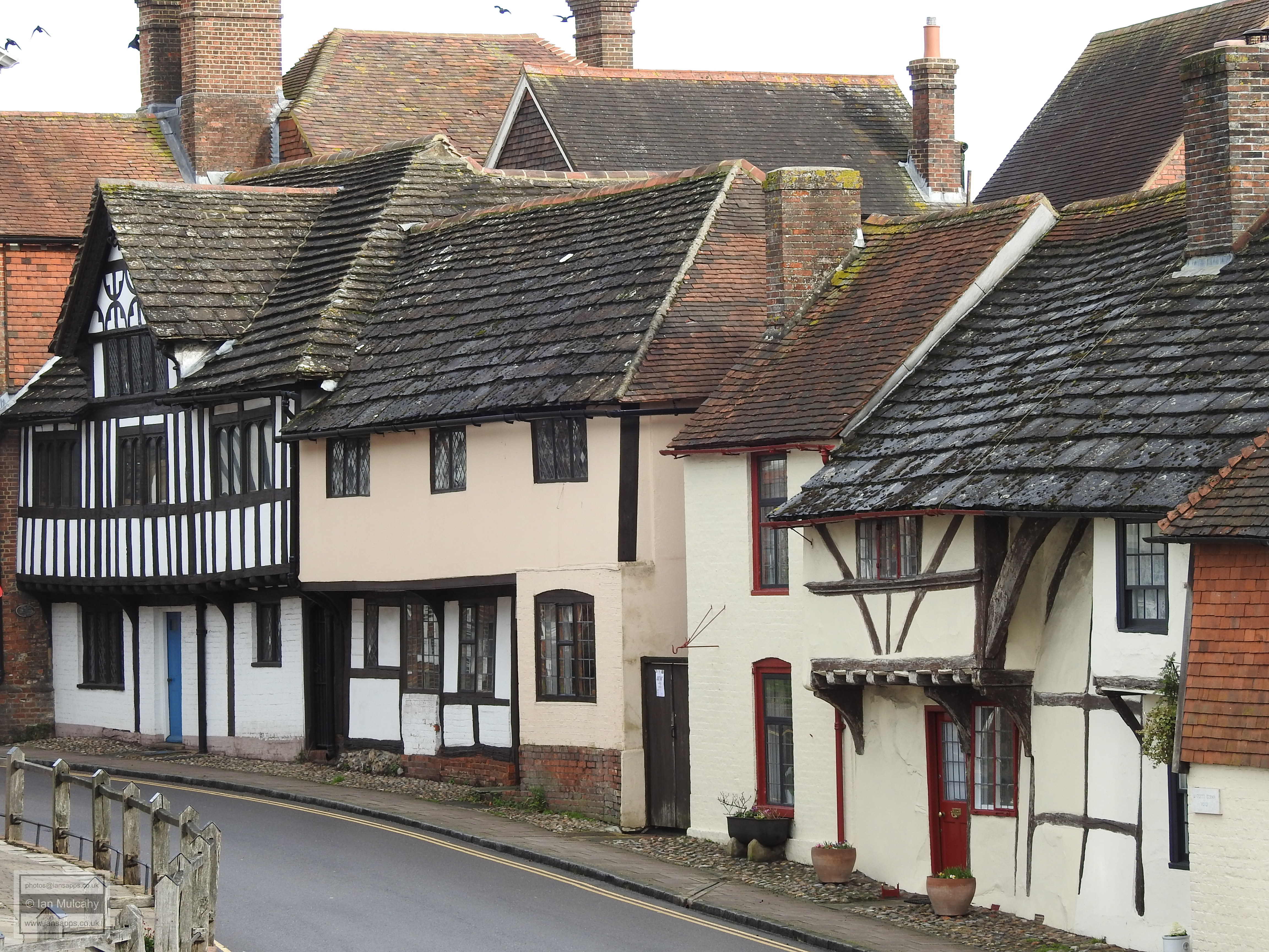
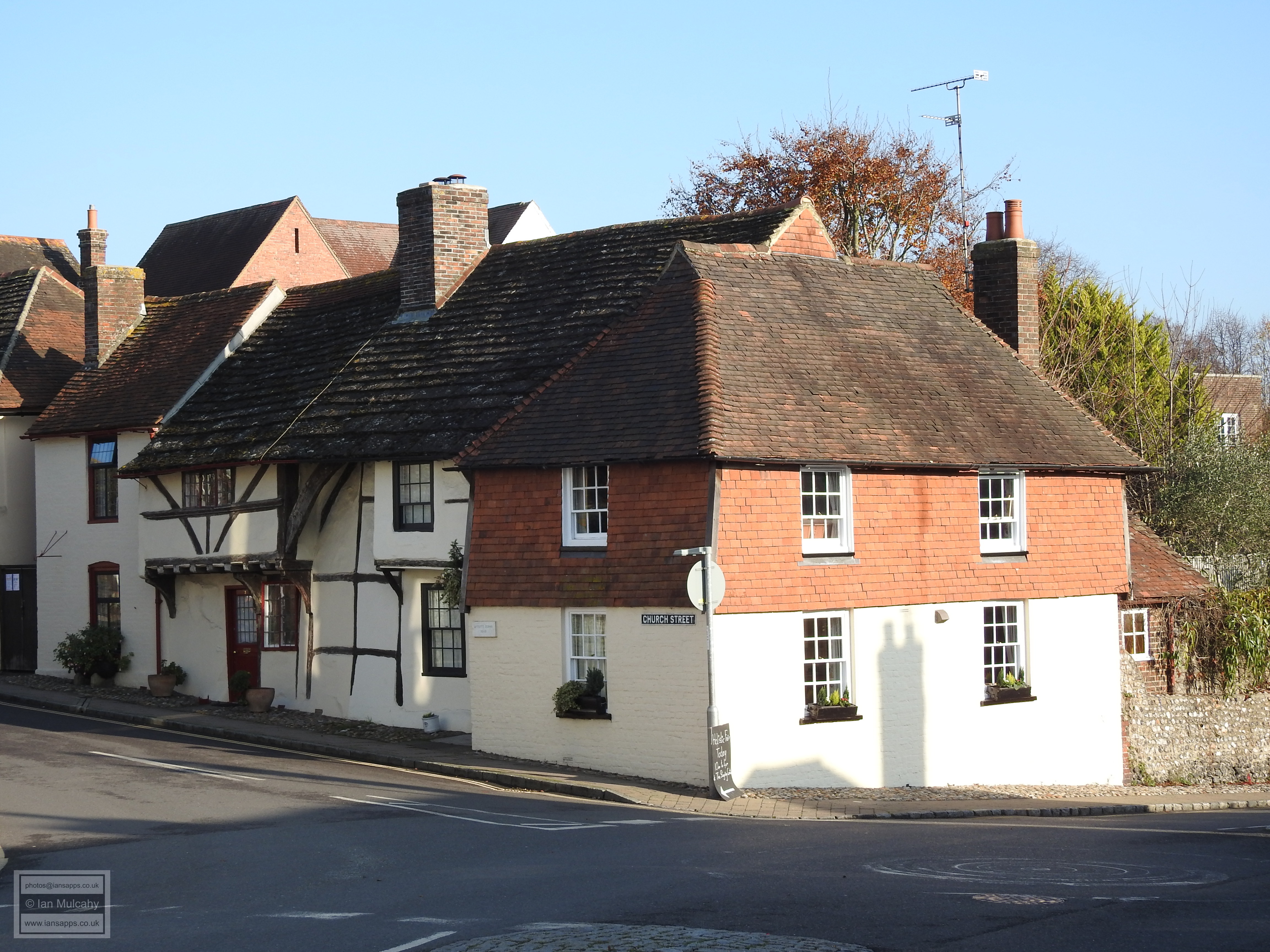
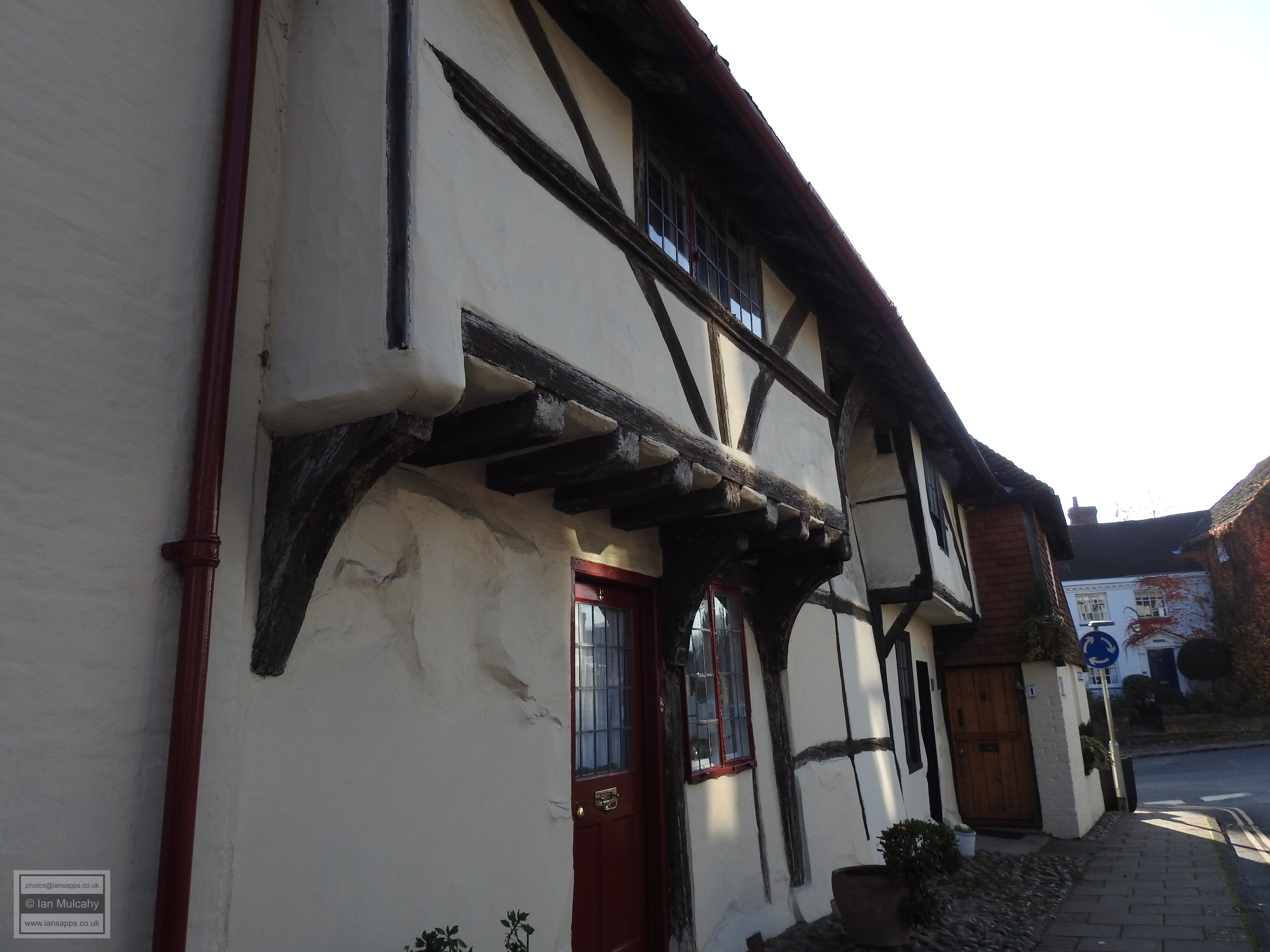
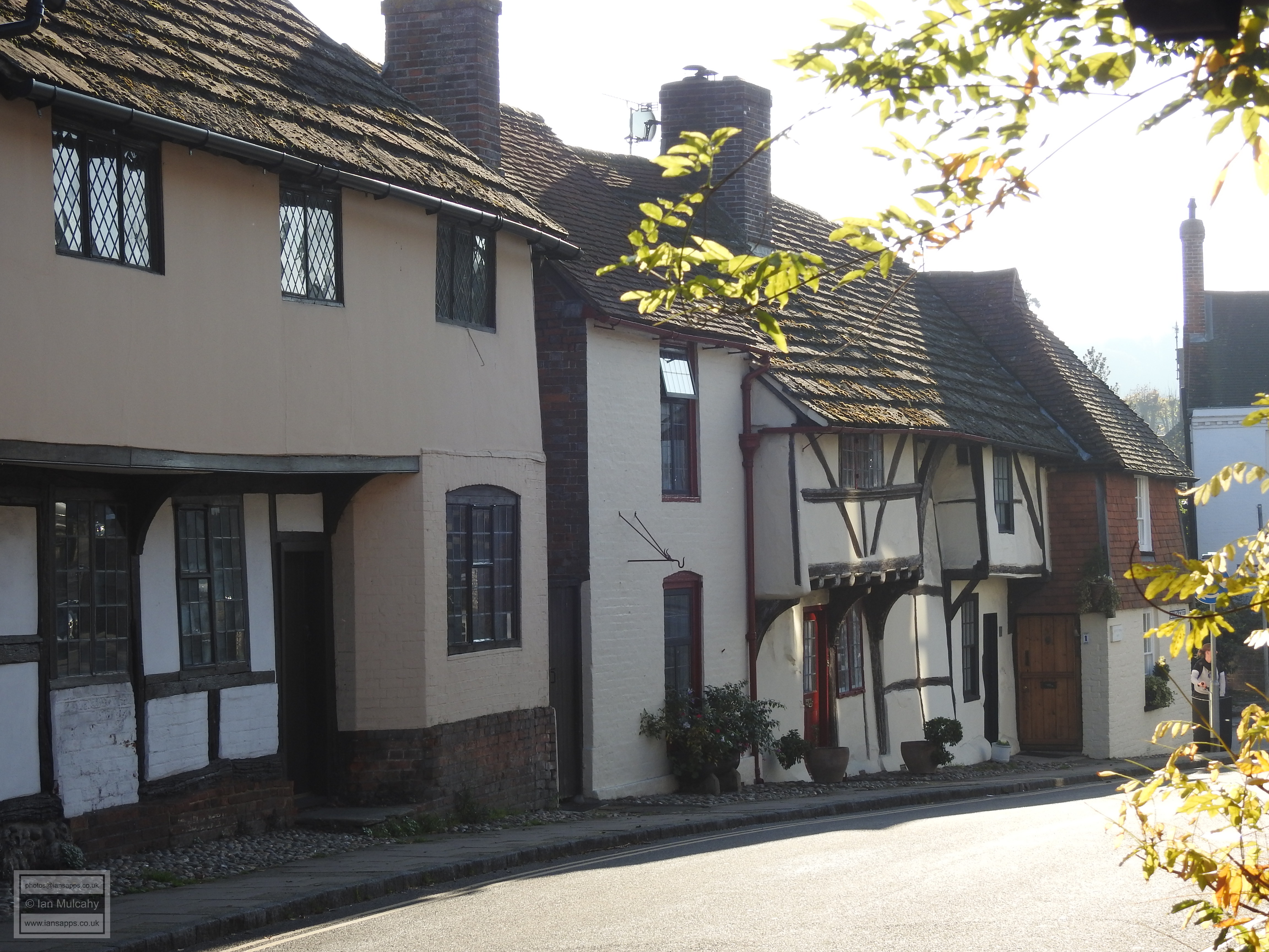
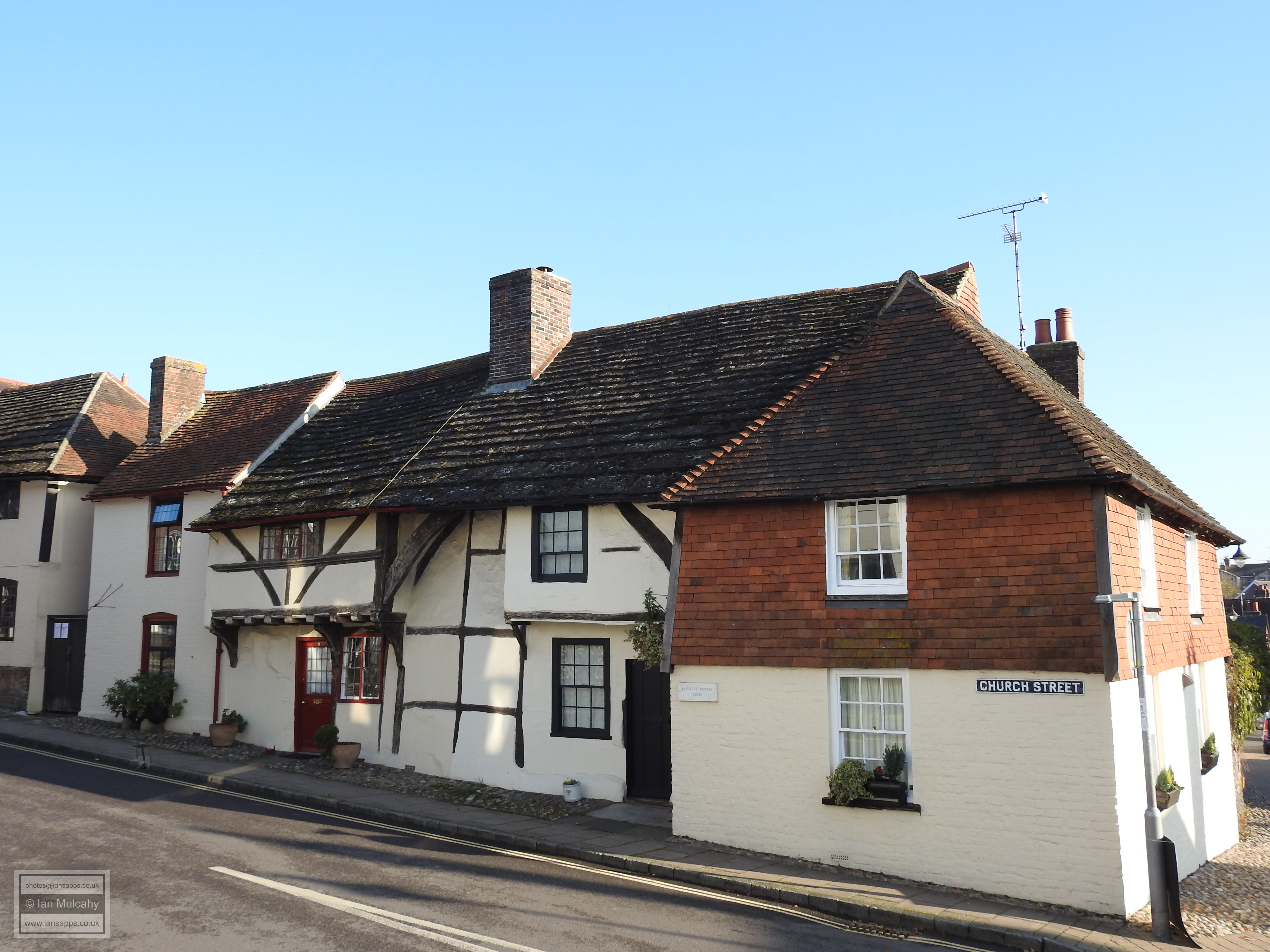
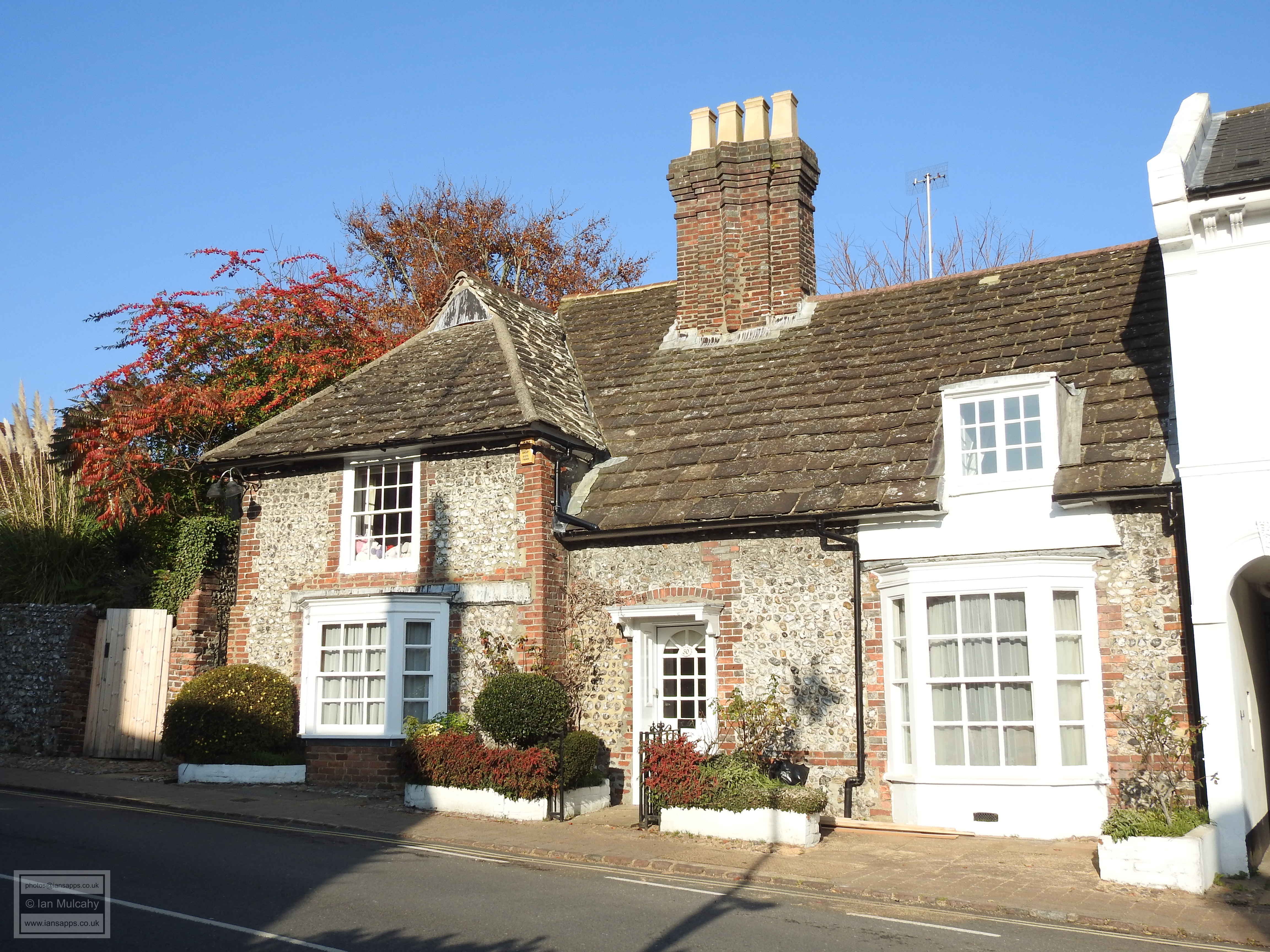
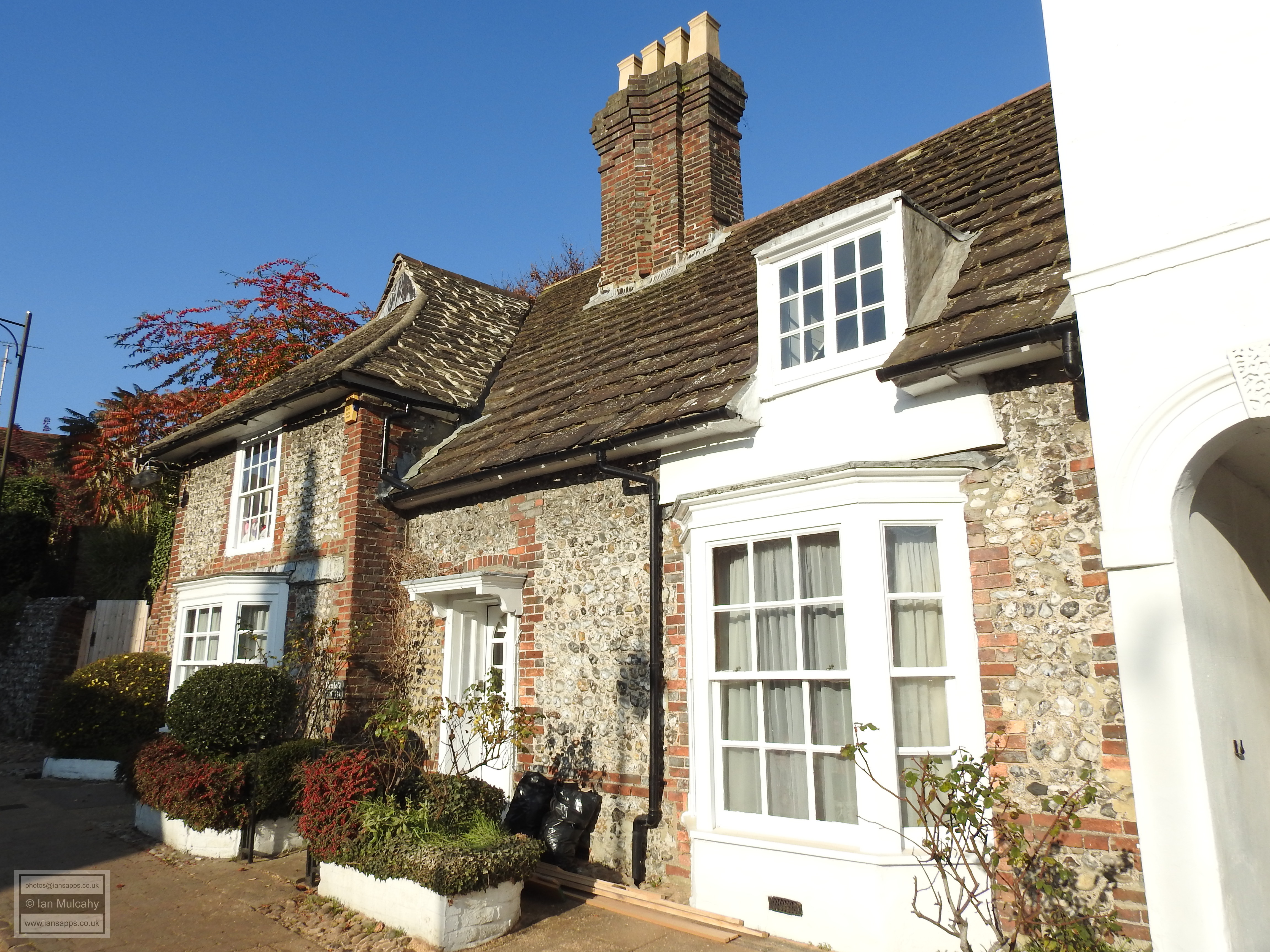
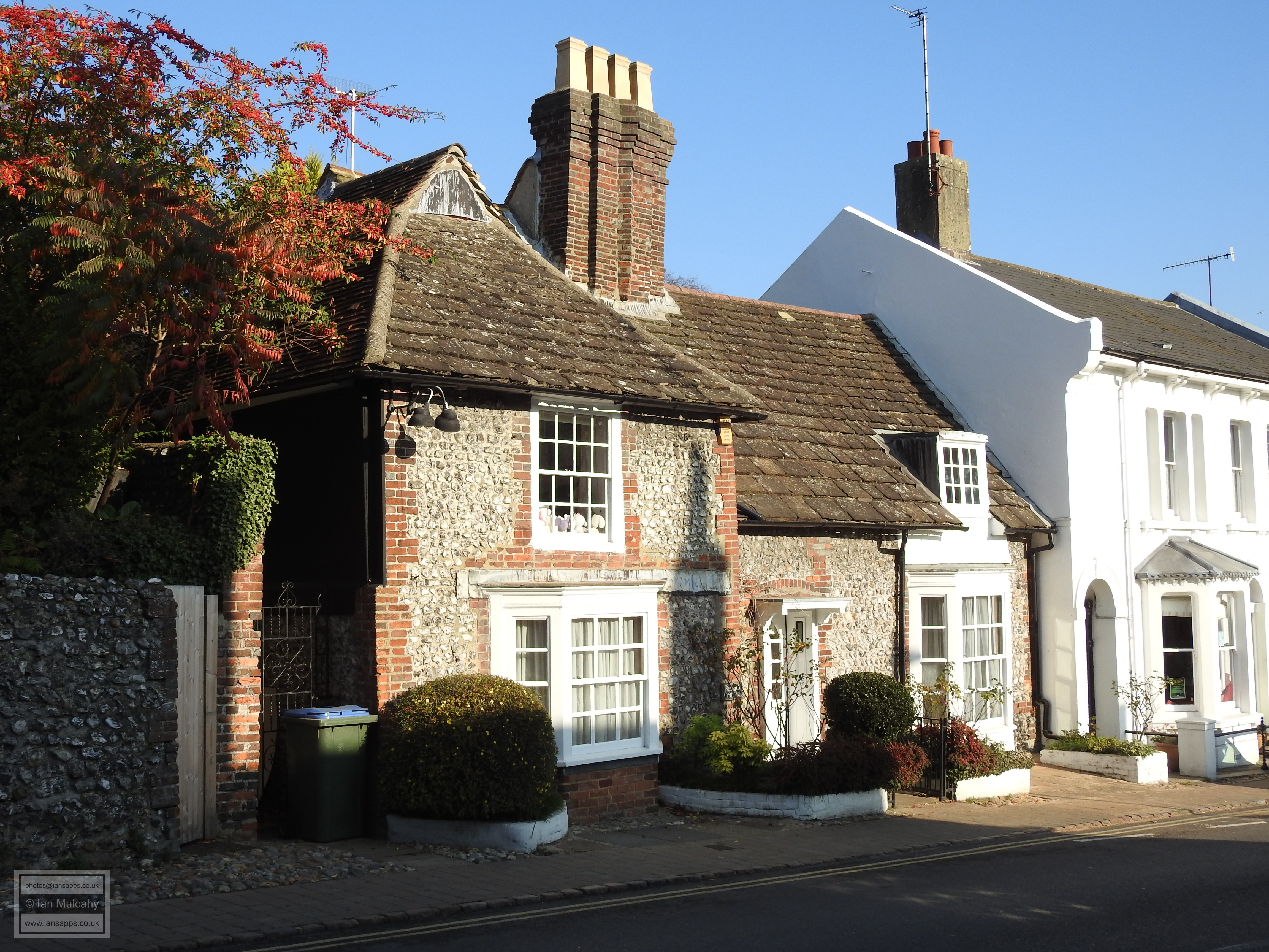
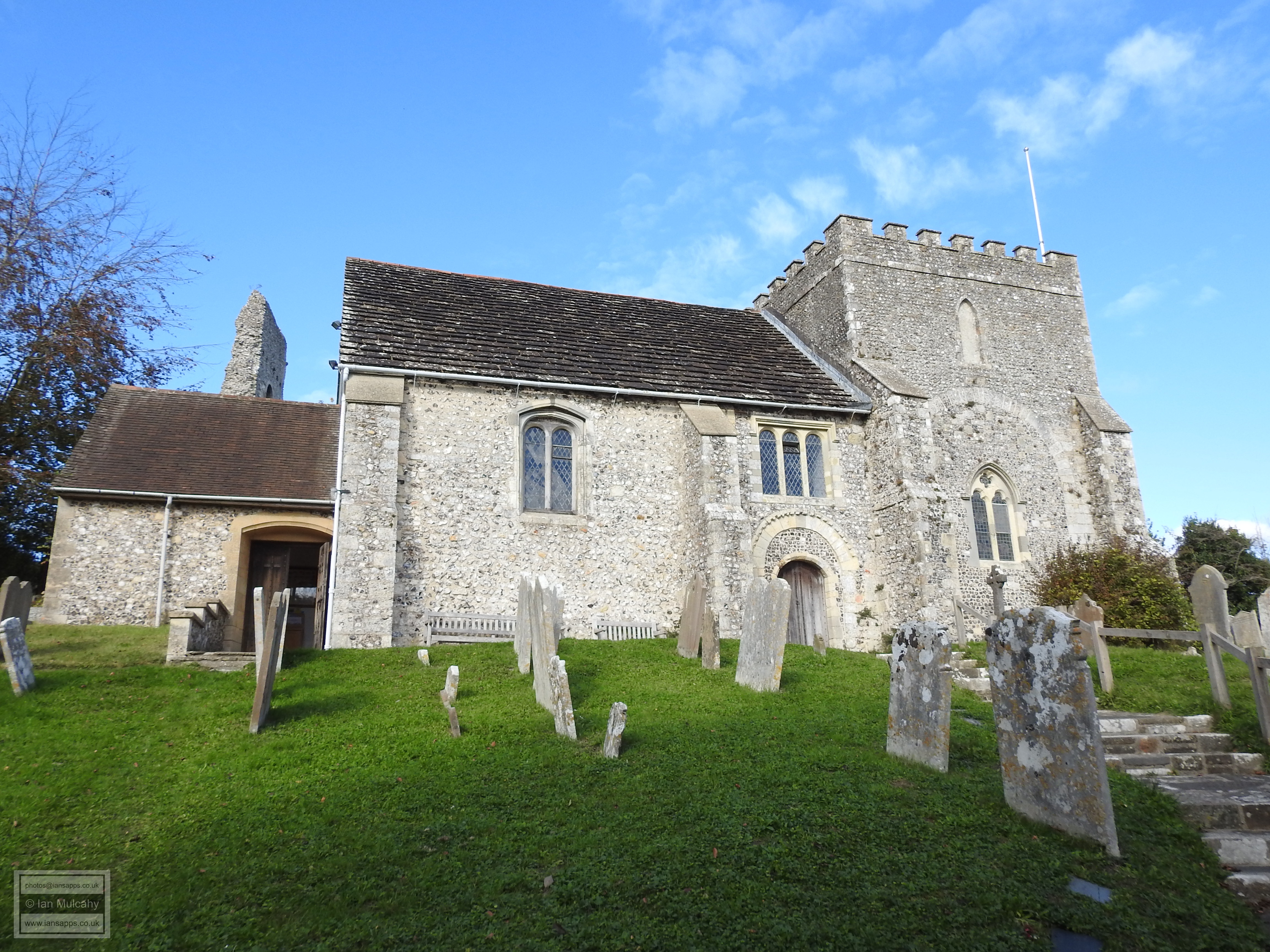
Excavations to the east of the church in 1988 revealed the remains of a small cluster of mid-10th century buildings within an Anglo-Saxon Farmstead, one of which was reconstructed at the Weald & Downland Museum (see Tudor Life, July 2019) and by the end of King Cnut’s reign in 1035, a mint was in operation at Steyning which remained in use until the time of William II. The Domesday Book records Steyning as being home to 223 villagers, 96 smallholders and 9 slaves, giving a total population of 328 which placed the town amongst the top 20% of recorded settlements by populace. Due to plague and economic factors the size of the population remained steady and was of a similar size in 1524. Other archaeological digs have discovered the remains of buildings to the south and west of the church which can be dated to the 10th, 11th & 12th centuries. In common with East Grinstead (see Tudor Life, July 2020), Steyning bore witness to the execution of a Protestant Martyr; 25 year old John Launder of Godstone, Surrey who was tied to a stake and burnt to death on Chantry Green in Church Street on 23 July 1555. Having parked the car close by, we will start our walk at the oldest extant building in Steyning, which is, of course, The Church of St Andrew. The current building is not, however, the timber church that was founded and constructed by St Cuthman, but a grand stone structure, in keeping with its former minster status, built on the site of the Saxon church. The earliest parts, including many supporting arches inside, date back to 1090, but the bulk of the current fabric of the building was constructed between 1160 & 1180 and the internal door of the south porch is that which was installed at this time. By 1263 the dedication had changed from St Cuthbert to St Andrew, when it is first documented as such, but this is likely to have happened either pre conquest or at the time of the rebuild shortly after the conquest. After the dissolution, the eastern end of the church fell into disrepair resulting in the loss of the tower, the chancel and the eastern transepts. The current tower, at the west end of the church, was built in 1602. Walking away from St Andrew’s along Church Street, an ancient track which formed part of the medieval centre of the town, our first building of interest on the western side of the road is the thatched and timber framed Saxon Cottage; the surviving southern wing of what was originally a much larger house built in 1550. The owners of the house would have been able to watch from their windows as John Launder was burnt at the stake (see above) in 1555 on Chantry Green.
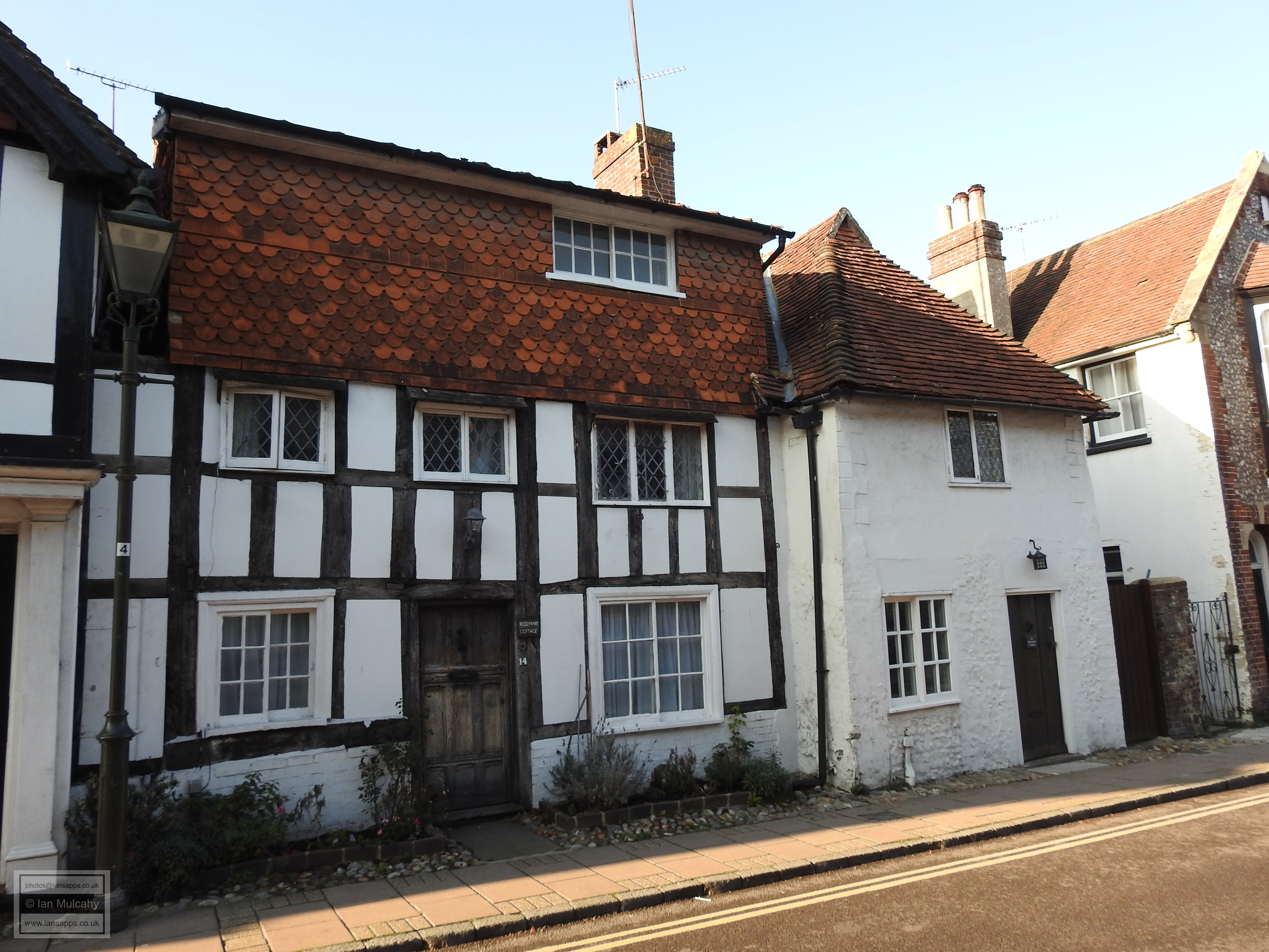
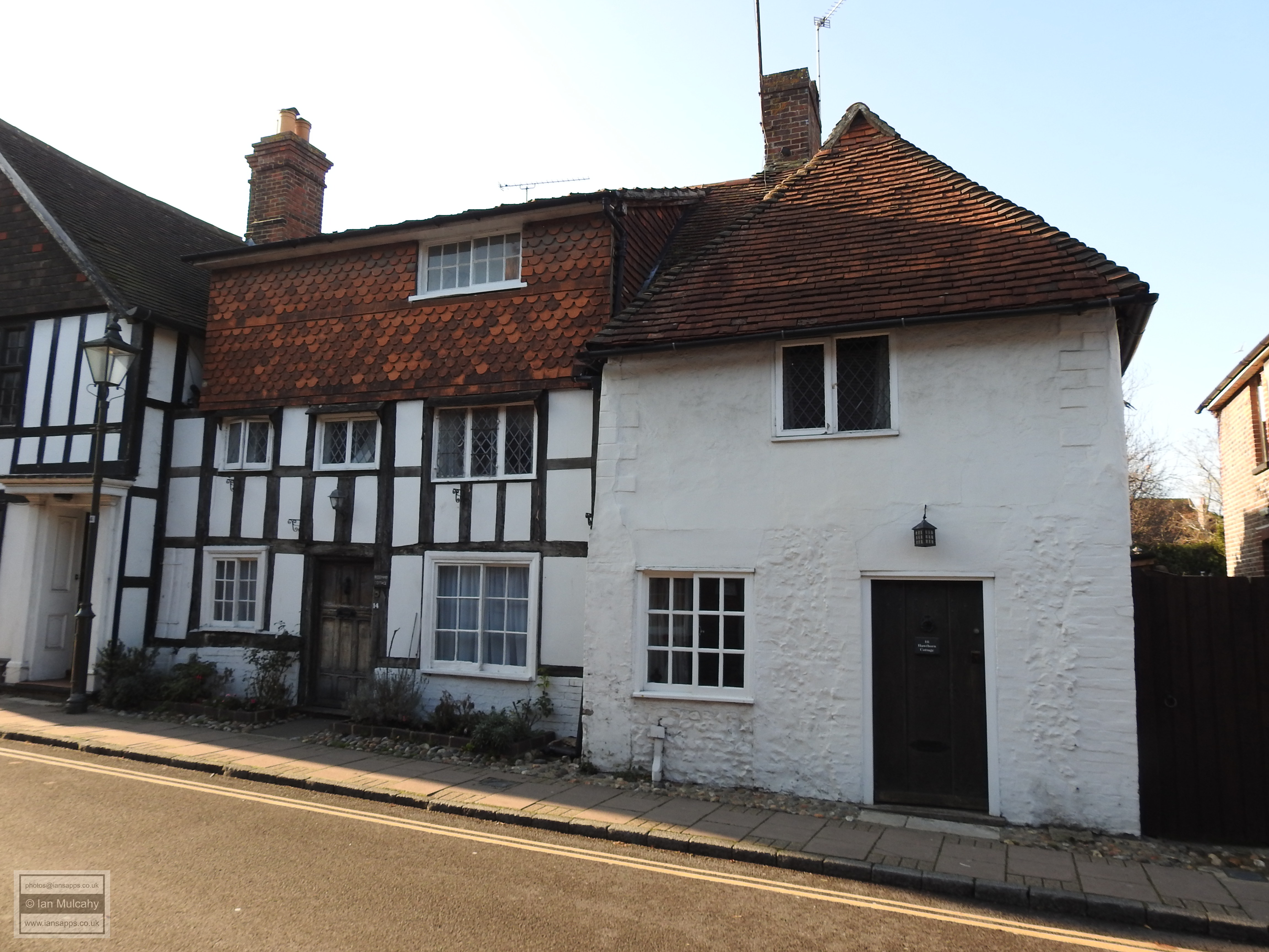
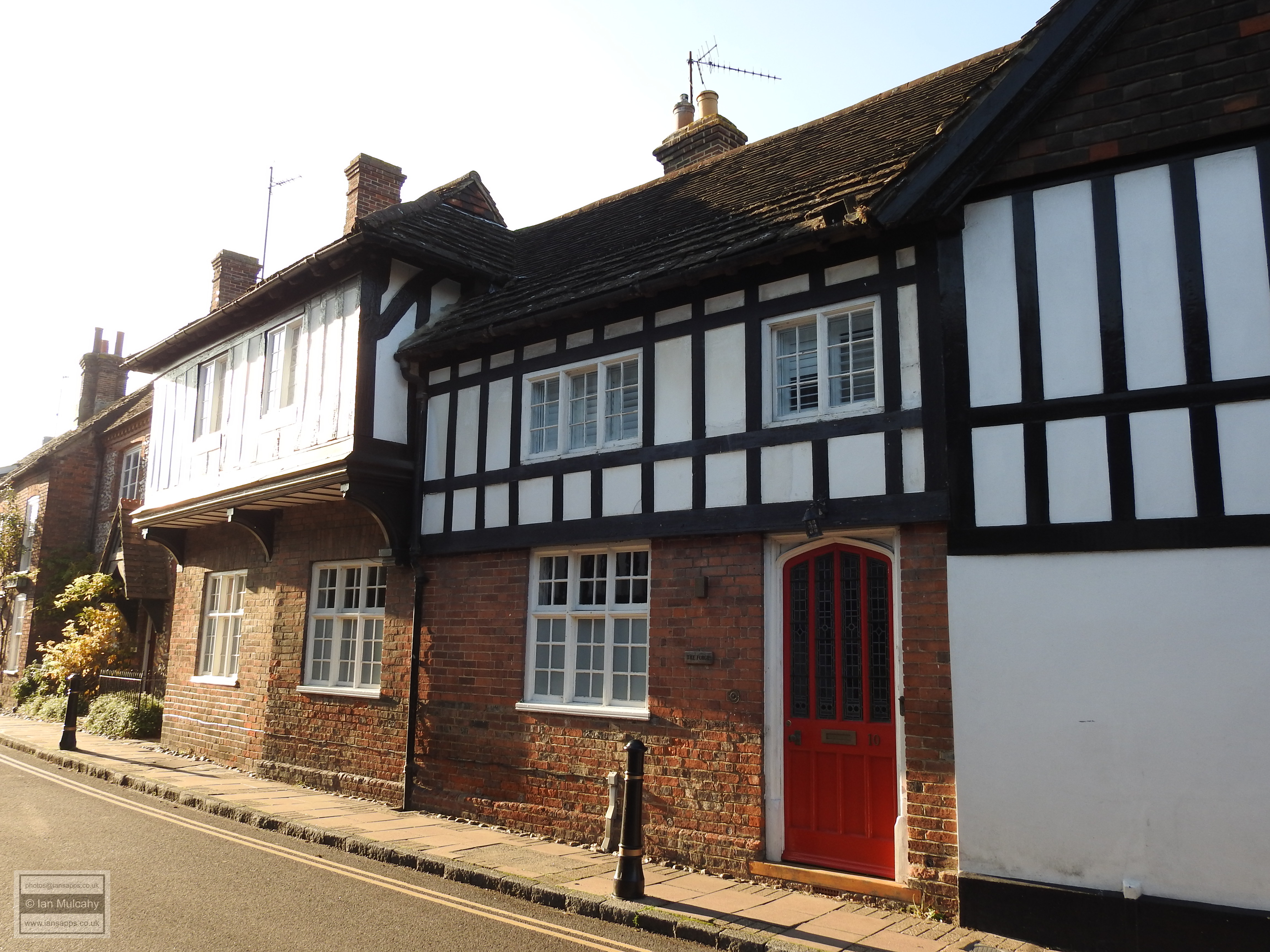
A little further south are the conjoined Hawthorne Cottage and Rosemary Cottage. Rosemary Cottage, to the left, is an early 15th century hall house with a peculiar looking third storey which is not a modern addition, but is certainly not original either. Hawthorne Cottage is a 16th century crosswing addition to Rosemary Cottage which is now an independent property. Adjoining to the south is 12 Church Street, a 16th century crosswing addition to The Forge, another 15th century hall house which has been much restored since its days as a blacksmiths workshop.
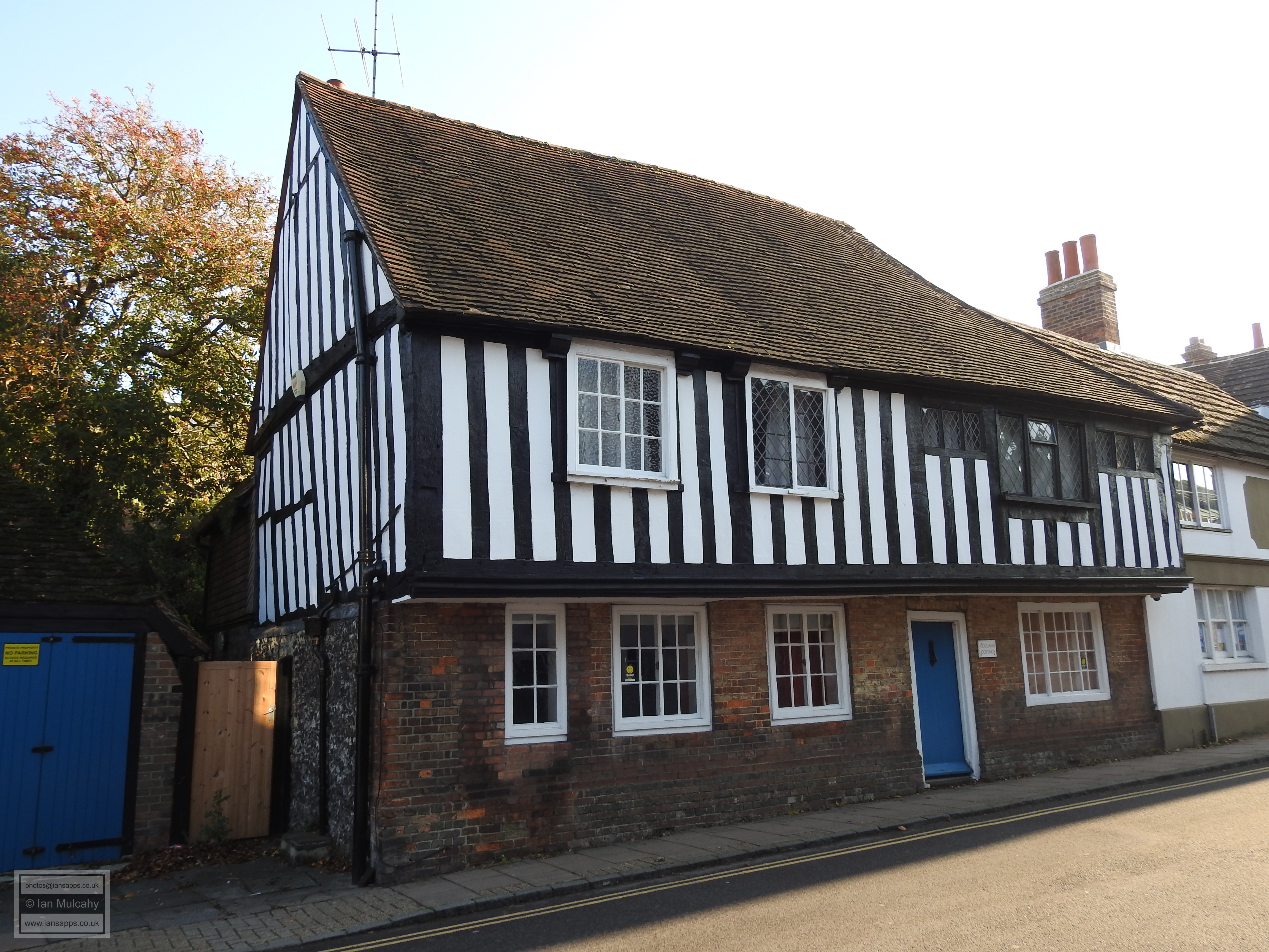
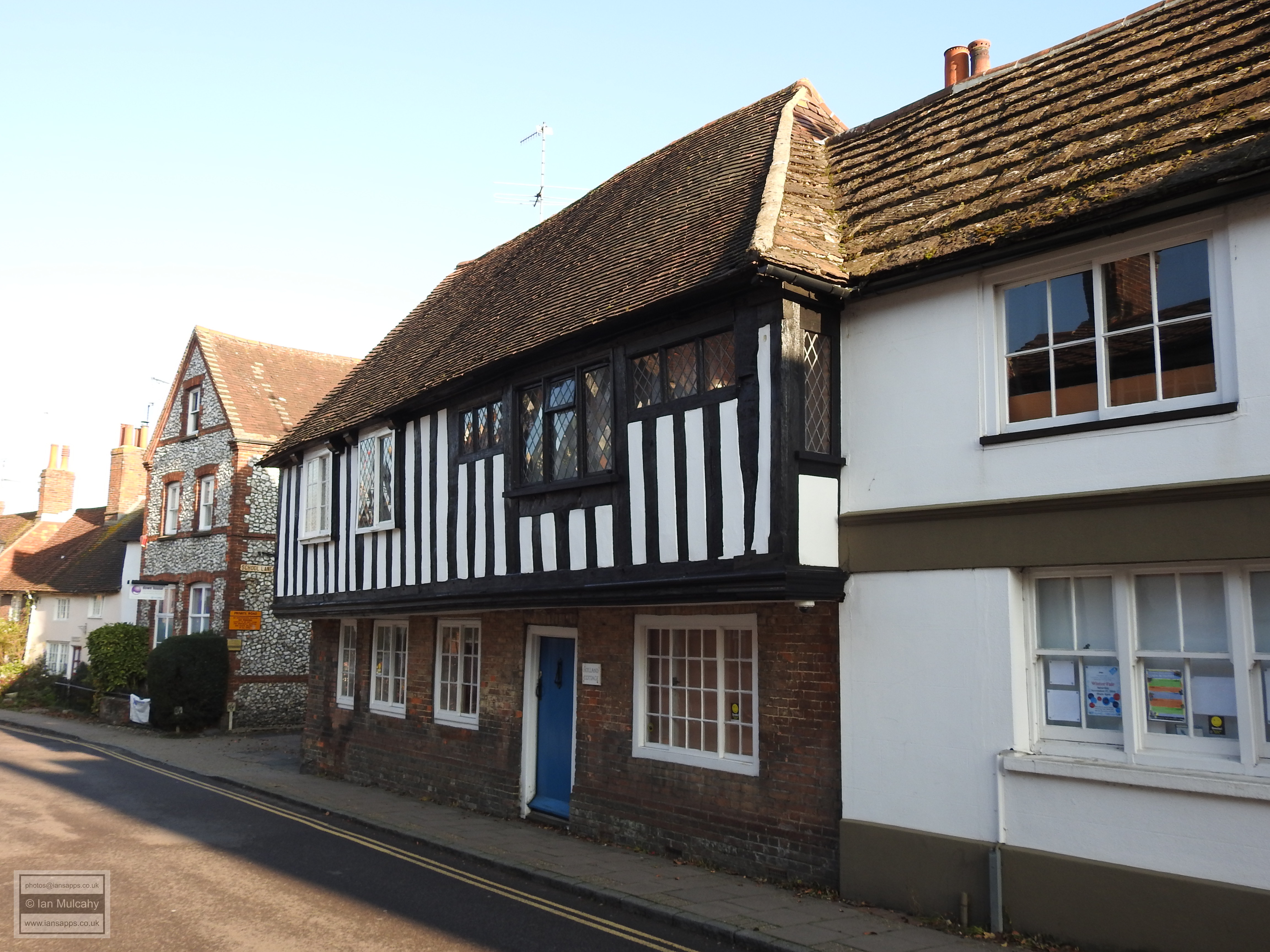
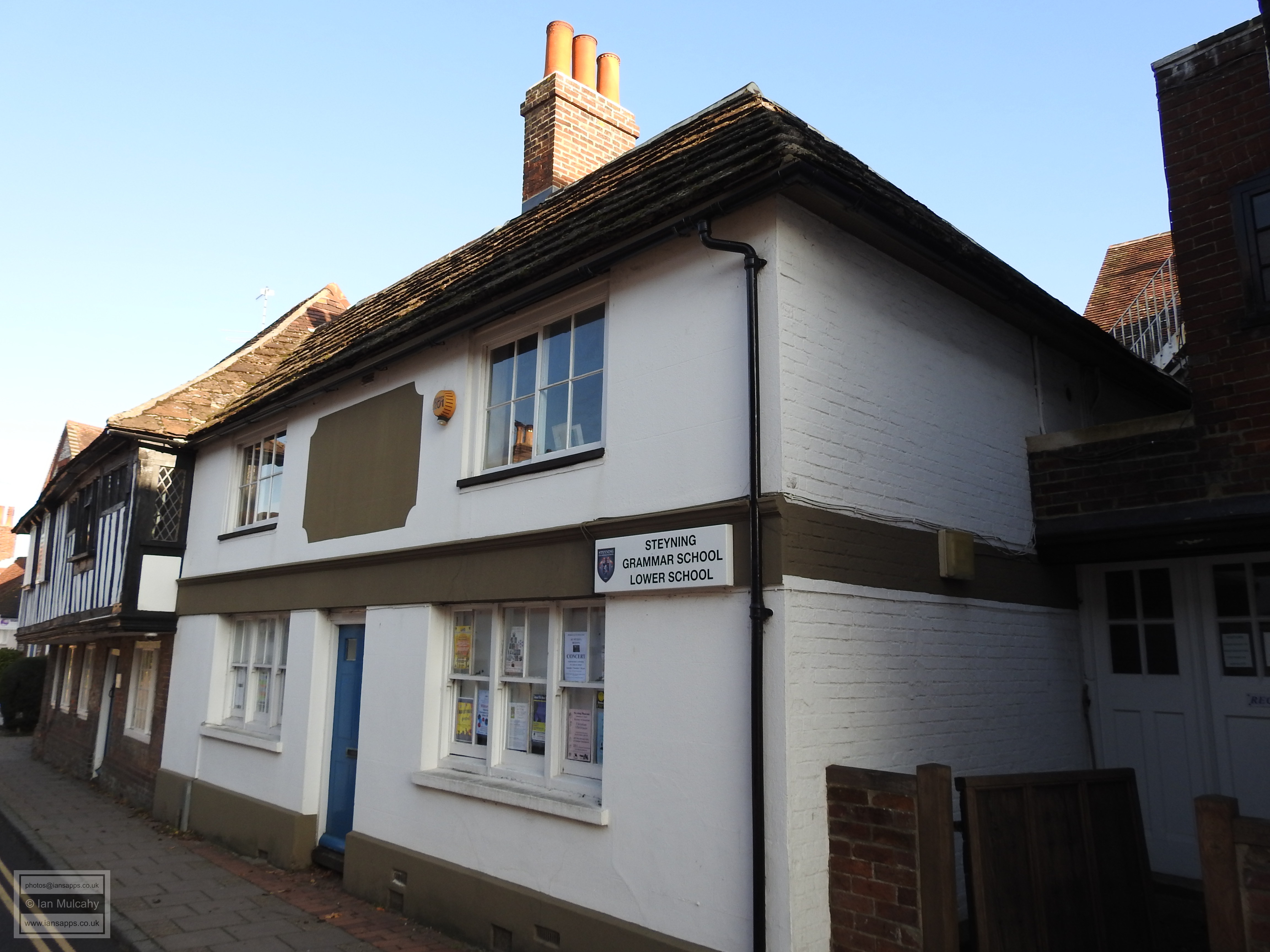
Crossing to the east of Church Street our first building here, on the southern corner of School Lane, is Holland Cottage, a lovely timber framed hall house built in around 1500 which boasts a full length jetty. Its similarly aged neighbour, 11 Church Street, is also a hall house, but unfortunately the timbers are hidden behind later rendering. Formerly a pub known as the Smugglers Arms, number 11 is now the bursar’s office for Steyning Grammar school.
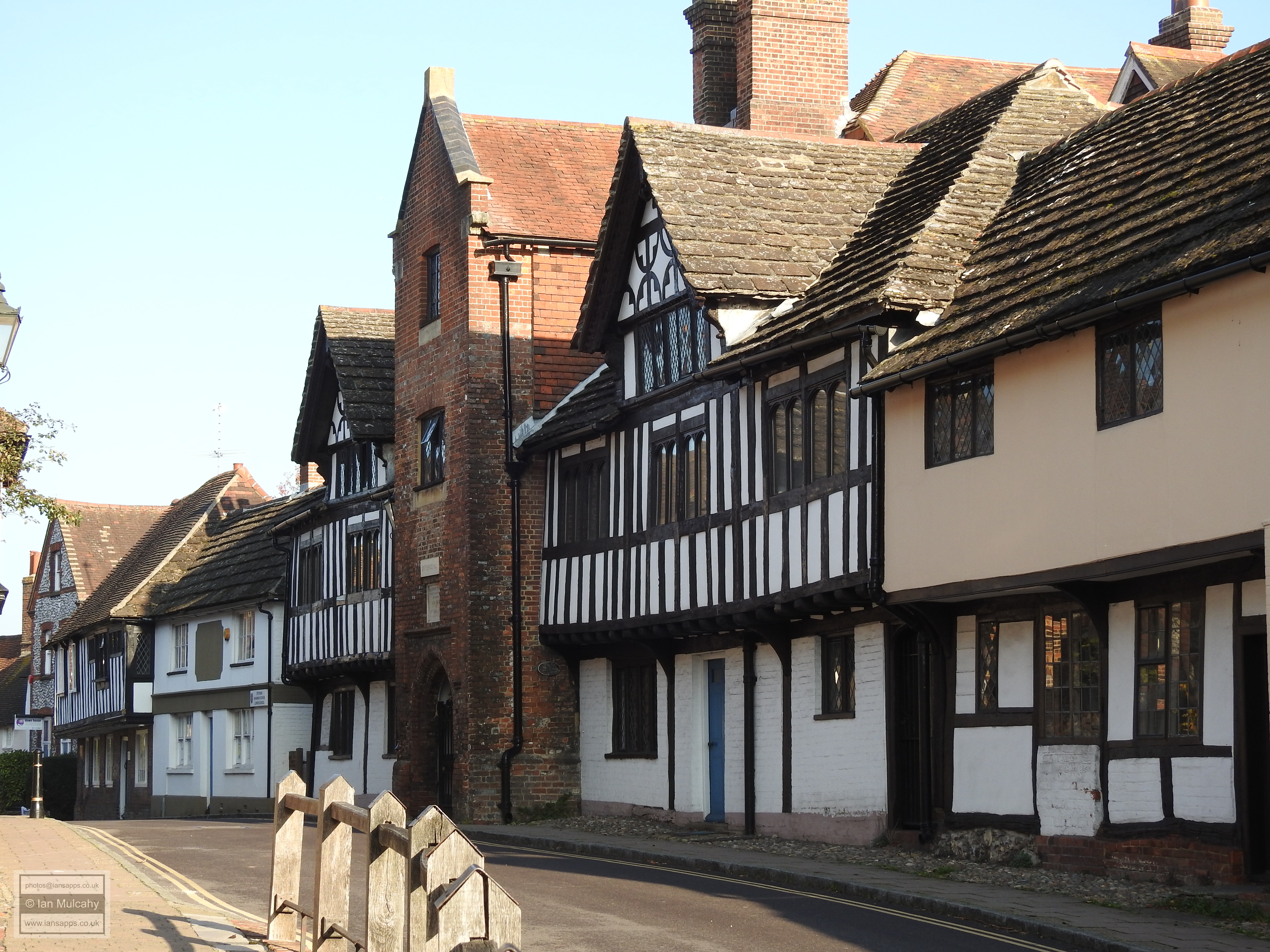
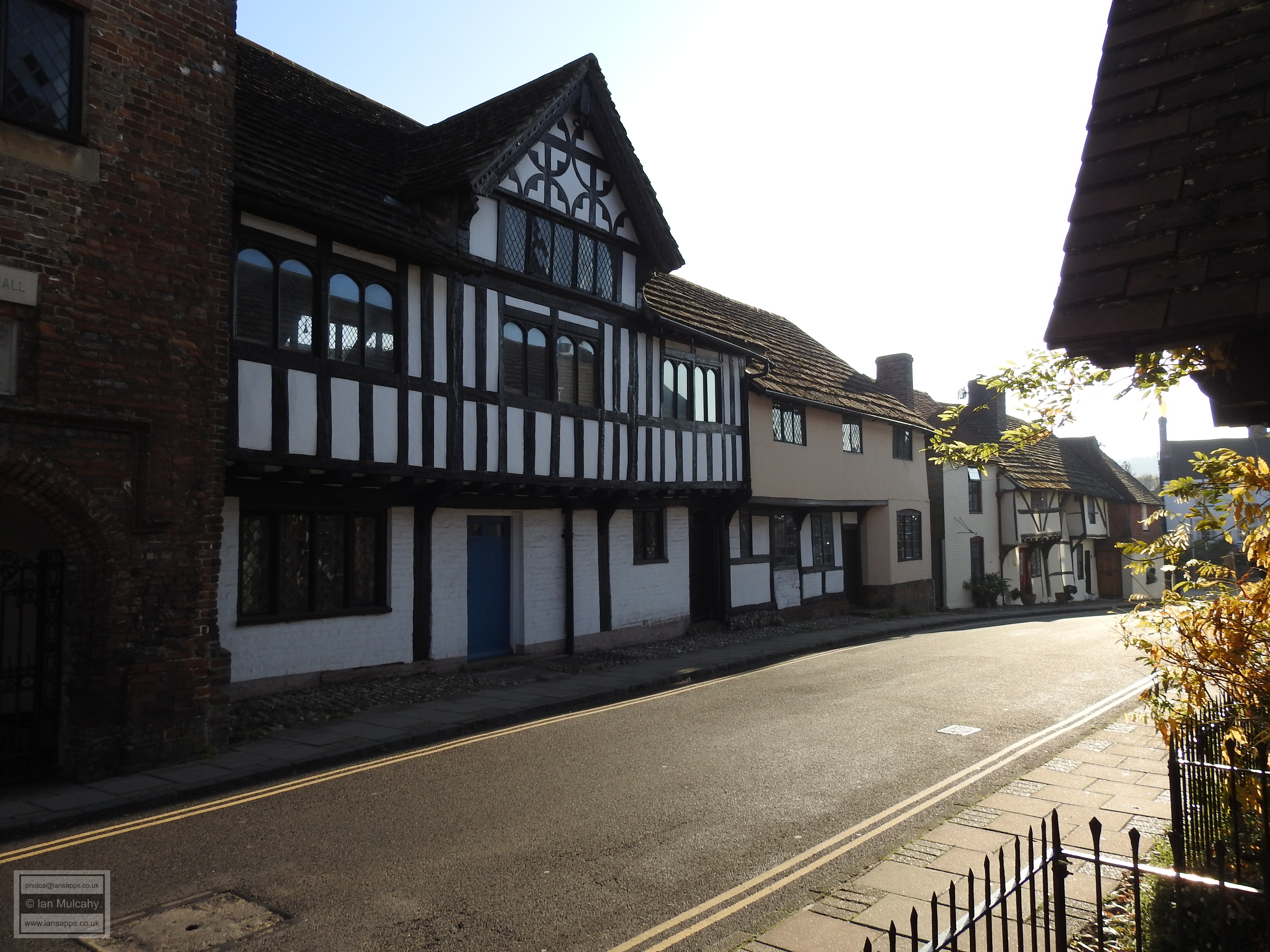
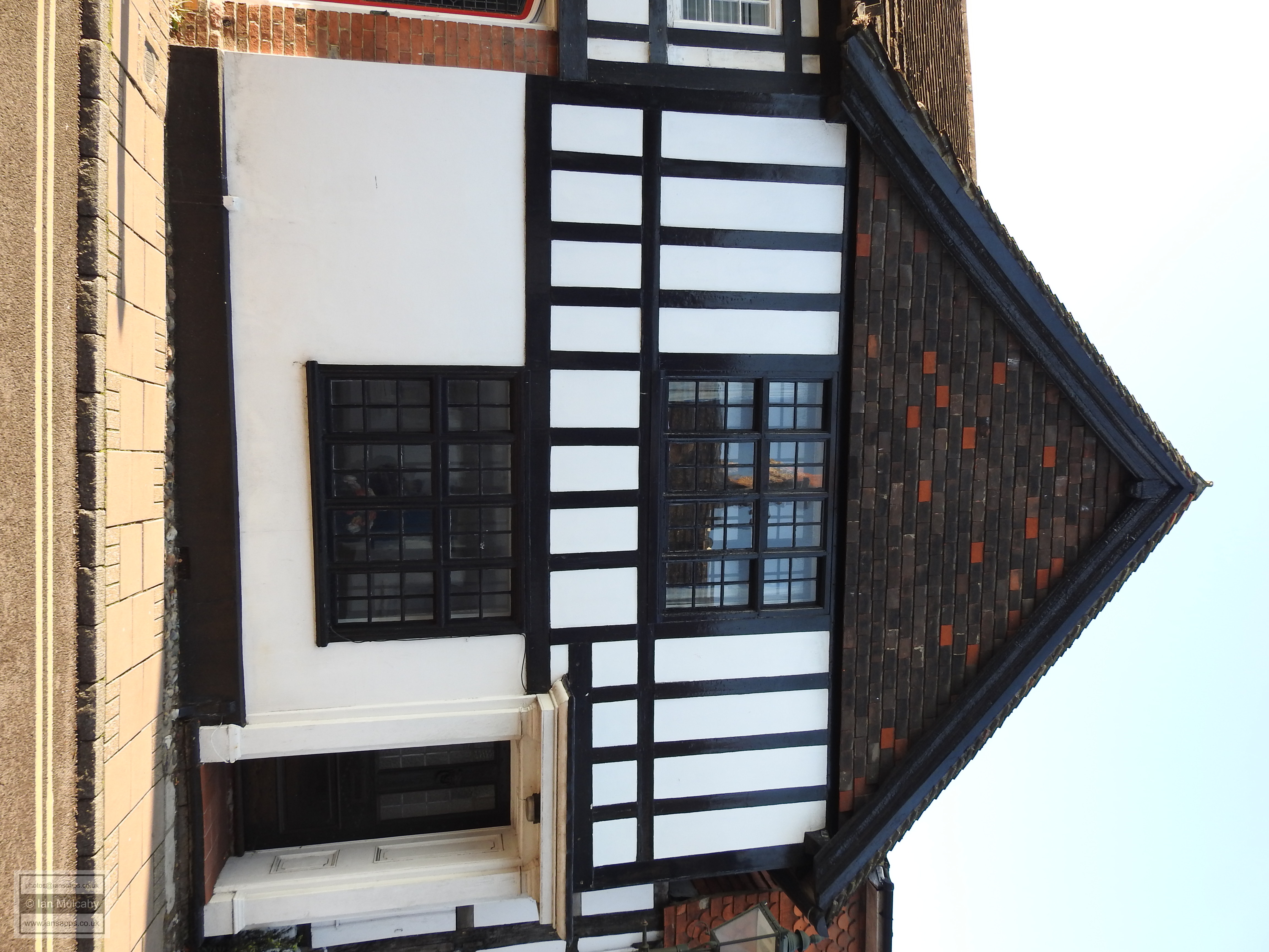
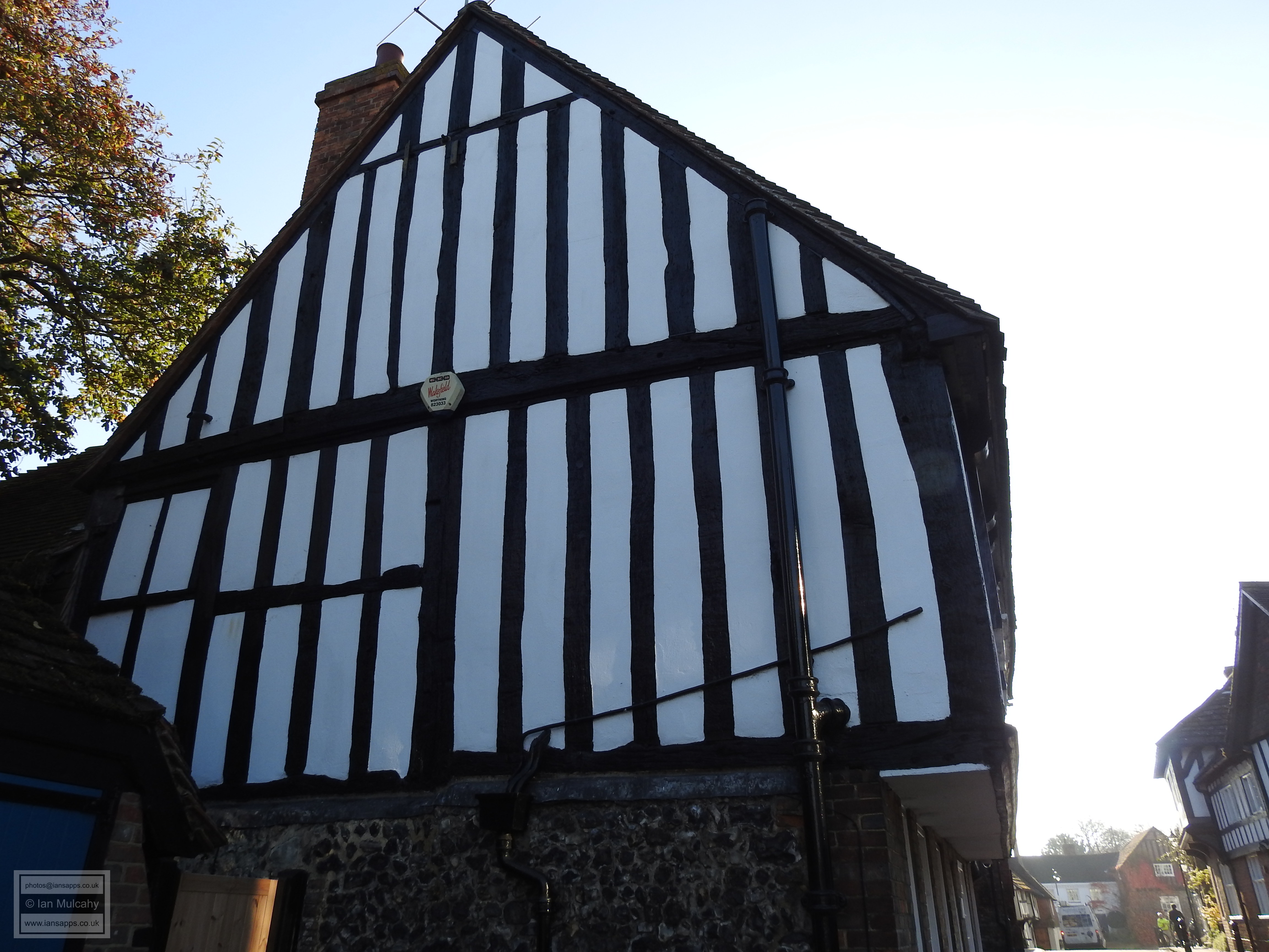
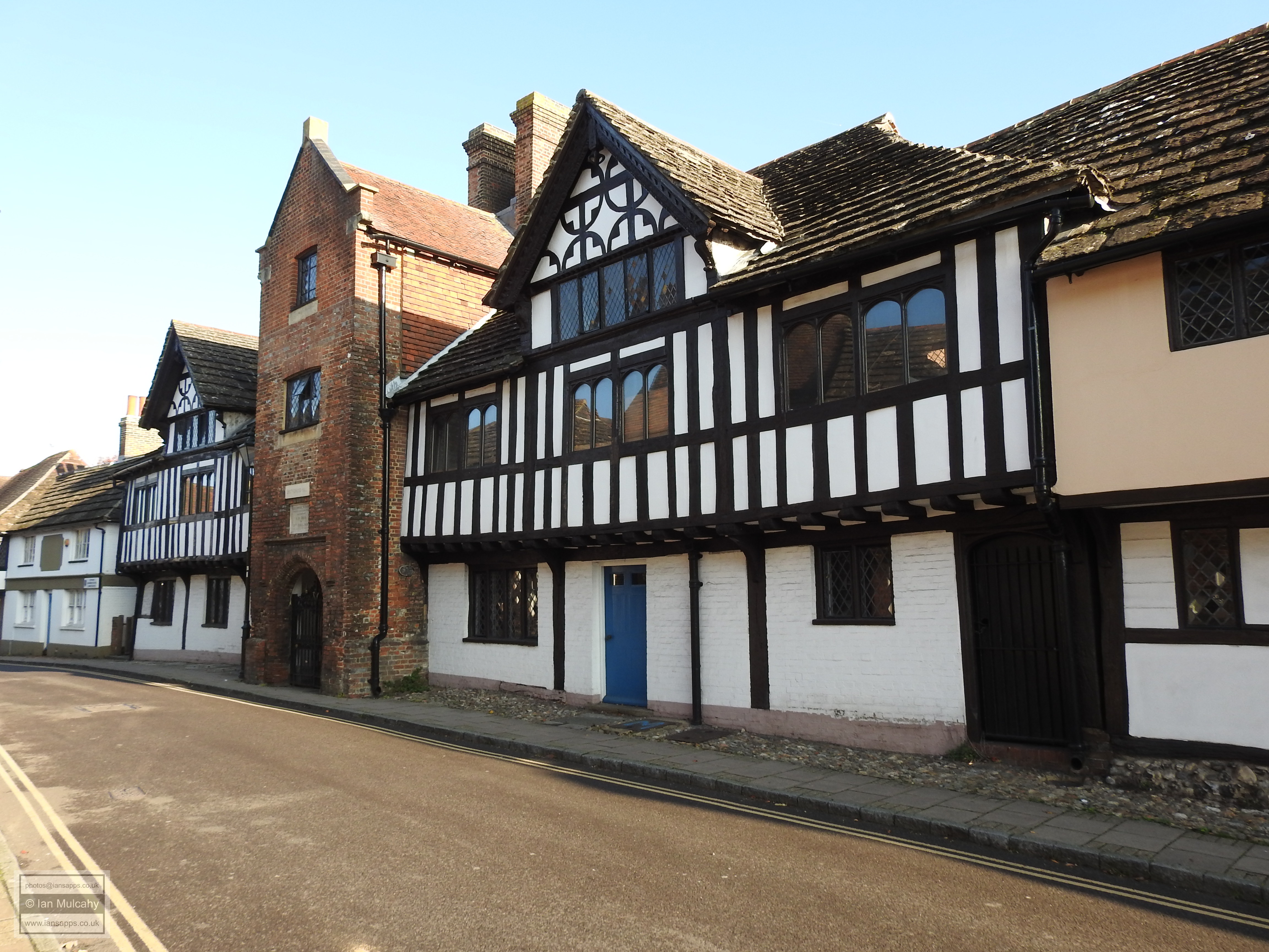
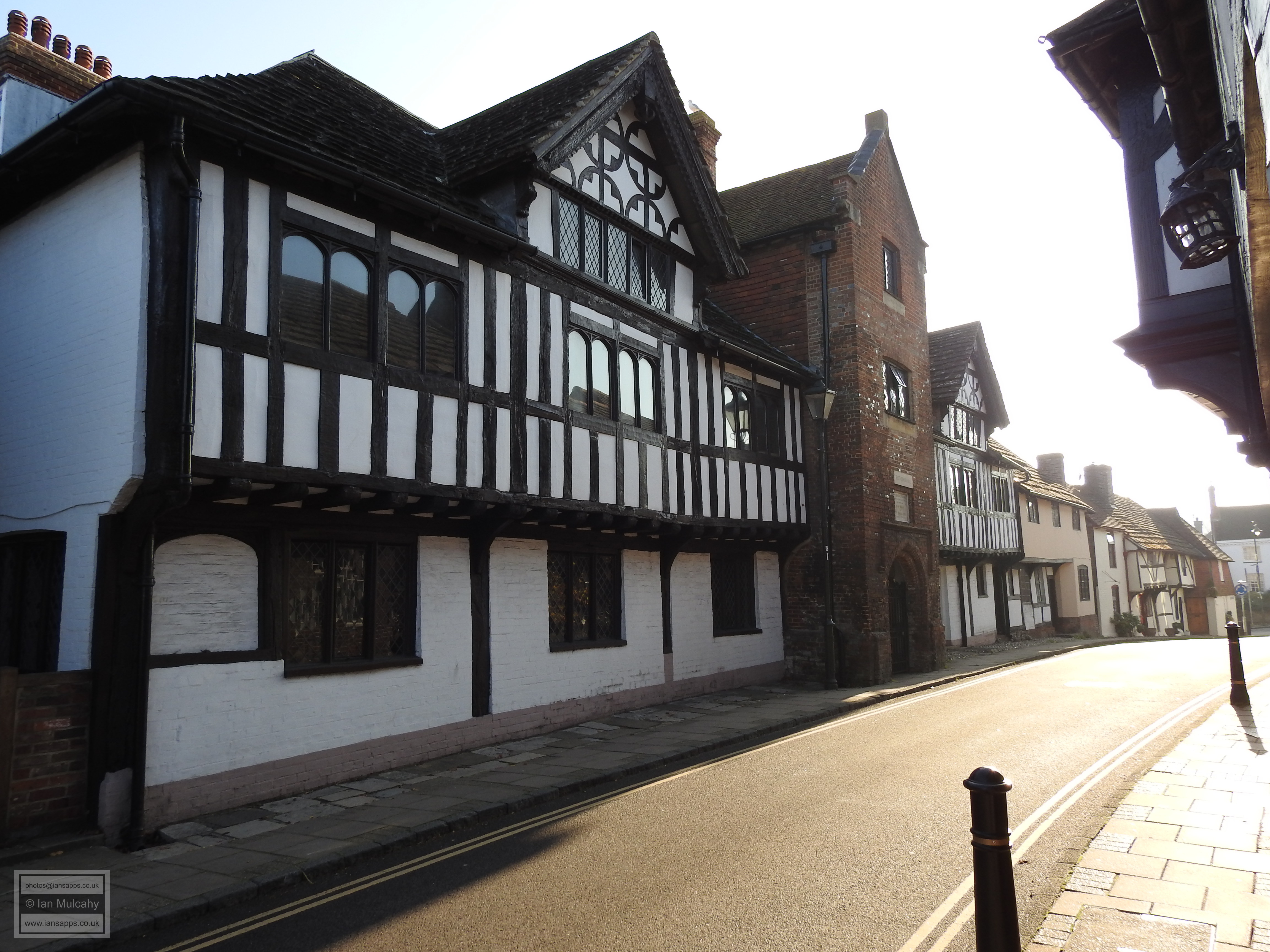
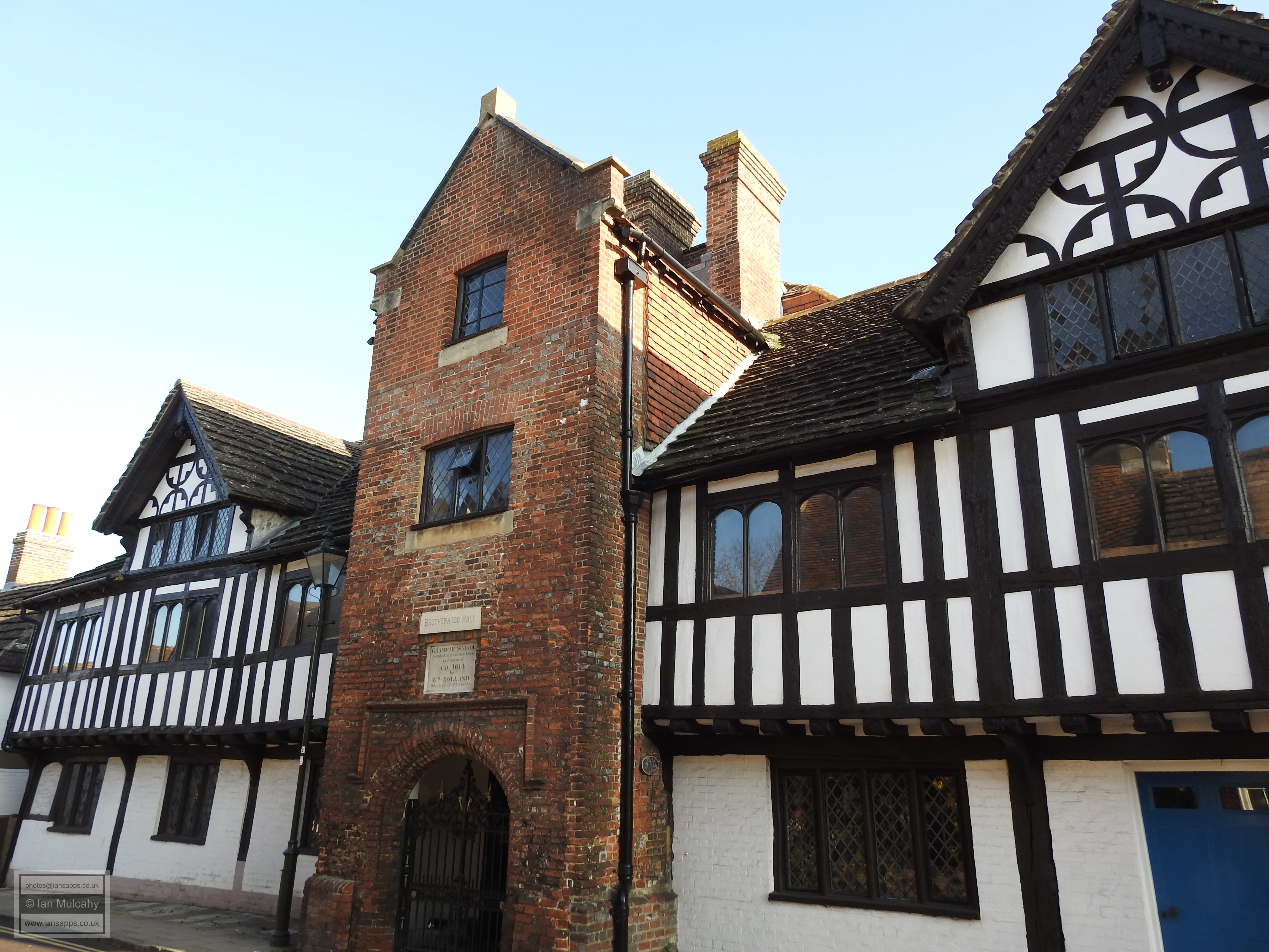
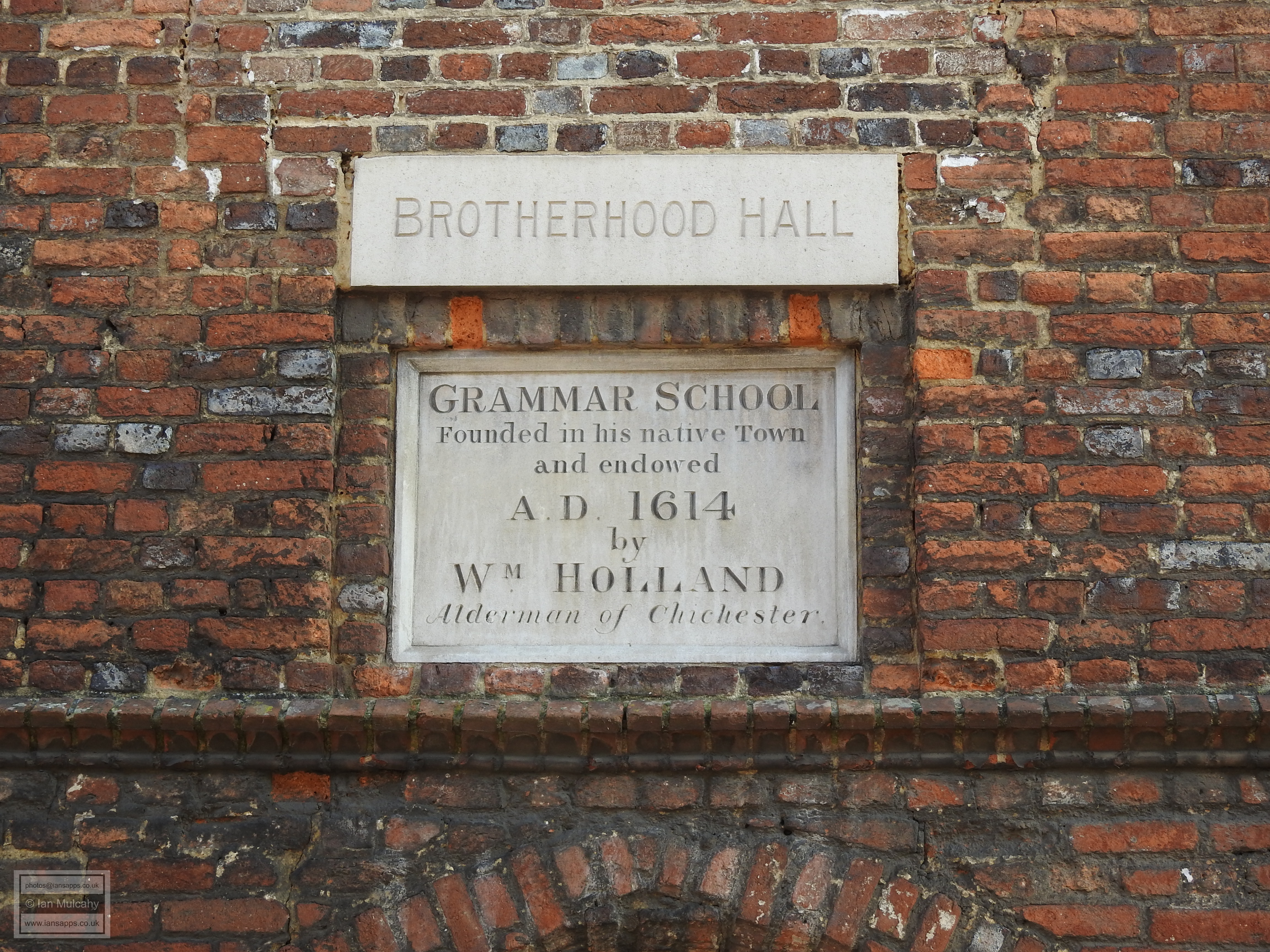
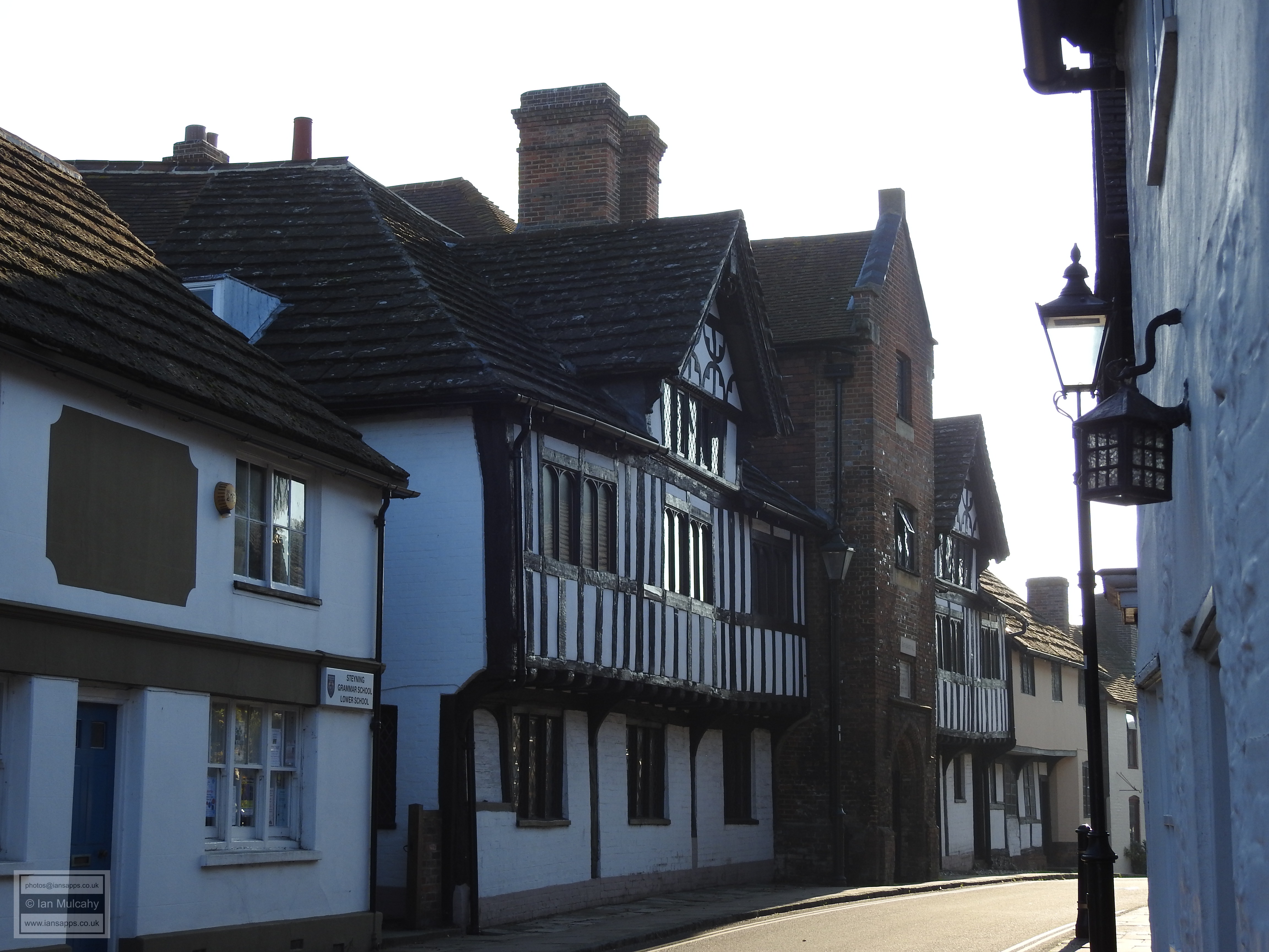
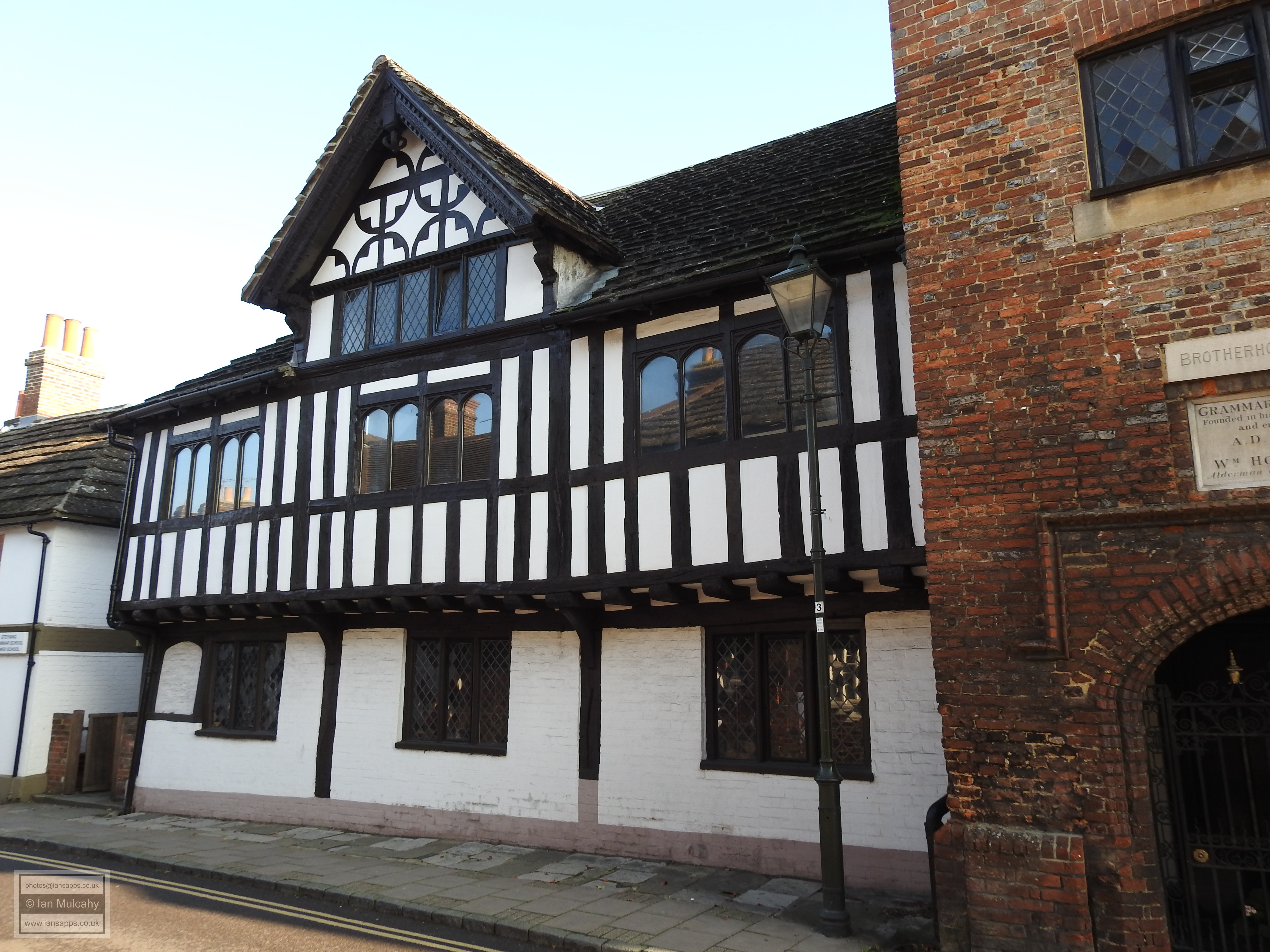
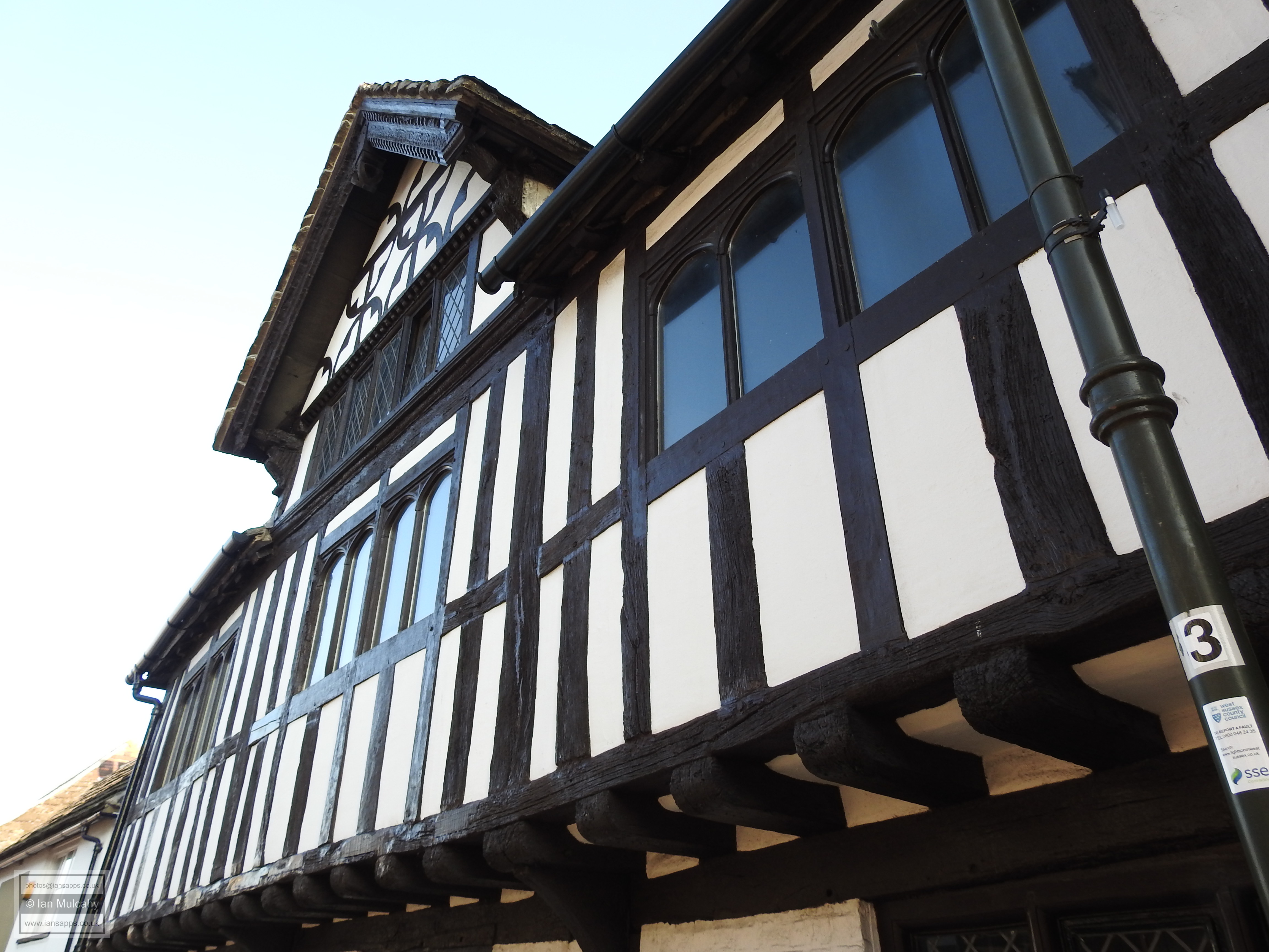
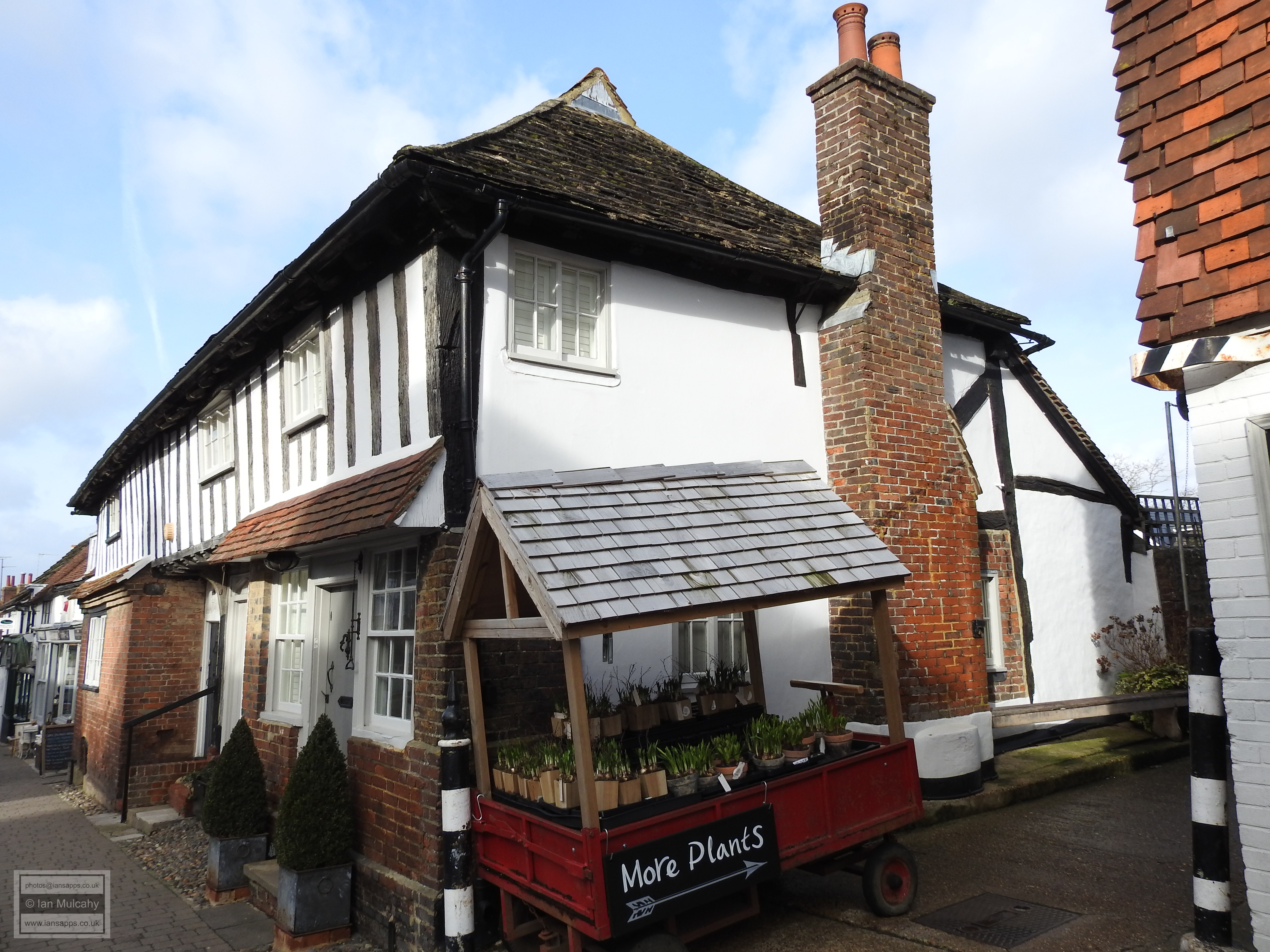
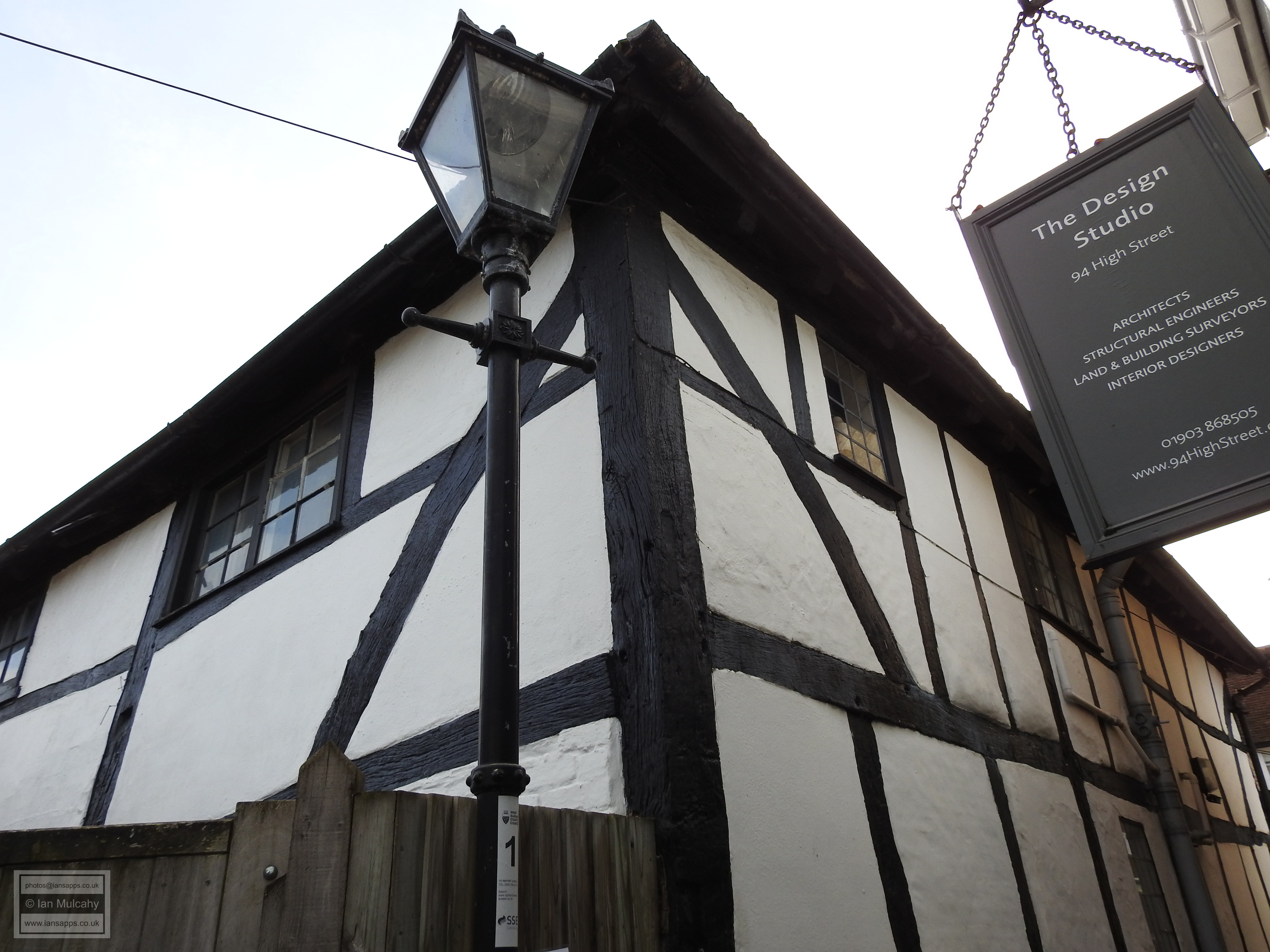
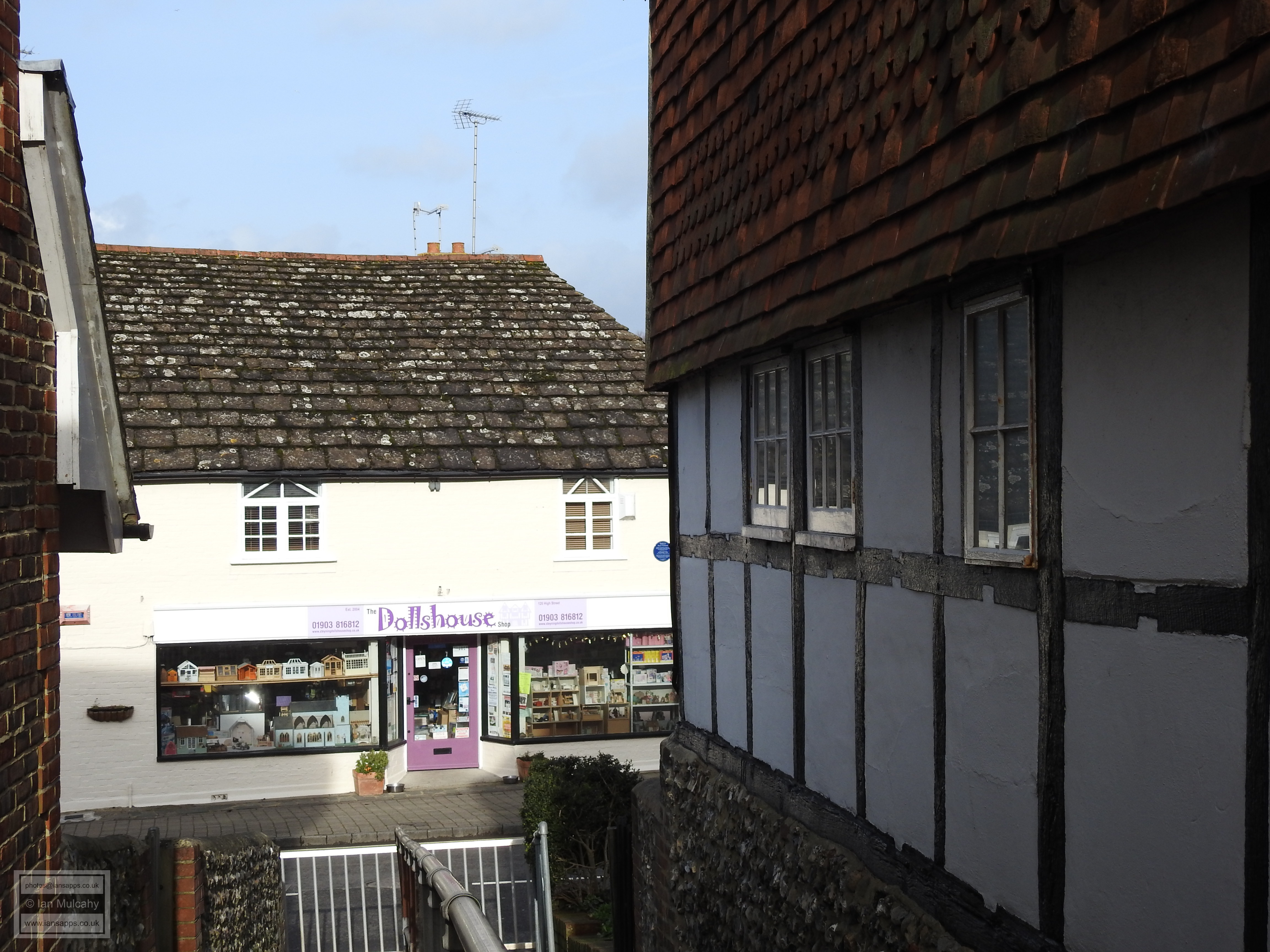
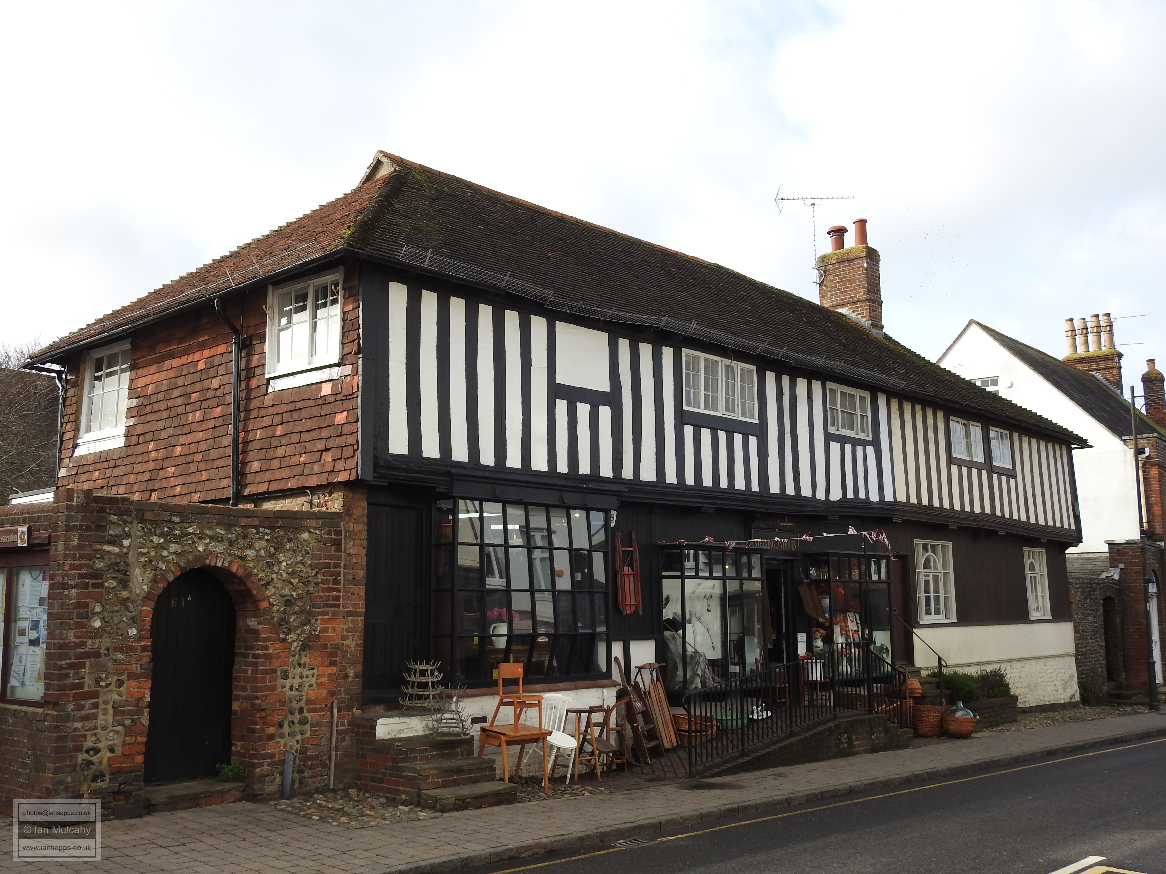
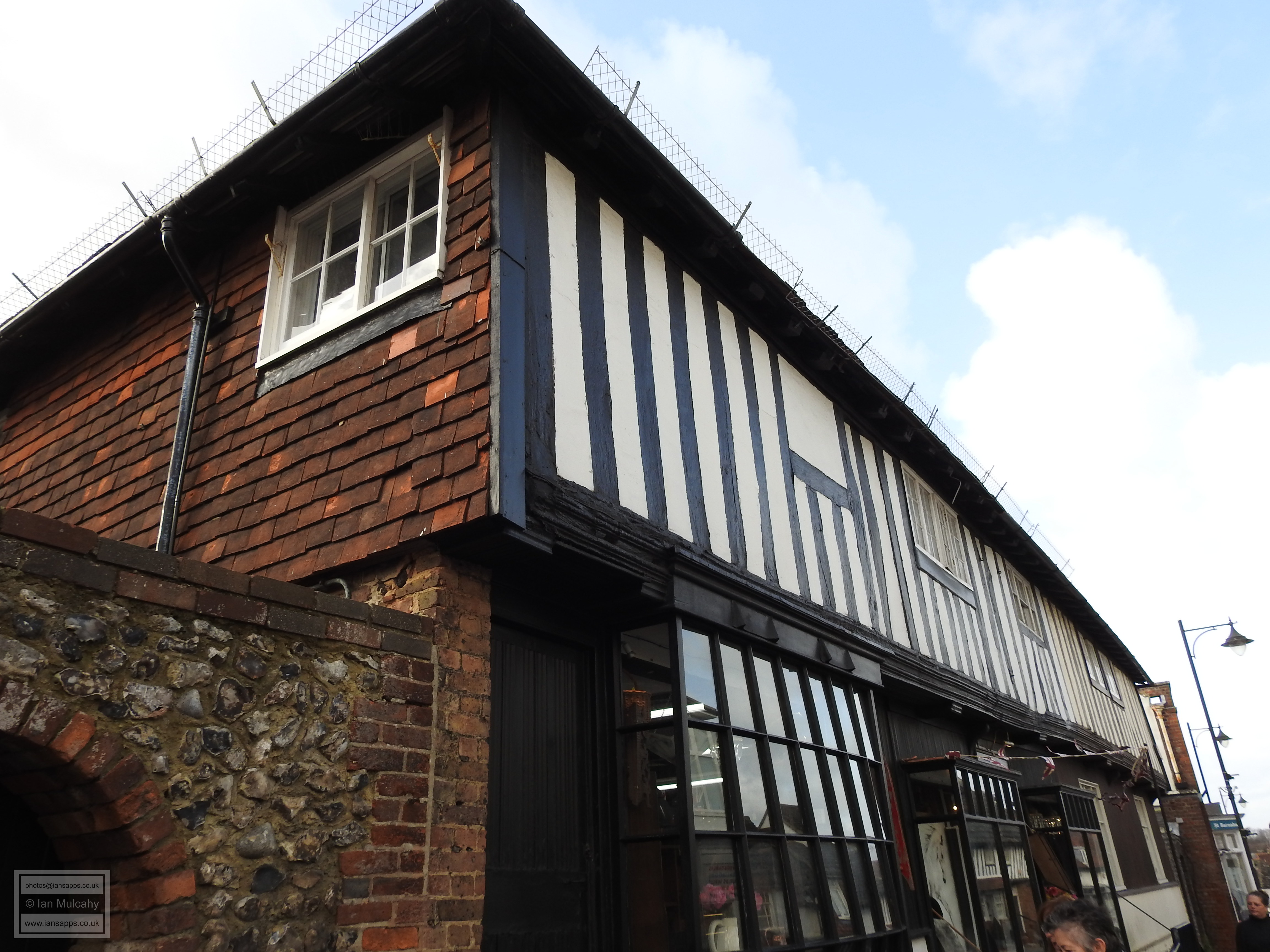
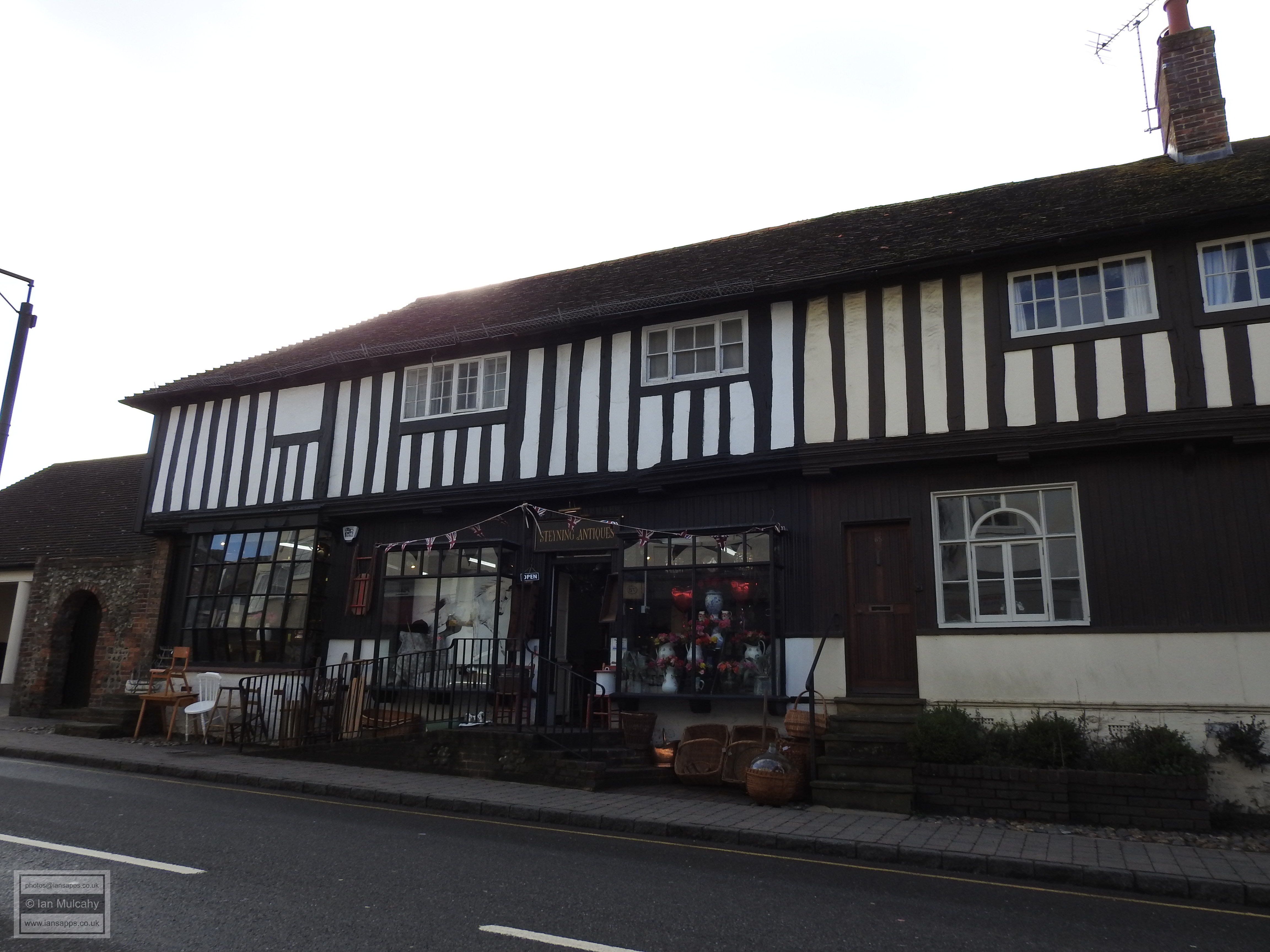
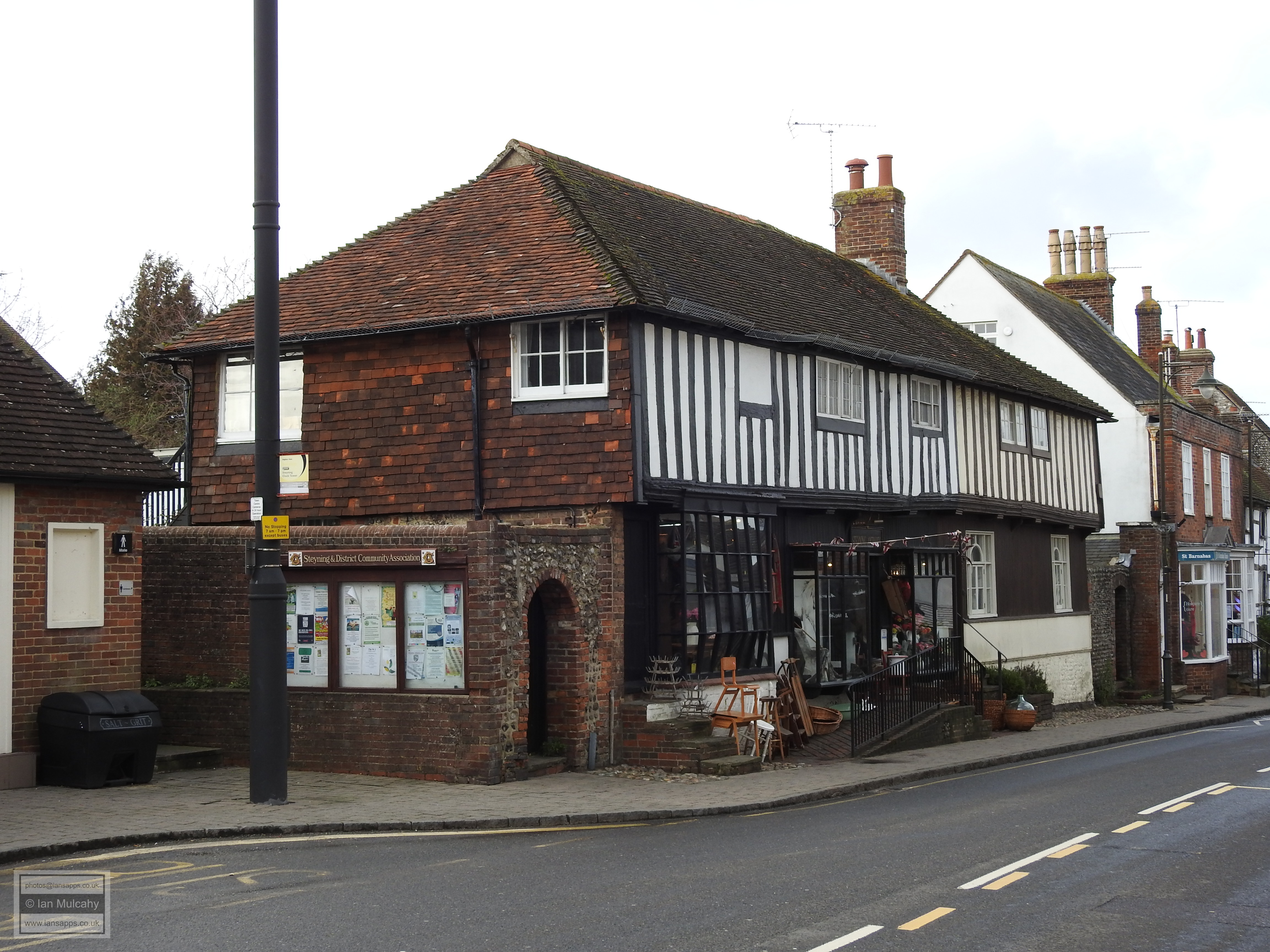
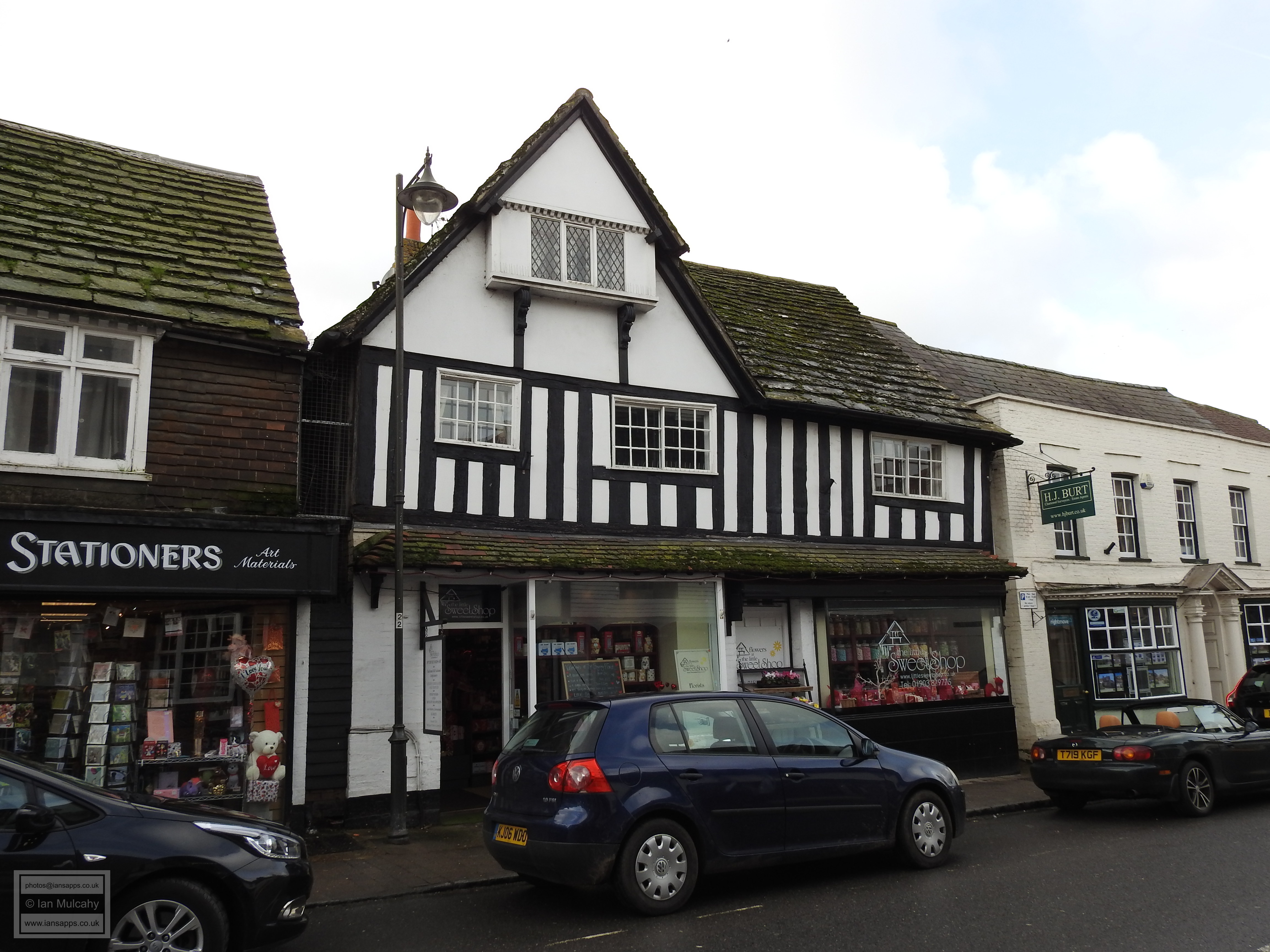
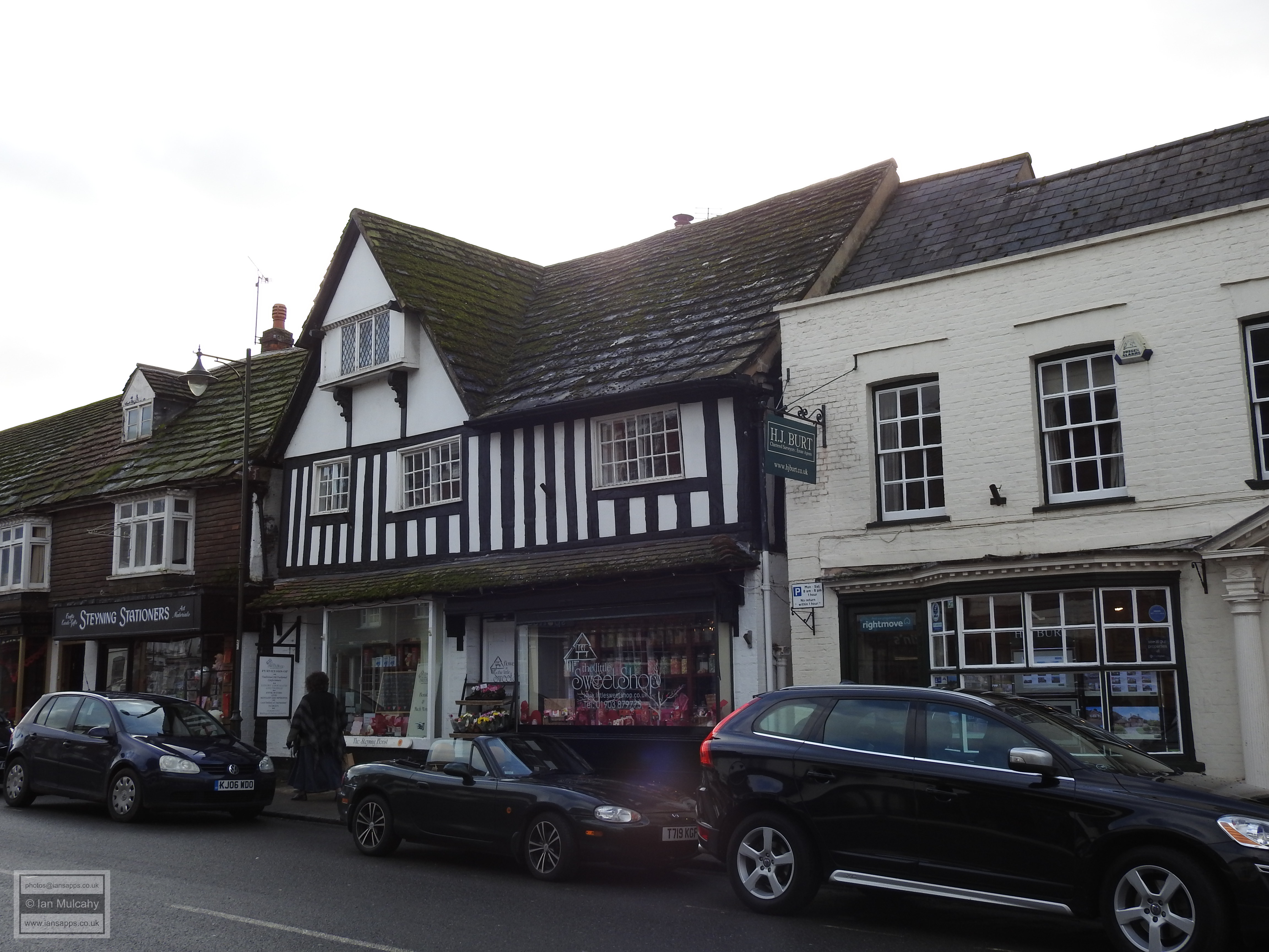
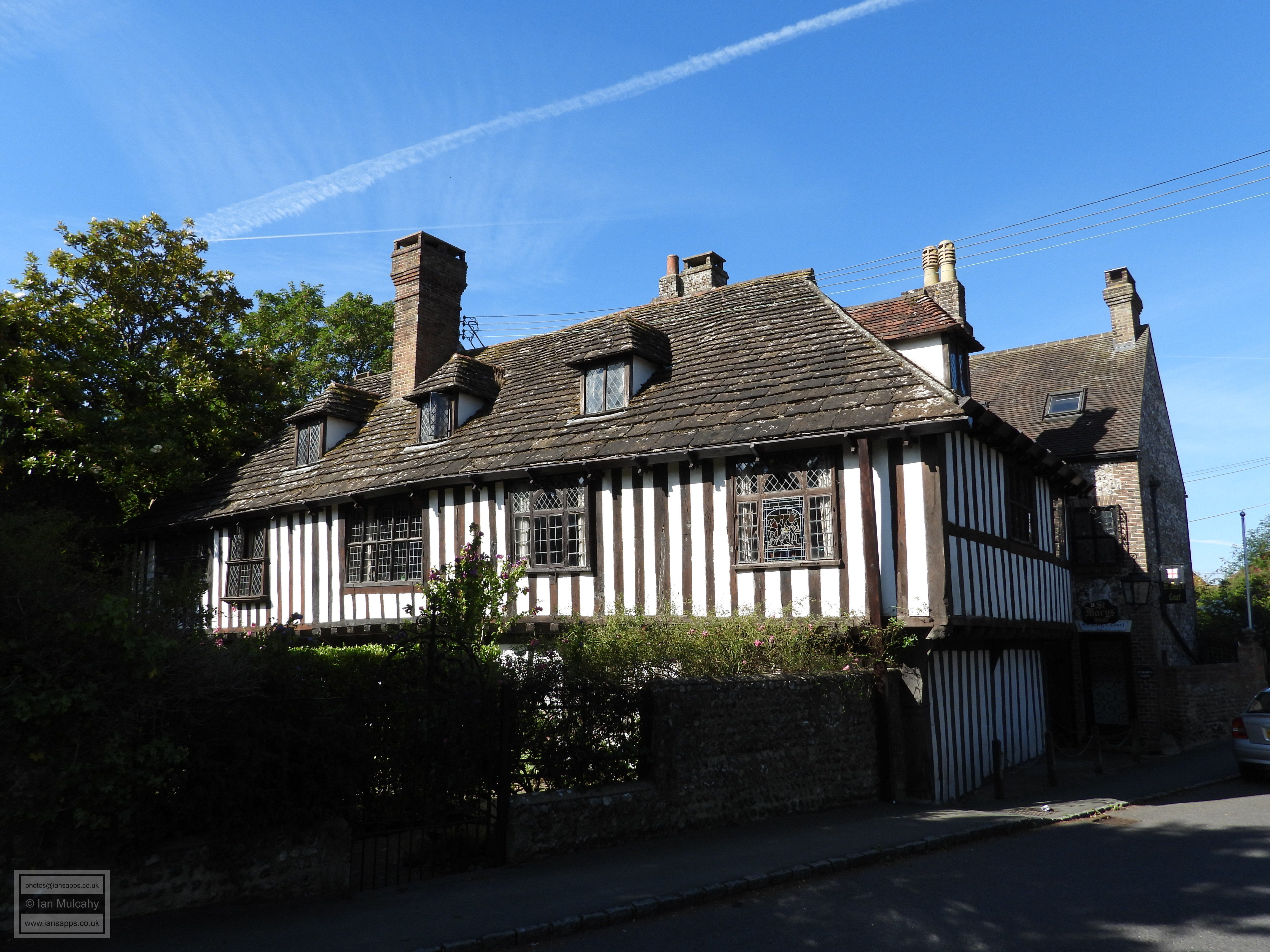
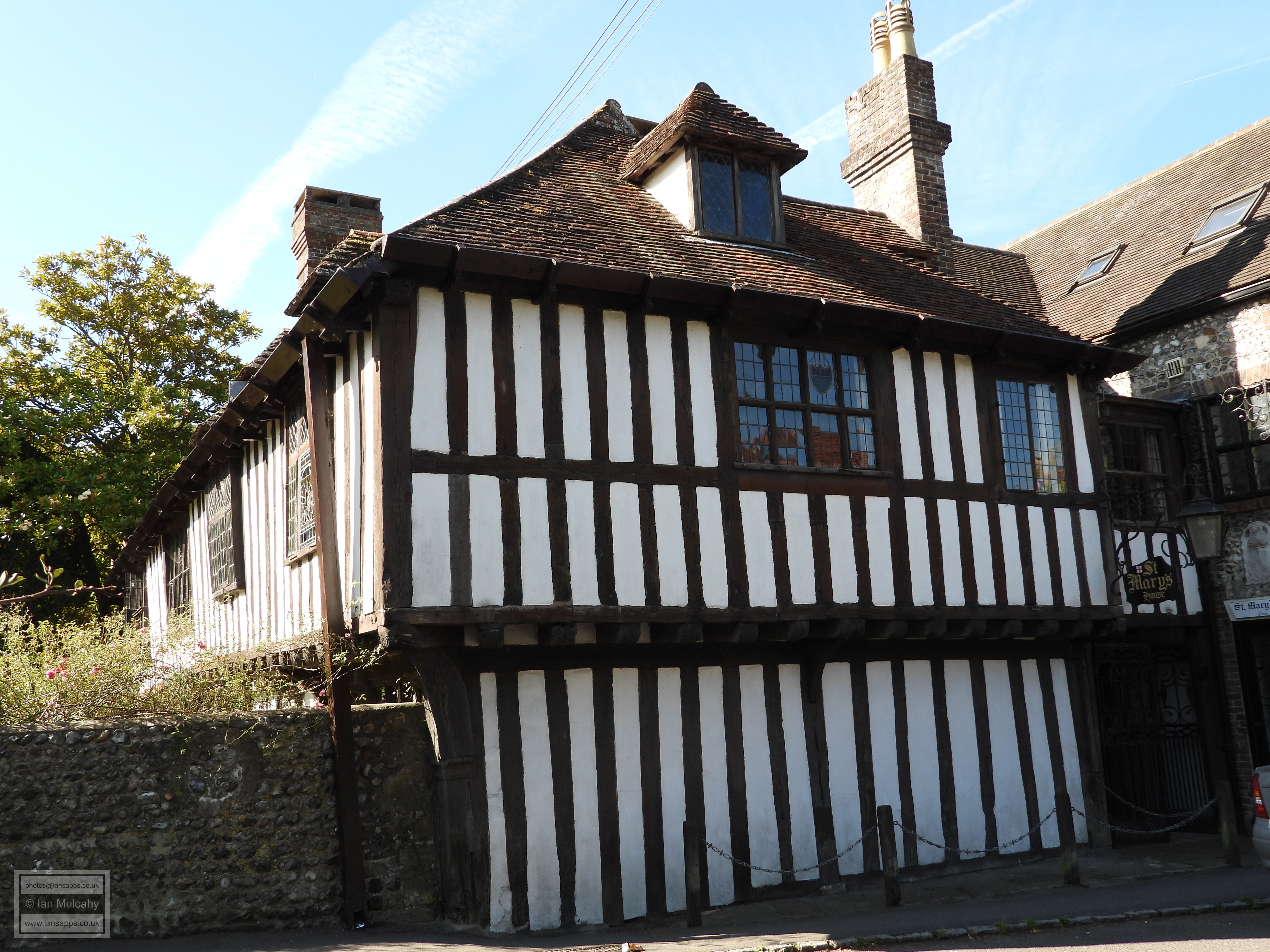
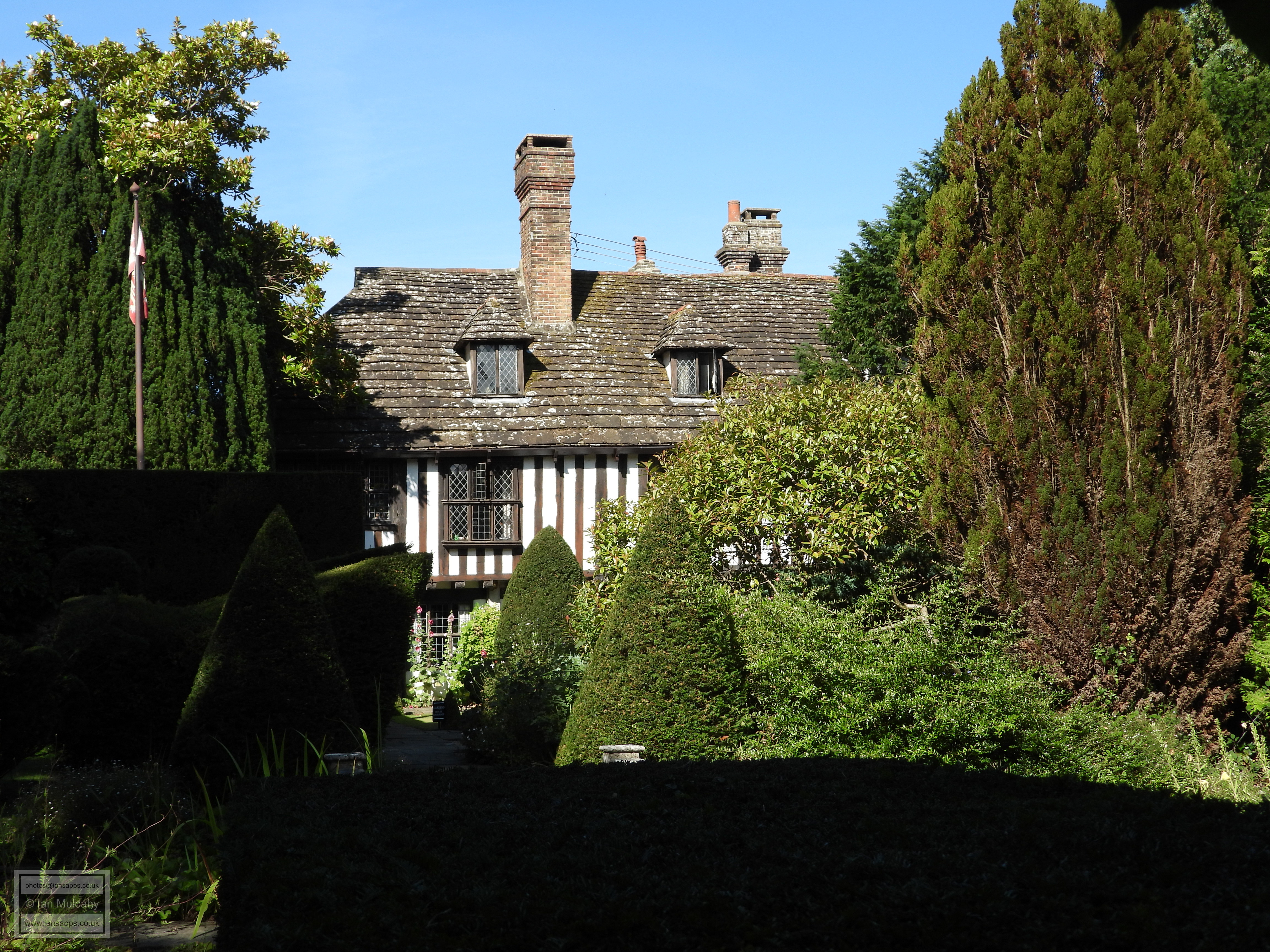
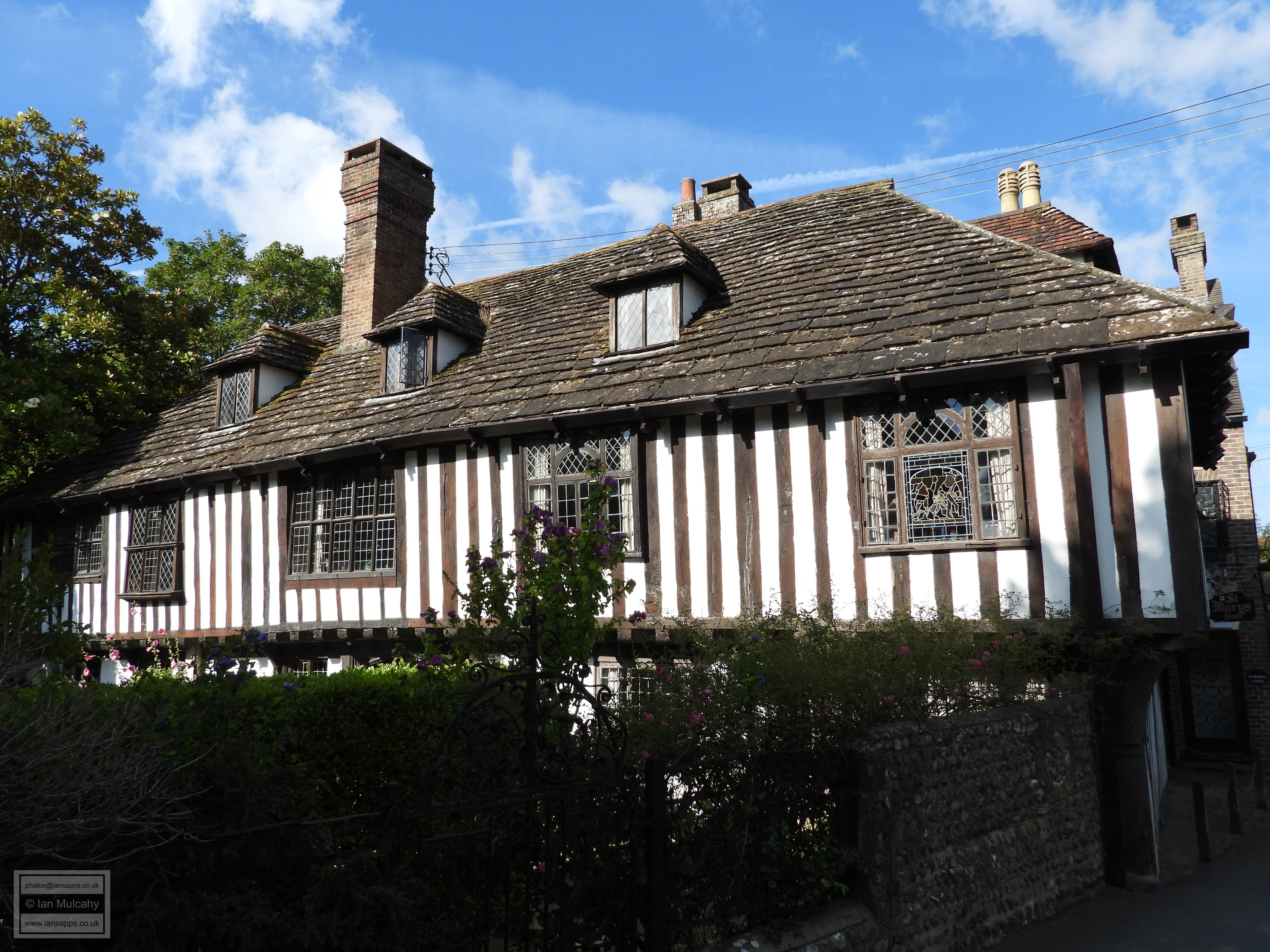
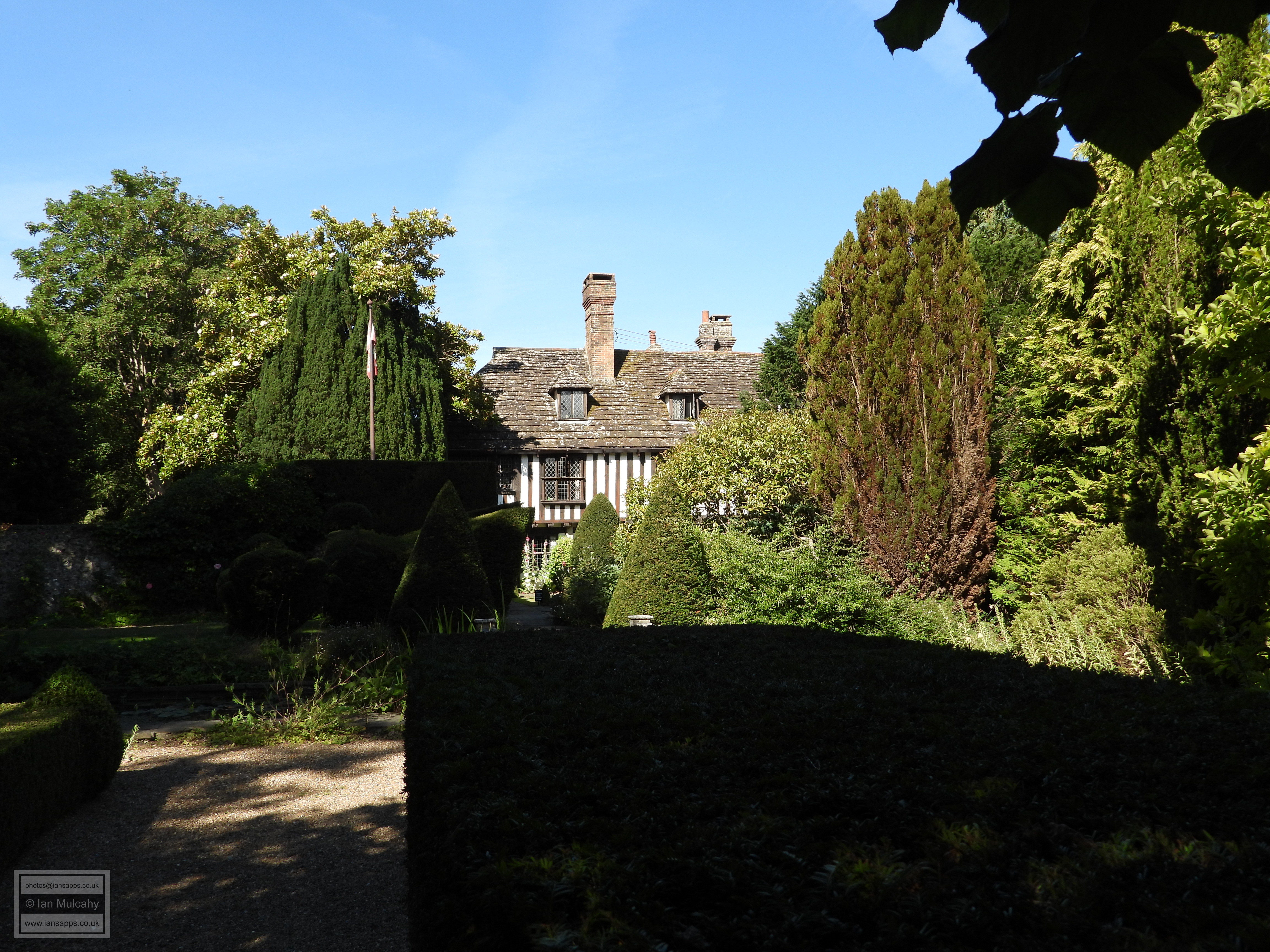
The next building is probably the most spectacular in town. The Grade I listed 9 Church Street, better known as The Brotherhood Hall, is a timber framed building with a full length jetty which was built in 1461. It was built as the Guild Hall of the Fraternity of the Holy Trinity (first recorded in 1424) but ceased to be used by the Brotherhood at the time of the Dissolution and the hall was confiscated by Henry VIII and sold for £535 – the equivalent of almost 50 years salary for a skilled tradesman at the time and roughly £225,000 in todays money, when adjusted for inflation. By 1579 the building was hosting a free school and in 1614 Steyning Grammar school was founded by William Holland and took ownership of the hall, at which point the first two floors of the central brick built porch were constructed. The third floor of this section was added in the late 19th century and the building is still in use by the school, over 400 years after its founding.
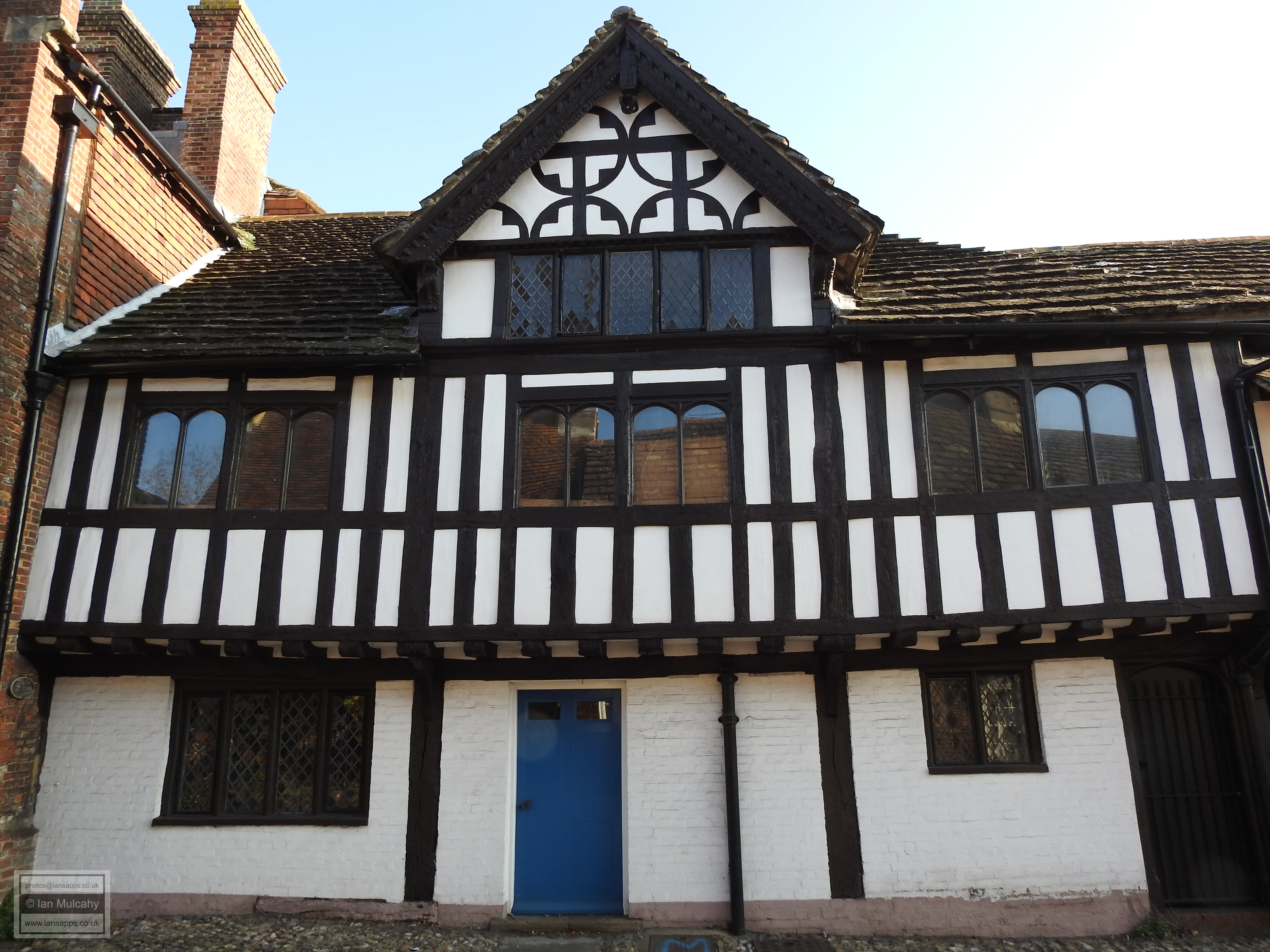
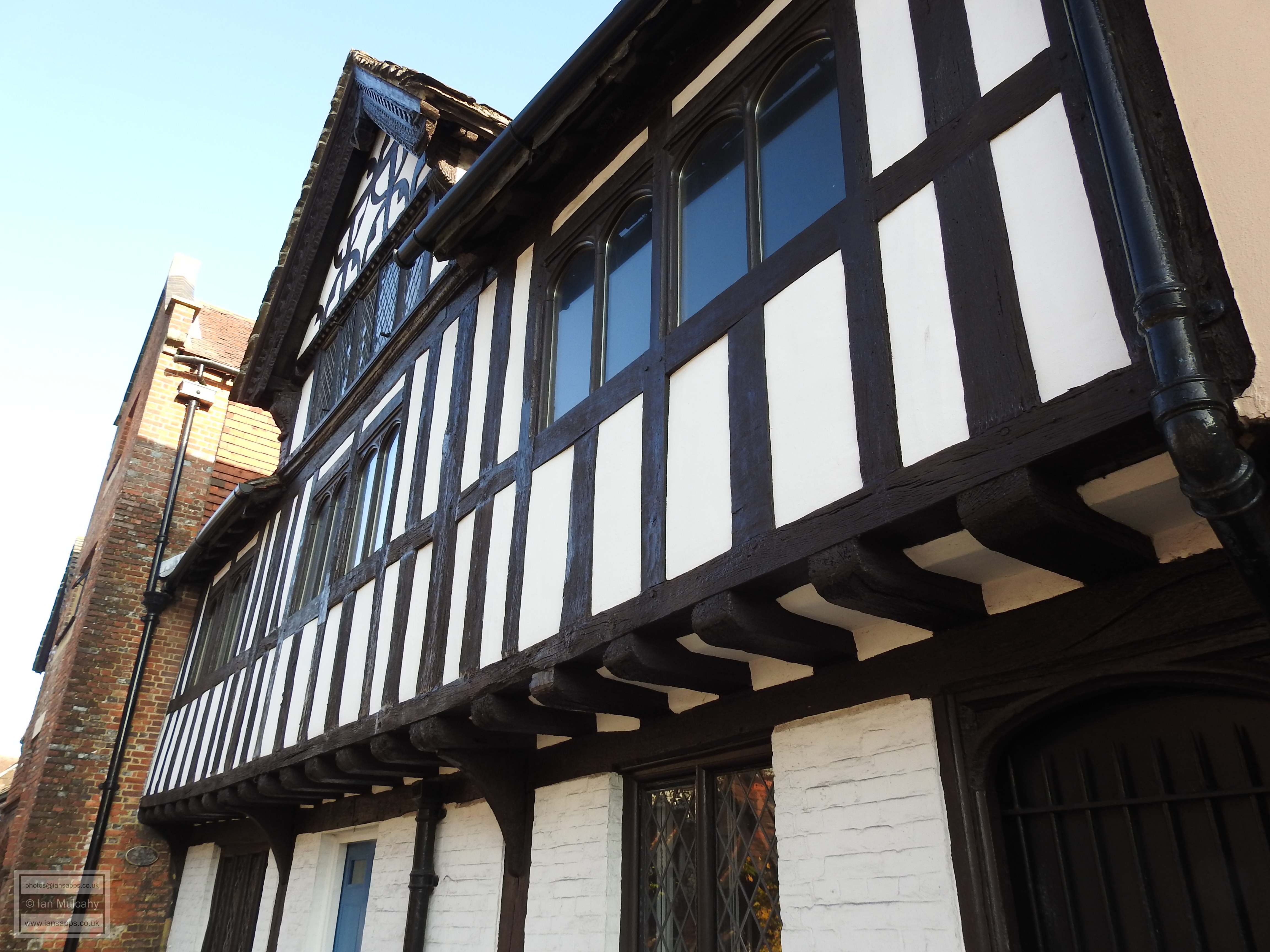
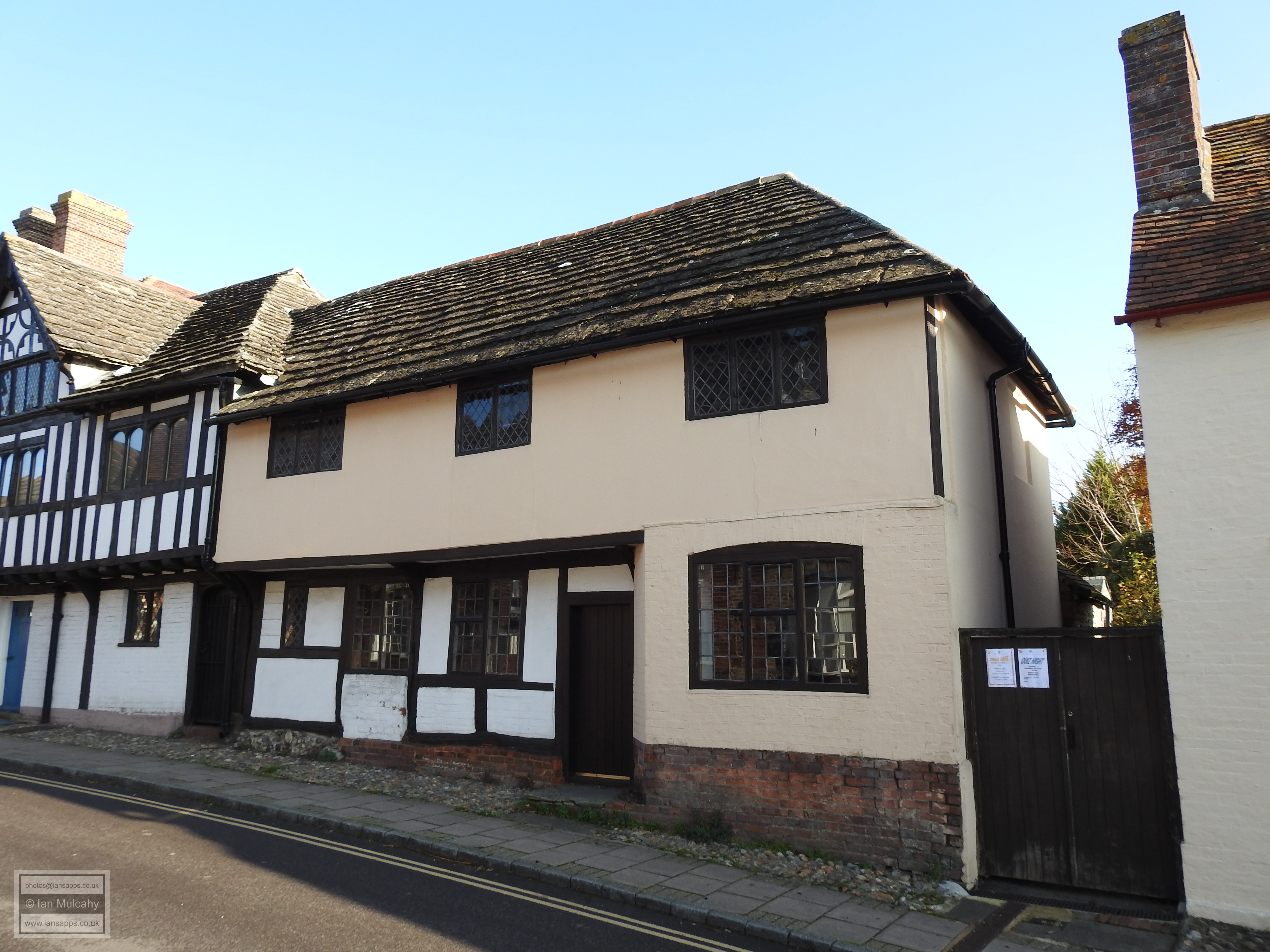
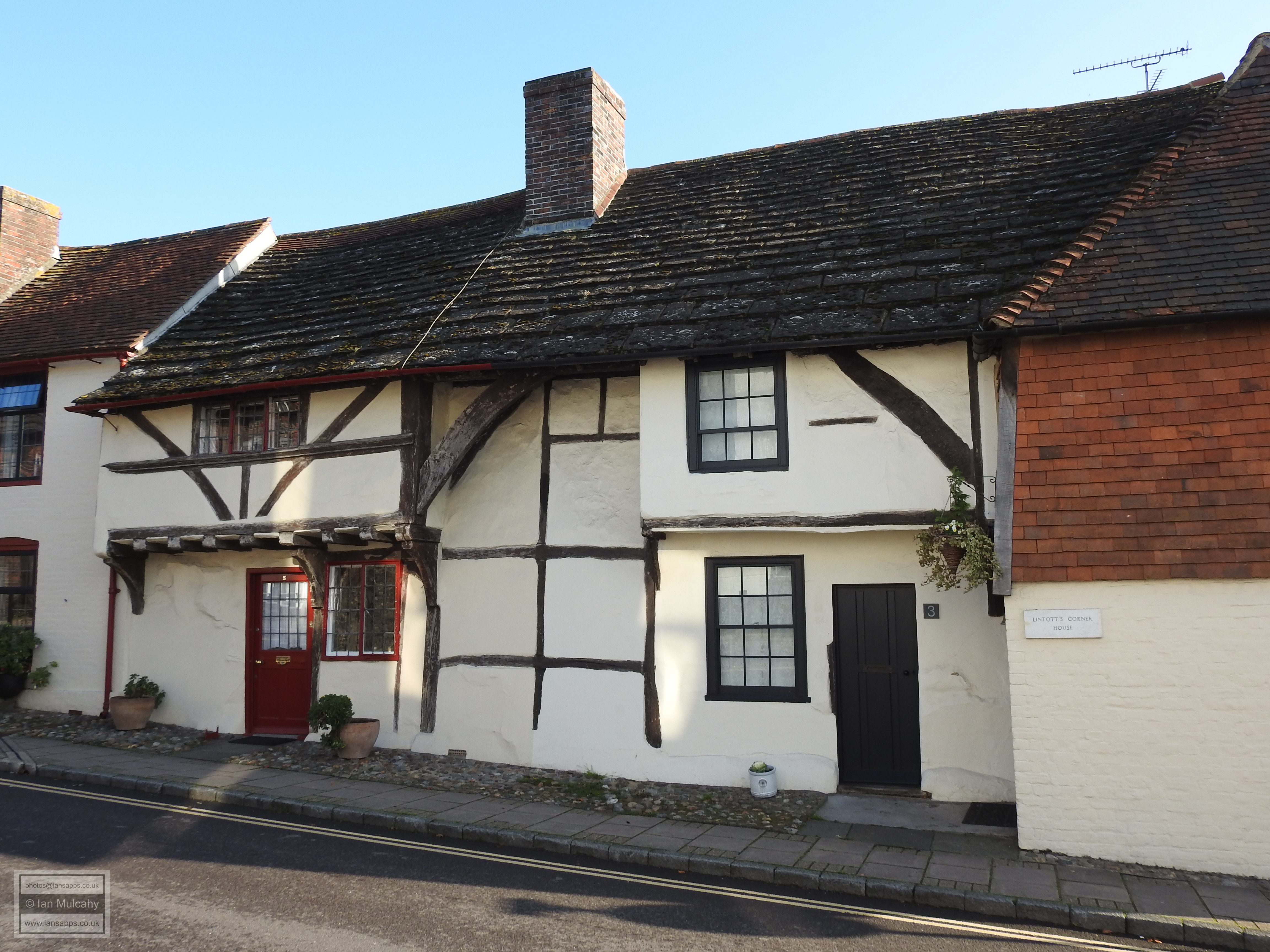
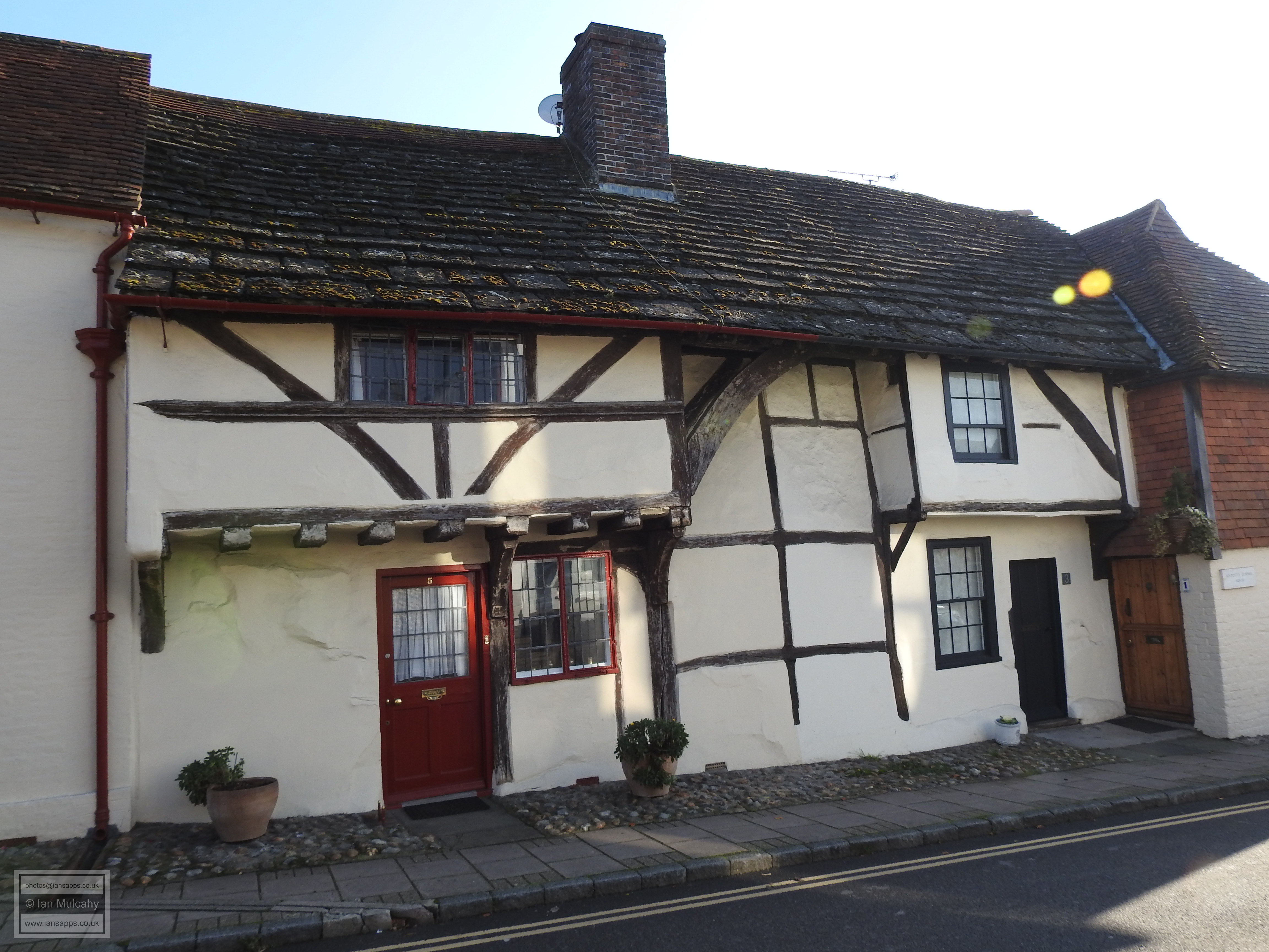
Adjoining the Brotherhood Hall, and also a part of the school, is 7 Church Street, an early 16th century timber framed house with a full length jetty, the right hand side of which has now been underbuilt in brick. The final building before we reach the High Street is 1, 3 & 5 Church Street, a quaint little late 14th century Wealden hall house with a mid 15th century crosswing to the south and an 18th century extension to the north.
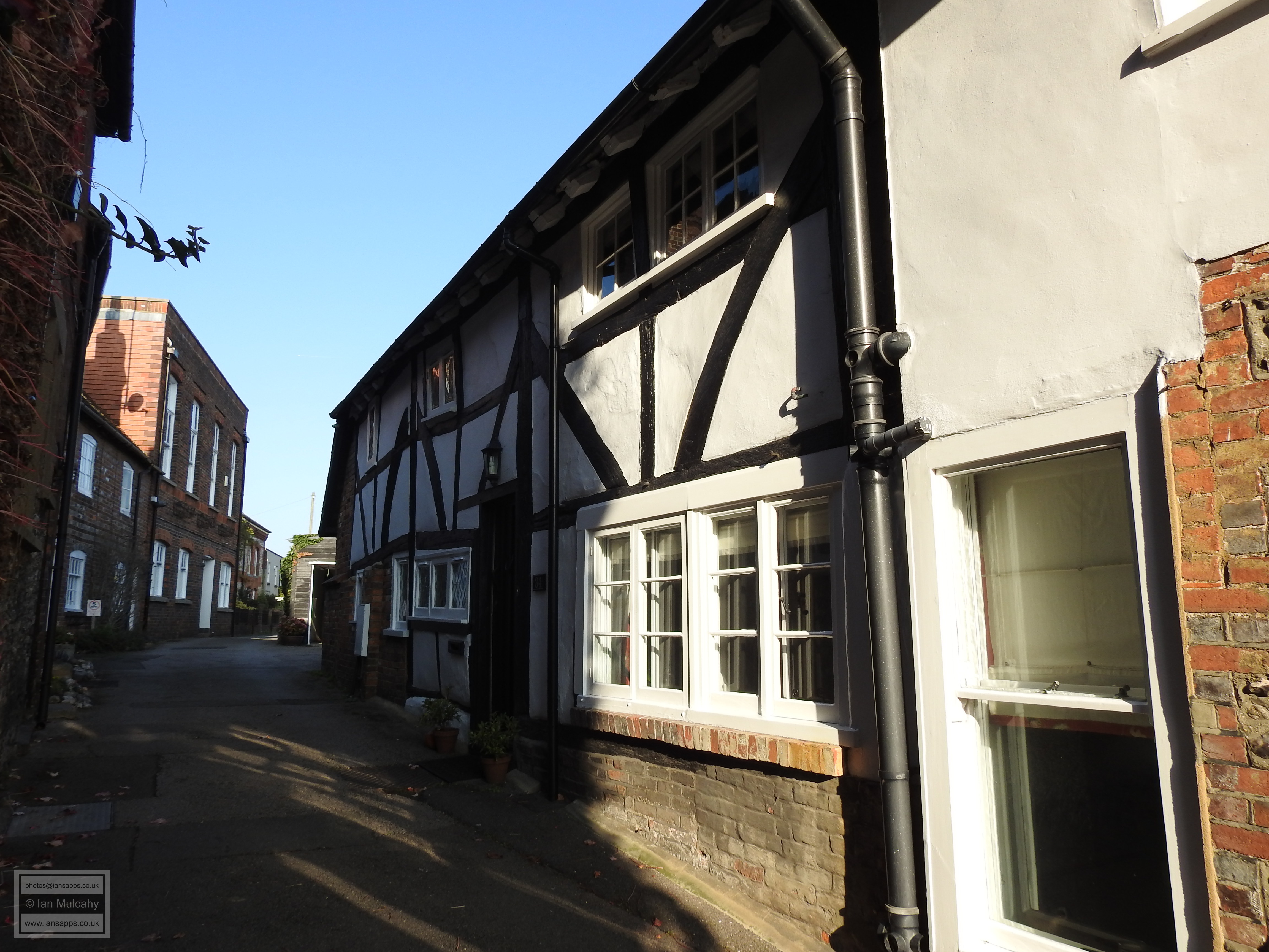
7 Church Street
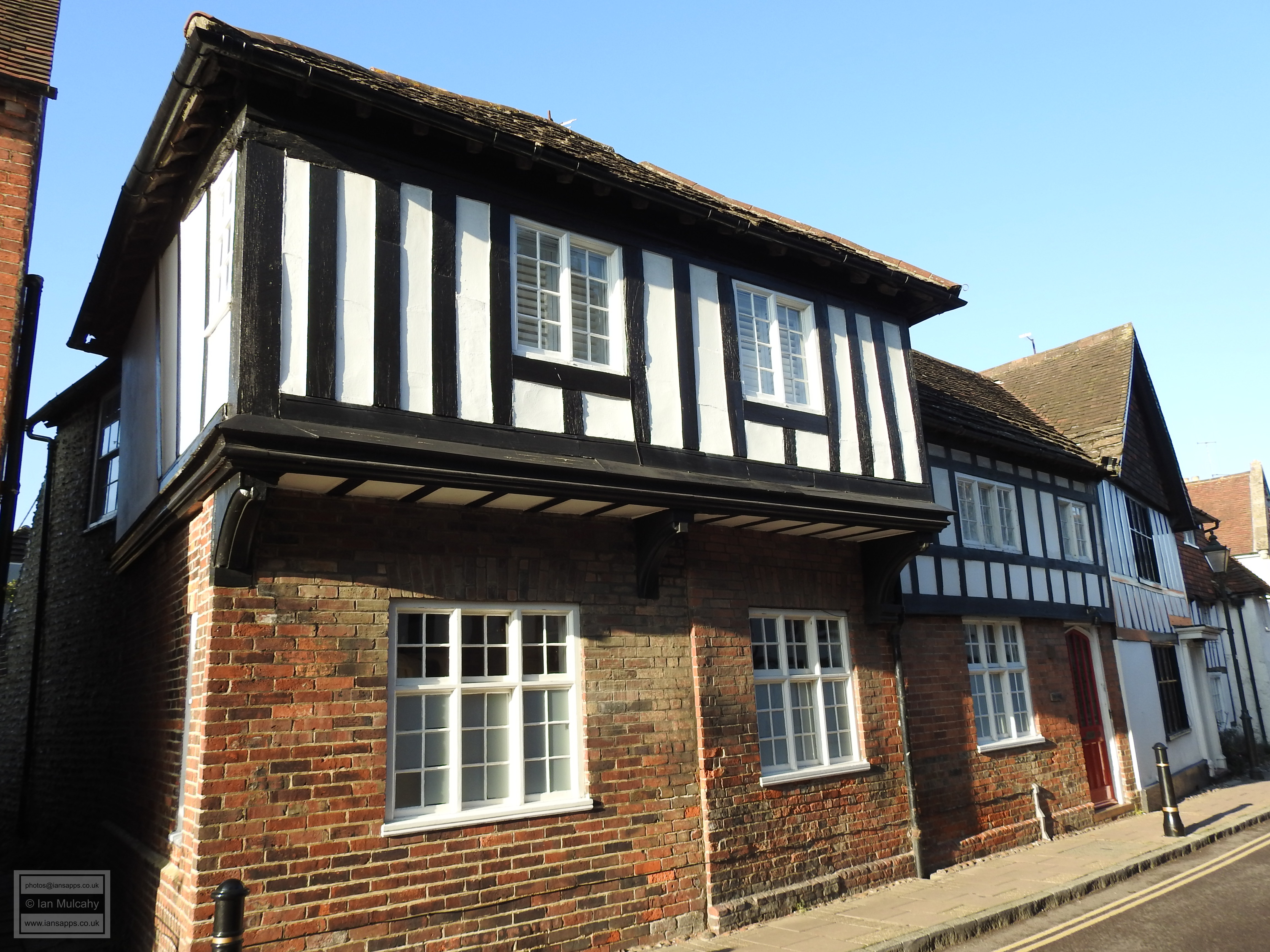
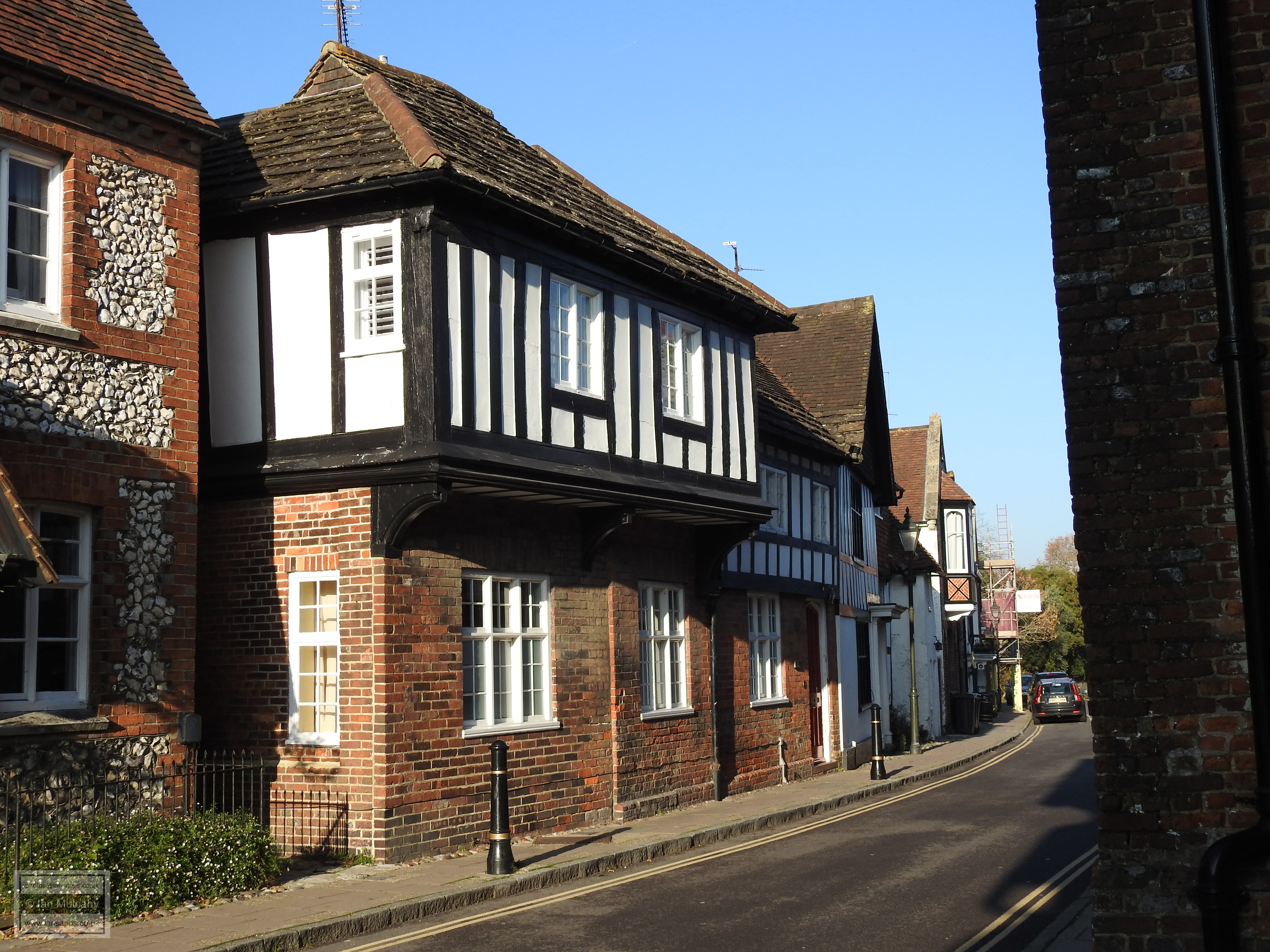
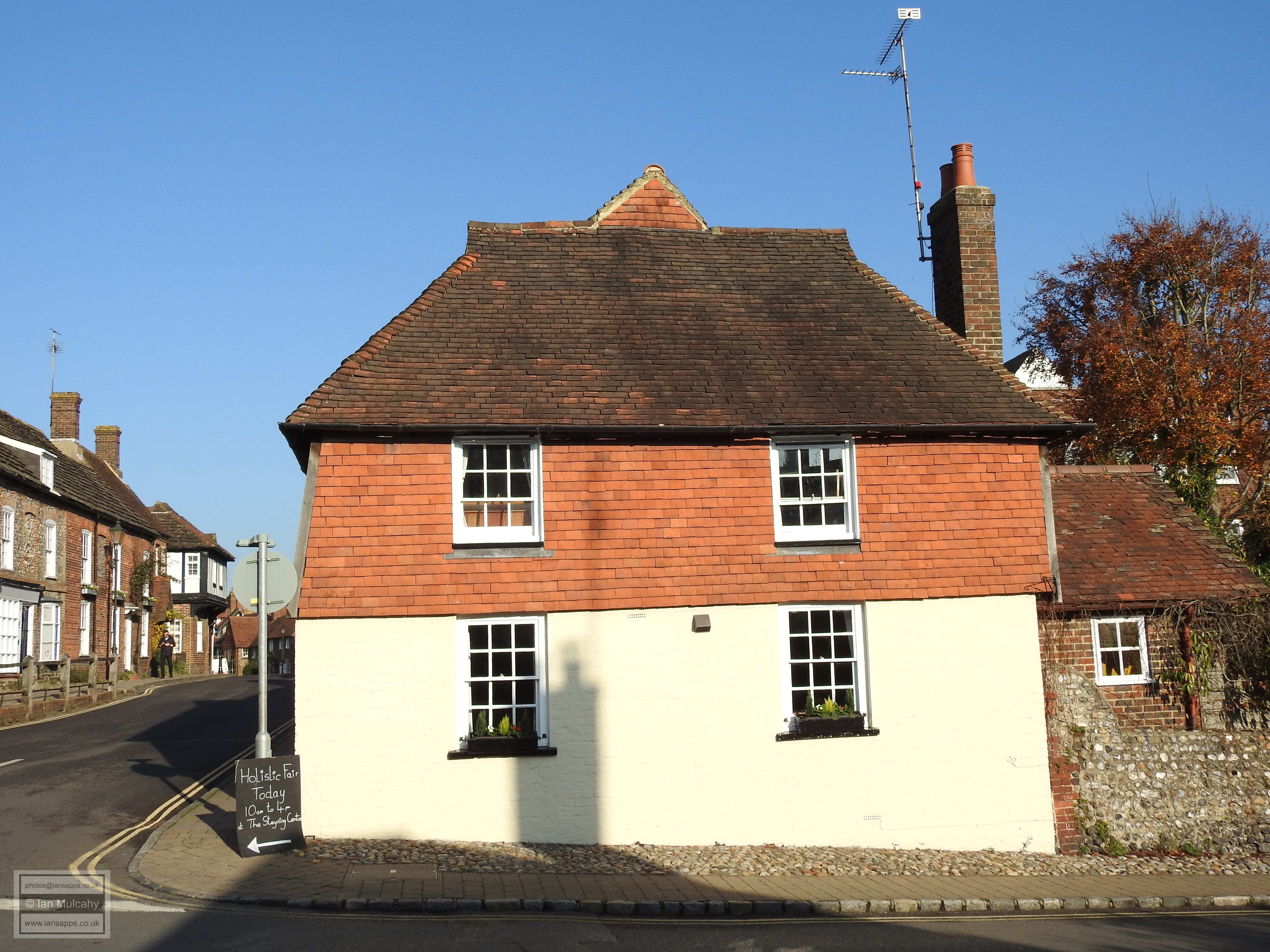
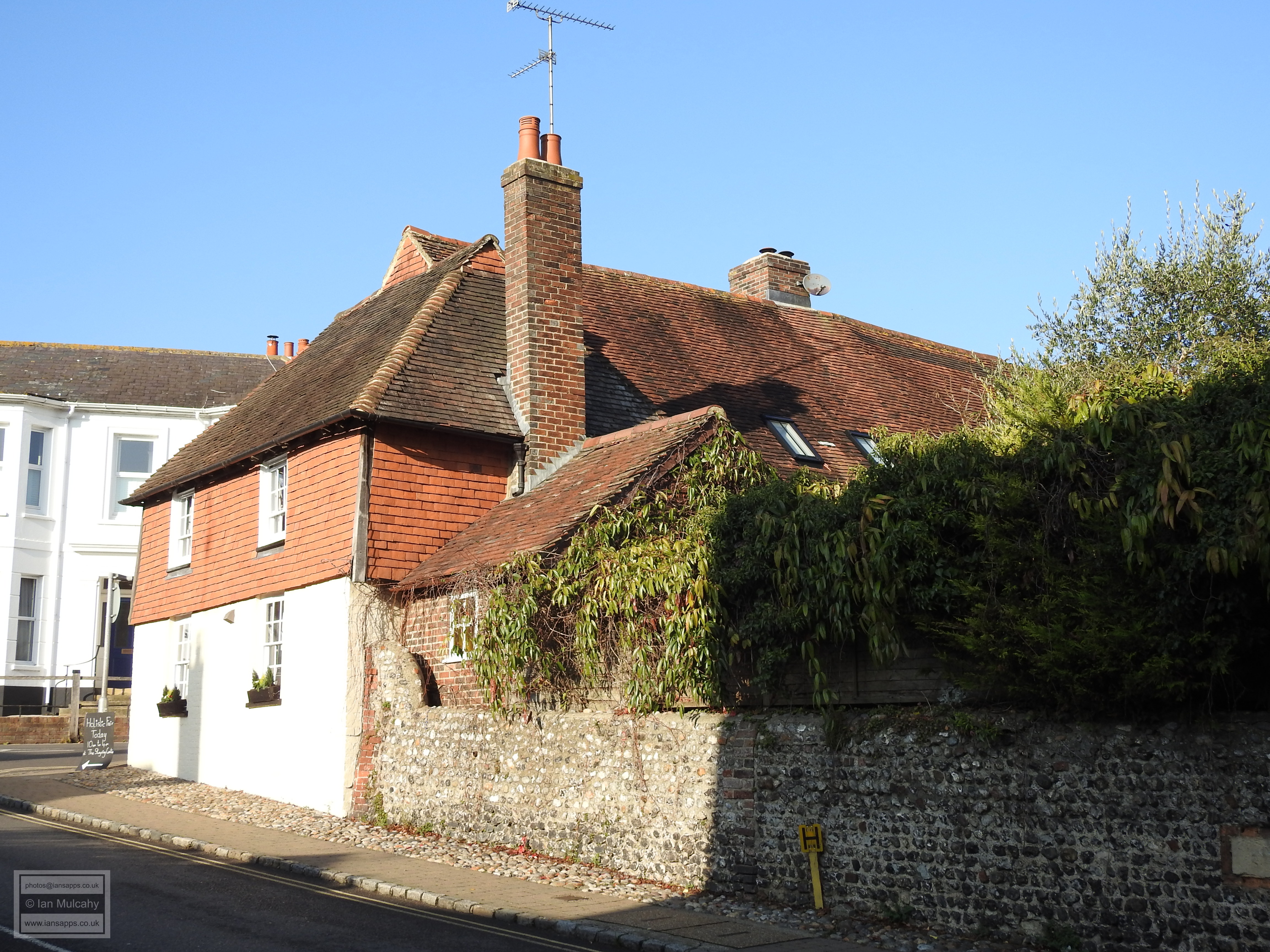
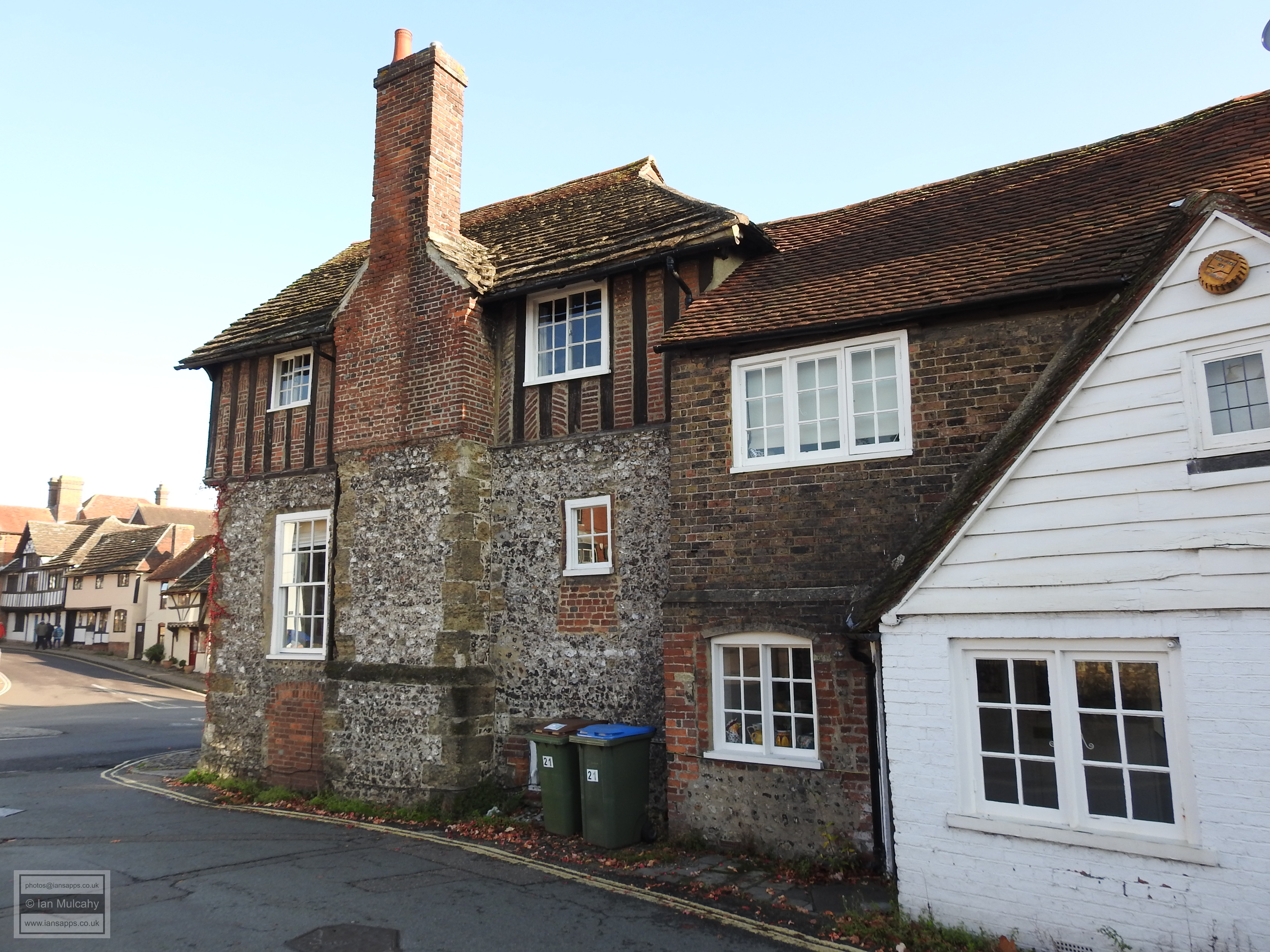
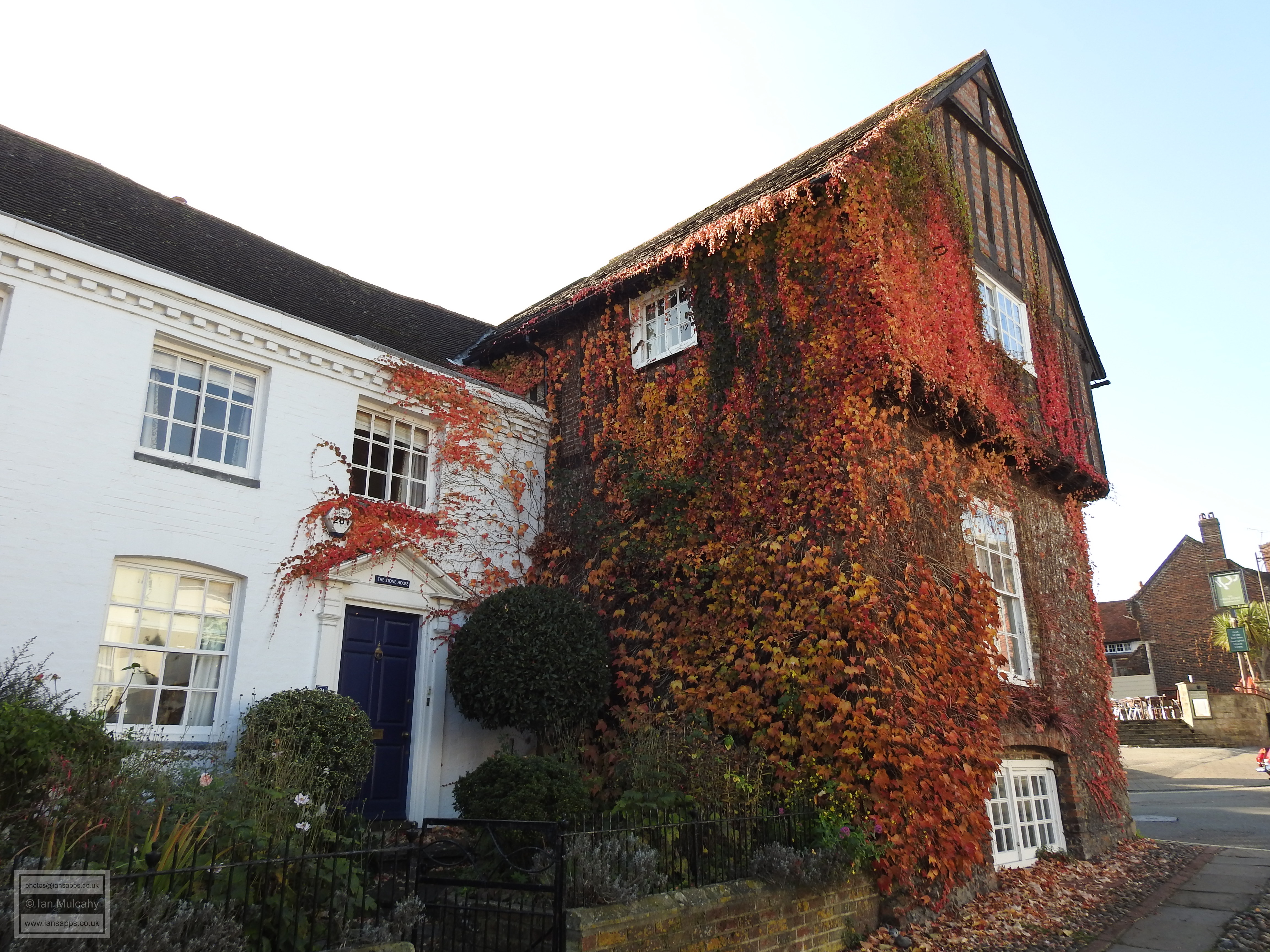
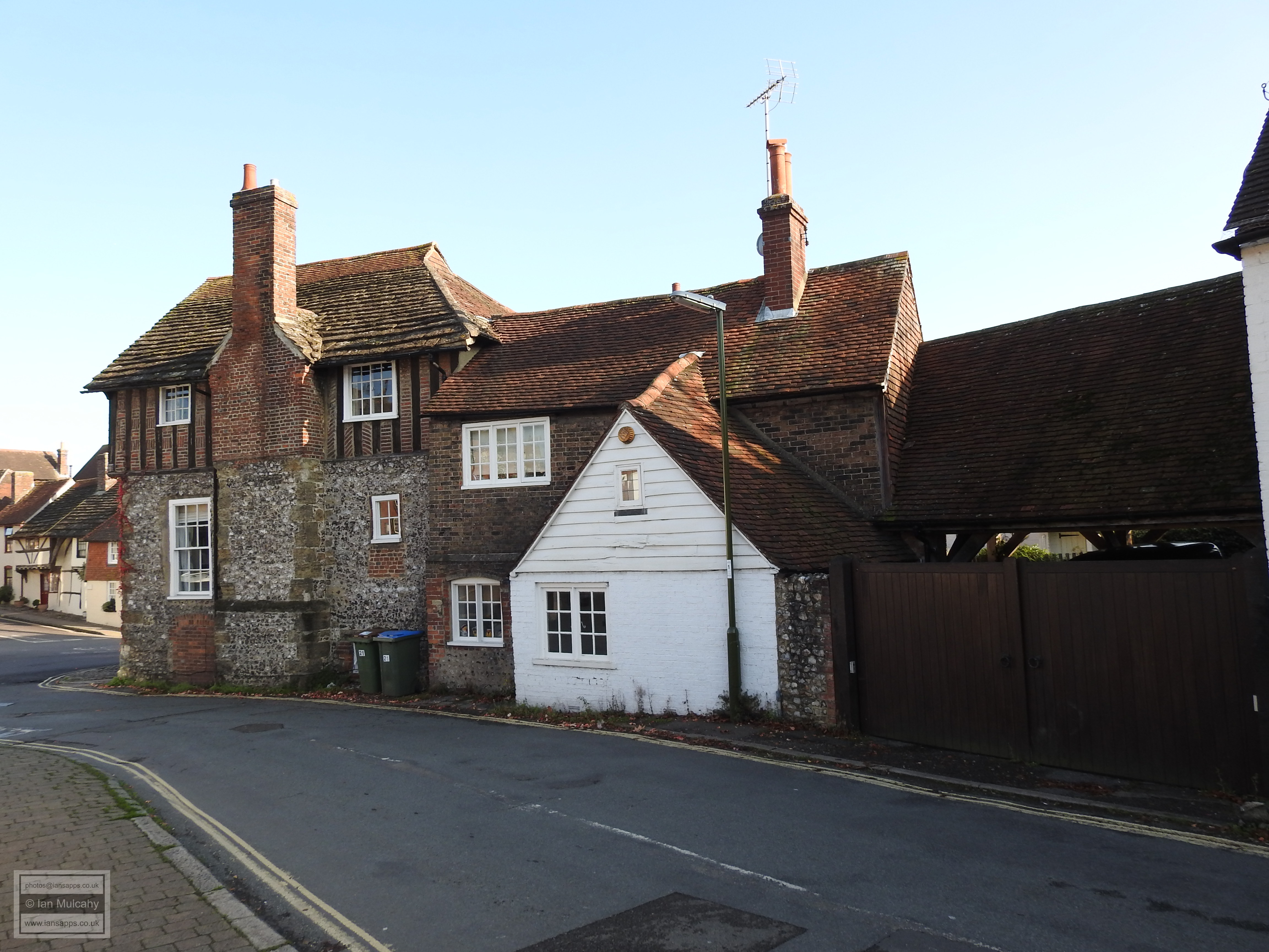
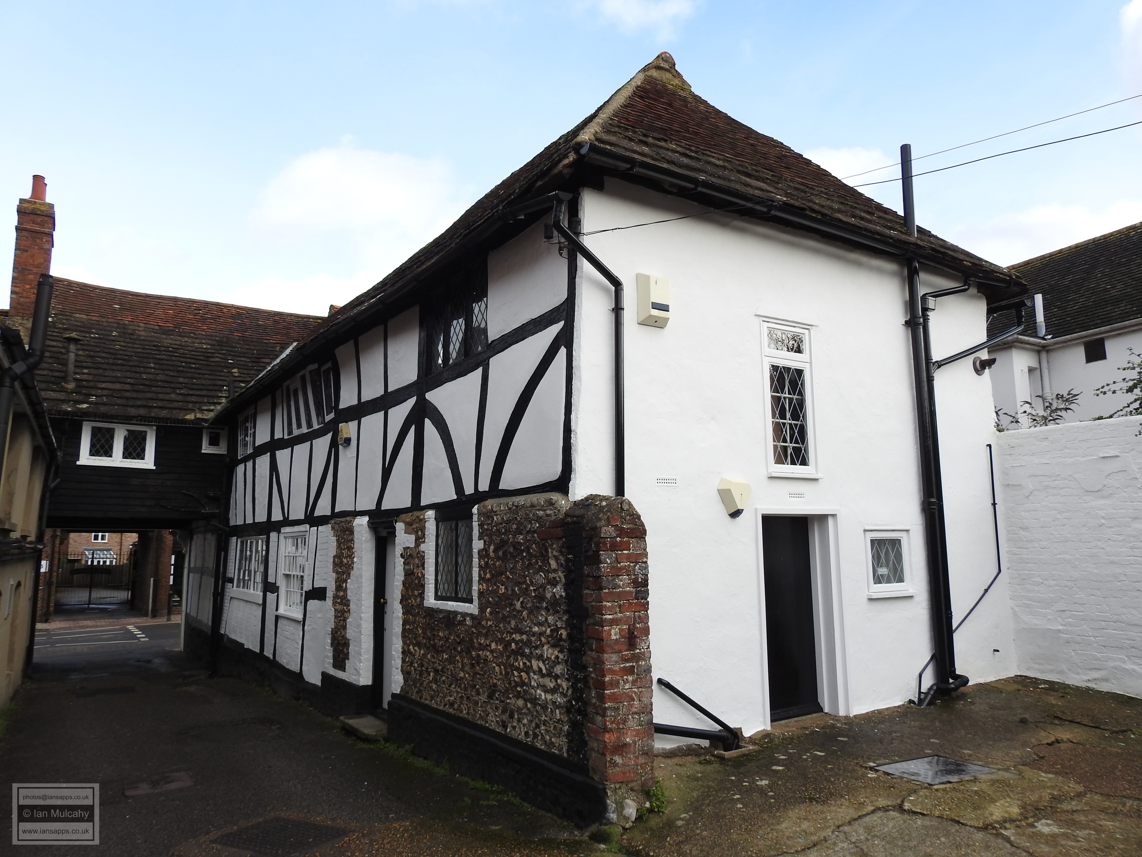
Before we walk along the north side of the High Street we can fix our gaze beyond the crossroads at the end of Church Street on The Stone House, the lower stone portion of which was built in the early 1300s on the site which is believed to have hosted King Cnut’s mint. The timber framed upstairs was added in the 16th century and the property has served time as a prison.
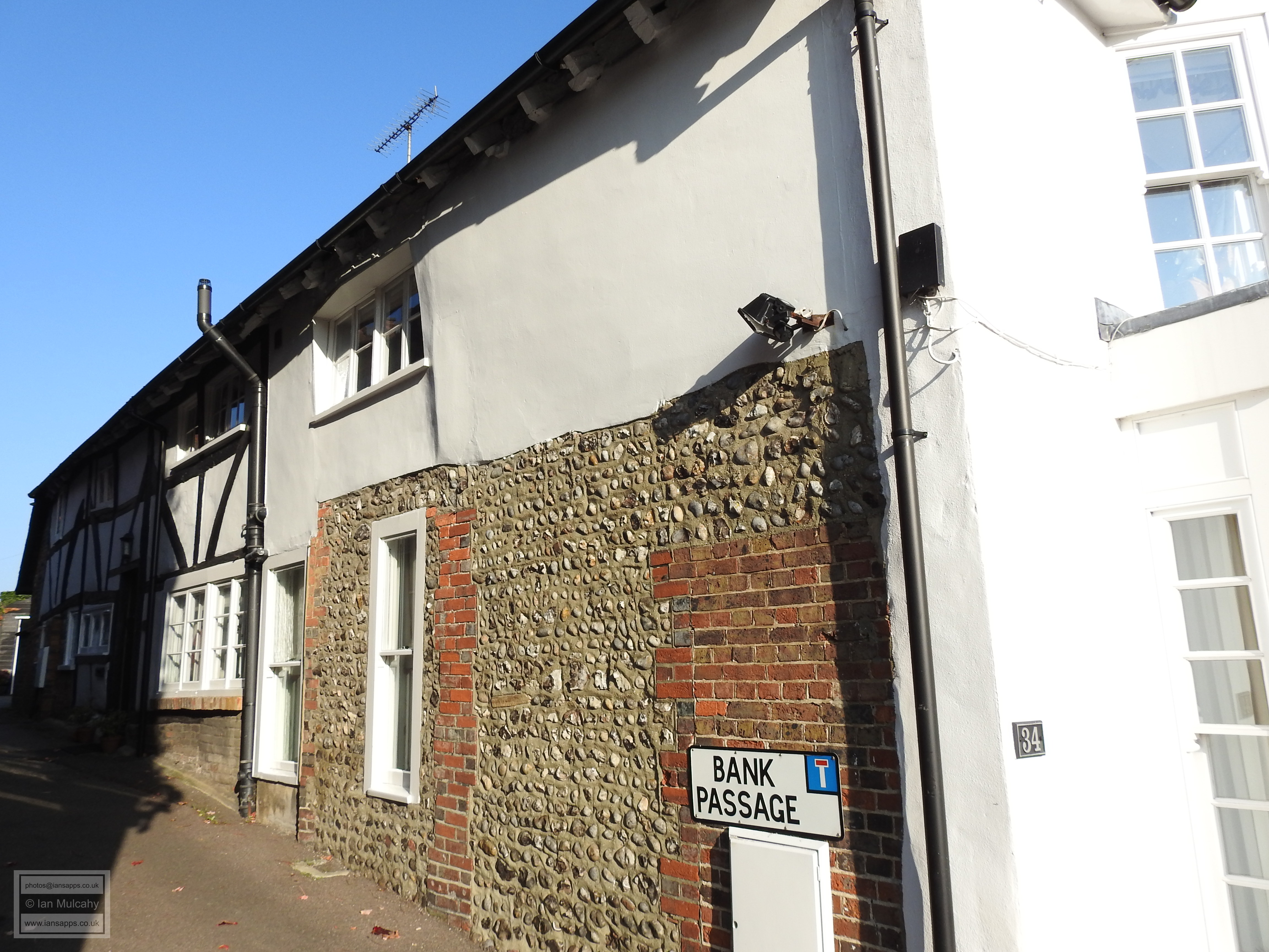
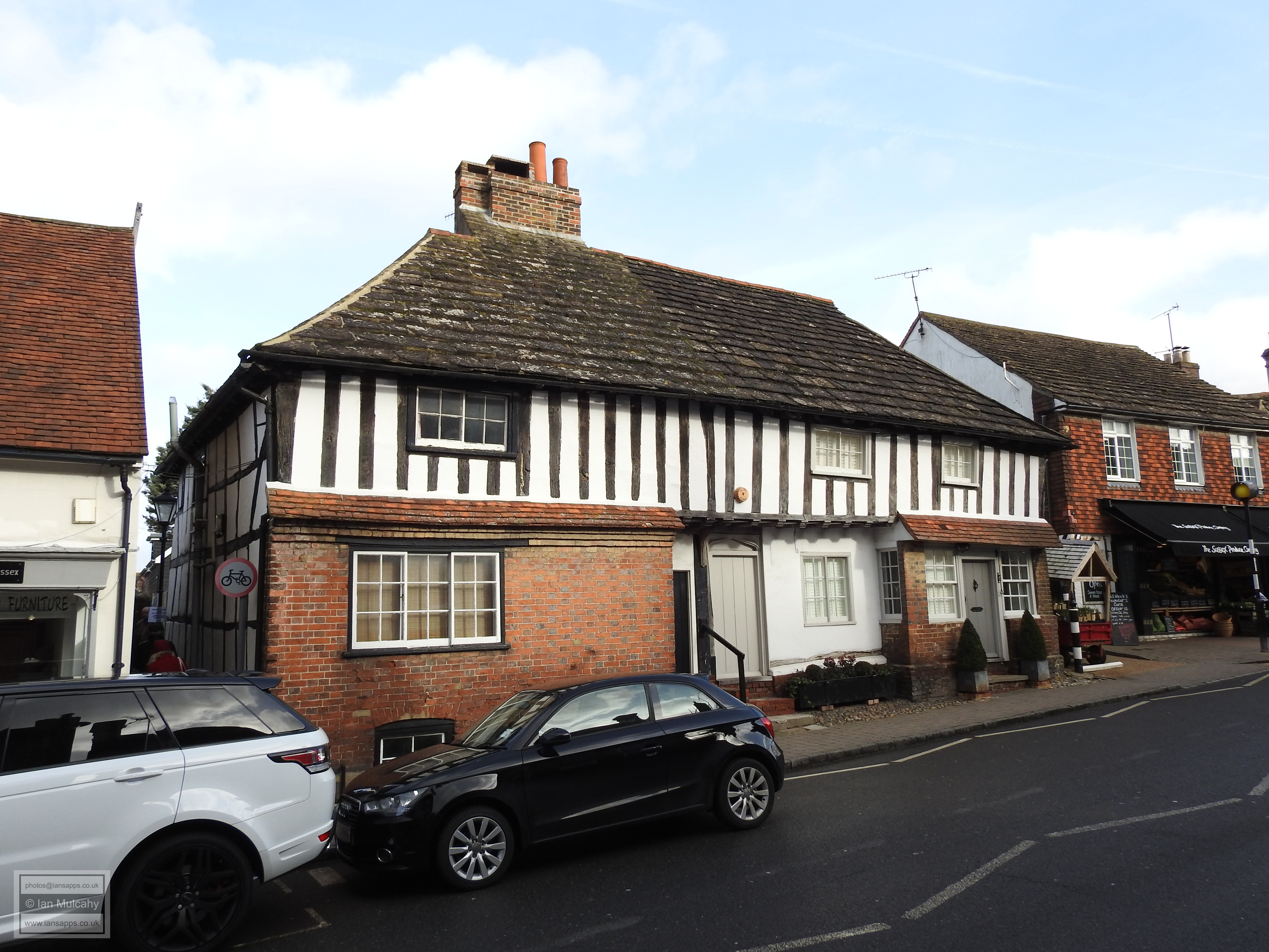
Back on the northern side, on the junction with Church Street, is 32 & 34 High Street, a 16th century building that was refronted in the 18th century. The building is now home to Steyning Tea Rooms, and its timber framing is visible to the western side and rear, via Bank Passage.
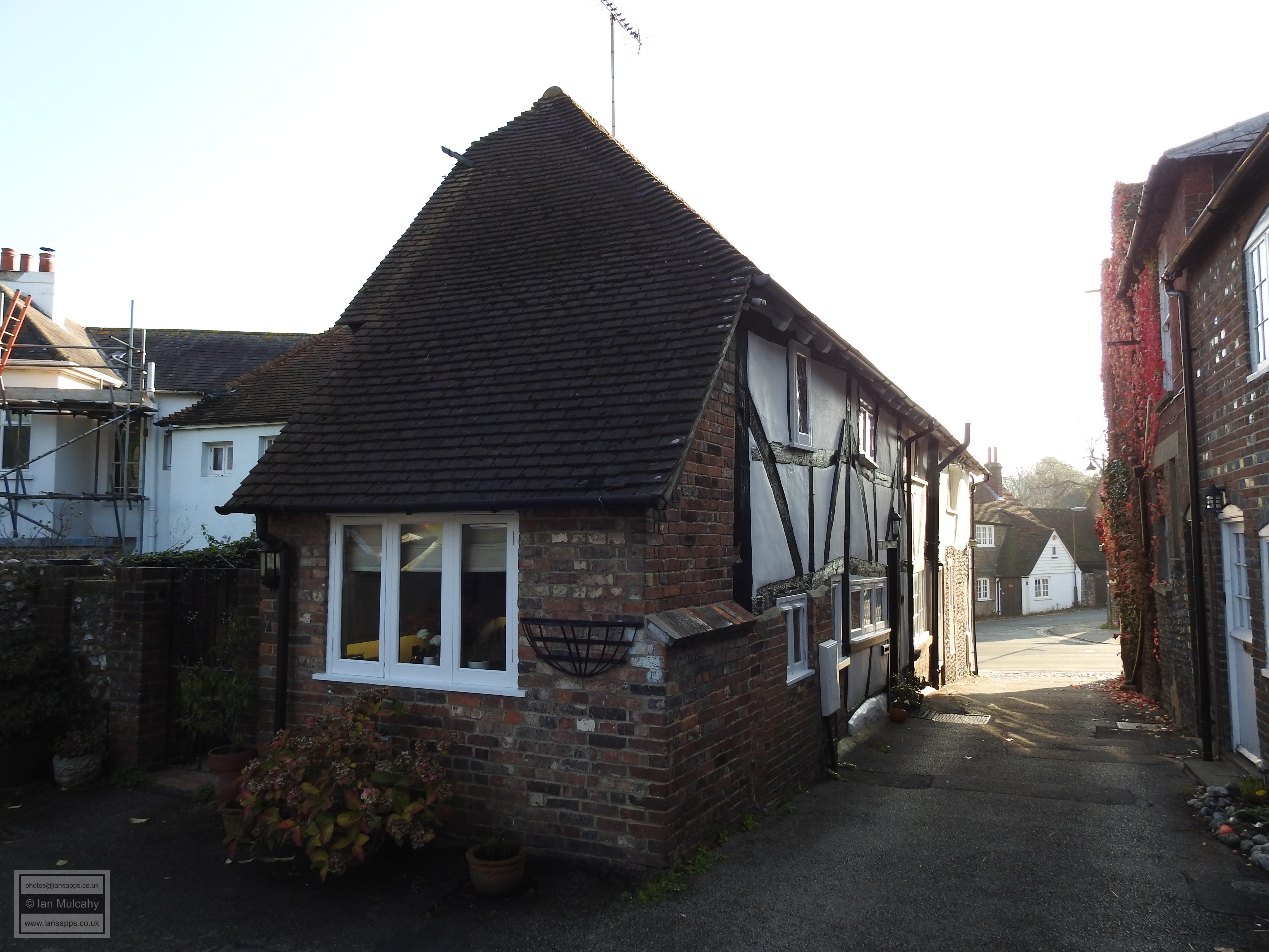
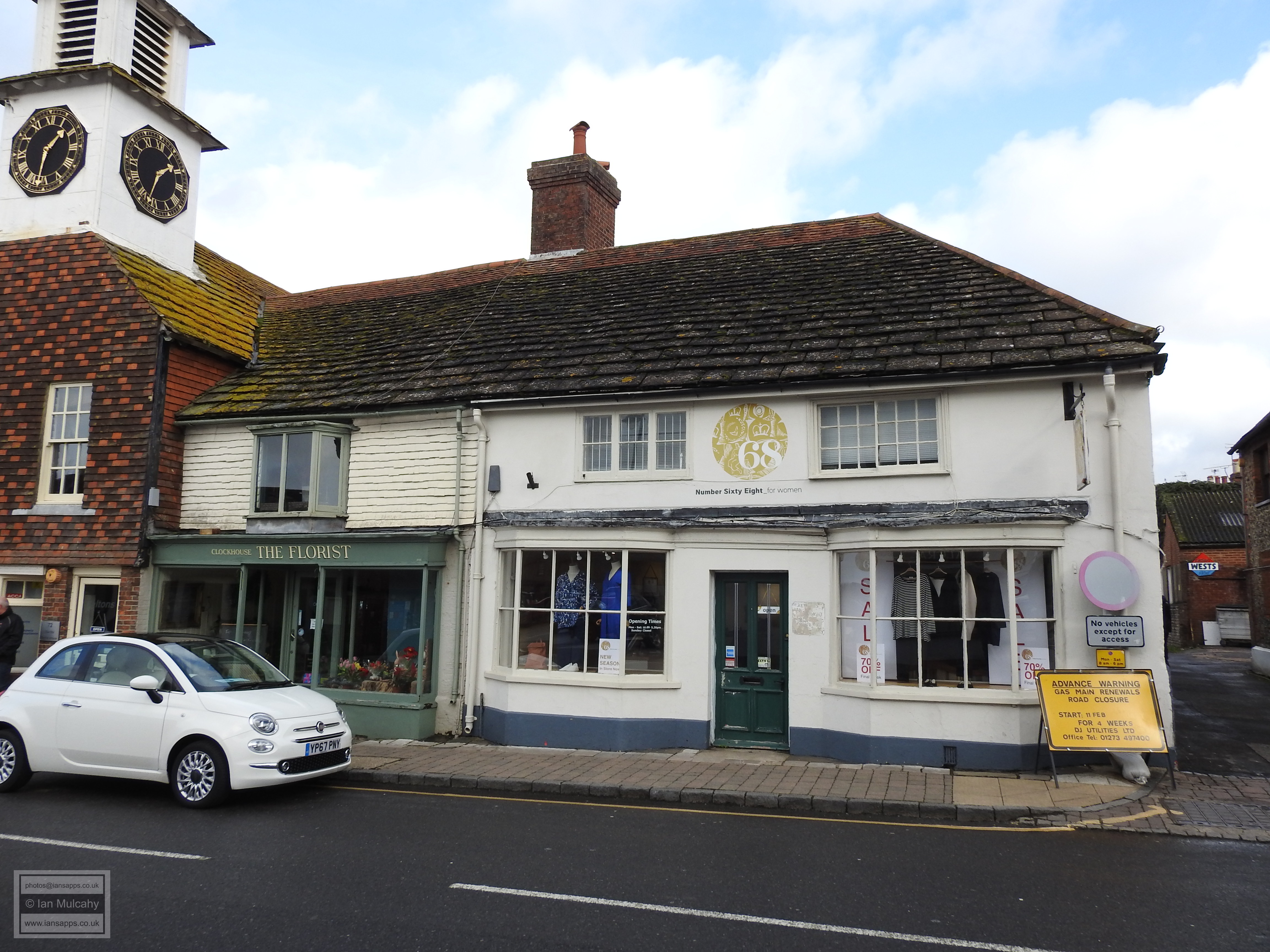
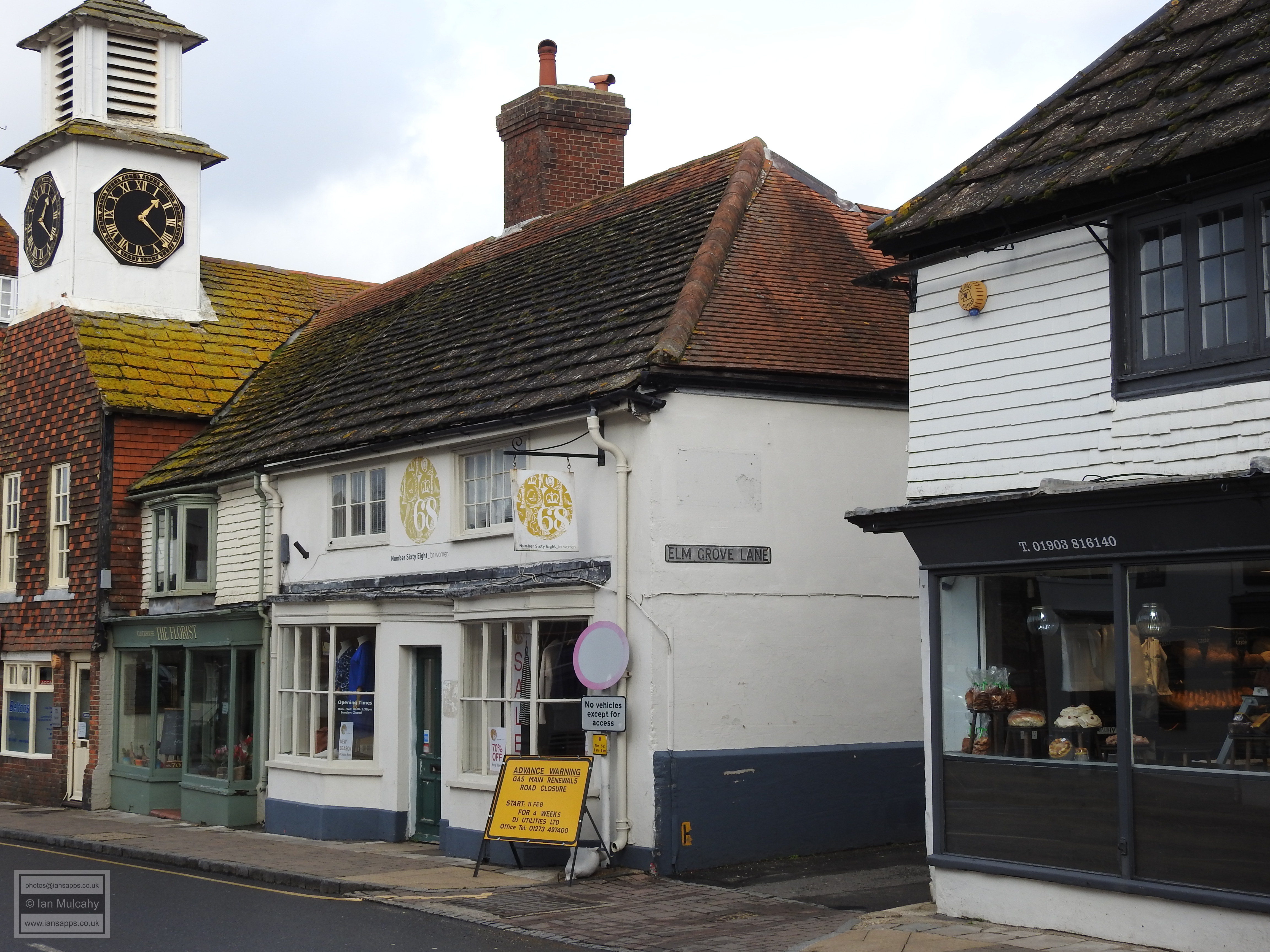
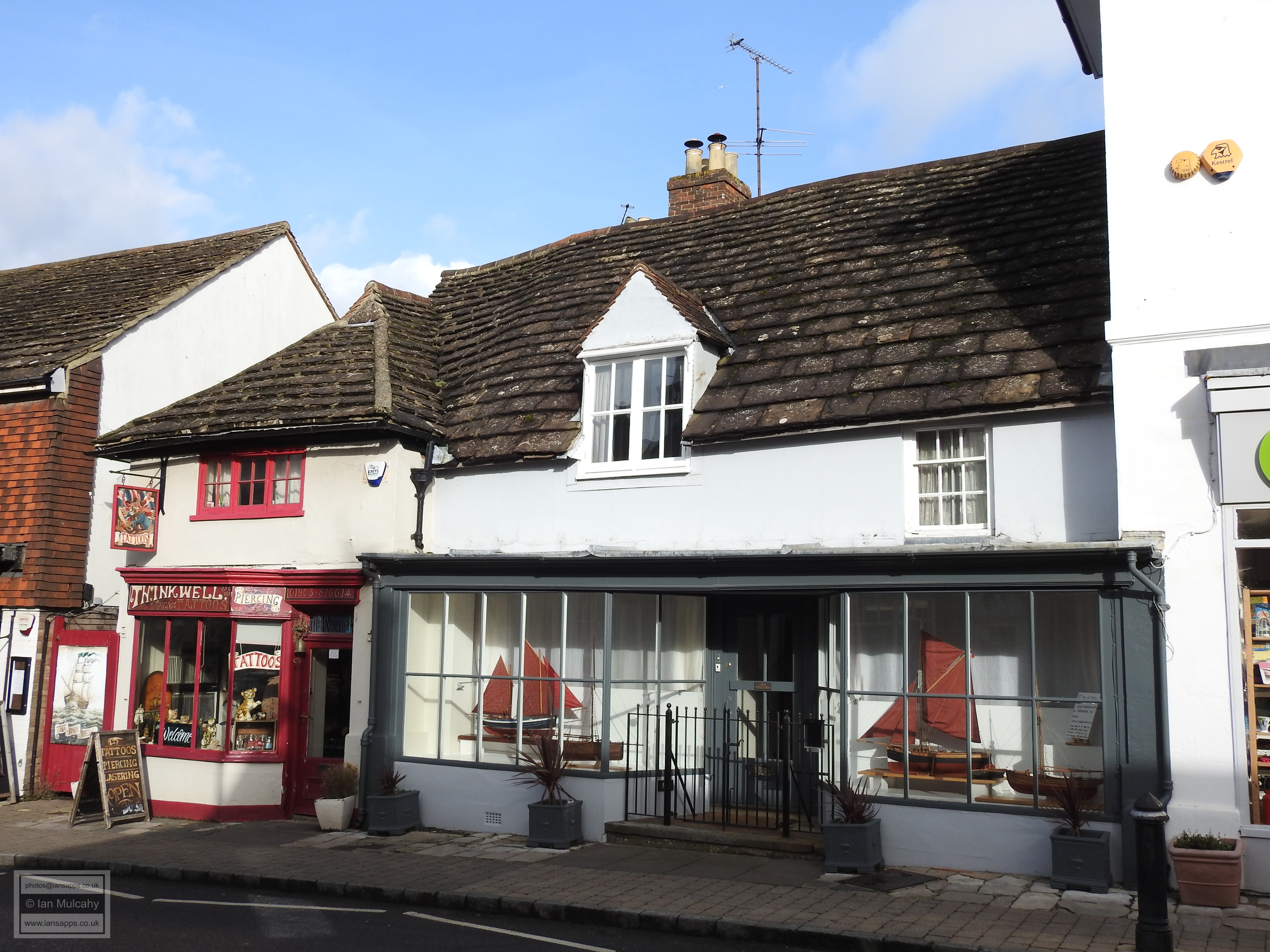
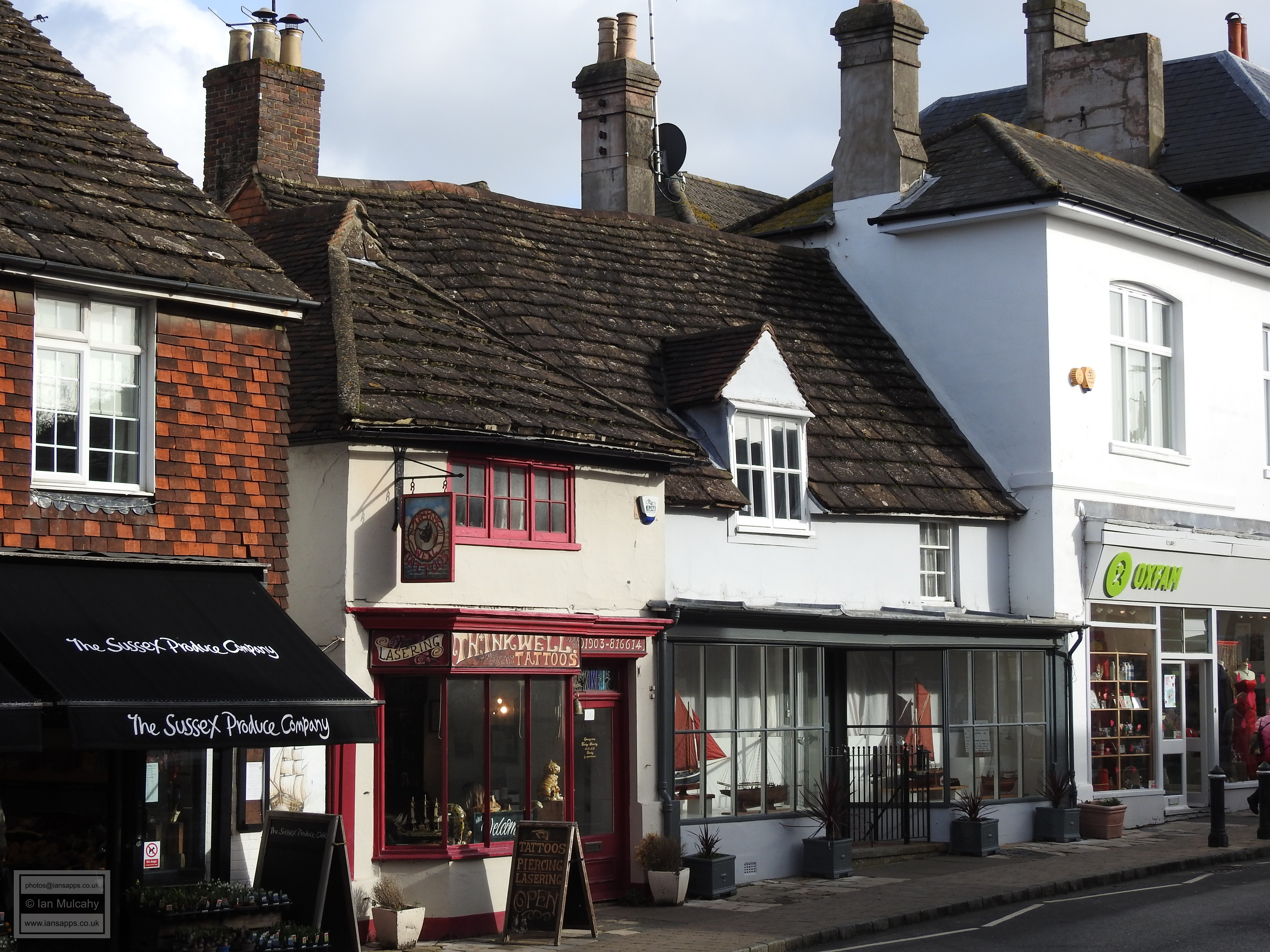
There are many medieval and Tudor buildings in Steyning (31 buildings in the town predate 1500 and a further 12 are from the 16th century), particularly in the High Street, that are no longer recognisable as such due to their archetypal timbers being hidden behind 18th and 19th century renderings and facades. Many of these have been excluded from this tour as they do not offer anything spectacularly pleasing on the eye, externally, but should you visit the town the evidence of the true age of these buildings is visible inside some of the shops, the Post Office being a particularly good example. Moving along the northern side of the High Street the next building we shall look at is 68 & 70 High Street, a couple of hundred yards along. This is a 15th century Wealden house, unfortunately disguised with the recessed centre and lower floor built out to be flush with the jettied wings and the whole building rendered, though it remains recognisable by the shape of the roof. 84 & 86 High Street is another 15th century structure, again unfortunately rendered, but retaining its character and identifiable by the roof.
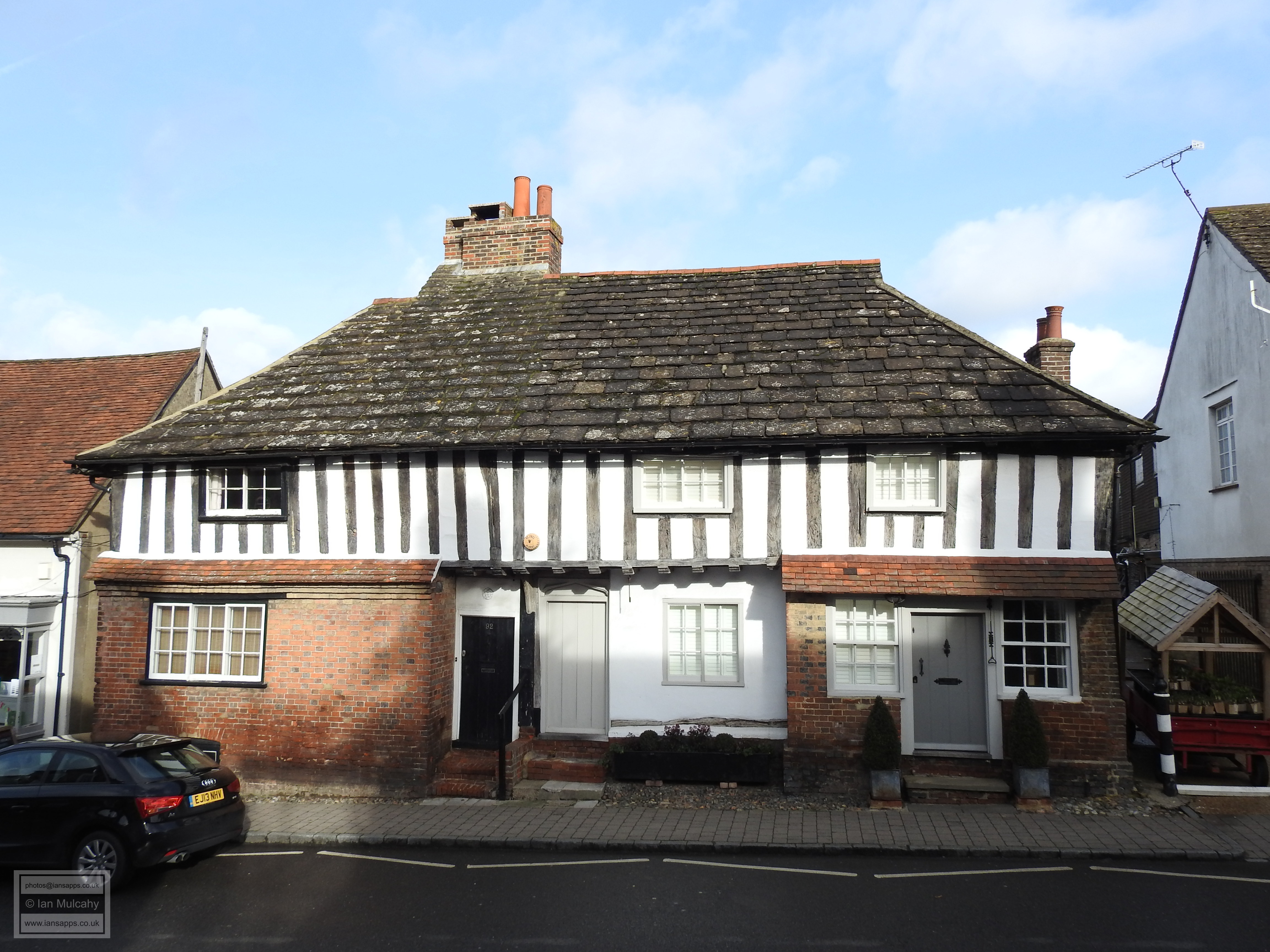
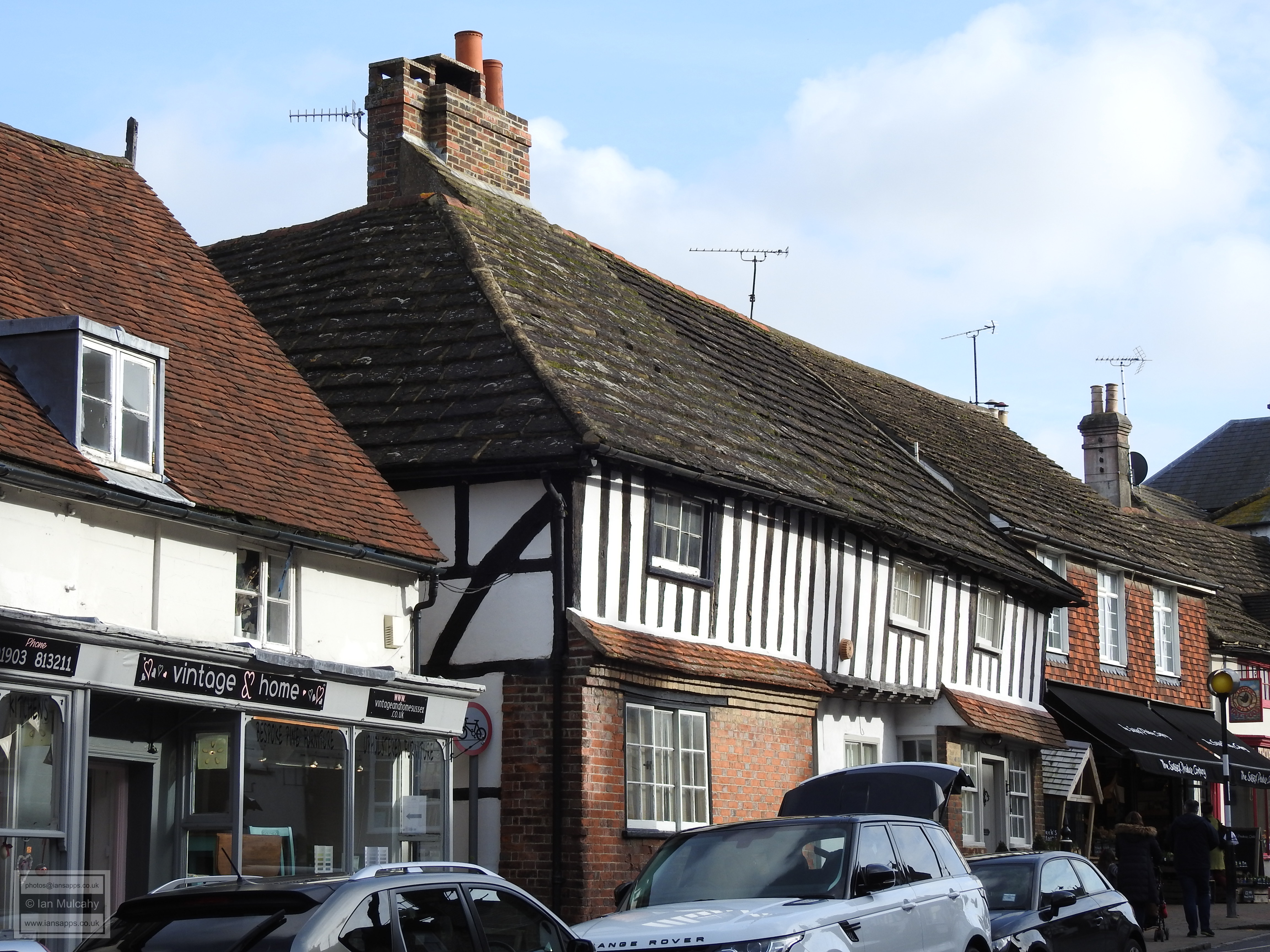
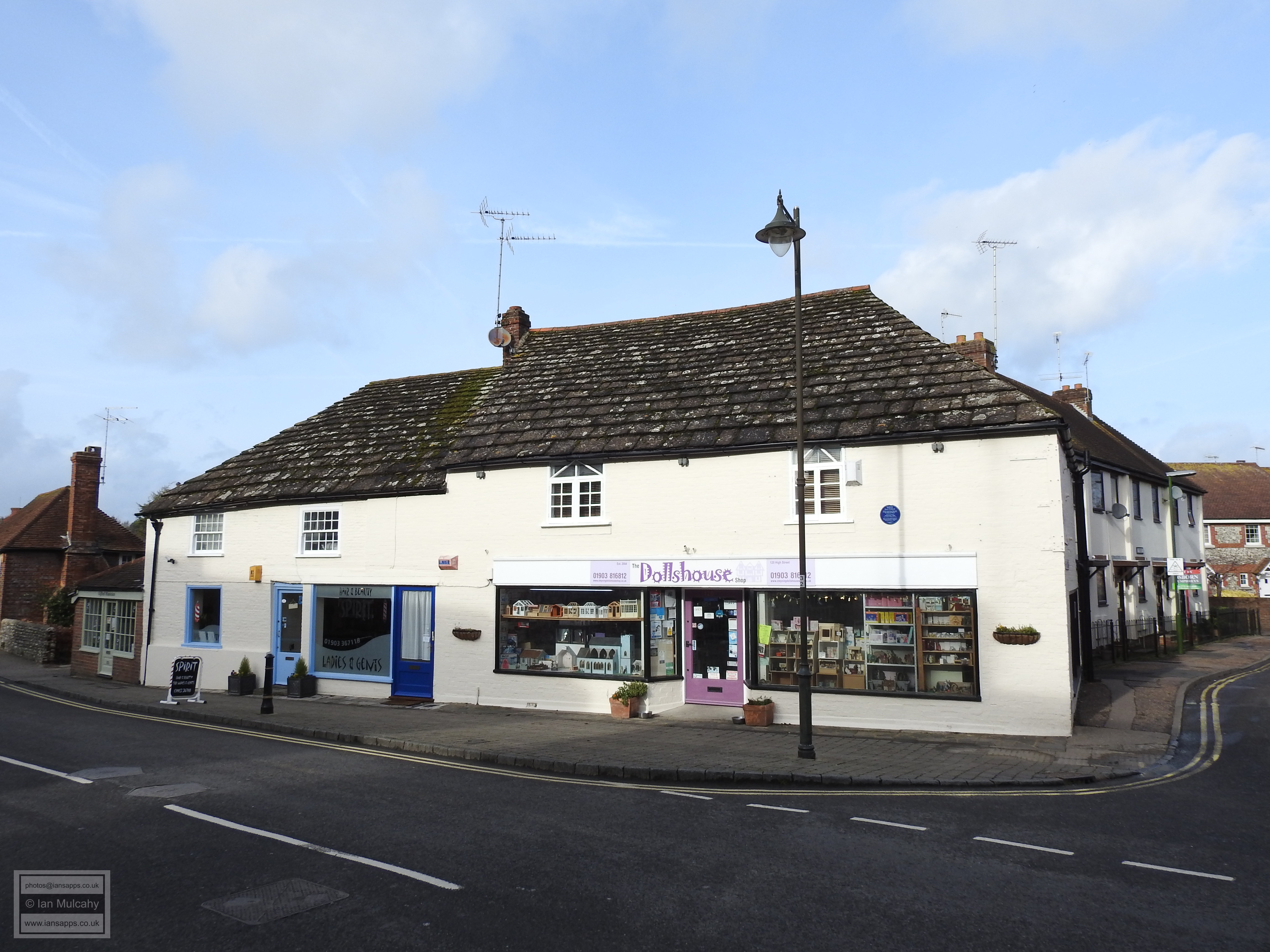
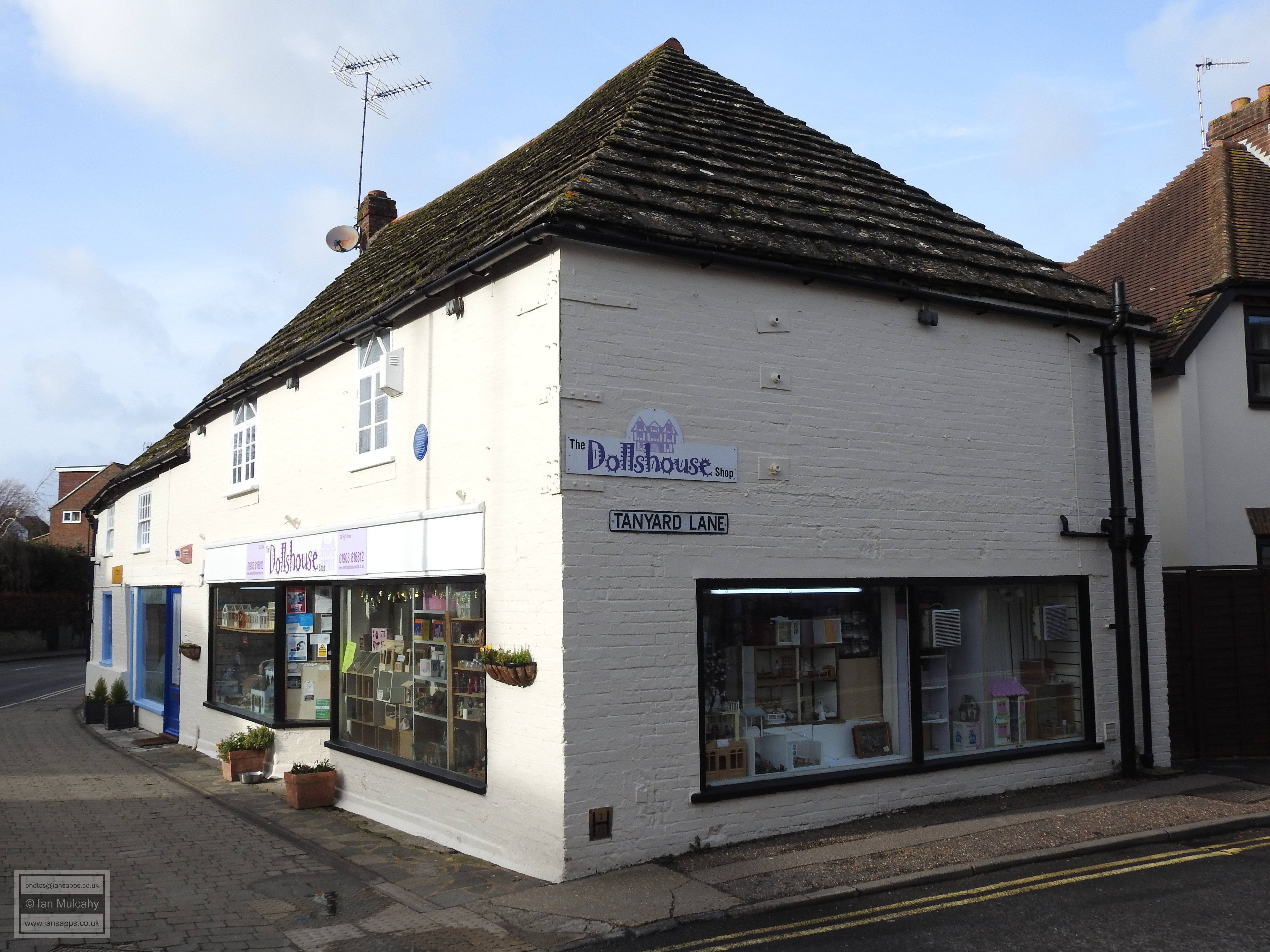
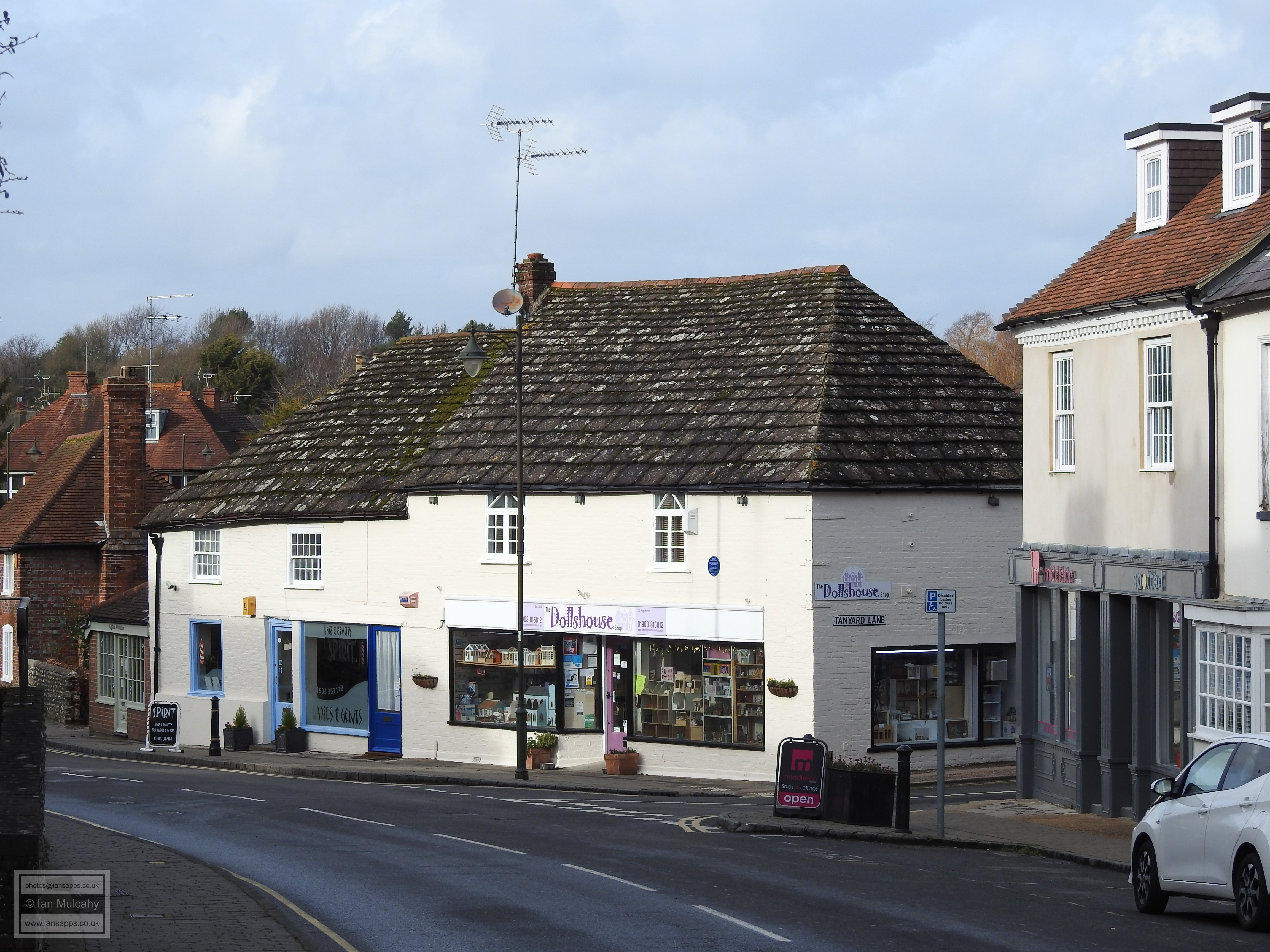
90 & 92 High Street is another 15th century timber framed building, but its timbers are proudly on display for our viewing pleasure. It has a full length jetty, but this has been under built at both ends, leaving just the central portion overhanging. Continuing with the 15th century theme, 120 & 122 High Street is a large L shaped block sitting on the western side of the junction with Tanyard Lane, another of the town’s Saxon thoroughfares. Despite having been refaced in painted brick, the building still manages to project a certain charm, the ancient Horsham stone roof being invaluable in facilitating this.
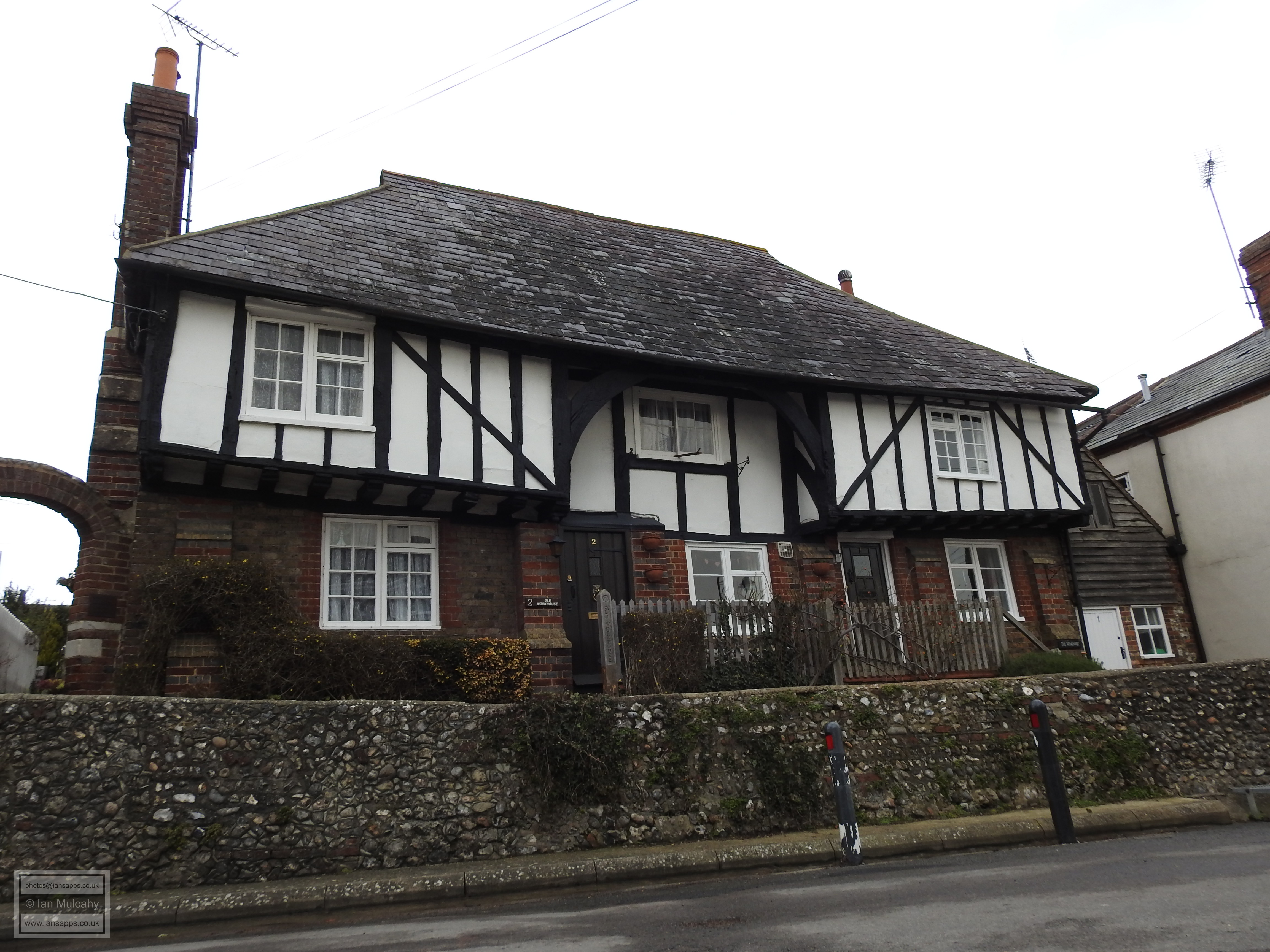
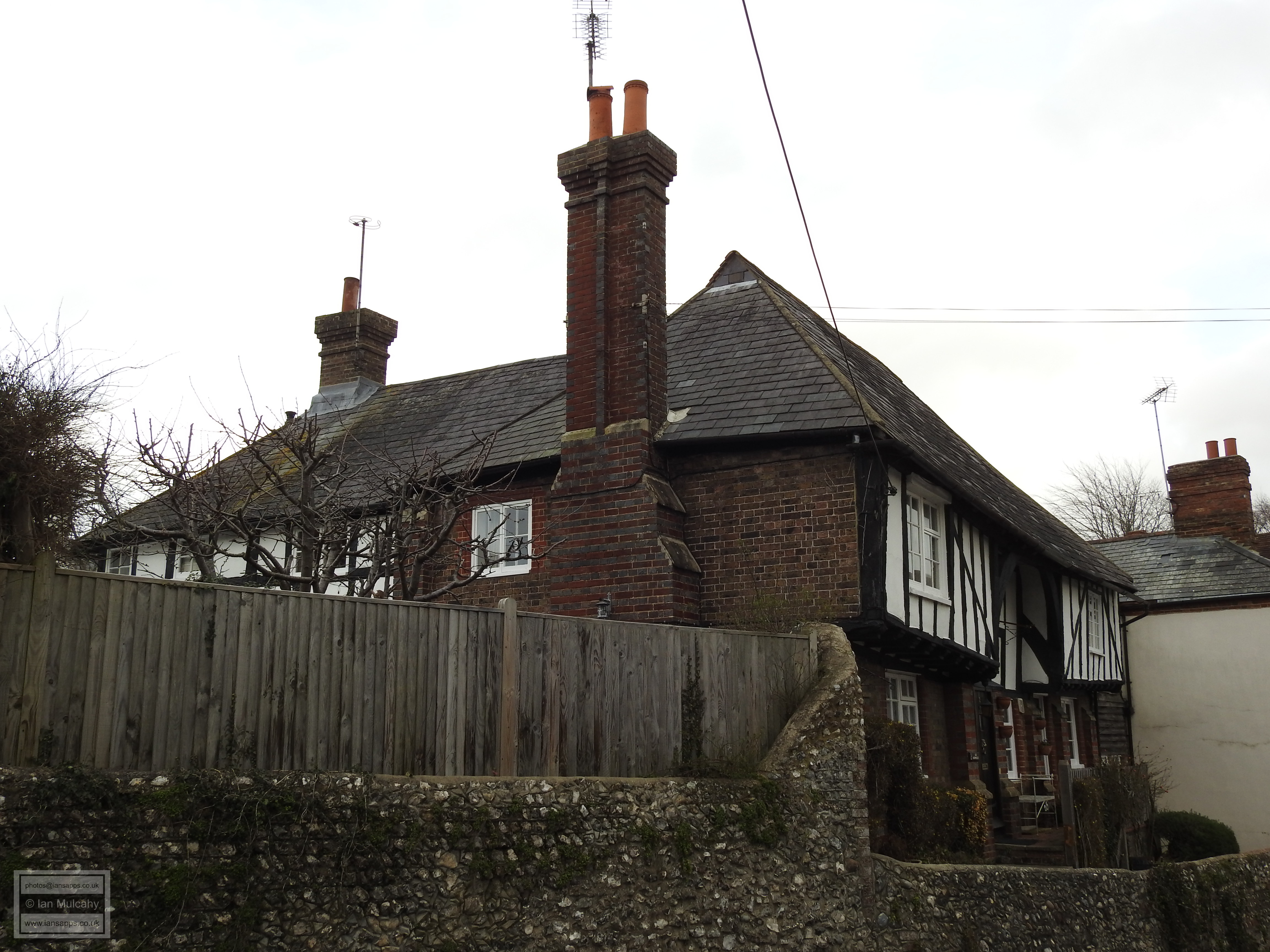
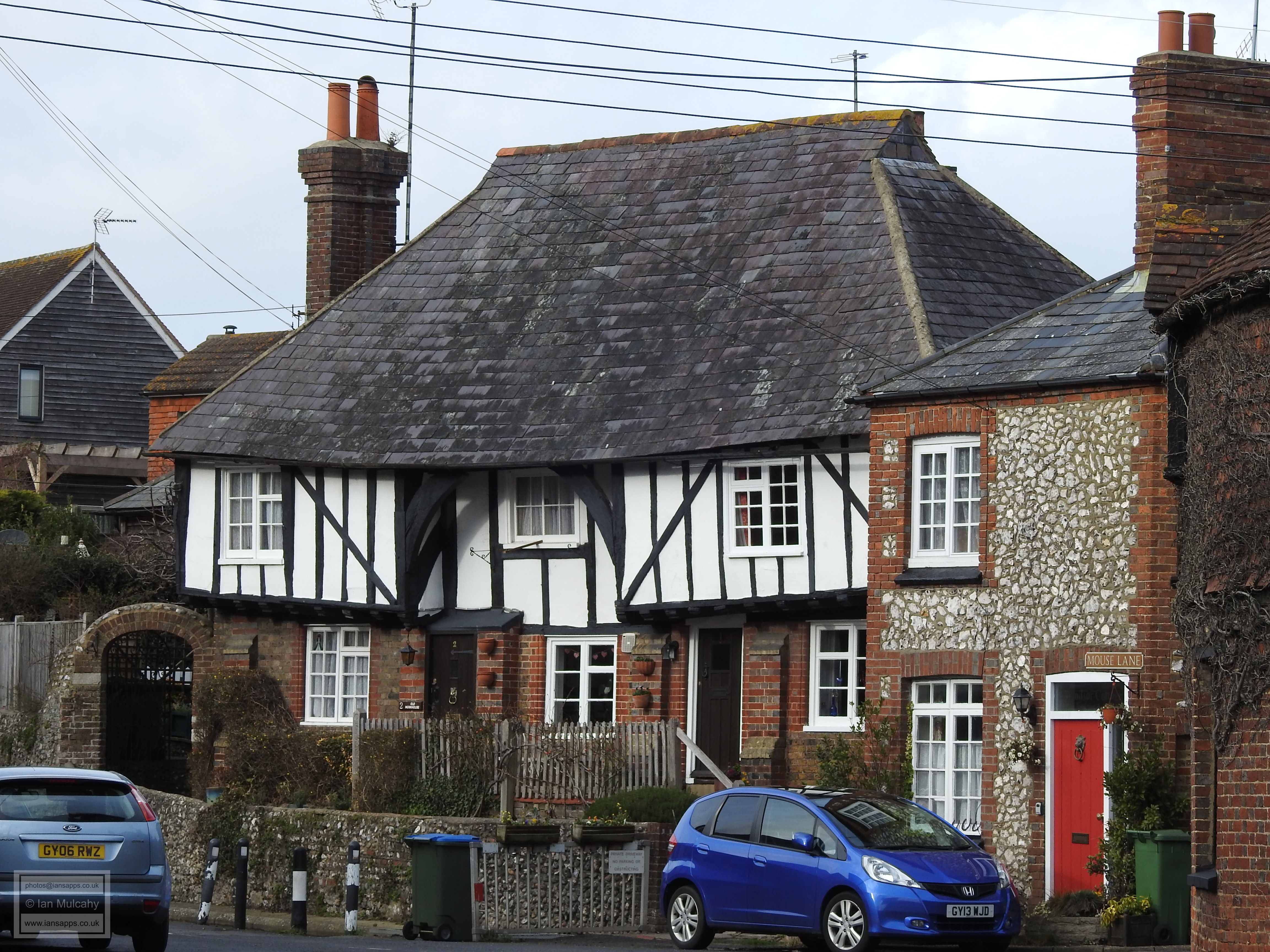
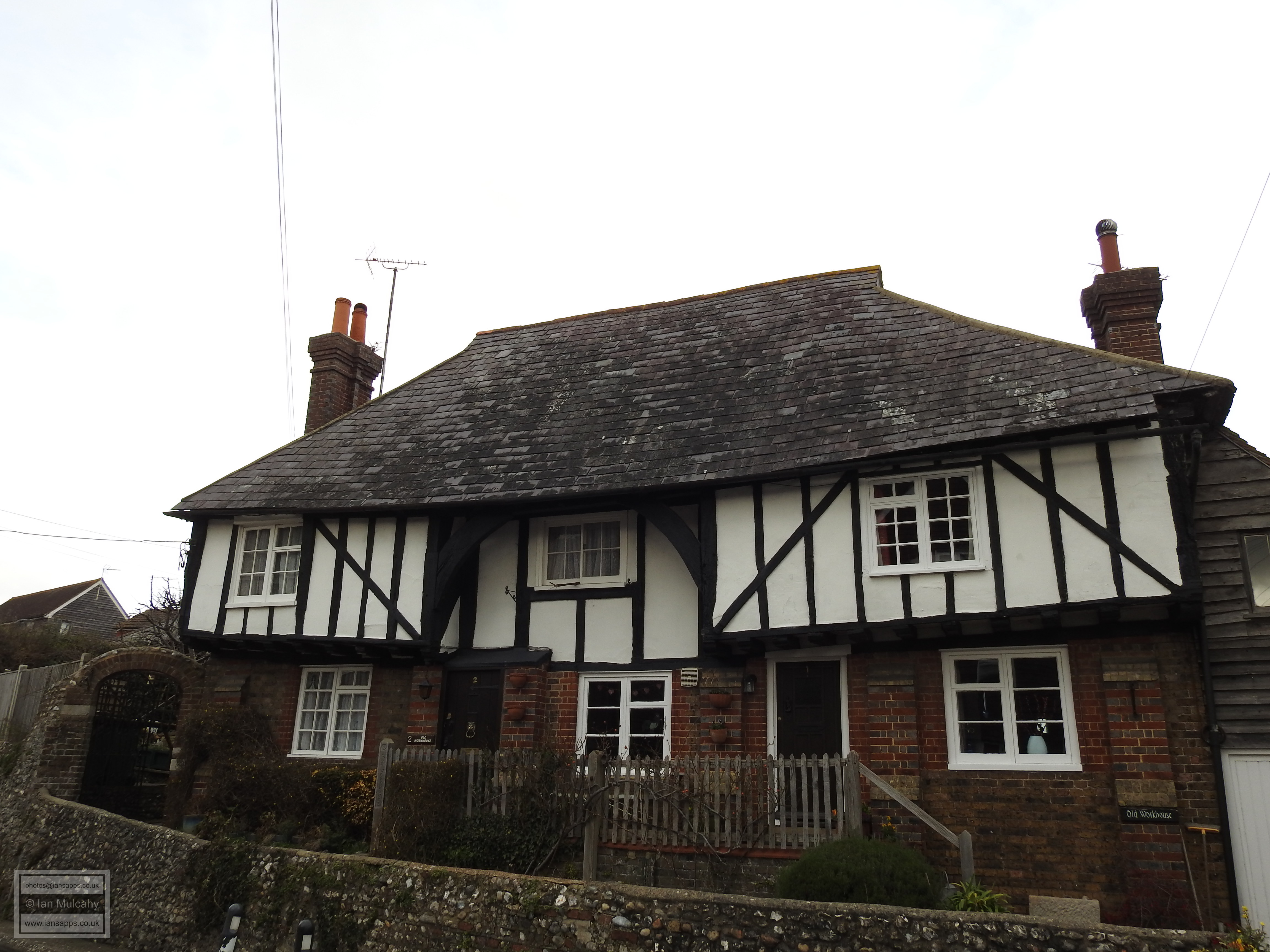
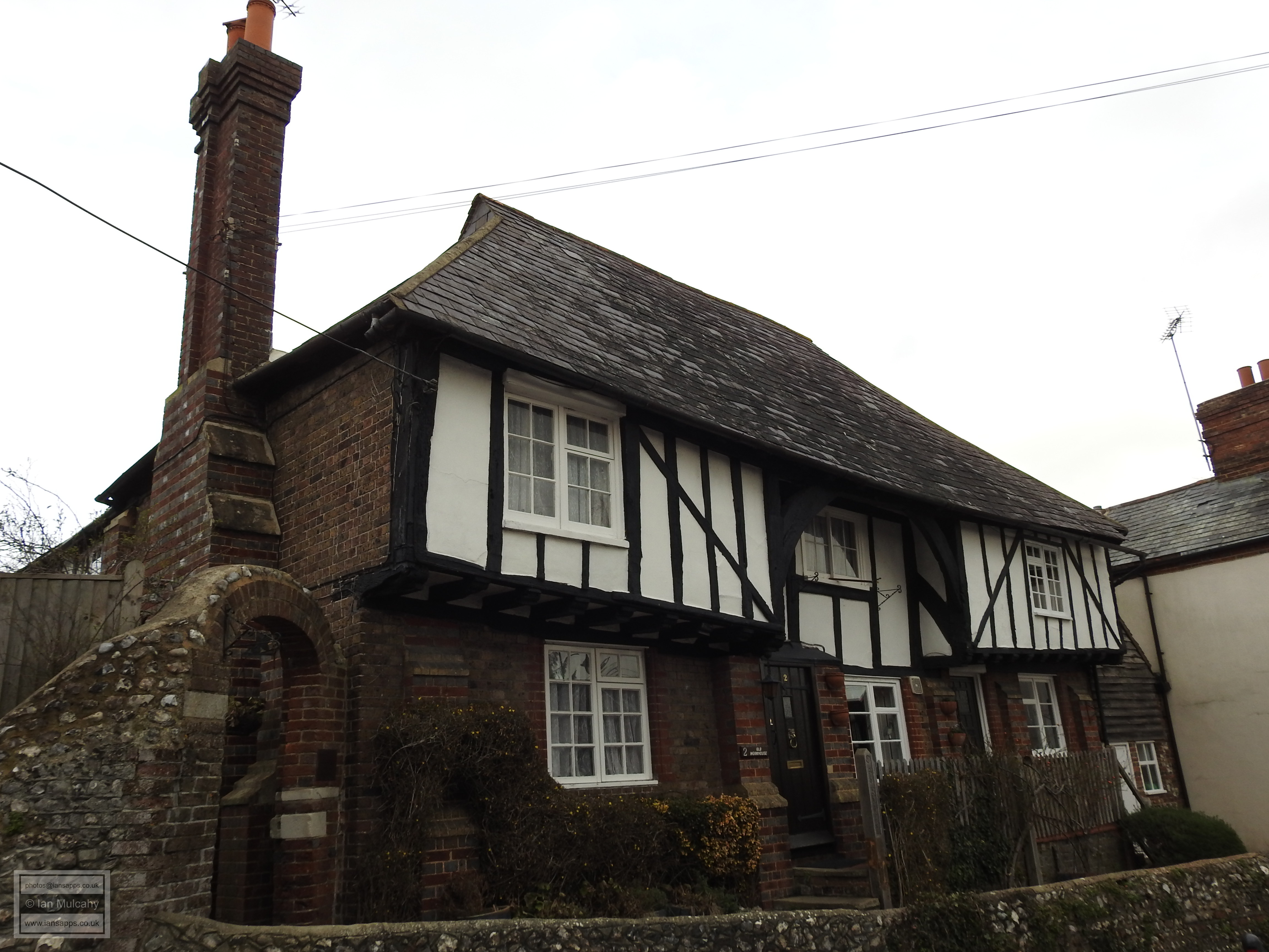
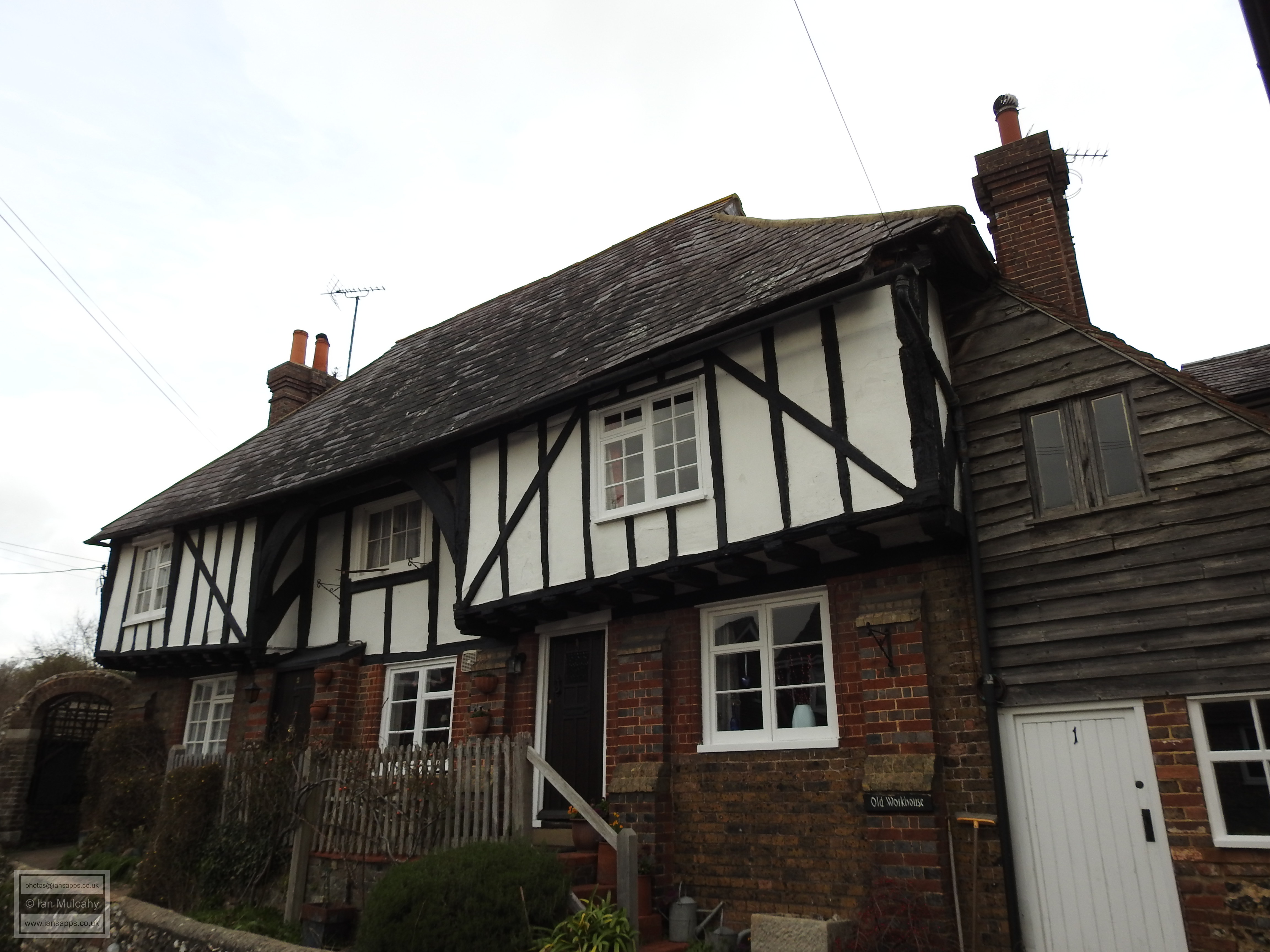
At the end of the High Street where it becomes the Horsham Road, there is a little side turning called Mouse Lane and a few steps along Mouse Lane, on the right hand side, can be seen Old Workhouse Cottages, so named as the property was bought by the Parish as a workhouse in 1729; a function that it carried out until 1835 when larger premises were sought. An archetypal Wealden hall house, the cottage was built in approximately 1450 and its upper timbers remain visible, though the ground floor has been rebuilt in brick. To the rear is a large L shaped extension which, unusually, was added soon after the original build.
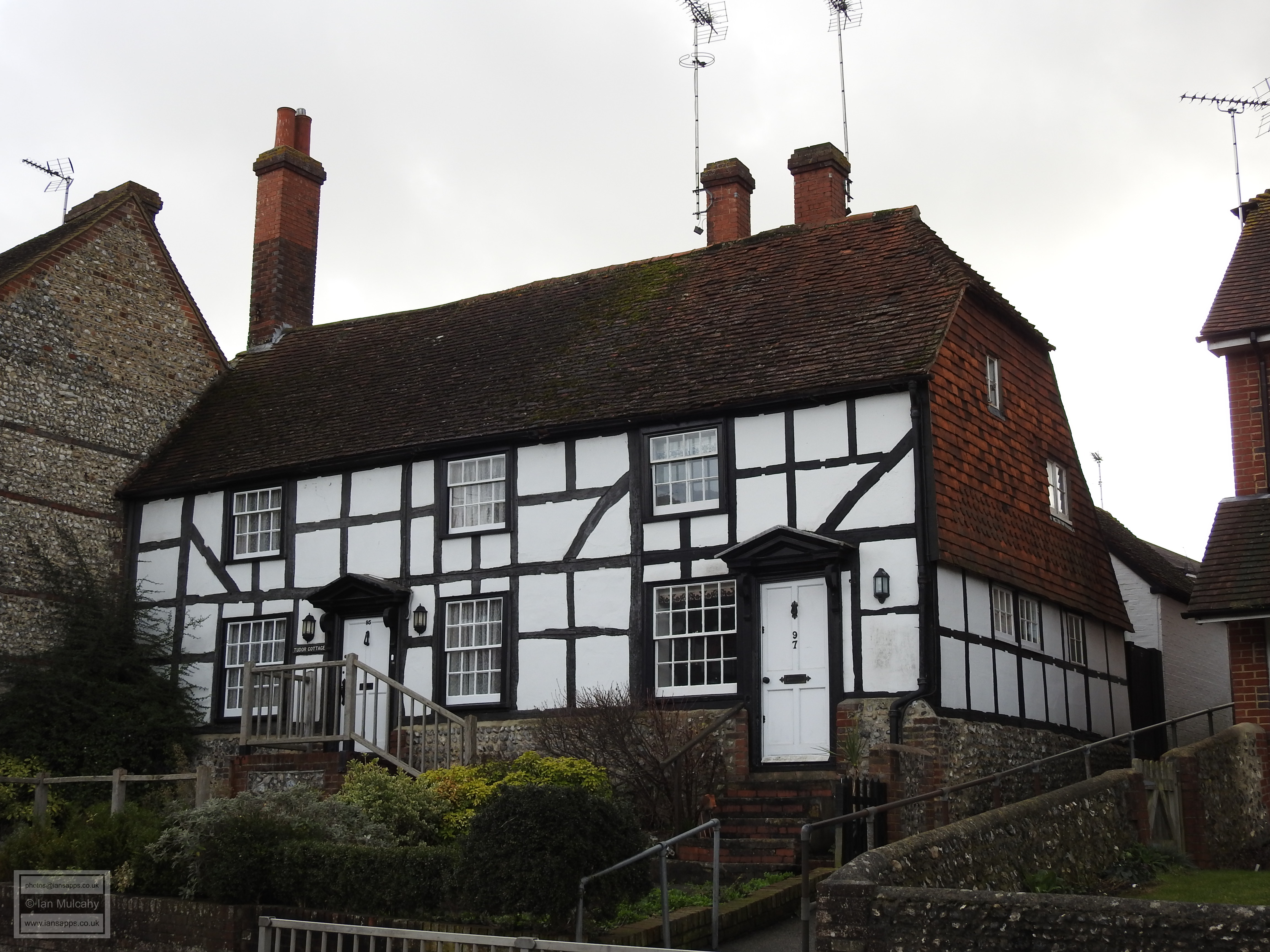
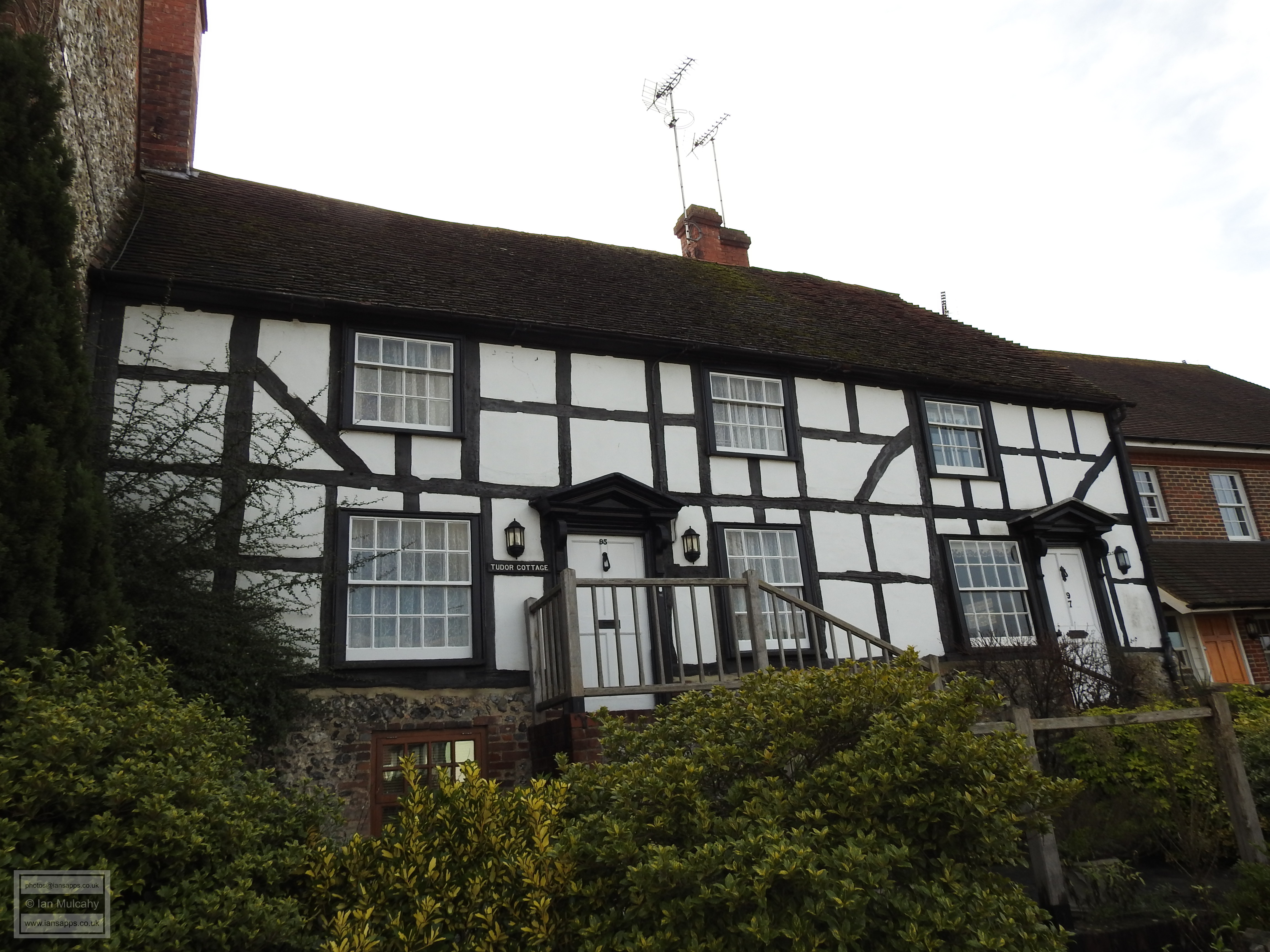
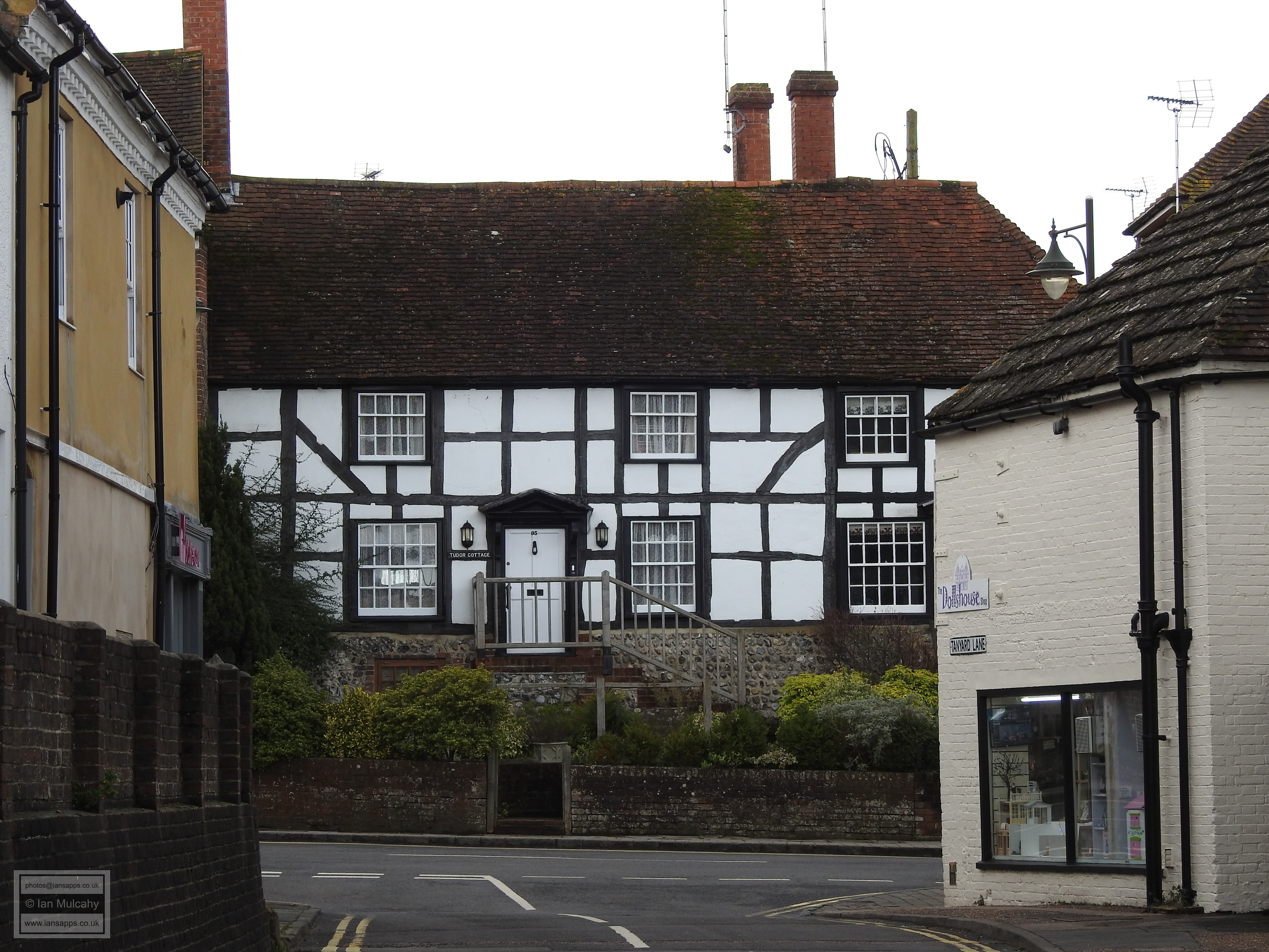
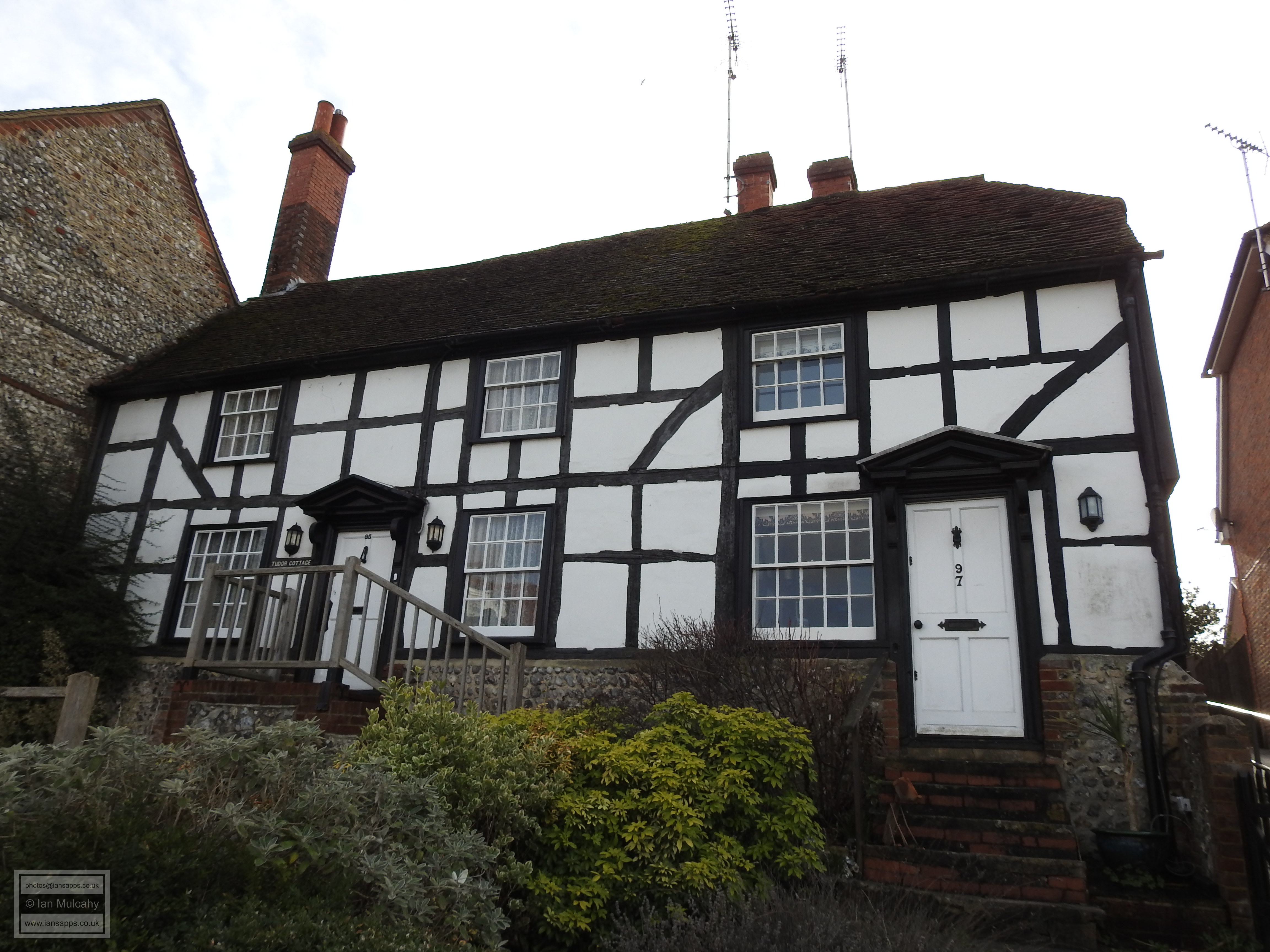
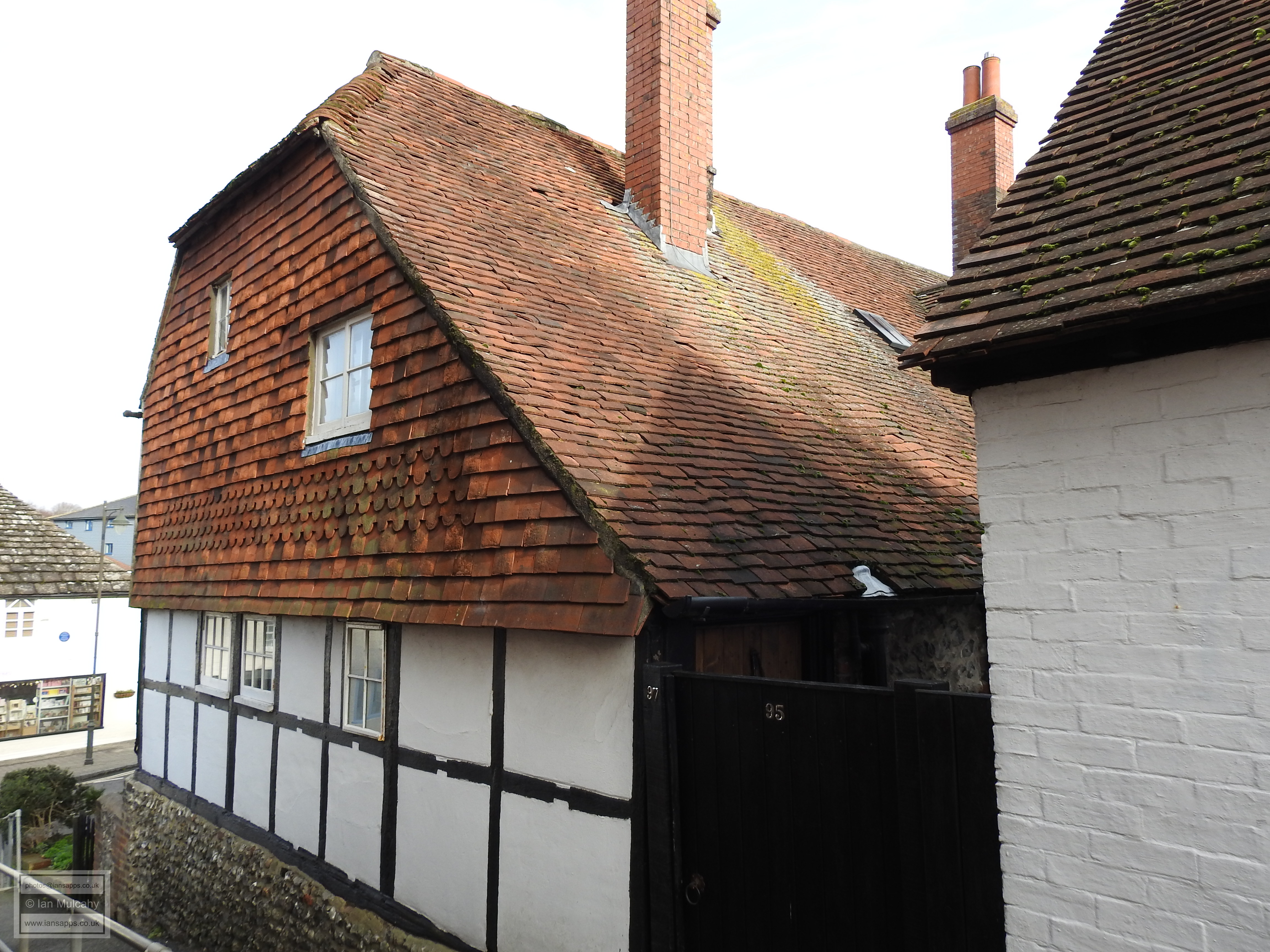
It’s now time to turn tail and head back along the southern side of the High Street and the first building of interest here is opposite numbers 120 & 122. 95 & 97 High Street is a relatively large pair of late 15th or early 16th century timber framed cottages with a couple of unusual features. Unlike most houses of this period within the central area of Steyning, 95 & 97 is set back a few yards from the road, affording the owners a small front garden. Was 16th century trade conducted from this space? The building is also raised on a flint and cobblestone base and, certainly with regards to no. 95, appears to have a cellar.
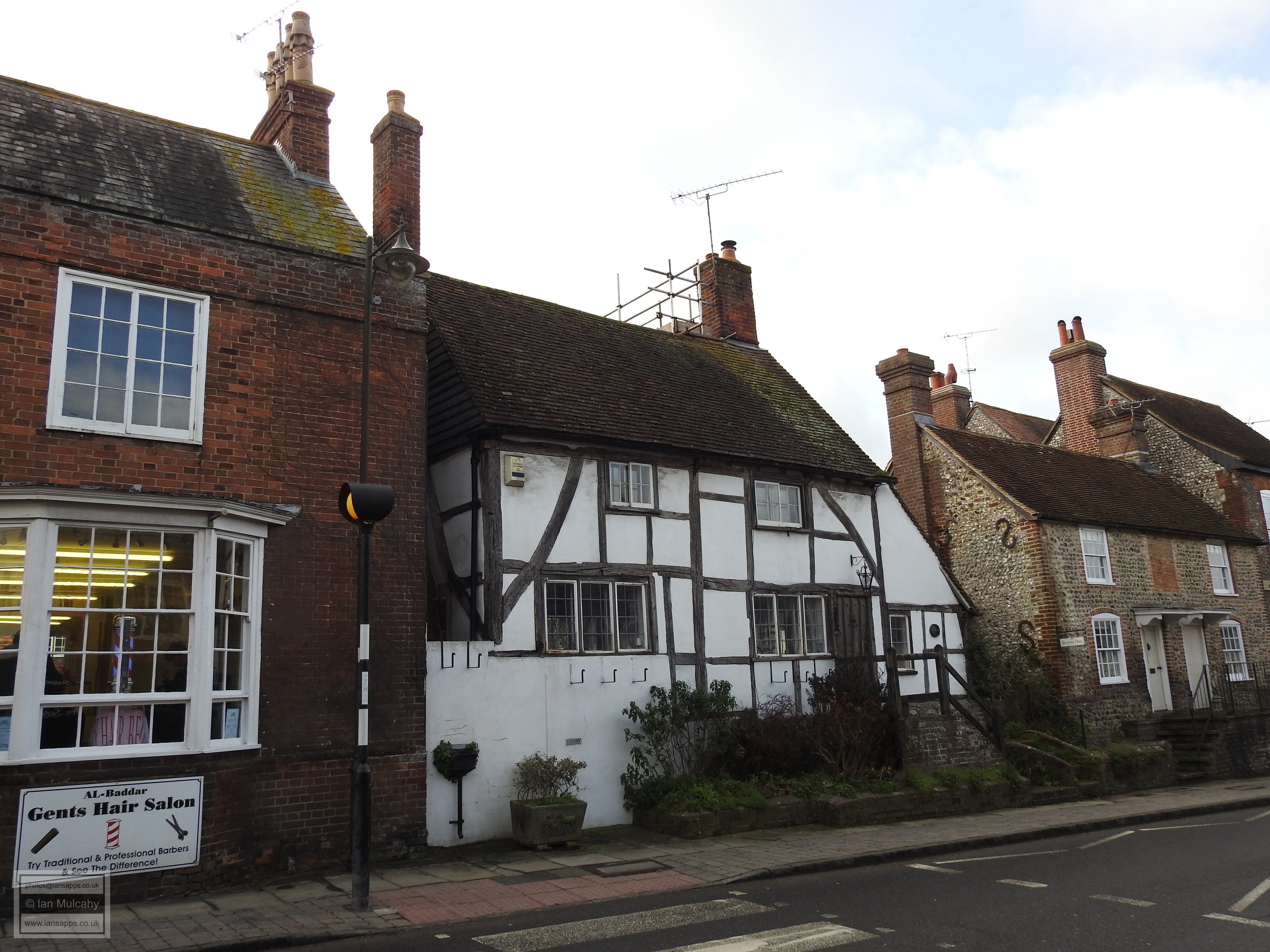
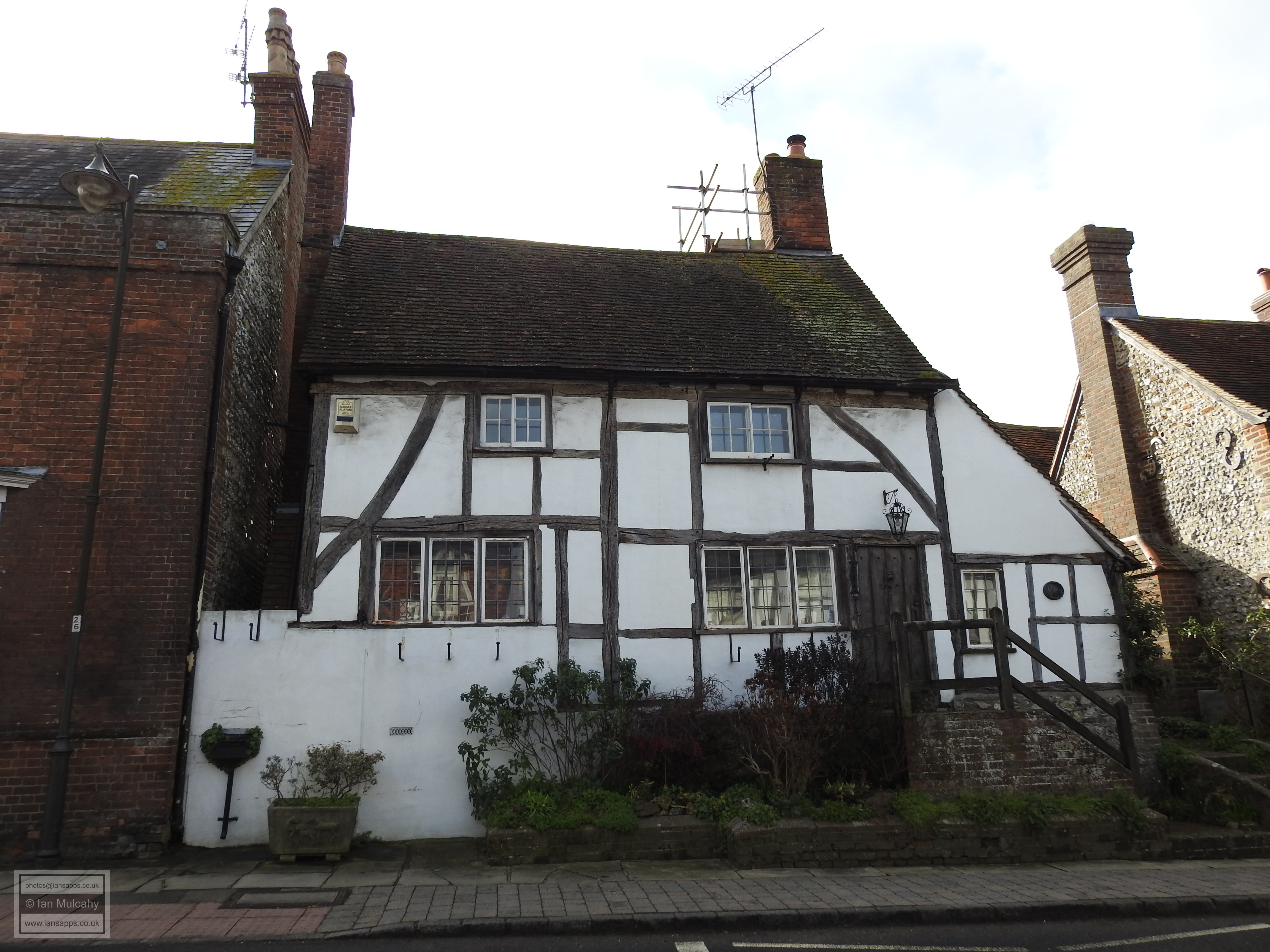
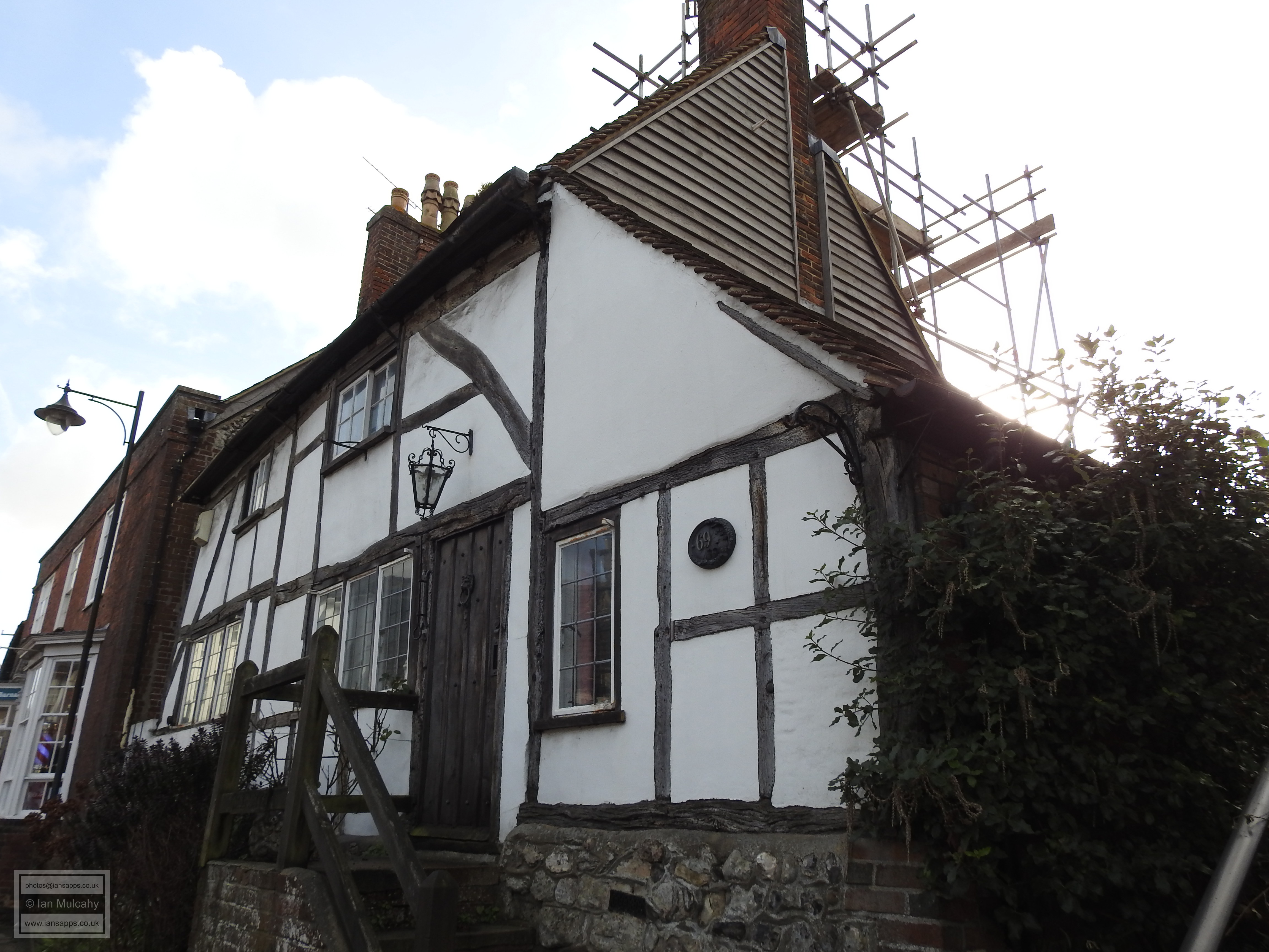
Opposite numbers 90 & 92 is number 69, better known as The Old Cottage, a 15th century timber framed building that was previously a forge. Interestingly, this building is also raised on a stone base. A few steps further along the road we find 61, 63 & 65 High Street, a large early 16th century row of shops whose first floor is jettied for the entire length. Evidence of internal division right up into the roof space suggests that this was purpose built to serve as a row of shops.
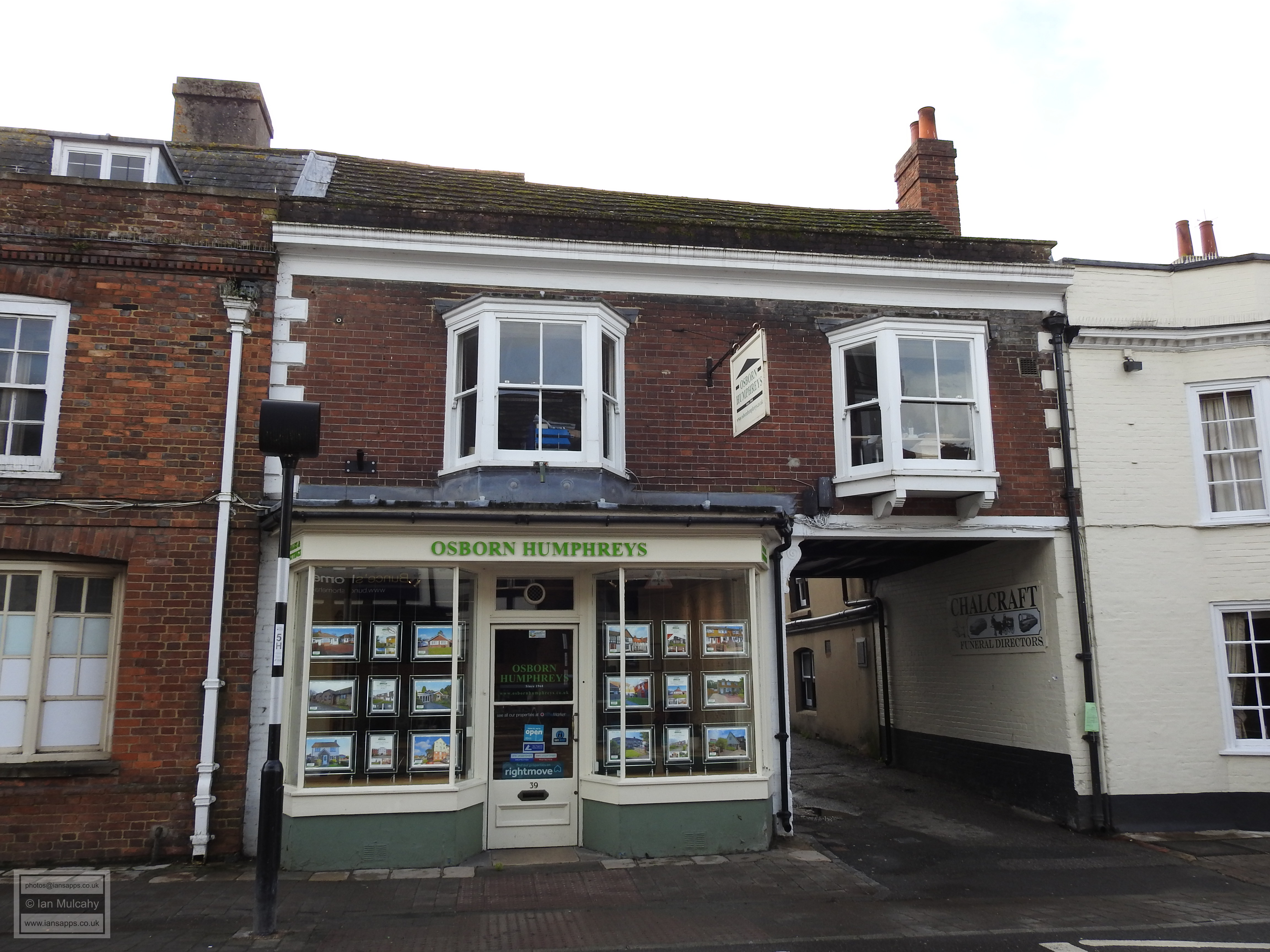
At 51 High Street, we find a small 15th century building with its timbers still on visible, but its jetty has been infilled. This sports an unusual gable end to the street on one side, reminiscent of a crosswing, but seemingly part of the original fabric of the building. 39 High Street is an L shaped timber framed building of the late 16th or early 17th century whose front timbers have been hidden behind brick for the last two hundred years, but wander through the carriage archway between this building and the adjoining Chequers Inn, a much altered 15th century coaching inn, and you will see the fine timber framed rear wing.
As we near the end of our walk, we once again return to the Old Stone House at the junction with Church Street, cross the road and continue walking south eastwards along the northern side of the High Street. The first building we come to is Penfold Cottage, a charming little 15th century hall house with a 16th century addition that was refaced in flint during the 18th century. The cottage somehow manages to squeeze two floors under its particularly low roof!
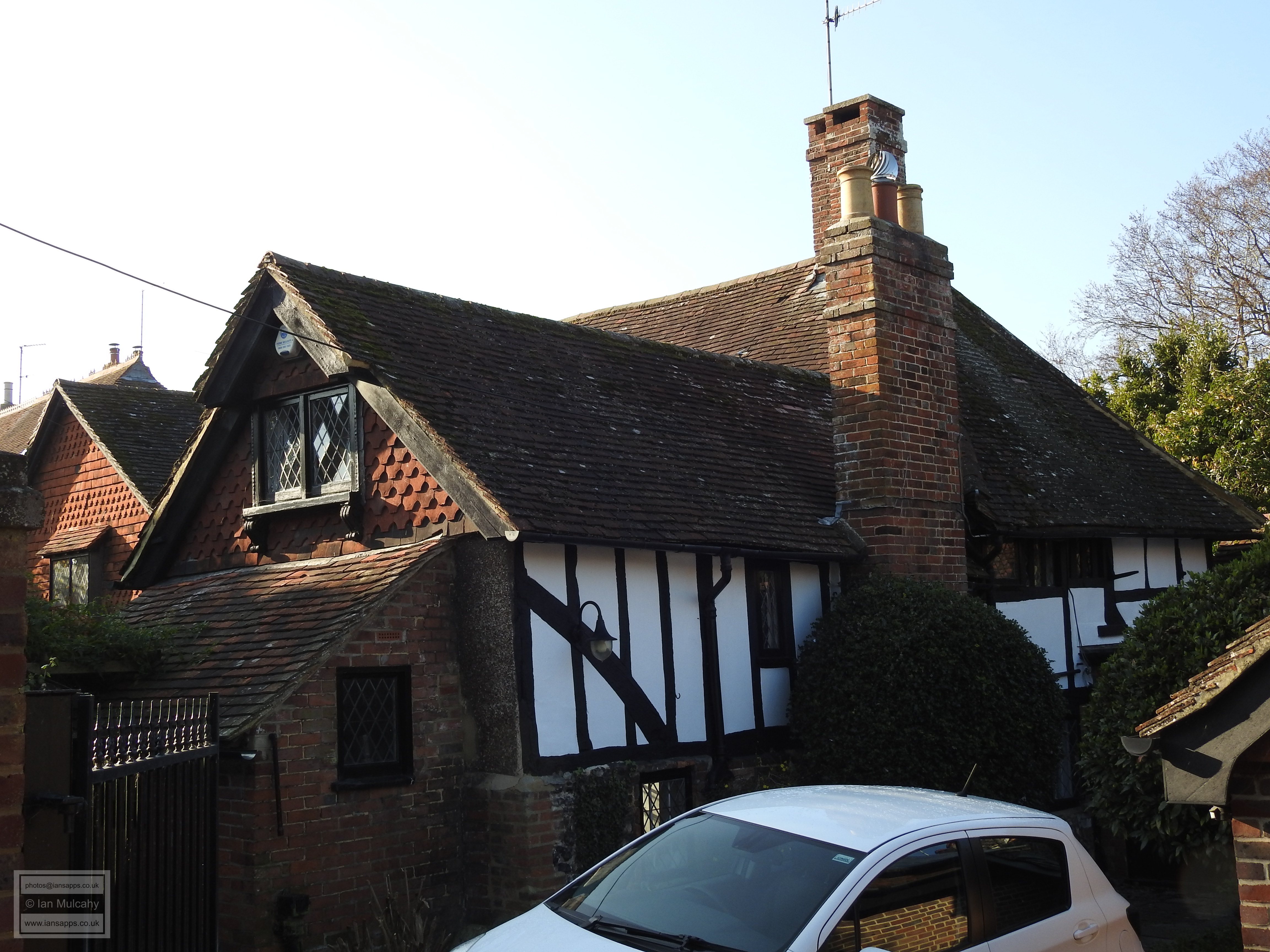
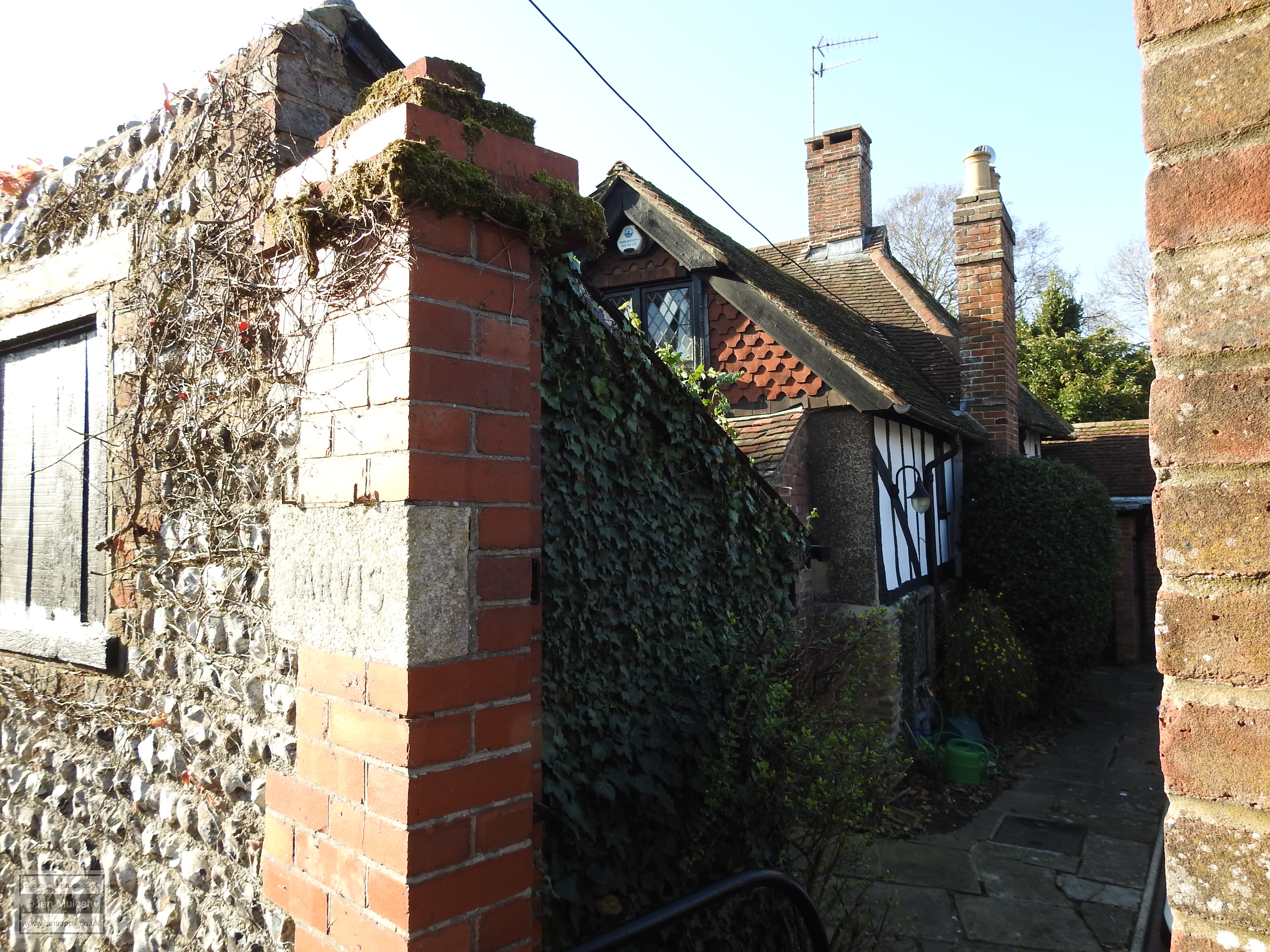
Our final building of interest in Steyning takes us slightly out of town but brings us back round nicely to the church and so where the car is parked. Turning left into Jarvis Lane we come, after a short walk, to Jarvis, a 16th century farmhouse whose lower floor has been rebuilt in brick, but the upper floor retains its plaster infilled timber framing. Jarvis is now surrounded by urban development, but 400 years ago it would have looked eastwards across its open fields as they gently sloped away towards the ruins of Bramber Castle…
BRAMBER
Adjoining Steyning to the south east is the small village,
population 750, of Bramber. Sited at the point of a wide, now silted
up, tidal compartment of the river Adur just north of the Downs
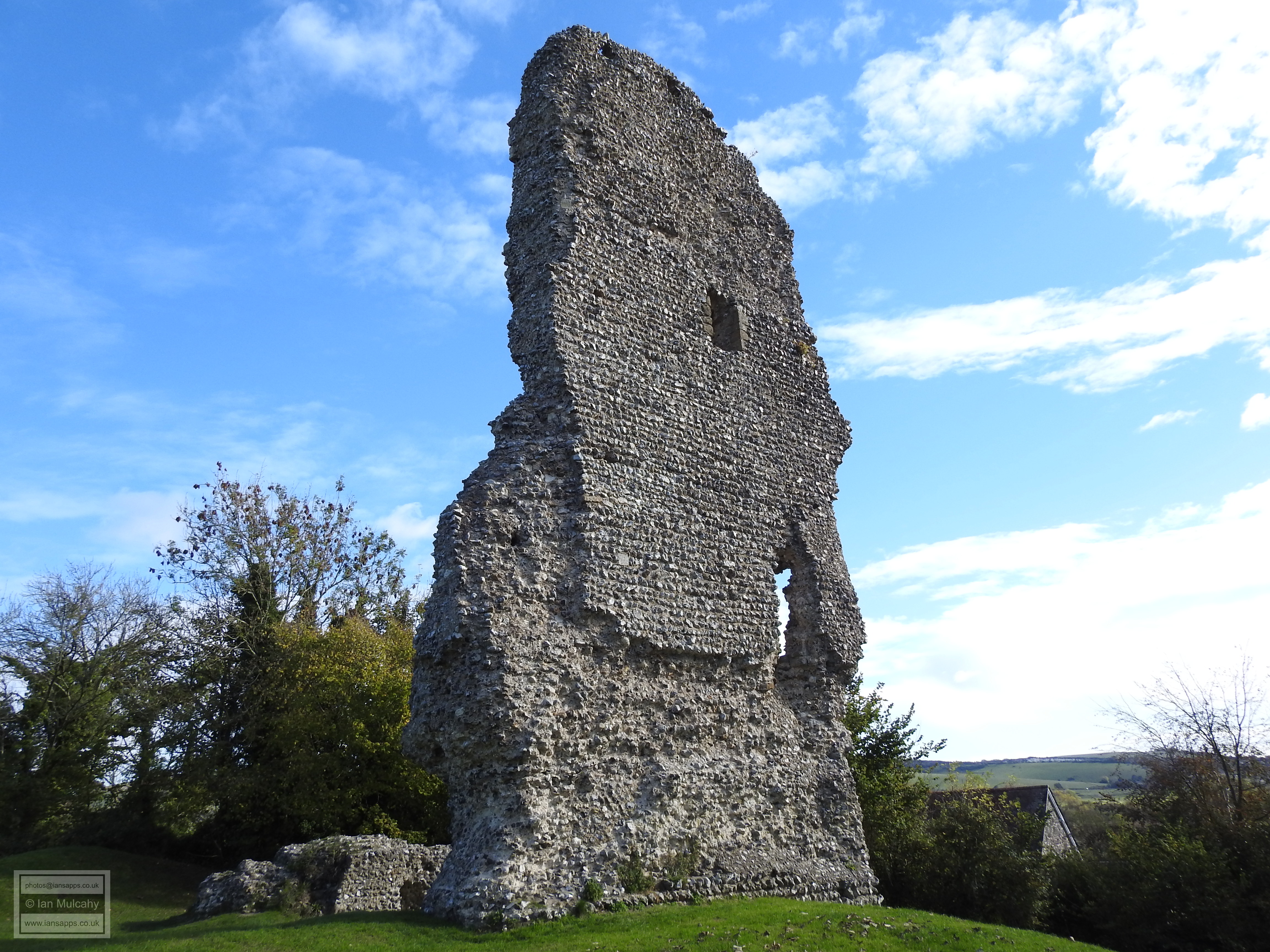
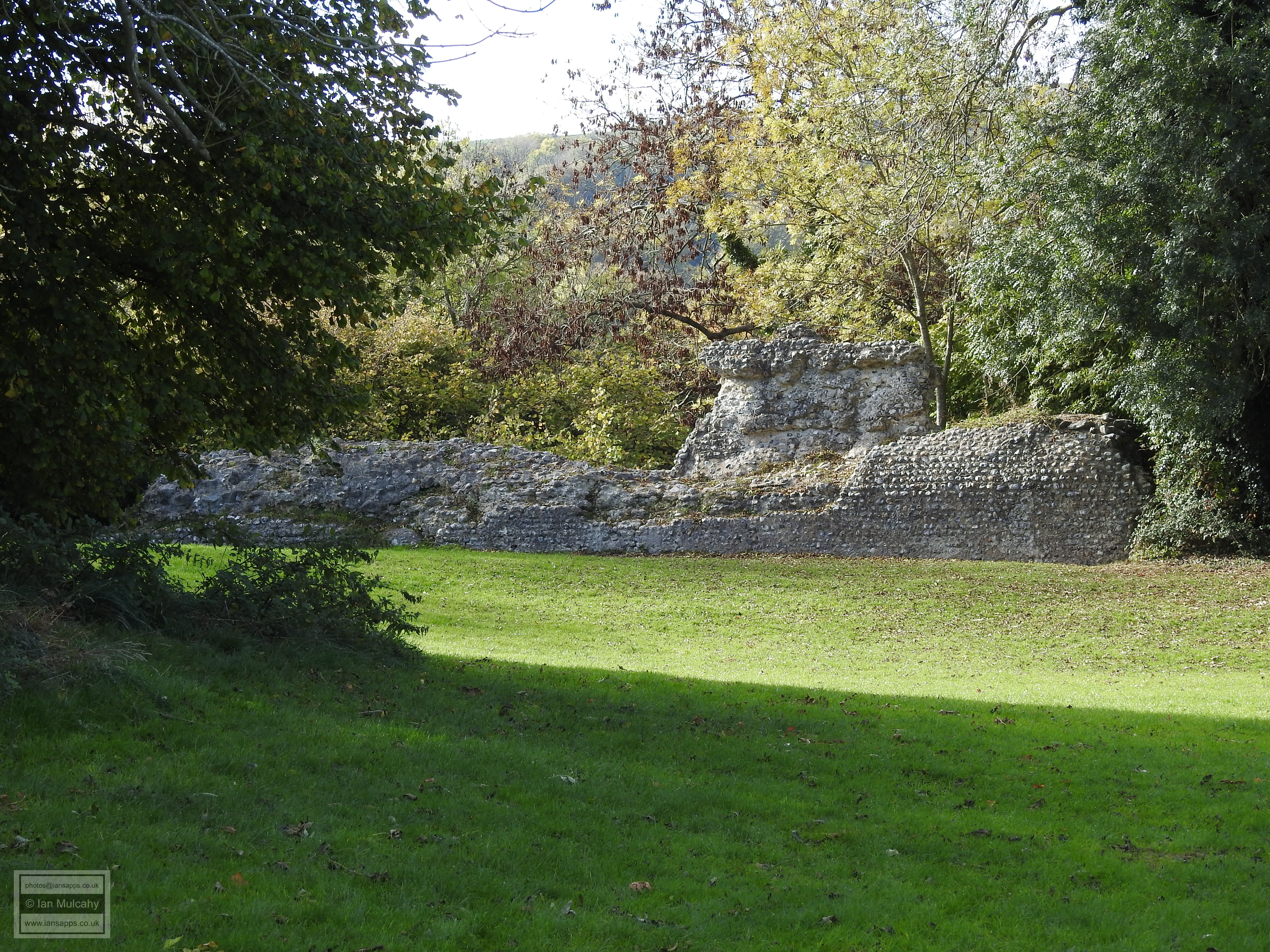
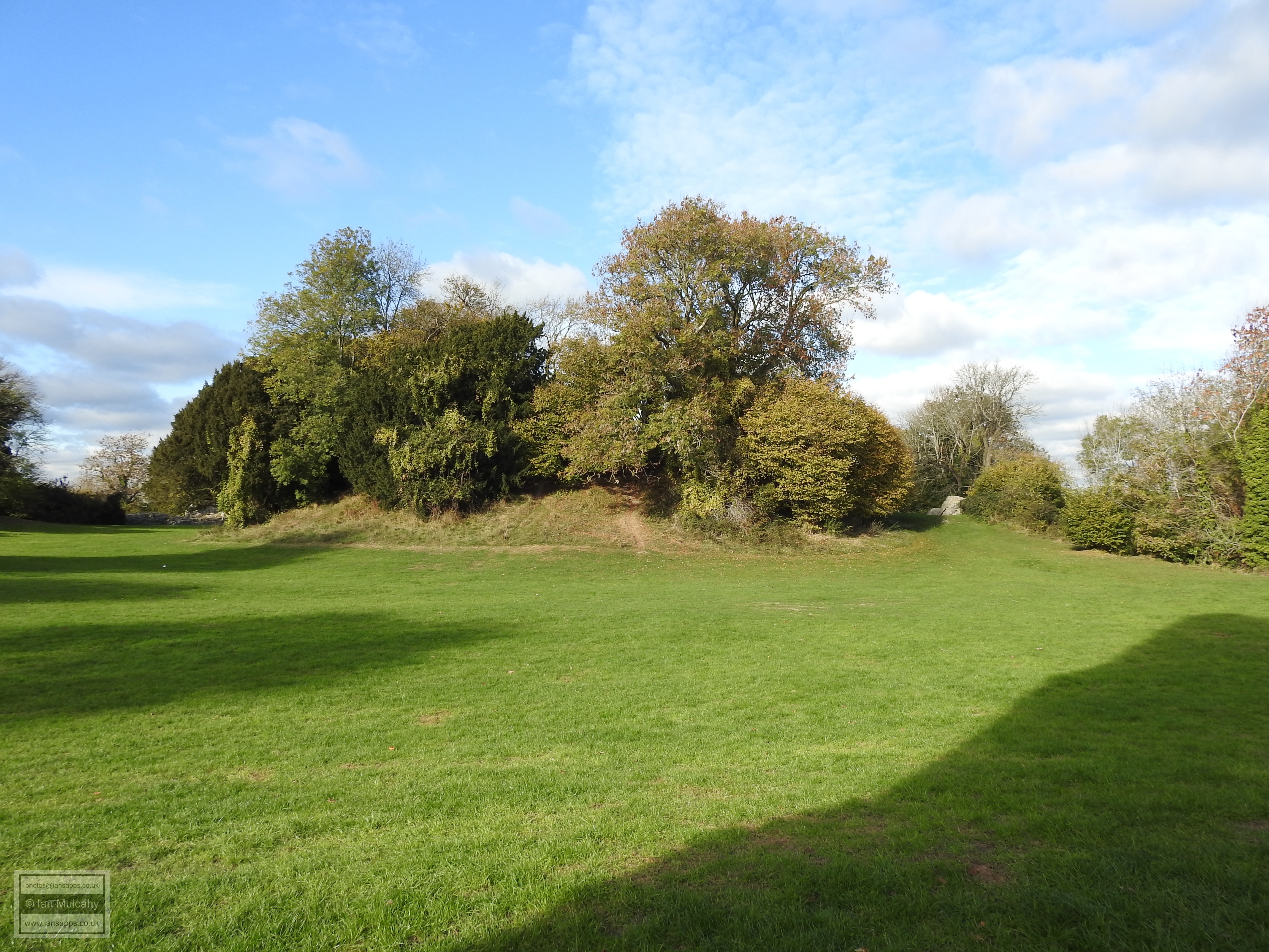
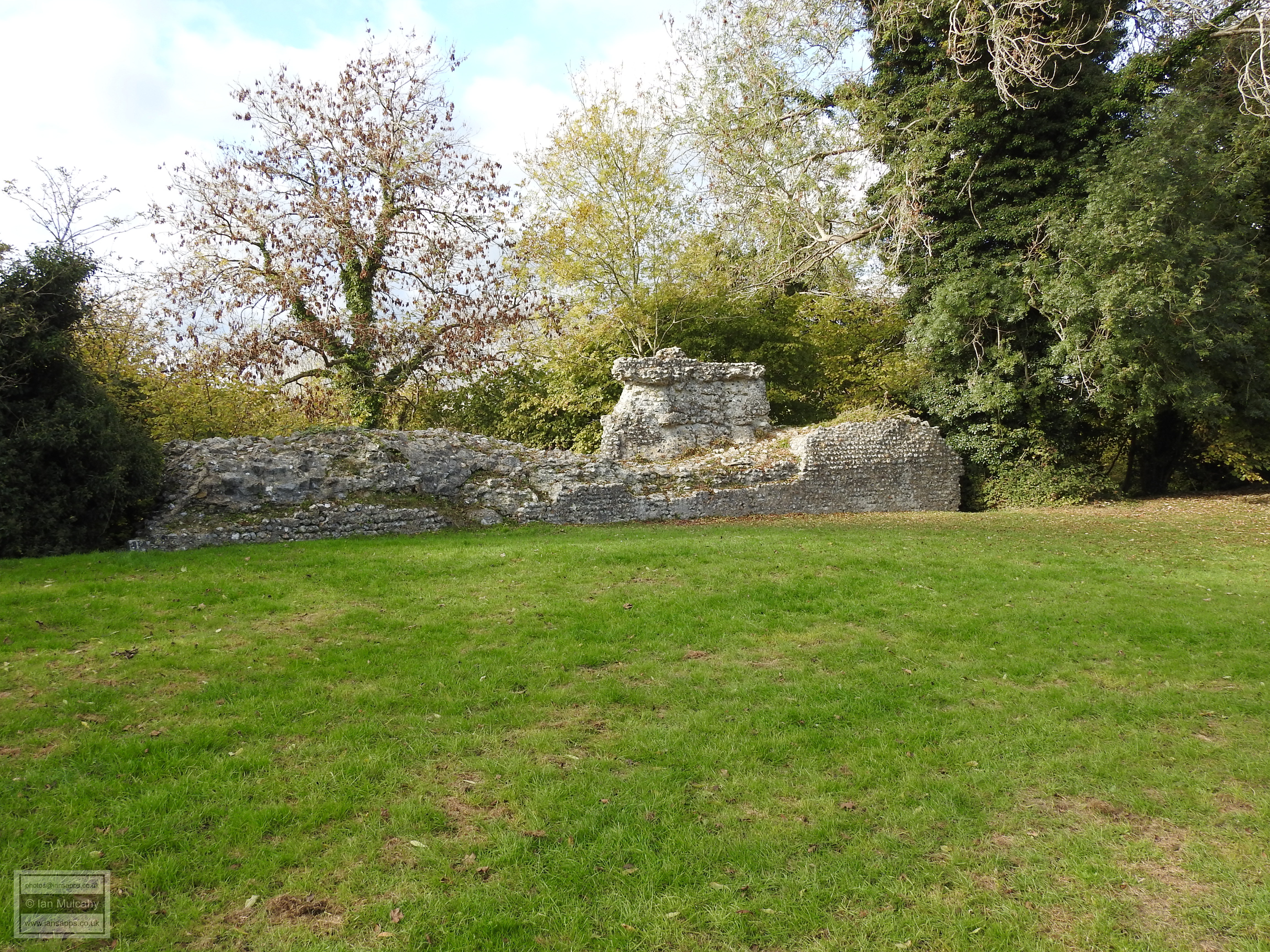
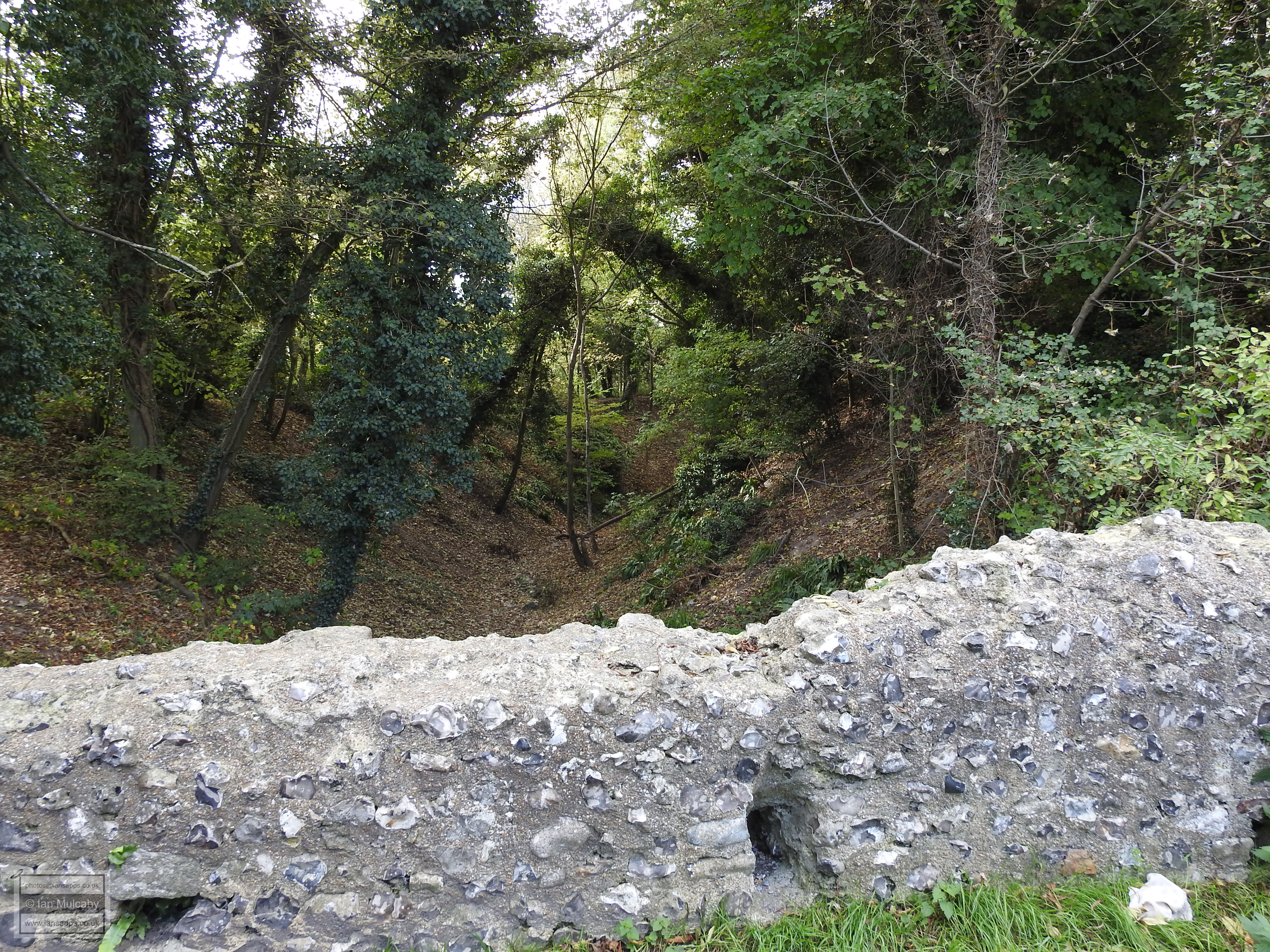
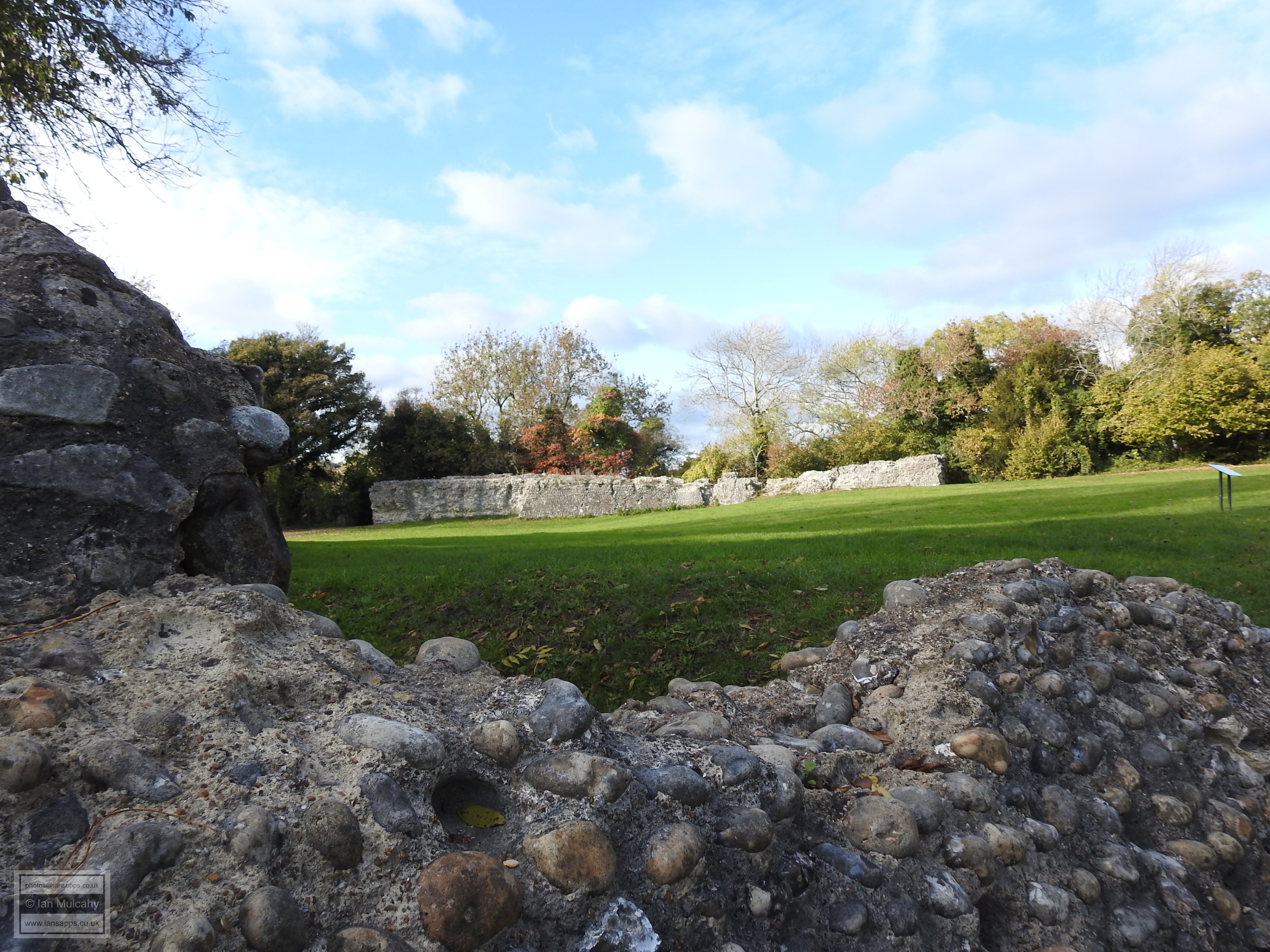
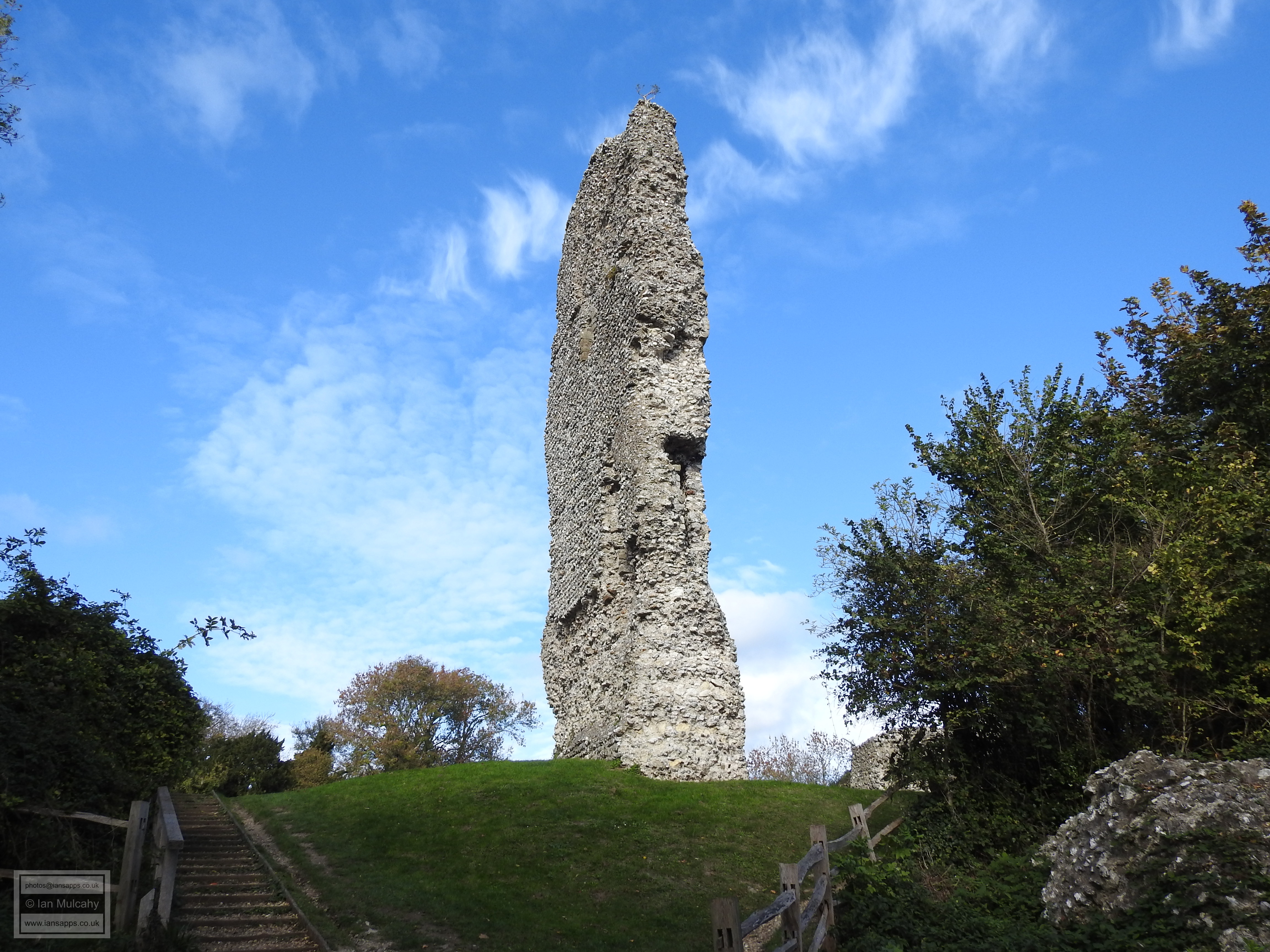
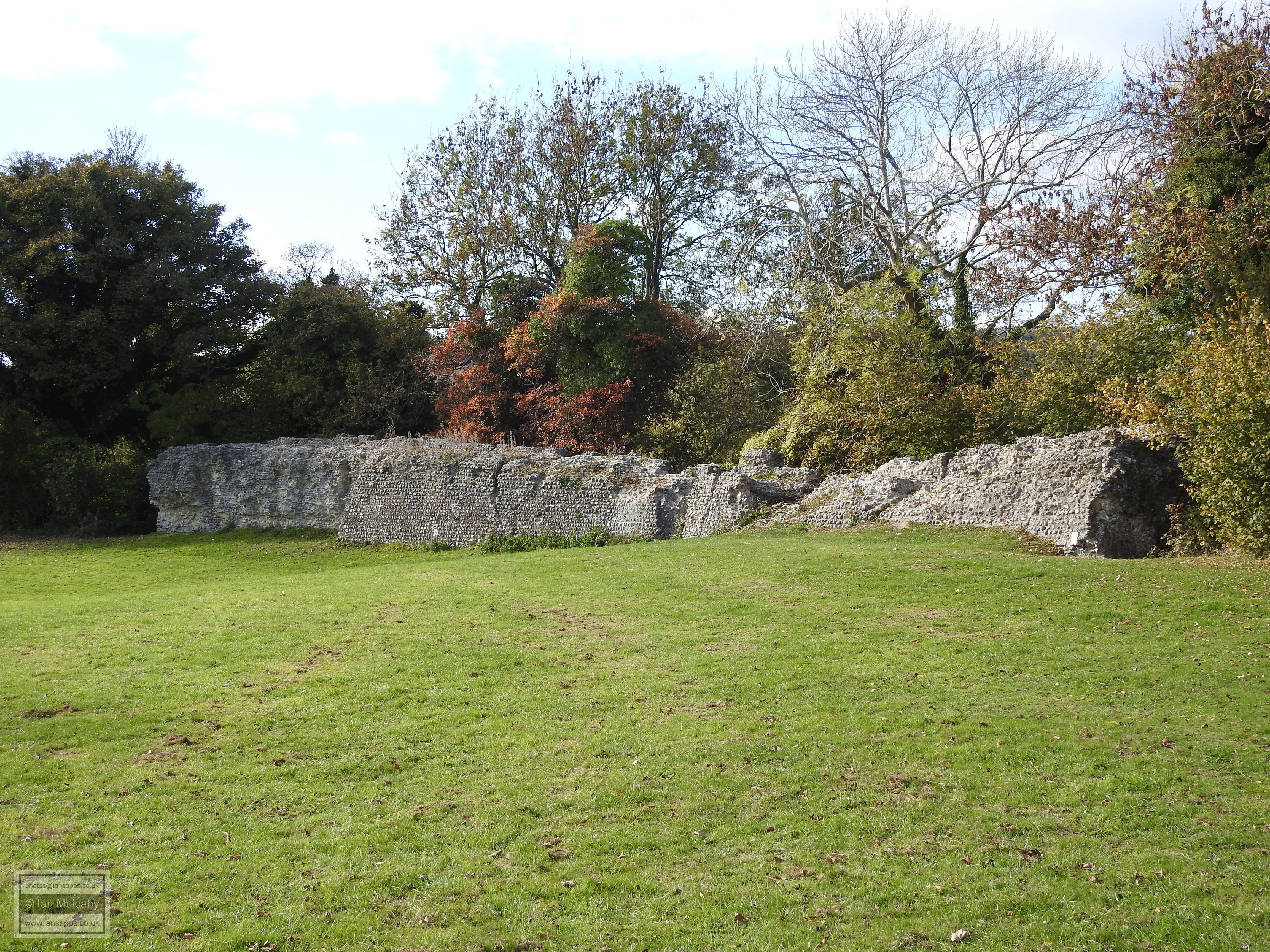
Bramber, meaning ‘Bramble Thicket’, is most famous for the ruins of
its Norman castle which was built on a natural knoll overlooking the
Adur estuary soon after the Conquest. There is a small amount of
archaeological evidence for prehistoric activity in the area which
became Bramber and finds here include a Palaeolithic hand axe,
Neolithic flints, flints, pottery and spearheads from the Bronze Age
and a single Iron Age coin!
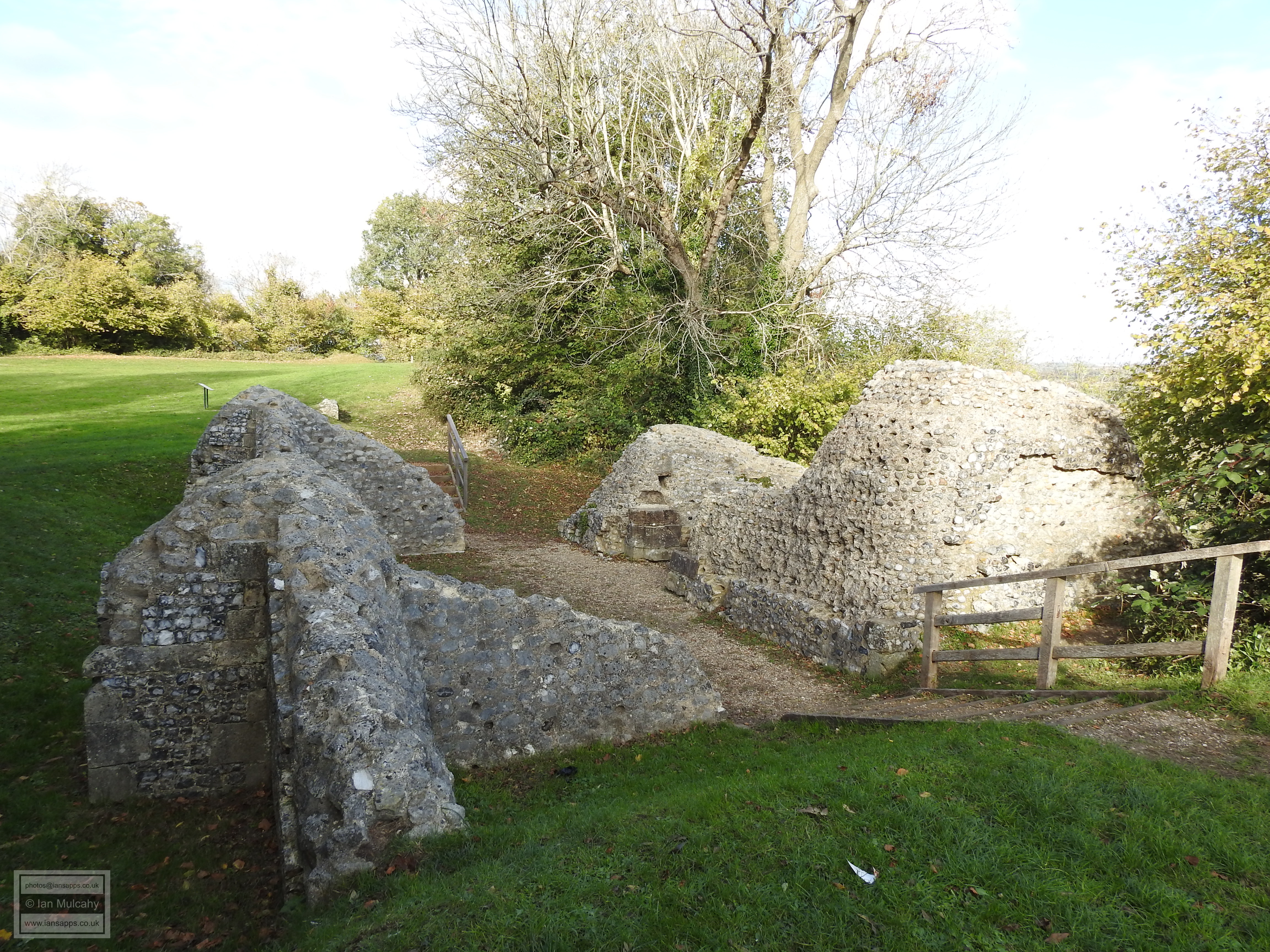
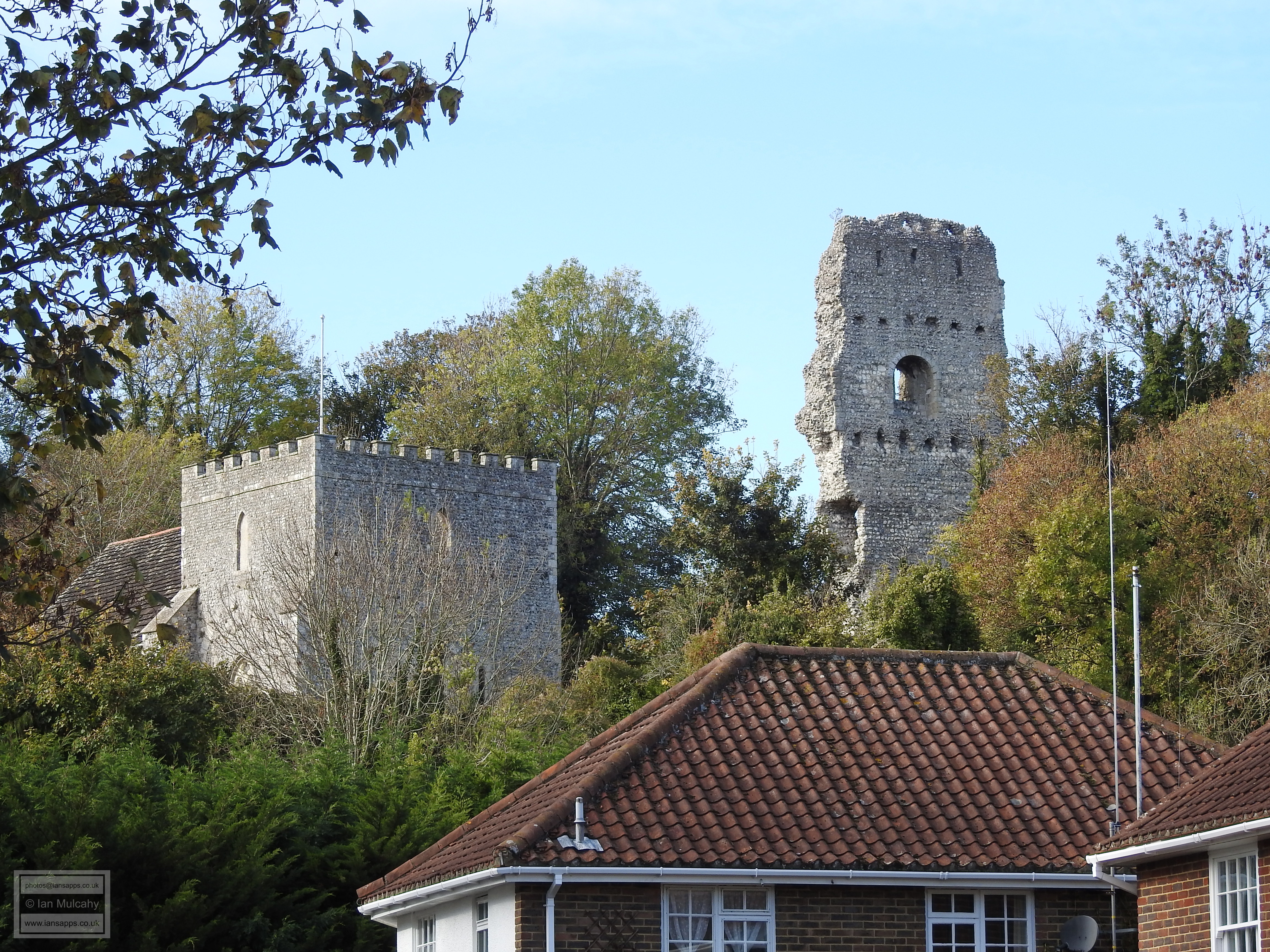
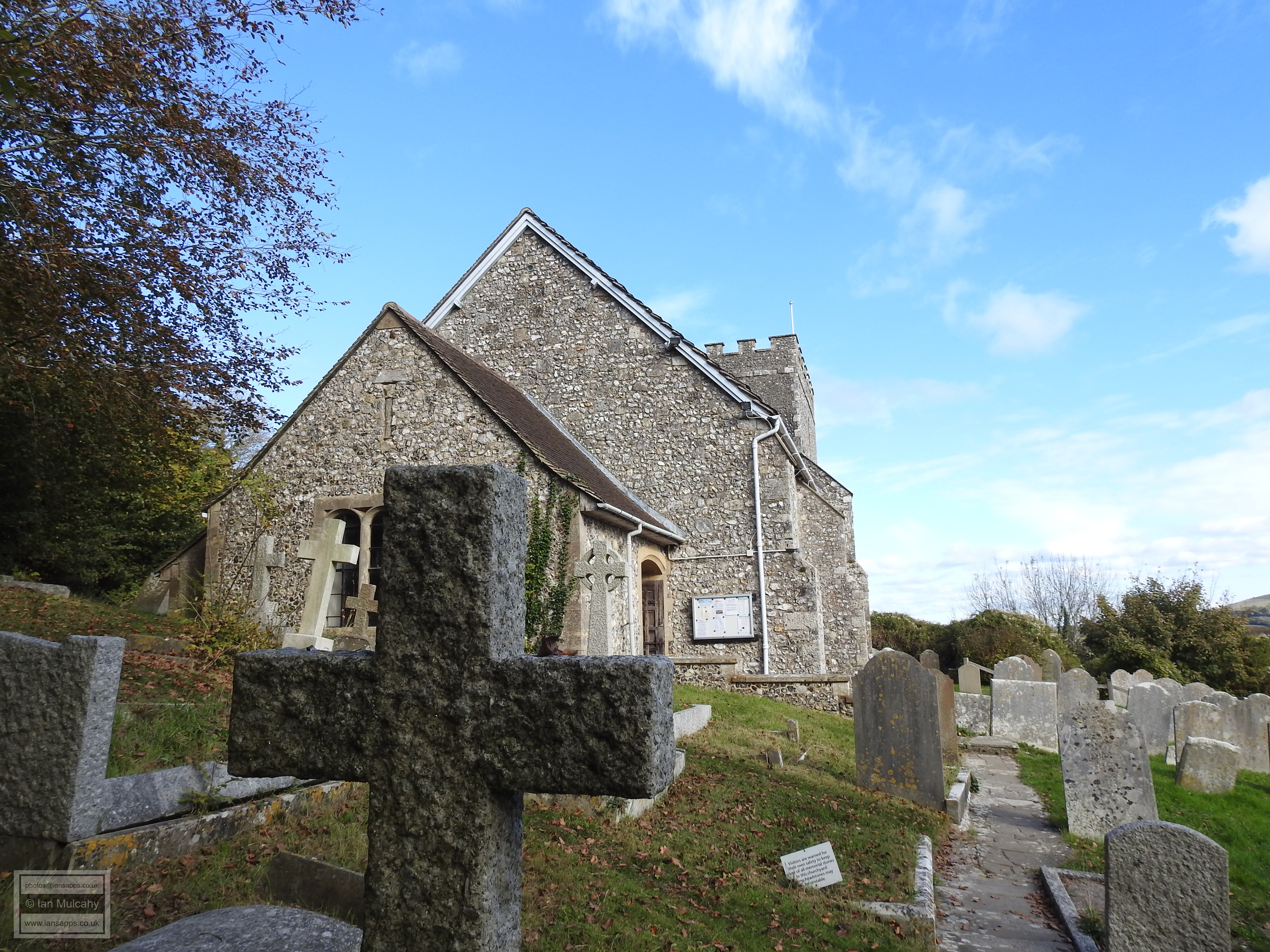
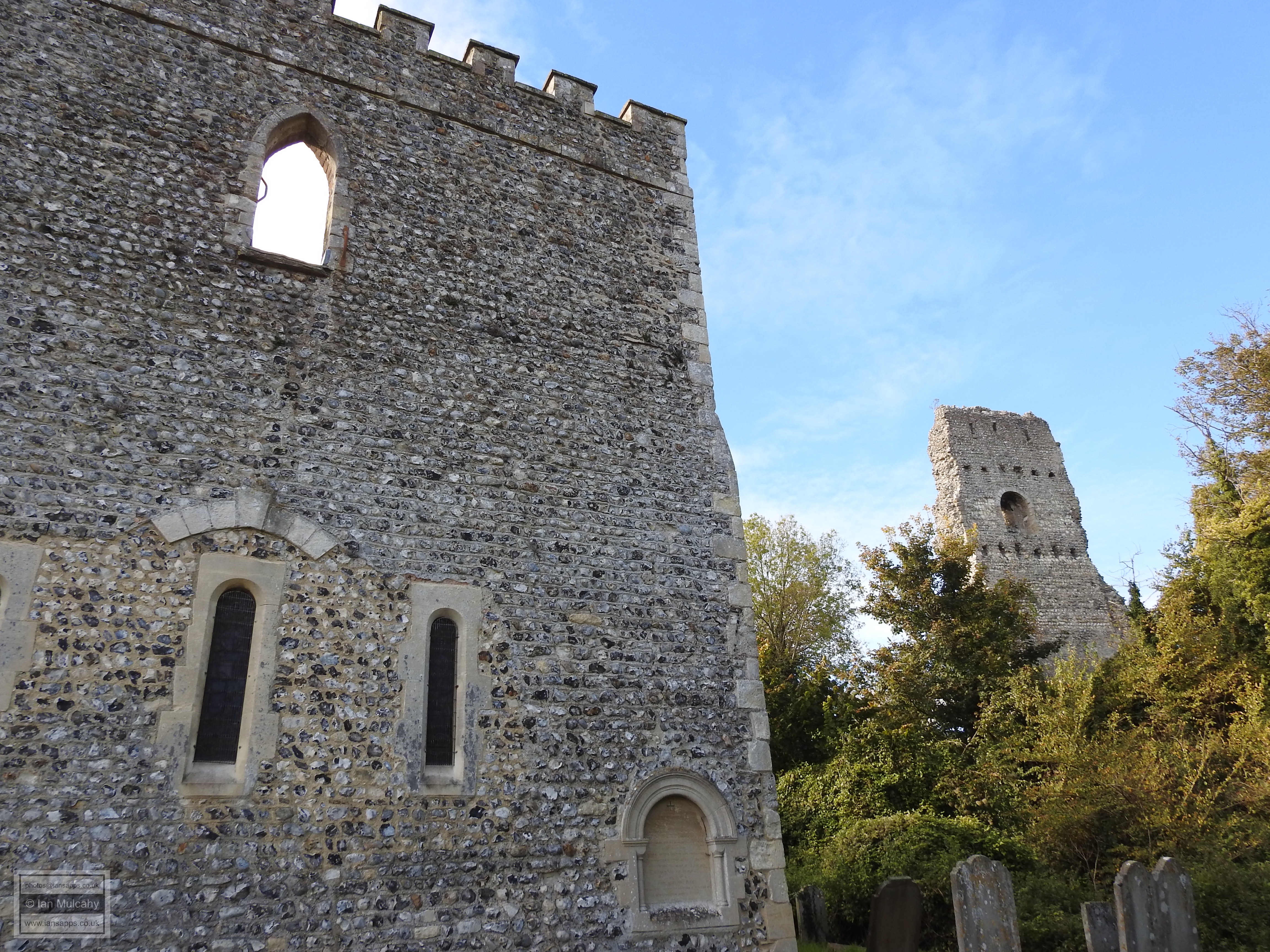
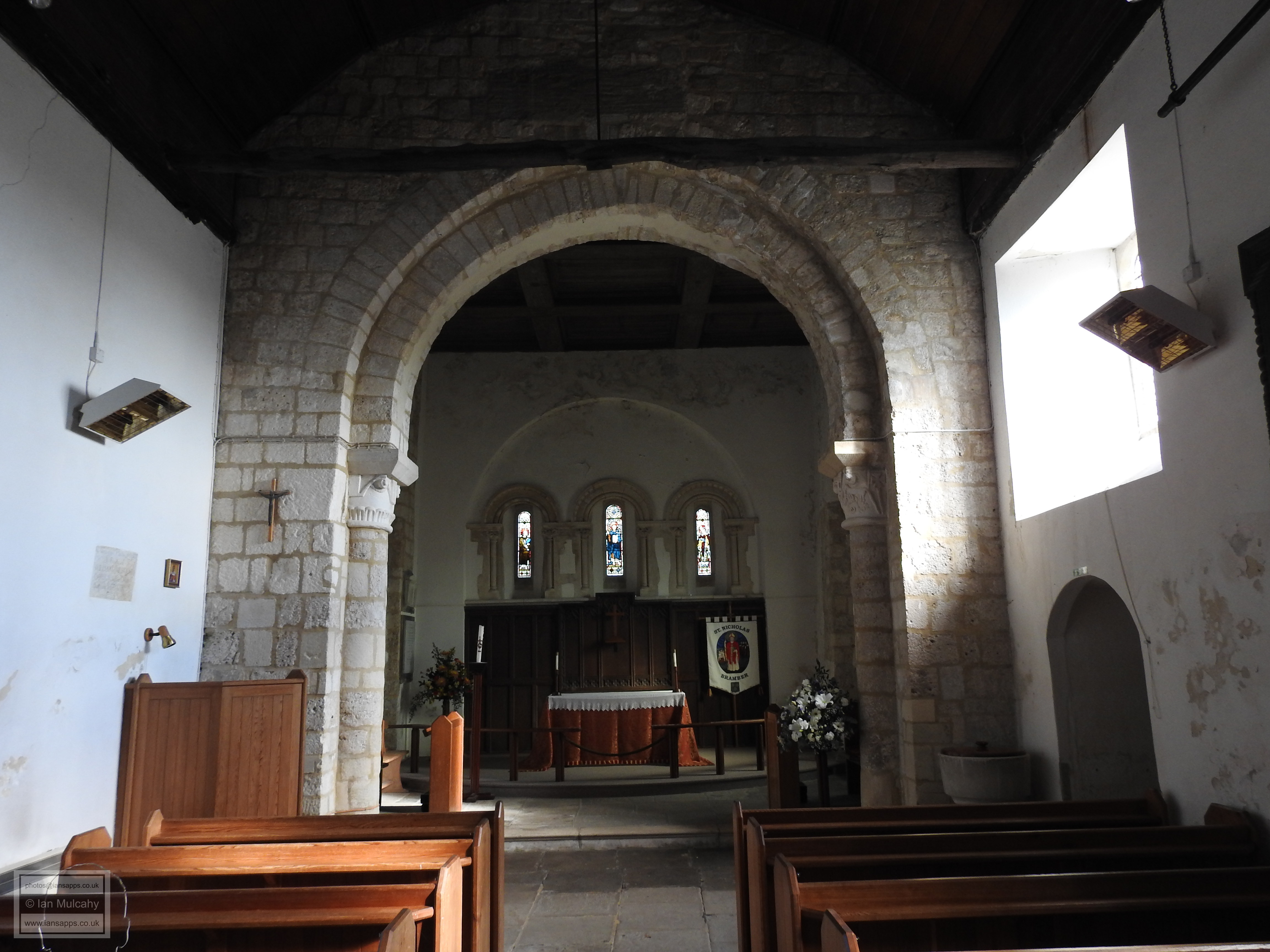
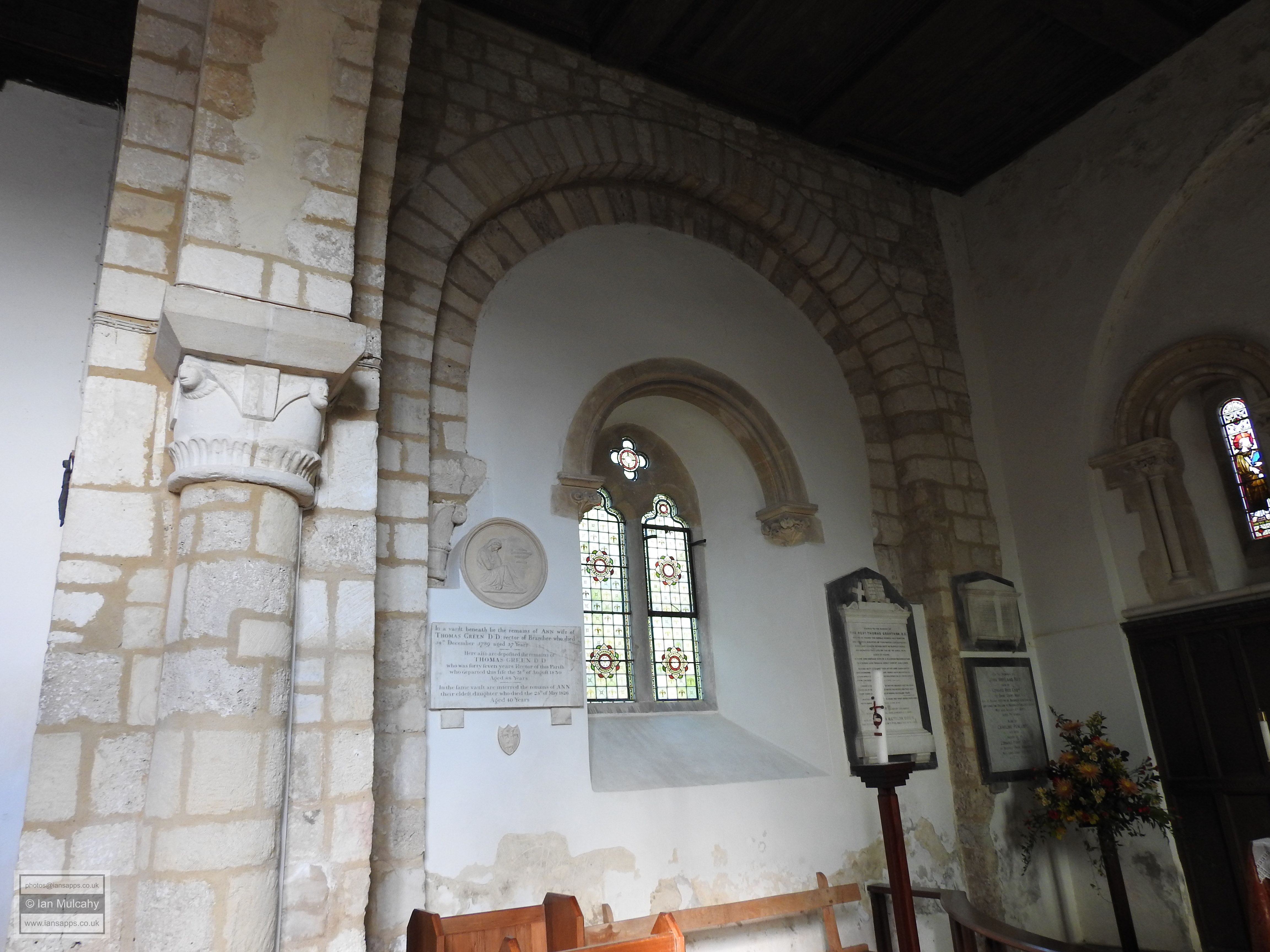
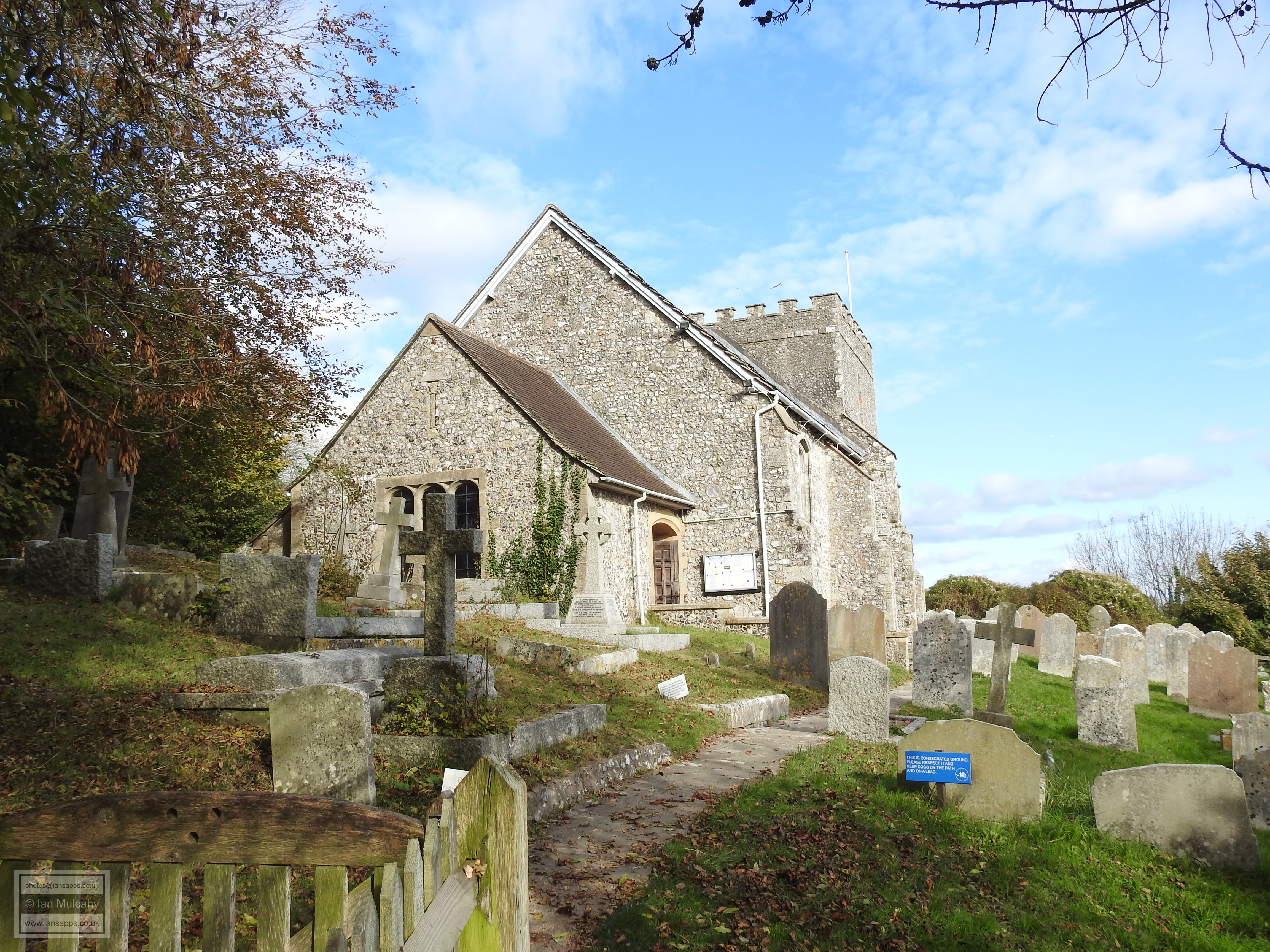
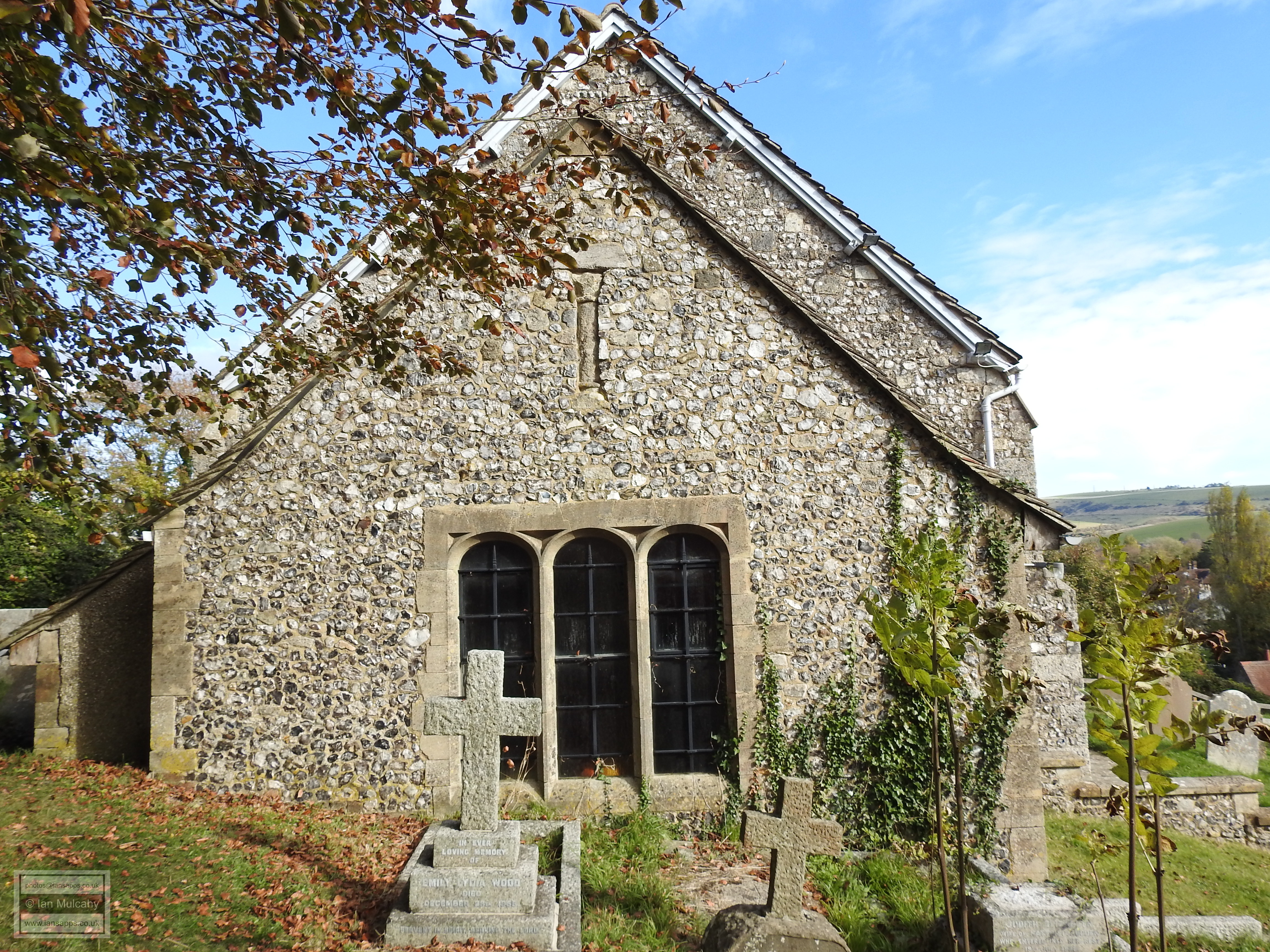
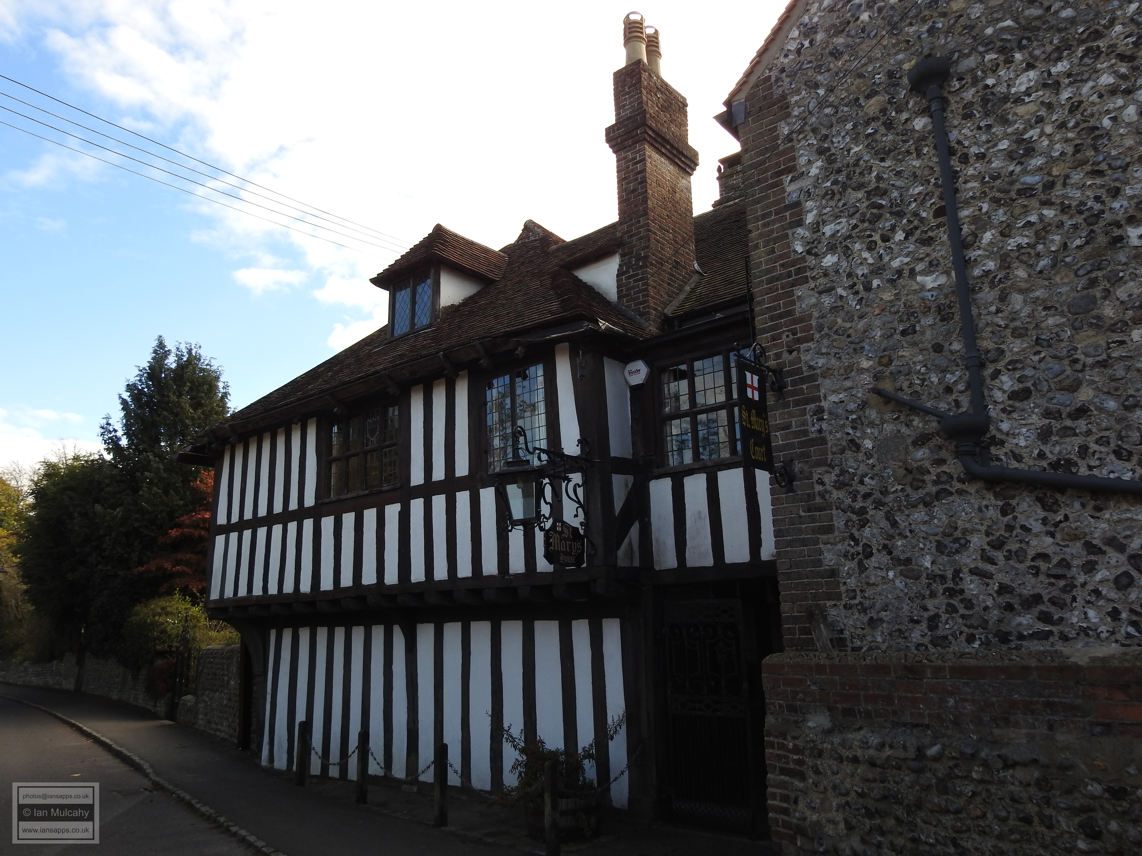
Outside of the castle’s deep ditch is The Church Of St Nicholas. Built at the same time as the castle, it has been maintained with a greater degree of success and remains a functioning church today, though on a somewhat smaller scale than originally, the north and south arms of the transept having been demolished in the 14th and 15th centuries; another reflection of the poverty that afflicted the town during this period. The church remained unaffected by the dissolution despite the castle being held at the time by the Howard Family.
The village itself was a new town which grew up alongside the castle
and was, as it is today, concentrated on a single east/west road
running through the centre which, in the late Medieval and Tudor
periods, formed part of the main route from Canterbury to
Southampton. The road, and the buildings either side of it, are laid
on a man-made causeway jutting into the estuary and this is thought
to have originally been a timber structure incorporating a quay. The
timber piles have been carbon dated to between 1010 and 1170 which
gives rise to the theory that it was built before the castle as a
way of transporting building material, much of which came by ship
from Northern France, across the marshy estuary from the main river
channel. The wooden causeway was later infilled with cobbles and
stone to produce the causeway seen today. The evidence for this was
discovered by chance during trench work by utility companies during
the 1950s with further evidence being uncovered in the 1970s.
Sources
Text & photographs © Ian Mulcahy. Contact photos@iansapps.co.uk or visit my 'Use of my photographs' page for licensing queries (ground level photographs only). |
pictures taken with and and |