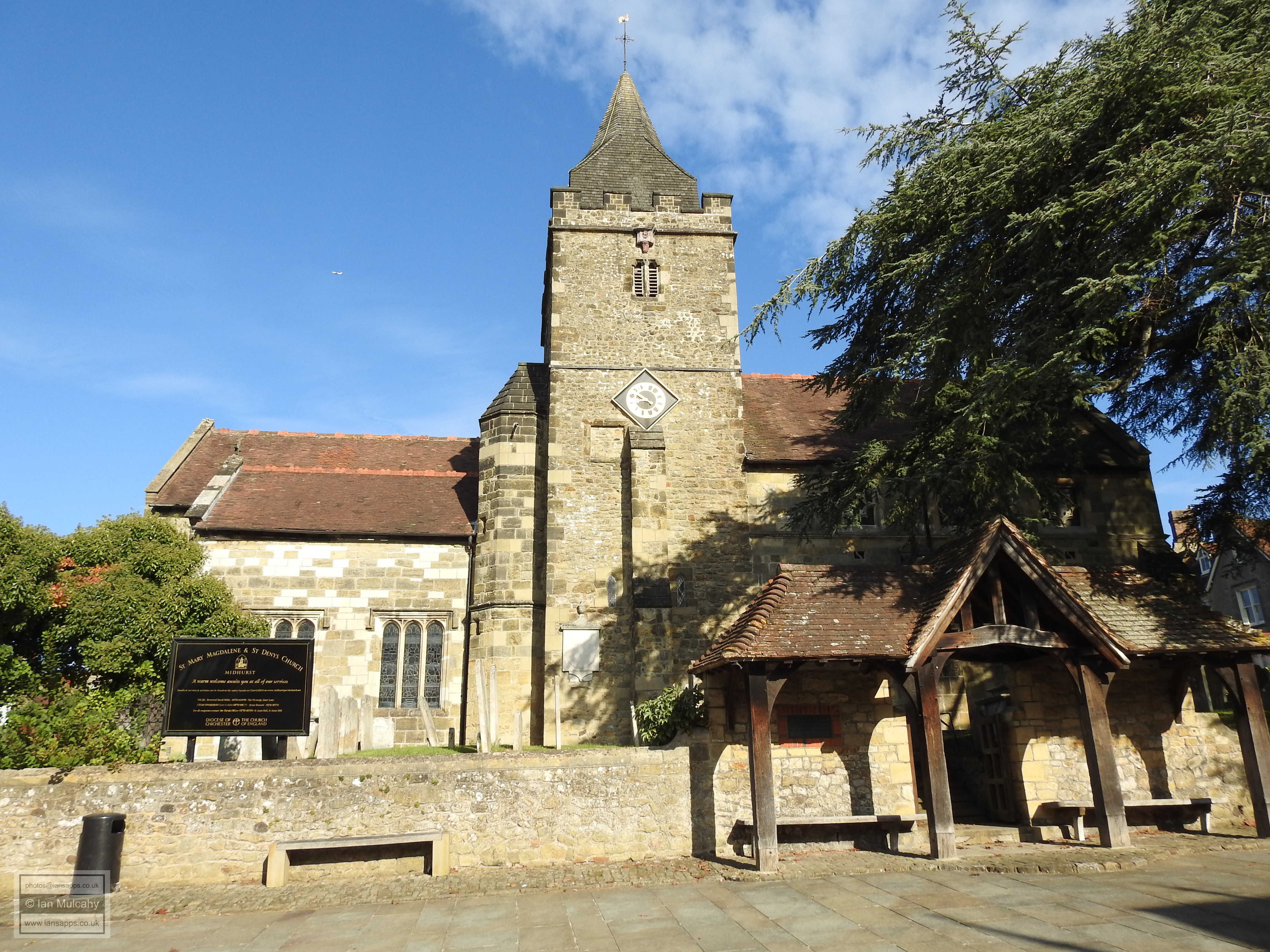

A Tudor tour of Midhurst
This article first appeared in the May 2021
edition of
Tudor Life, the magazine of the
Tudor Society.
By Ian Mulcahy
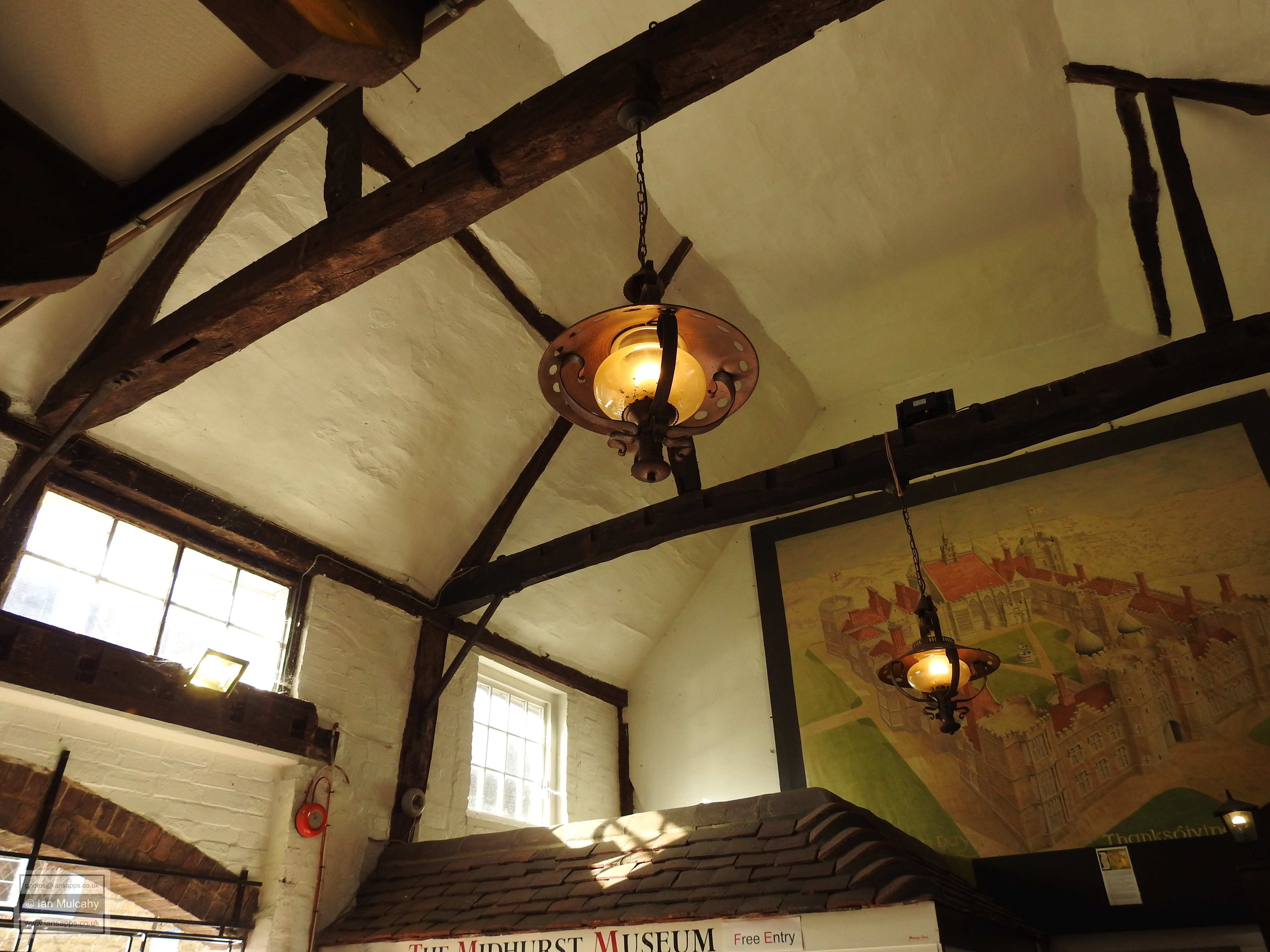
Old Britain Home | Historic curiosities of Midhurst
|
For this month’s Tudor tour I’m 12 miles to the north of the Roman city of Chichester visiting Midhurst, a small West Sussex market town within the South Downs National Park that is home to approximately 5,000 inhabitants. Despite its proximity to a Roman stronghold, pre-conquest archaeology is thin on the ground here and finds are limited to a handful of pre-historic tools (including a Palaeolithic hand axe), a Bronze Age barrow and Roman coins and pottery, likely to be the remnants of an isolated Roman farm. All of these items were discovered outside of the centre of the town.
The name Midhurst was first recorded in 1186 and translates from old English as place in the middle of wooded hills and this reflects the position of the town at the base of the Rother valley at a point where major north-south and east-west routes cross the river. Some local historians believe that the town was founded as a subsidiary burh of Chichester by Alfred the Great in the 8th century, but with no documentary or archaeological evidence of any Saxon settlement it seems most likely that the name was given for the purposes of navigation or trade and that Midhurst started to develop as a planned town shortly after the Norman Conquest.
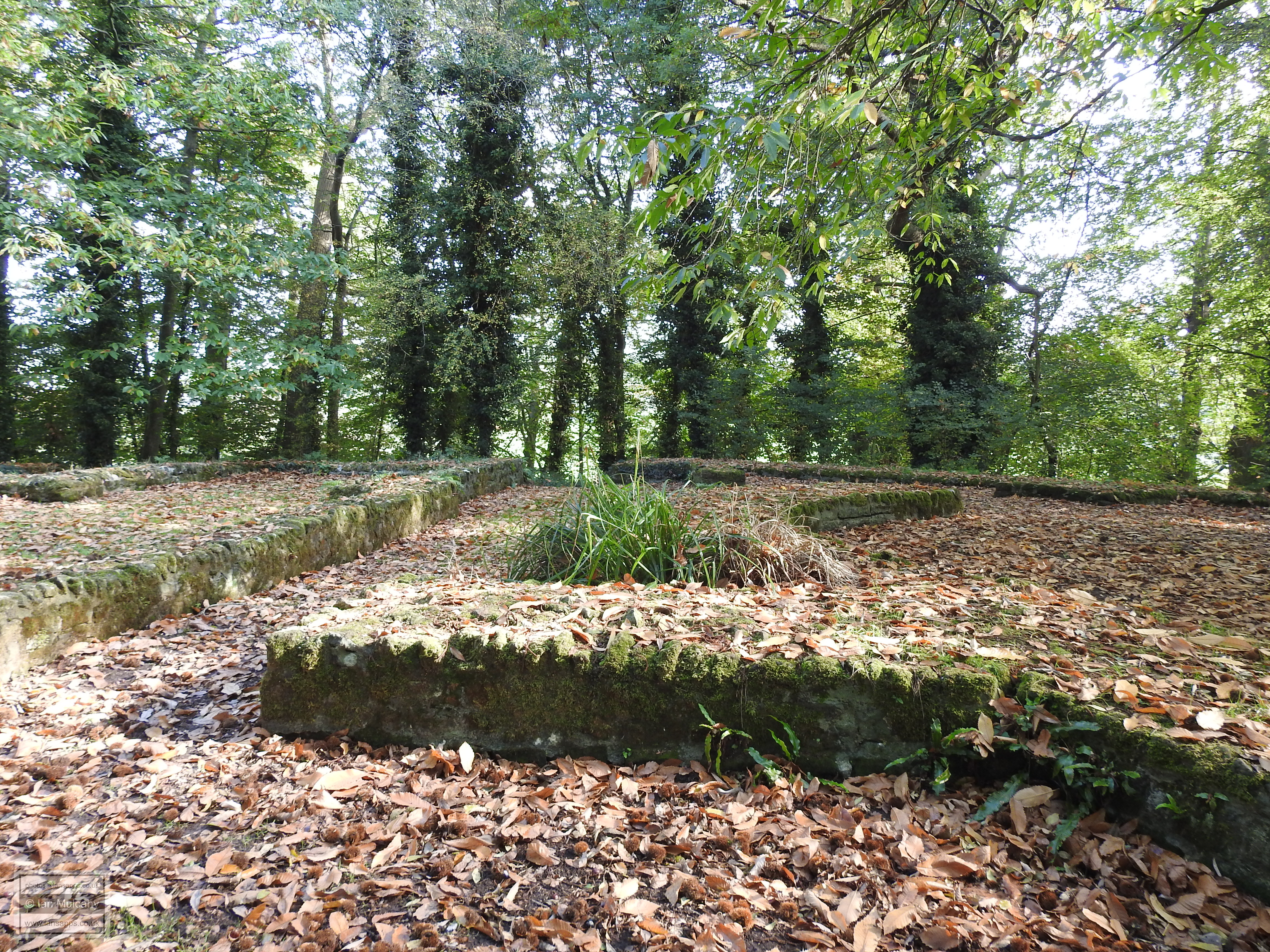
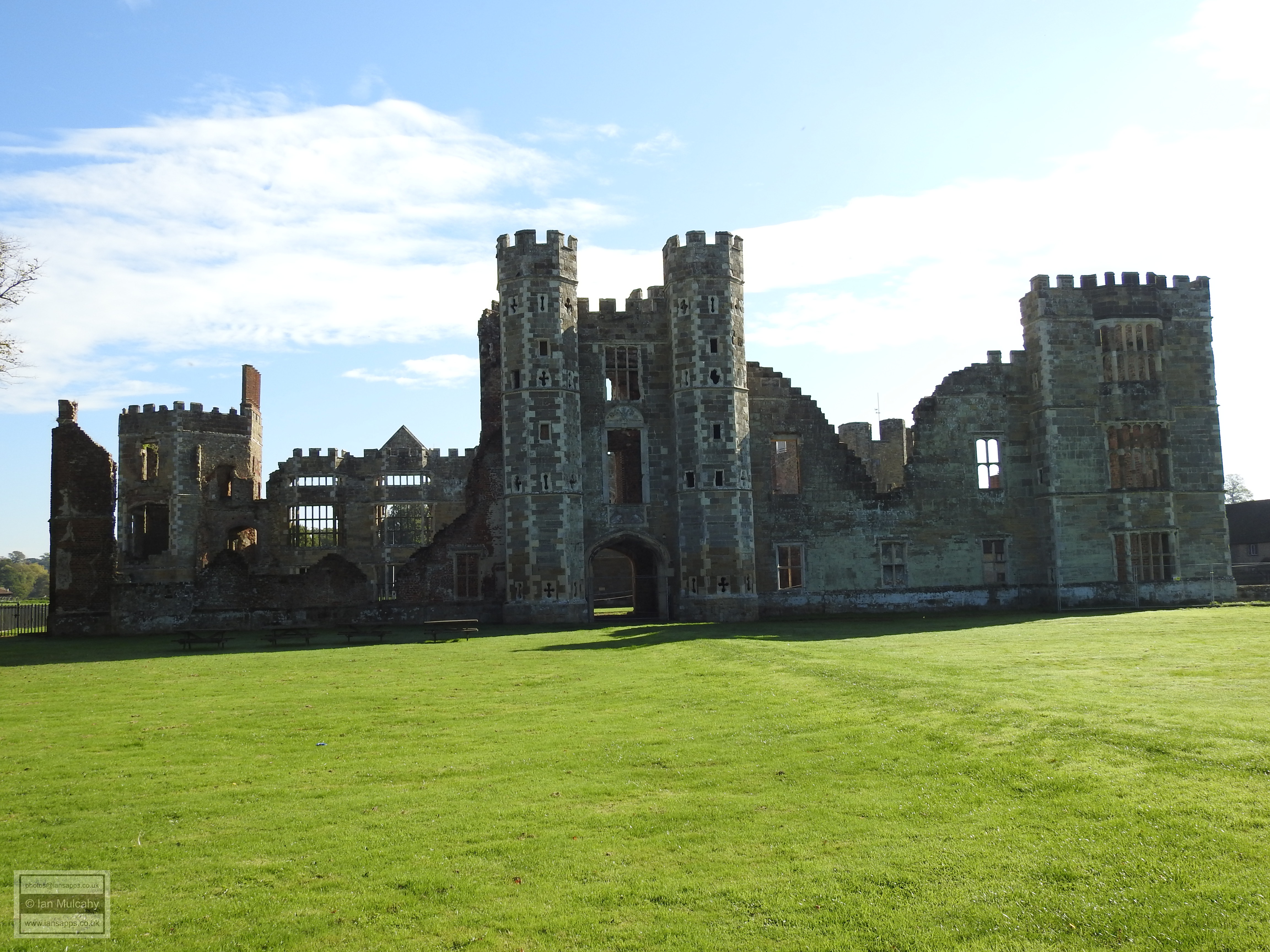
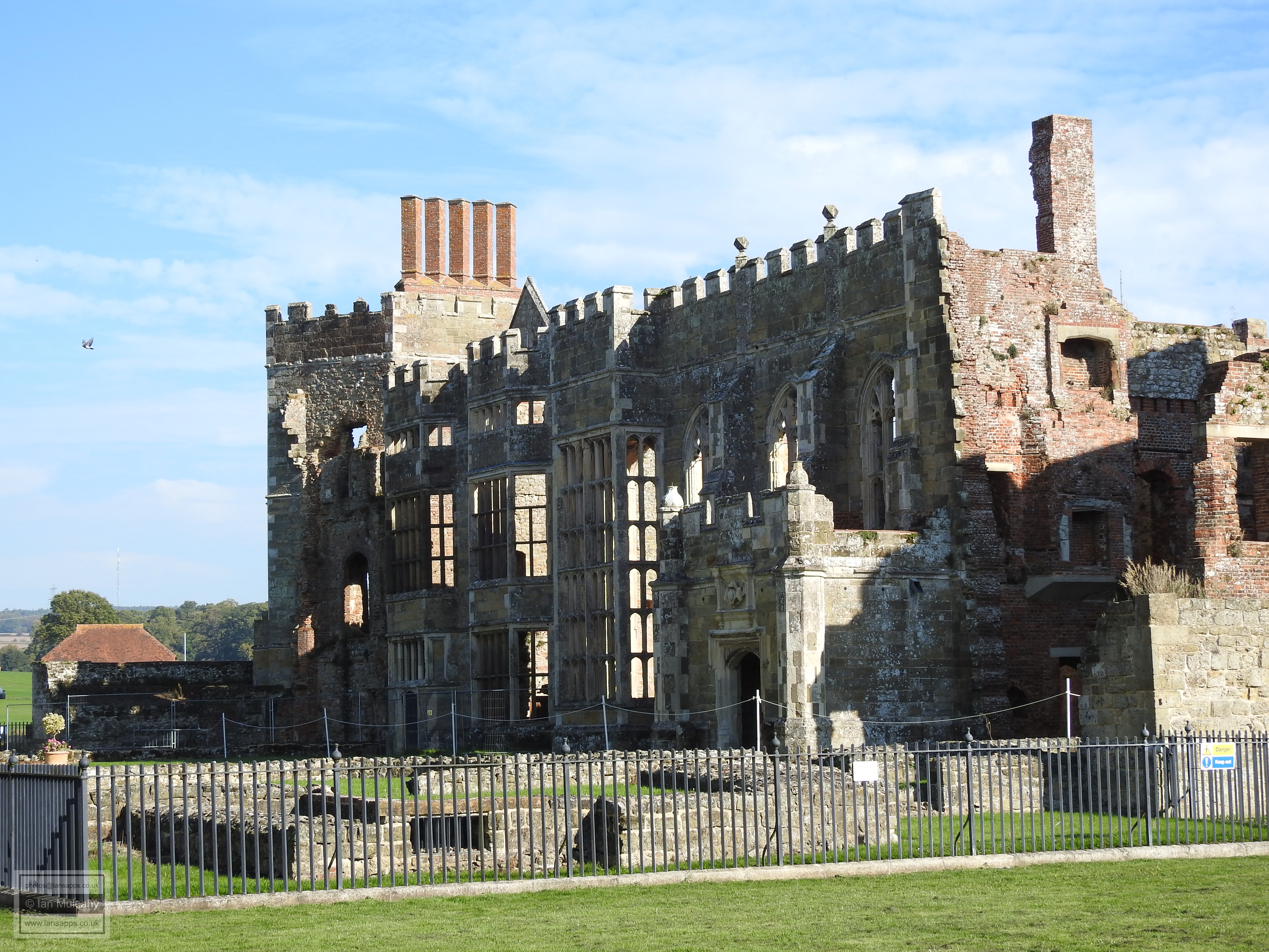
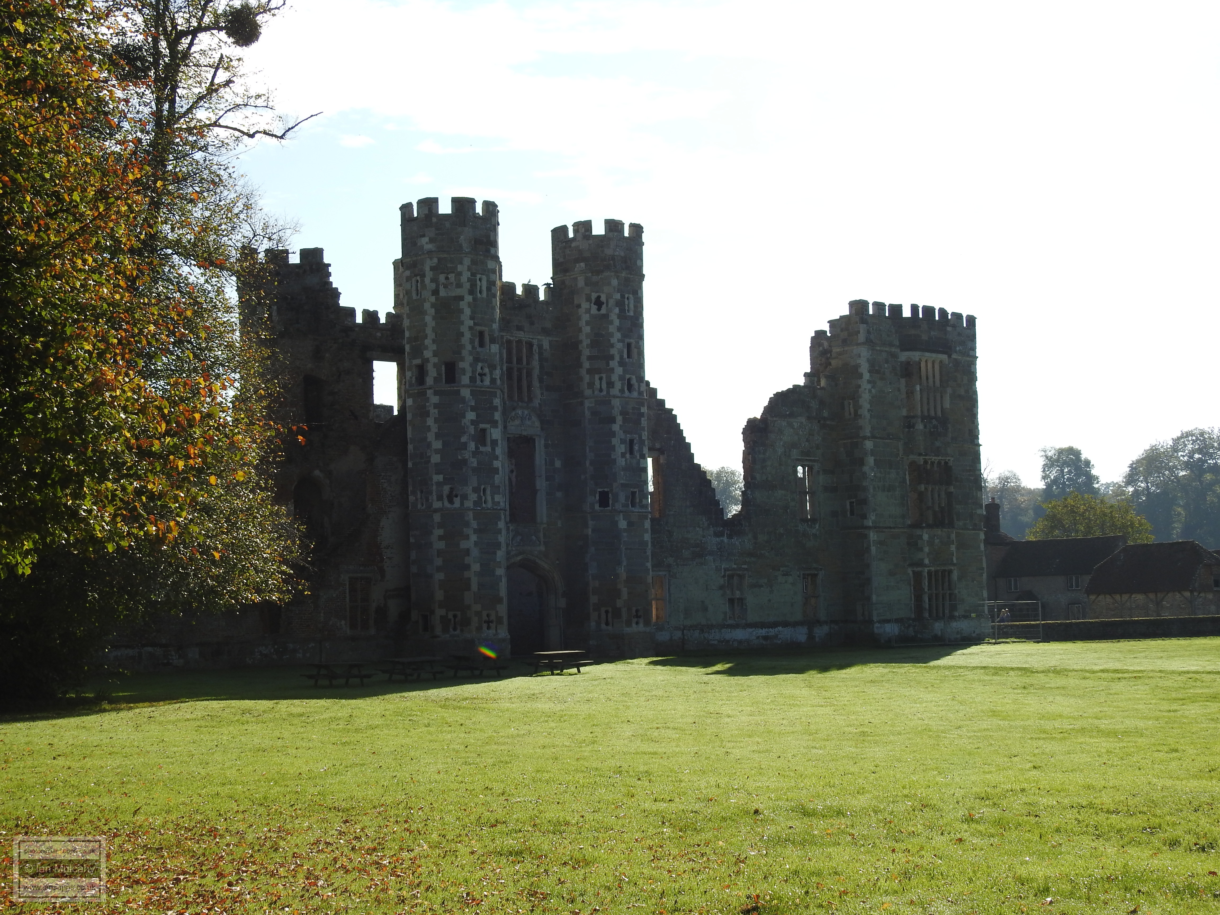
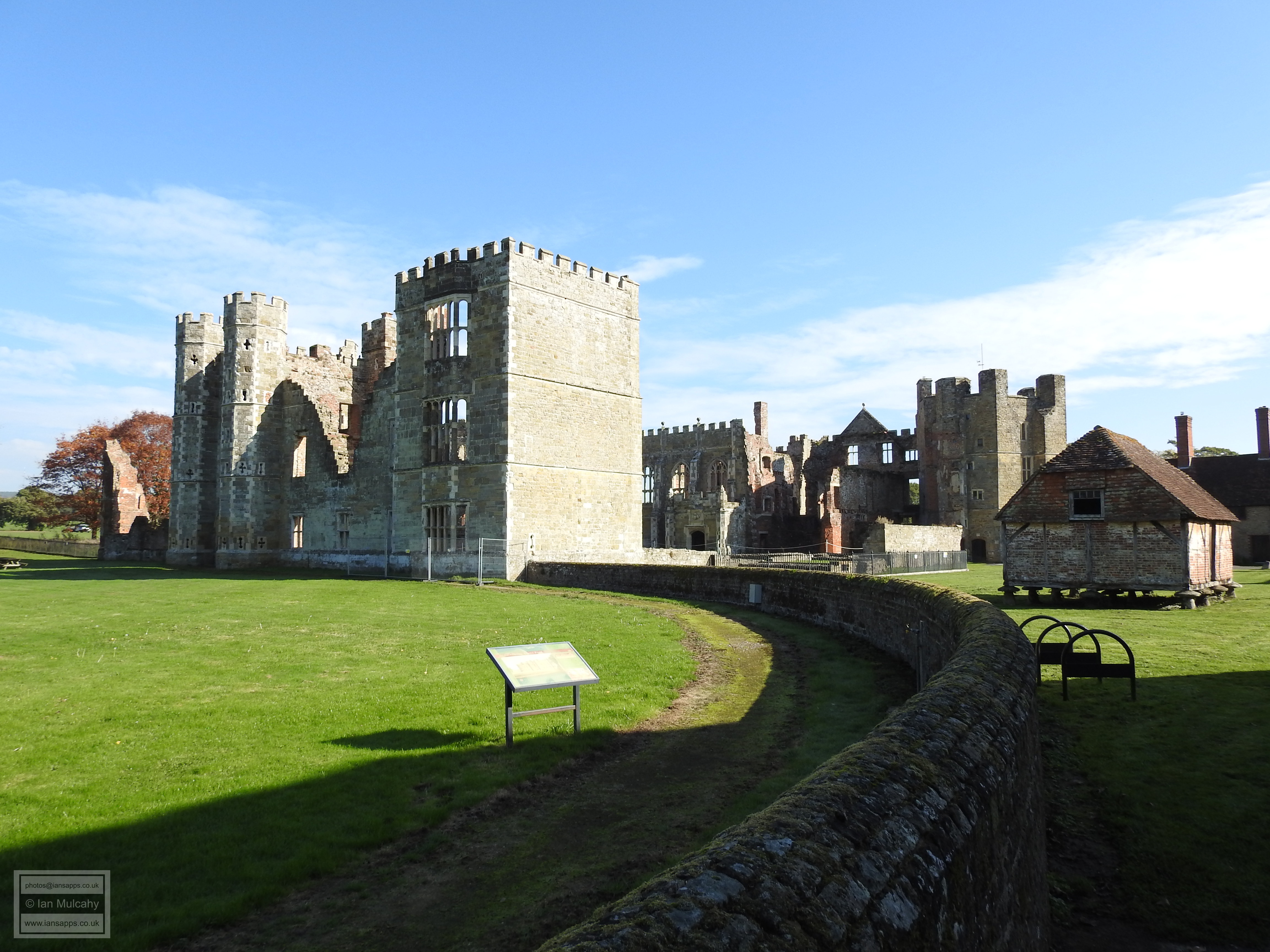
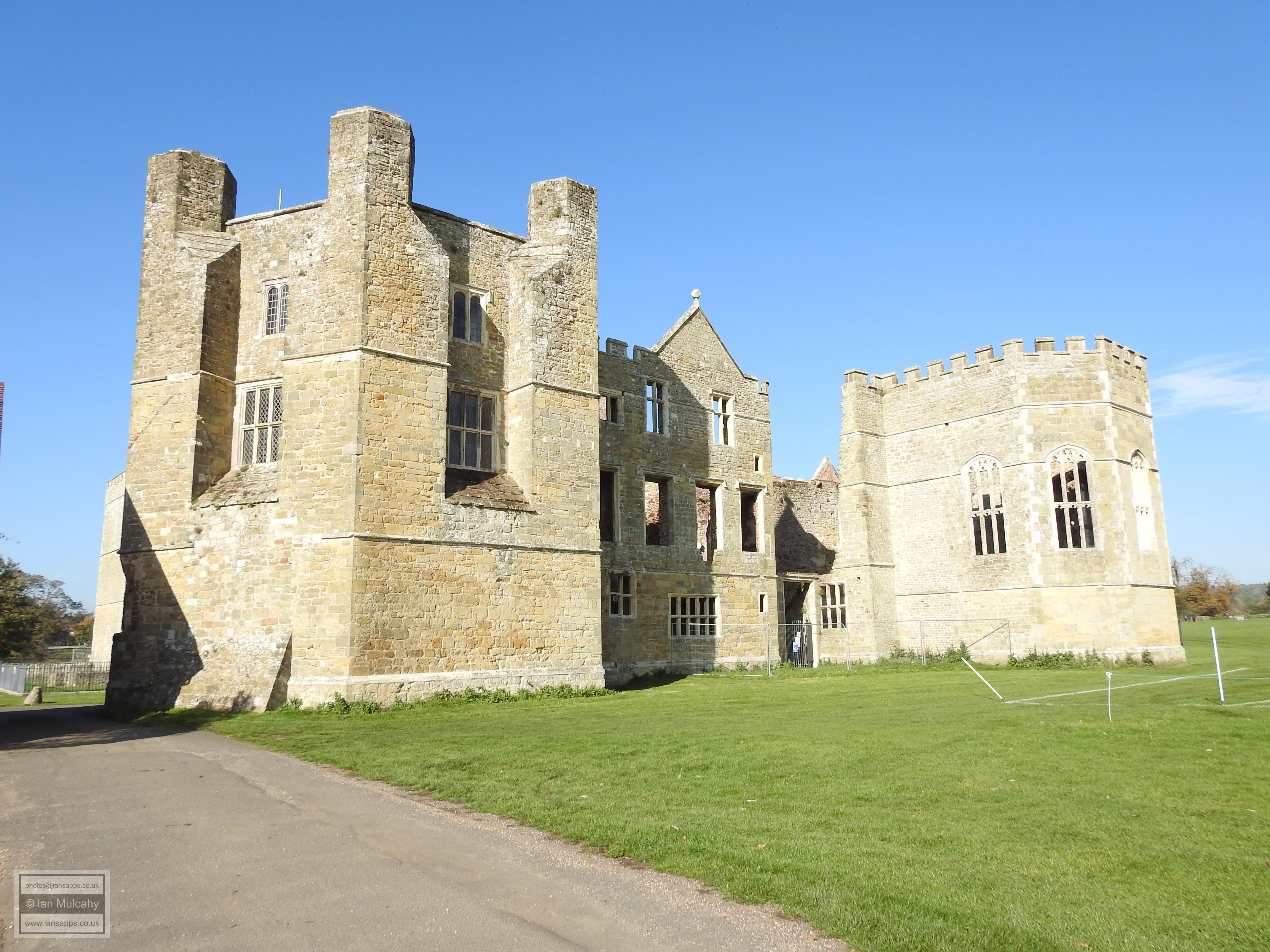
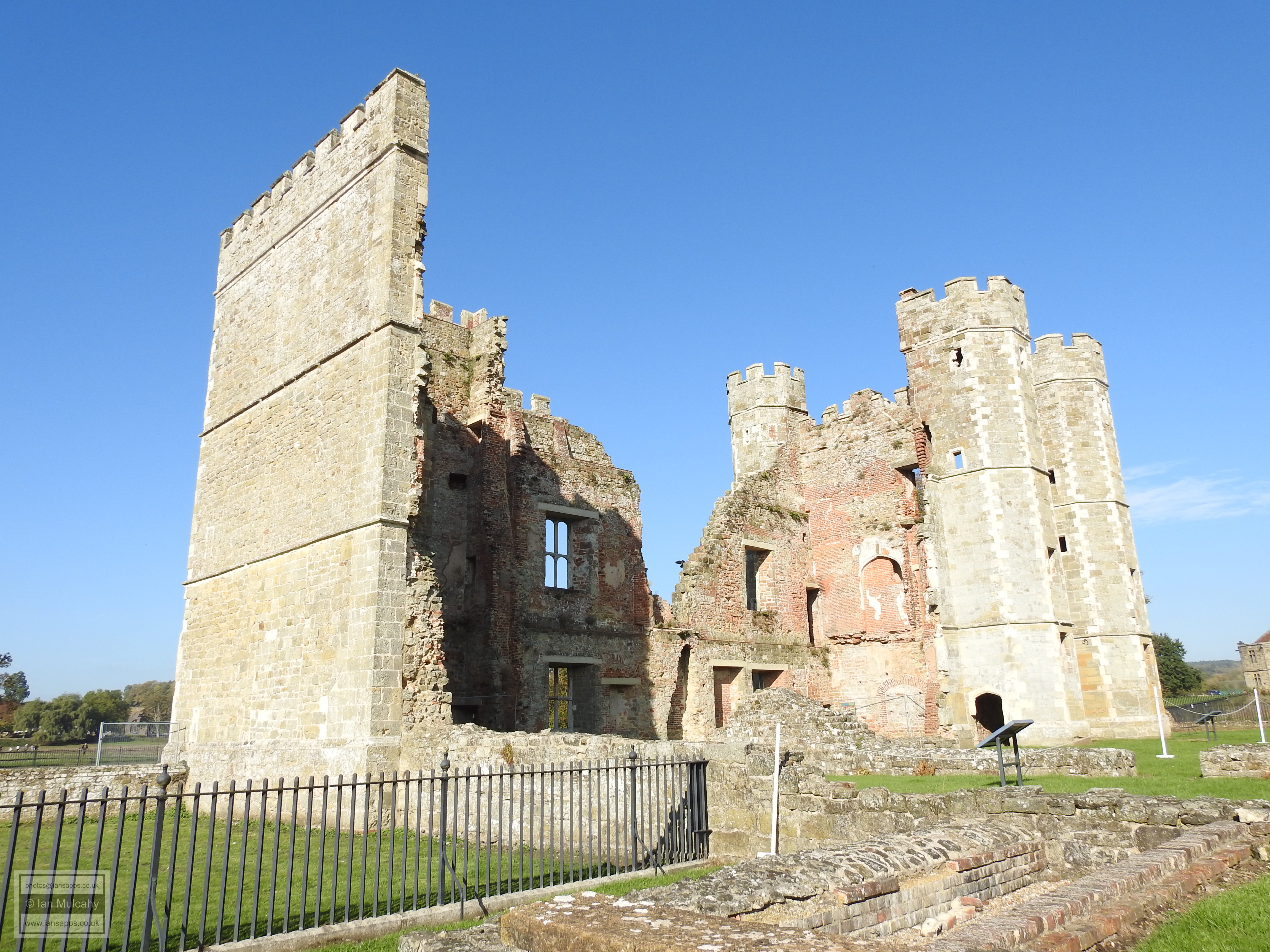
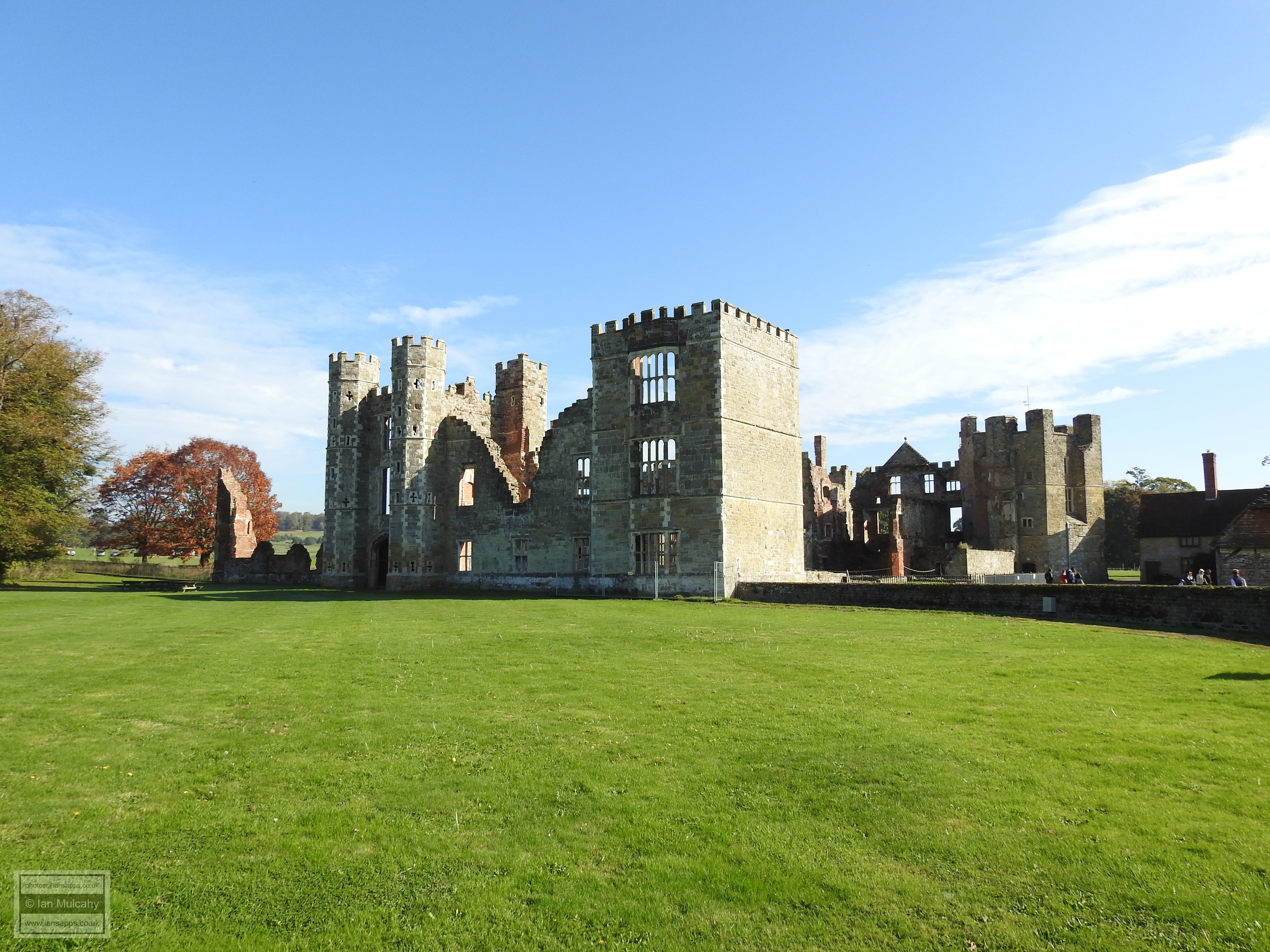
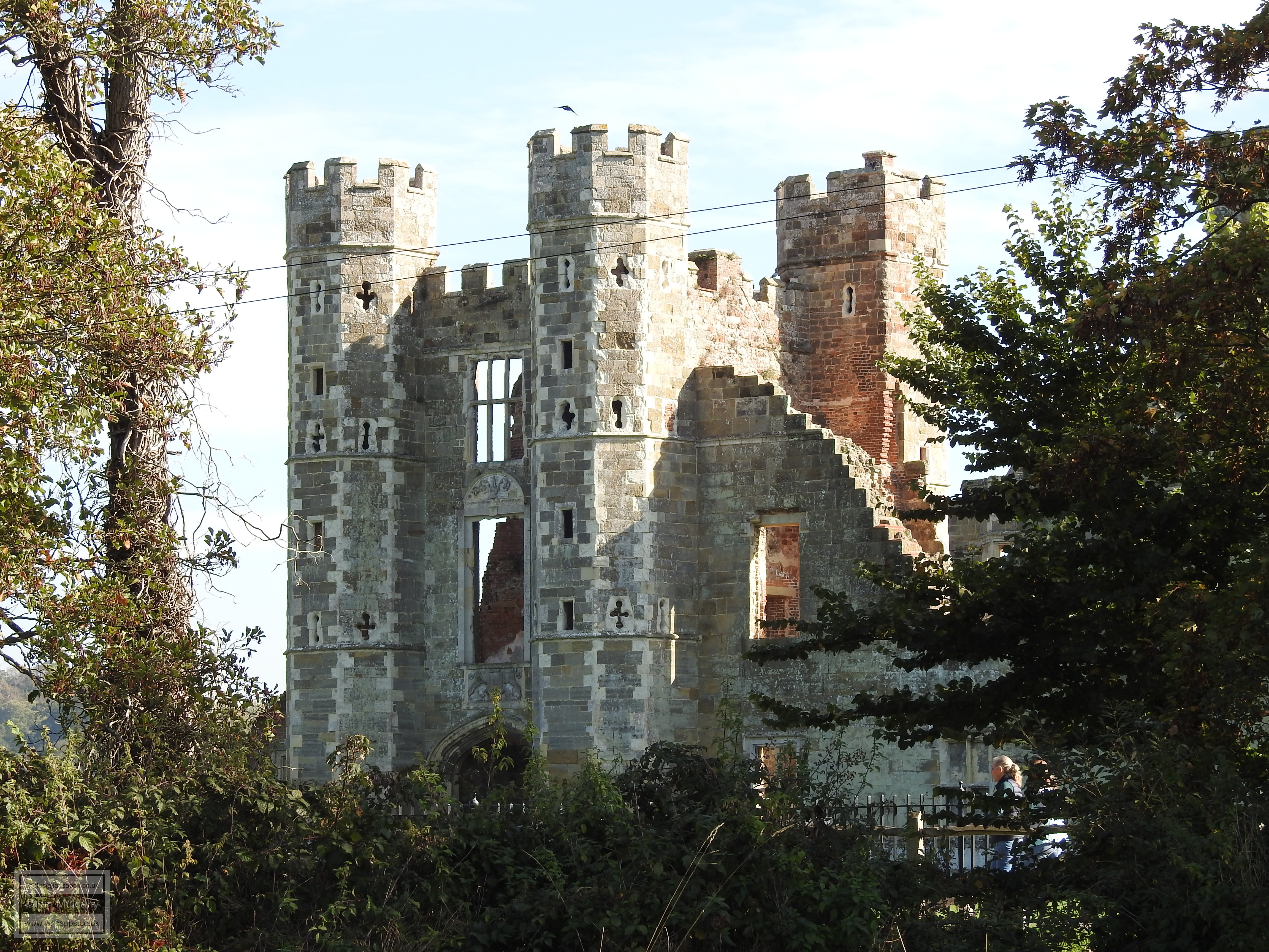
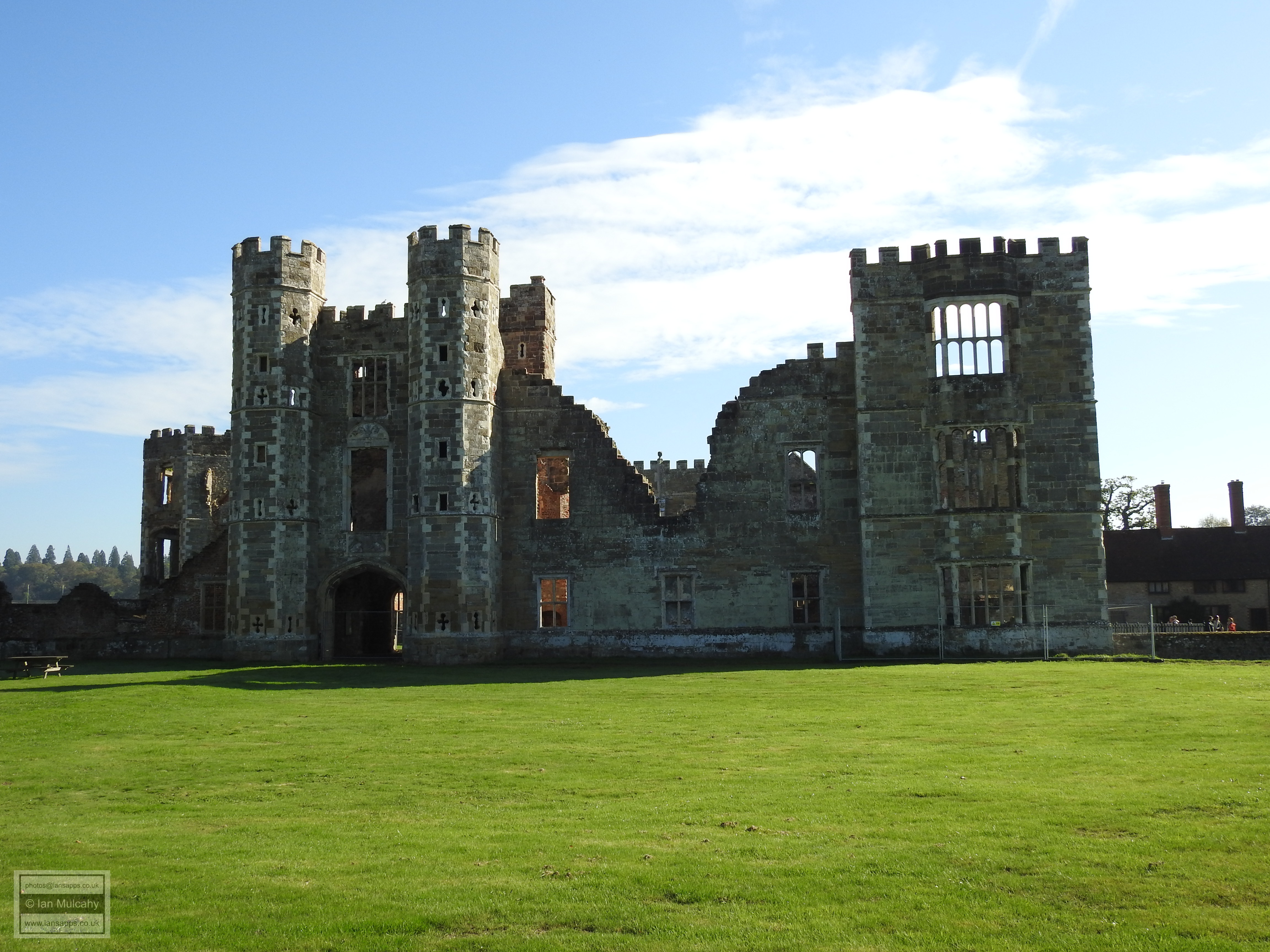
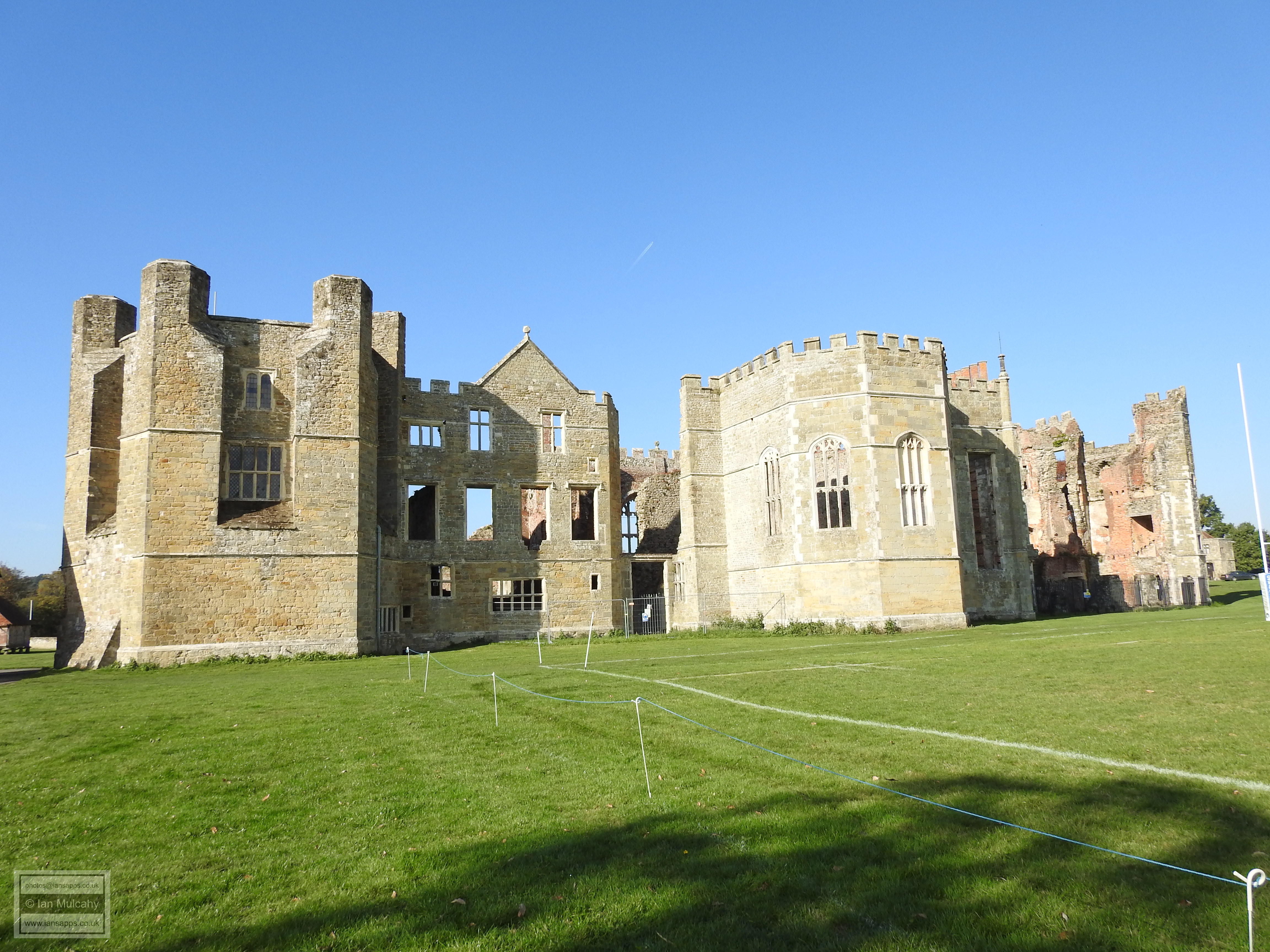
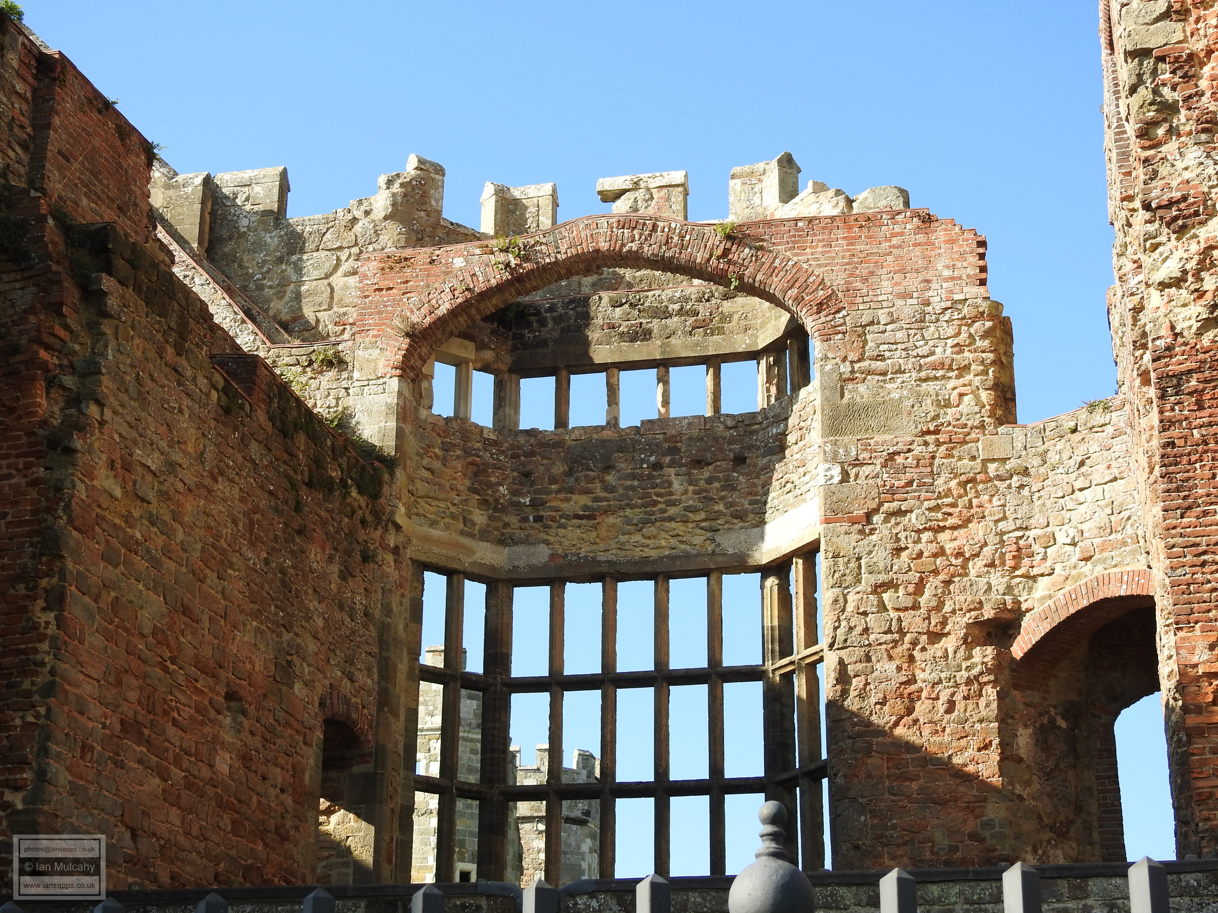
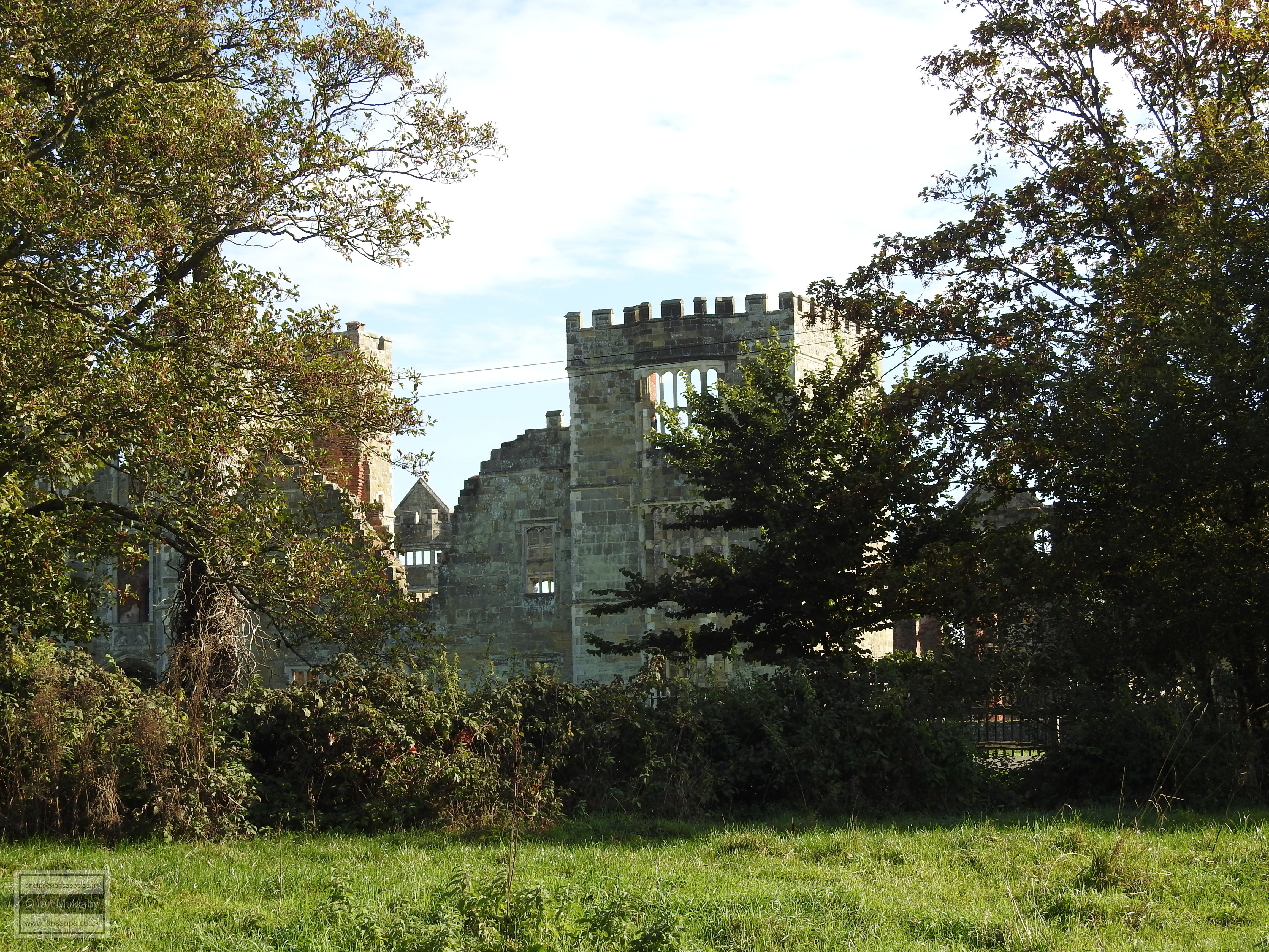
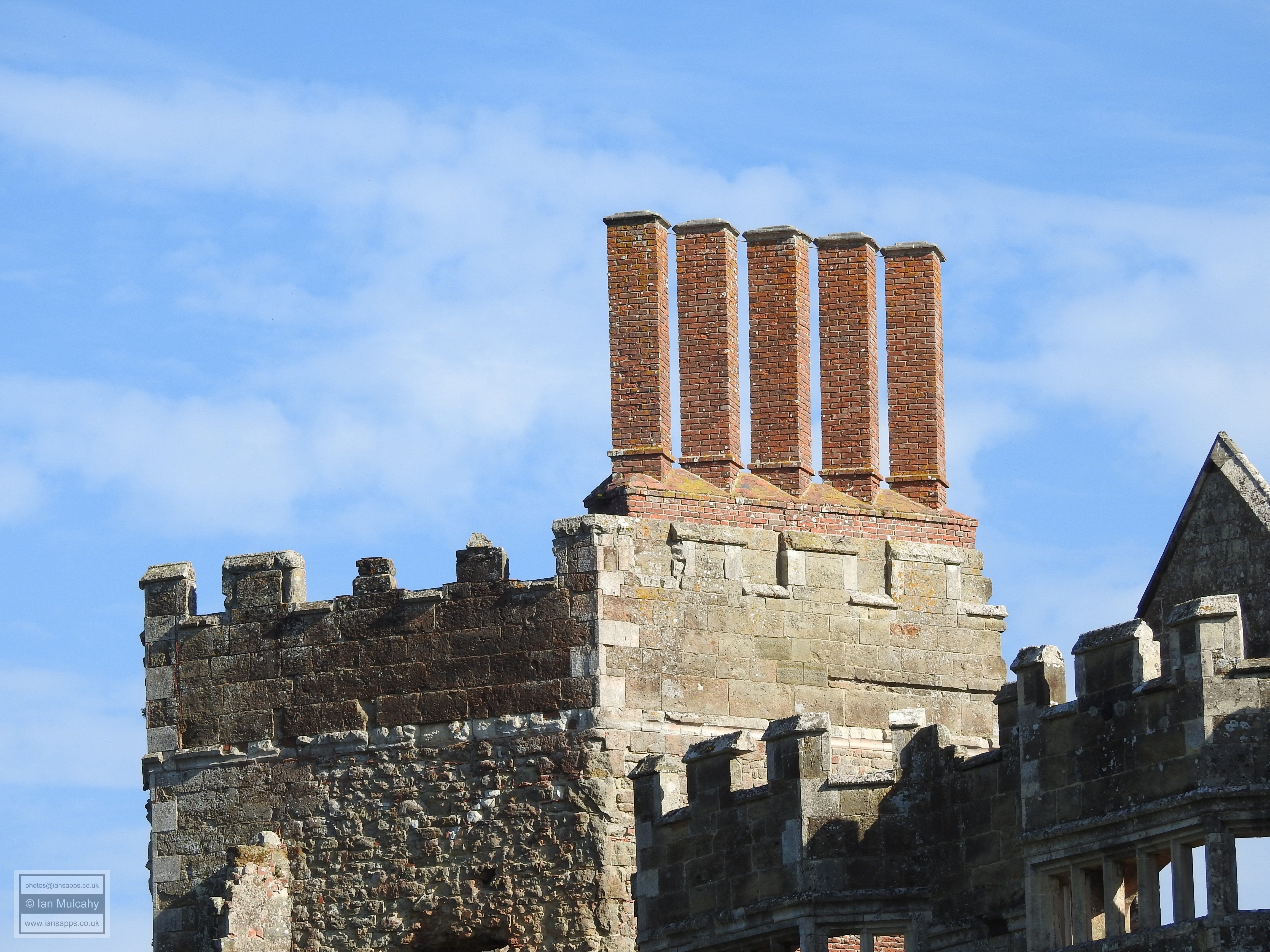
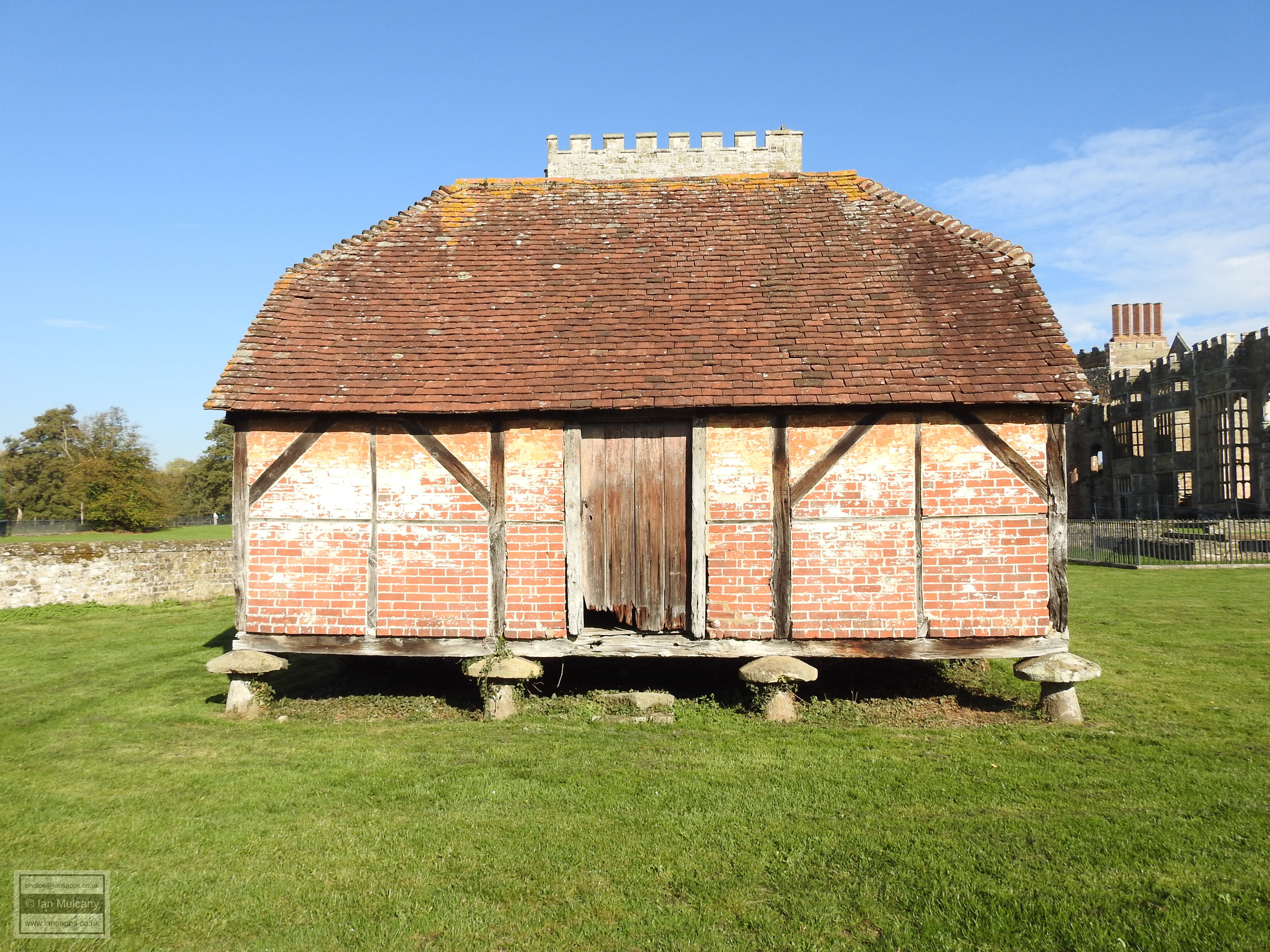
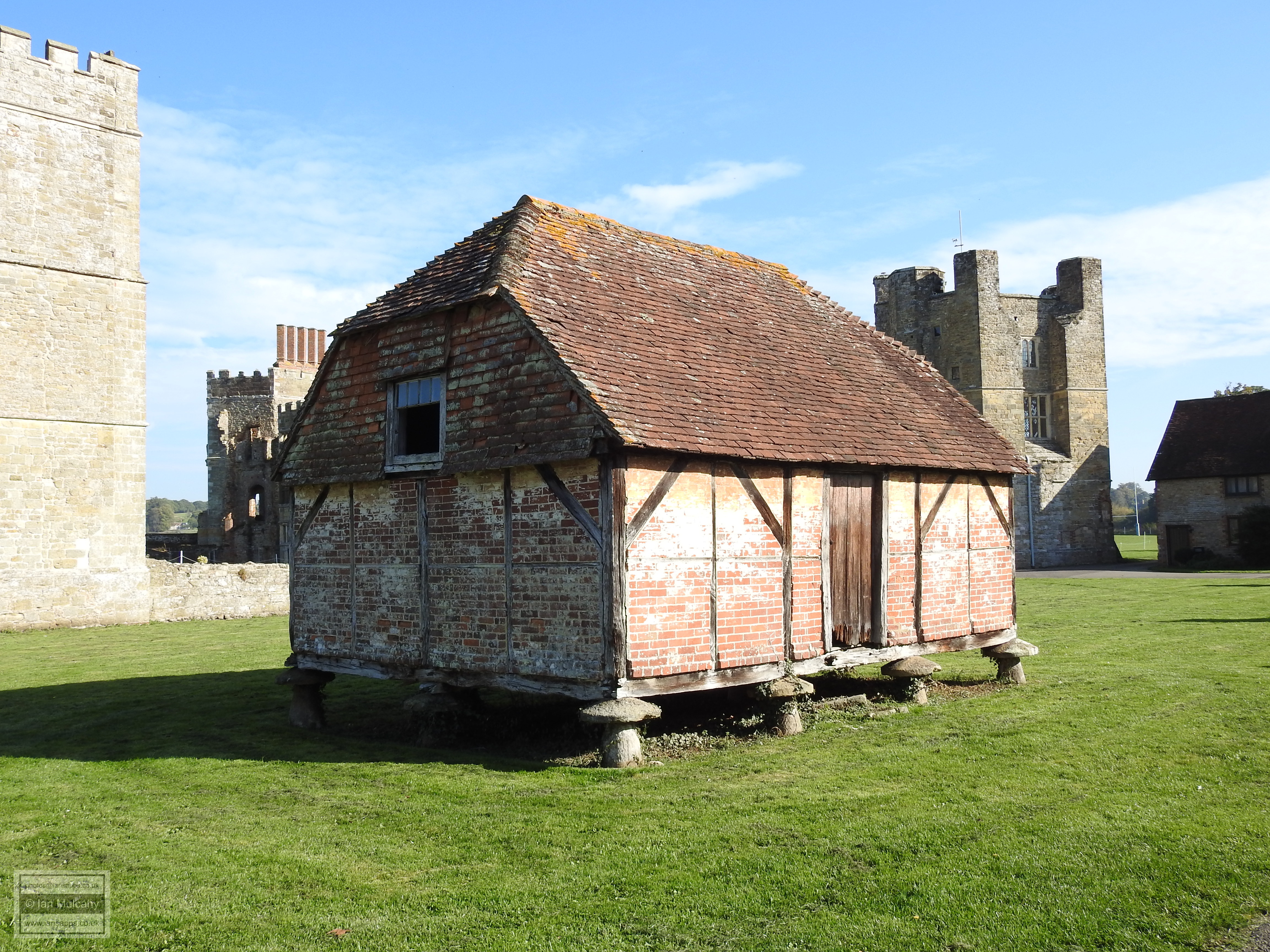
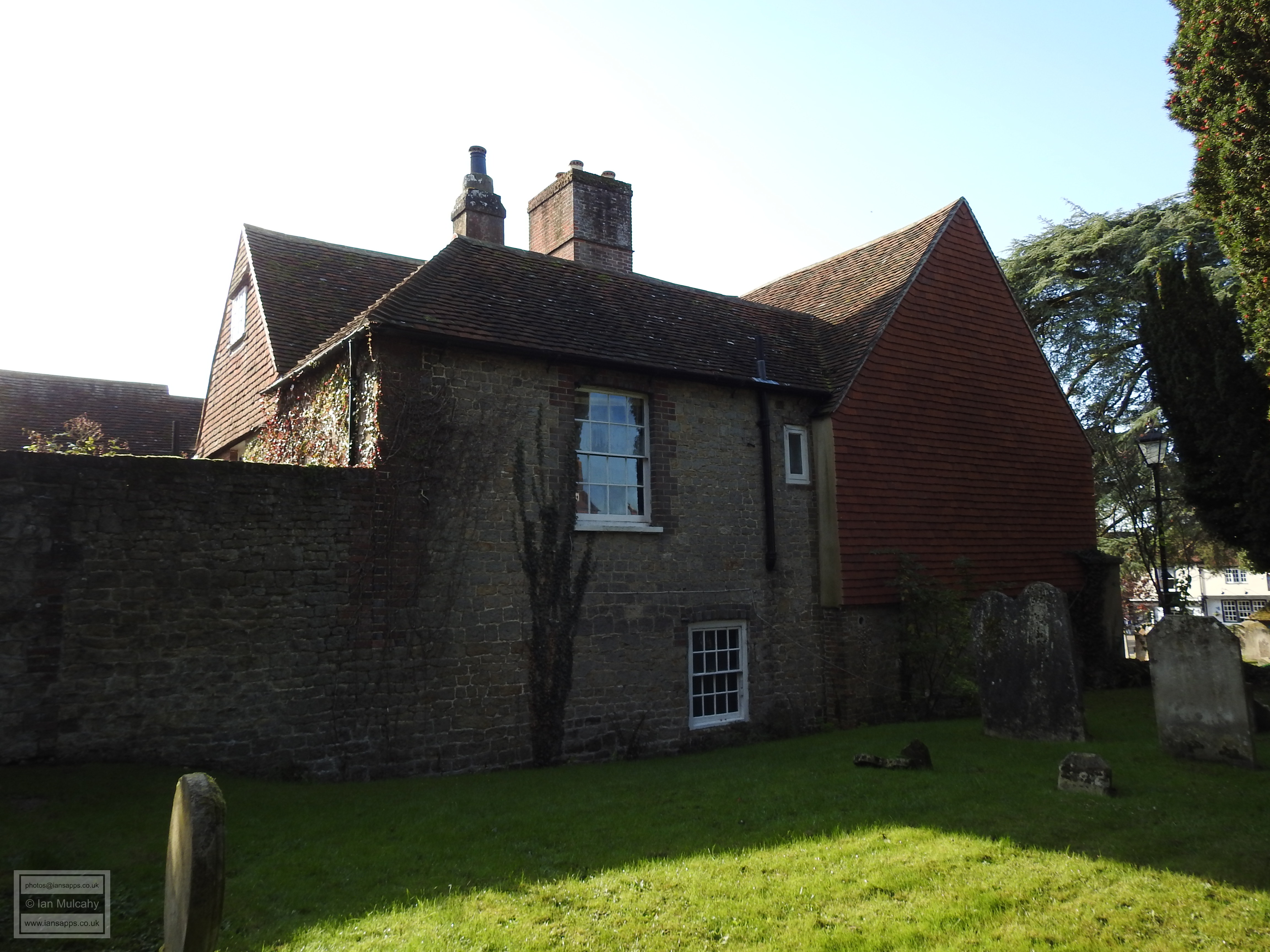
The castles replacement, Cowdray House, positioned less than 400 metres to the north east of St. Ann’s Hill, stands on low ground beside the River Rother and was first developed as a fortified moated manor house in the late 13th century, but was almost completely rebuilt as a semi fortified country house during the Tudor era. The rebuilding commenced in the early 1520s under the control of Sir David Owen, the illegitimate son of Owen Tudor (grandfather of Henry VII), but he sold the estate to Sir William Fitzwilliam, courtier to Henry VIII and Earl of Southampton, and it was Fitzwilliam who completed the works by 1542, creating one of the great Sussex Houses of the time in a style similar to that of Hampton Court Palace. Henry VIII, Edward VI and Elizabeth I were all entertained at Cowdray during its heyday, but the house was destroyed on 24 September 1793 during restoration work when a fire broke out in the carpenters’ workshop in the north gallery and the walls now stand in a ruinous state. In a strange twist of fate, the only part of the house to survive the fire intact was the kitchen, due it being designed in such a way as to protect the rest of the house from kitchen fires!
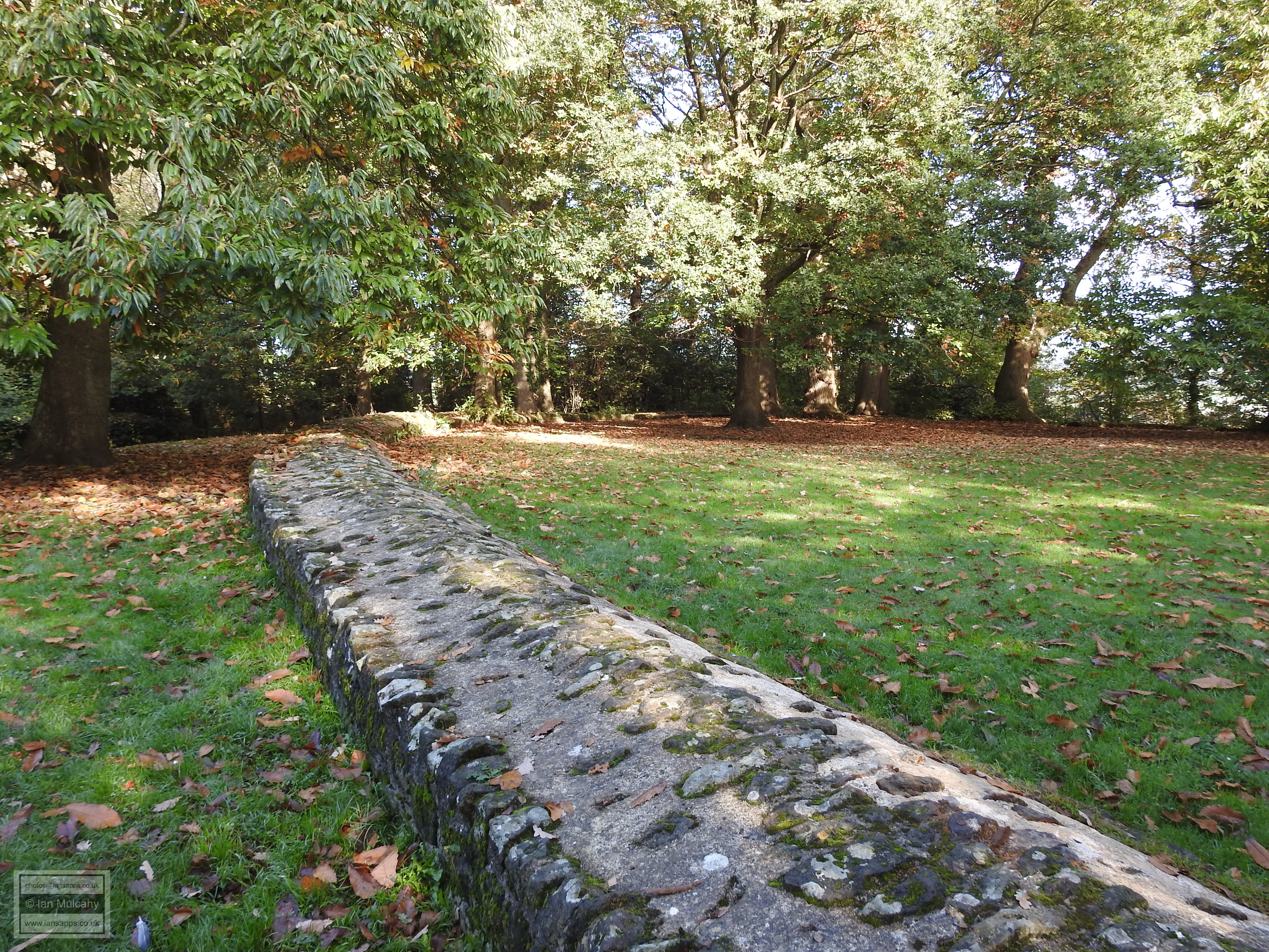
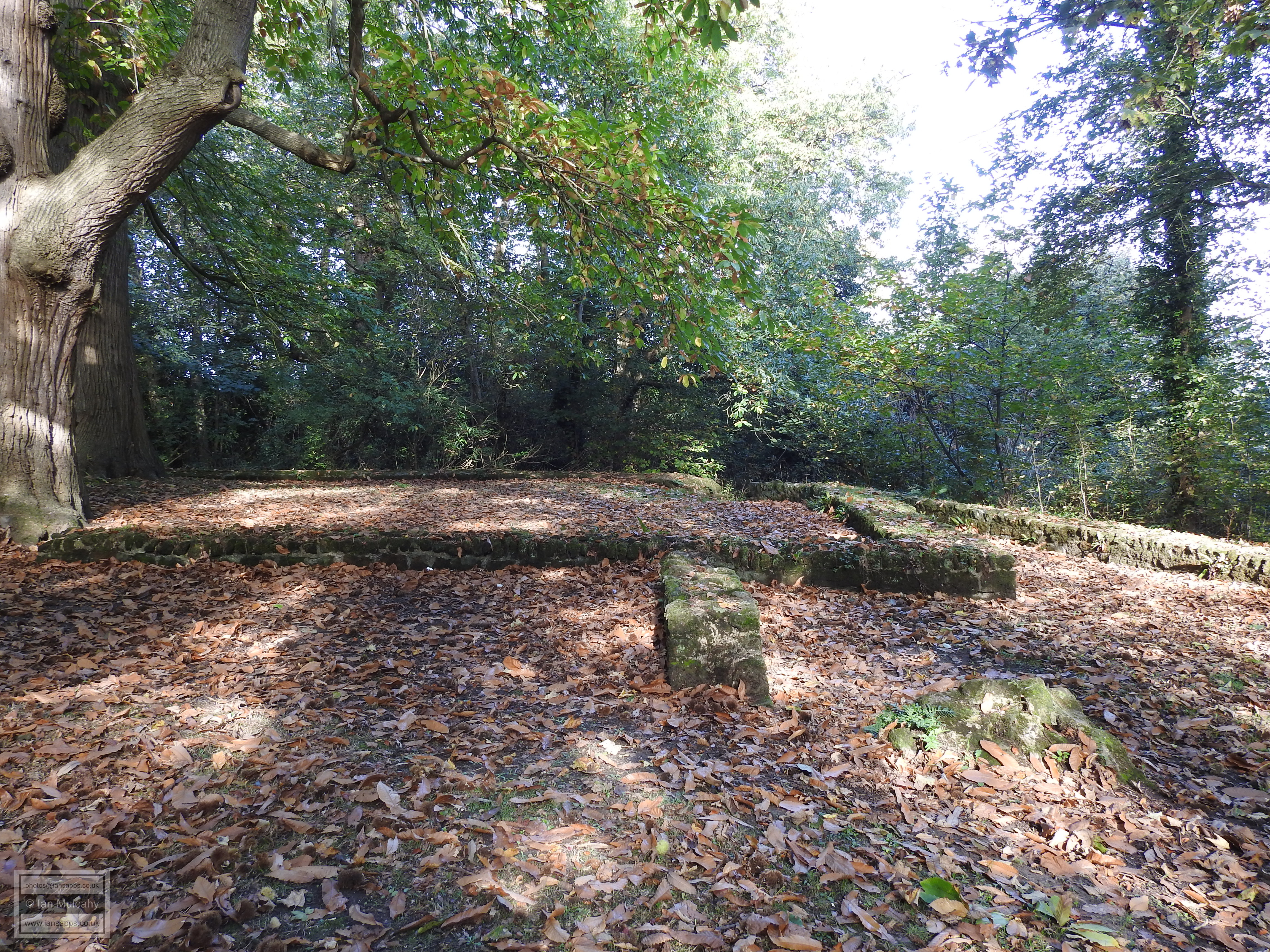
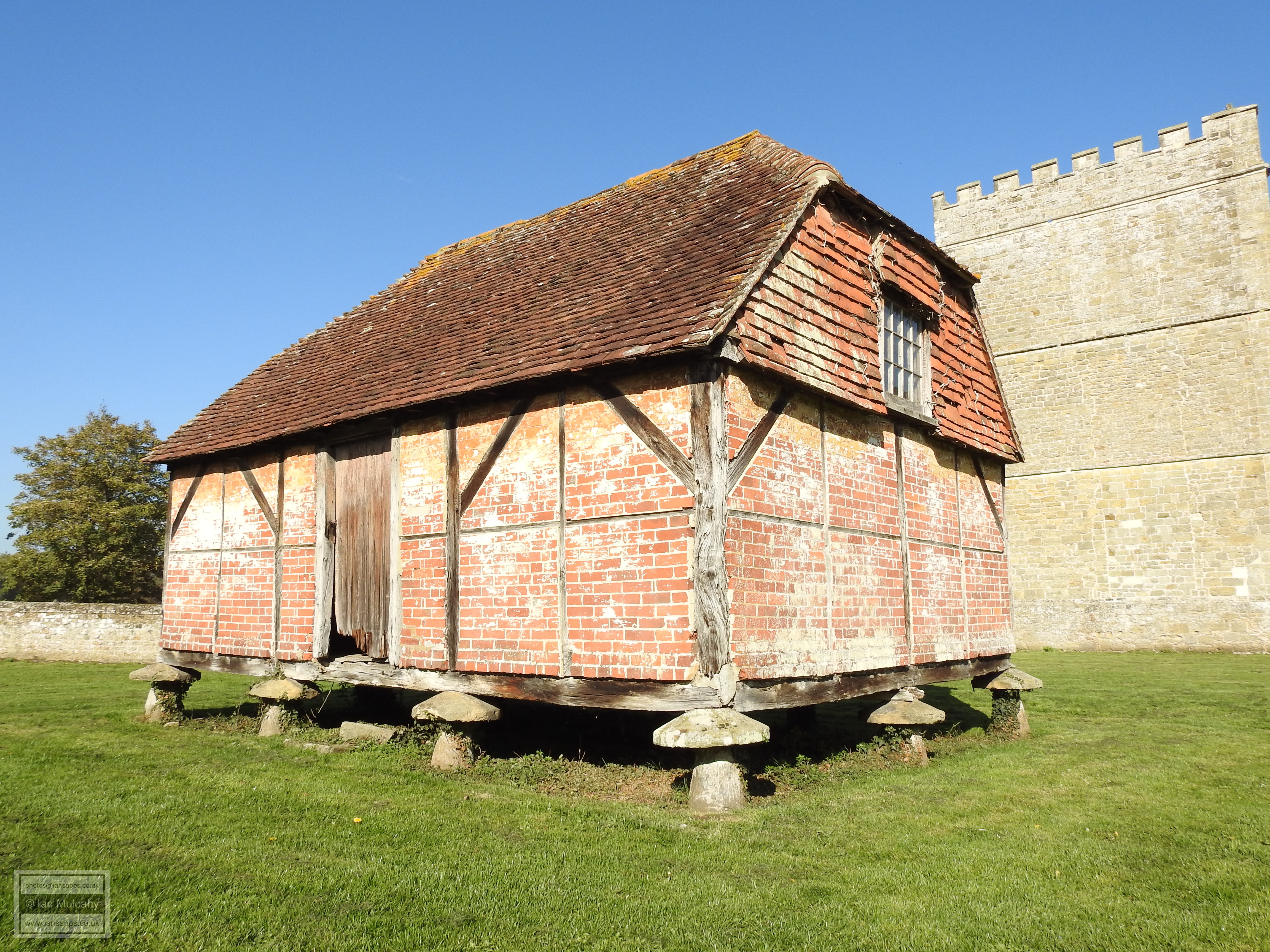
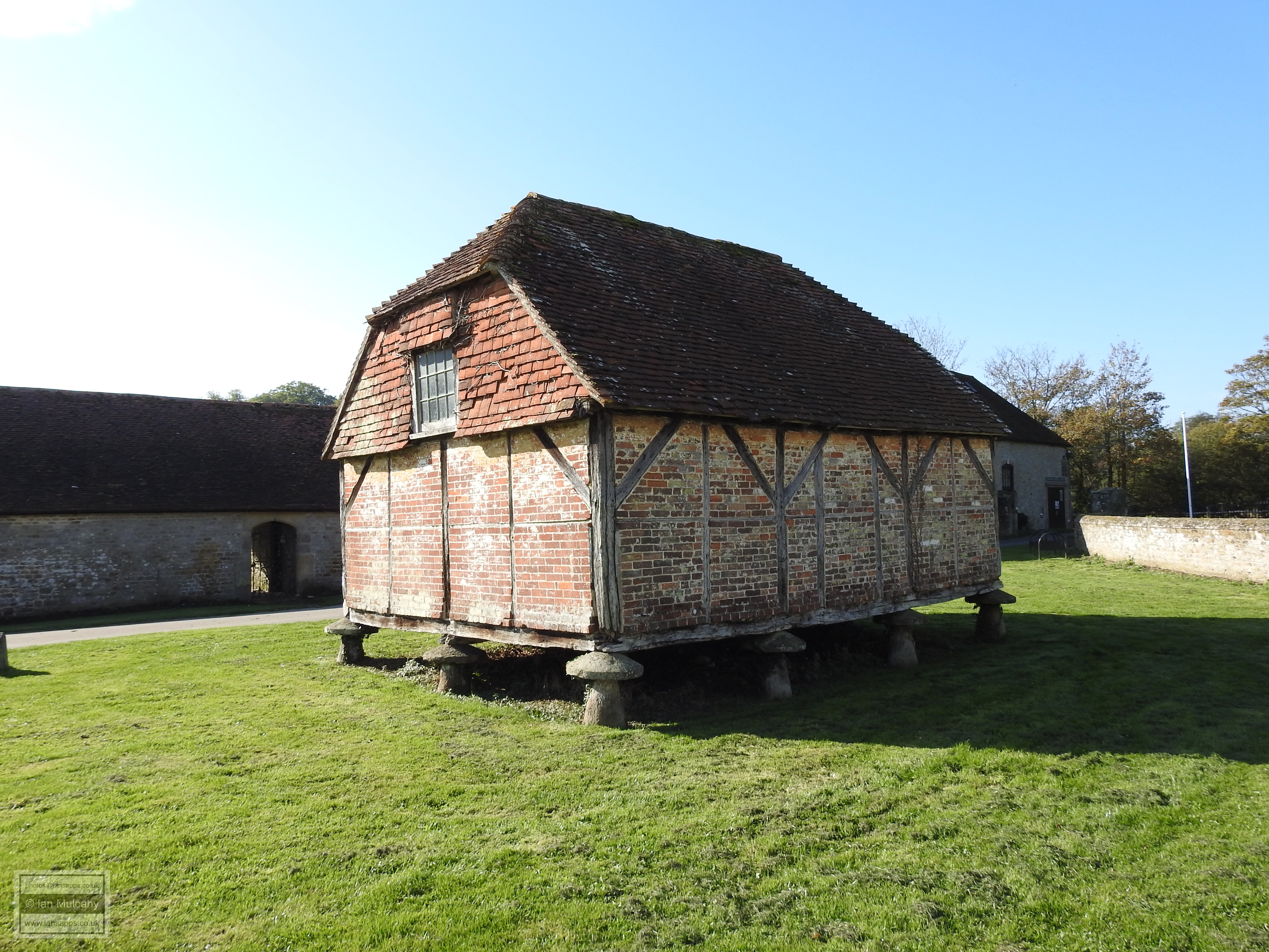
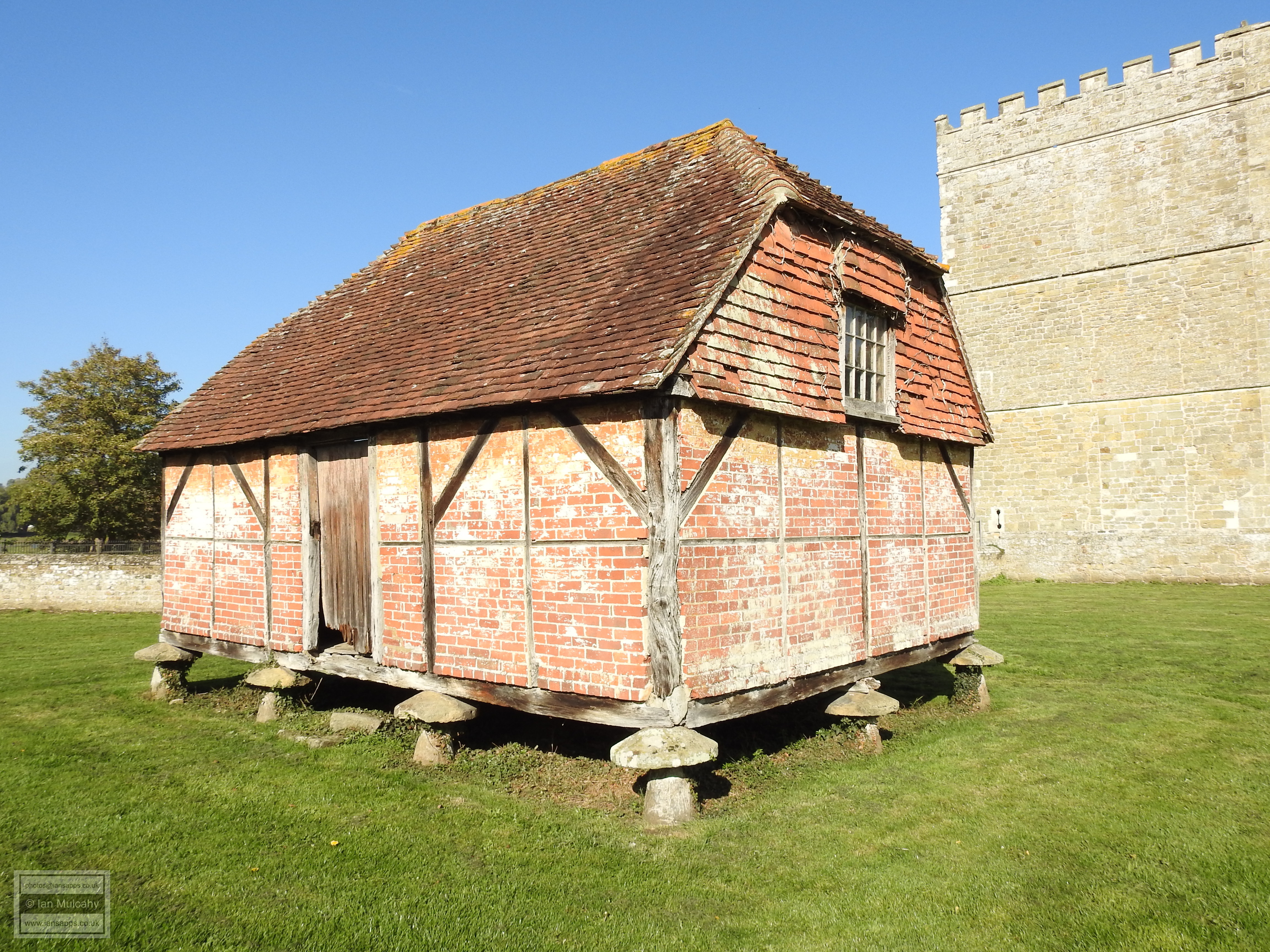
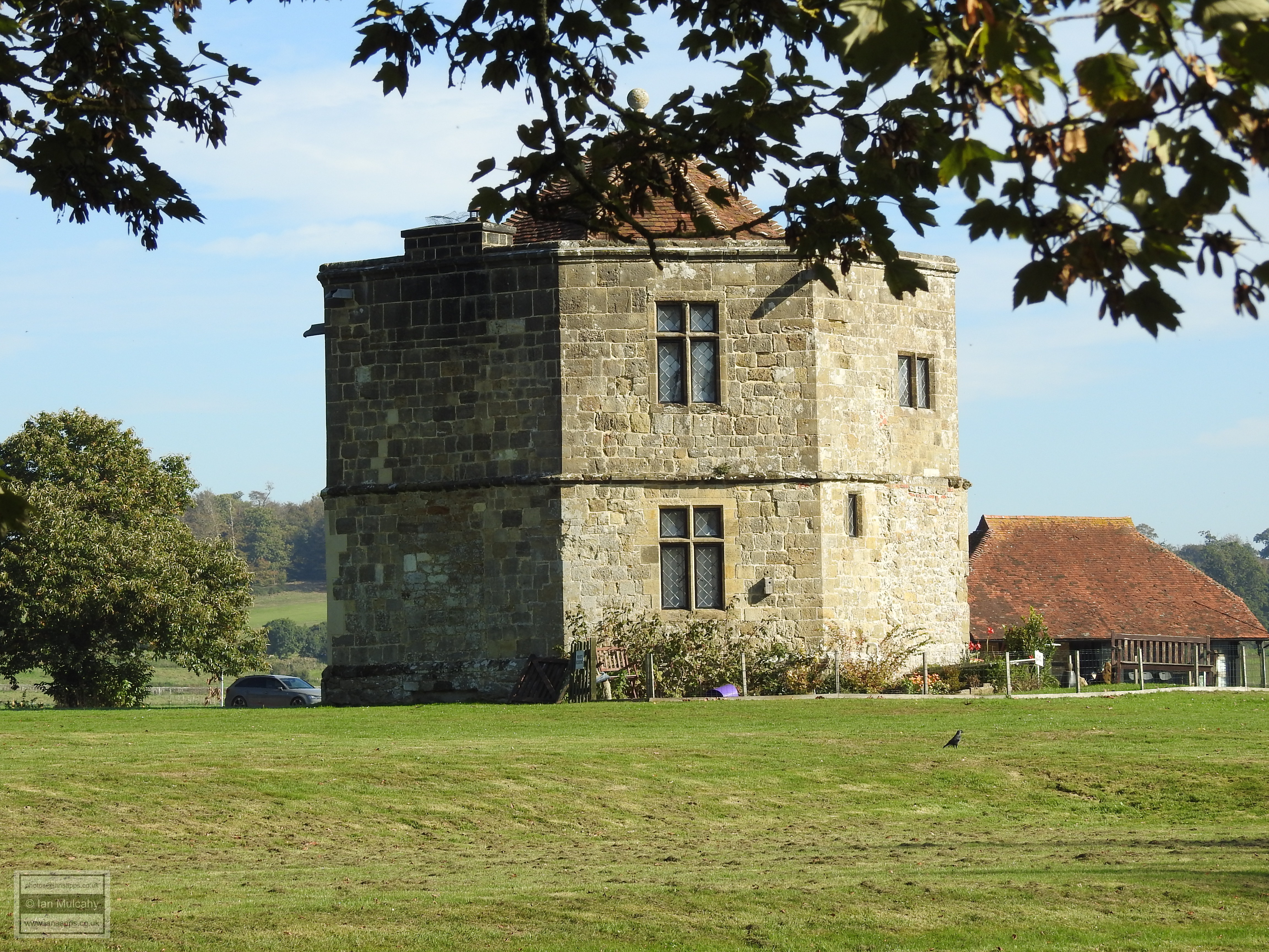
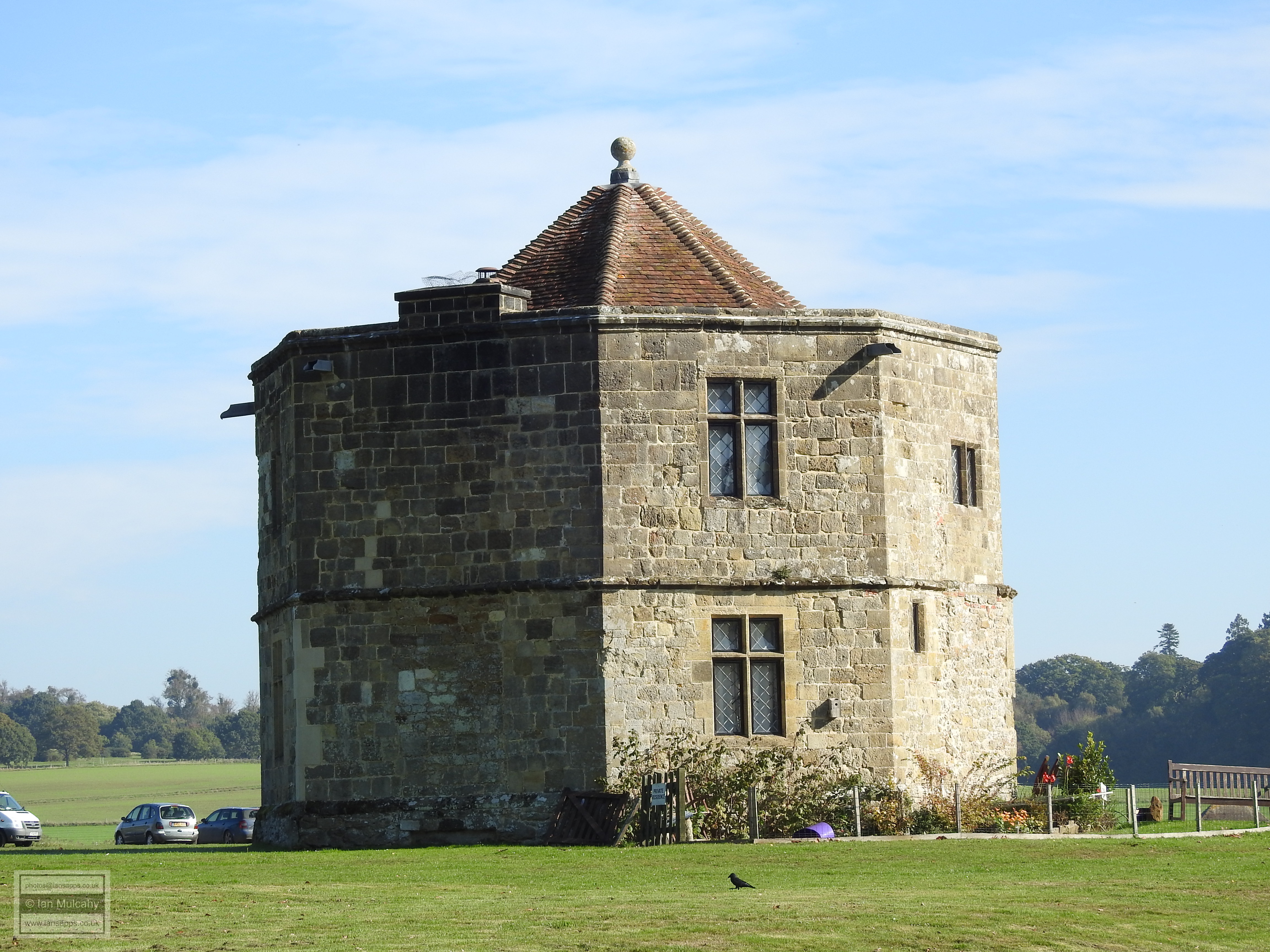
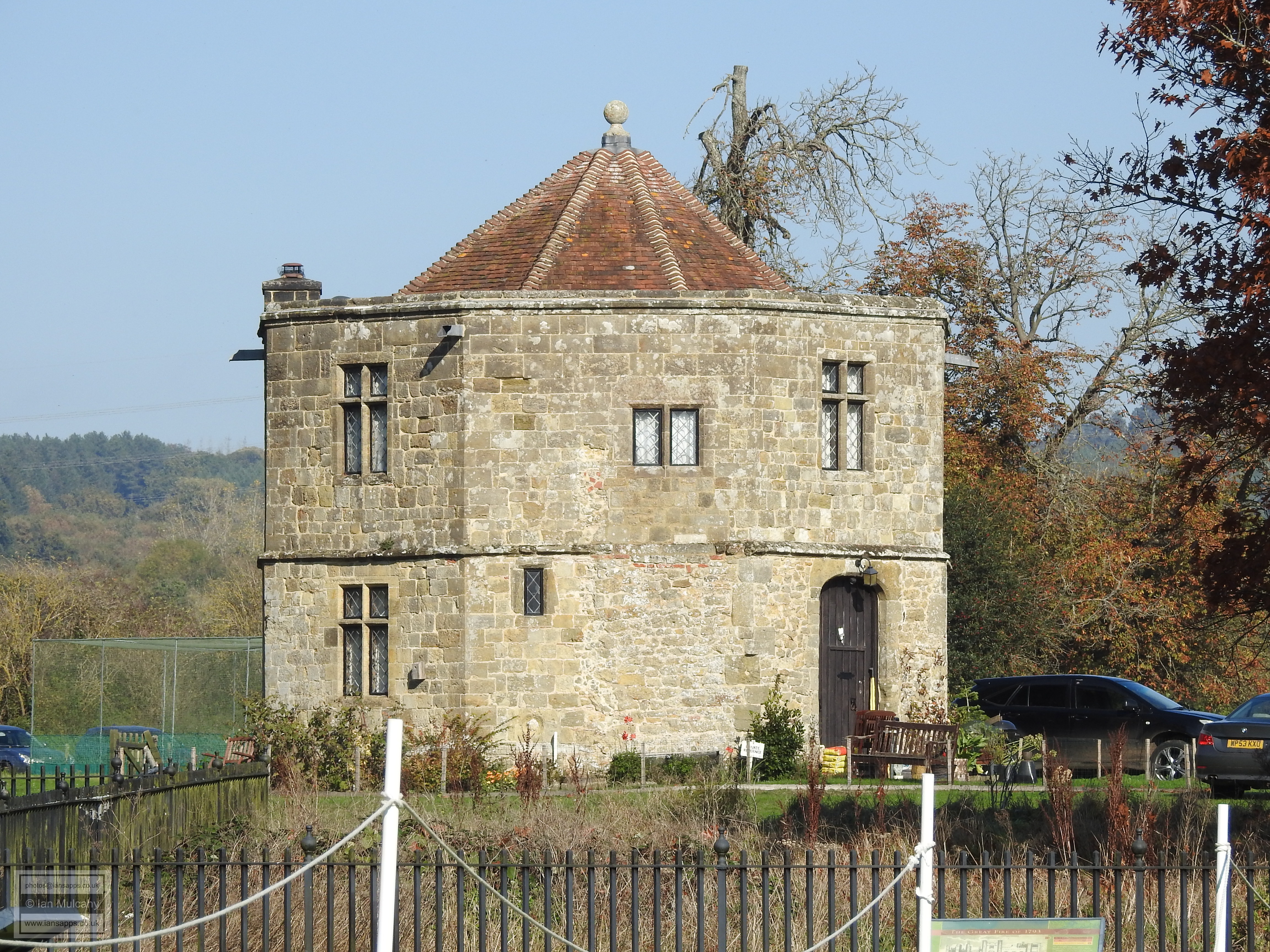
Within the grounds of the estate can be found The Granary, a quaint and crooked early 17th century granary and The Round Tower, an octagonal stone building, contemporary with the house, which was built as a conduit to supply the house with water.
Shortly after the establishment of the castle a planned and fortified
town started to form to the west within a second, outer, bailey. The
river and St. Ann’s Hill formed the eastern defence and a deep ditch of
approximately 11 metres in width was dug around the other three sides of
the fledging town, each side being approximately 200 metres long. On a
modern map, the southern flank of the ditch ran from just north of the
eastern end of ‘The Wharf’, through the car park and Jacobean Hall at
The Spread Eagle Hotel and turned north just after the hotel gardens,
forming the western section between Duck Lane (derived from Back Lane;
the lane at the back of the bailey) and Wool Lane before bending across
to Knockhundred Row (known as ‘Wildes Hill’ in Tudor times) to form the
northern flank which then joined up with the northern side of St. Ann’s
to complete the defensive structure. Visitors from the north would have
entered the town along Knockhundred Row and through a gate at the point
where it turns and becomes Church Hill while the entrance for those
travelling from the south was roughly where the street splits into two
to accommodate the central infill. There were two further entrances in
the western defence, one on modern day West Street and the other into
Duck Lane where it joins North Street, a road which pre-dates the town
formation.
A market was first recorded at Midhurst in 1223 when a market charter
was awarded, but it would have existed long before this and it’s
possible that Montgomery’s reasoning for the siting of the castle and
planned town here was due to the area already being a focal point for
trade as a result of the crossroads of the two major routes. As time
passed, buildings started to appear within the market area as central
stalls became permanent structures and shops were added around the edge
of the square. There are several buildings within the confines of the
original town that have survived from the medieval and Tudor eras and it
is suspected that many others, which haven’t been subject to internal
examination, also date back to the 14th, 15th and 16th centuries. Some
of the buildings we will look at were listed in the 1950’s as being of
‘17th century or earlier’ origin and haven’t been inspected since. It is
a fair assumption that the ‘or earlier’ will apply in many cases, making
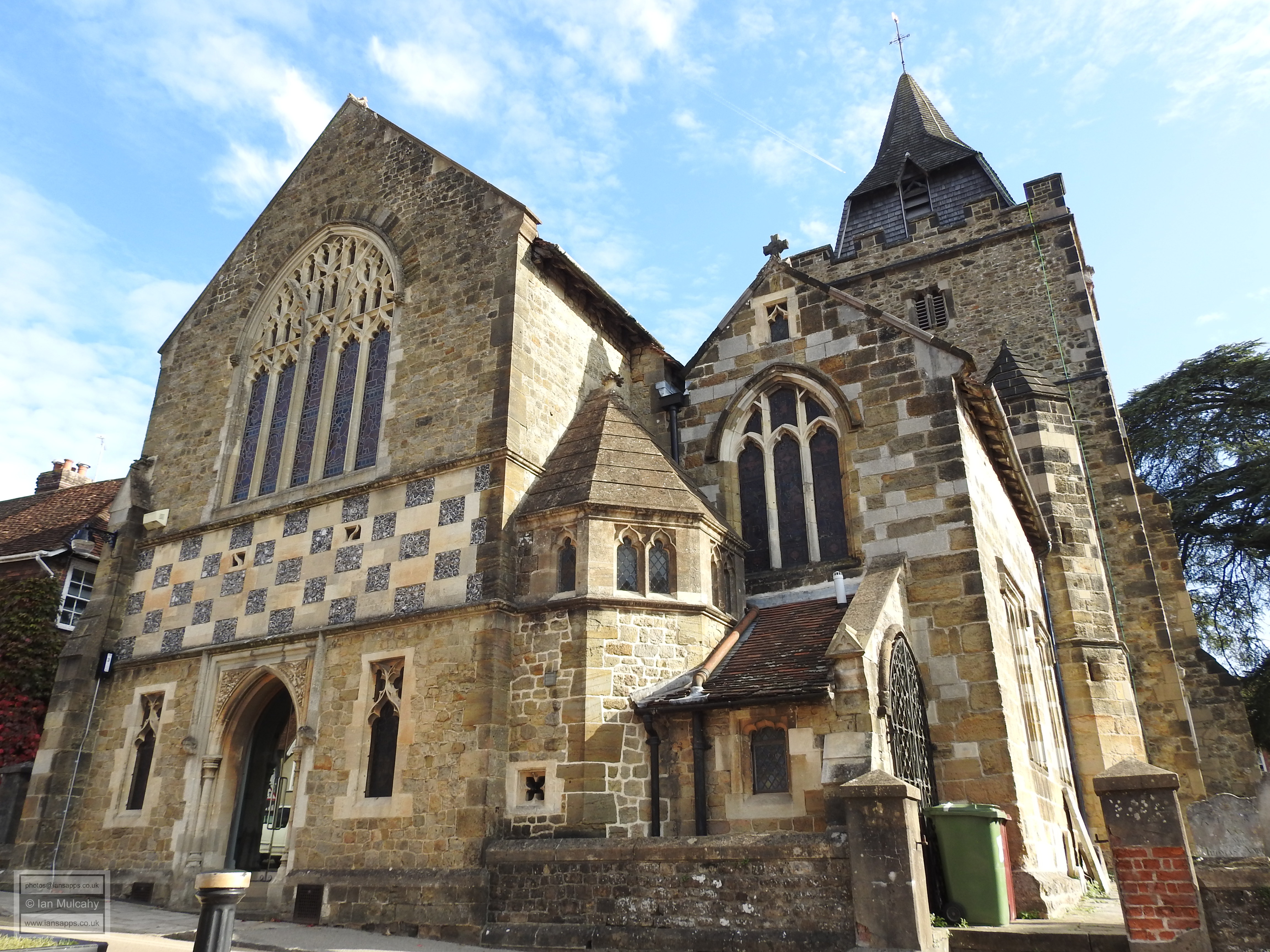
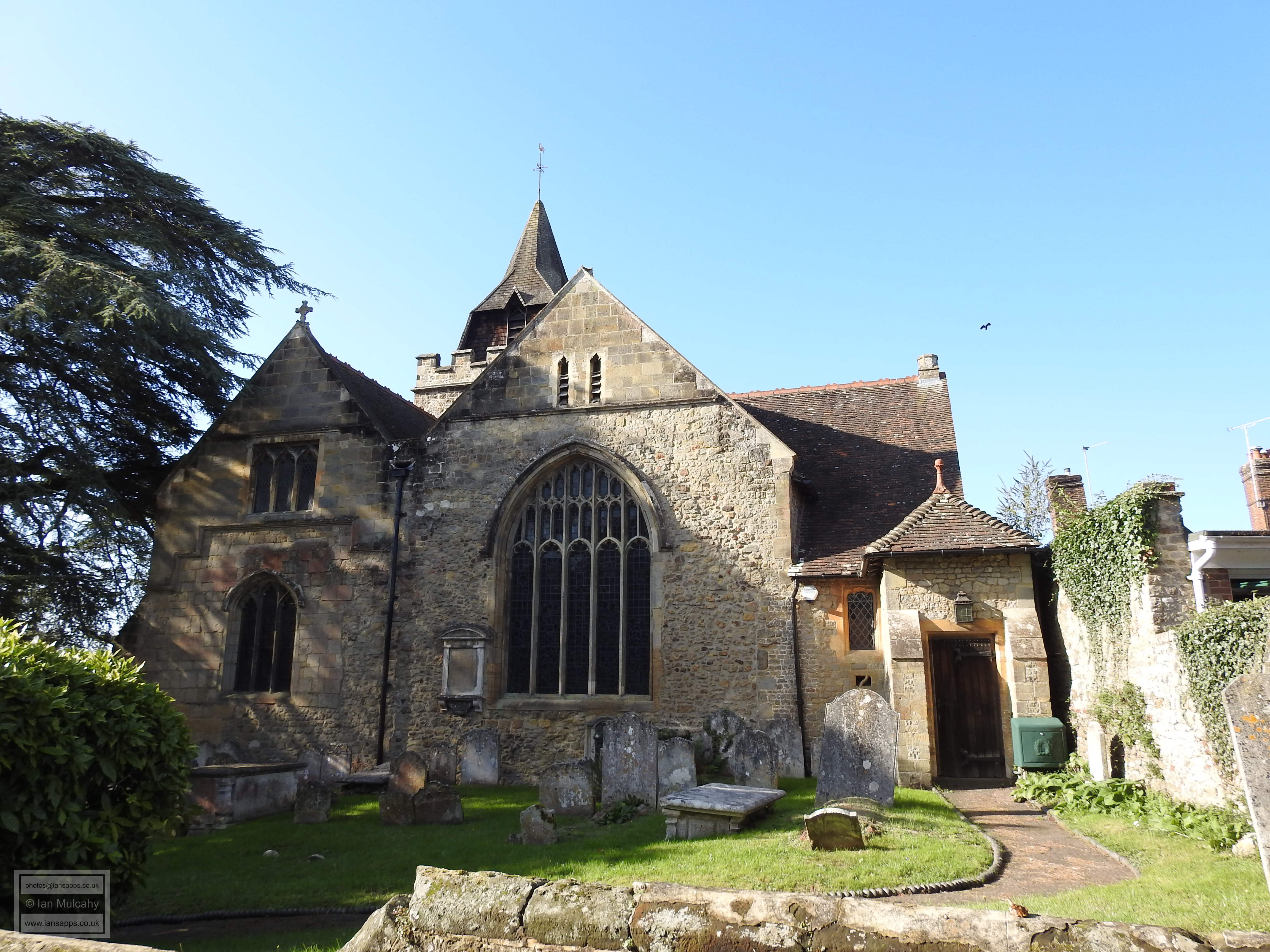
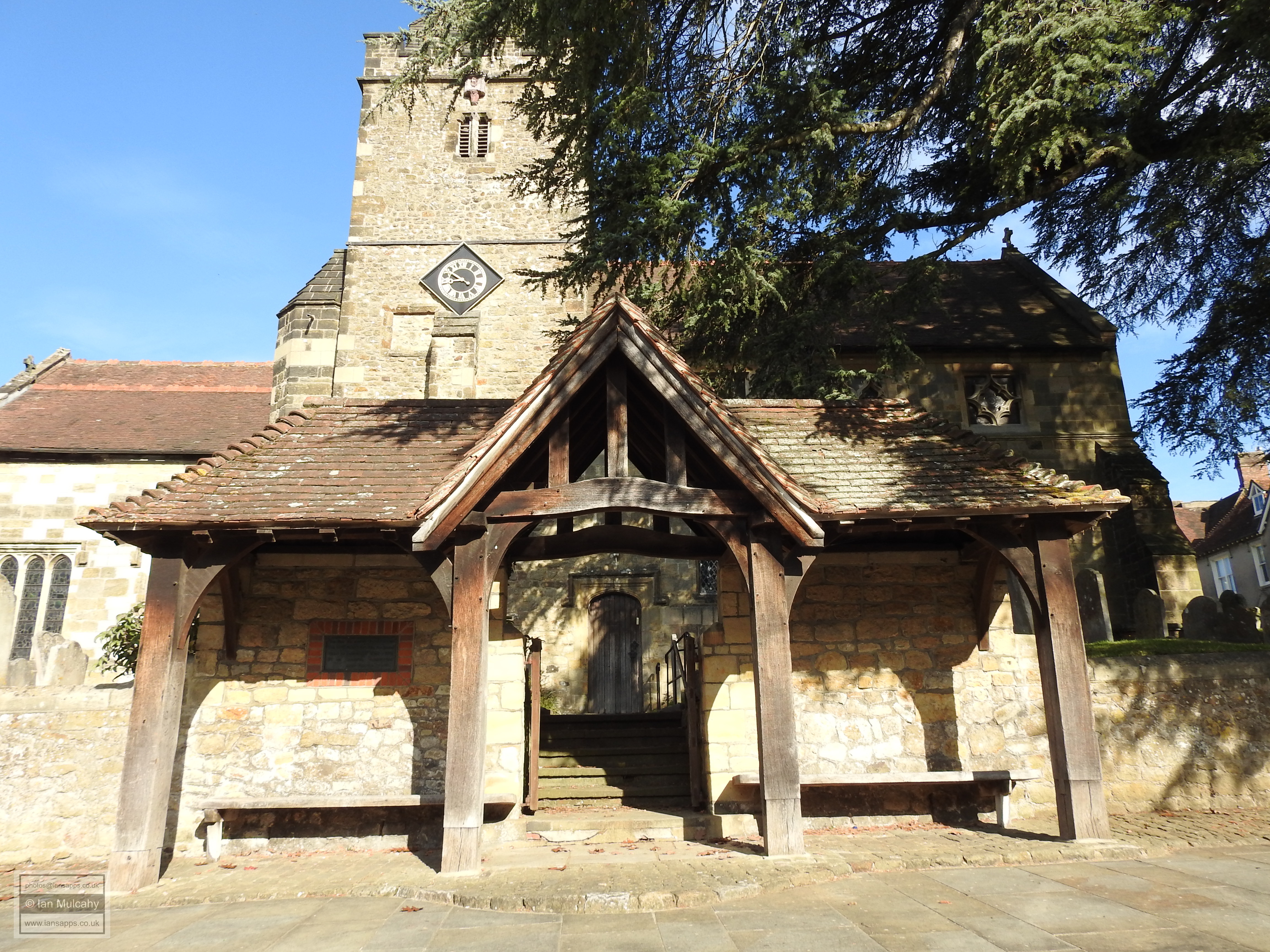
Midhurst a very Tudor town.
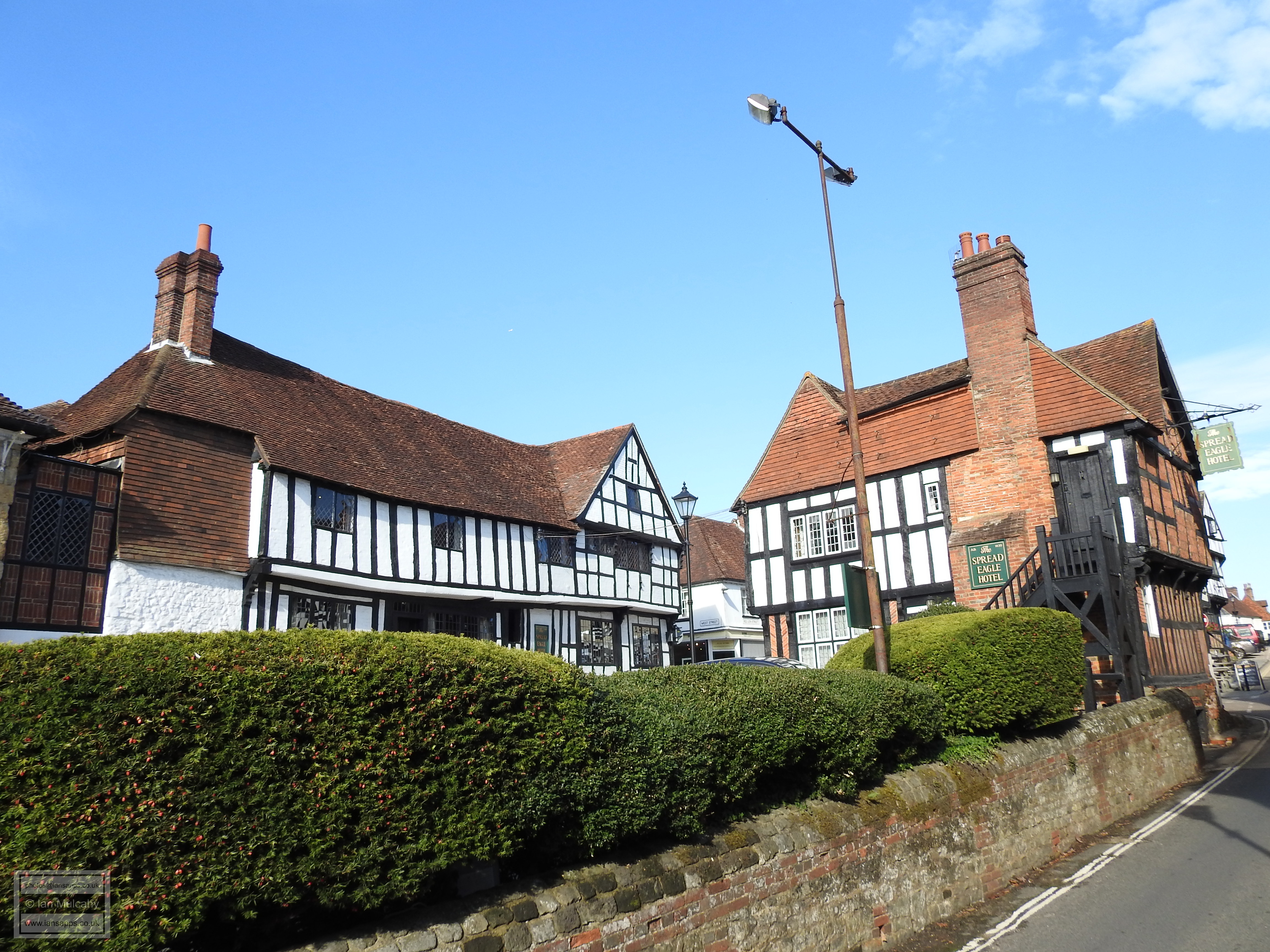
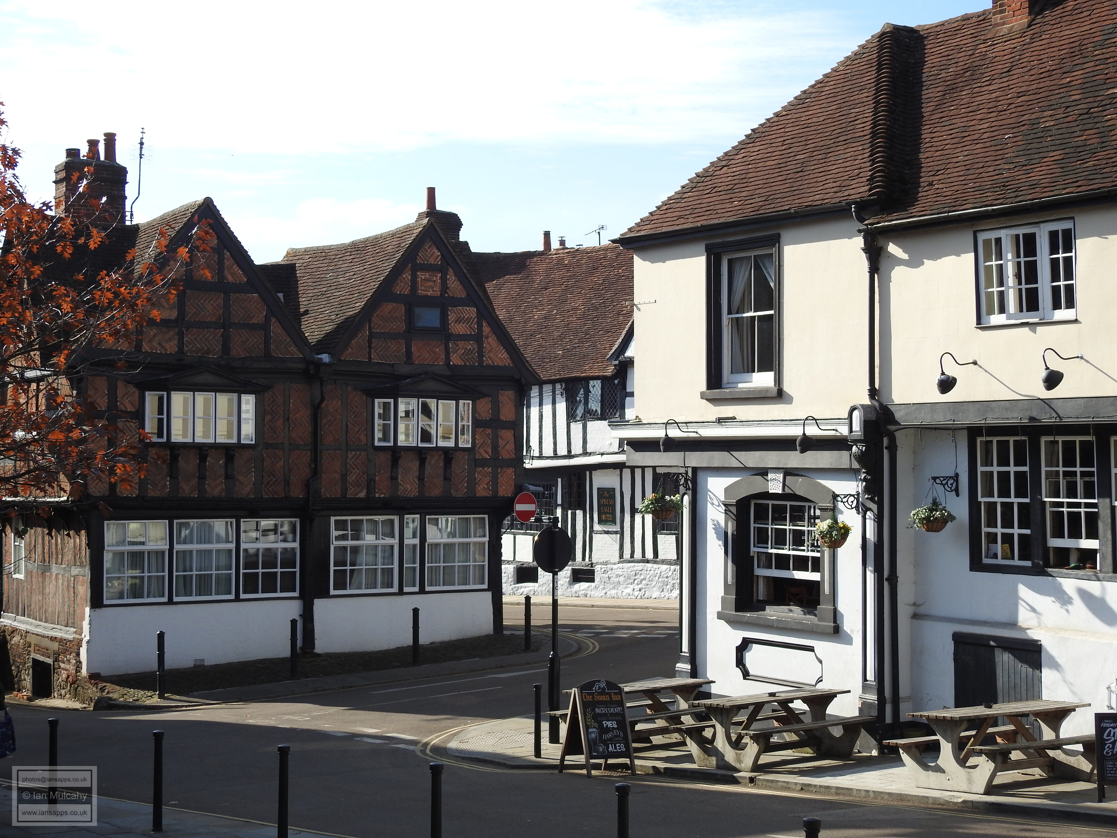
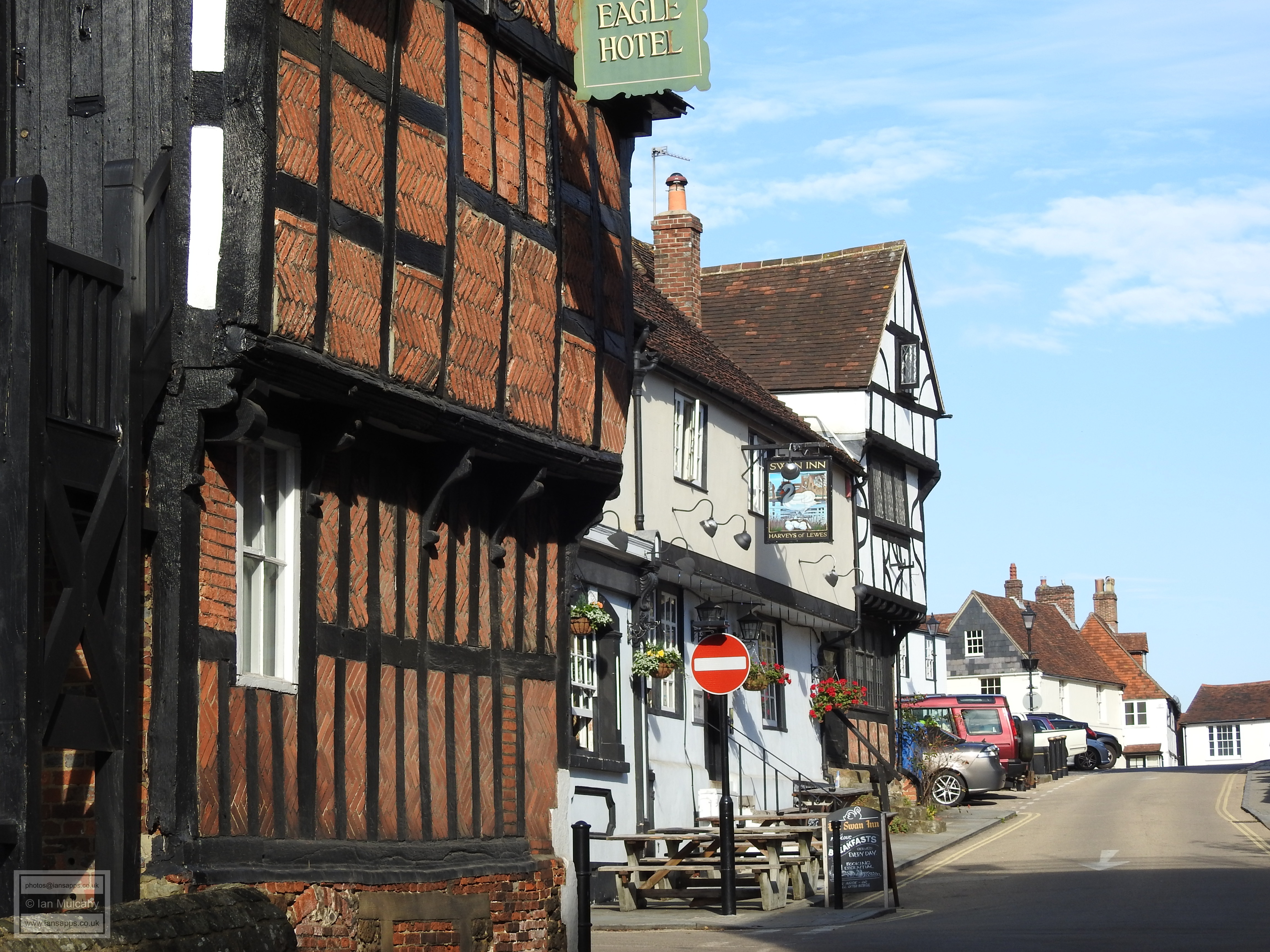
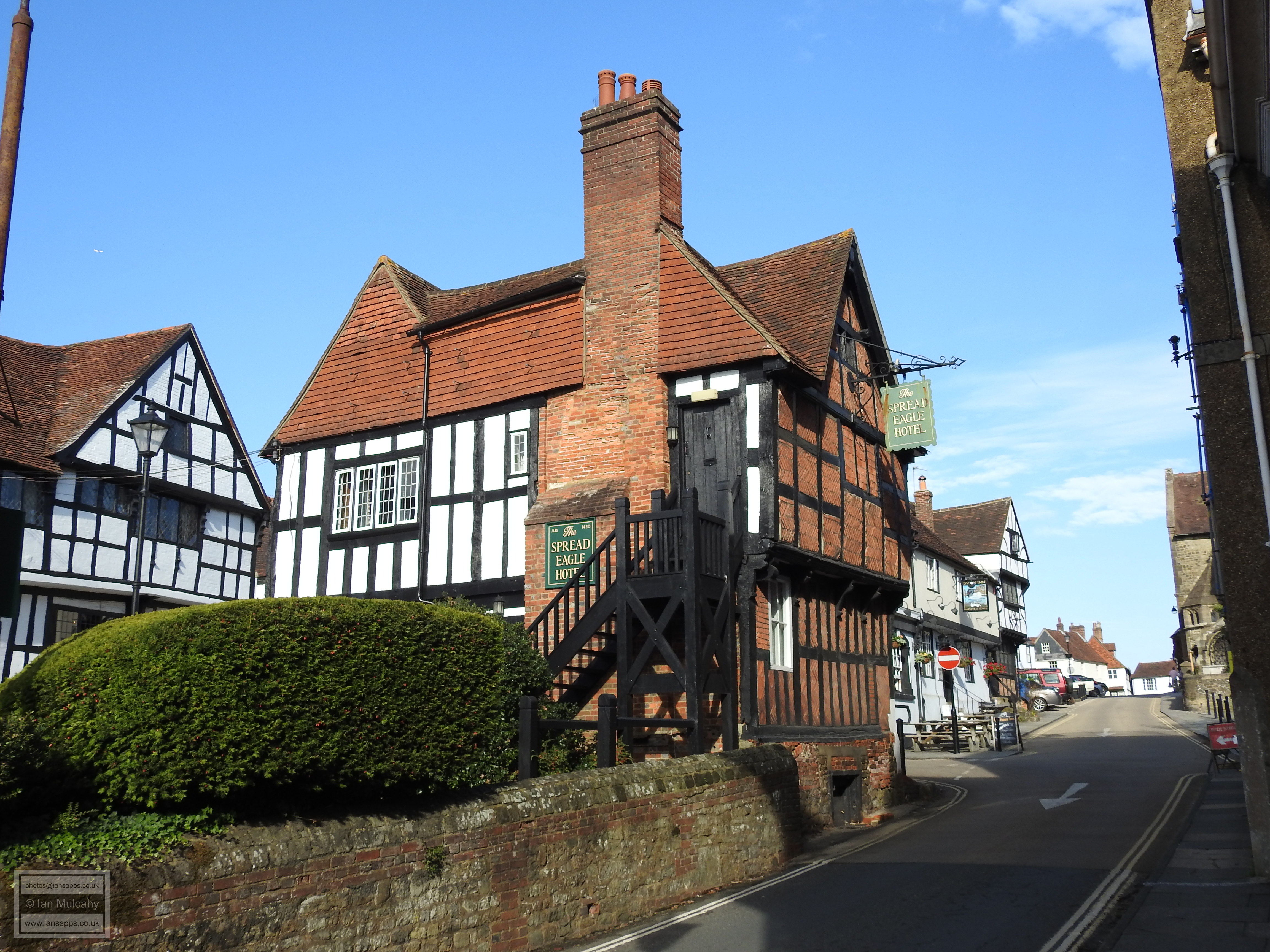
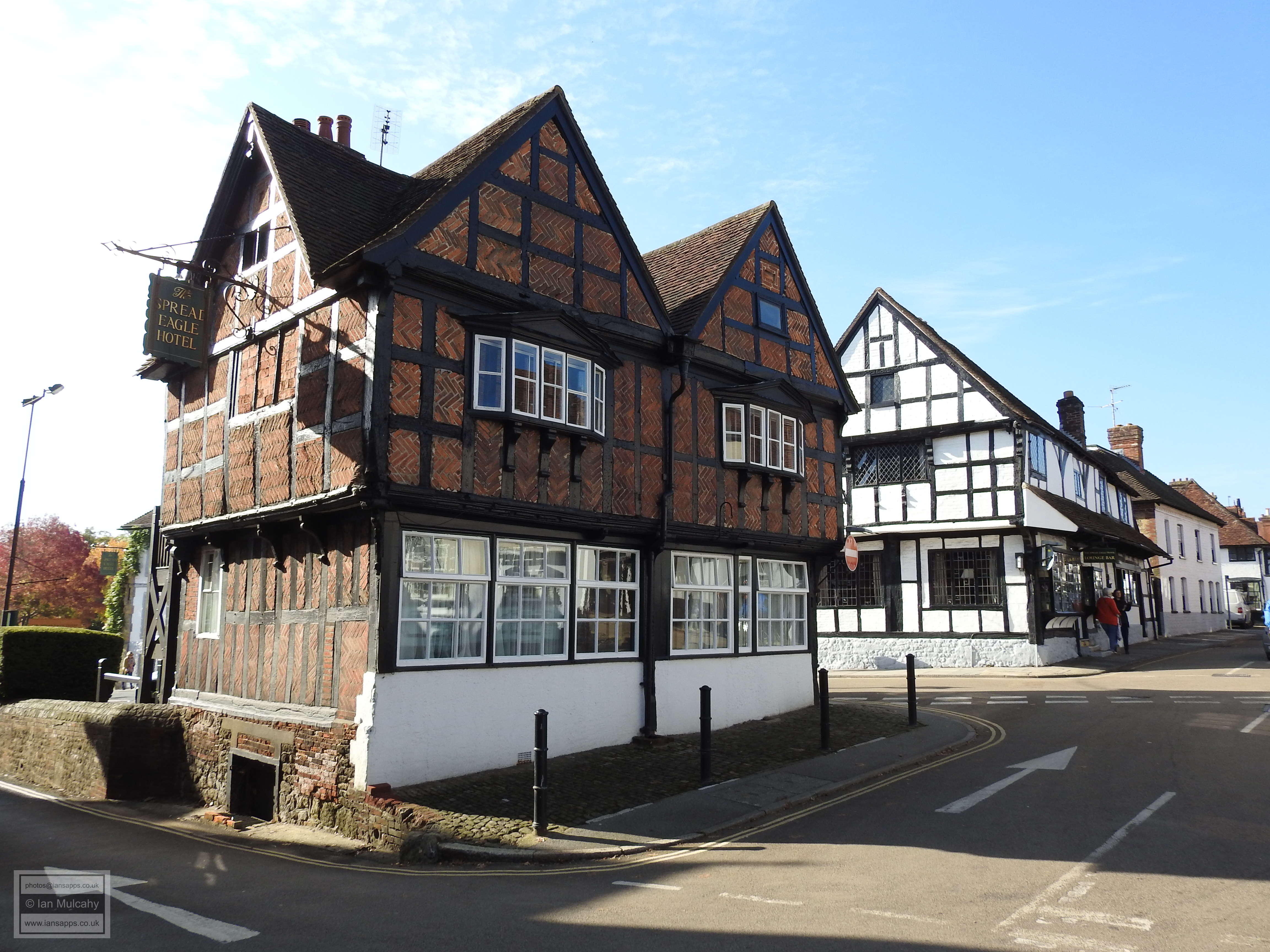
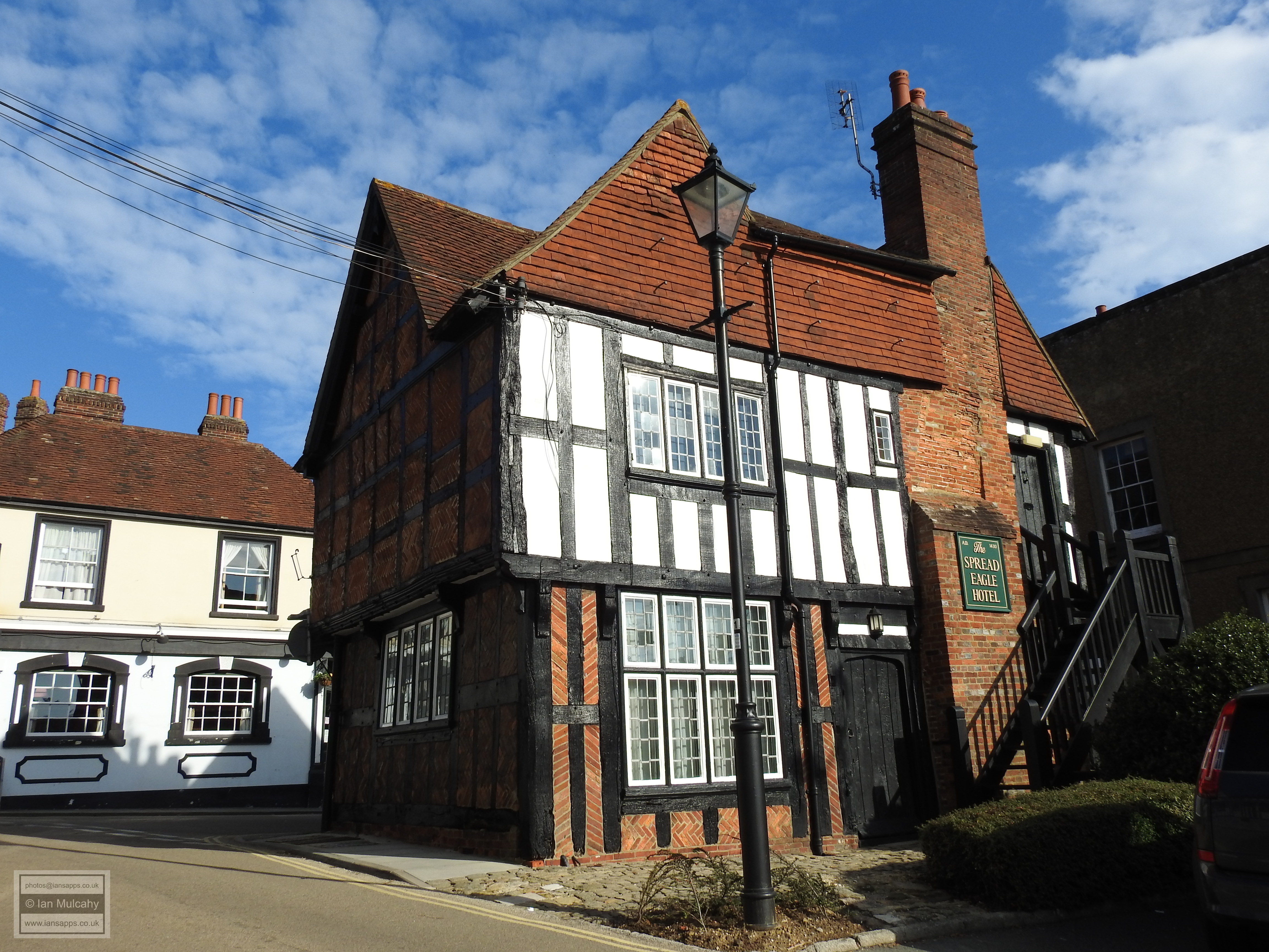
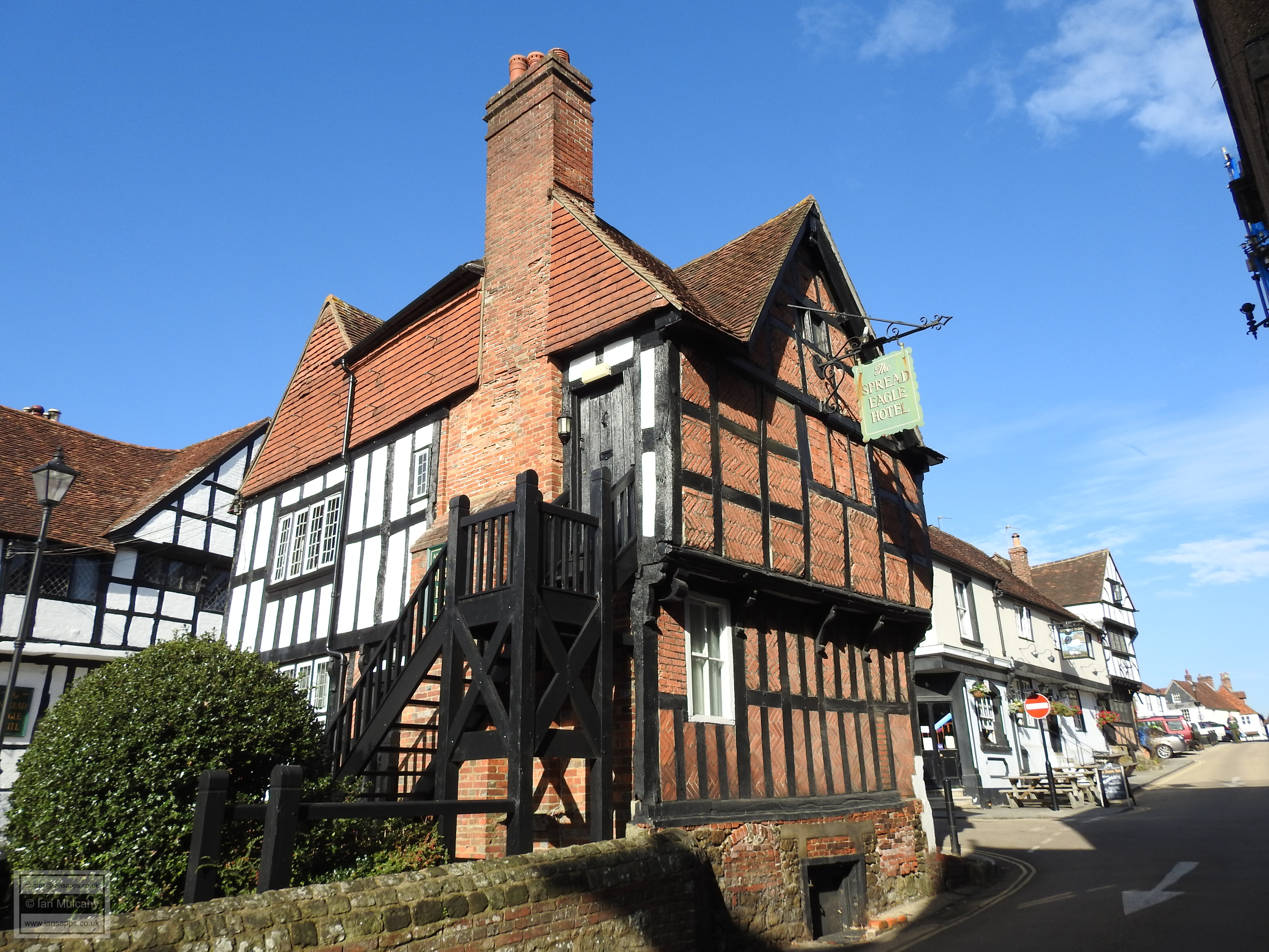
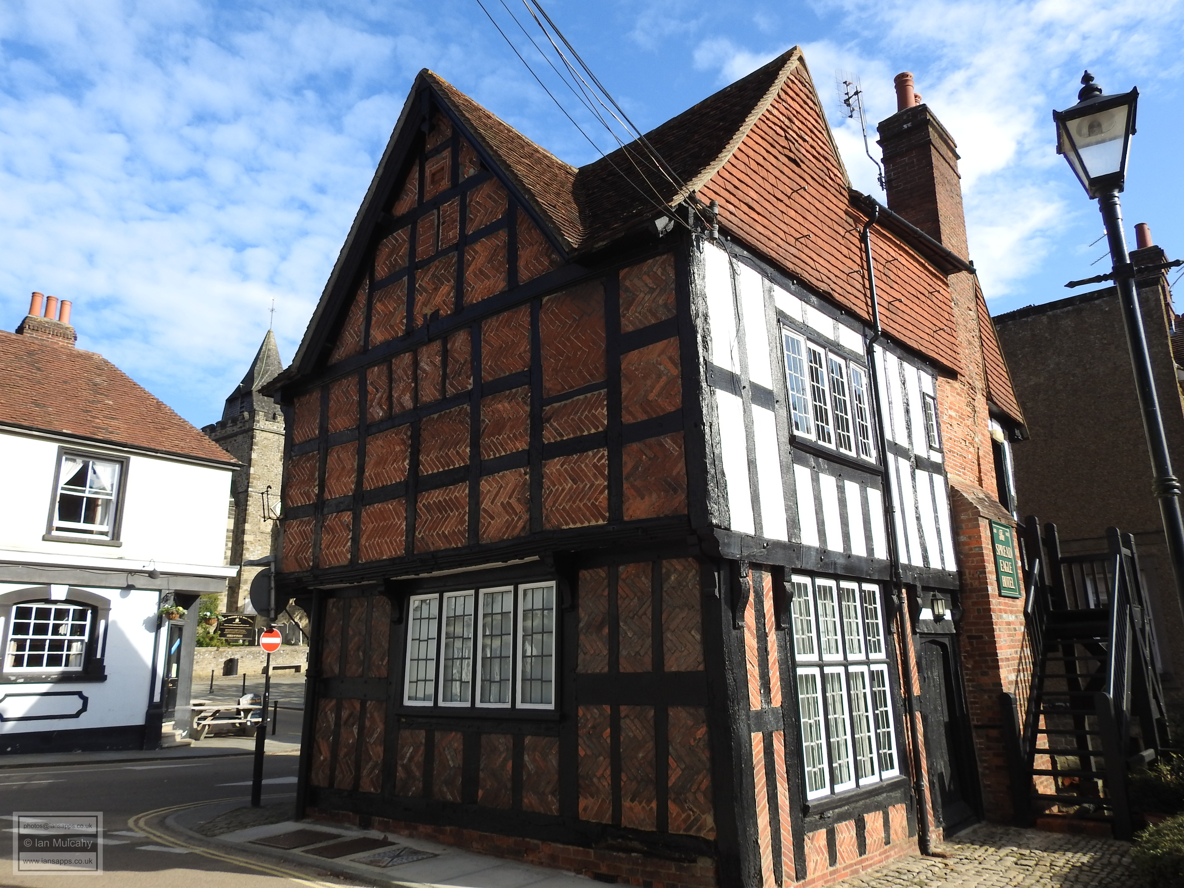
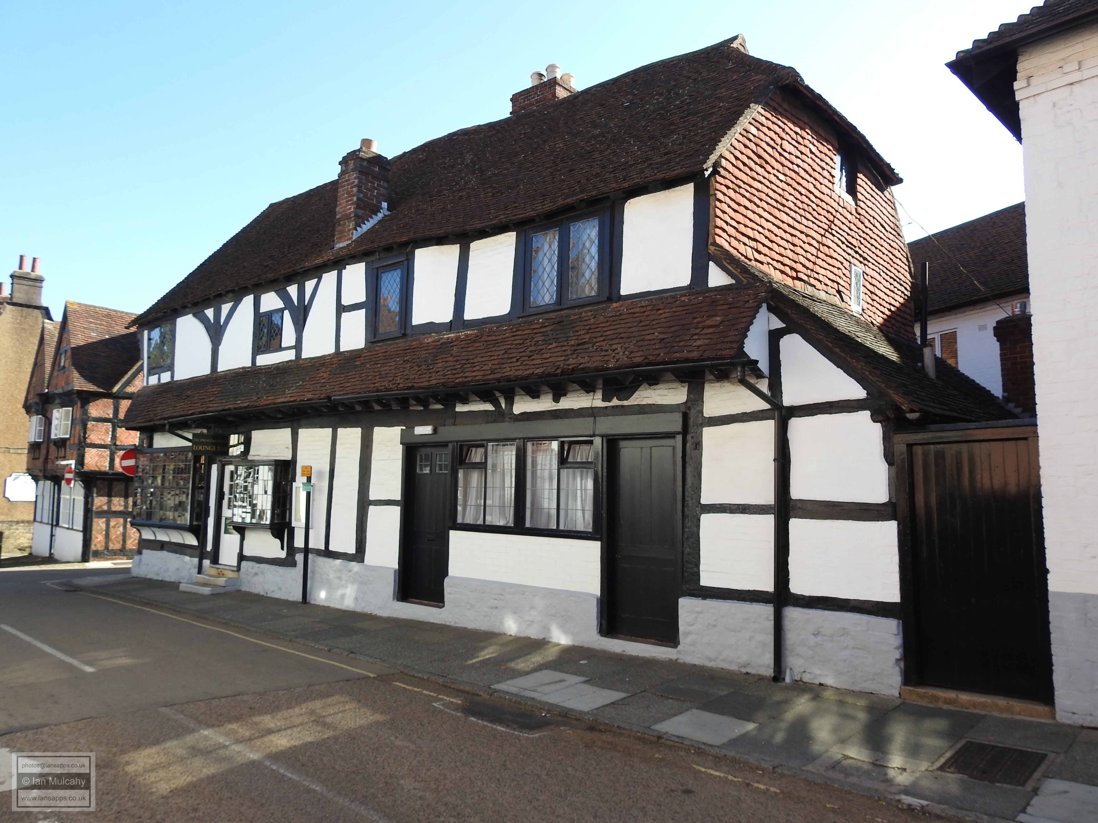
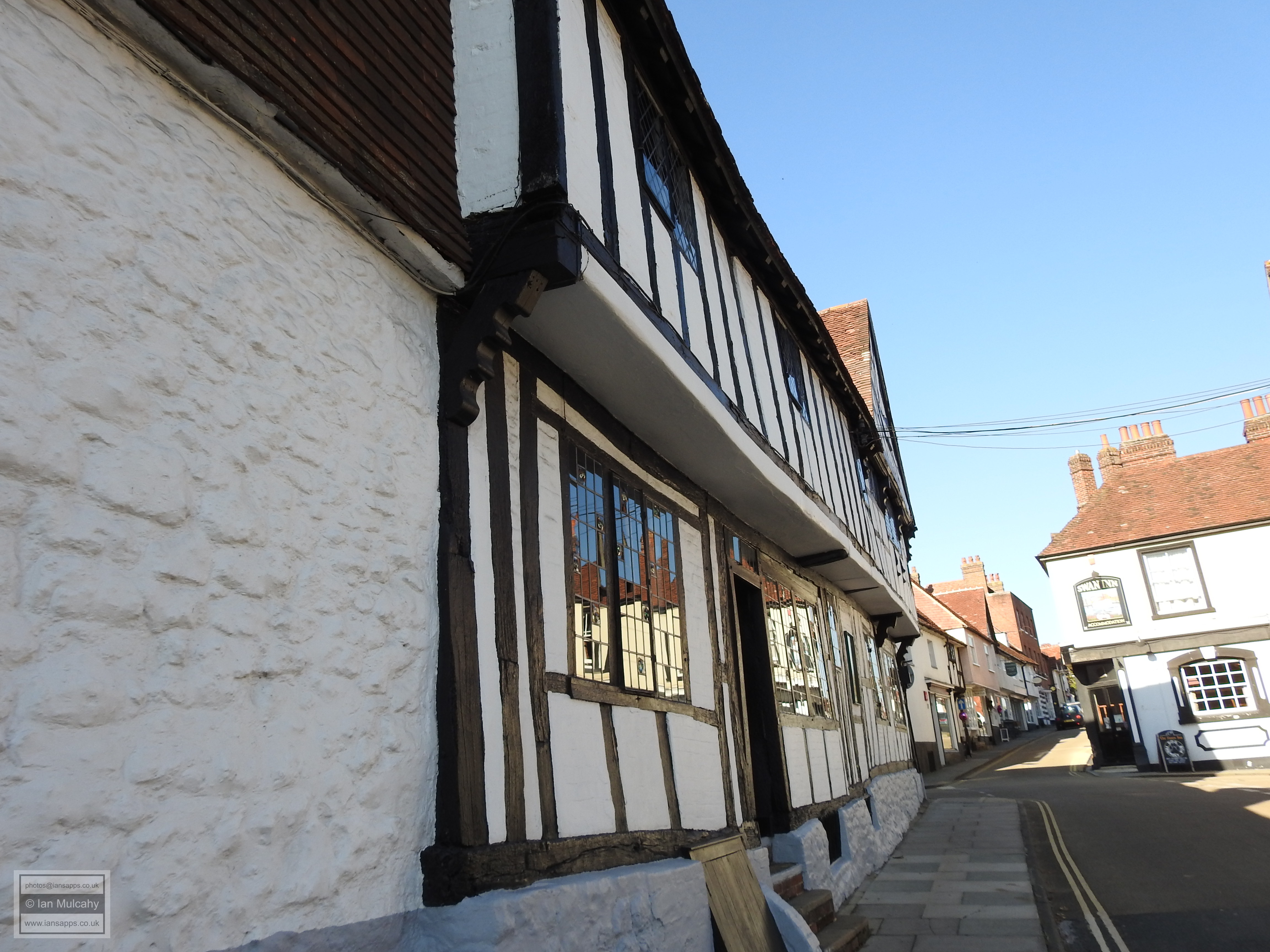
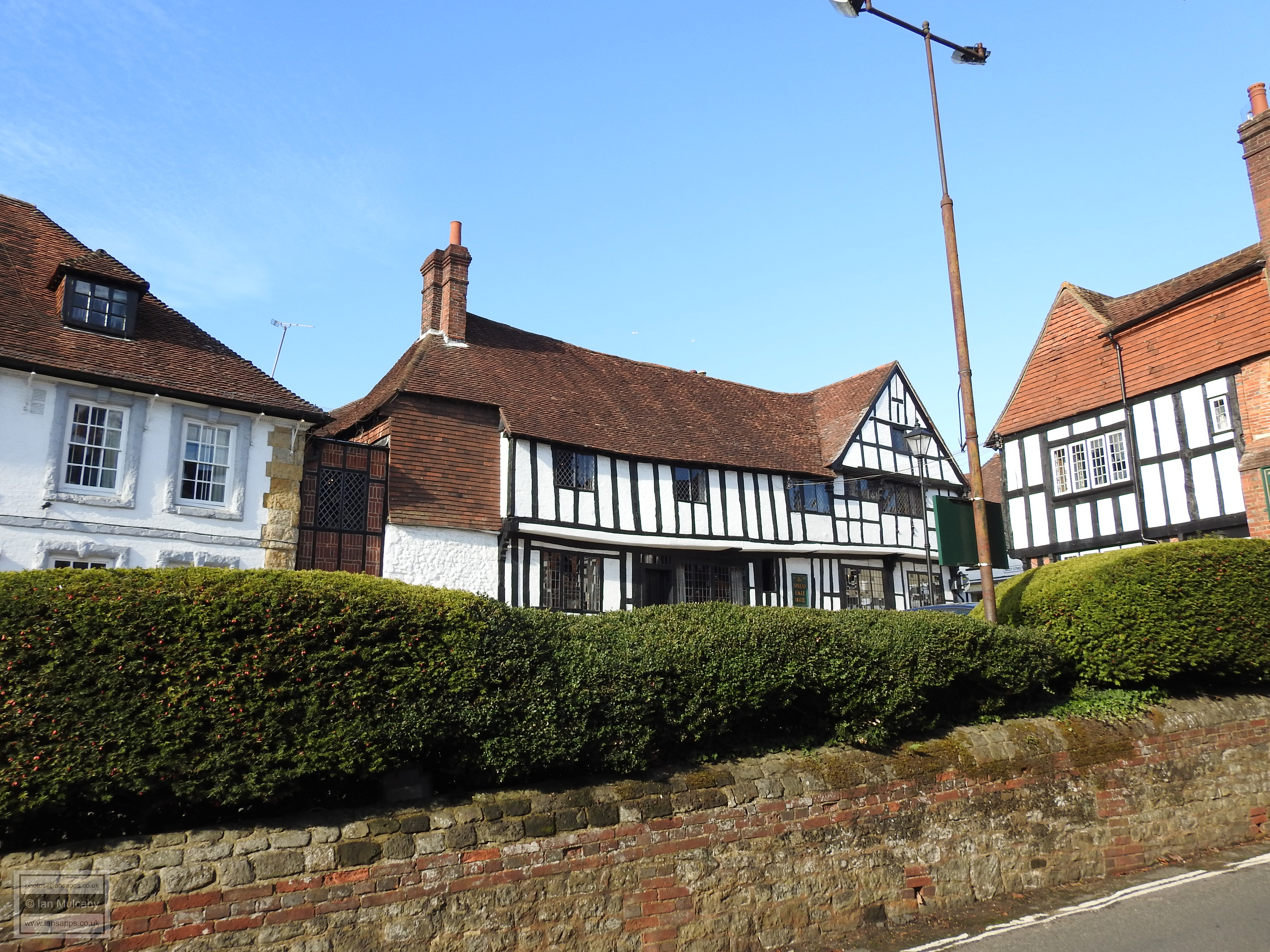
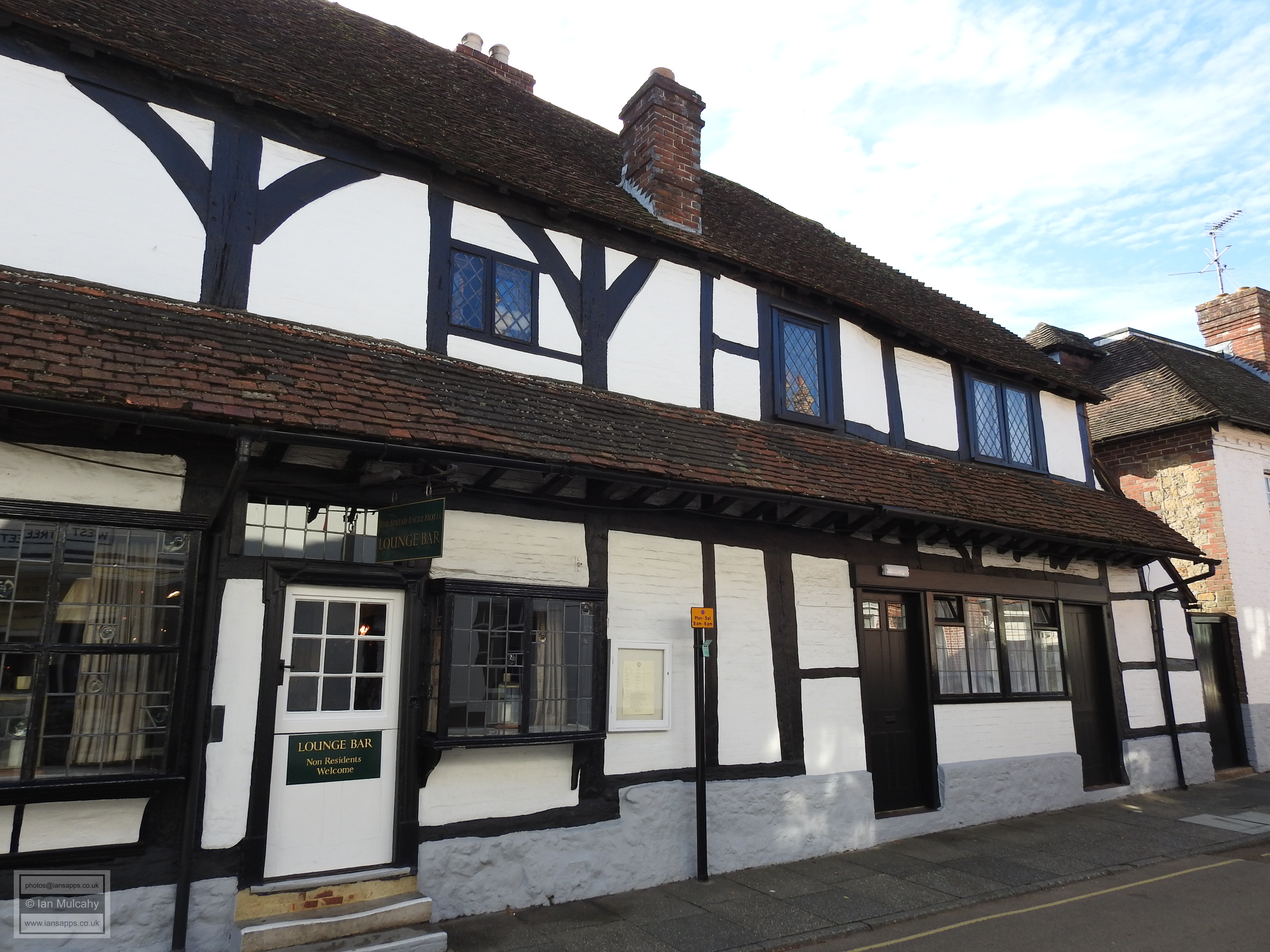
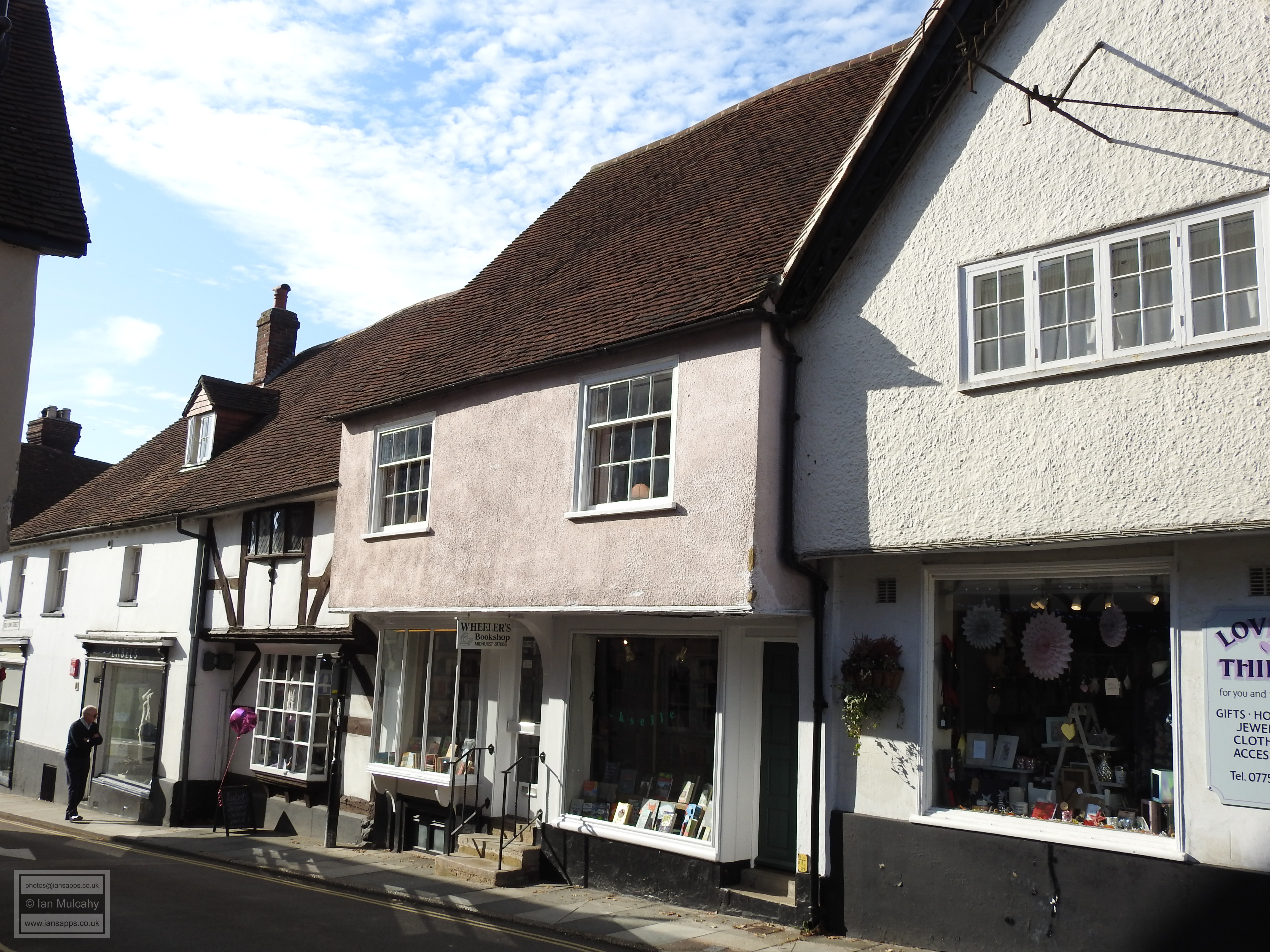
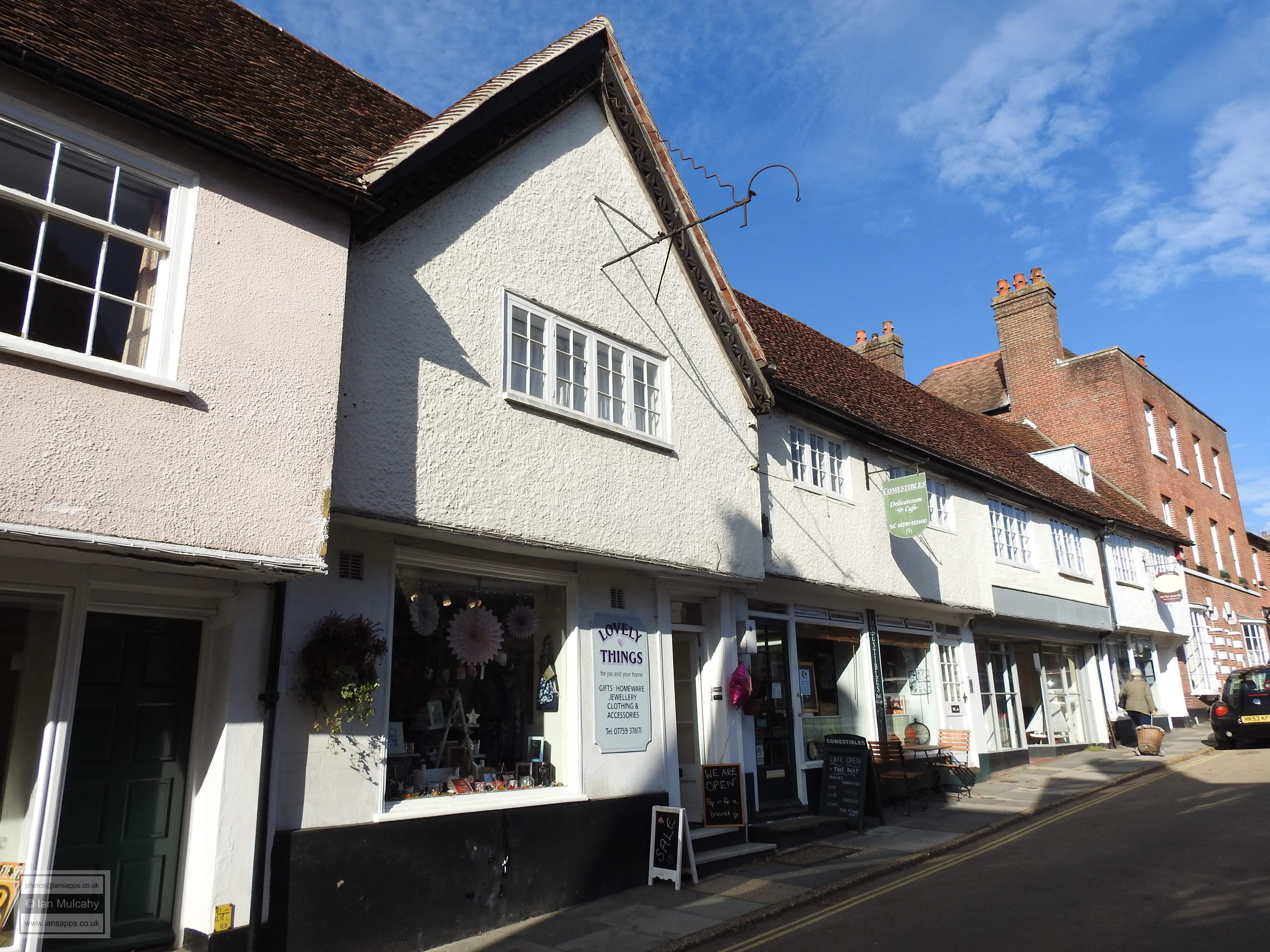
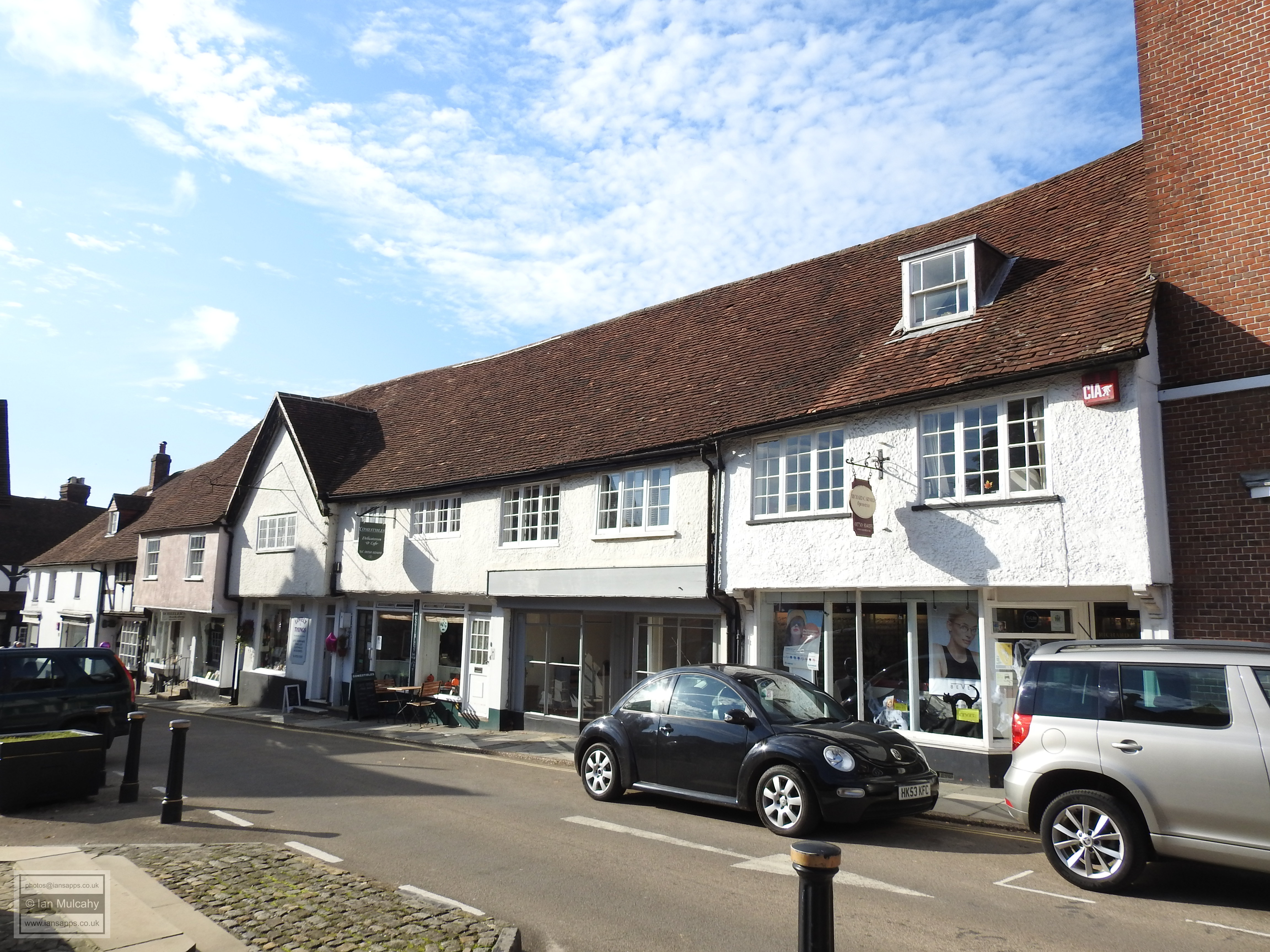
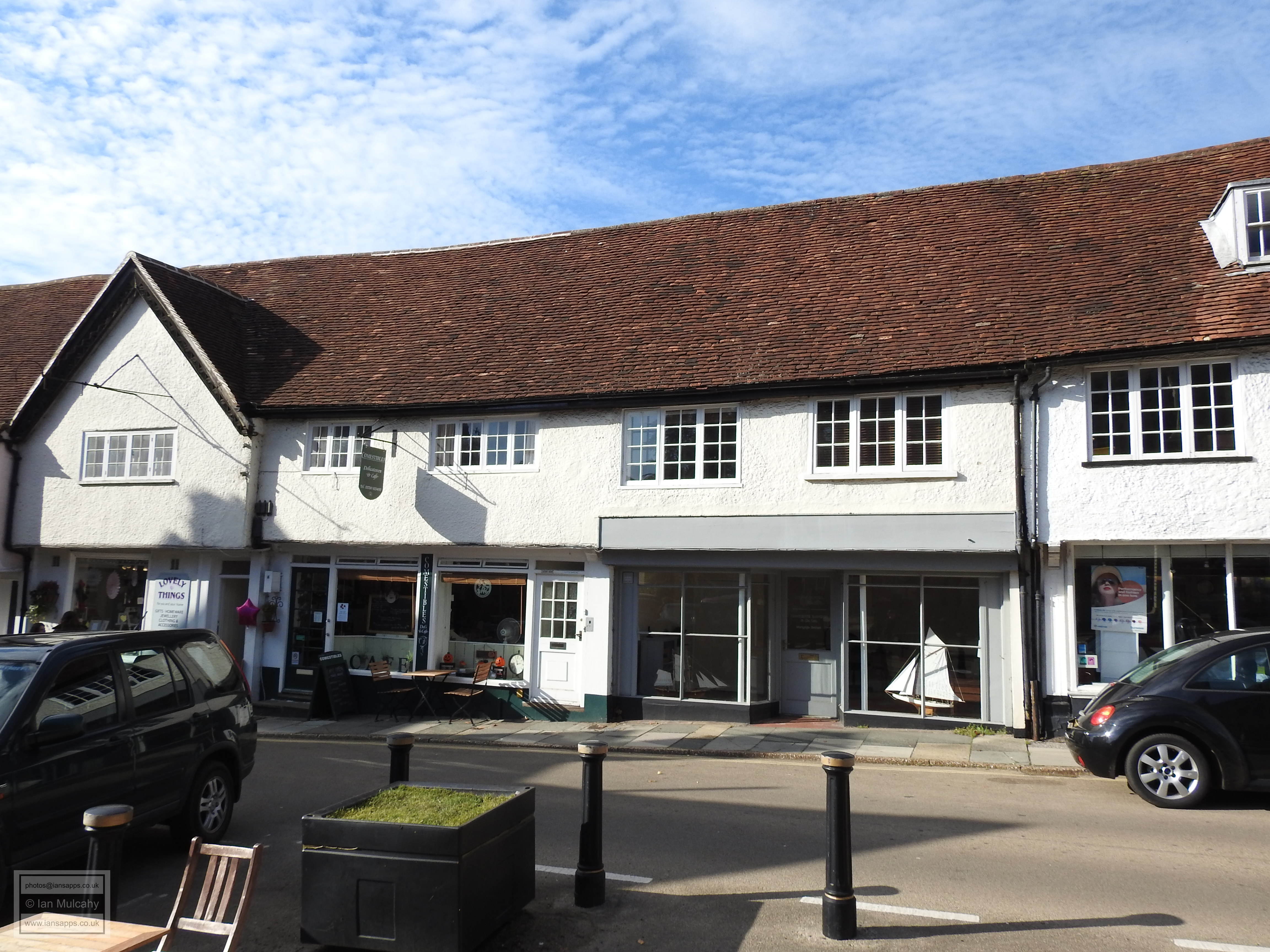
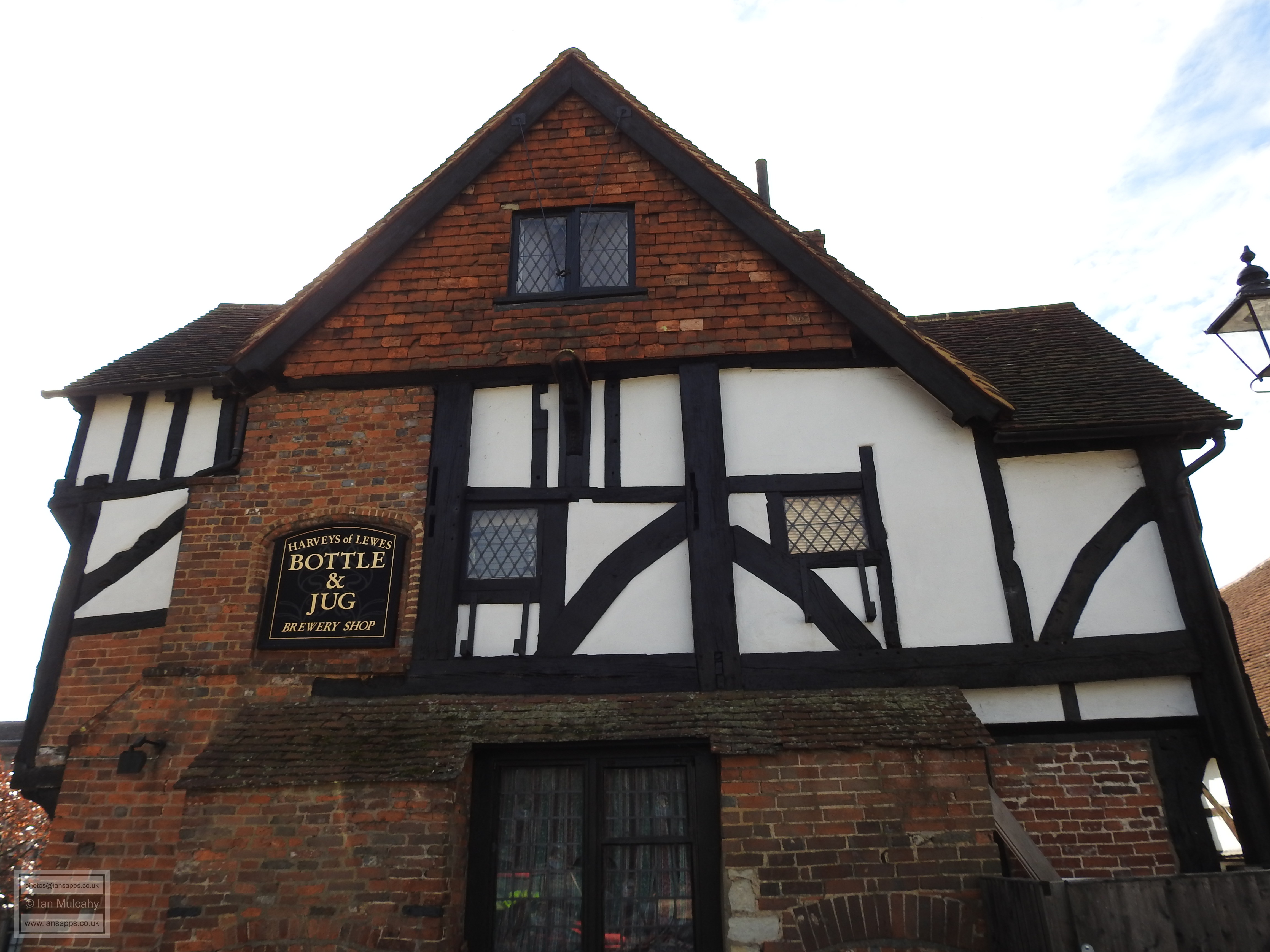
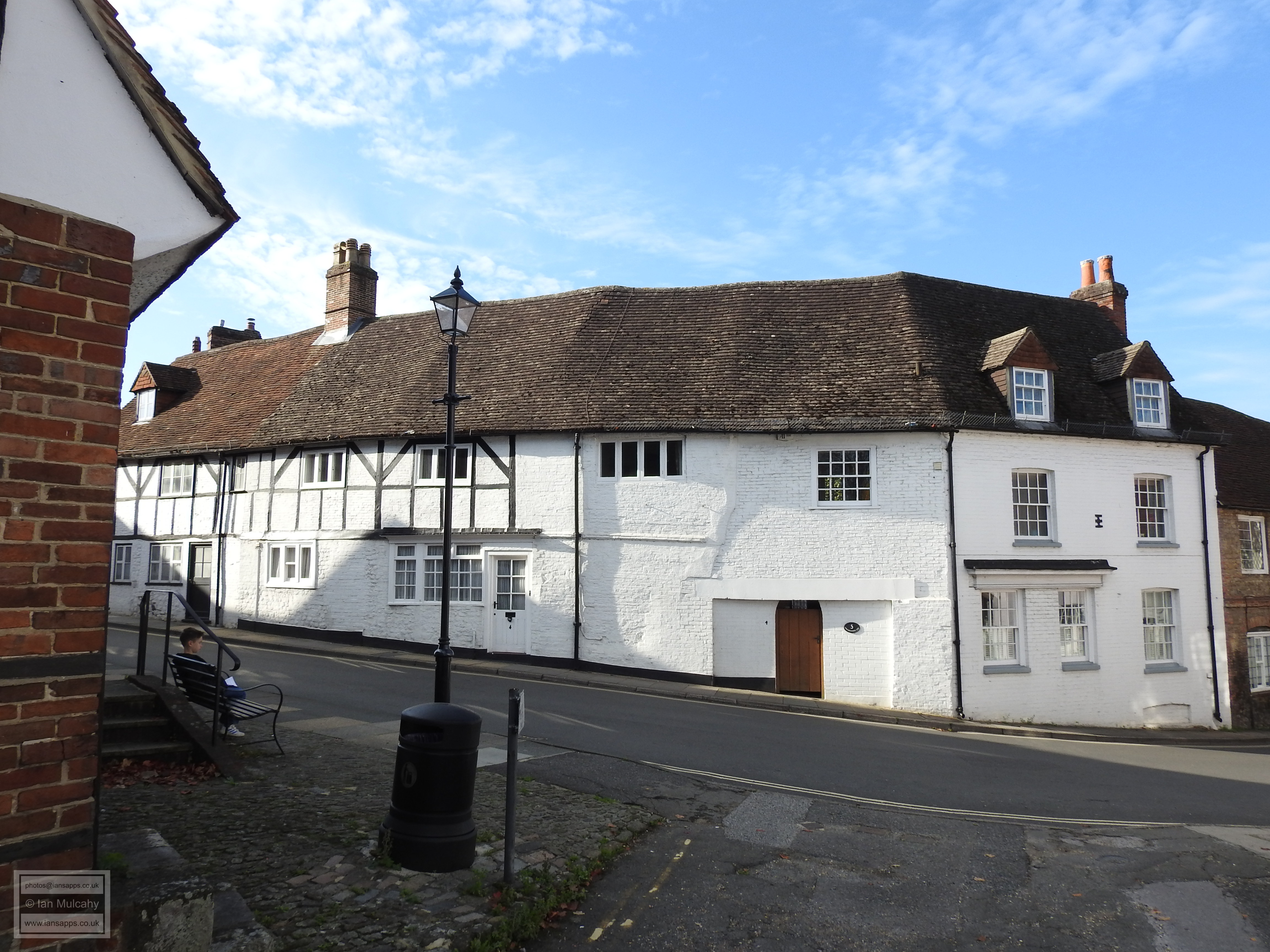
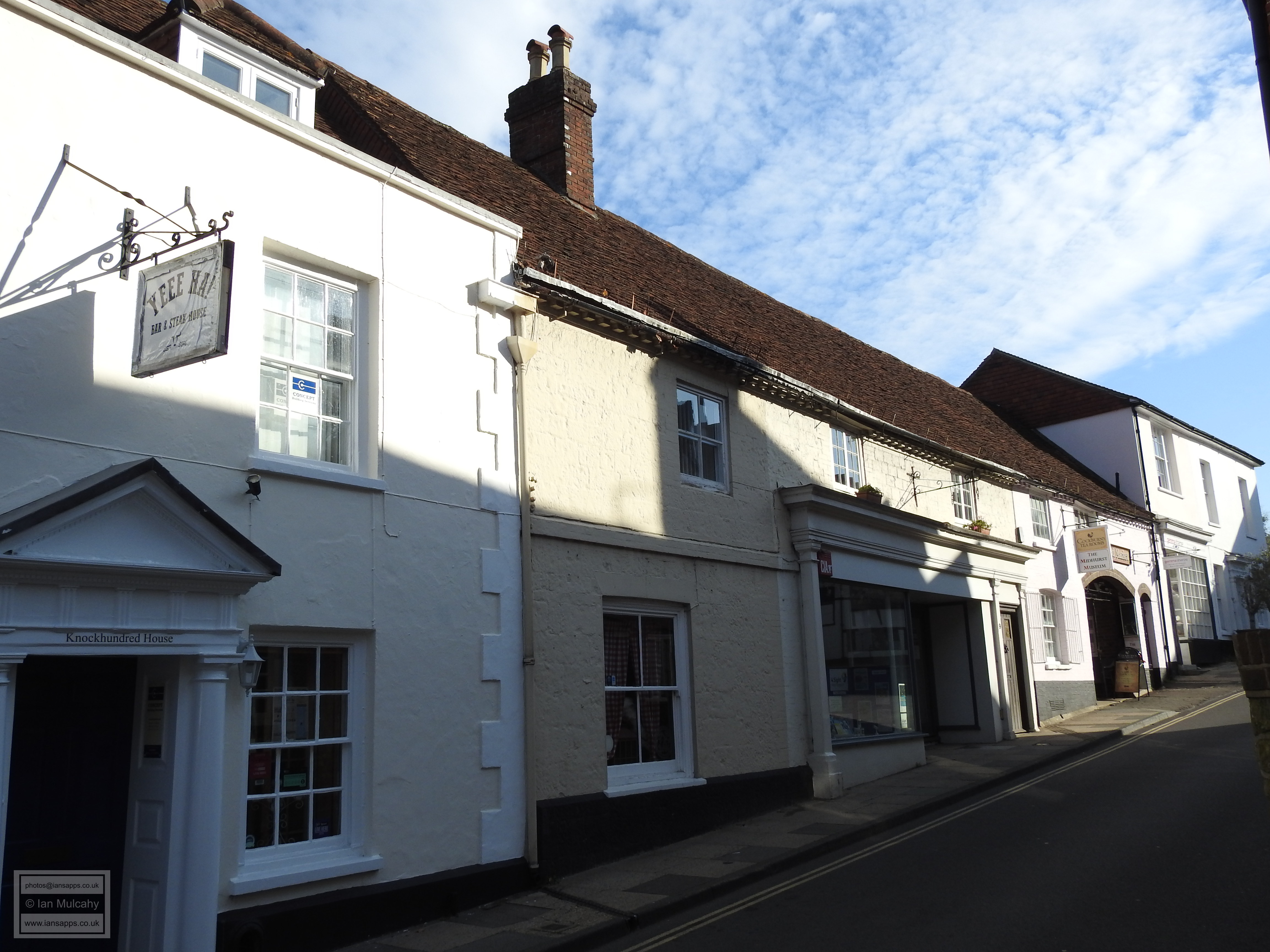
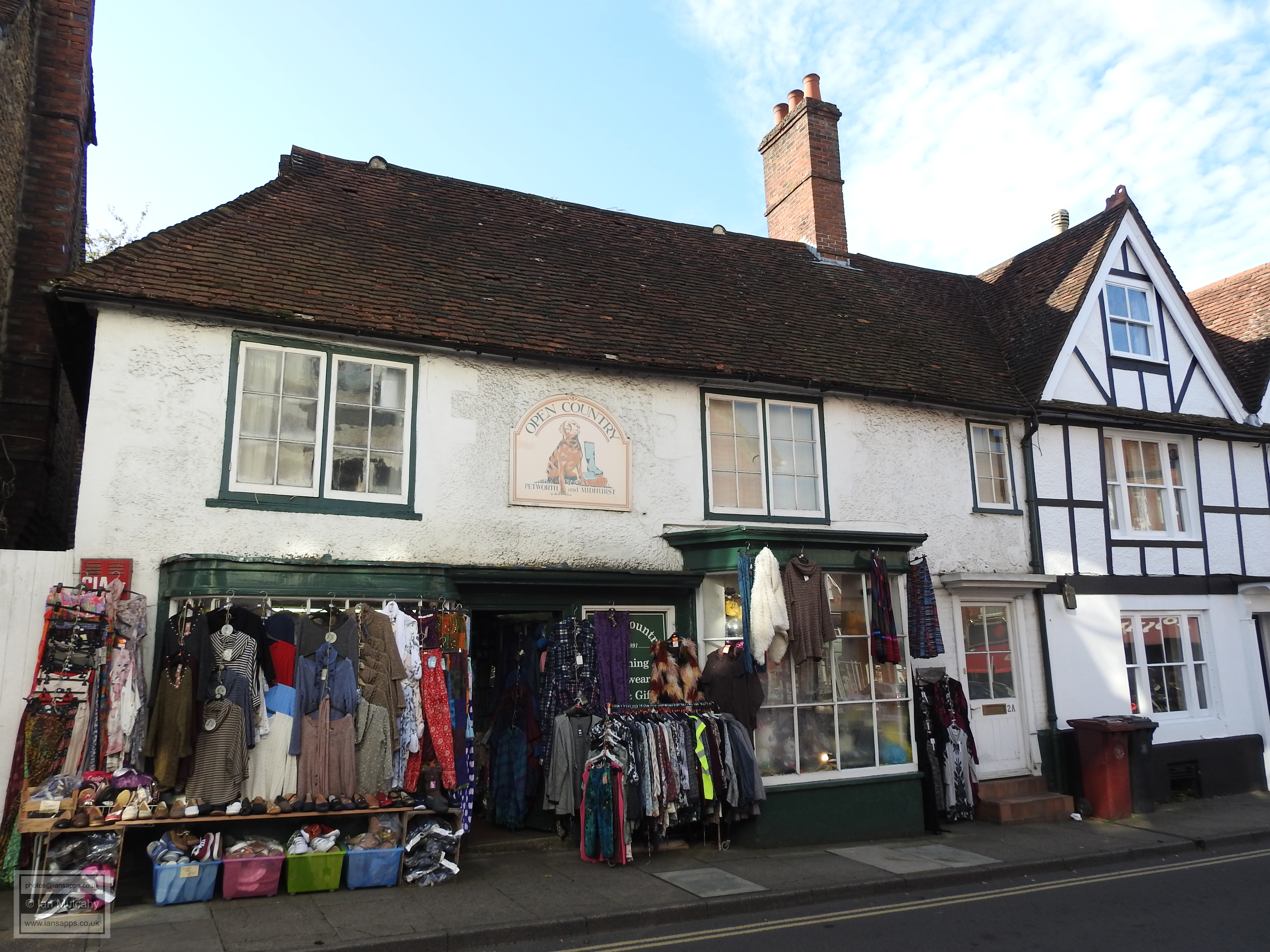
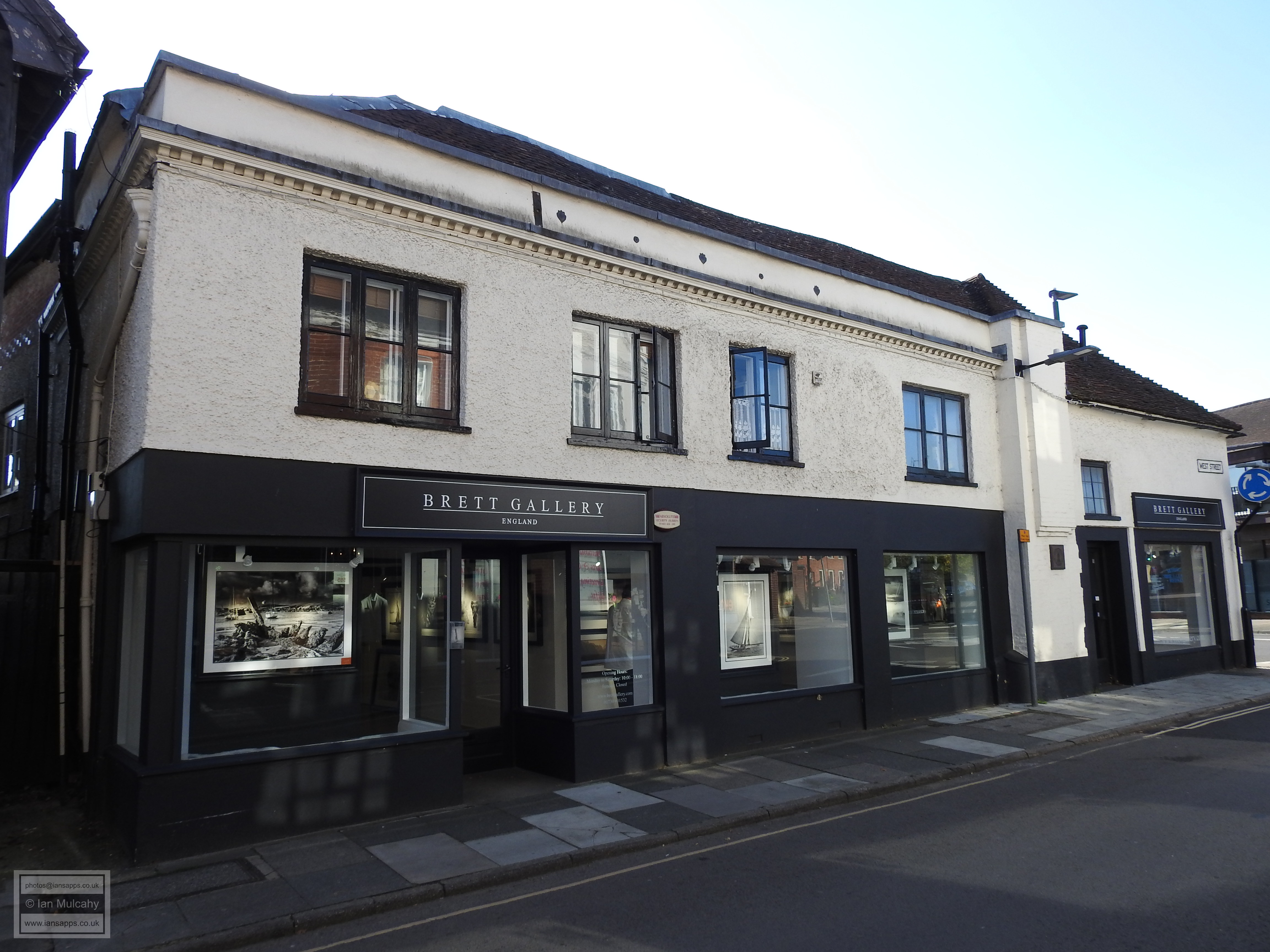
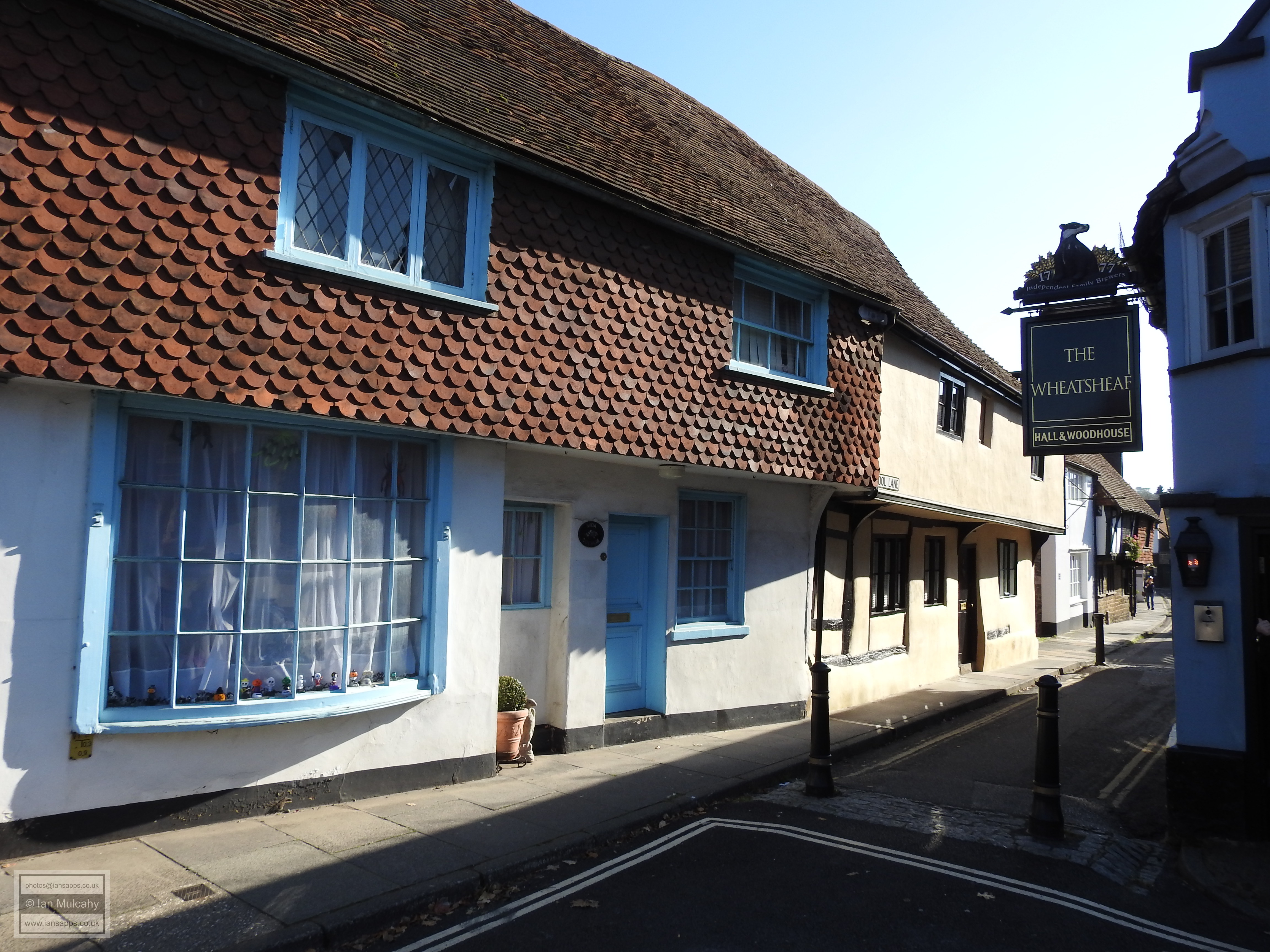
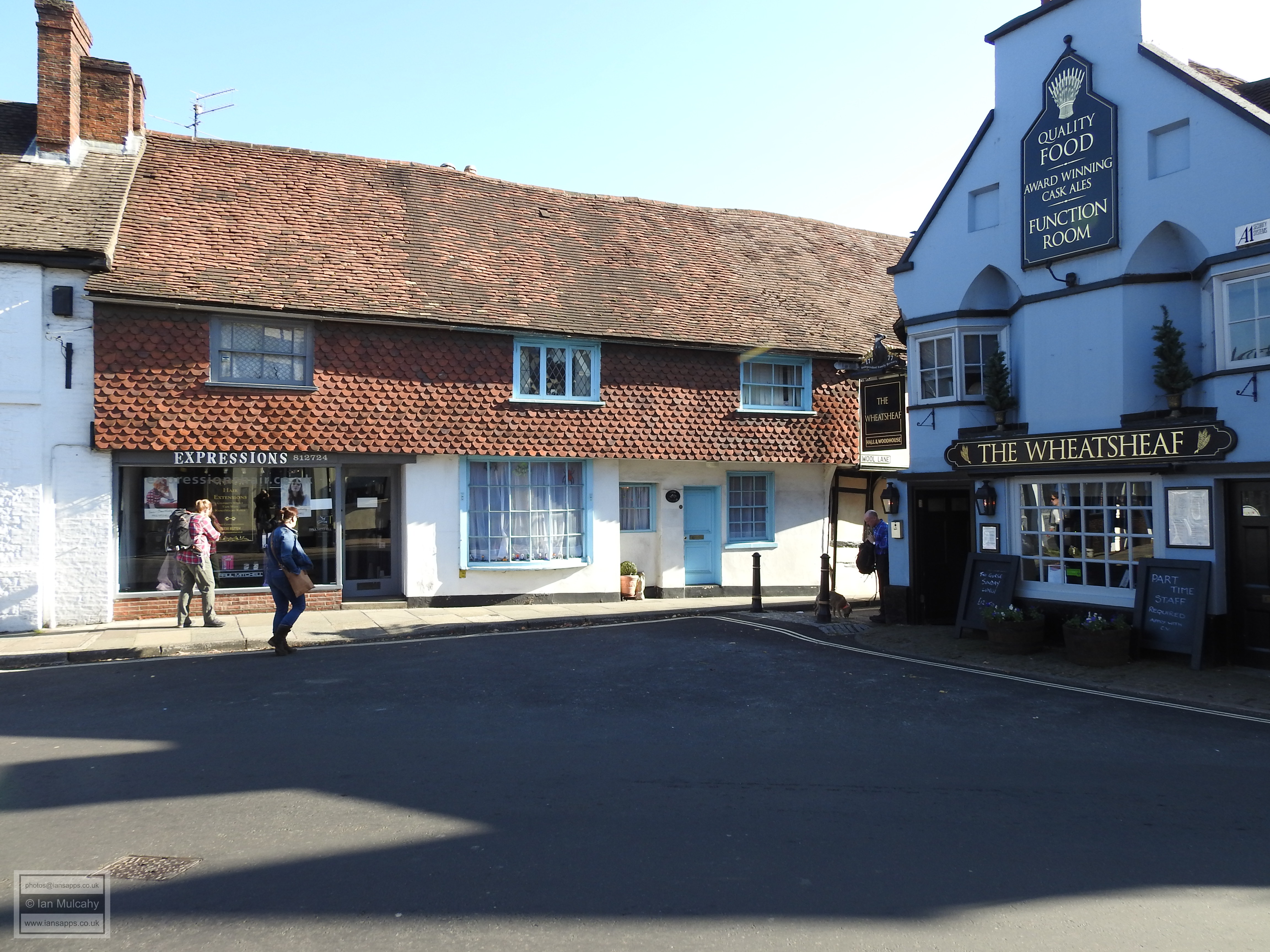
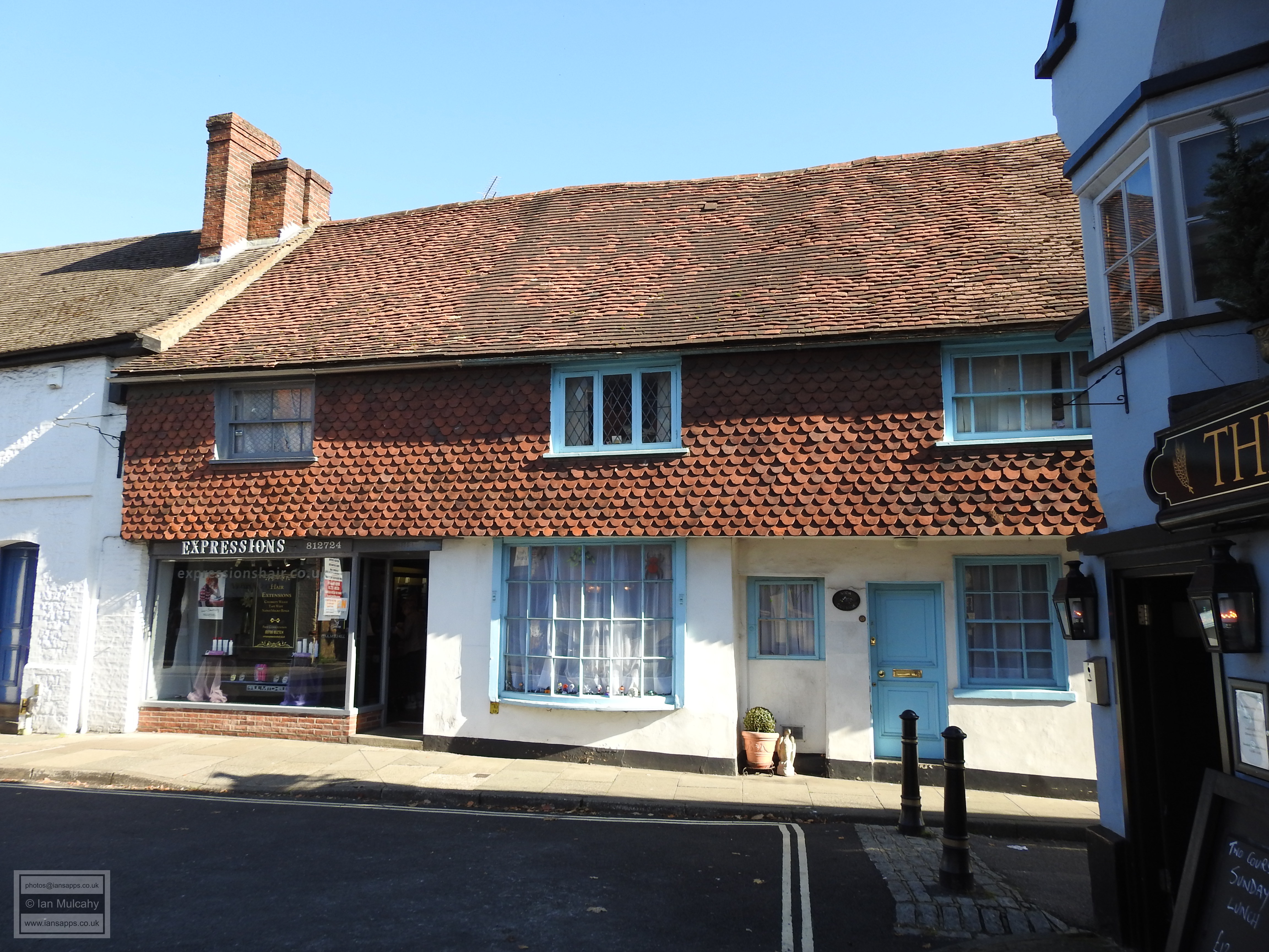
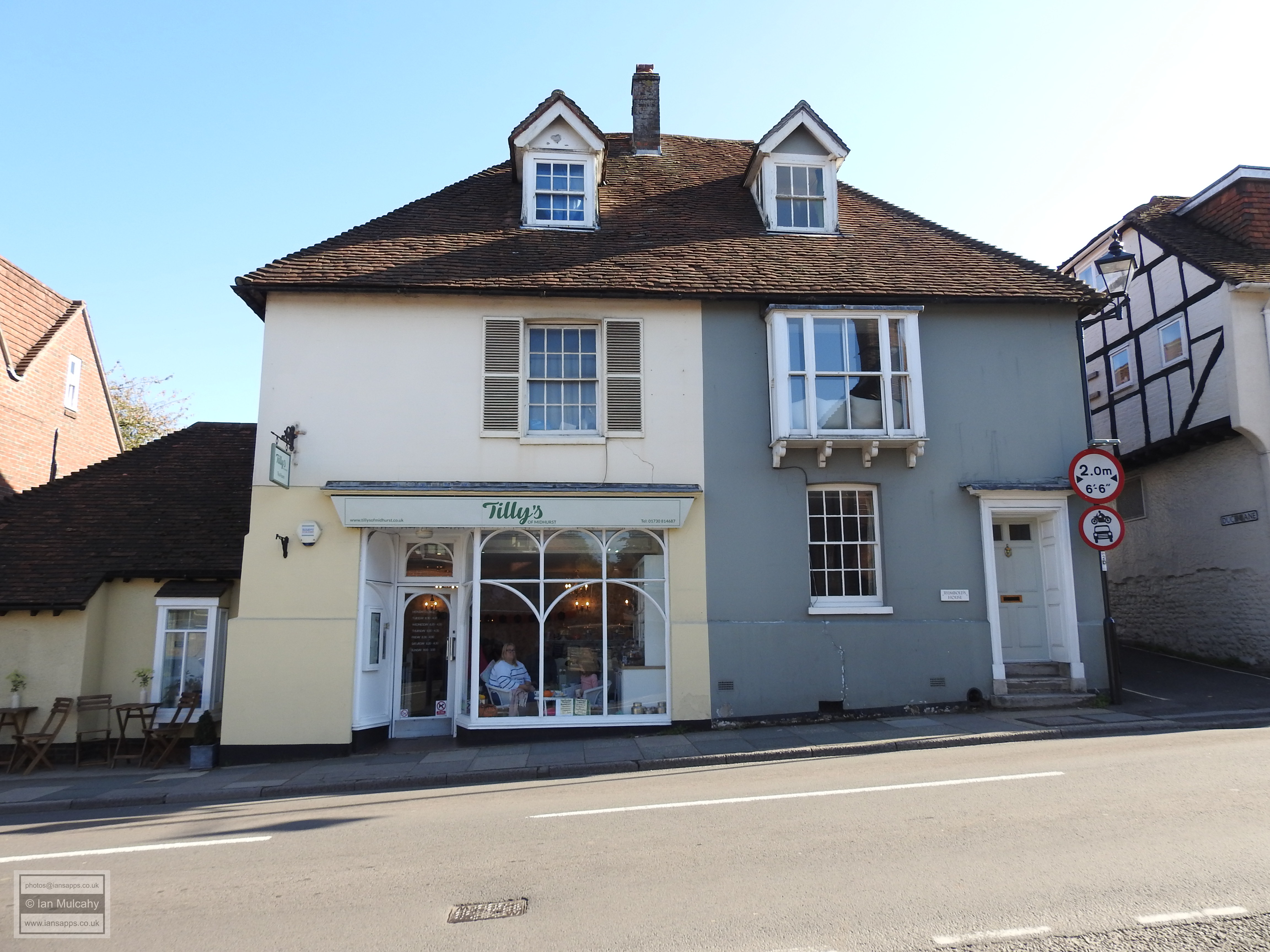
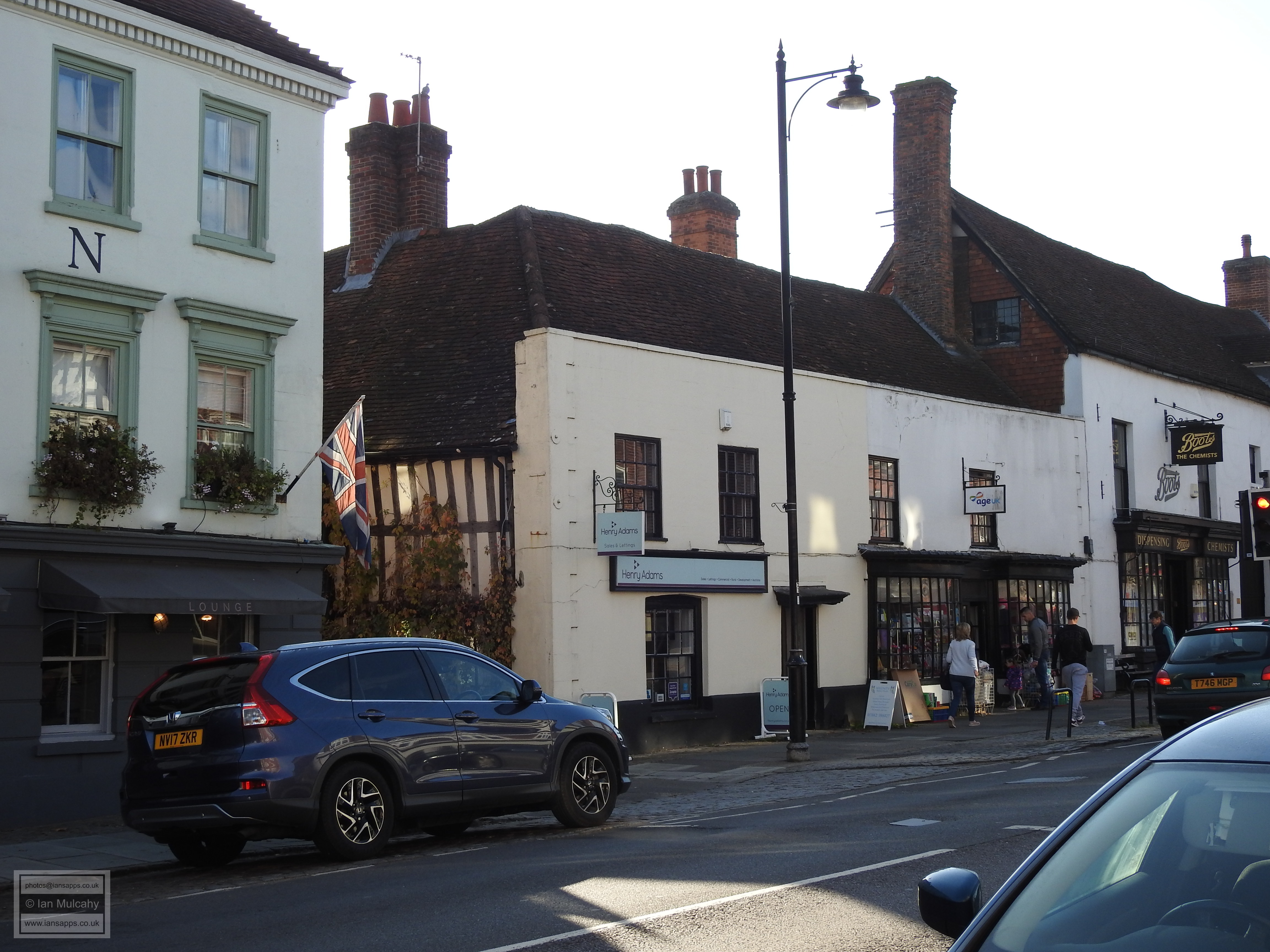
Nowadays, the market hall is an annex to The Spread Eagle Hotel, a large attractive L-shaped timber framed building in the south west corner of the market place dating to 1430, though the current external fabric suggests a rebuild in the mid-16th century which was probably contemporary with the construction of the Market House. Opposite the hotel is Sussex House, the southern part of which is an 18th century extension to a small jettied early 16th century timber framed house and next door is a building knowns as The House of Anita & Tudorcraft, a small two bayed jettied shop of the 16th century. Adjoining this is Bird, Potter & Co and Ewen House, a late 16th or early 17th century timber framed building, now rendered in roughcast, with an archetypal jetty and crosswing which was originally the Red Lion Inn.
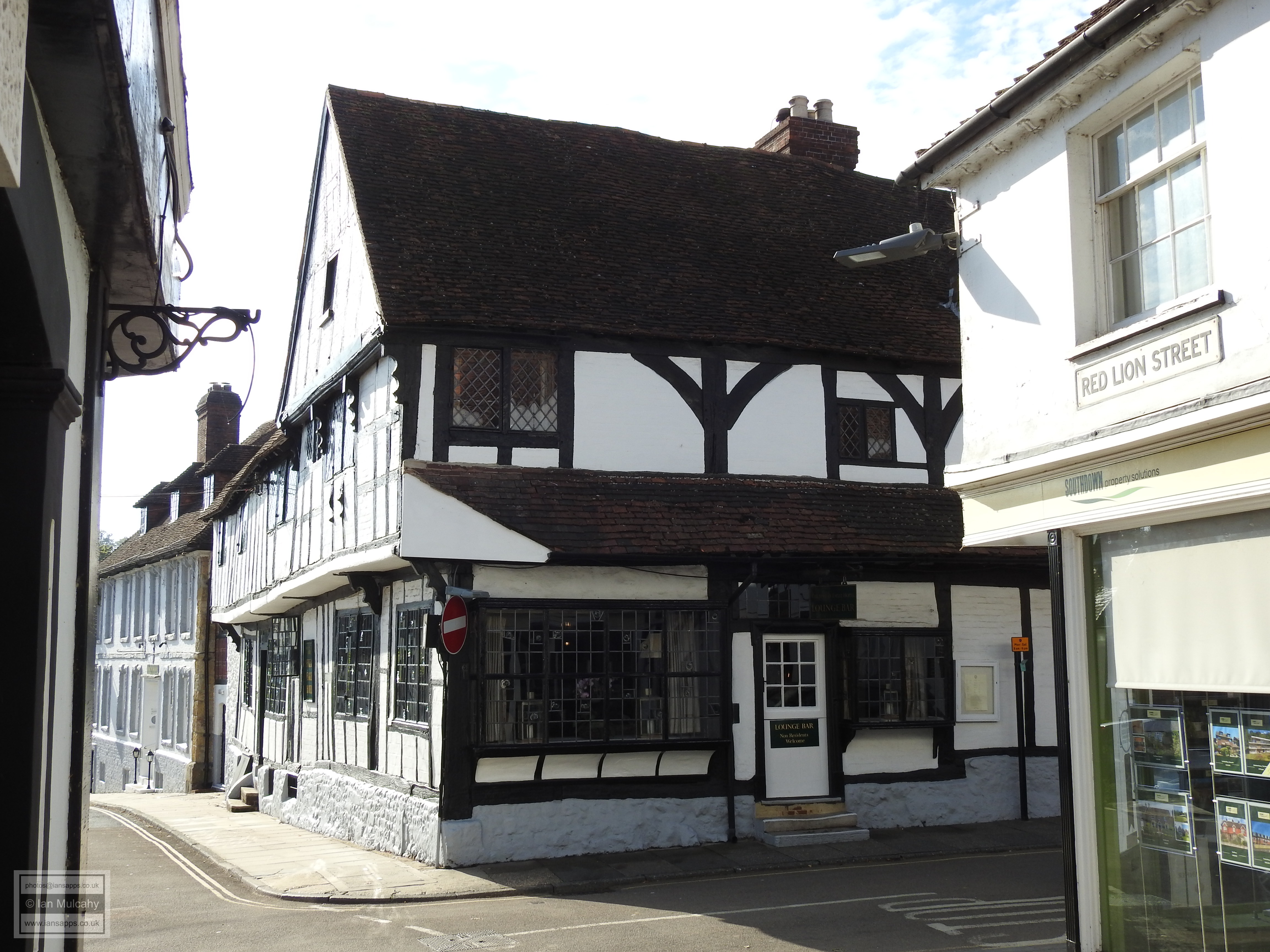
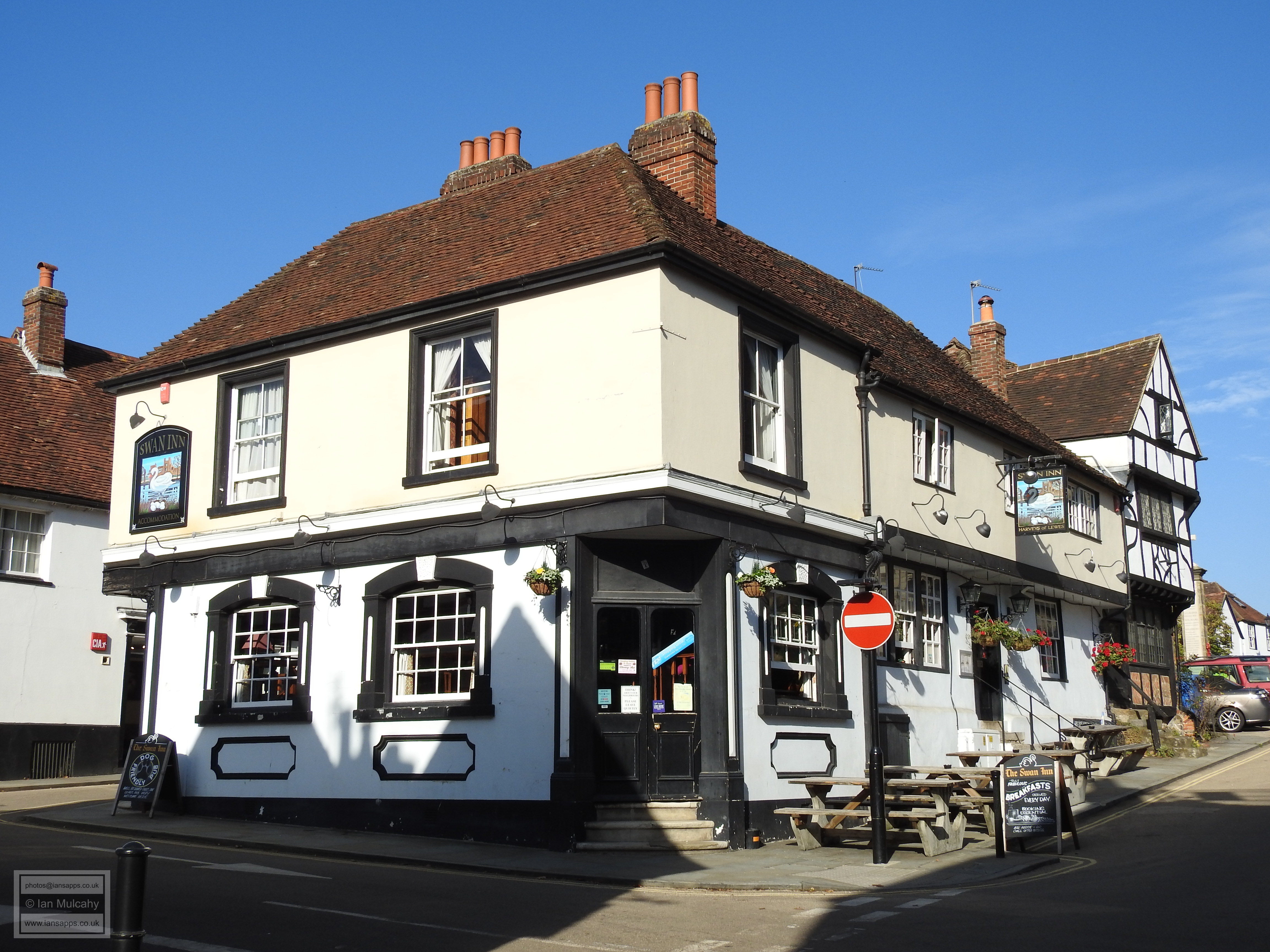
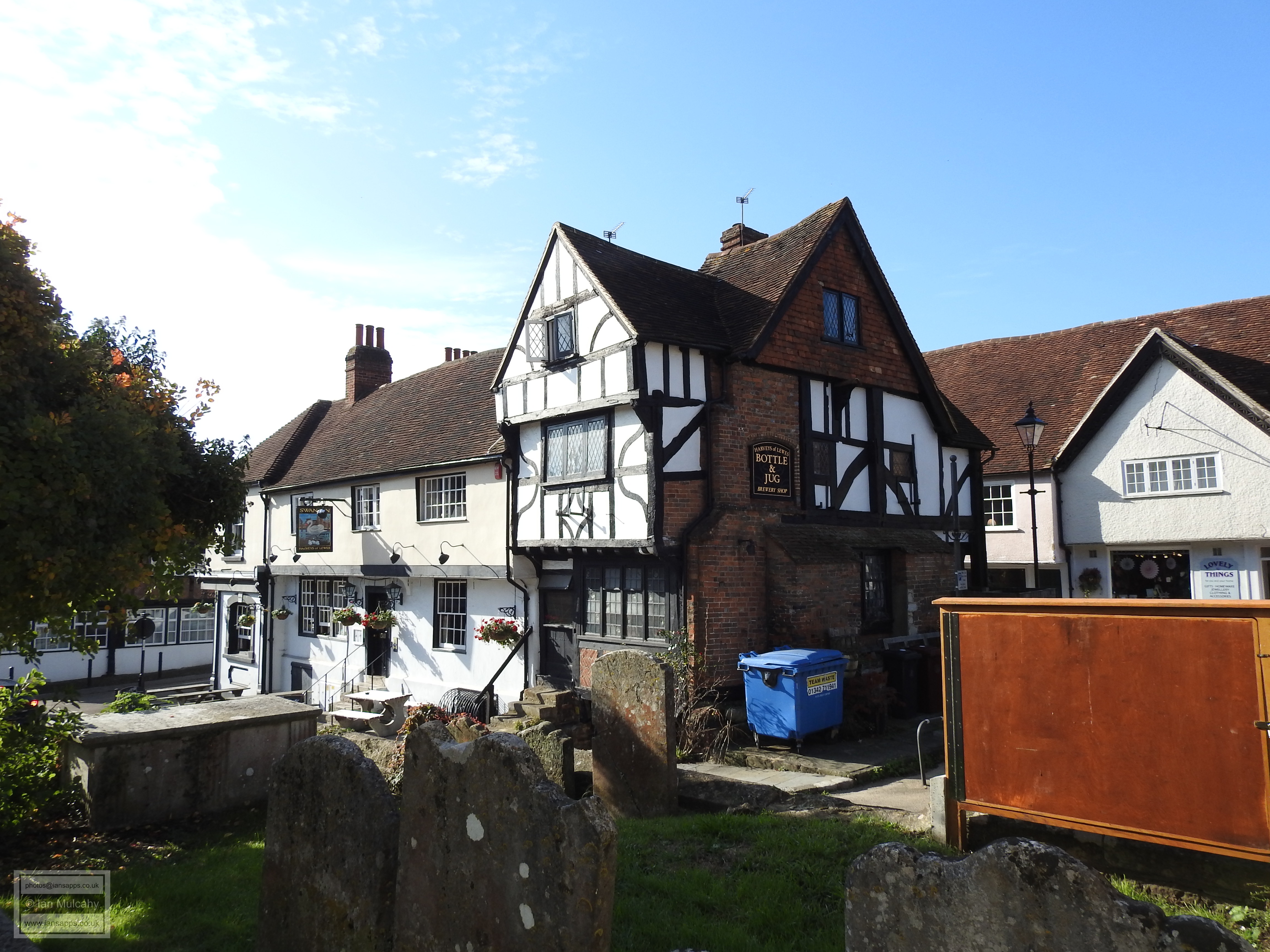
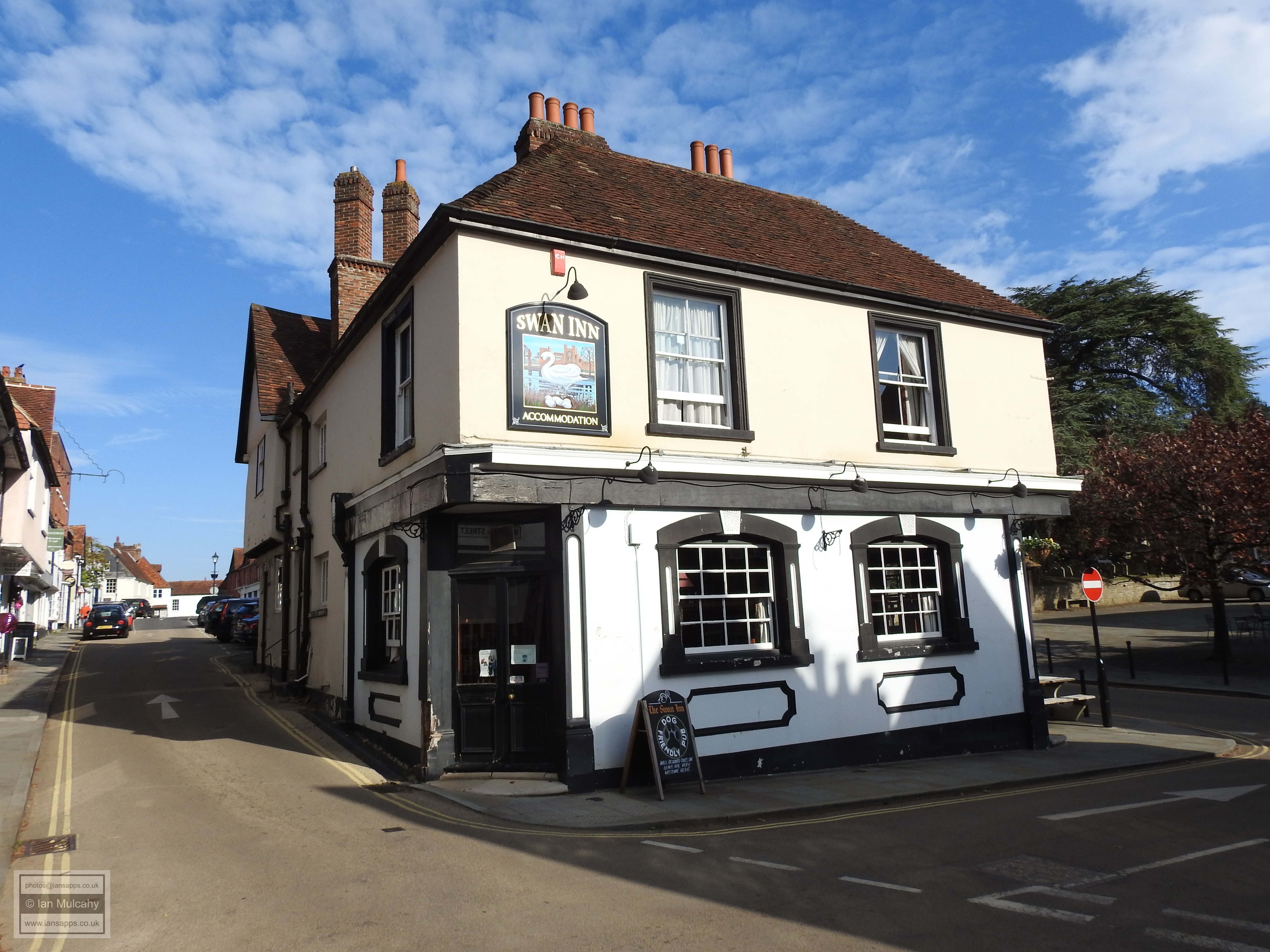
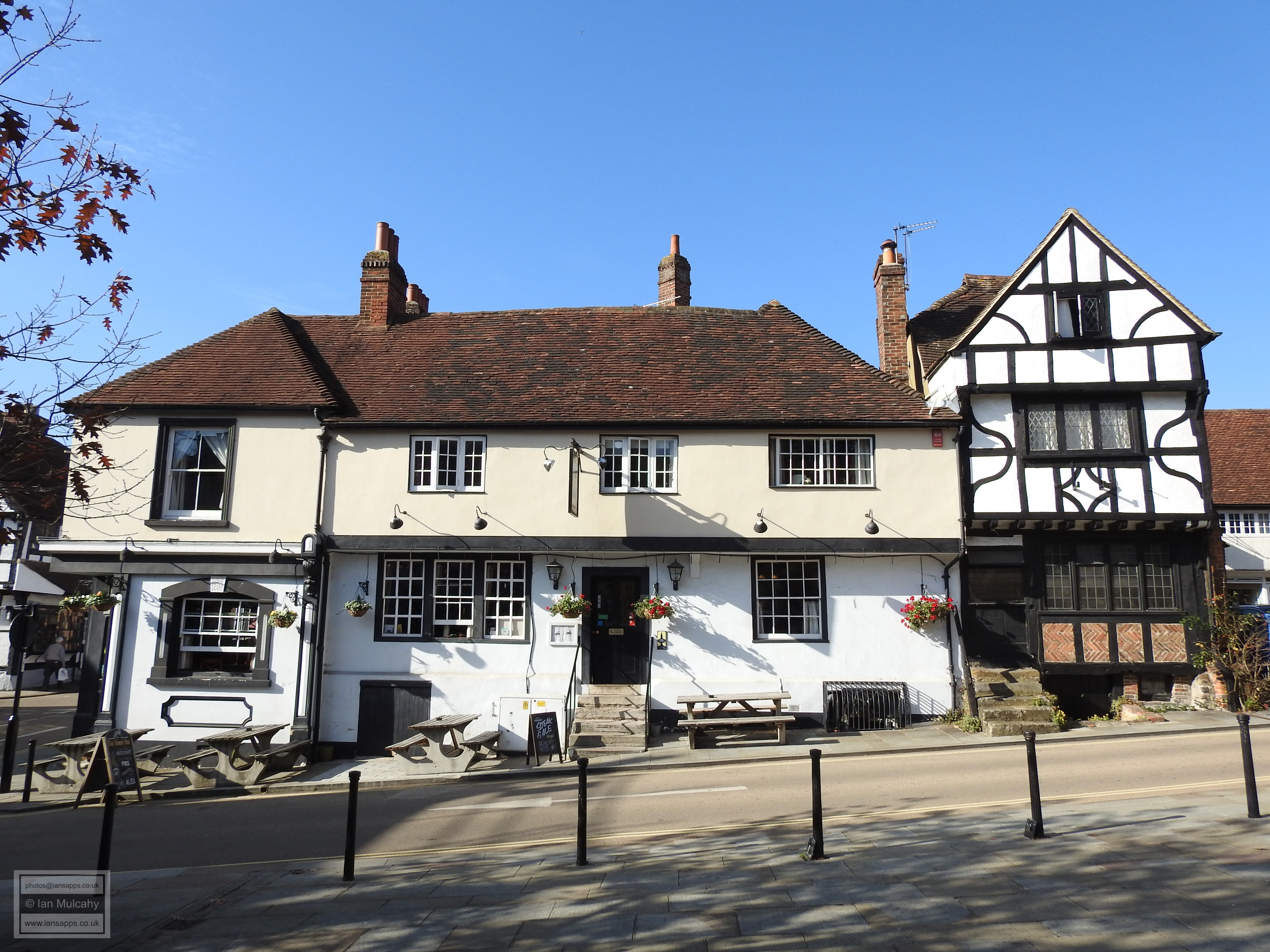
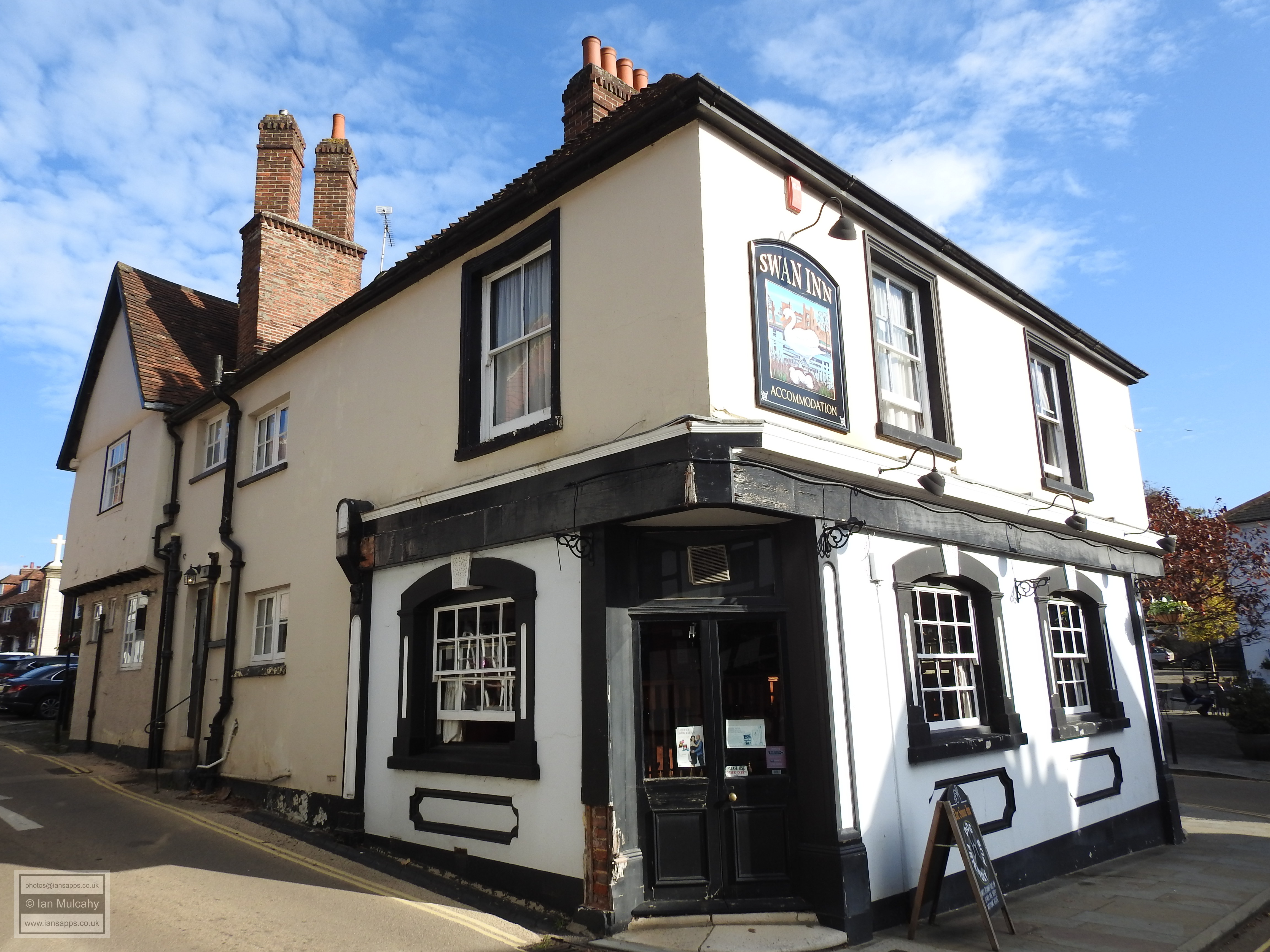
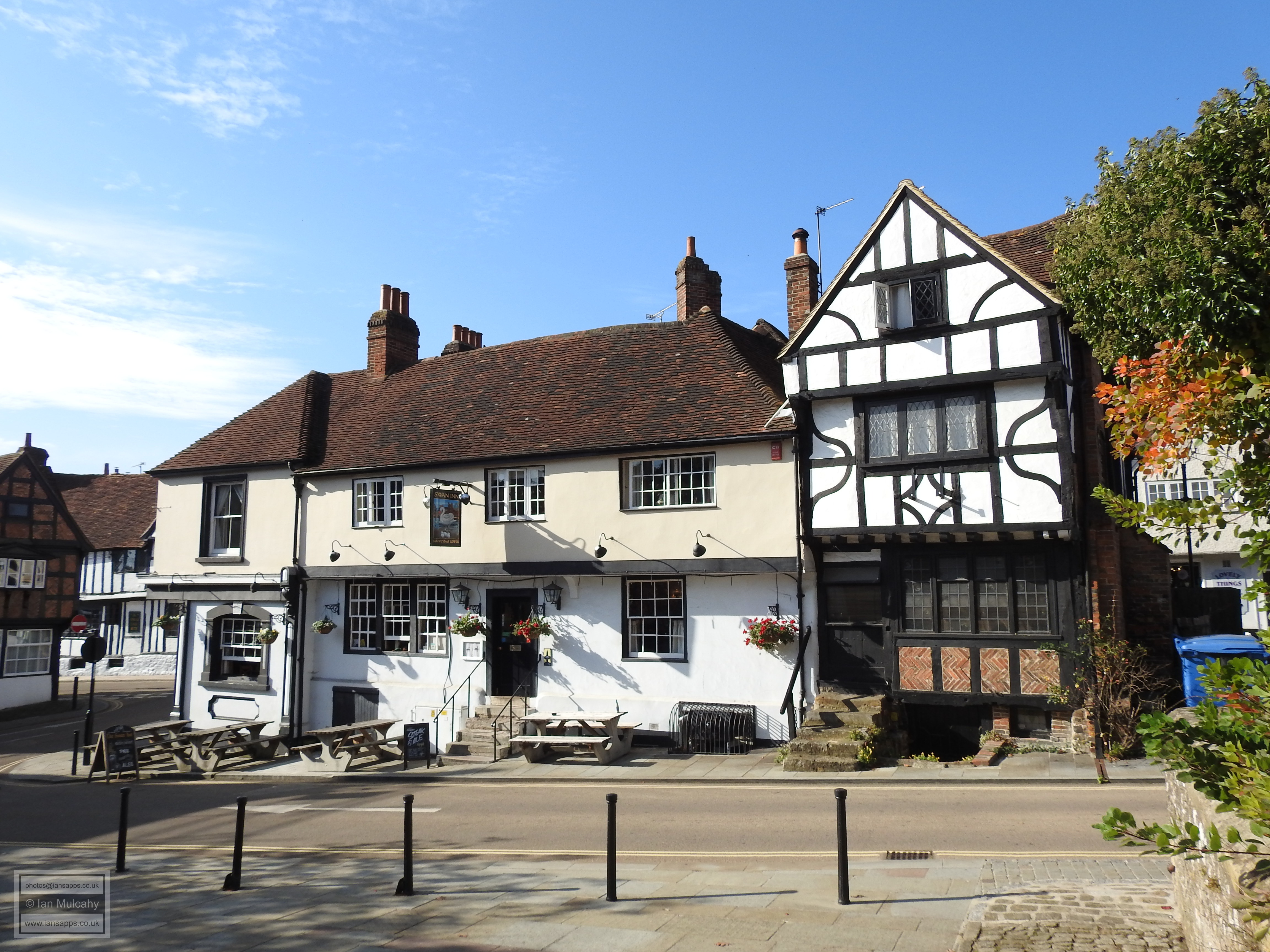
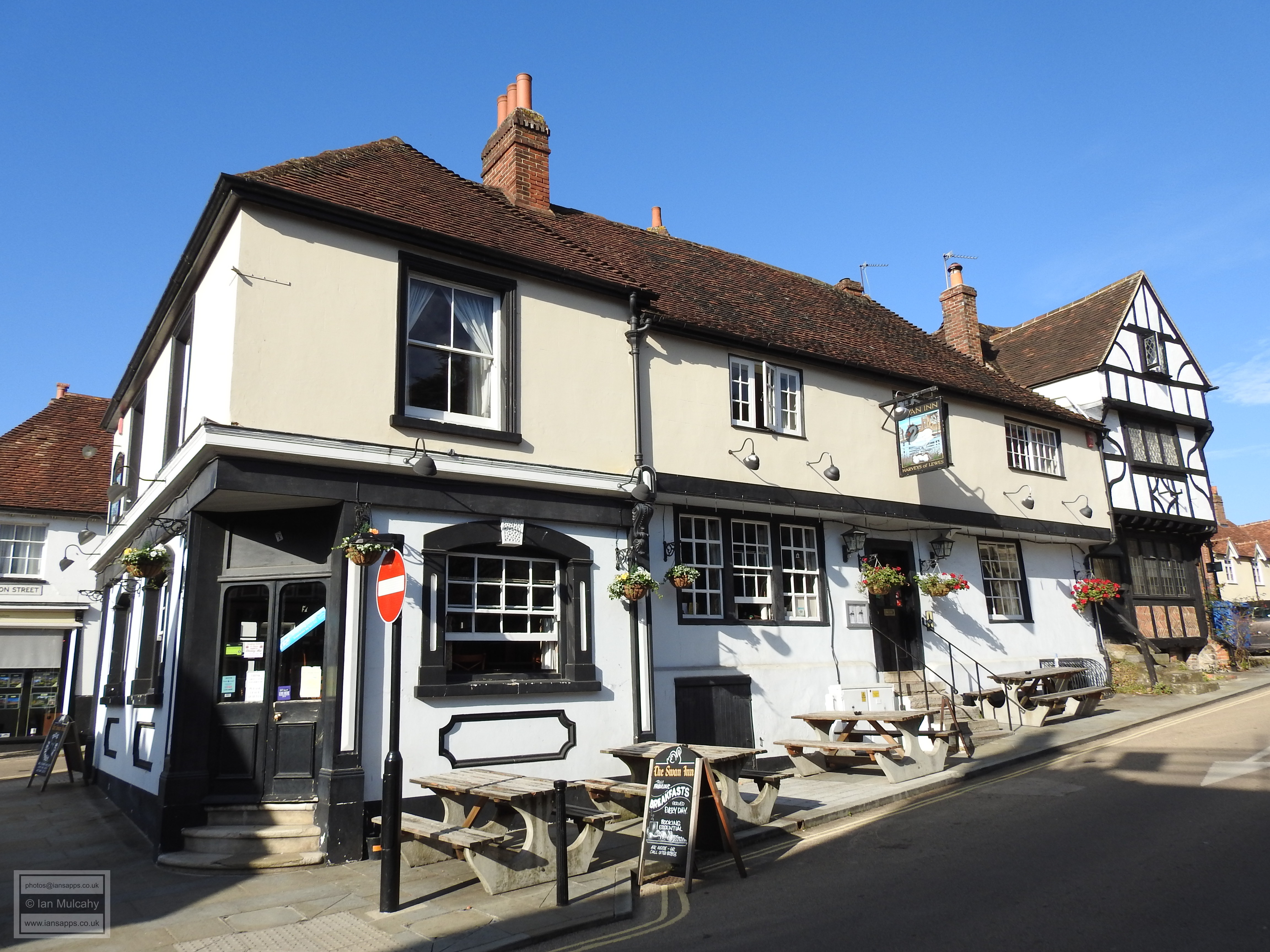
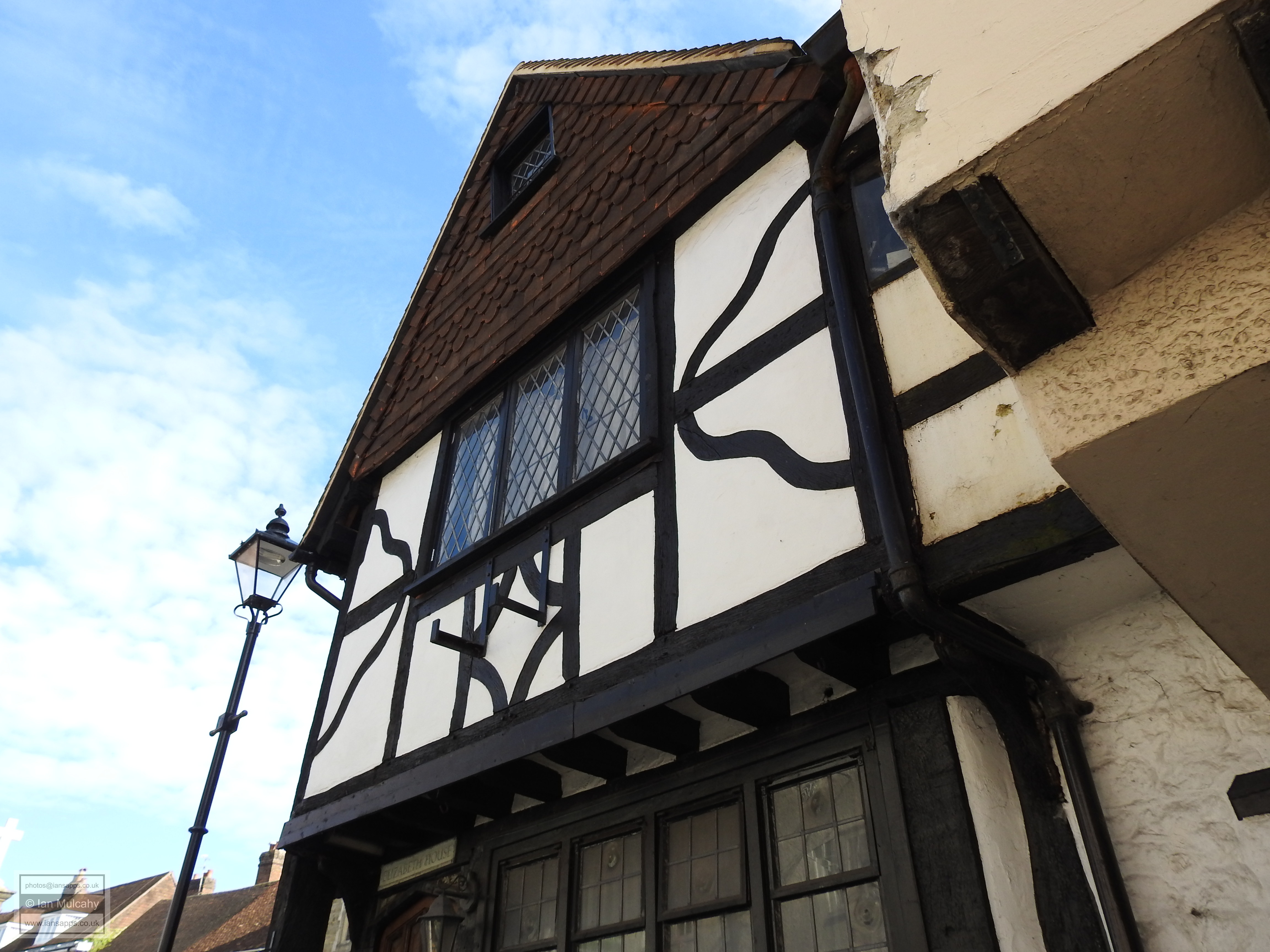
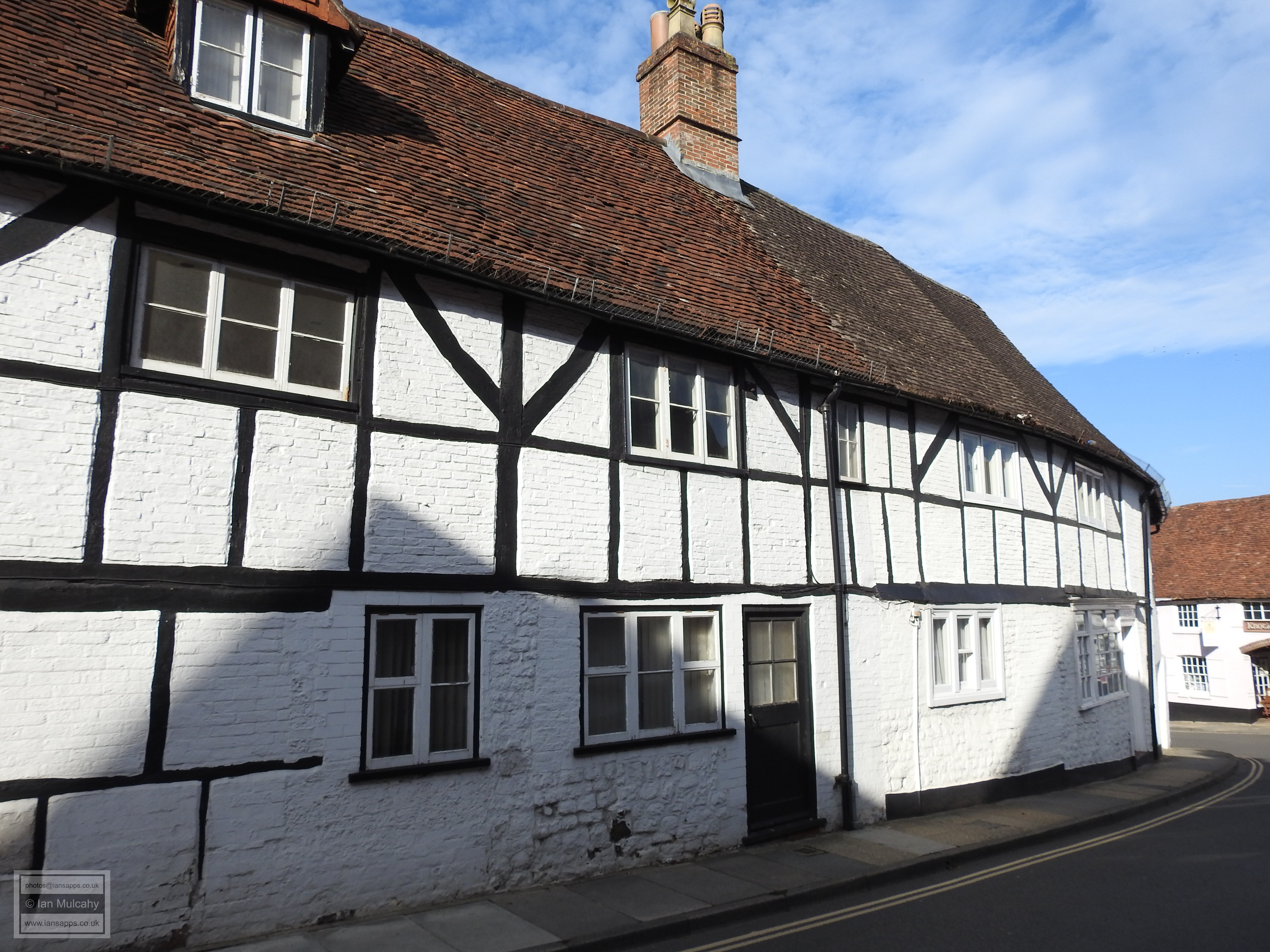
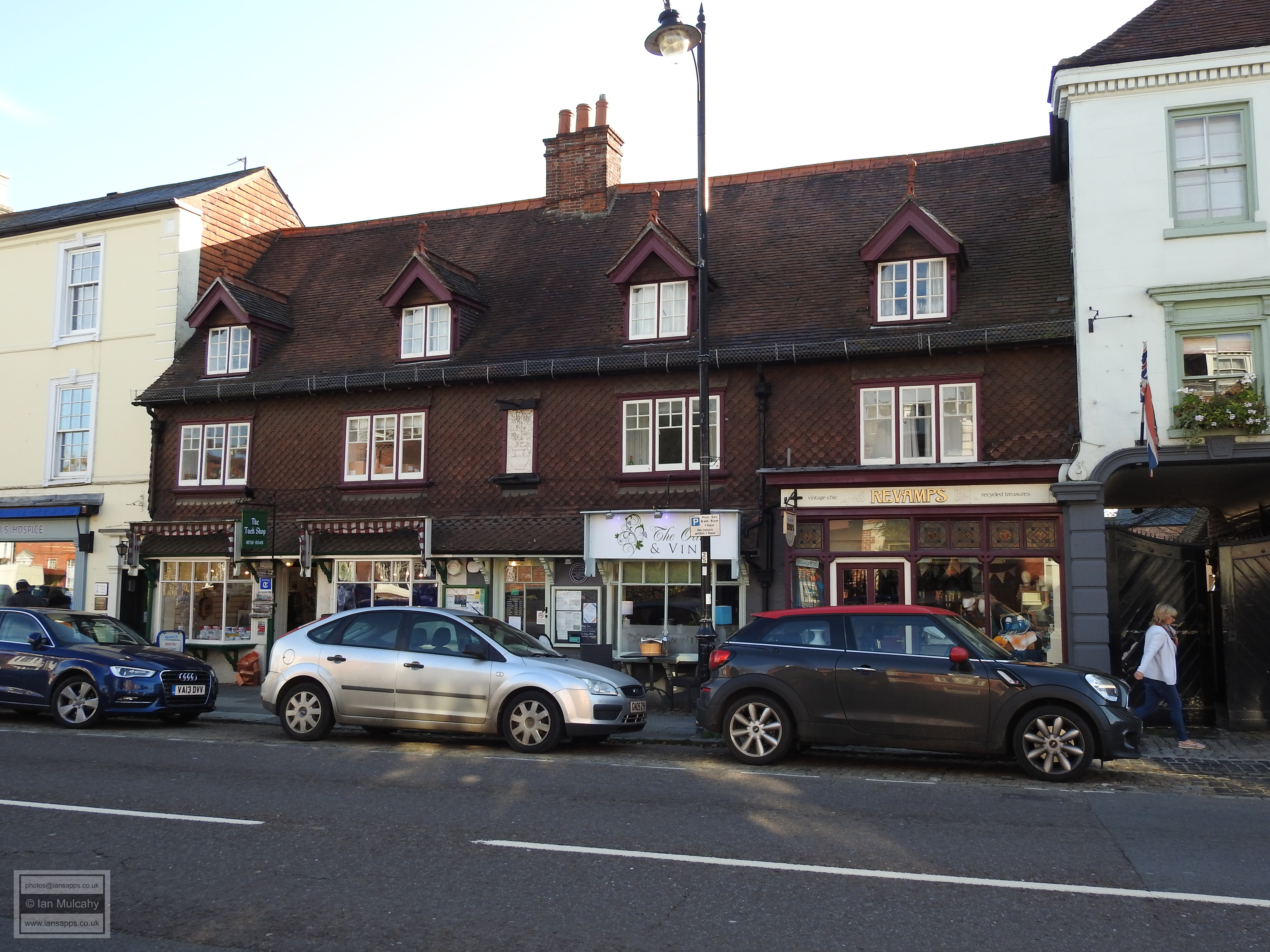
In the centre of Church Hill are The Swan Inn and Elizabeth House. The earliest parts of The Swan date back to 1460 when it was built as a coaching Inn and both visible external walls of the original structure are jettied; the eastern aspect for its full length. The southern end is a 19th century addition. Elizabeth House is a narrow single bay 15th or 16th century structure with a fabulous double jetty overlooking the church and what remains of the open market square. When a previous owner died, in 1948, the house was sent for auction and the auctioneers advised potential purchasers that the property was being sold as a leasehold, with a ground rent of sixpence (2.5p in decimal currency which is about 3.5 US cents) payable each year for 10,000 years from when the lease commenced in 1760. The purpose was to retain, for the seller, the right to the parliamentary vote which was attached to the property. If this yearly ground rent had kept pace with inflation a little over £2.50 (USD3.50) would be due annually. I have been unable to ascertain whether it is still payable. There were a further two adjoined cottages to the north of Elizabeth House, but these were demolished after the Great War to create a space for the town war memorial. This means that the northern wall has been an internal one for all but the last century of the building’s c.500 year existence.
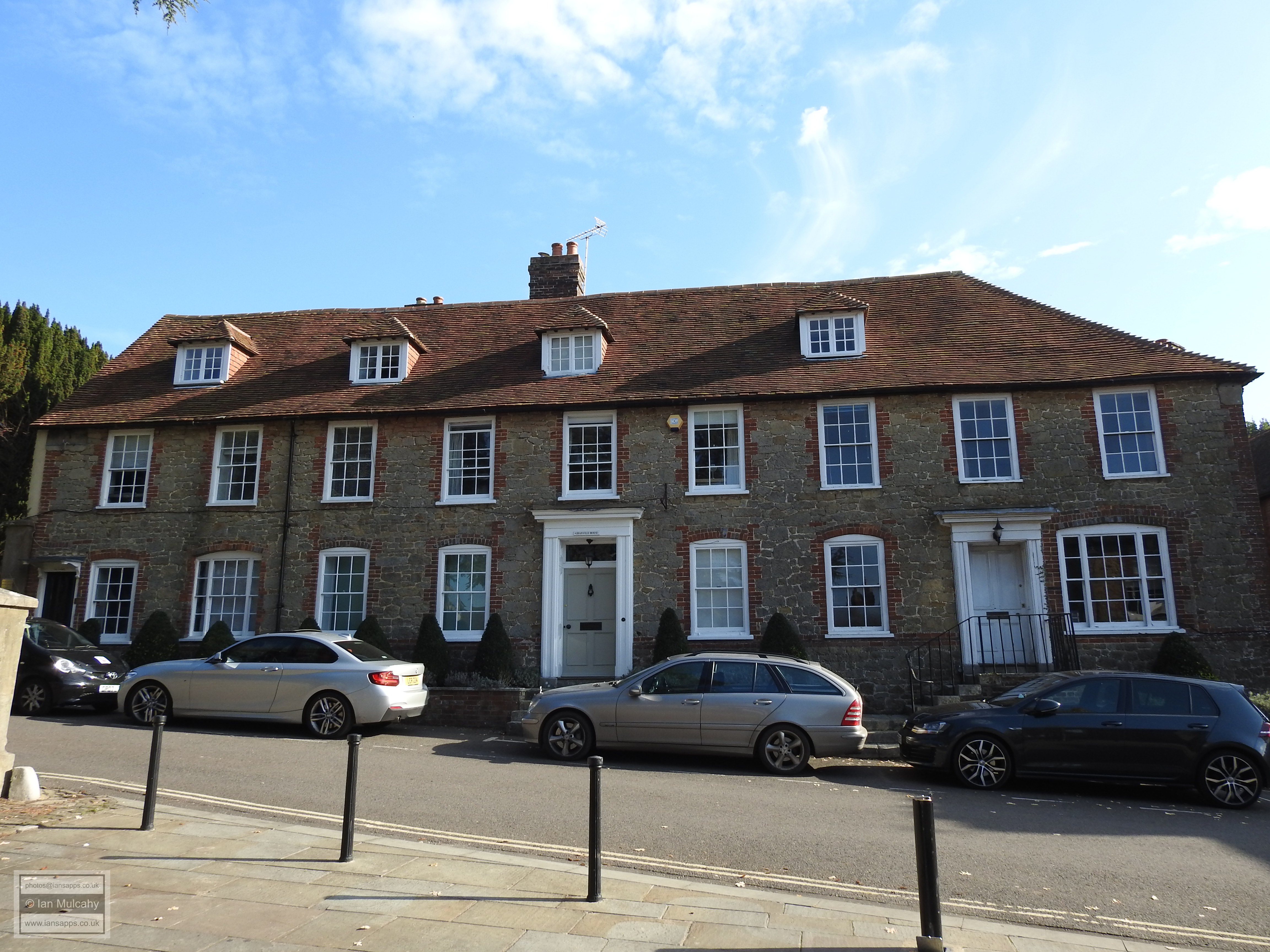
On the southern side of the square, is 2 Market Square, a small jettied cottage believed to date to the 15th century and to the east, by the track to St. Ann’s Hill, is Granville House, a large terrace of timber framed houses dating back to the 17th century or earlier that were refronted in the 18th century, though parts of the timber framing are still visible to the rear.
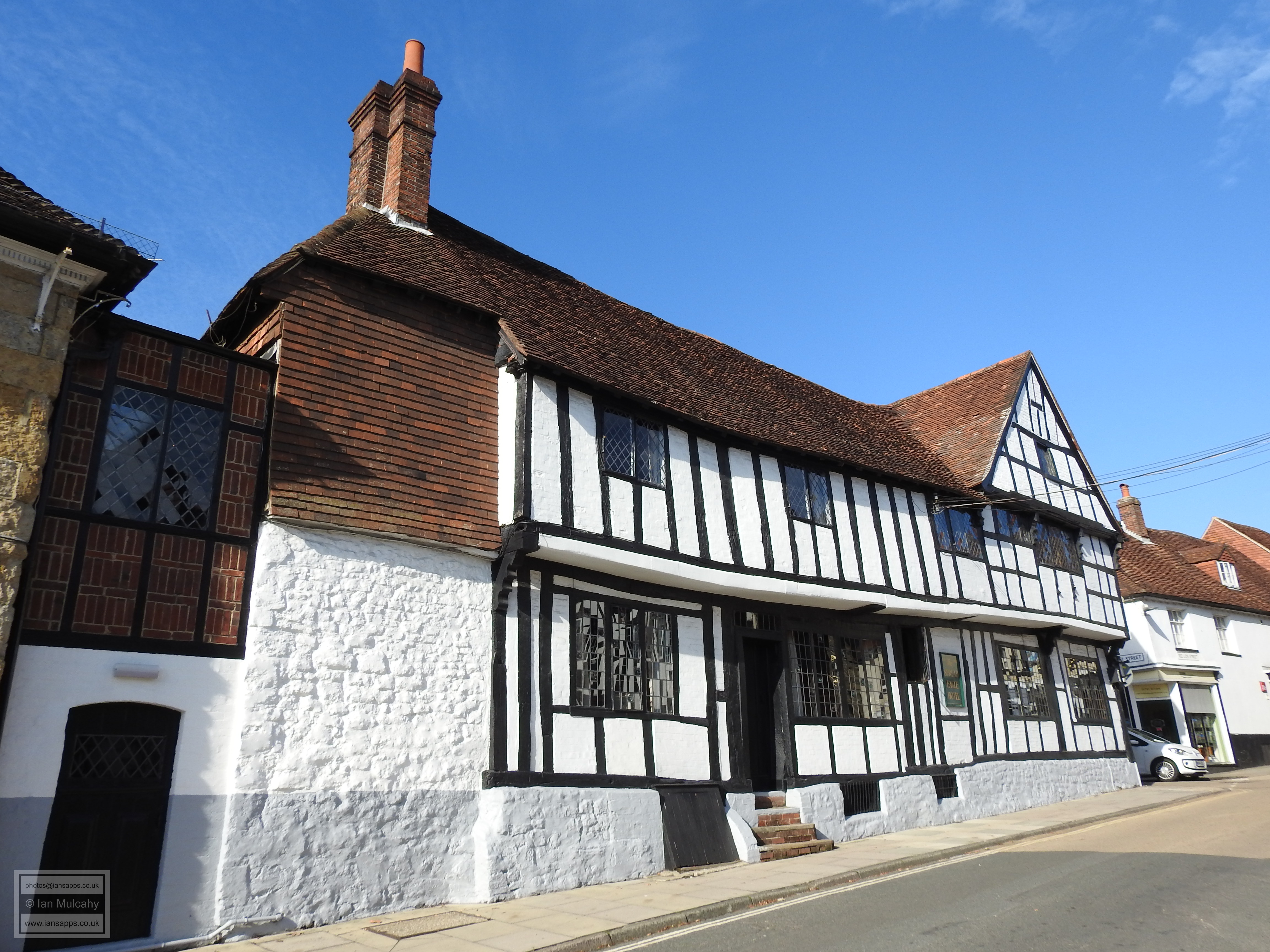
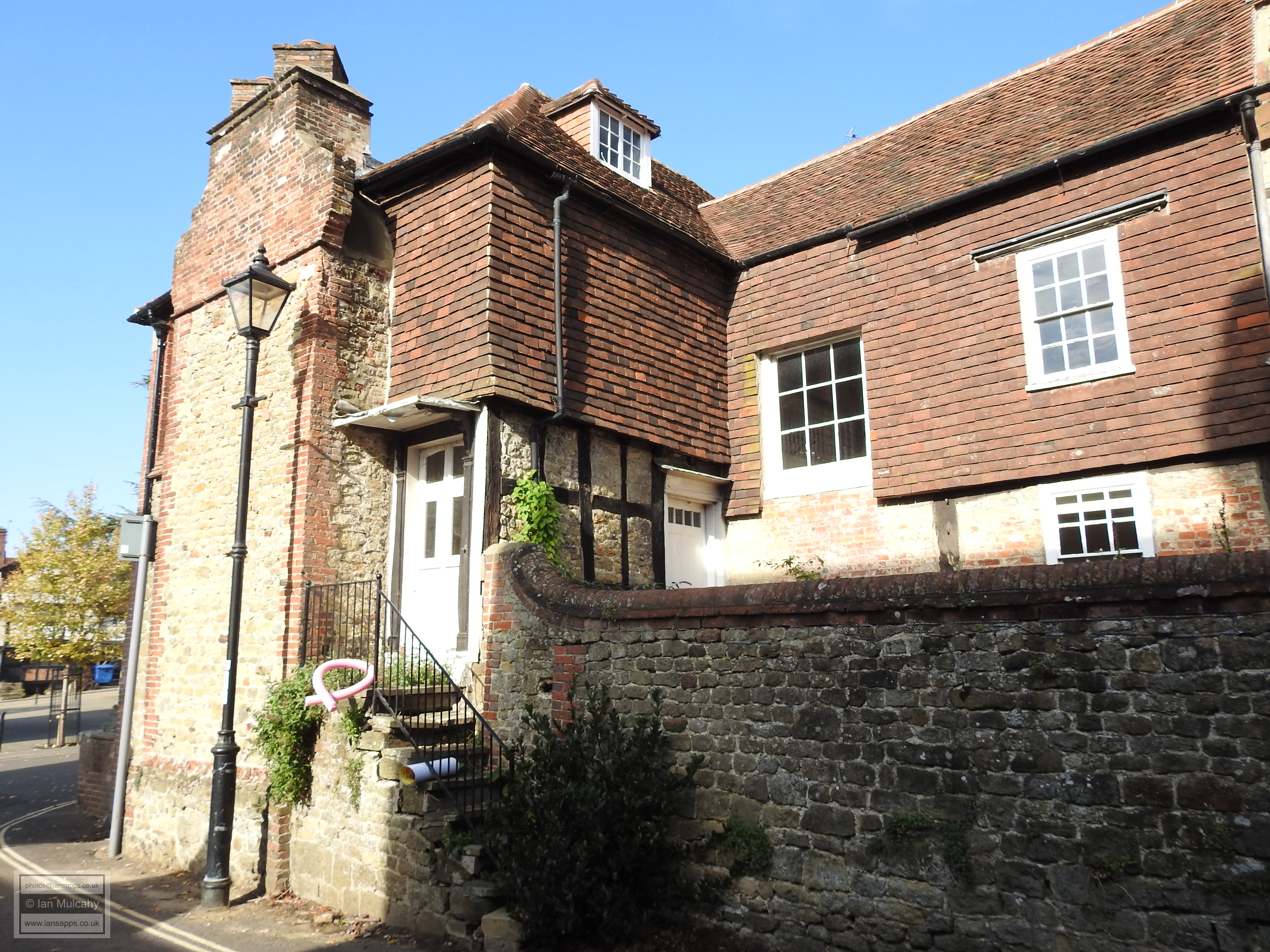
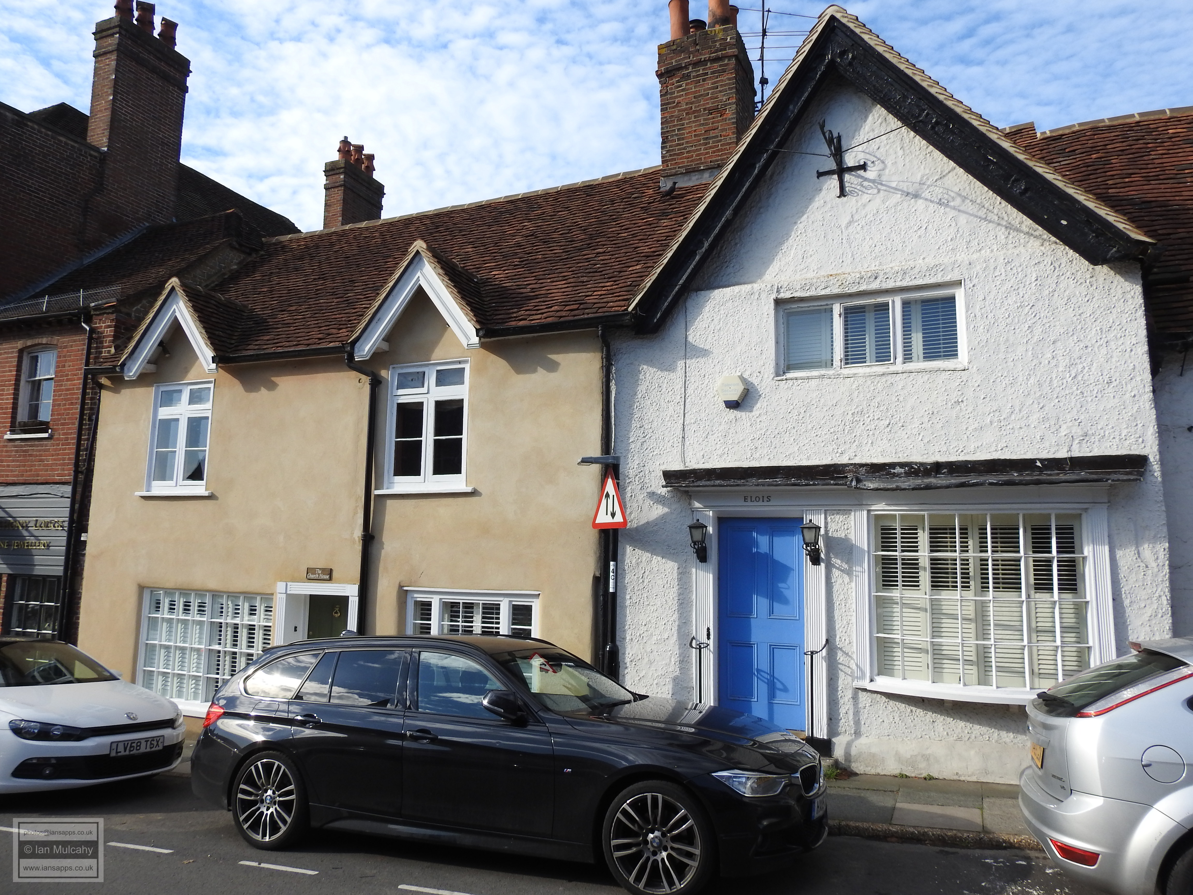
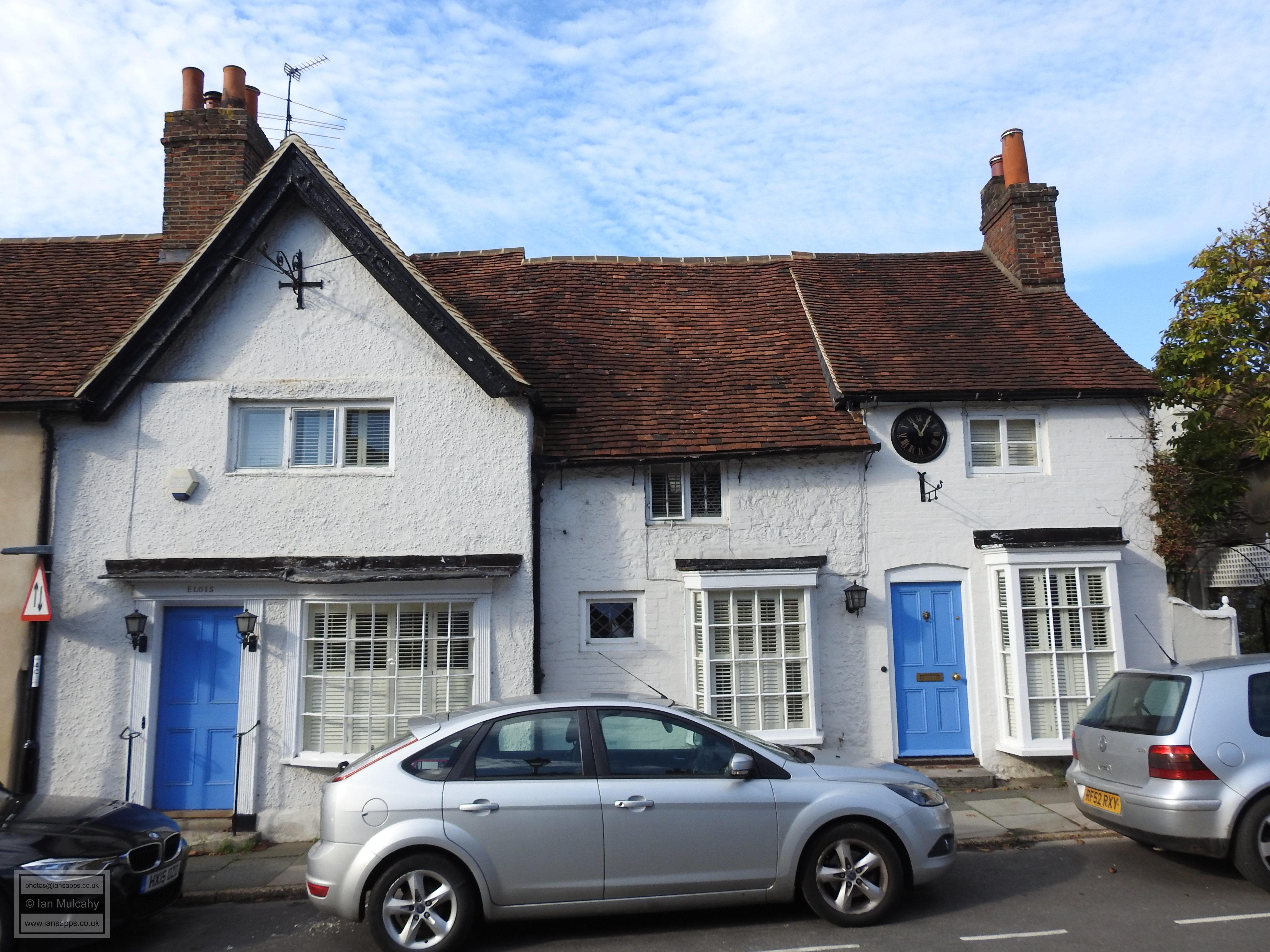
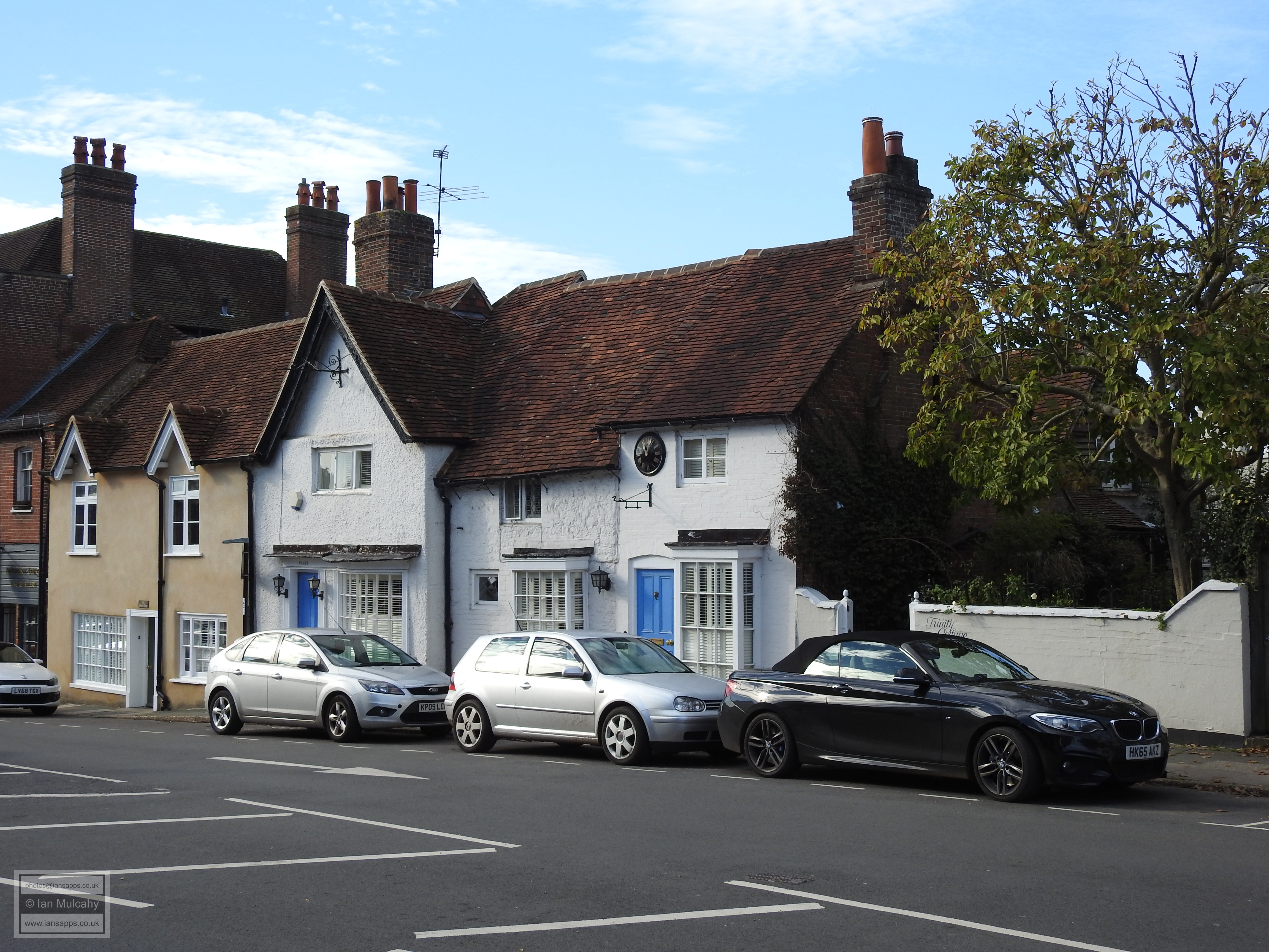
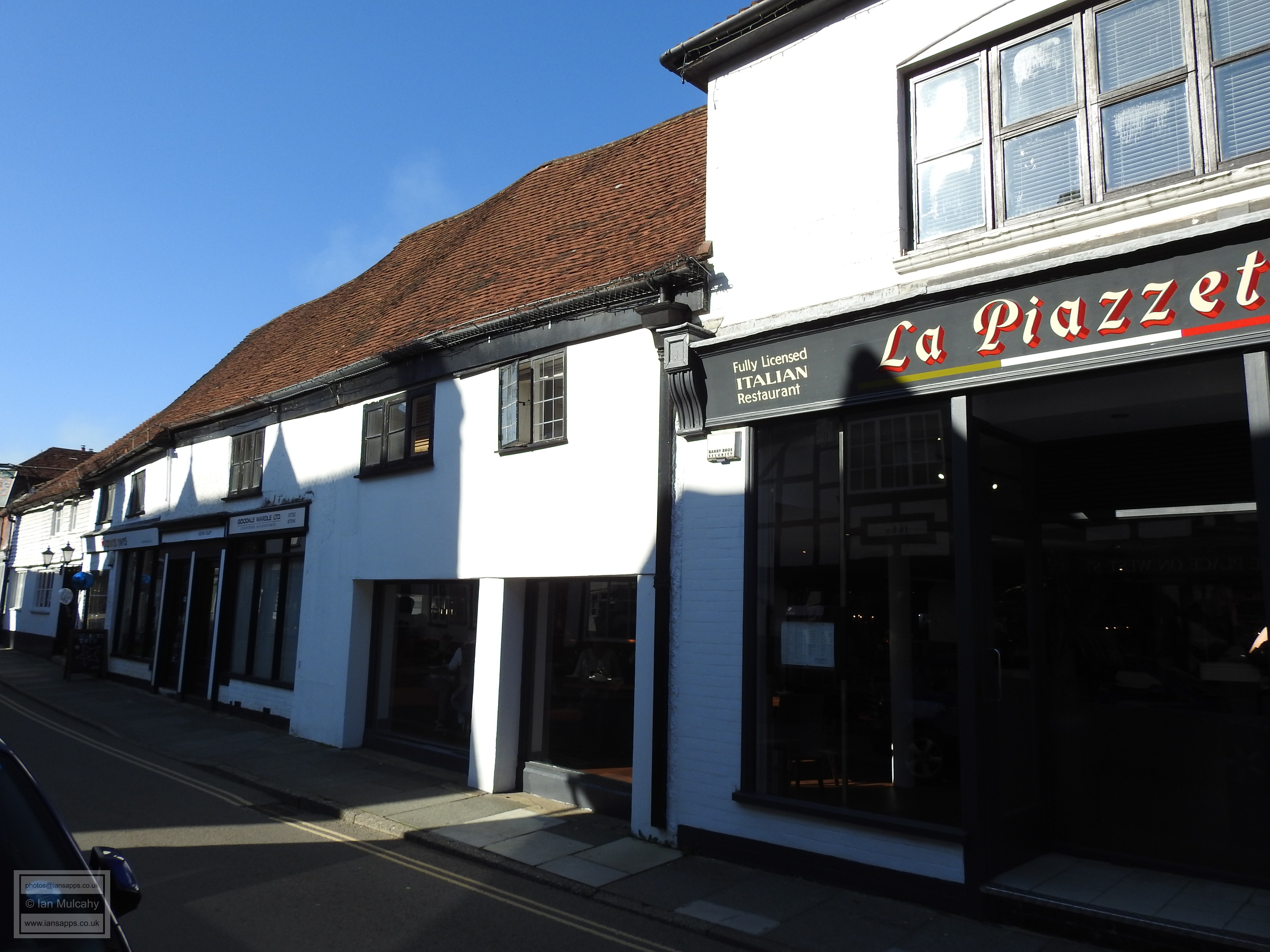
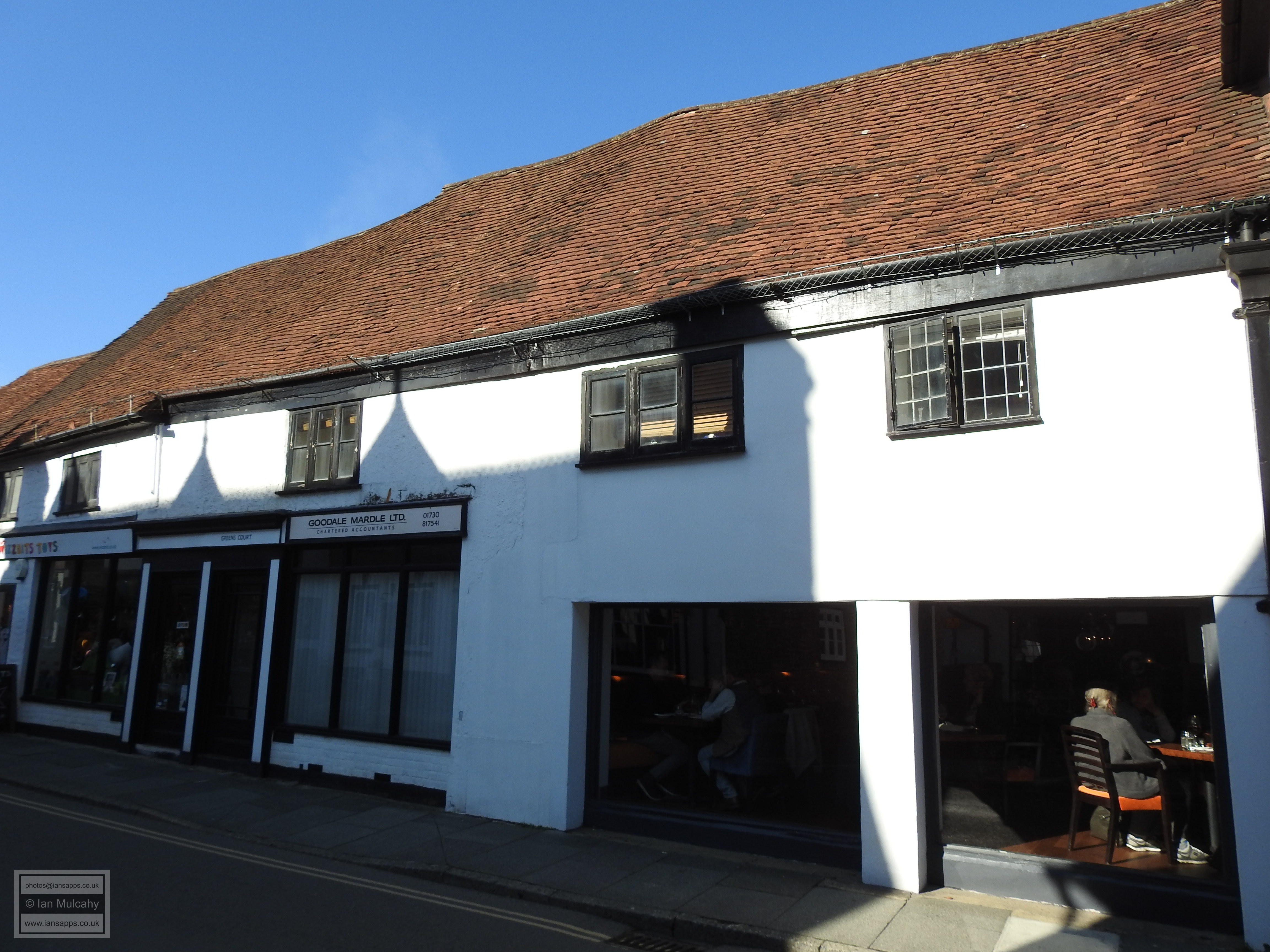
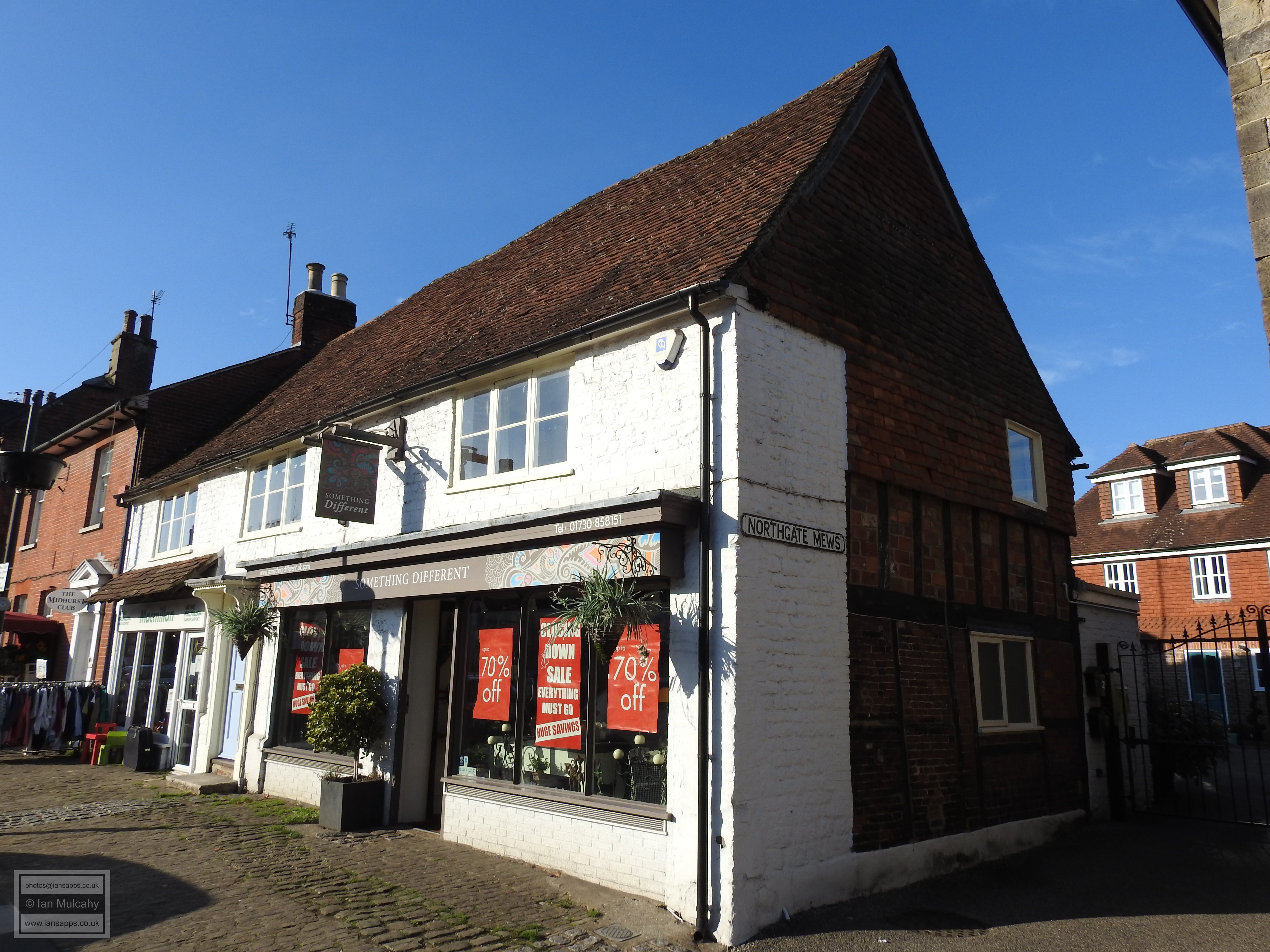
A short way along the west side of Church Hill, as the road starts to narrow into a single carriageway again, is an old property known as Campbell Walchli Antiques, Old Manor Cottage, and Old Manor House Restaurant. This was originally a timber framed open hall house, probably built in the 1500s, but maybe earlier. In about 1600 the hall was floored over and a chimney added, as was often the case with hall houses. Adjustments were made to the roof and the house was refronted during the 18th century. It is easily identified as there is a large wall mounted clock to the right.
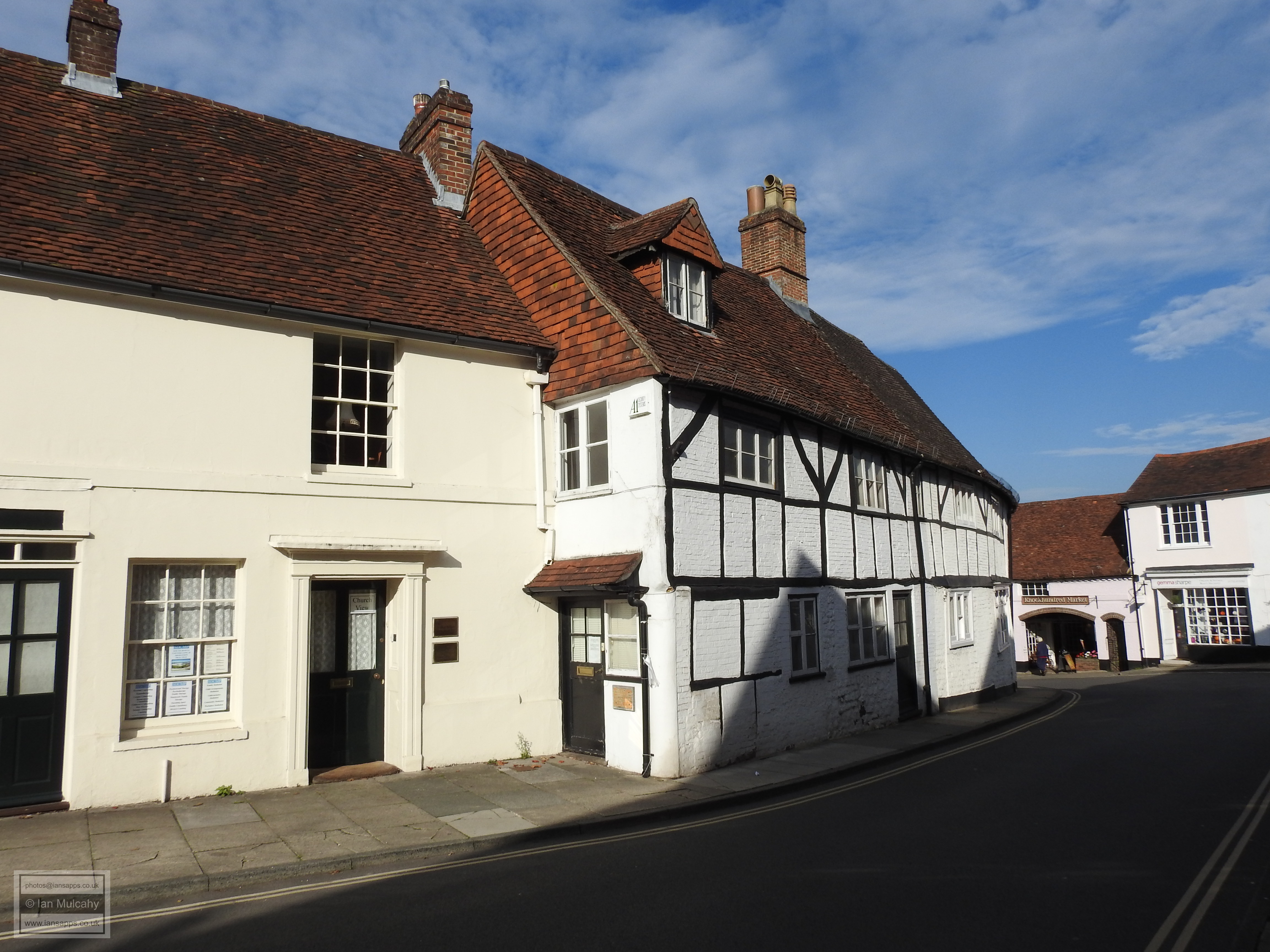
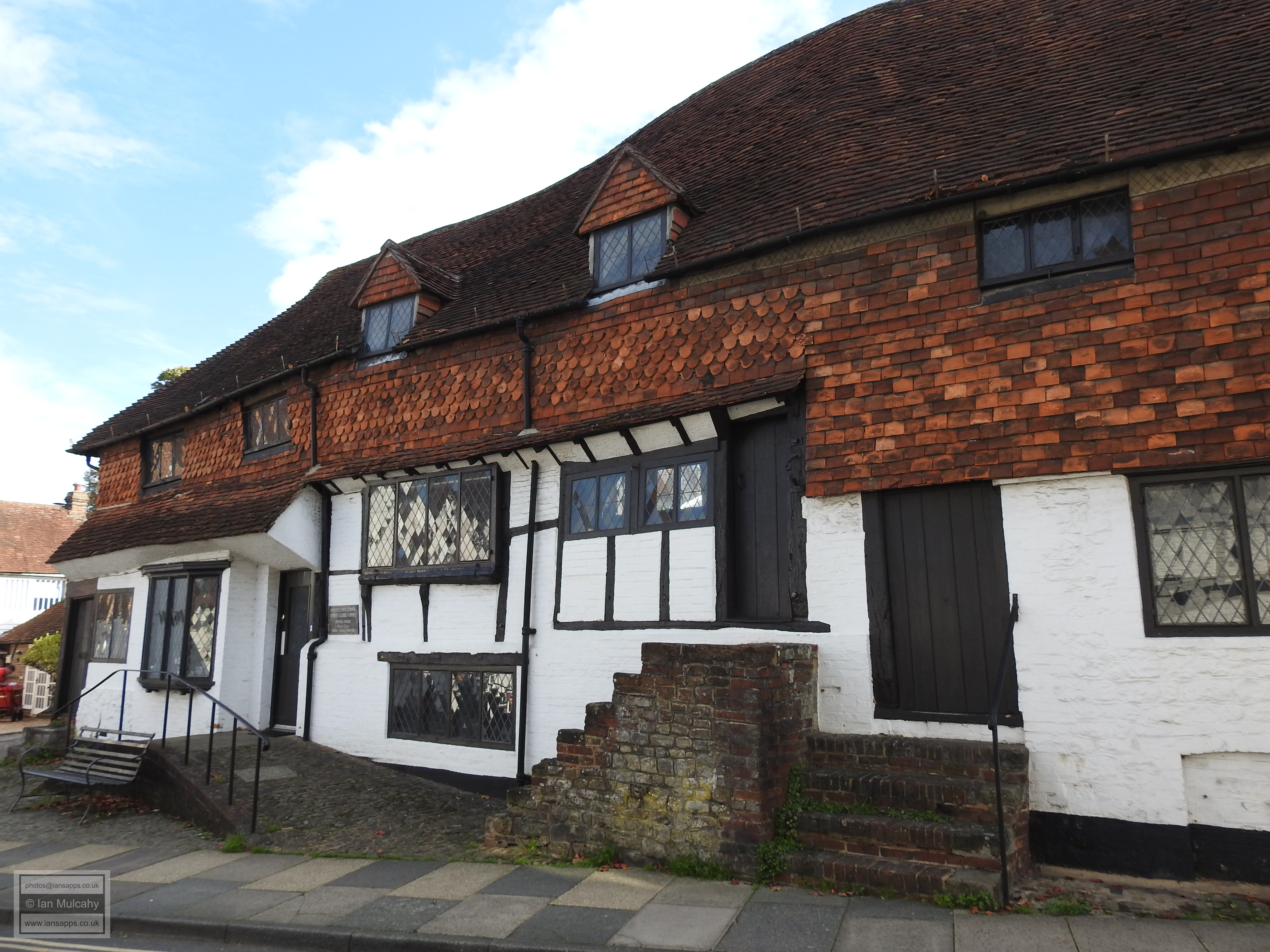
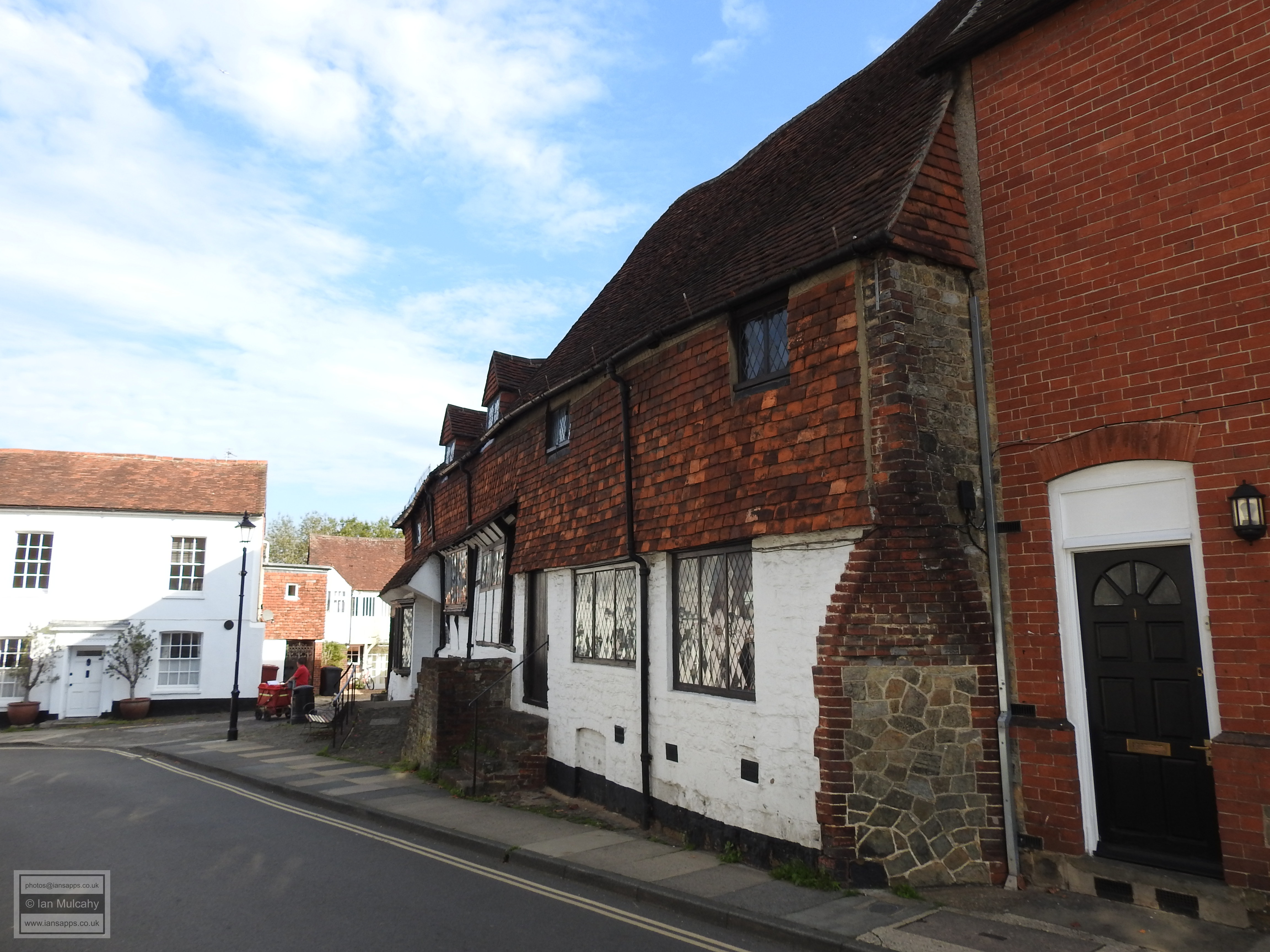
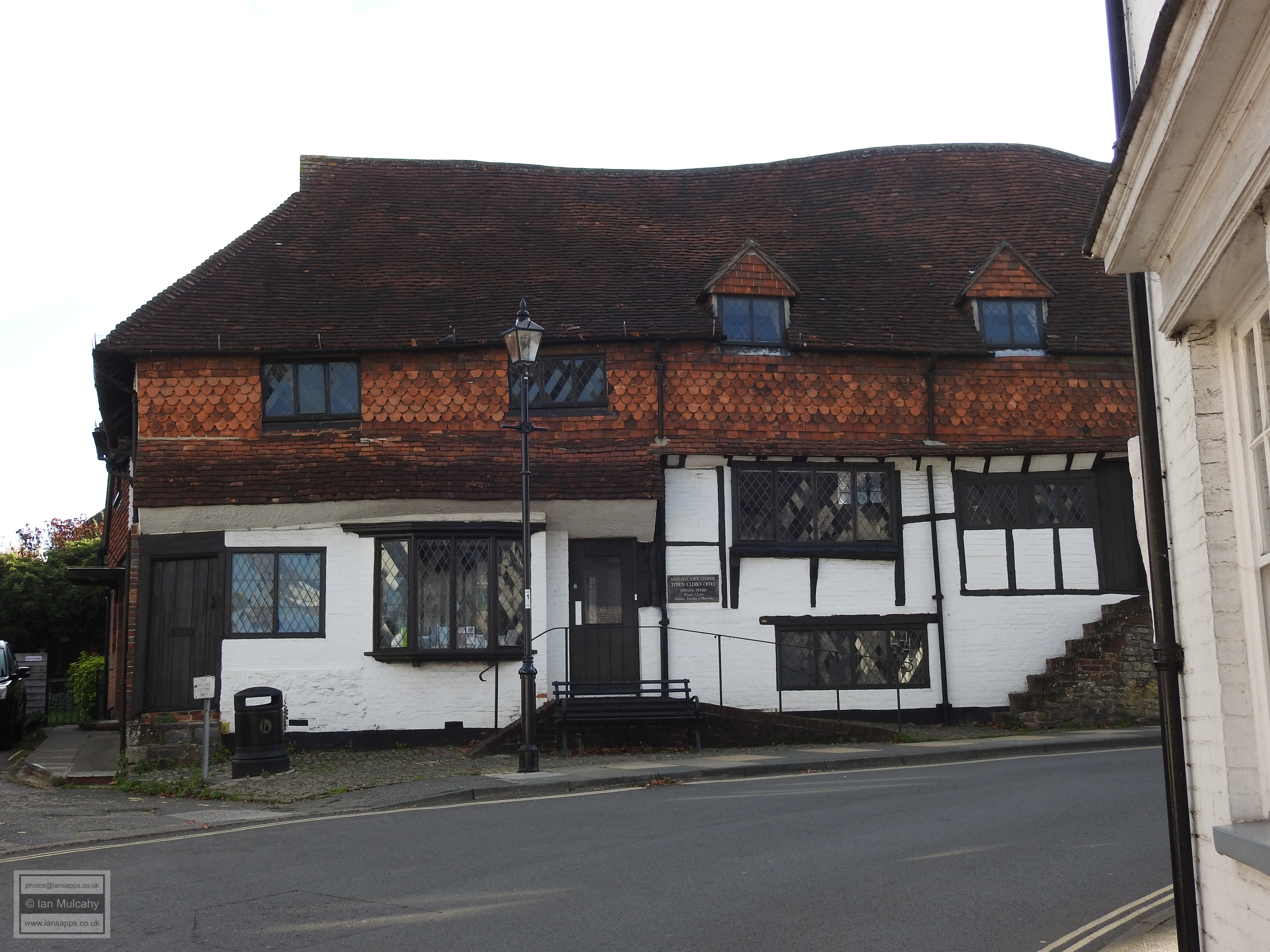
A little further north, as we approach the position of the northern entrance to the fortified Norman Town, we find the long and wonderfully curved late 16th or early 17th century timber framing of 3 & 4 Knockhundred Row. Opposite, and right on the edge of the old town, is The Former Public Library, a large quirky seven bay timber framed building with all kinds of odd angles and entrances. Built towards the end of the Tudor Period in the late 16th century, it is first recorded in 1602 when ownership of the burgage on which it stood carried voting rights. Later in the 17th century, the house was split when it was passed to the two sons of the owner in his will. A further change of ownership saw one half become the White Horse Inn and the other living quarters before the whole building was converted into five tenements, a state in which it remained for 200 years or so. It was then bought by the future Lord (George) Onslow and became a row of commercial premises. Lord Cowdary came into ownership in 1913, when it was described as three houses and two cottages, and he removed the internal walls to create the Midhurst Working Men’s Club. During World War 2 it was used as an evacuation centre and has since hosted a youth centre, a canteen for the local Grammar School and a public library. It is now the home of Midhurst Town Council.
As time progressed, Britons integrated with their conquerors from
Normandy and the need for fortification to protect the town from
insurgency waned. By the 13th century the northern ends of the
original market place had become infilled with permanent buildings
and the town was spilling out from its boundaries into the
surrounding land. A secondary market had developed to the west of
the fortifications in the centre of the triangular area now marked
by Wool Lane, Rumbolds Hill and West Street, with burgage plots set
out around the outside of the new market place. Later in the 13th
century, or perhaps early in the 14th, a third market was created in
North Street. Whether this was as a result of rapid infilling of the
second market or booming trade is unclear.
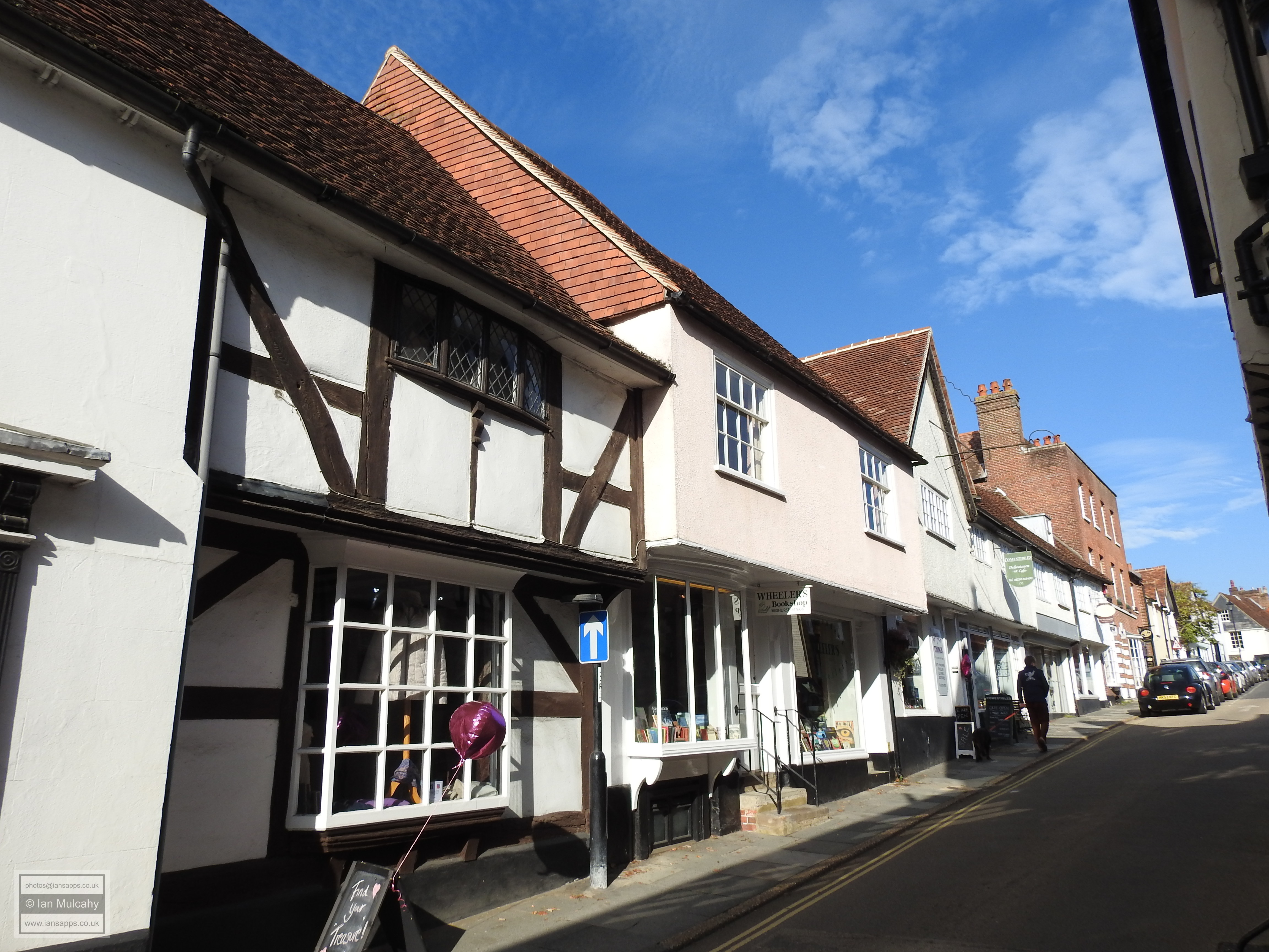
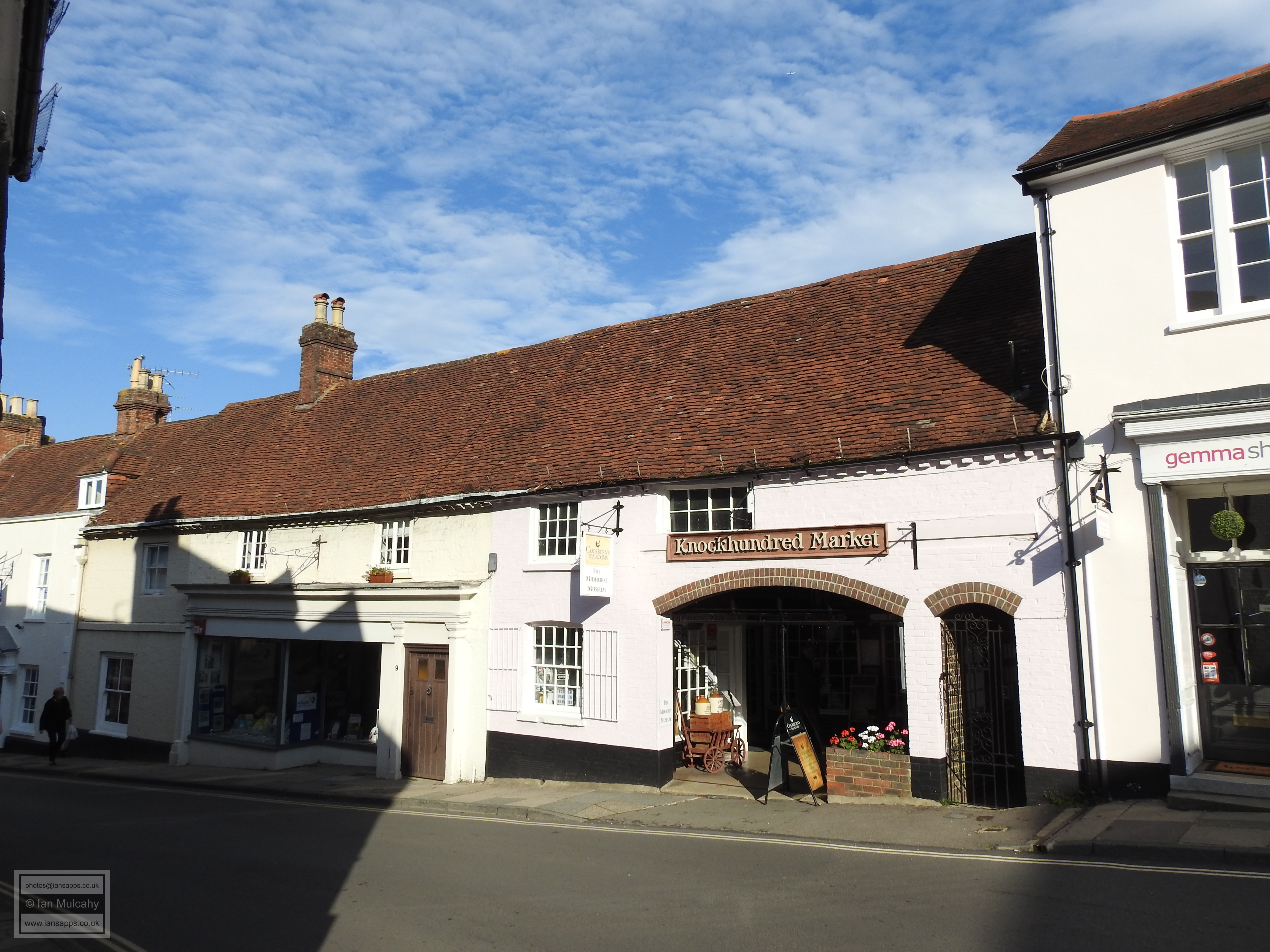
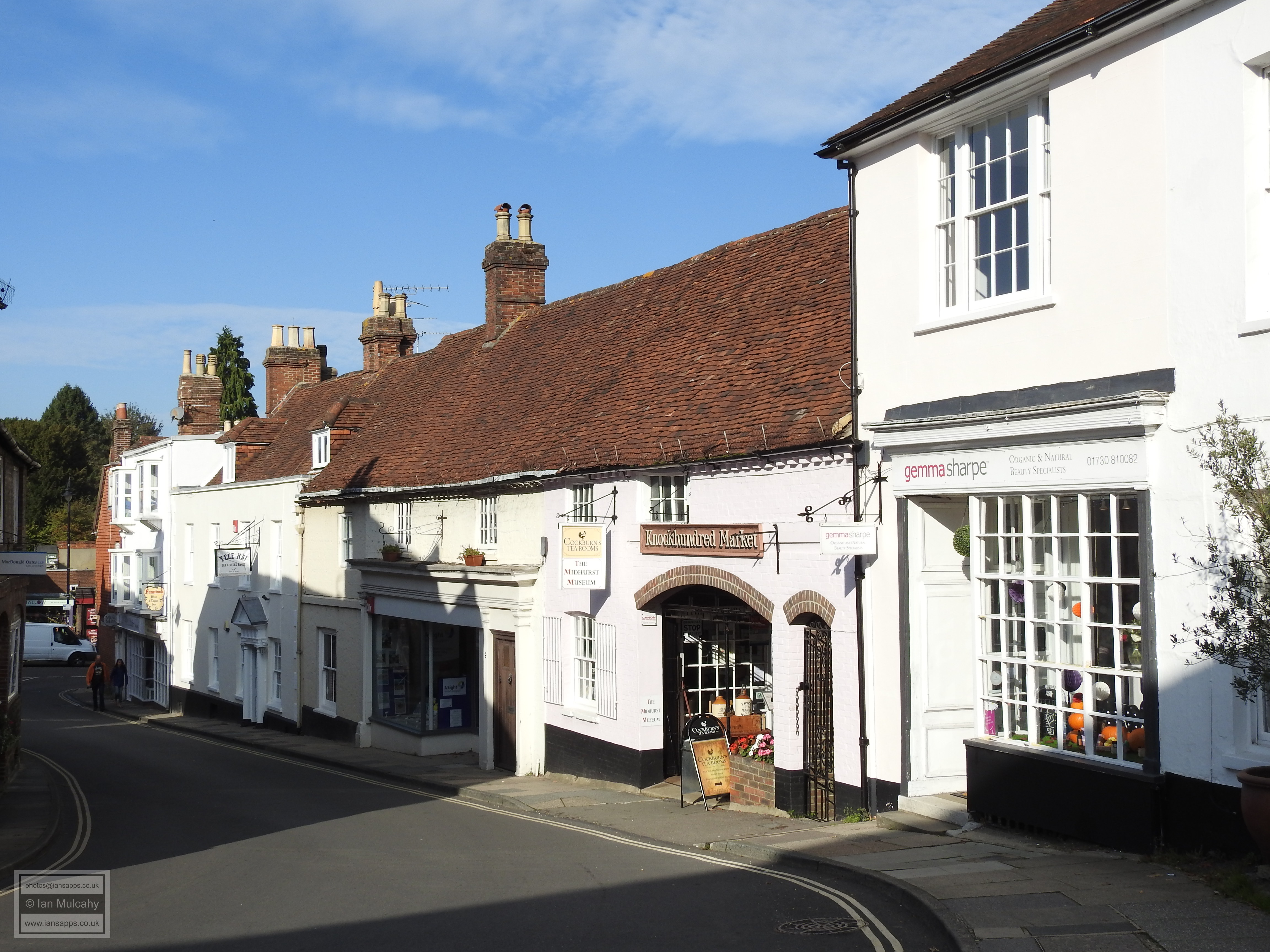
The defensive ditch was backfilled over hundreds of years; from the 13th century through to the 16th or 17th century. The recovered land was of course re-used and the path of the ditch was gradually lost under new buildings. In Knockhundred Row, immediately north of the old gateway into the town and directly over the course of the ditch, stands The Bloody Mary Bar and Knockhundred Market. Listed as being of 17th century or earlier, the long building was refronted in the 18th century, hiding all of the timber framing, but venture inside the market section and the building is open to the roof for the most part with the framing clearly visible. A little way down the hill on the opposite side of the road is another 17th century or earlier structure built on the infilled ditch known as 2 & 2a Knockhundred Row, and this was also refronted in the 18th century, retaining the curved windows inserted at that time on the ground floor.
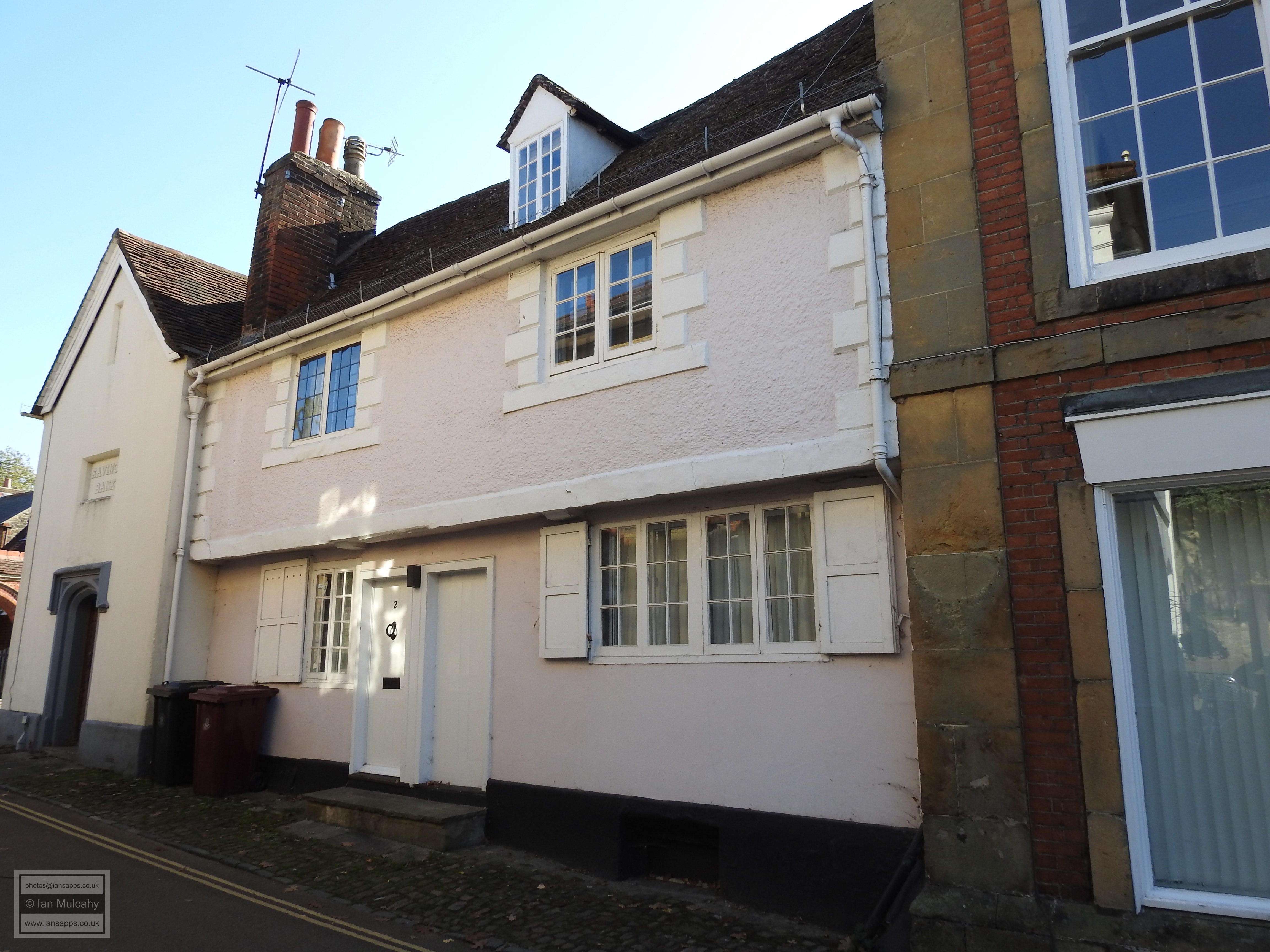
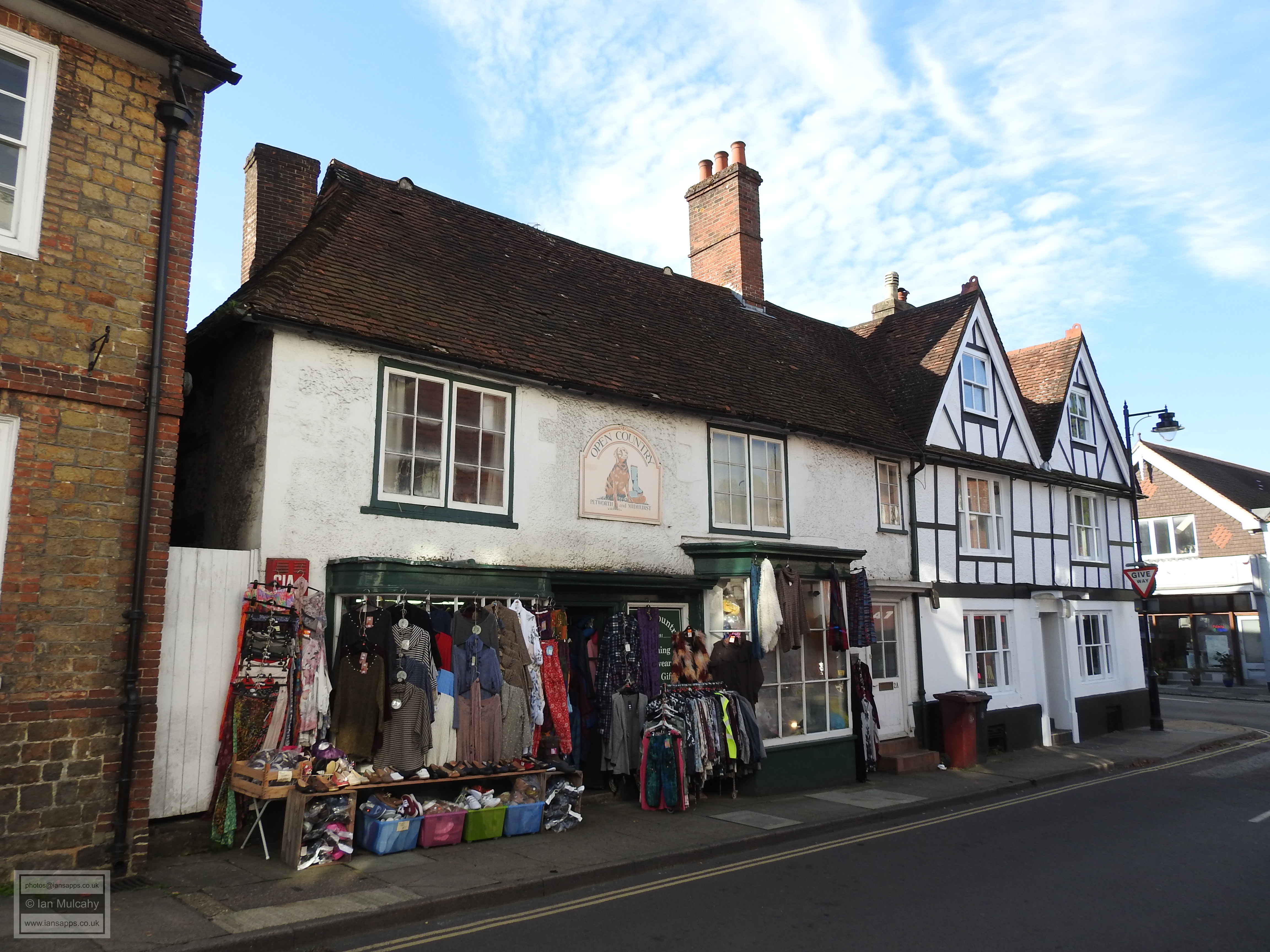
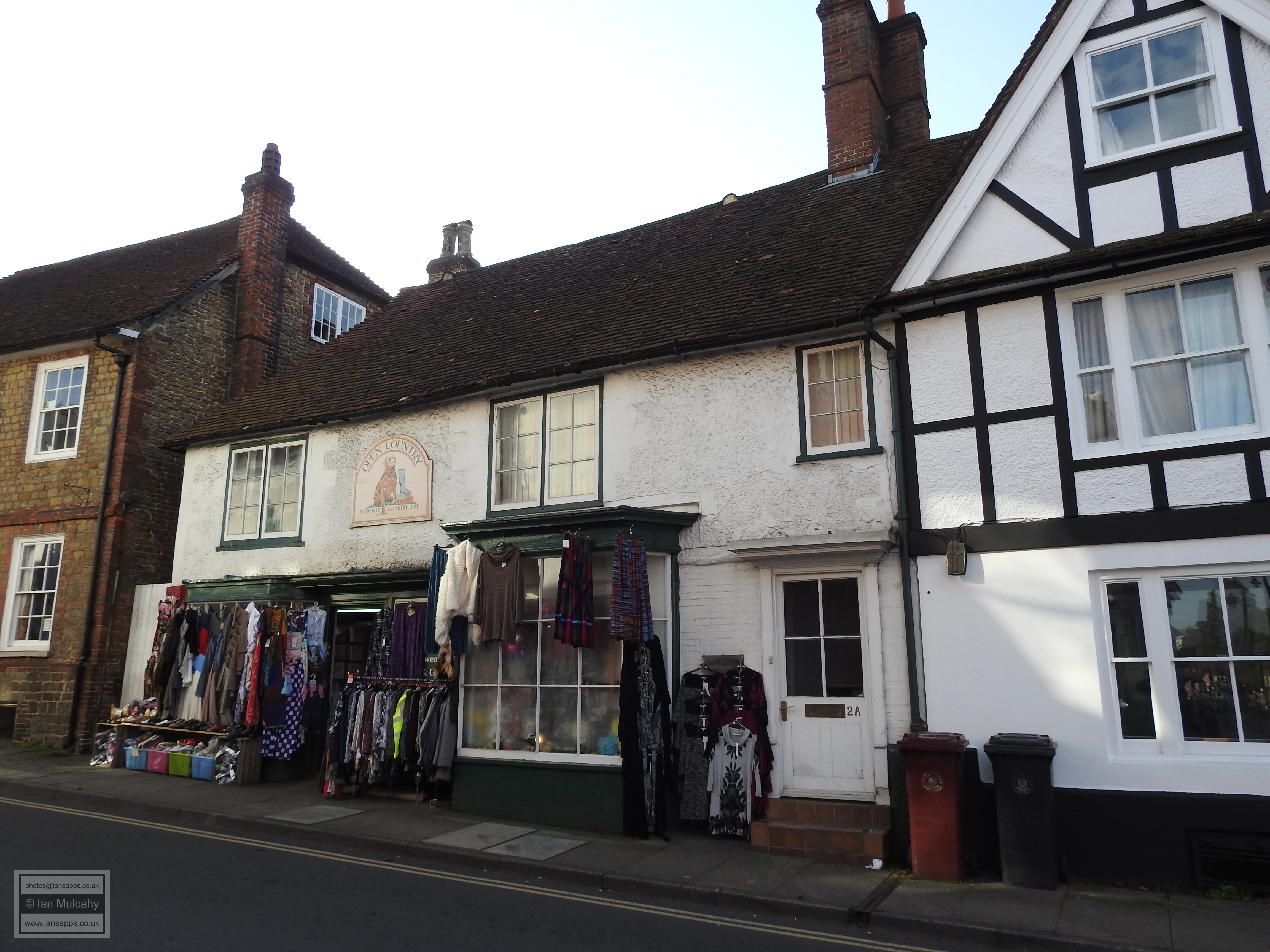
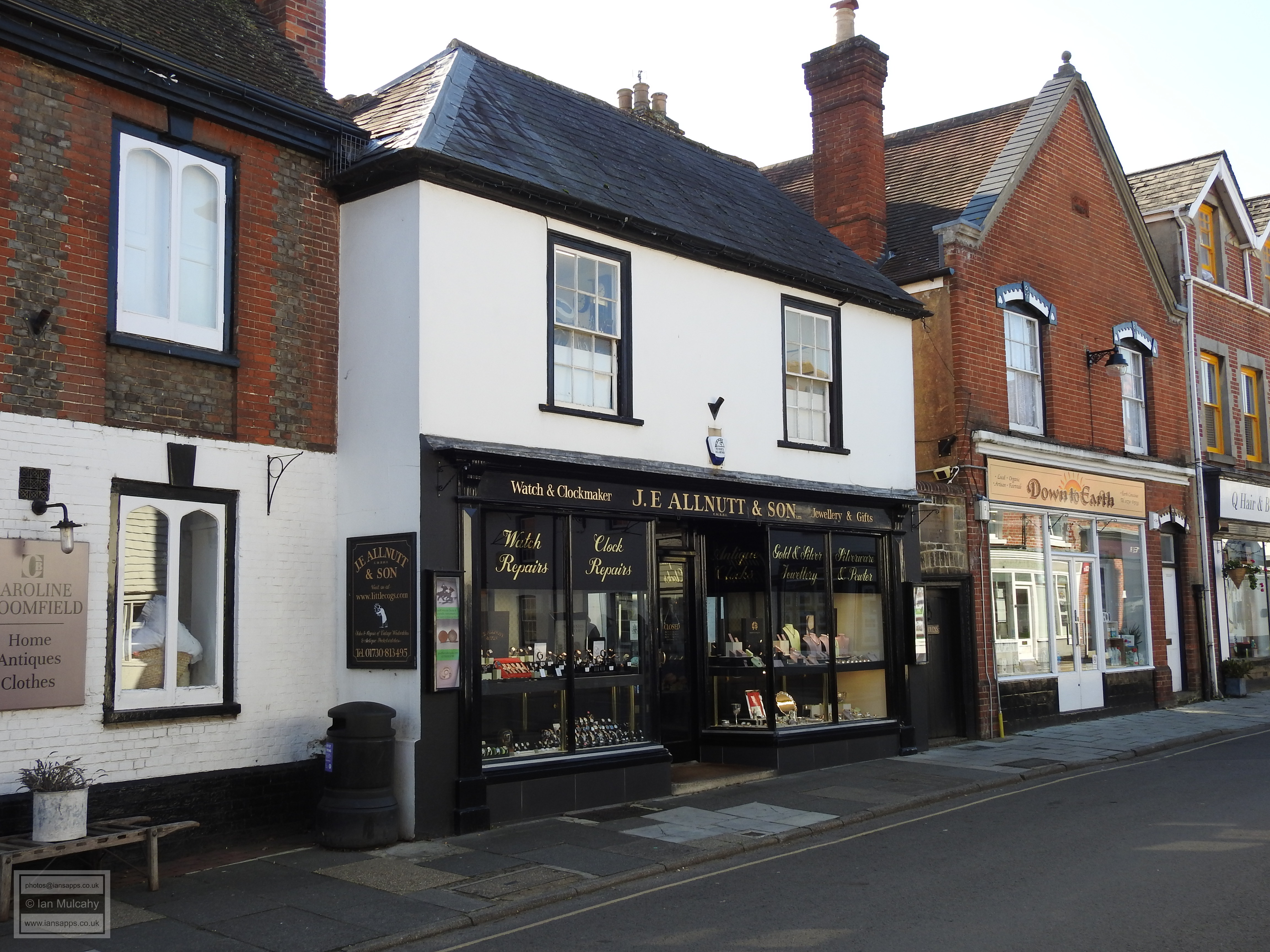
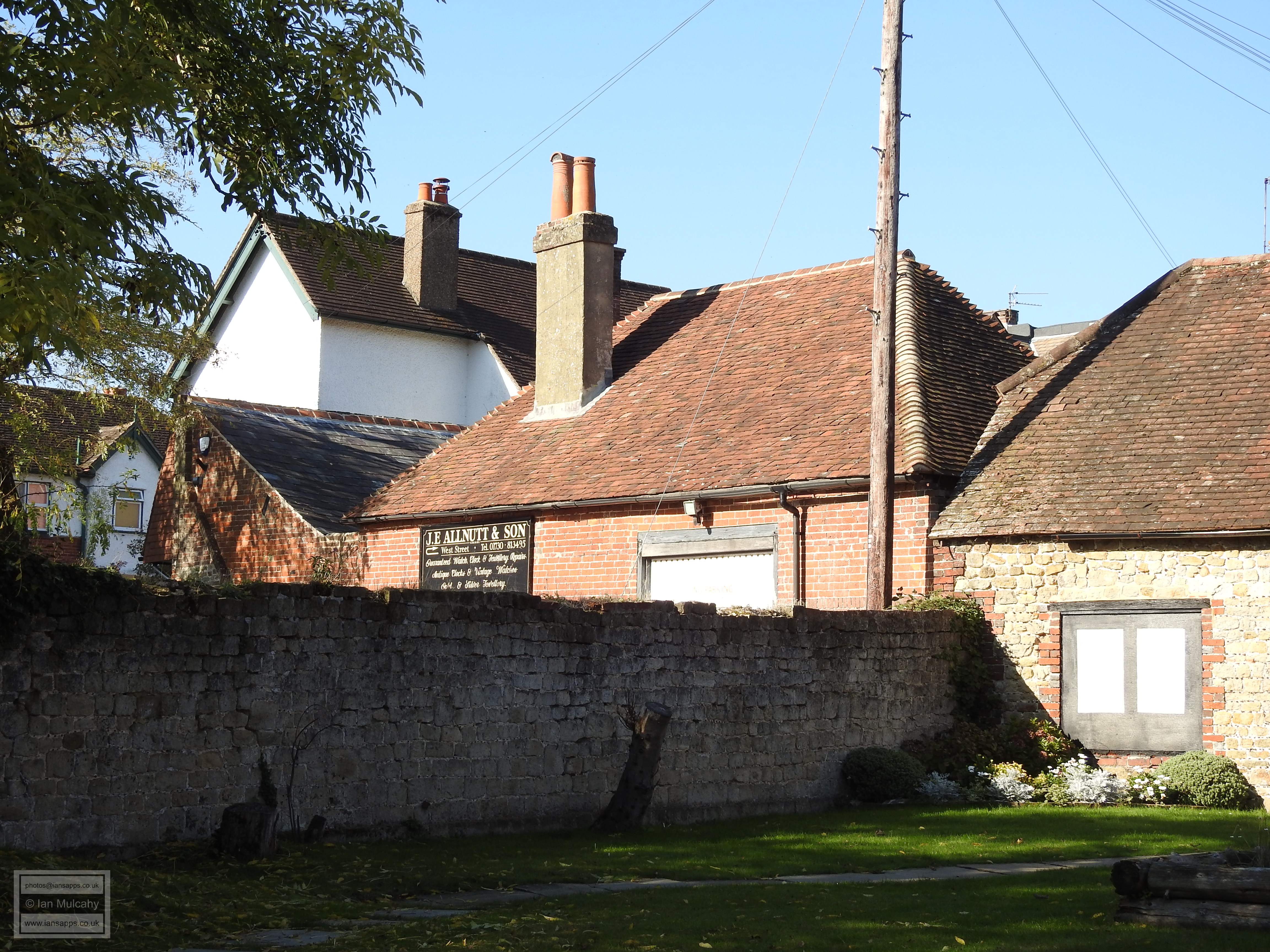
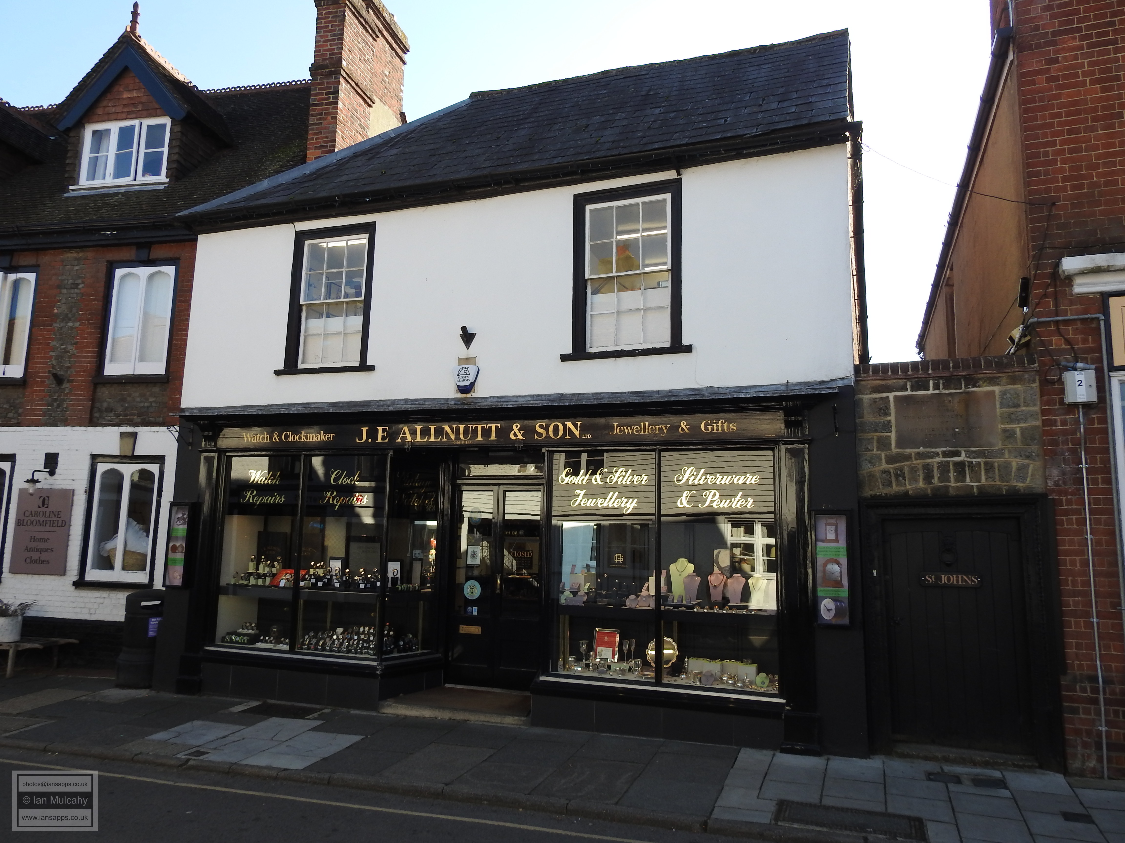
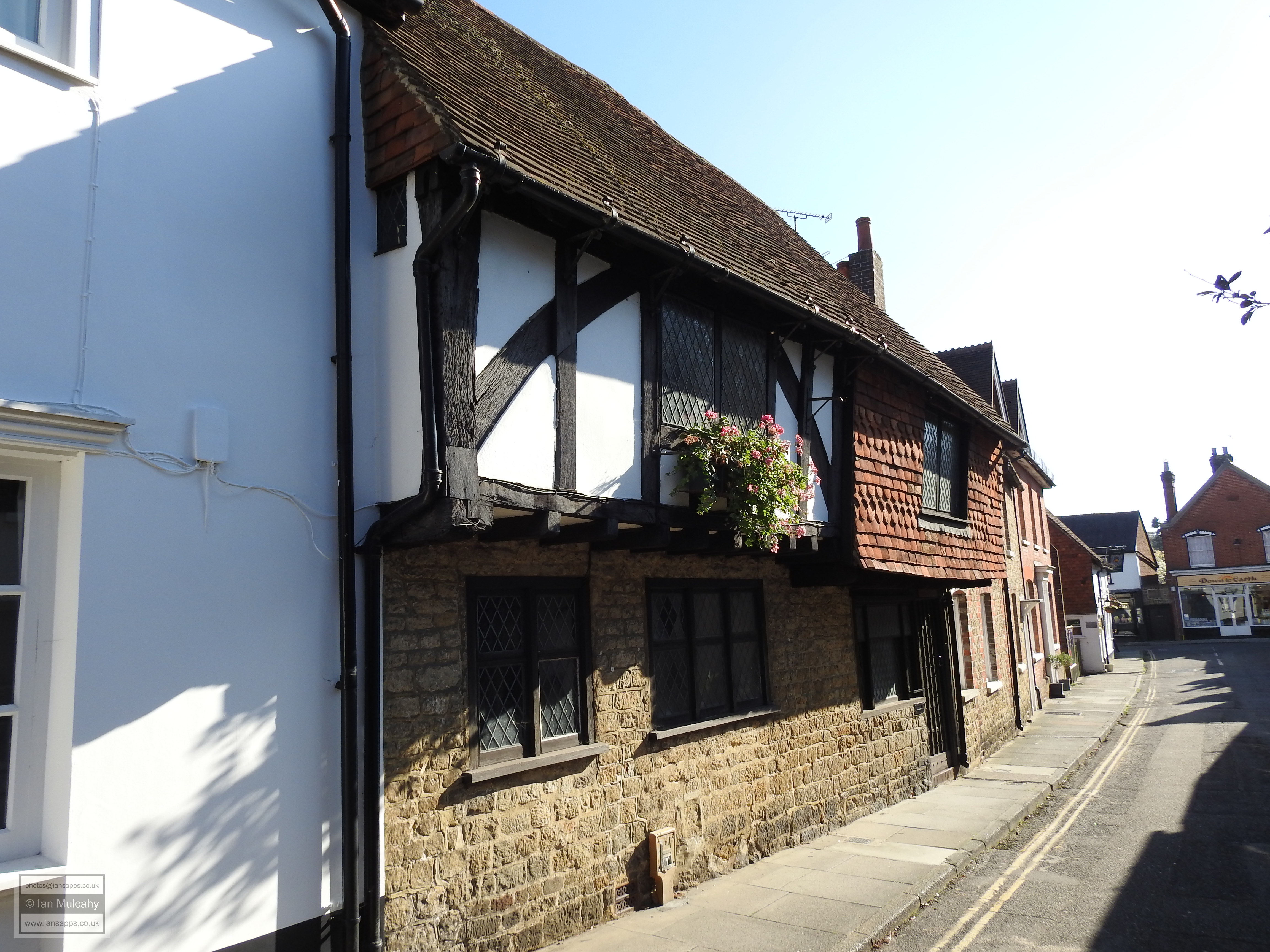
The oldest surviving building that was constructed on or outside of the Norman ditch is an old shop in West Street known as Richard Green. Outwardly, the rendered structure is unremarkable and the statutory listing dates it as 17th century, but the façade conceals an open hall building of the late 14th century. Almost opposite is J E Allnut & Son, a small refaced 15th century house/shop.
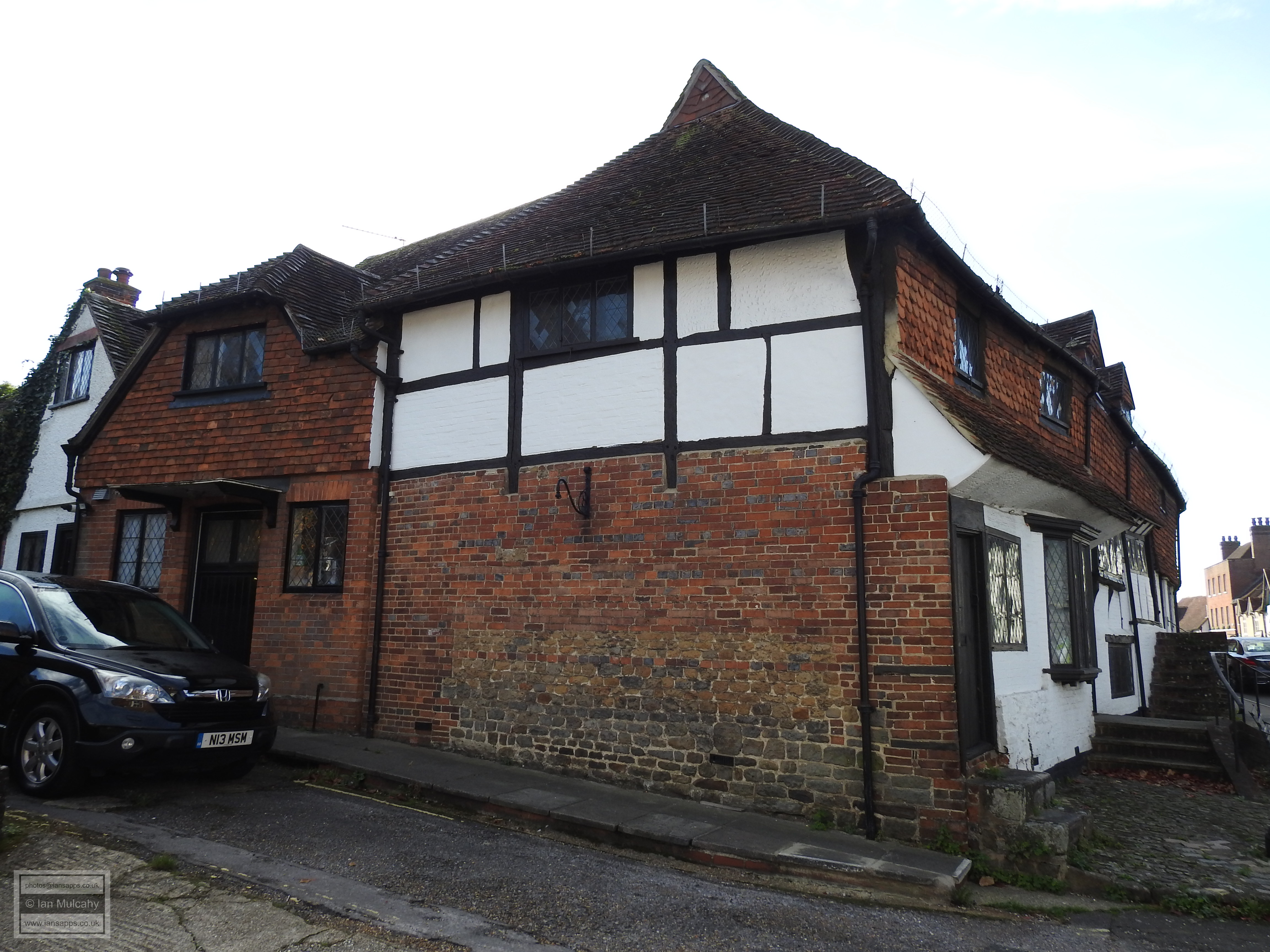
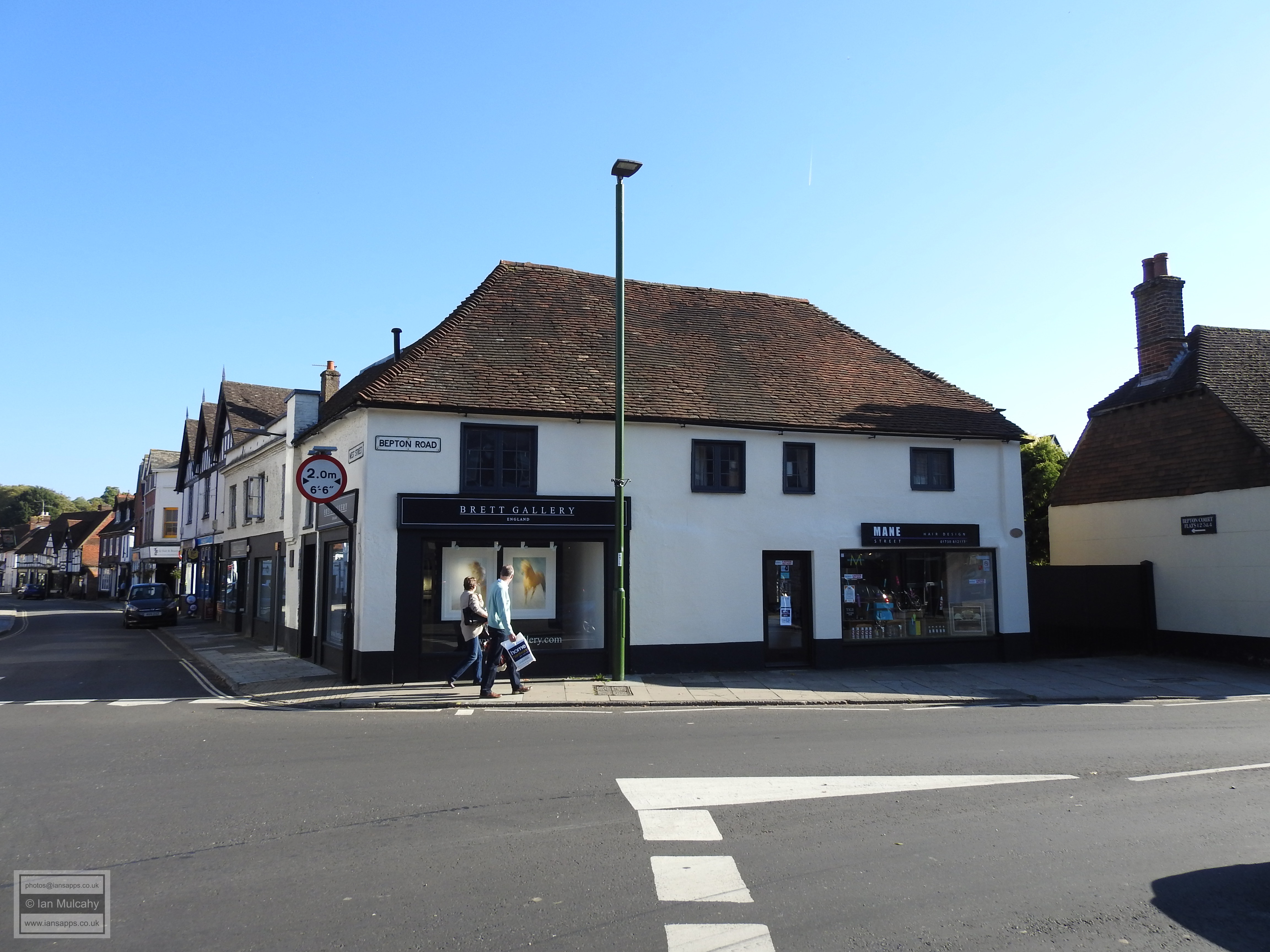
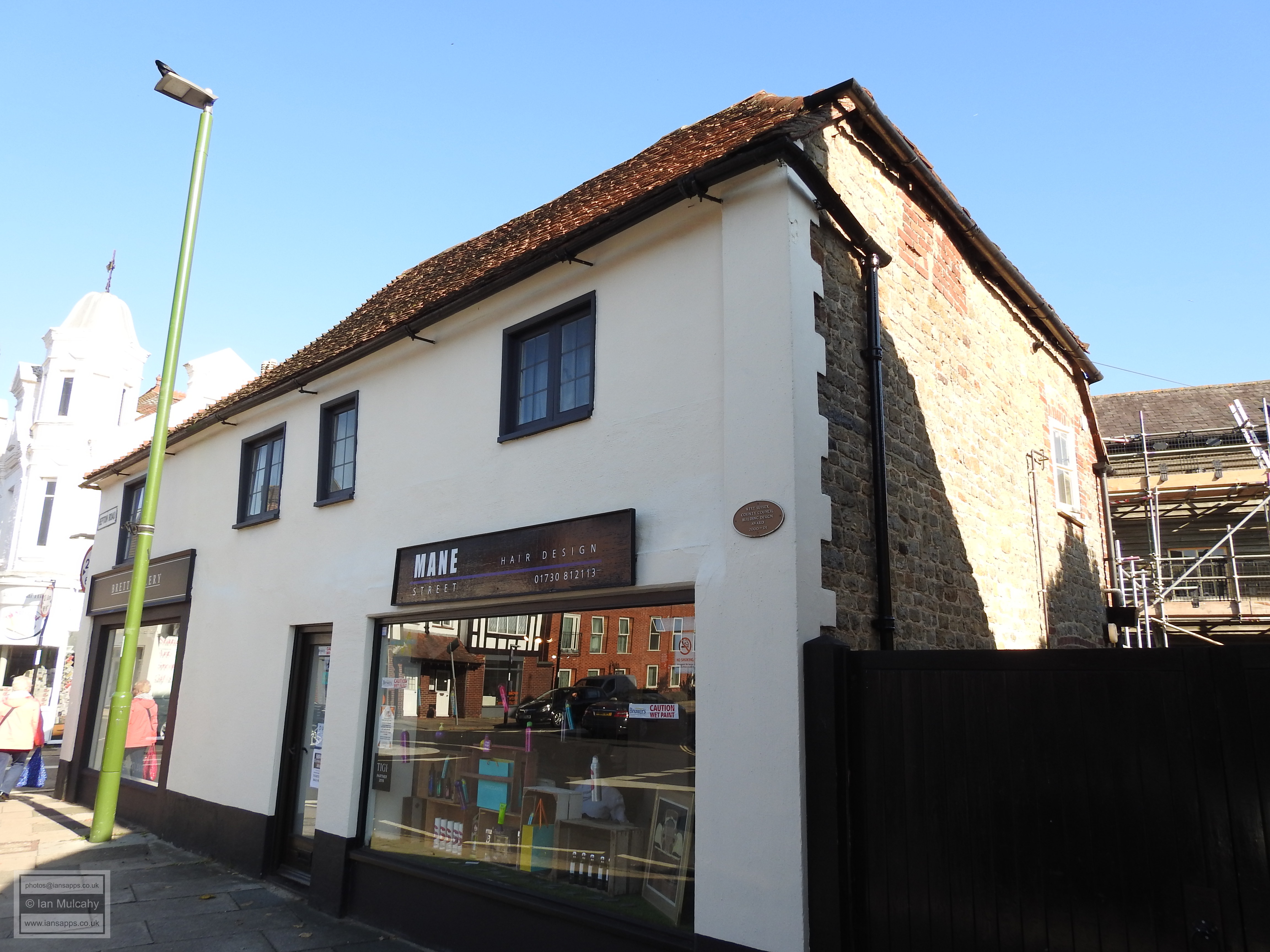
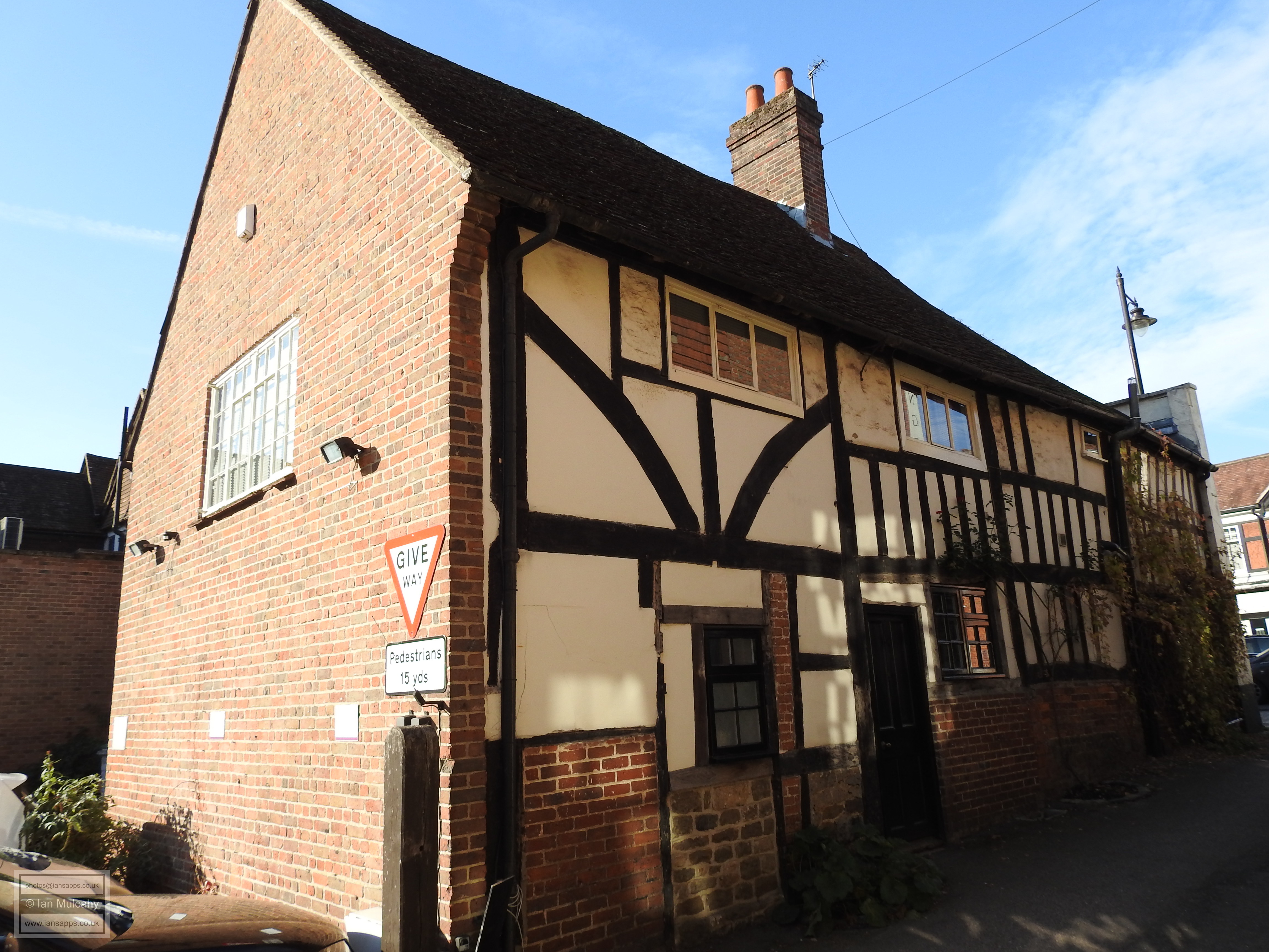
At the end of West Street on the south eastern corner of the junction with Bepton Road and just outside of the confines of the secondary market, is Bepton Court. The western range, fronting Bepton Road and shown in the photo, is an open hall house of the early 16th century with the eastern range on West Street being added in the late 16th century. This is another building which has been well disguised under painted masonry and render, but the distinctive shape of the hipped roof betrays its age.
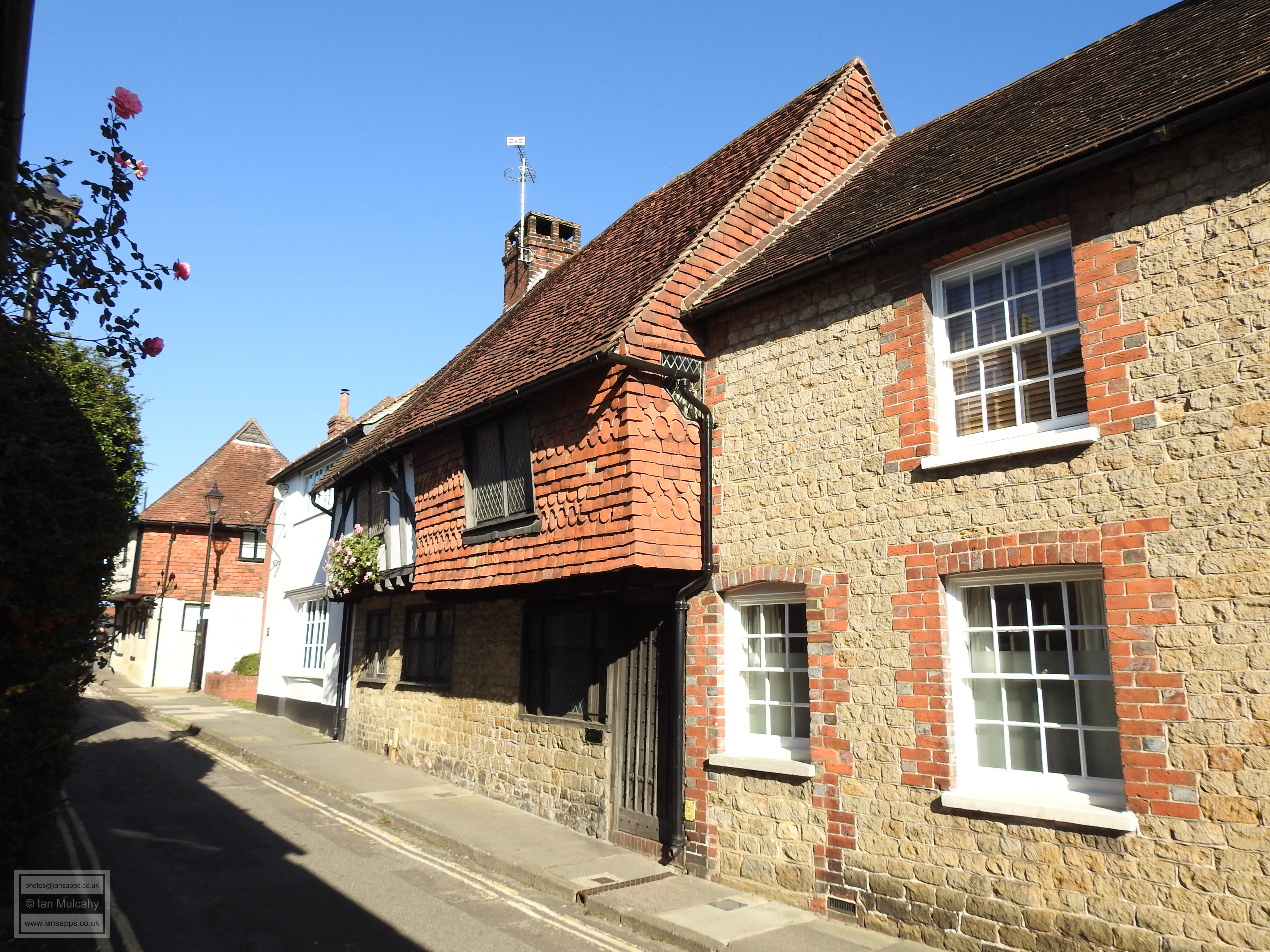
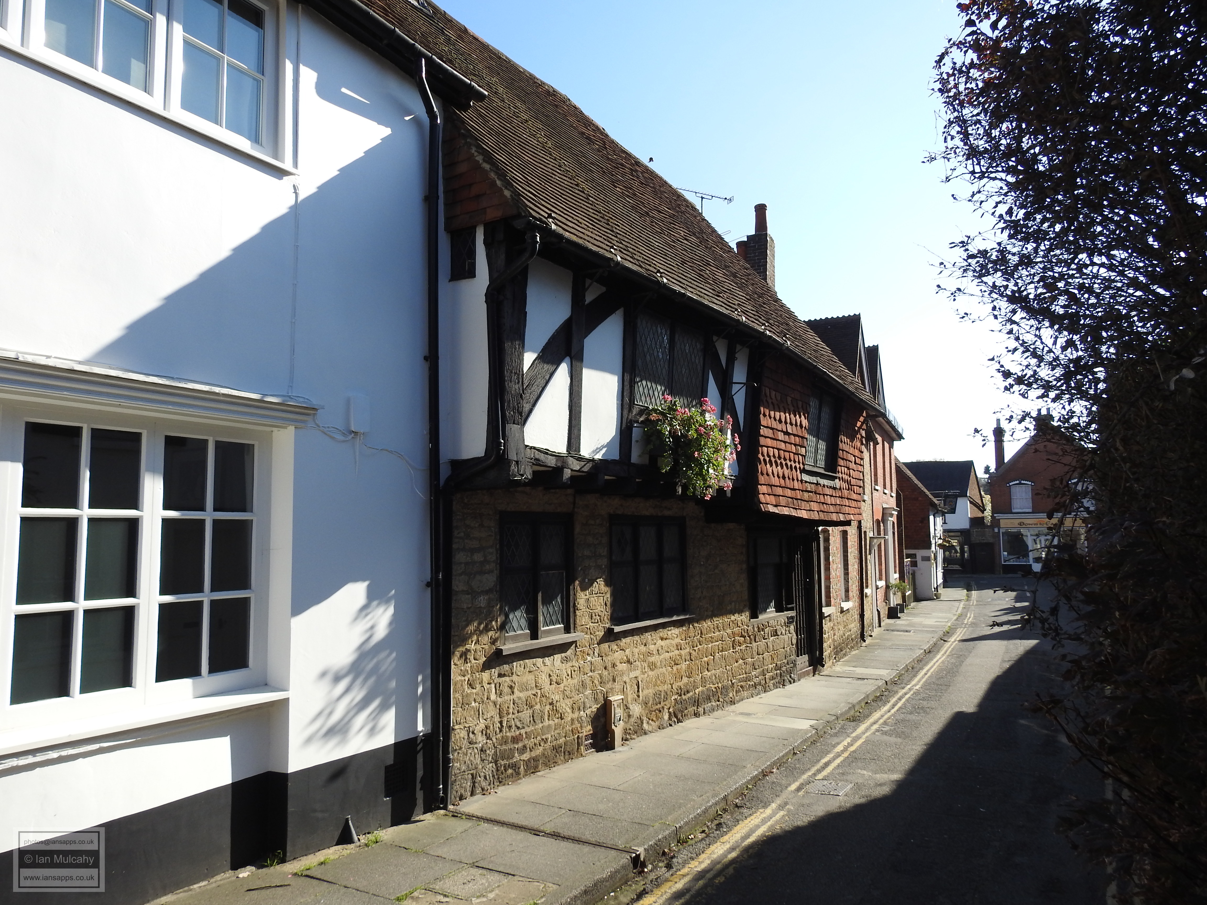
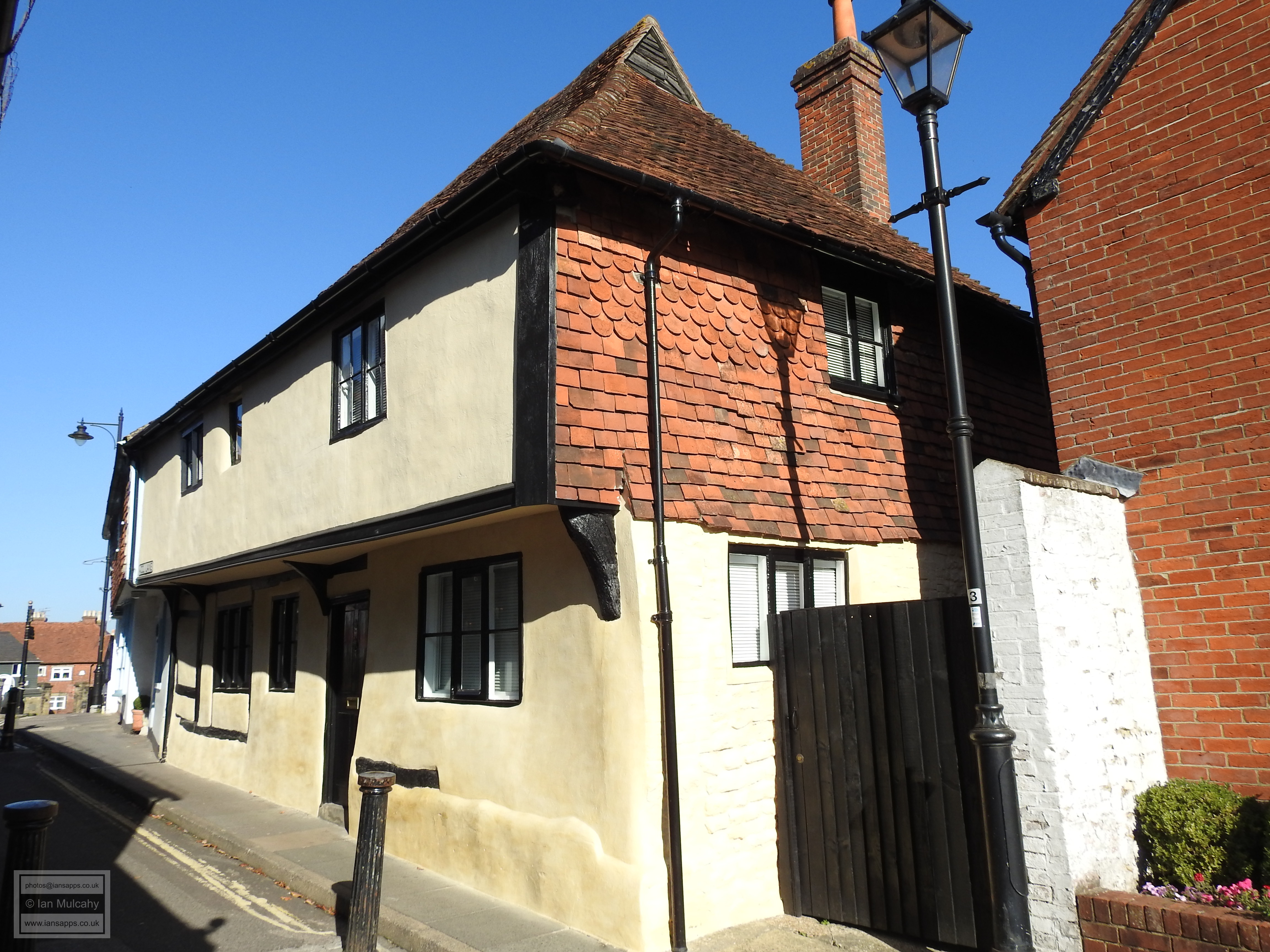
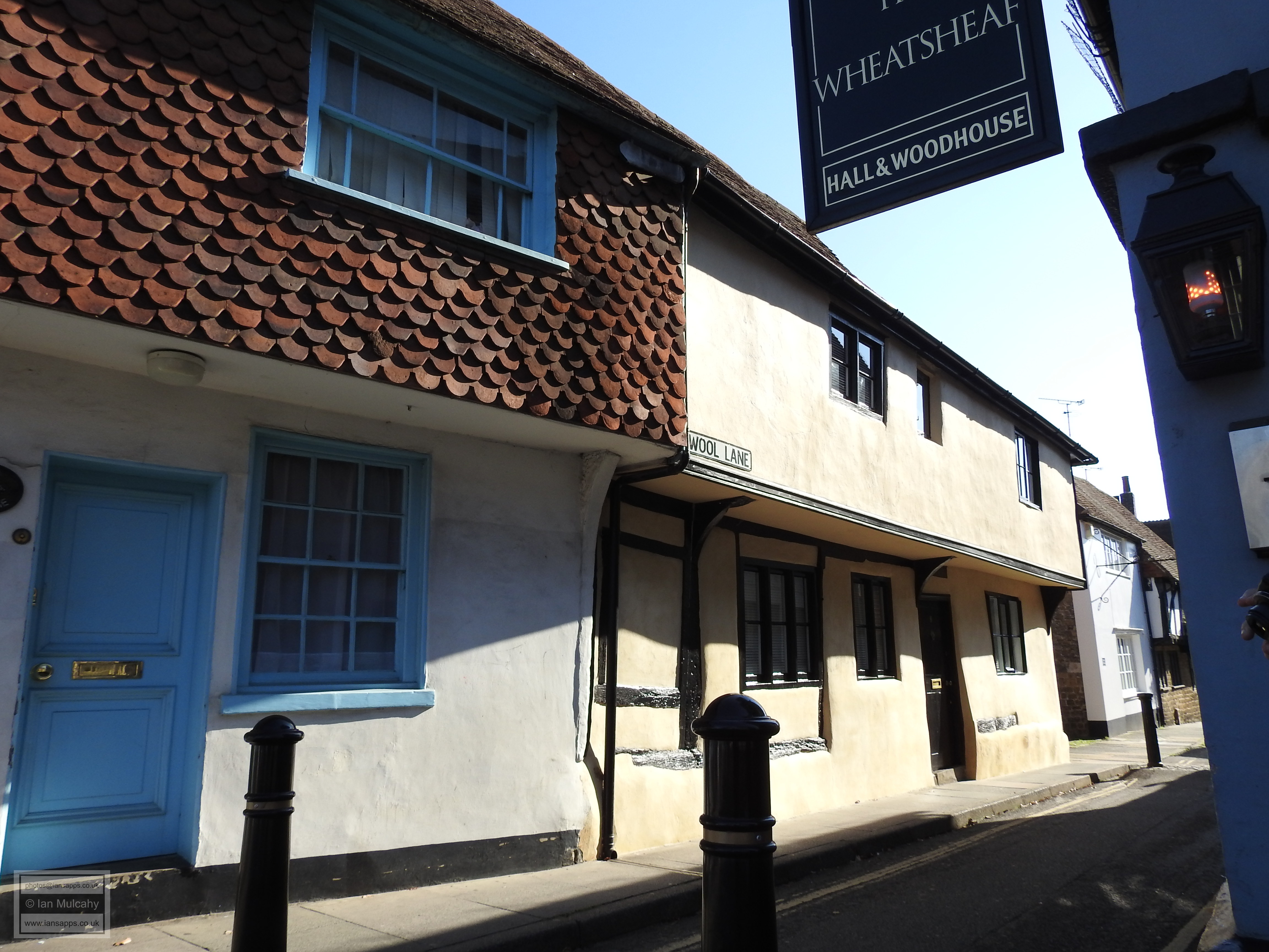
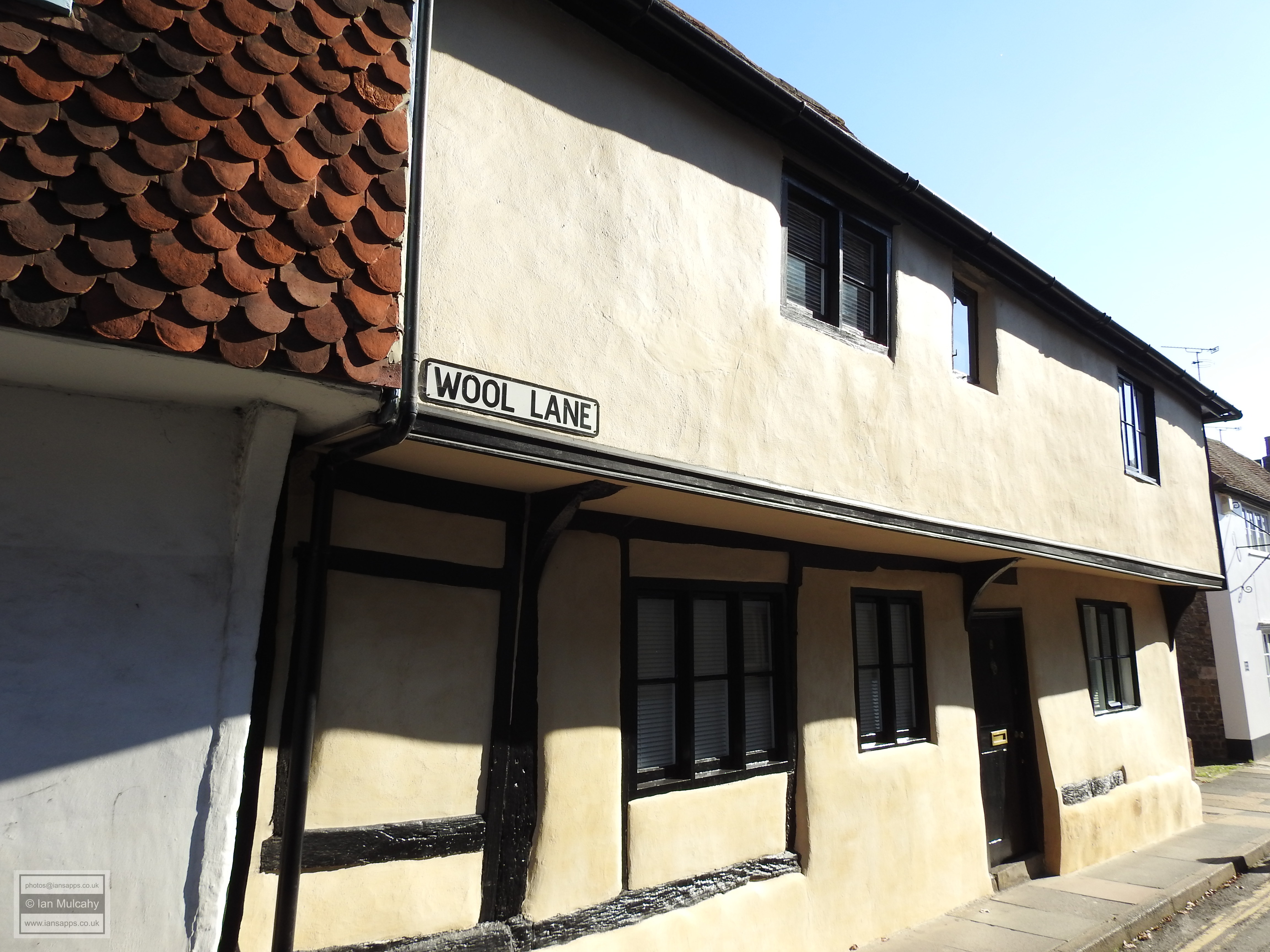
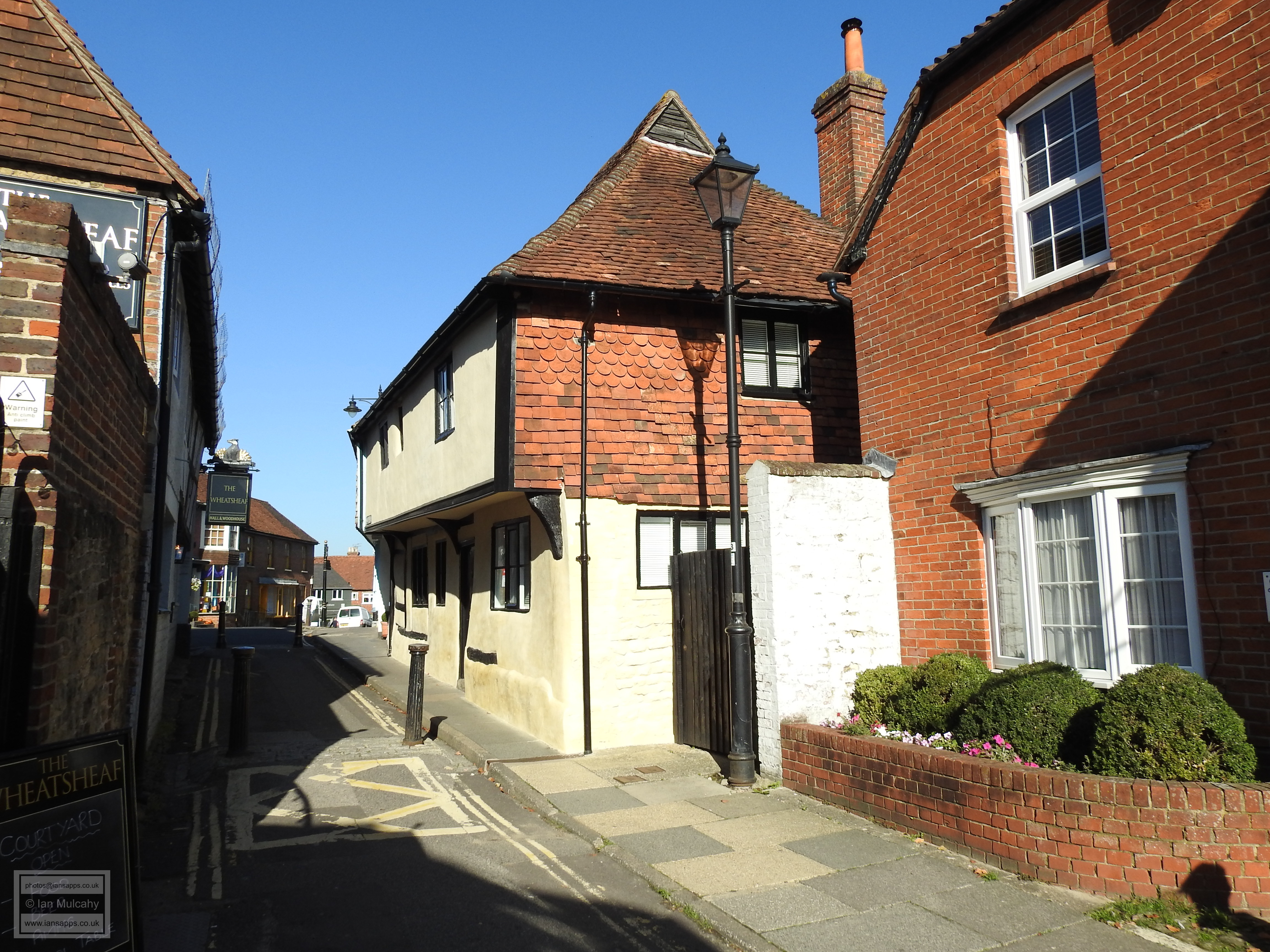
A short way back along West Street, is Wool Lane and in the burgage
plots to the east of the road can be found Wool Cottage
and 3 Wool Lane. Both are timber framed houses of
probable 16th century origin and both can boast a full length jetty.
The timbers are still visible on the upper floor of half of Wool
Cottage, whilst the other half is tile hung and the lower floor has
been rebuilt in stone. Number 3 has been plastered at the front,
though some timbers are still visible on the lower floor. Adjoining
3 Wool Lane is The Premises of Lamb & Glue, another
refaced old cottage, though this probably dates from the early 17th
century.
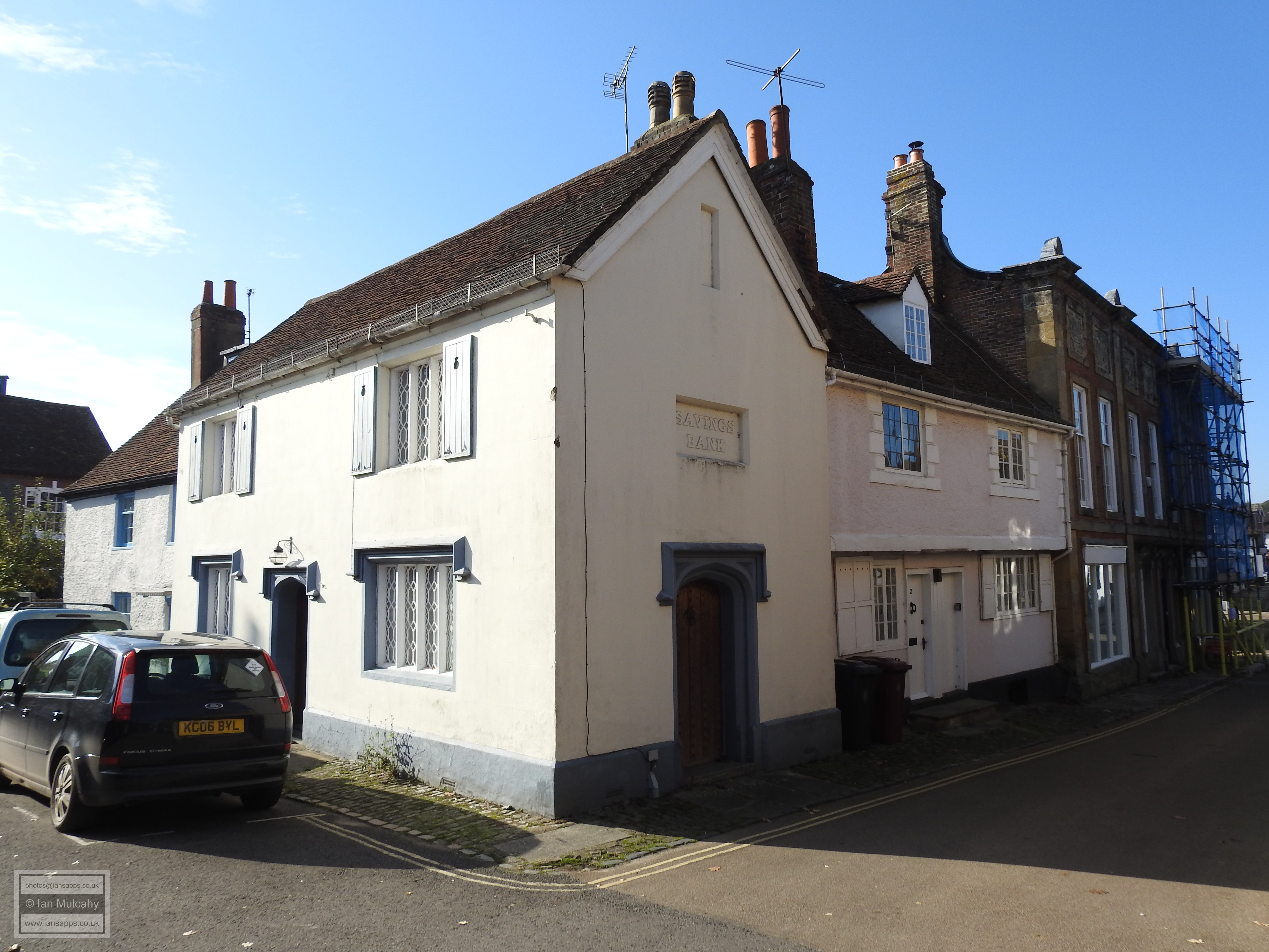
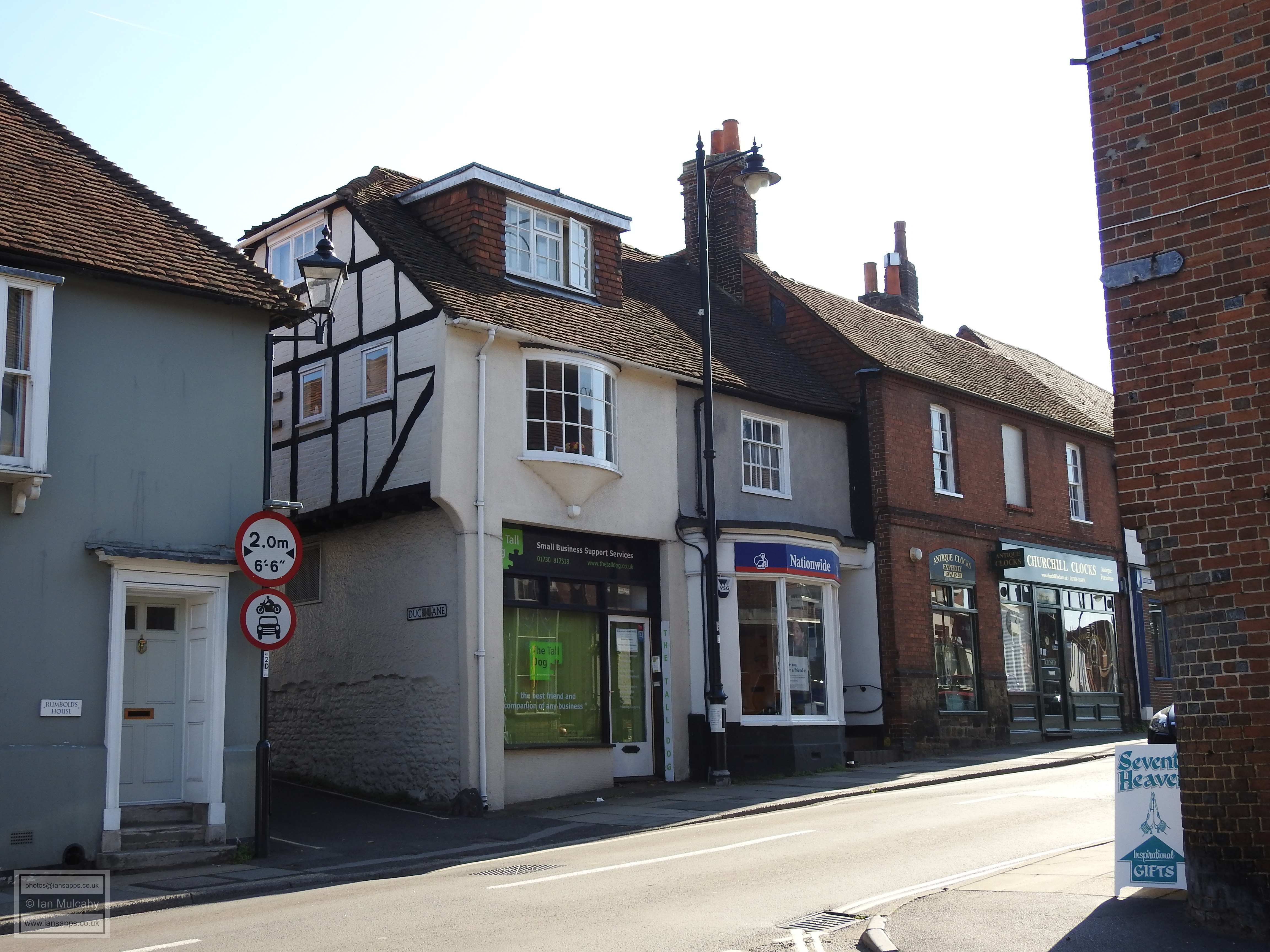
A little further north, on the corner of Duck Lane and next to the site of one of the original gateways into the old town is EJ Tomes Regency Building Society, a larger, and probable late 16th century, timber framed building that has suffered from considerable modernisation over the course of its 400 year existence, though the over sailing timber frame of the upper floor can still be seen on the Duck Lane side of the building. On the opposite side of Duck Lane is Rumbolds House, another extensively modernised building whose 19th century exterior offers no clues to its true age except, in common with Bepton Court, the shape of its hipped roof which suggests that it too dates to the early to mid 16th century.
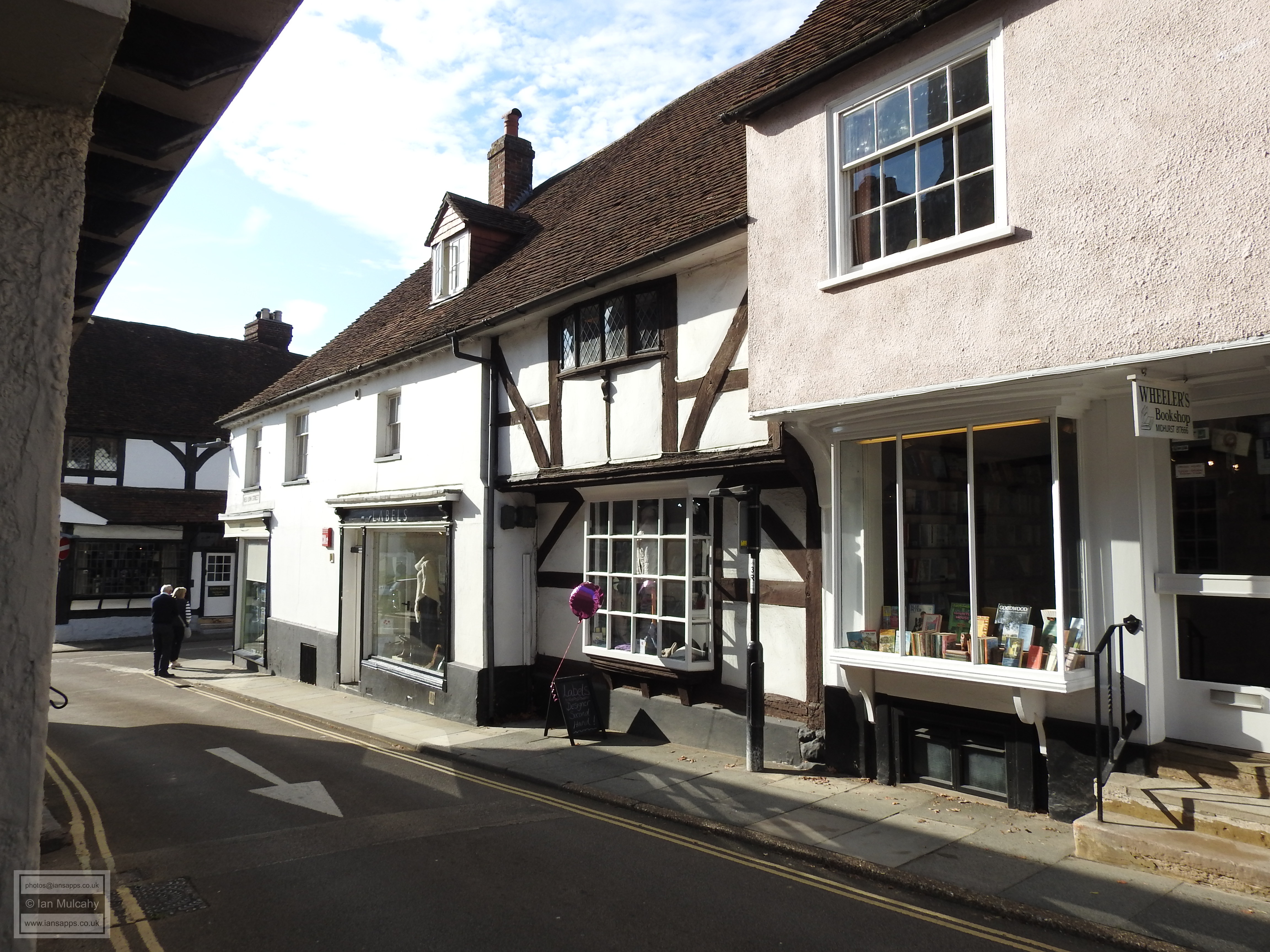
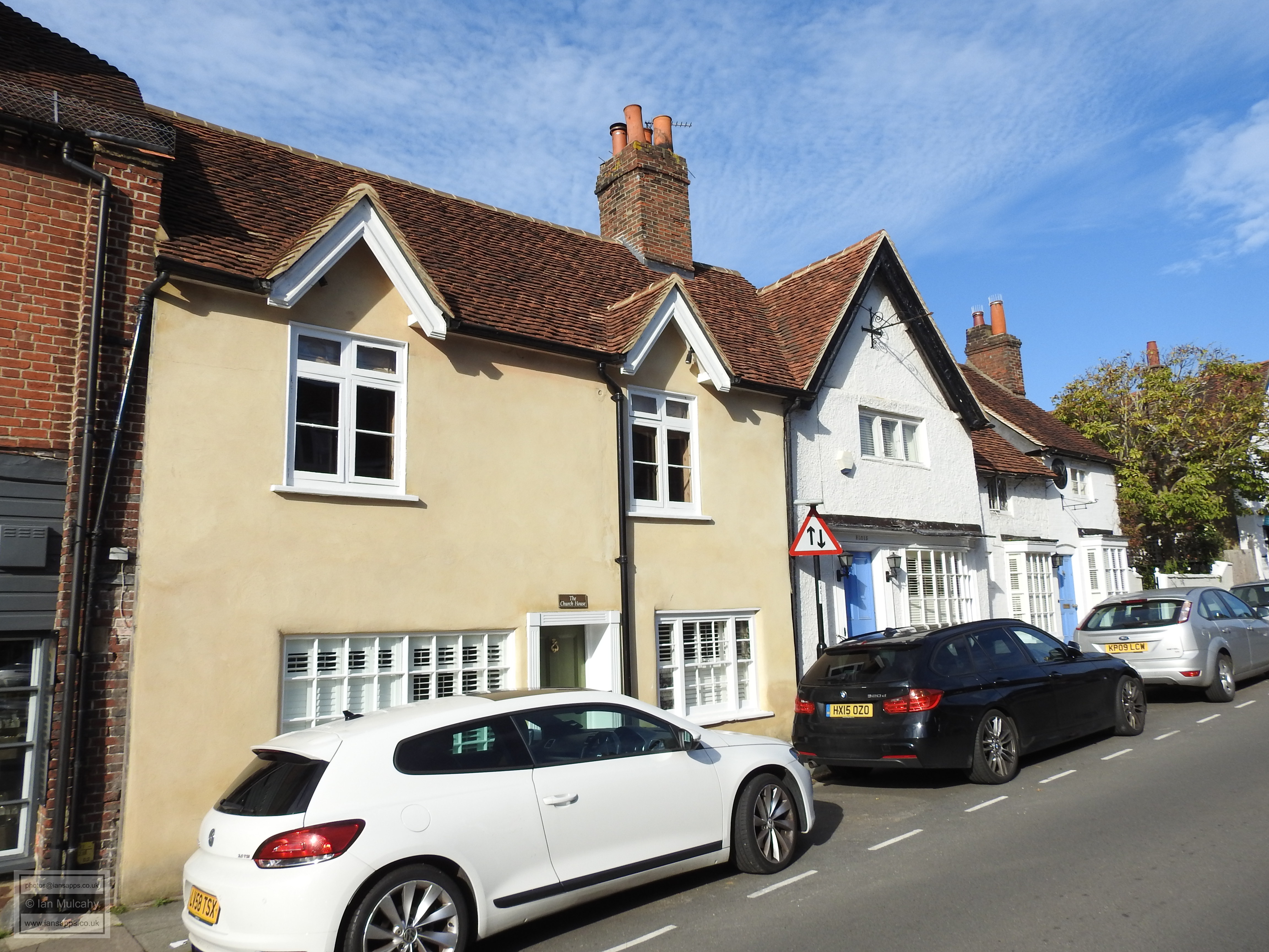
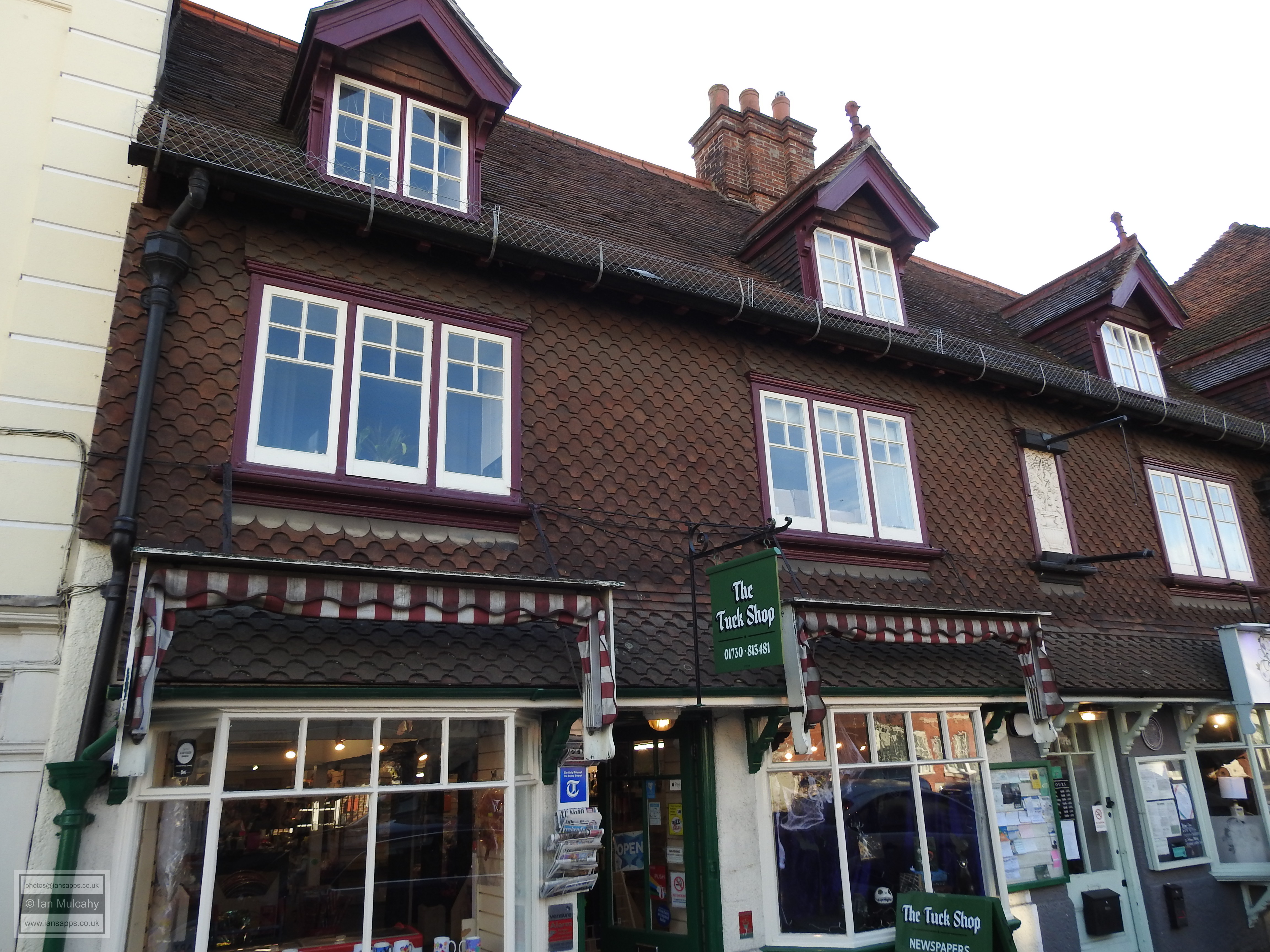
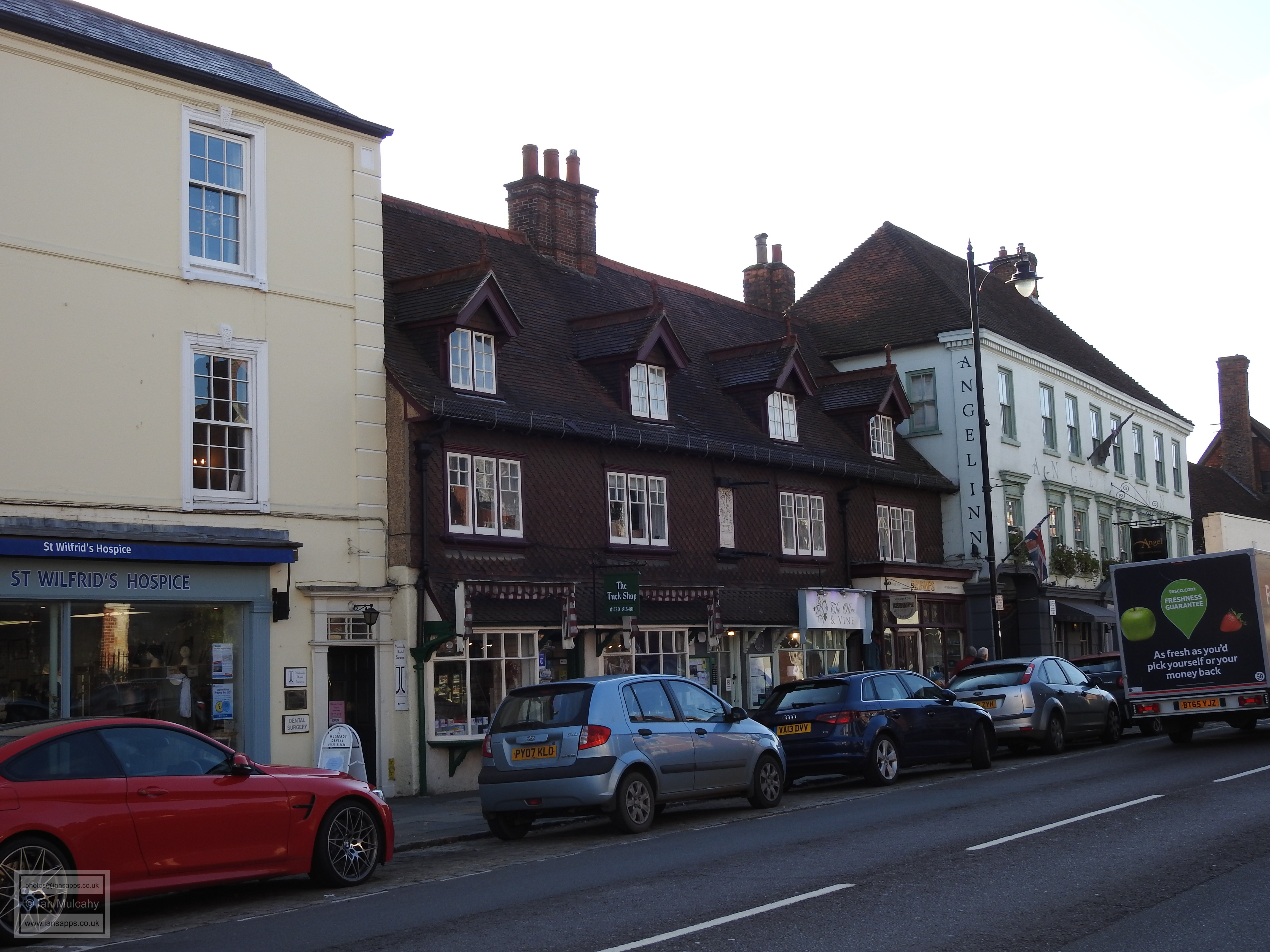
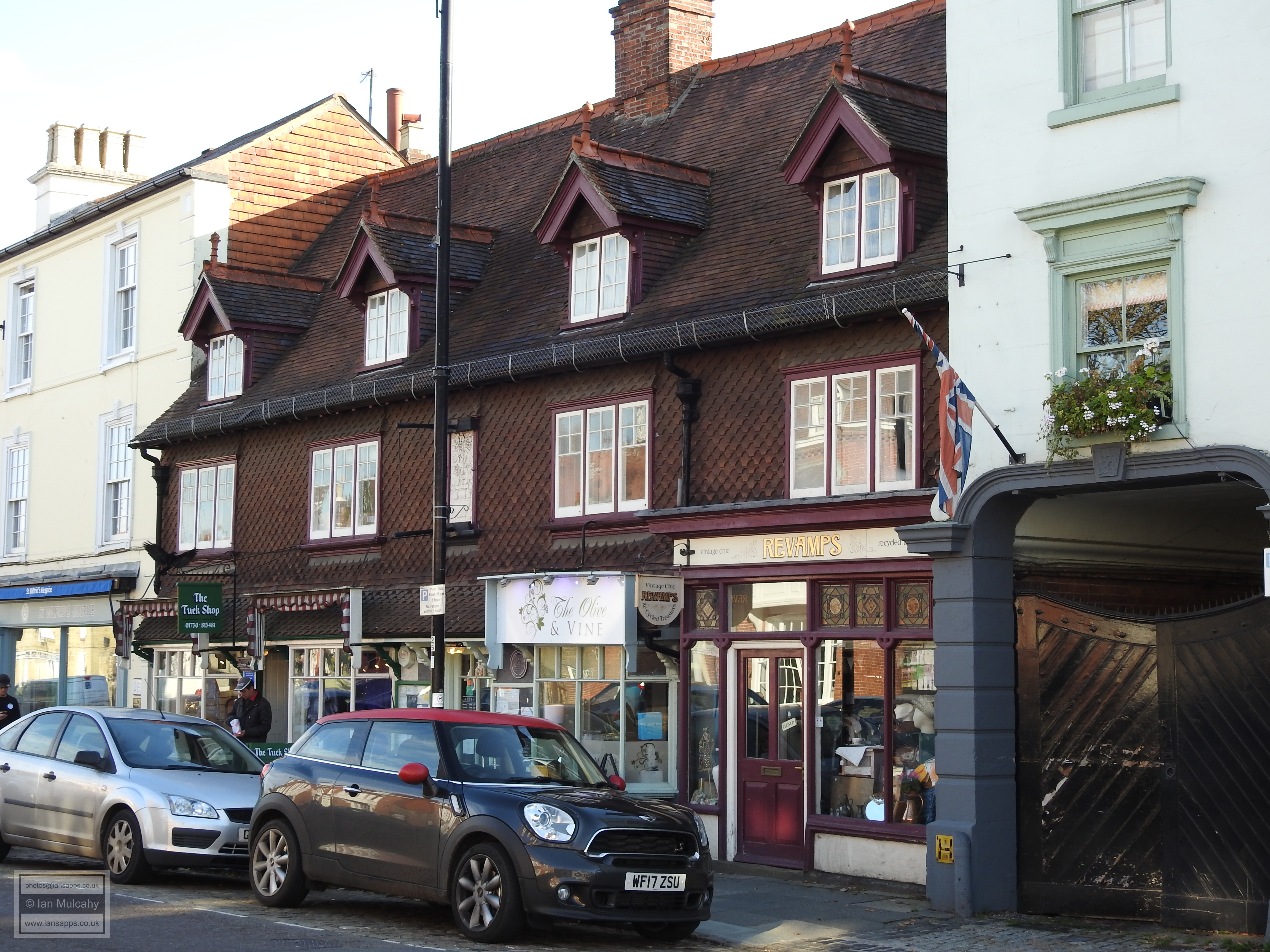
A further 50 metres north and we arrive at the junction of Knockhundred Row and North Street and the site of the third market opens up in front of us as the street widens considerably. Not much survives from the Tudor era here, but a little further north, on the corner with Angel Yard, is a building known as Tudor View. The street frontage is an 18th century Georgian addition, but look behind, in Angel Yard, and you will be rewarded with a substantial timber framed building of the 16th century. To the north of the Angel Hotel is The Tuck Shop which has the external appearance of an early 20th century building, but the tile cladding hides a substantial 16th century timber framed shop. The central chimney was inserted early in the 17th century and wall paintings from c.1600 survive inside. The author HG Wells lodged at the Tuck Shop whilst employed as a teacher at the nearby Grammar School in 1883/4.
Our final Tudor era building in Midhurst is a little further north and on the opposite side of the road at 65 North Street, a late 16th century or early 17th century building that has been refaced in painted brick, though some of the framing can still be seen in the north wall.
Sources:
Text & photographs © Ian Mulcahy. Contact photos@iansapps.co.uk or visit my 'Use of my photographs' page for licensing queries (ground level photographs only). |
pictures taken with |