Anderitum Roman Fort: The History of Pevensey & Westham
By Ian Mulcahy
|
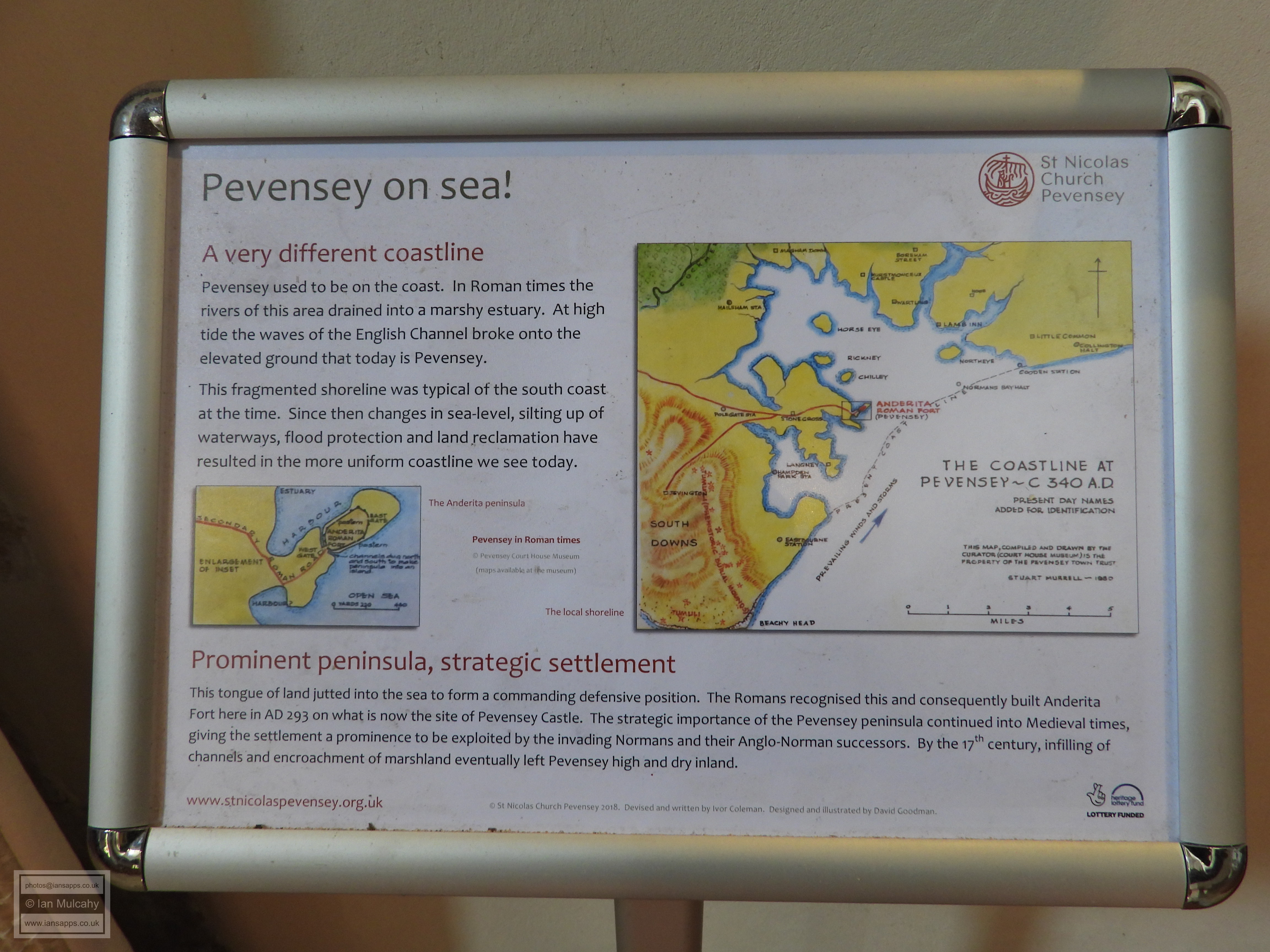
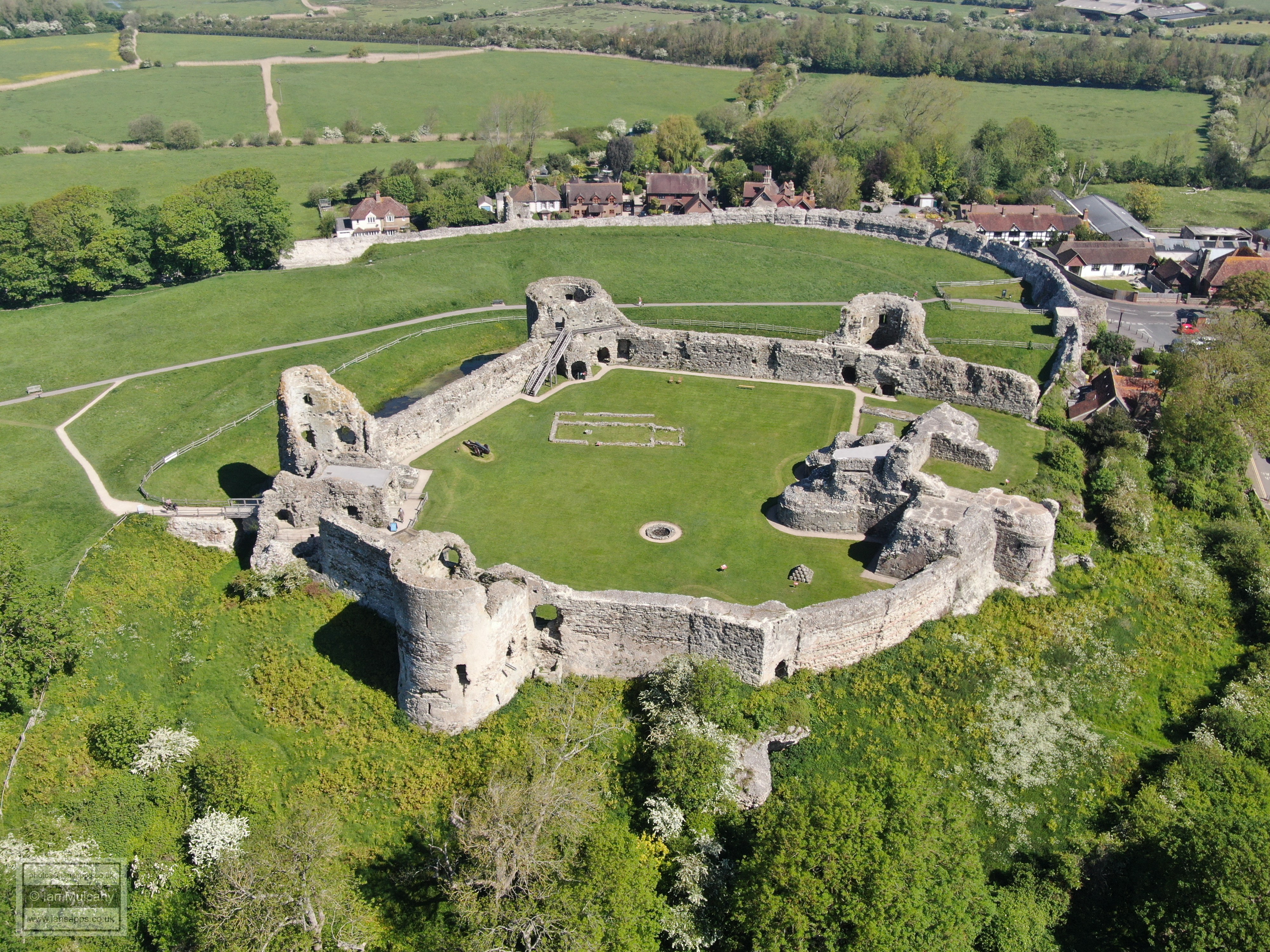
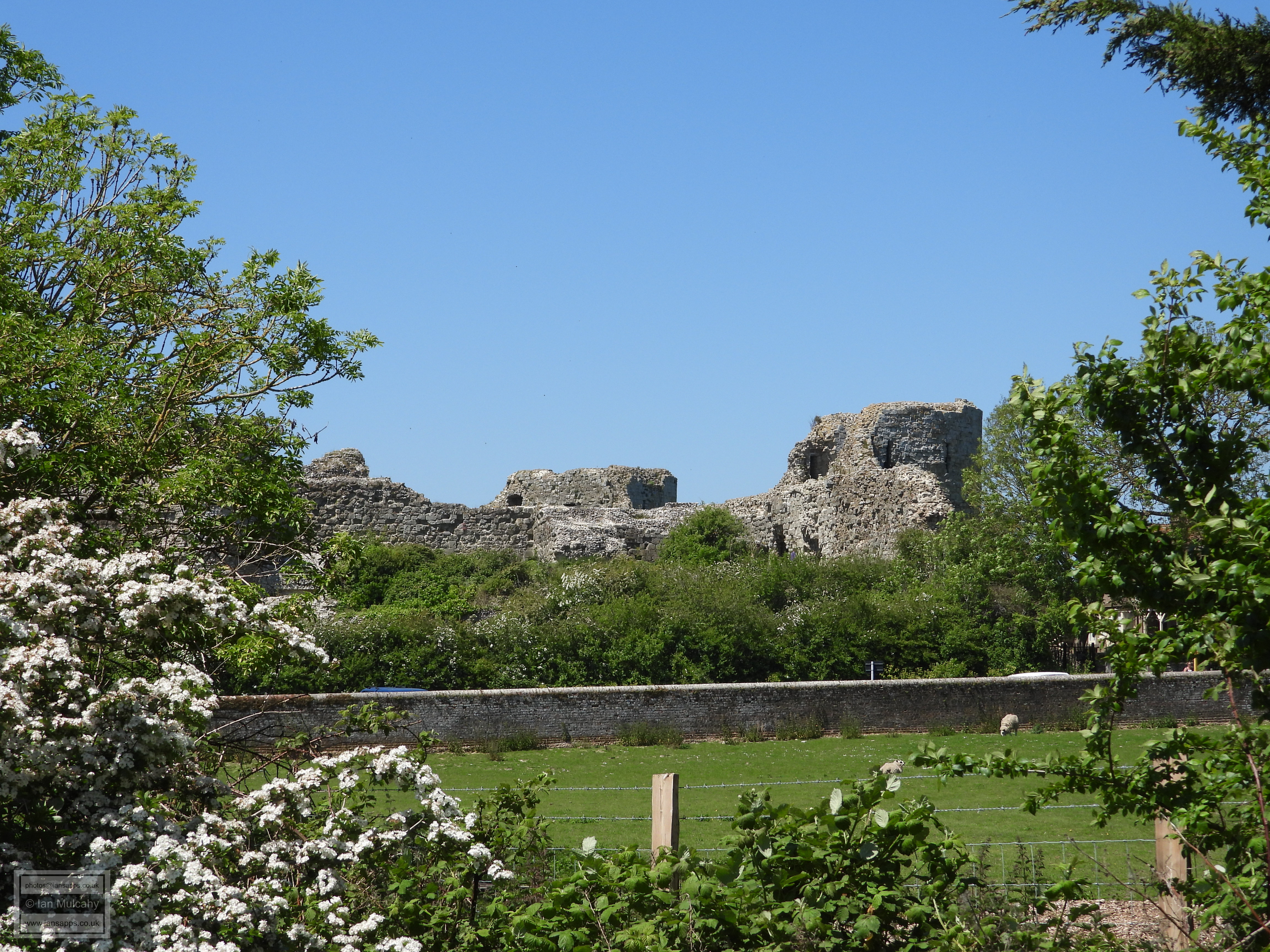
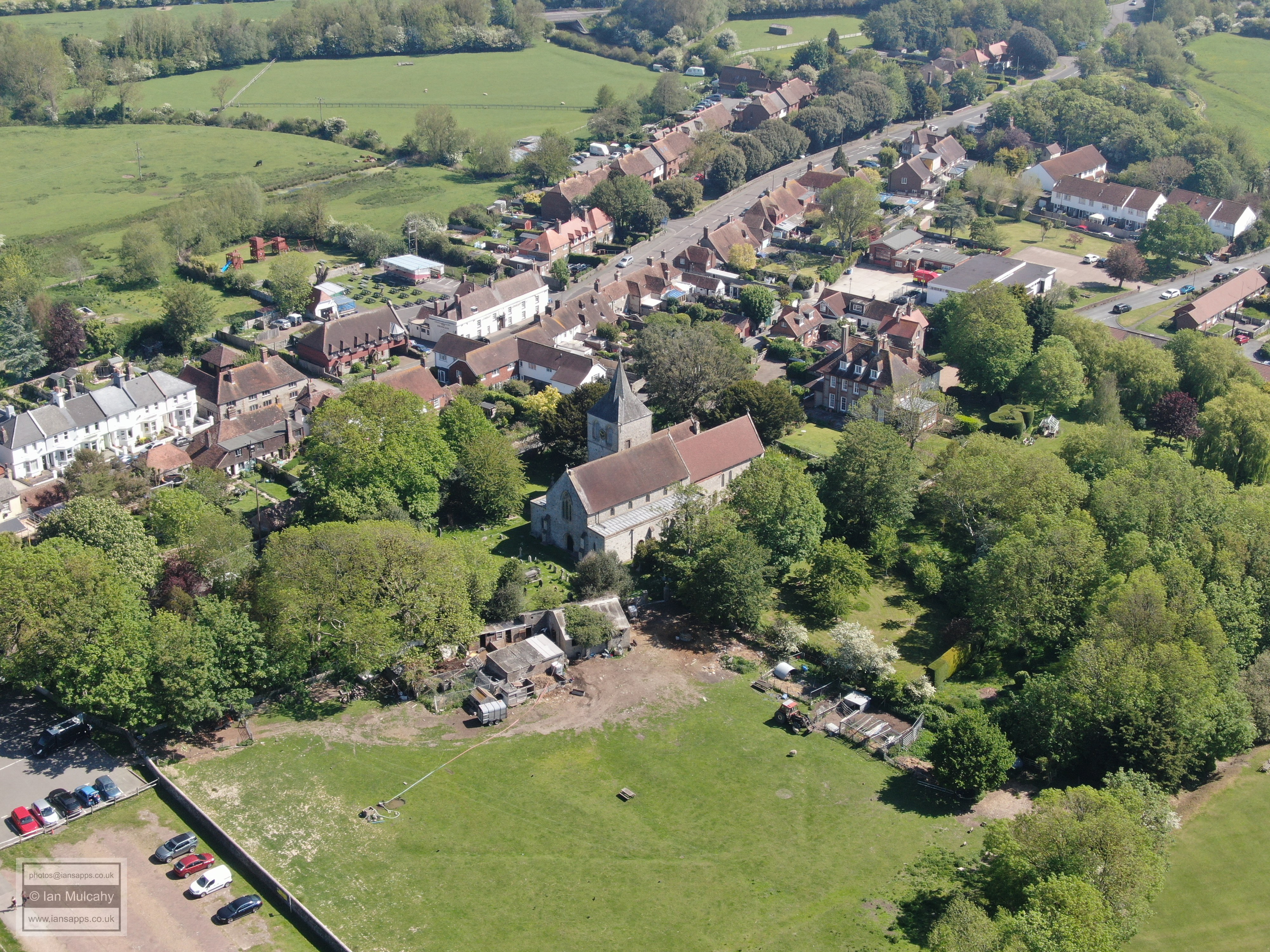
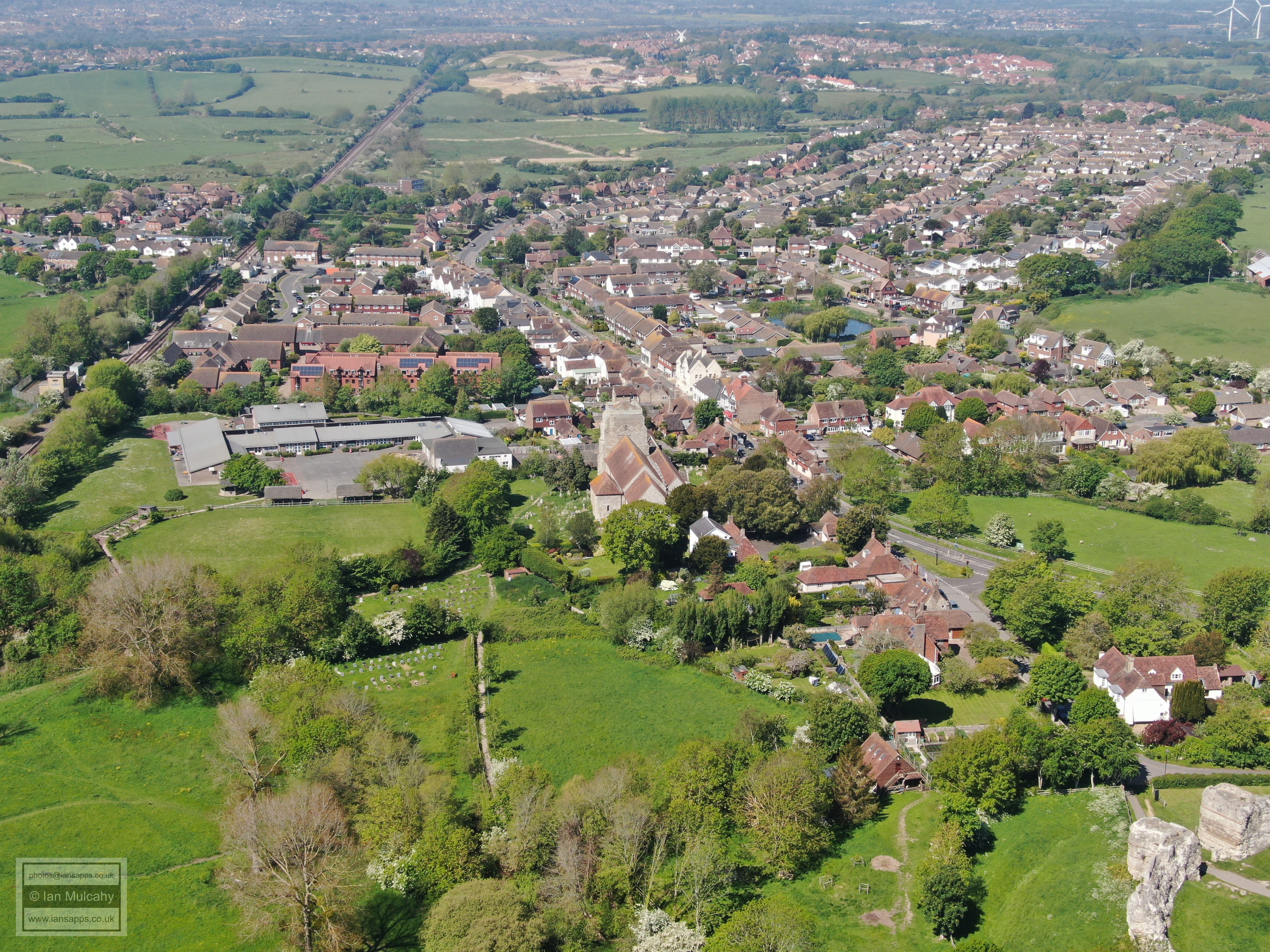
Pevensey is a small village (and larger parish) in East Sussex, close to Eastbourne, with little by way of evidence for pre-Roman settlement. The place suddenly became significant in the late 3rd century when the Romans built their fort of Anderitum on a natural clay and sandstone peninsular jutting out into what was, at the time, tidal marshland and a natural harbour which enclosed the fort on three sides. The area has now silted up and been reclaimed, leaving the fort landlocked west of the modern village and a mile away from the present shoreline. It's modern name is derived from Pefe Ie, Saxon dialect for the 'Island of Pefe'.
Anderitum is the only Saxonicum (‘Saxon Shore Fort’) in Sussex and is the largest of a string of nine such forts which were constructed along the eastern and southern coasts of Britain, from the entrance to The Wash at the top end of Norfolk to Portsmouth Harbour in Hampshire, to defend against Saxon raiders. It is quite possible that the build was originally commissioned by Carausius, the self-declared Emperor in Britain, to defend his lands after he revolted against Rome. Carausius was killed by his treasurer Allectus in 293 before the fort was completed and Allectus himself was subsequently killed in 296 when Emperor Constantius Chlorus invaded in order to regain Britain for the Empire.
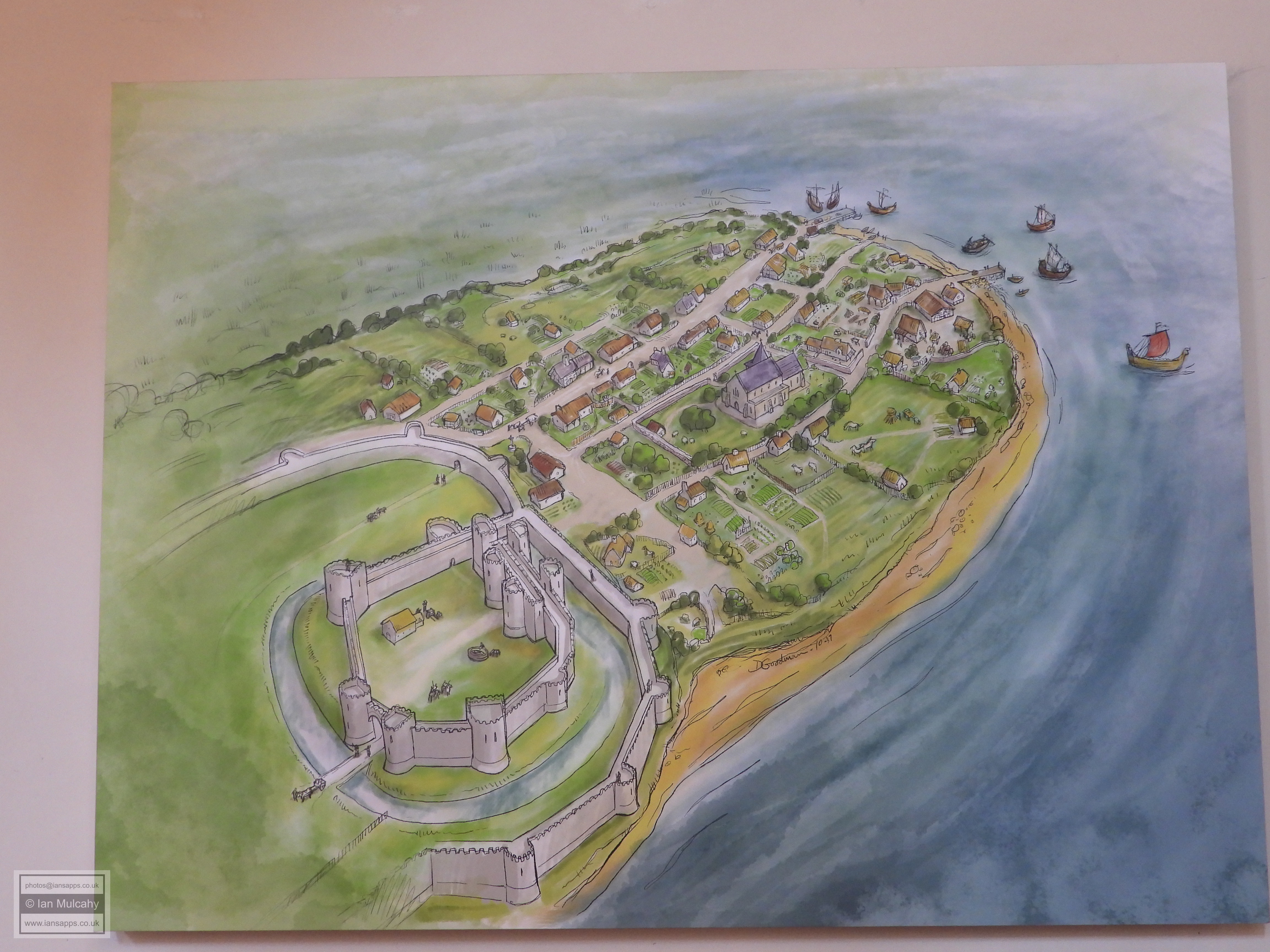
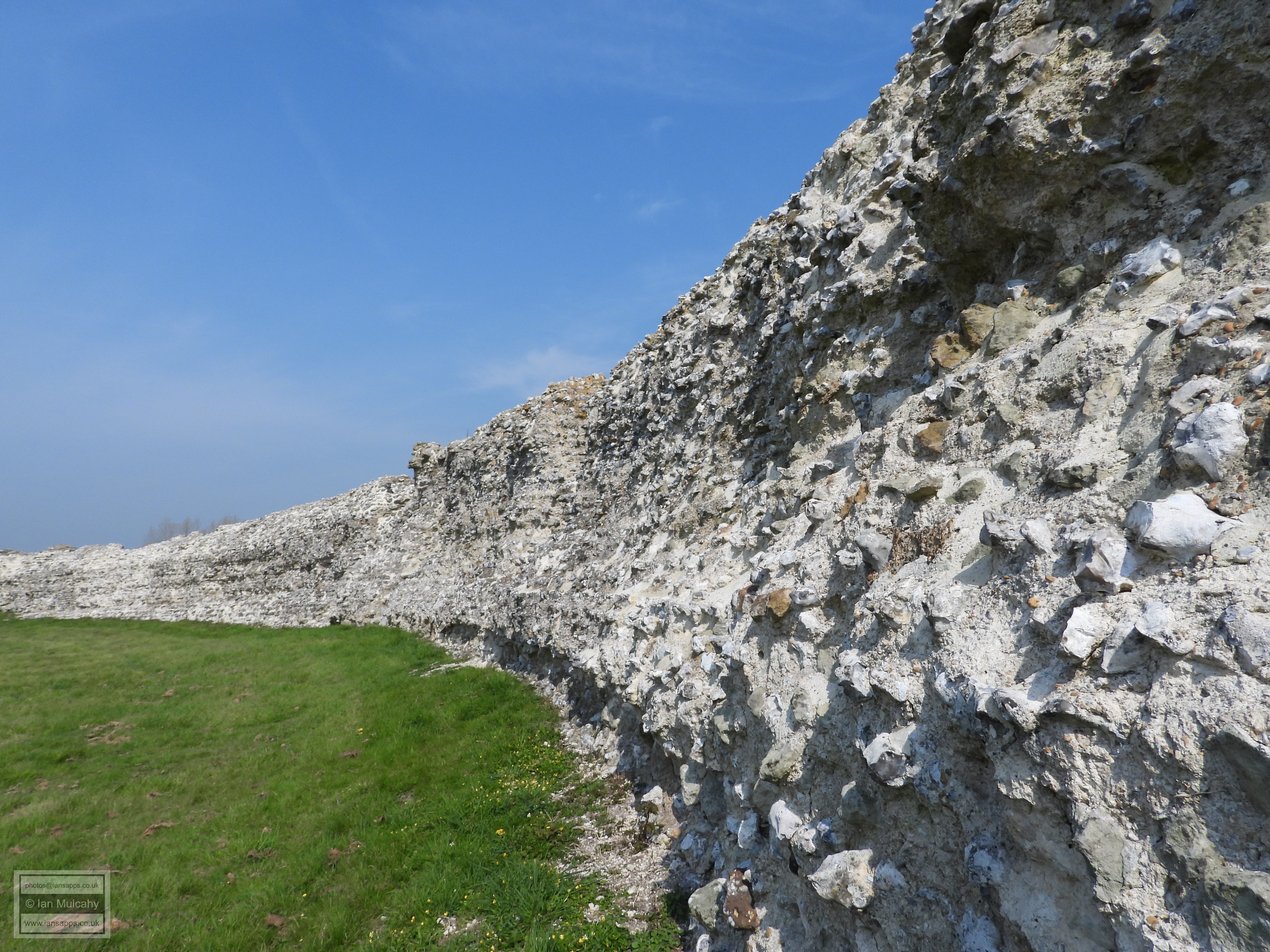
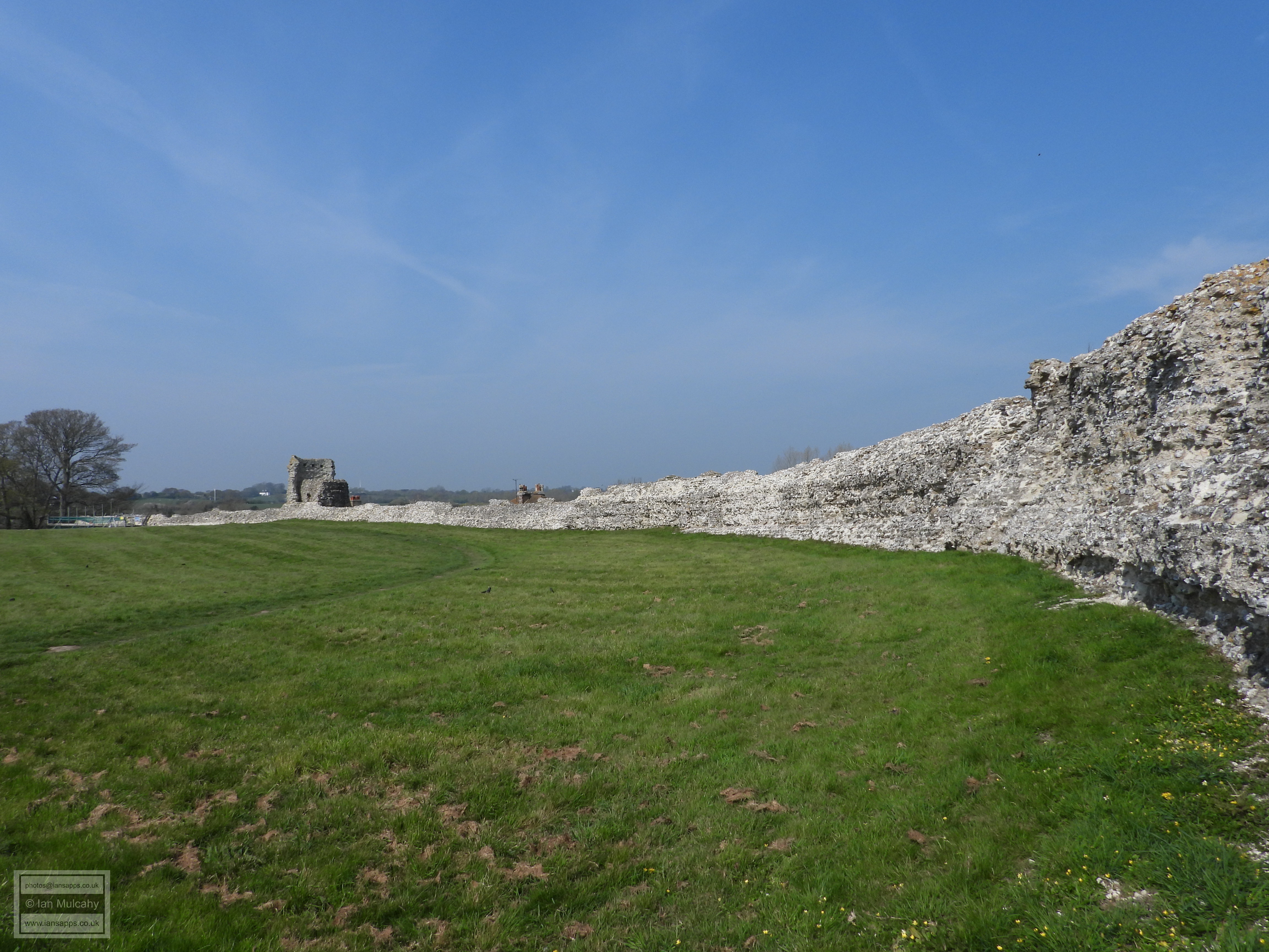
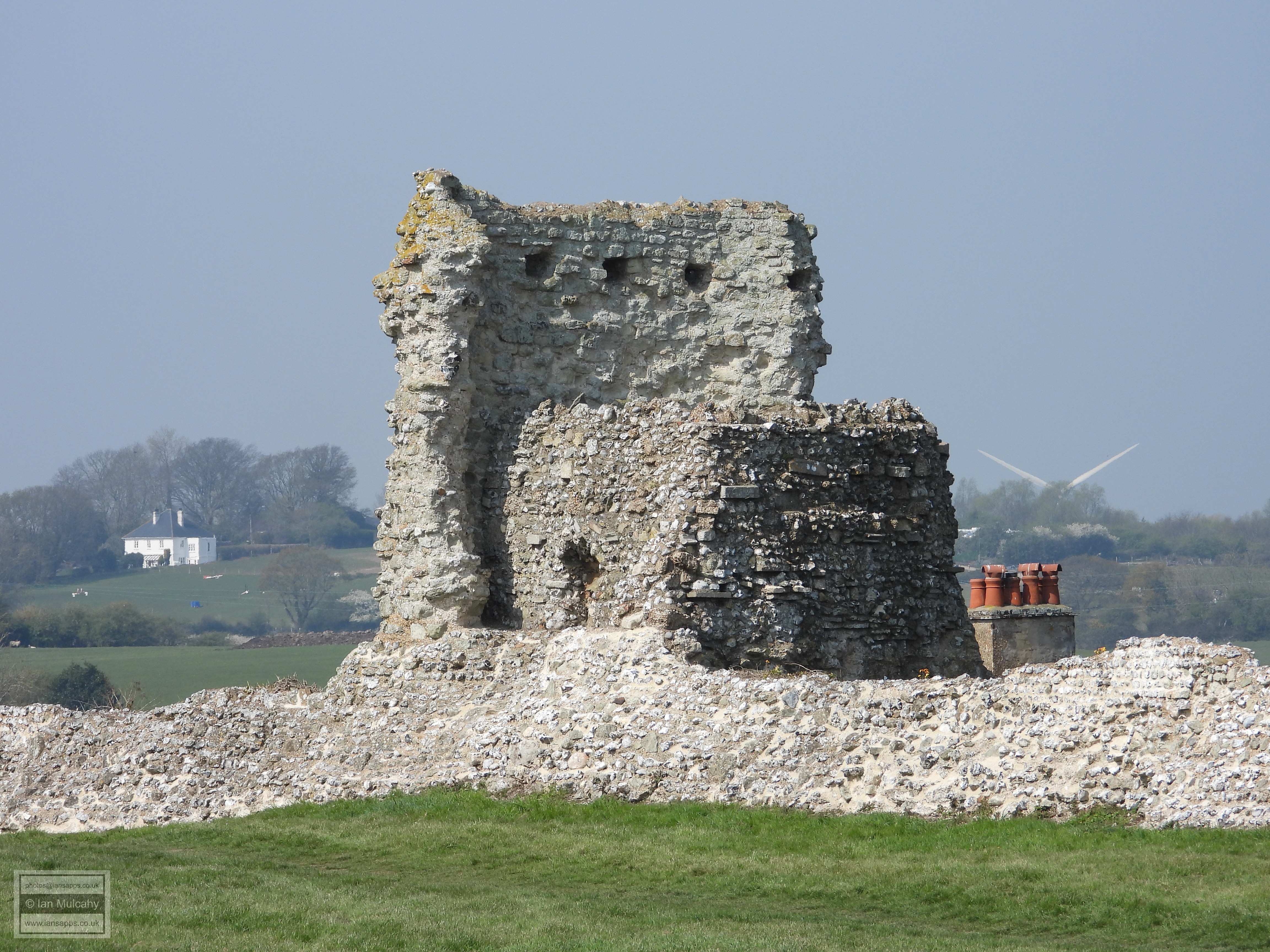
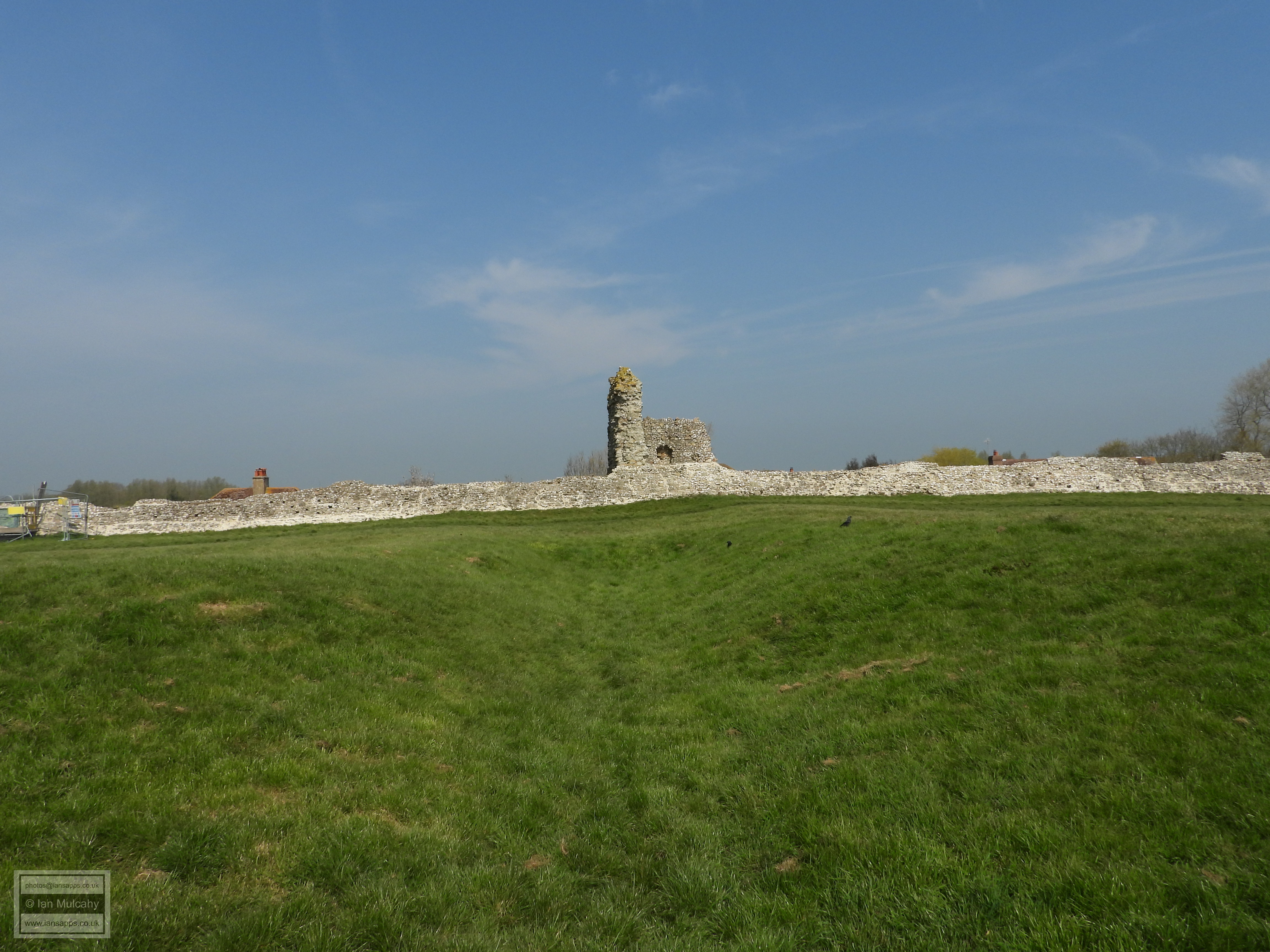
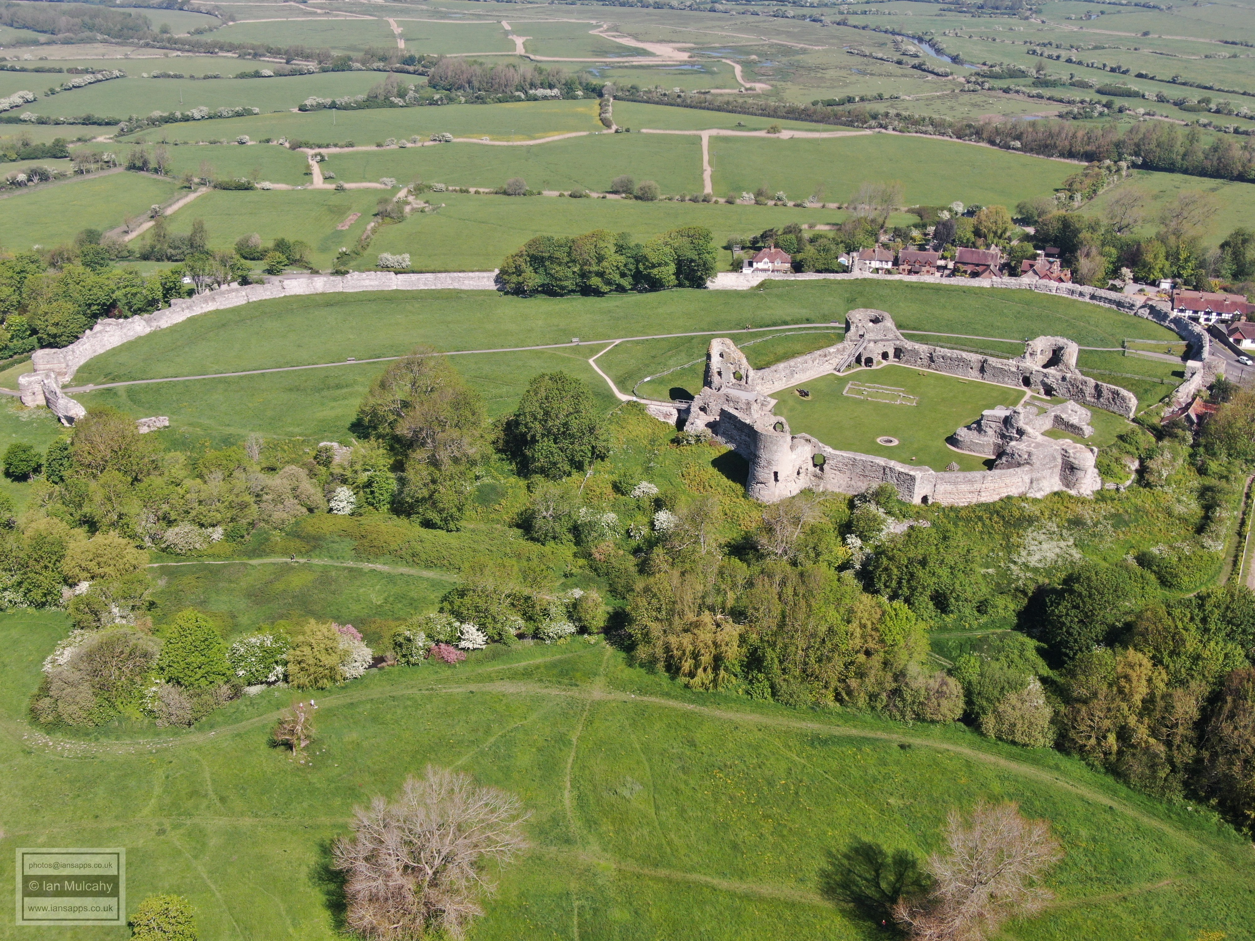
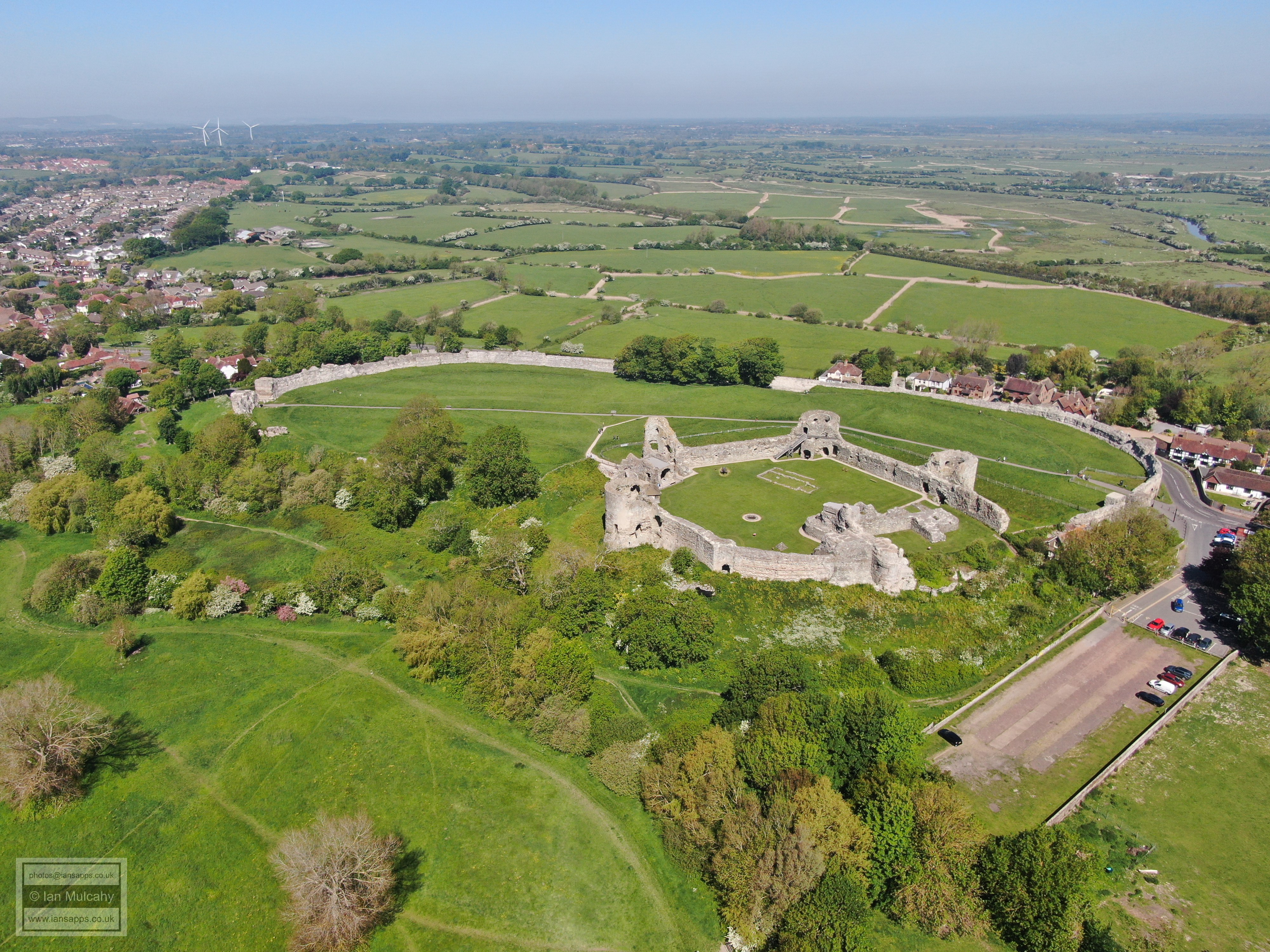
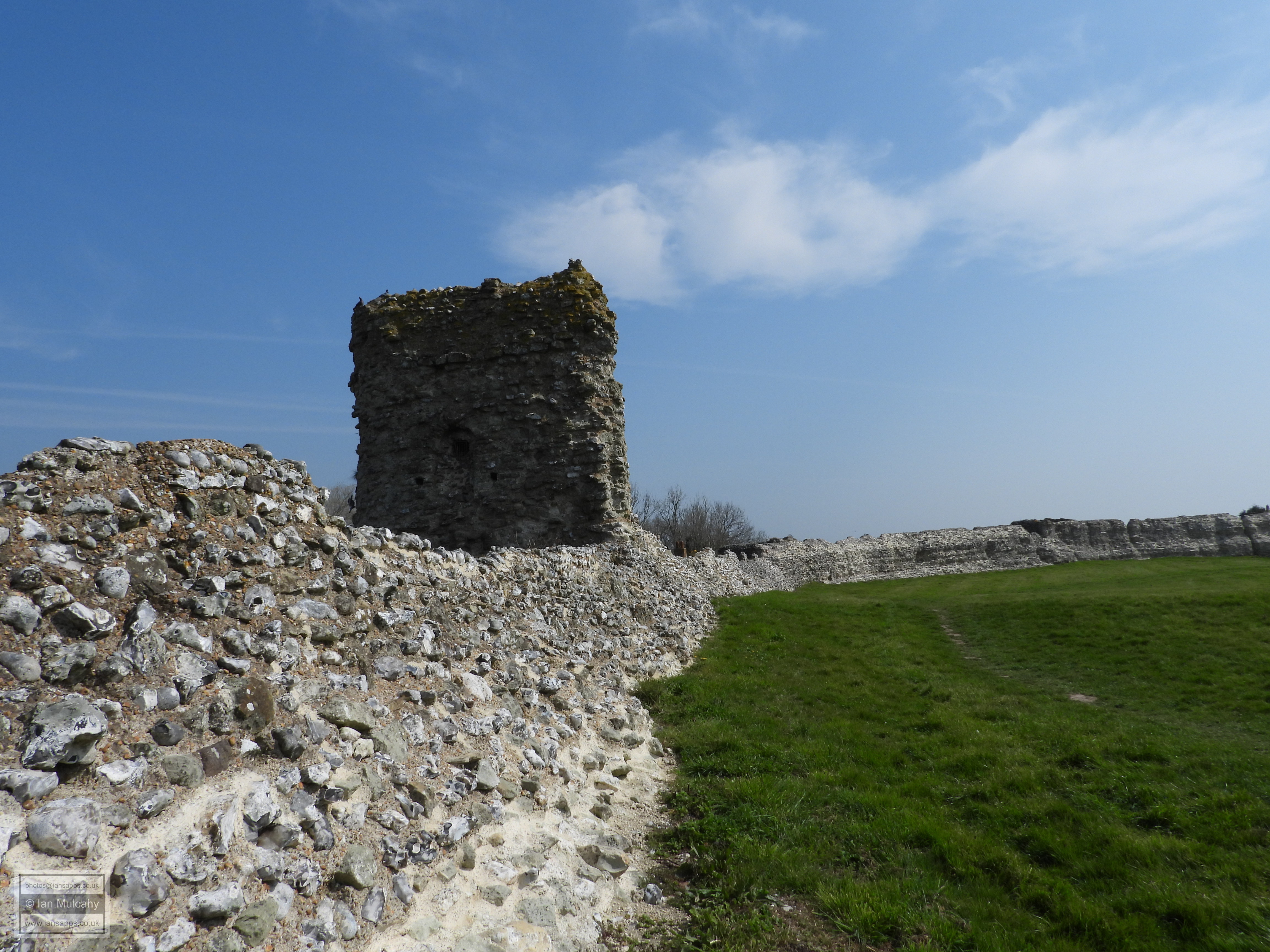
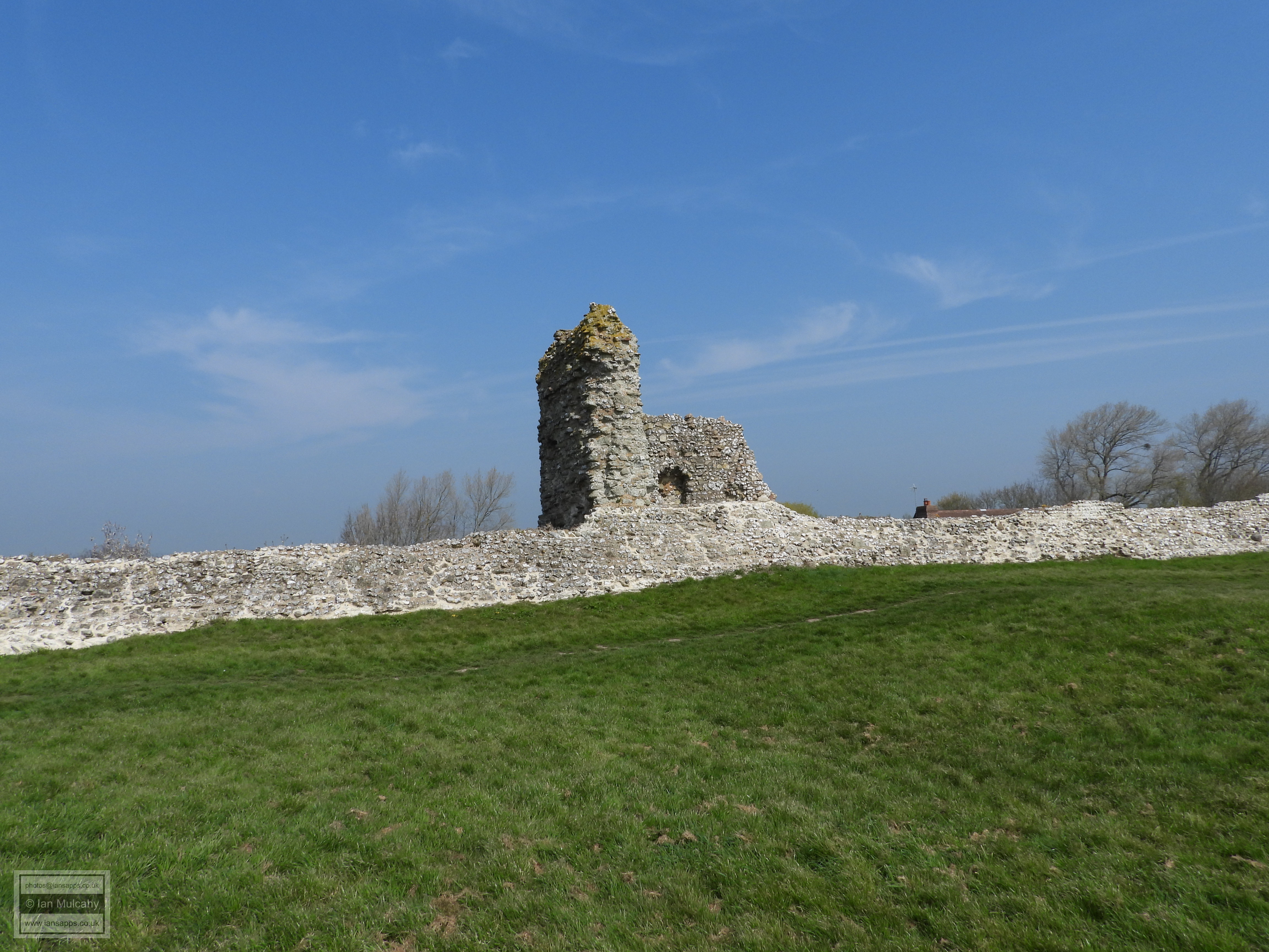
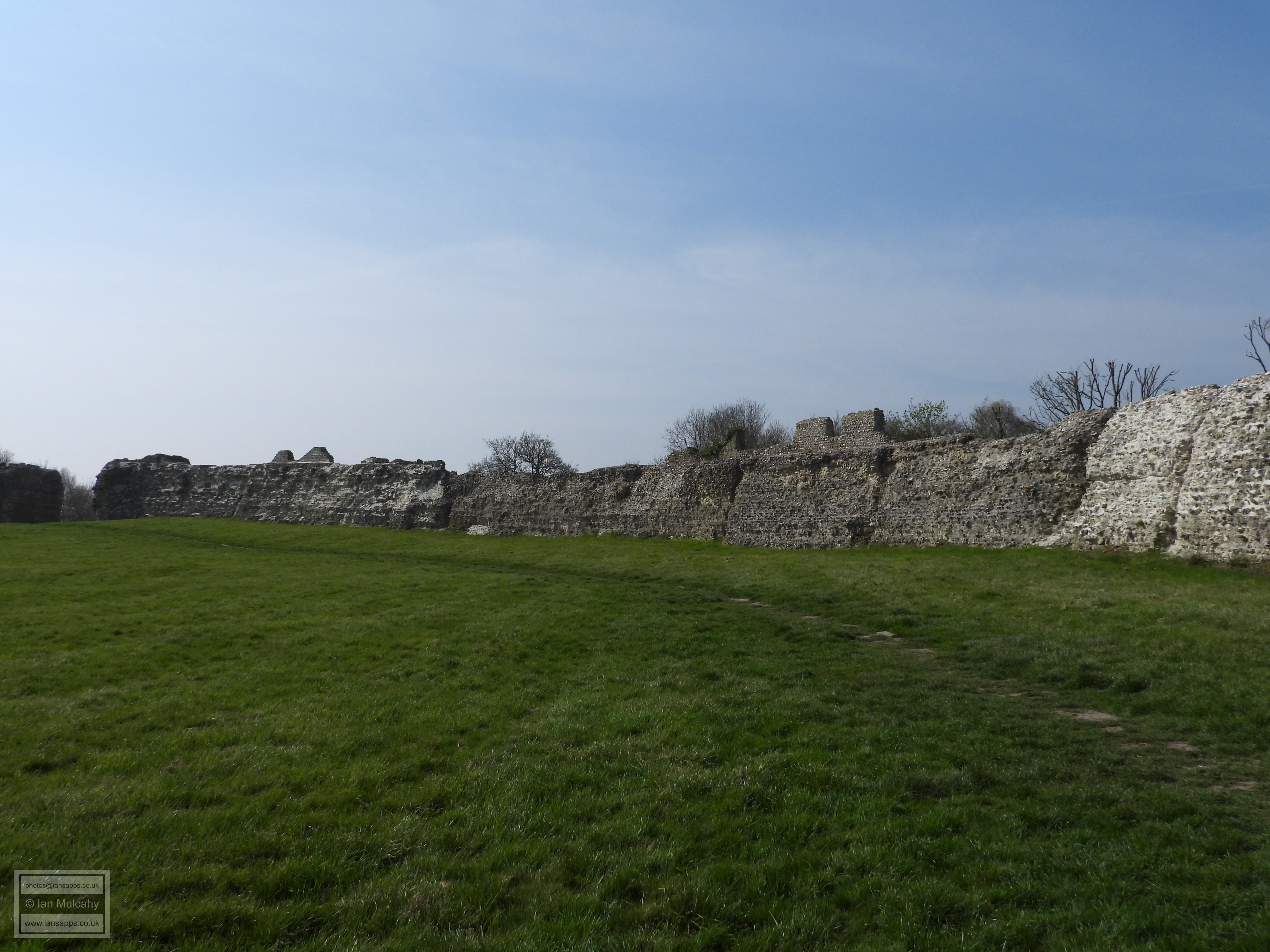
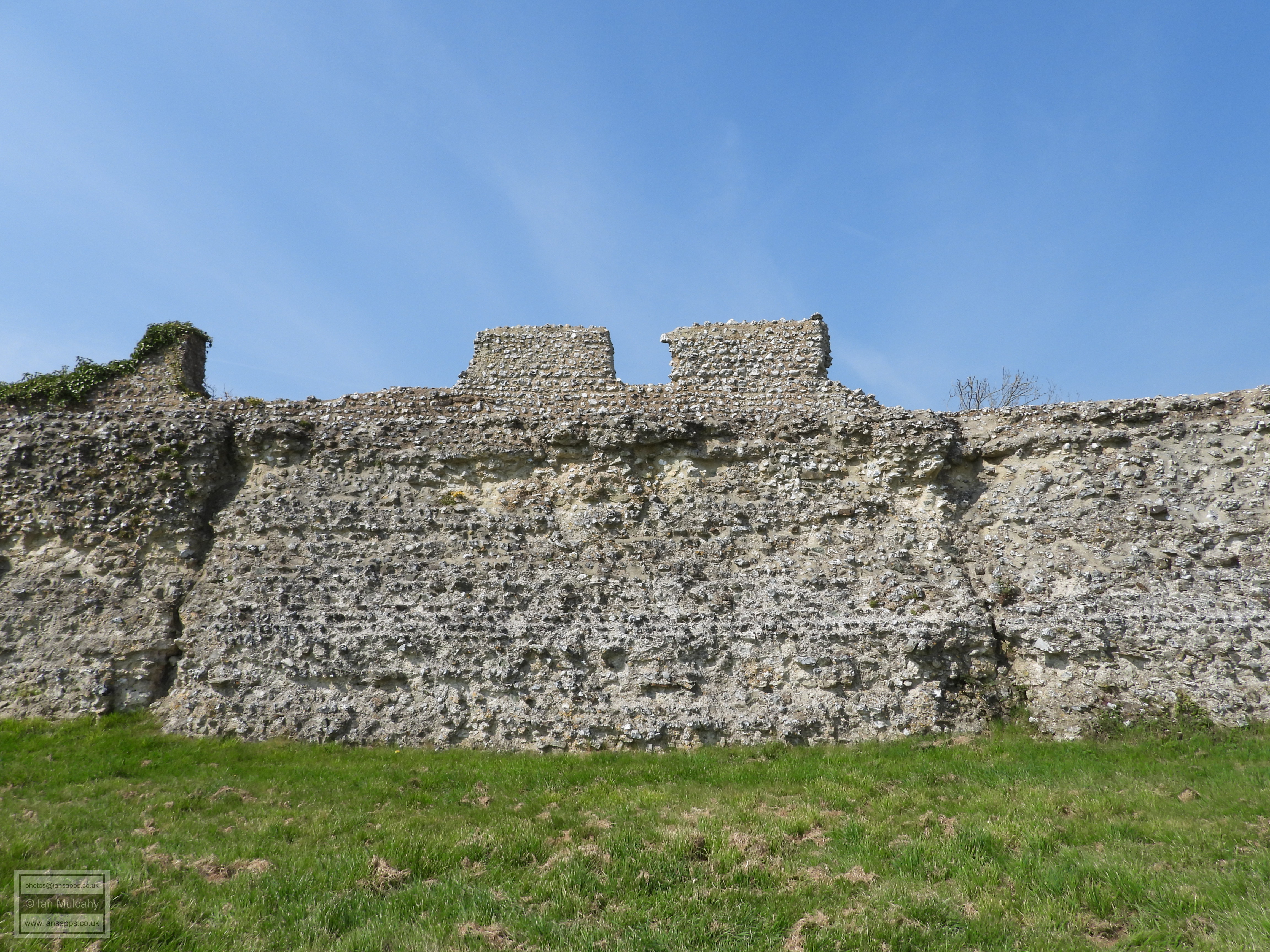
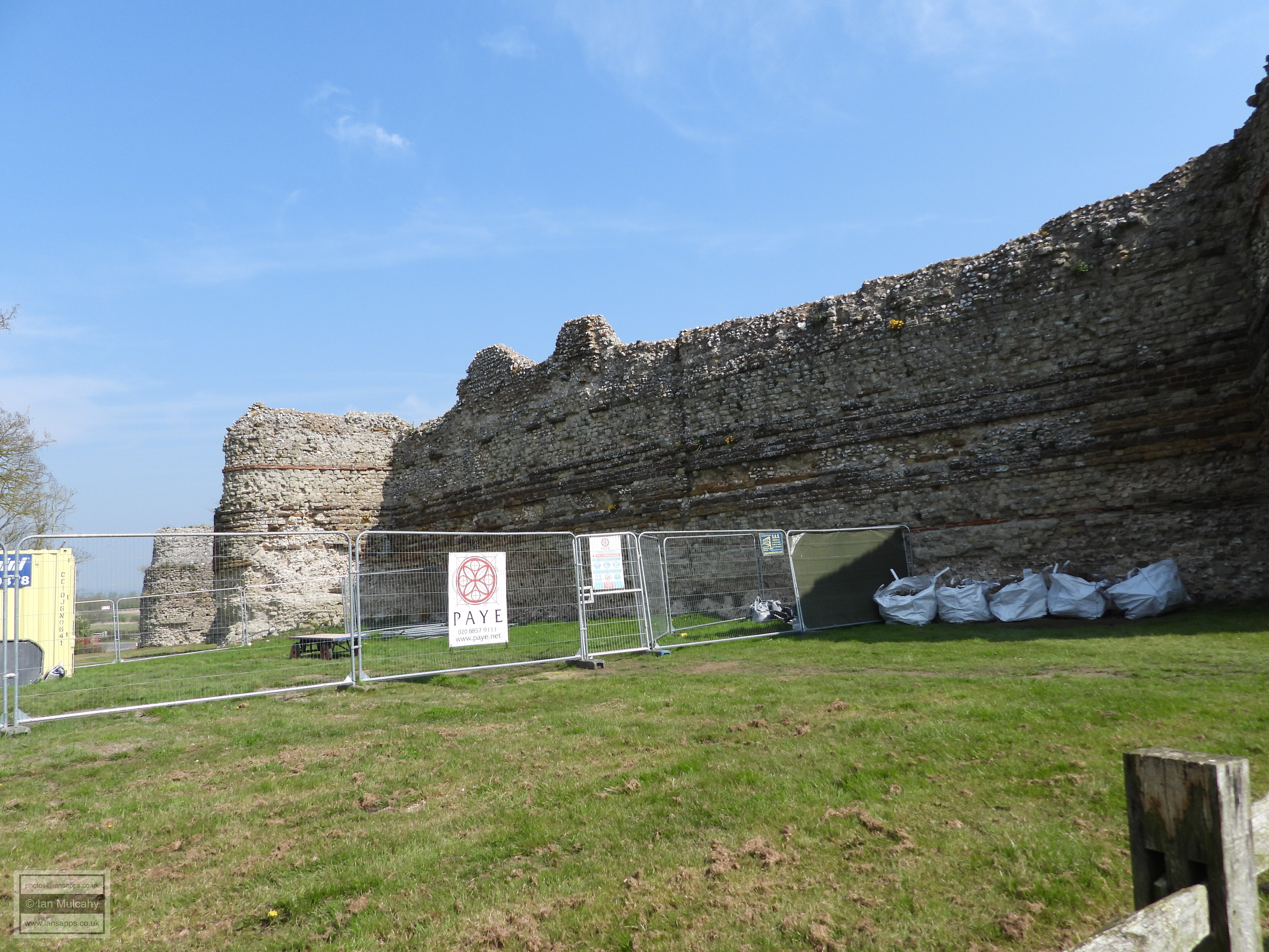
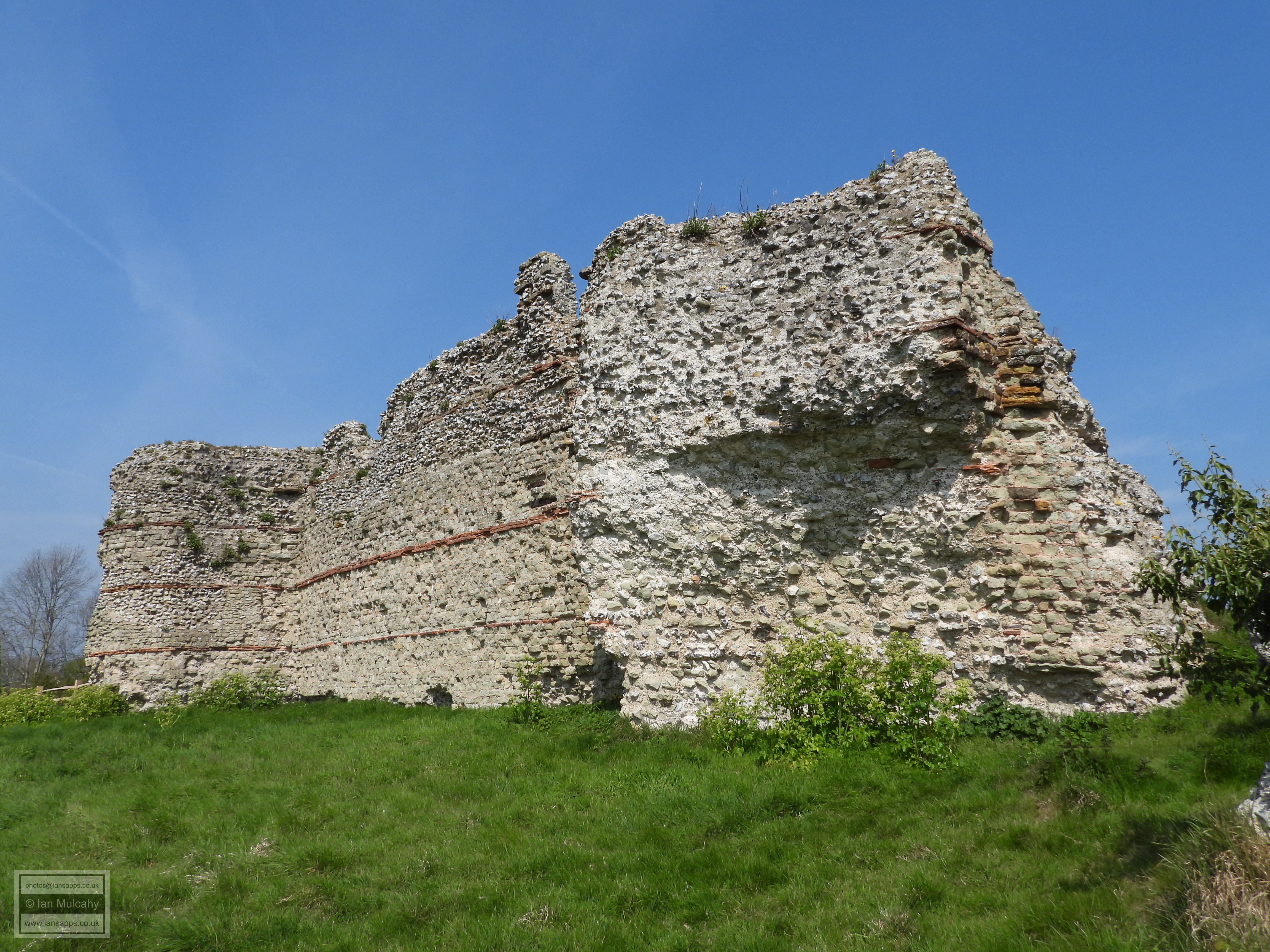
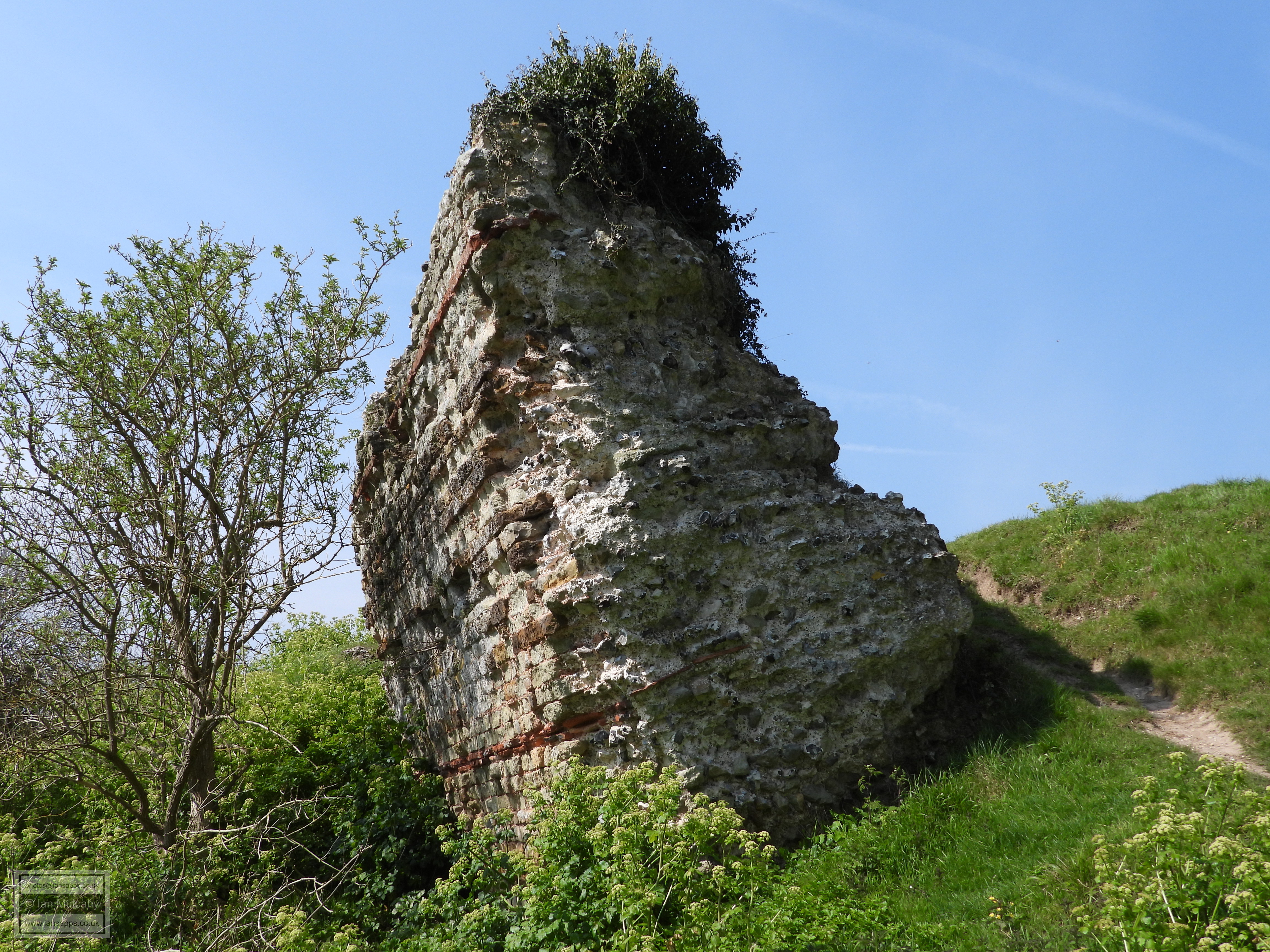
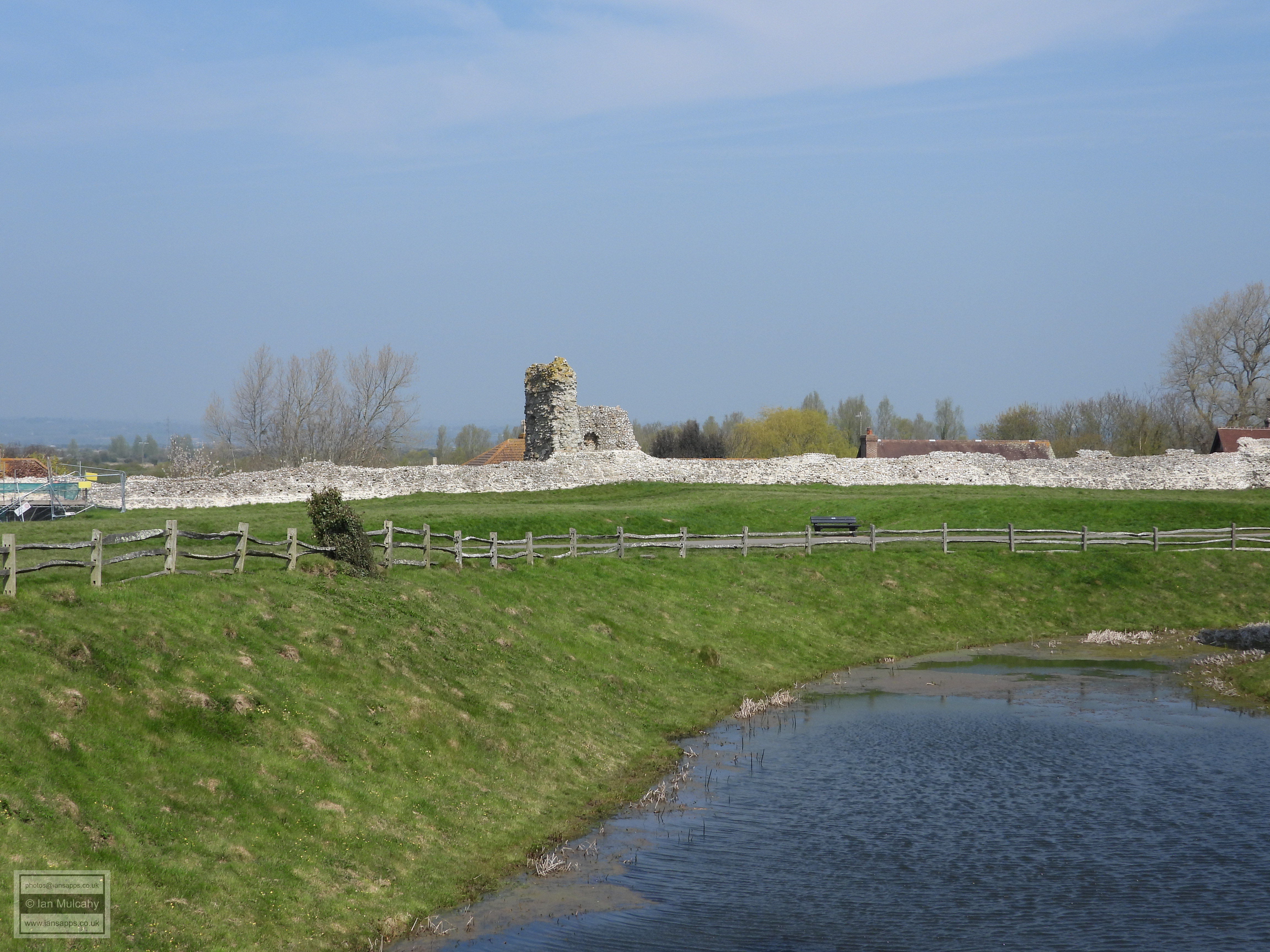
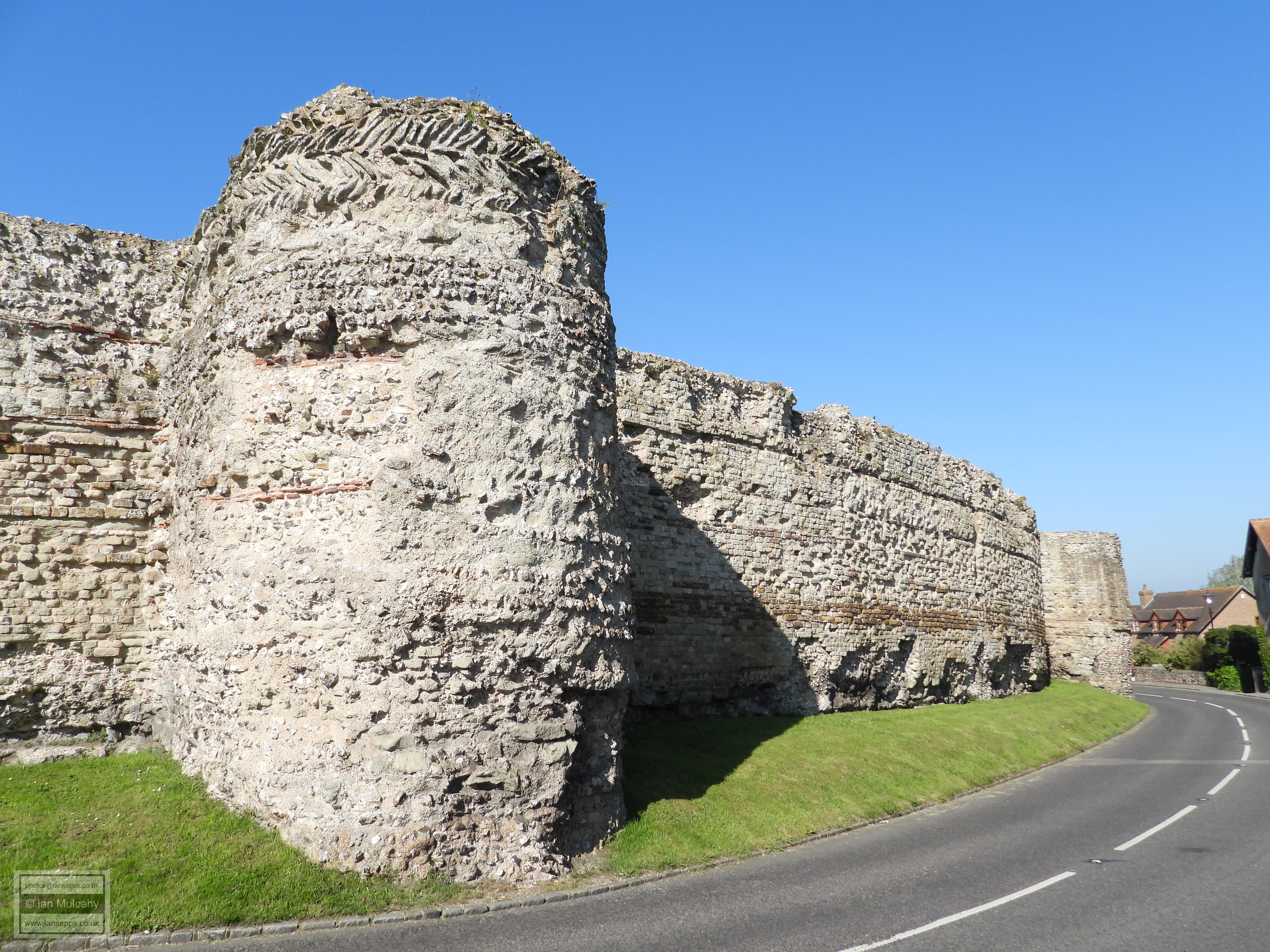
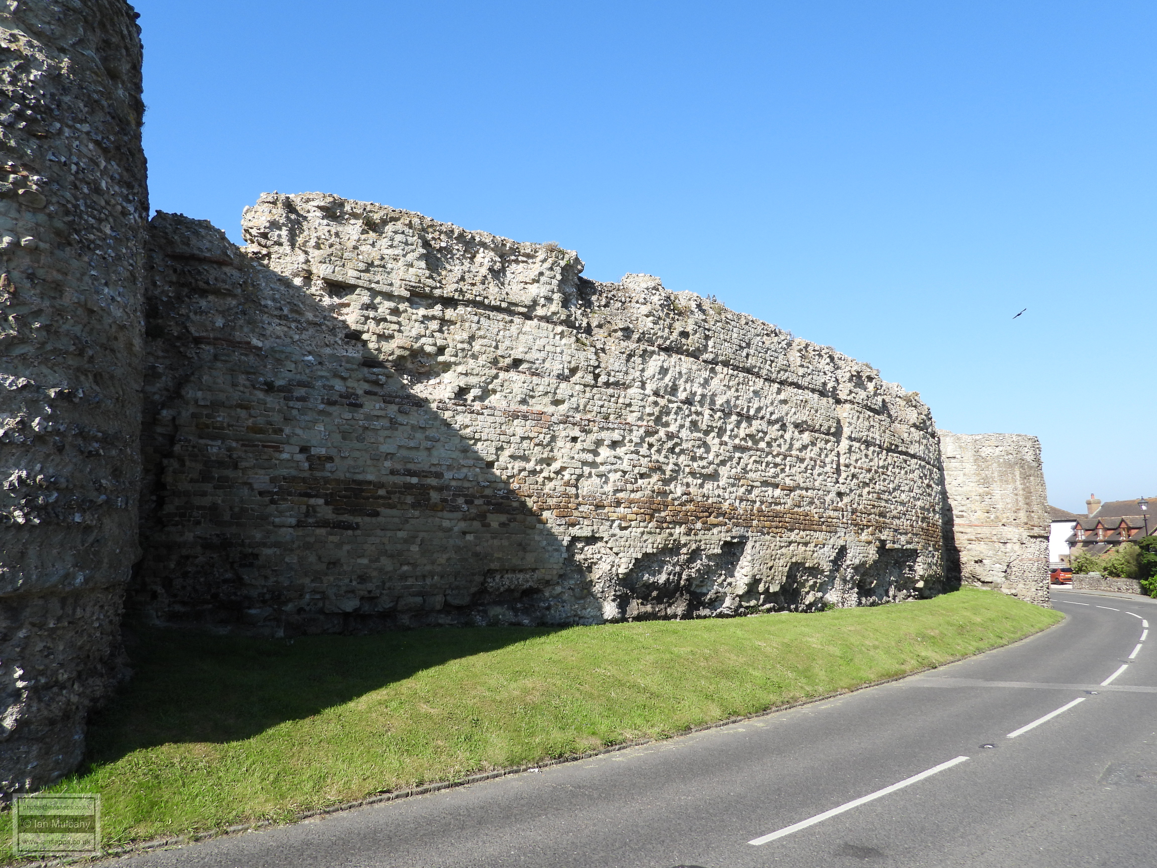
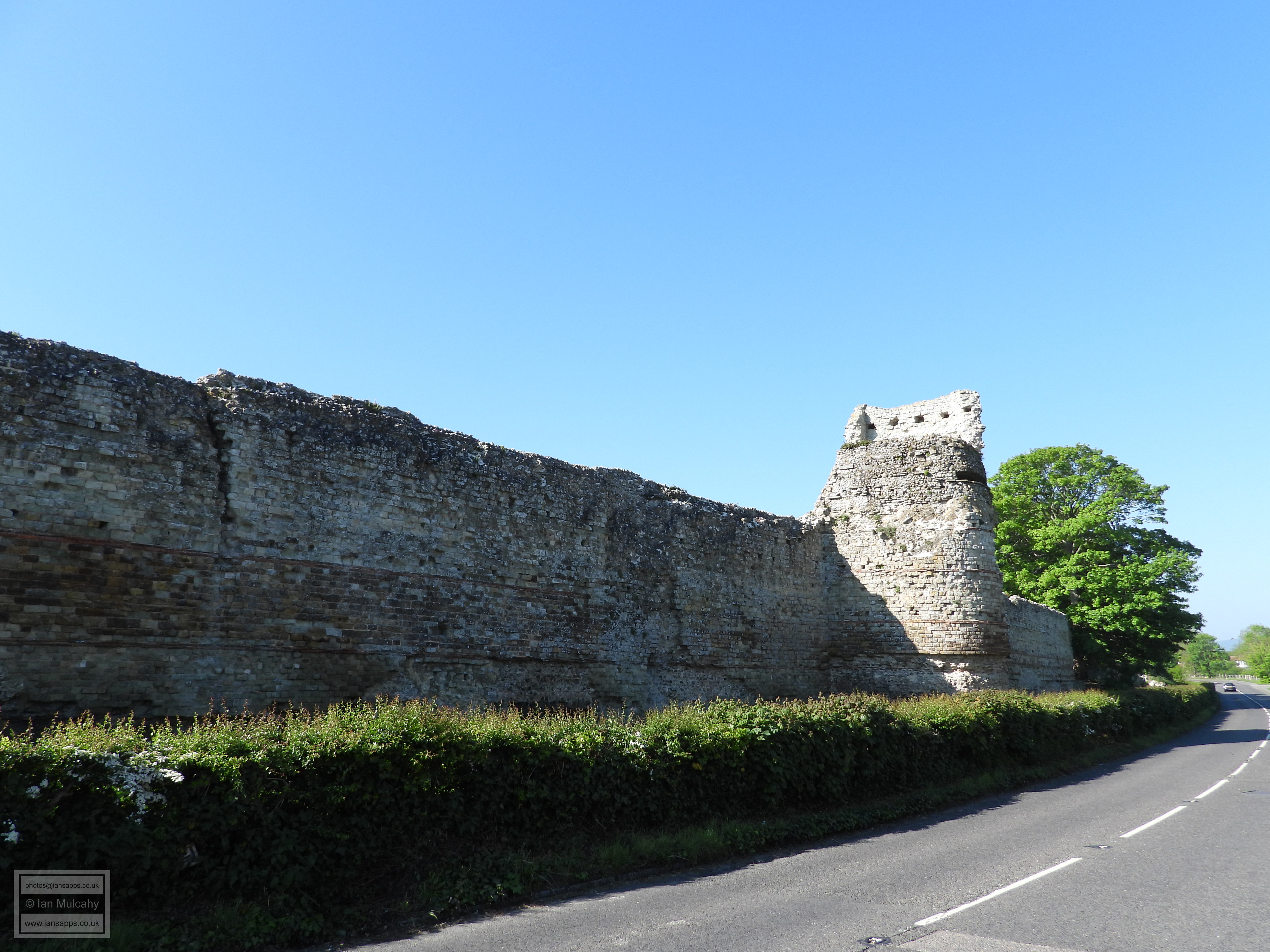
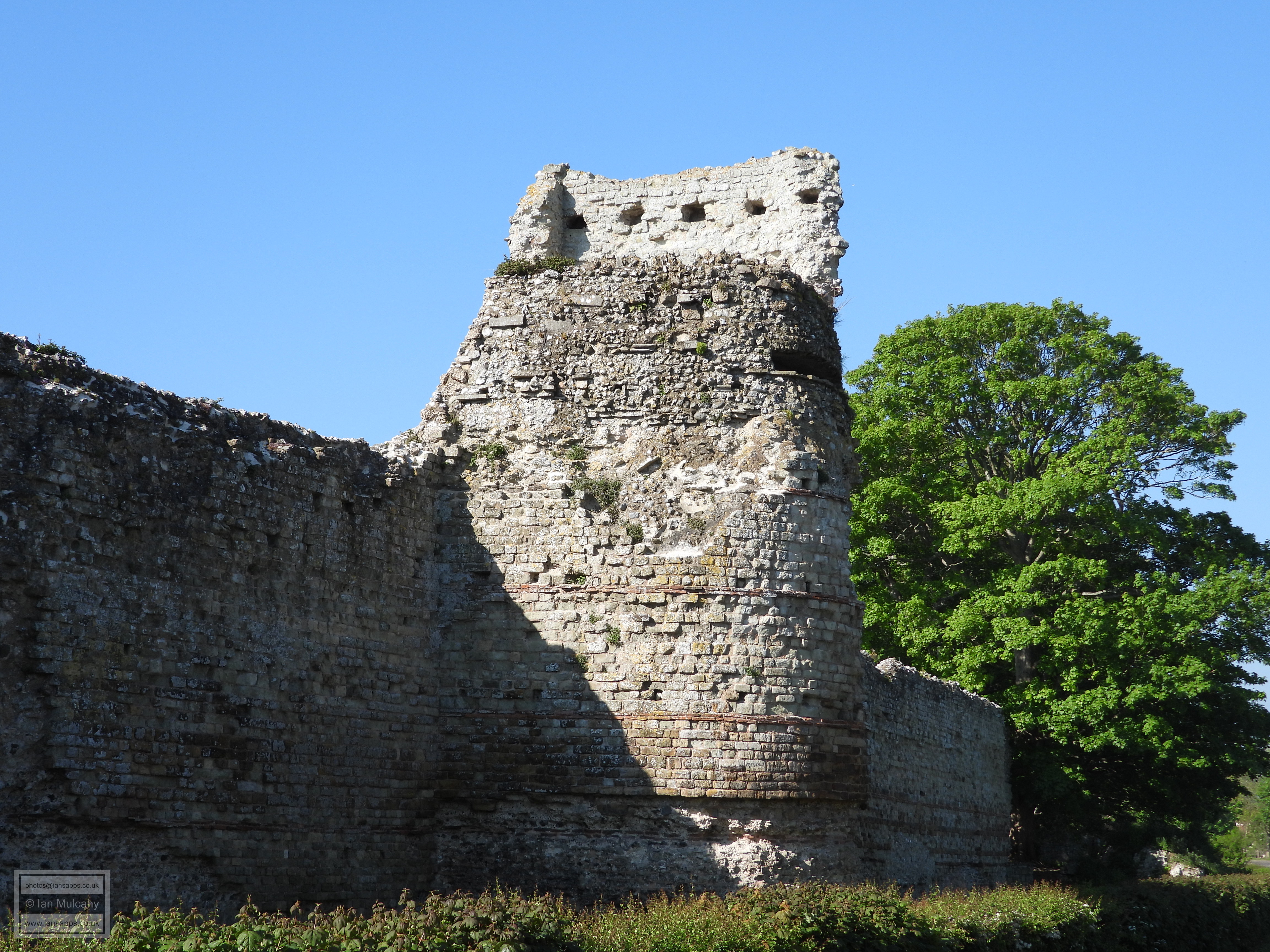
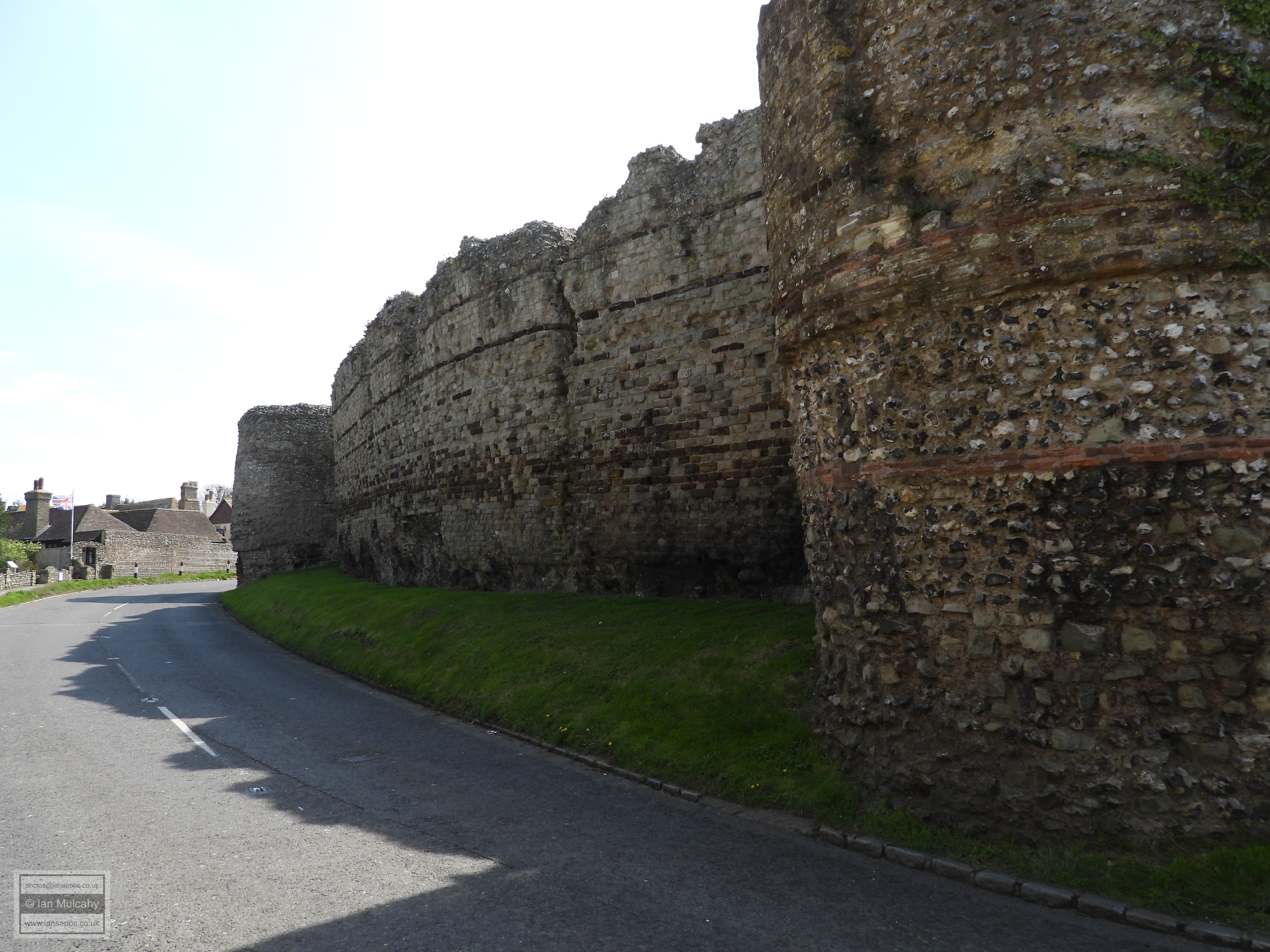
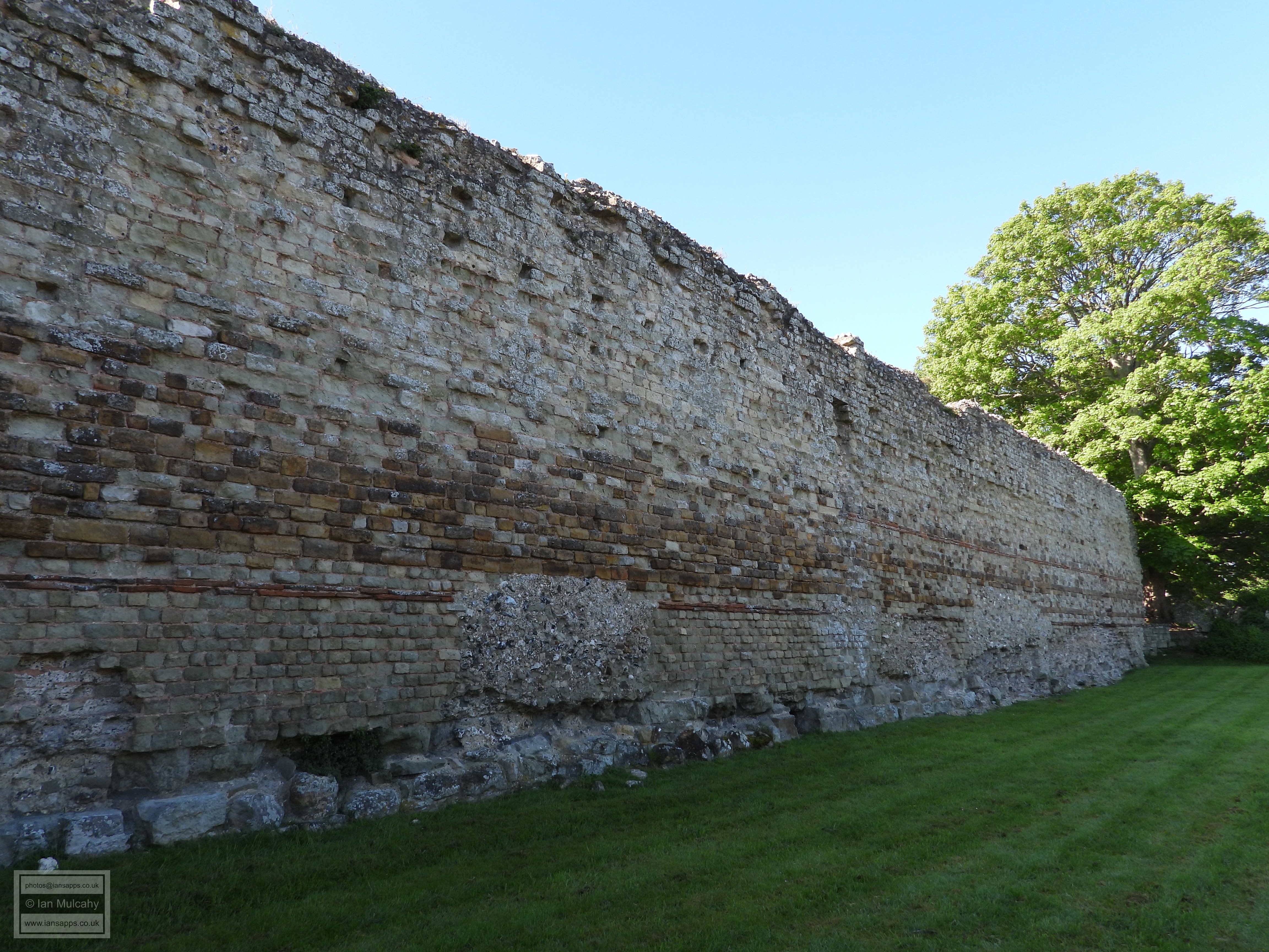
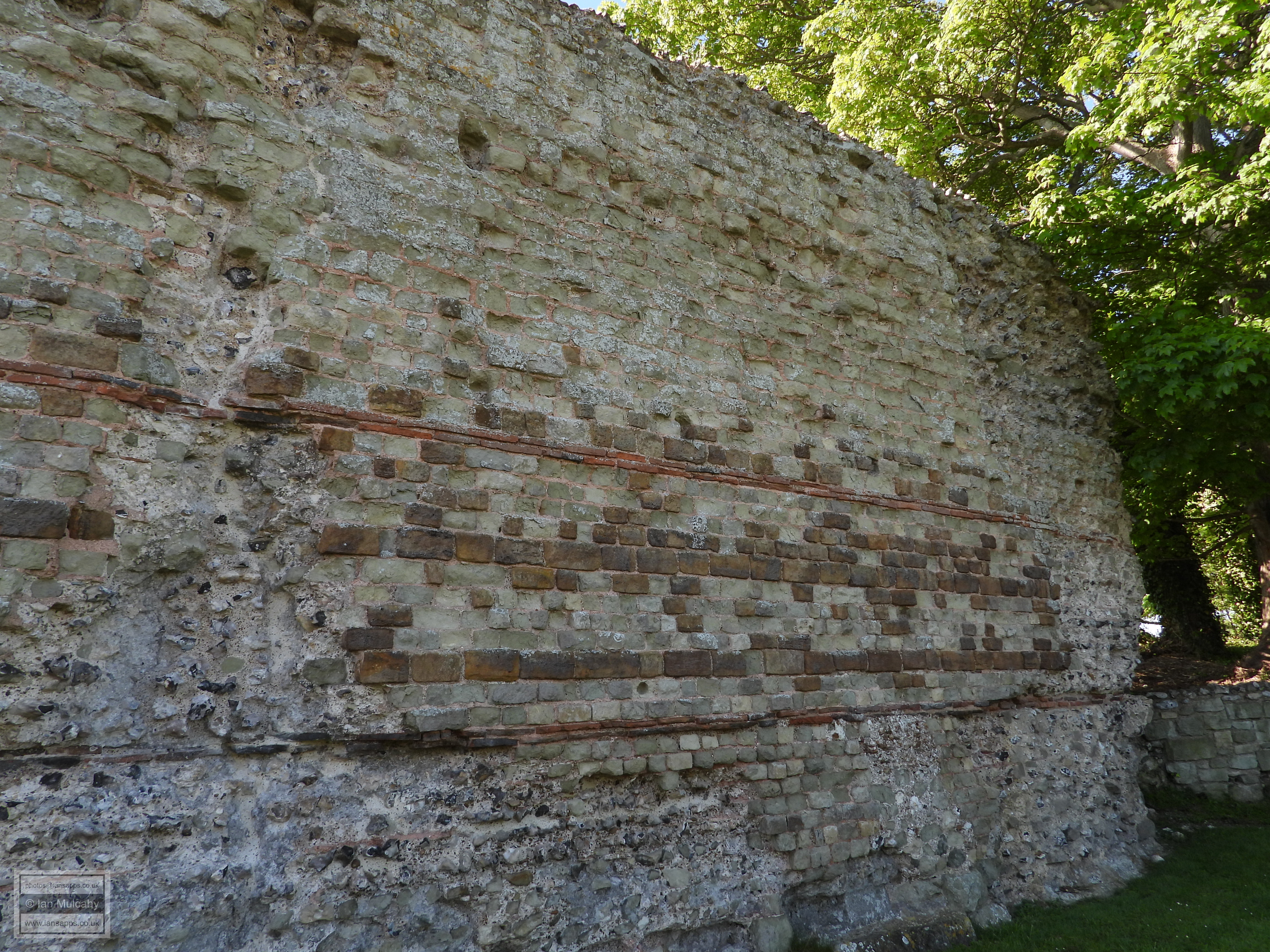
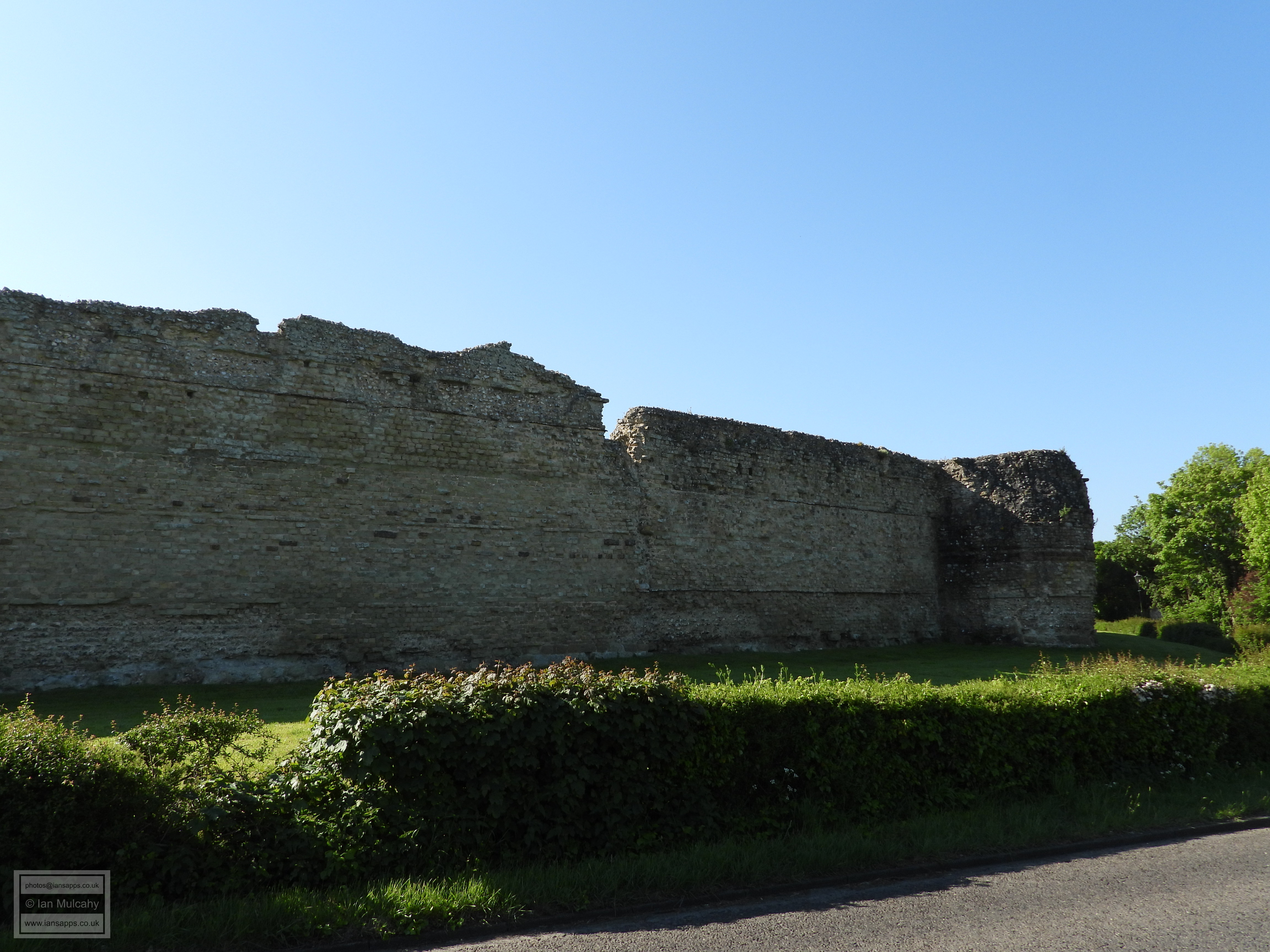
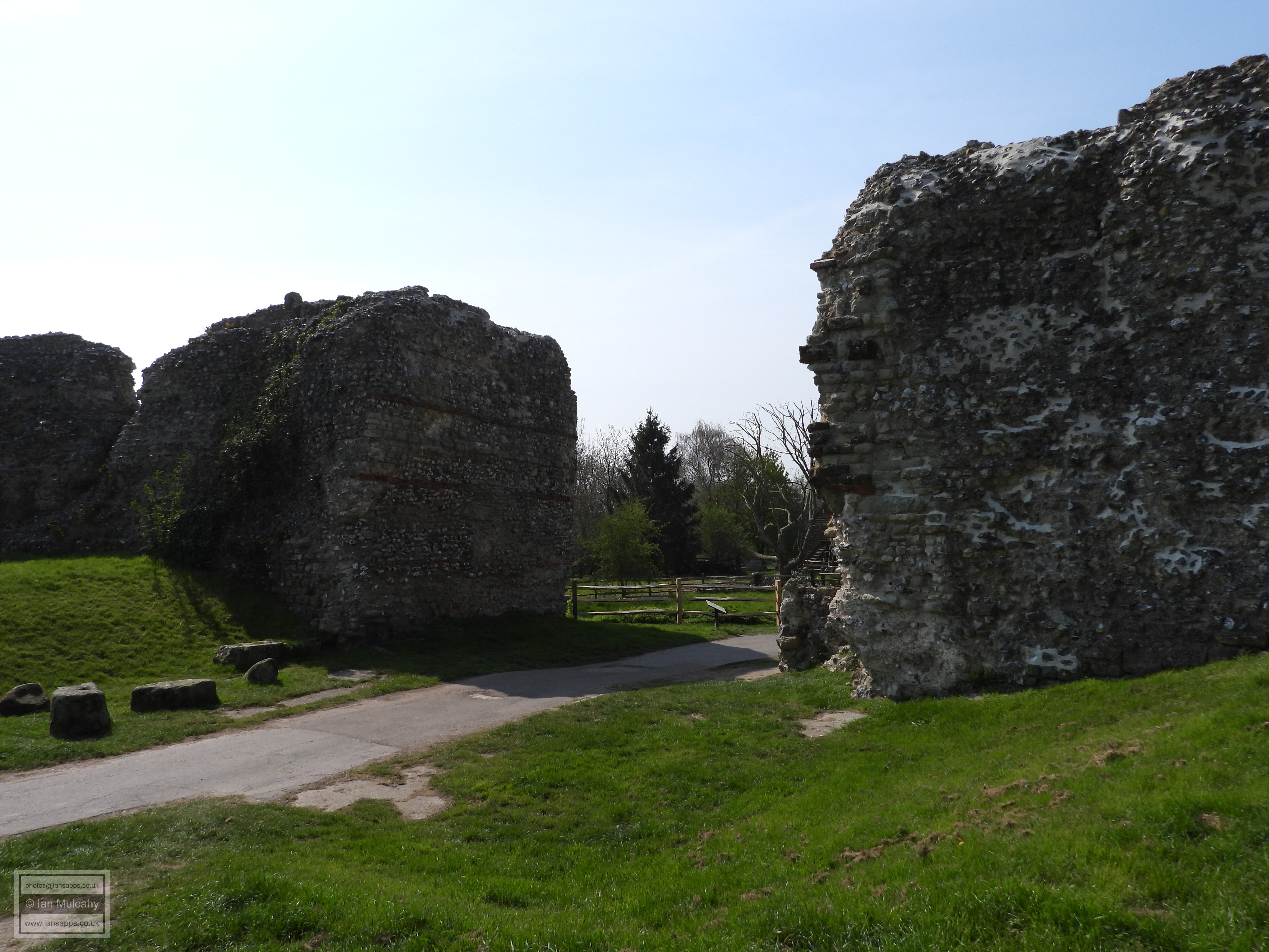
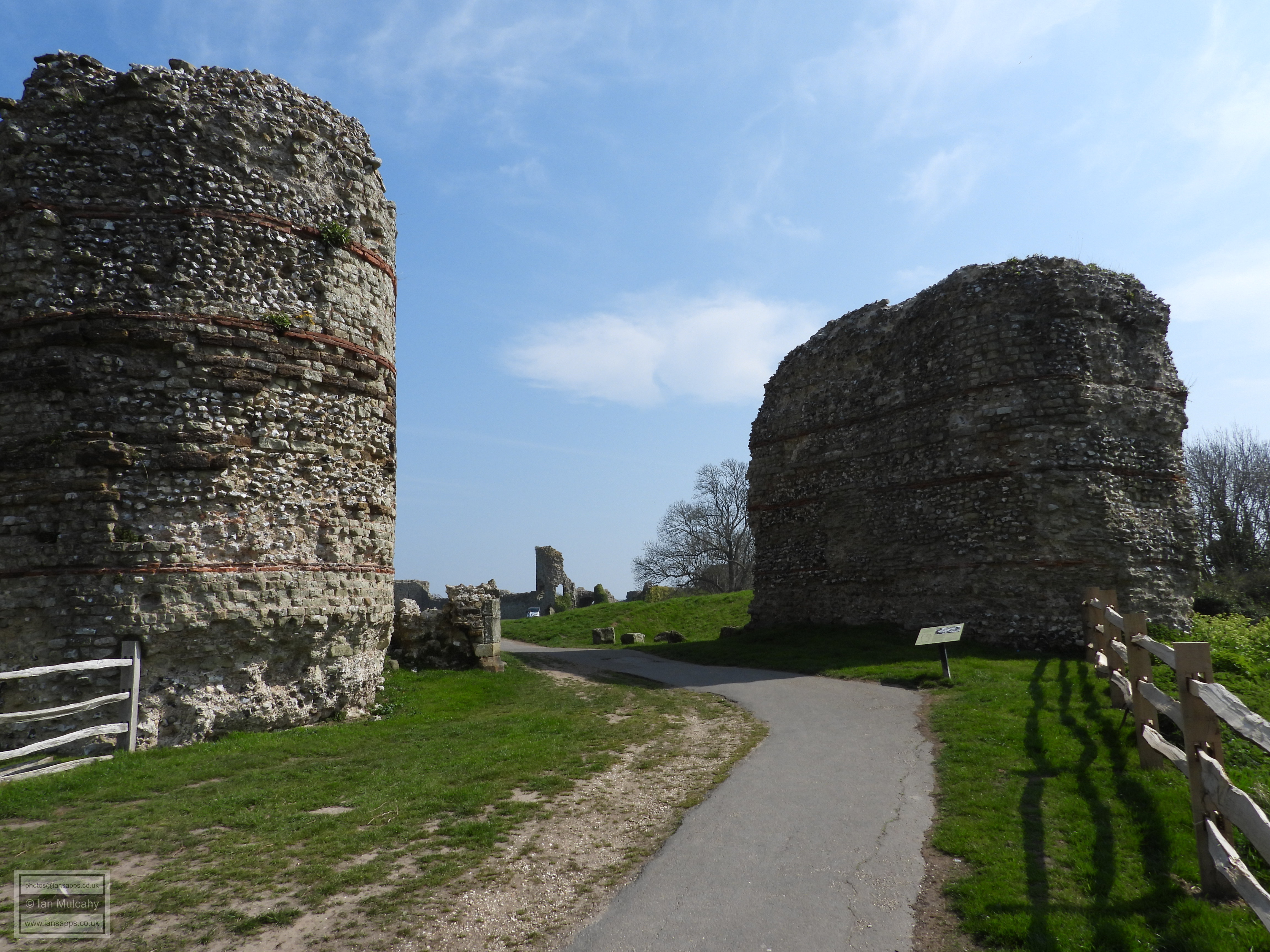
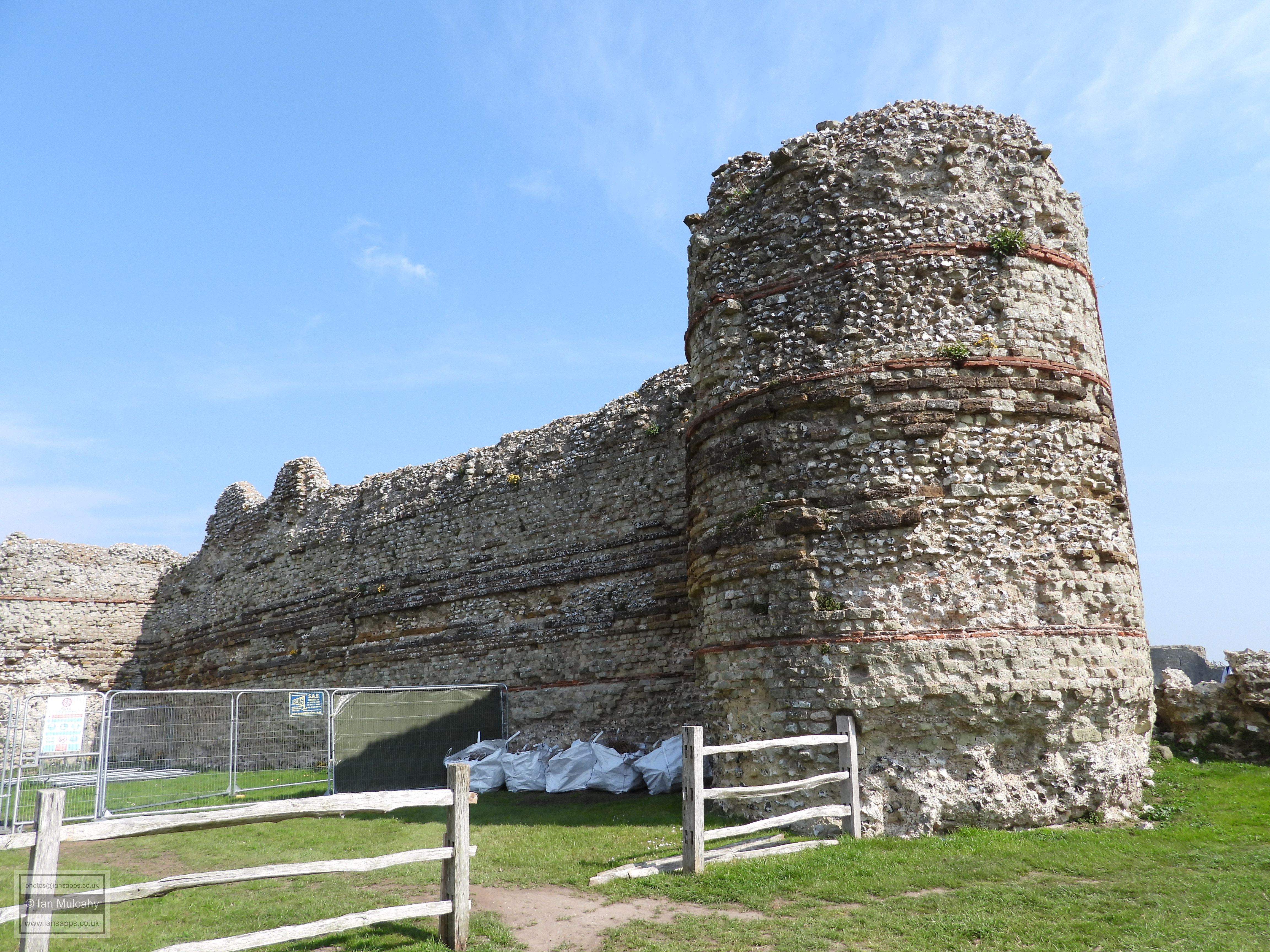
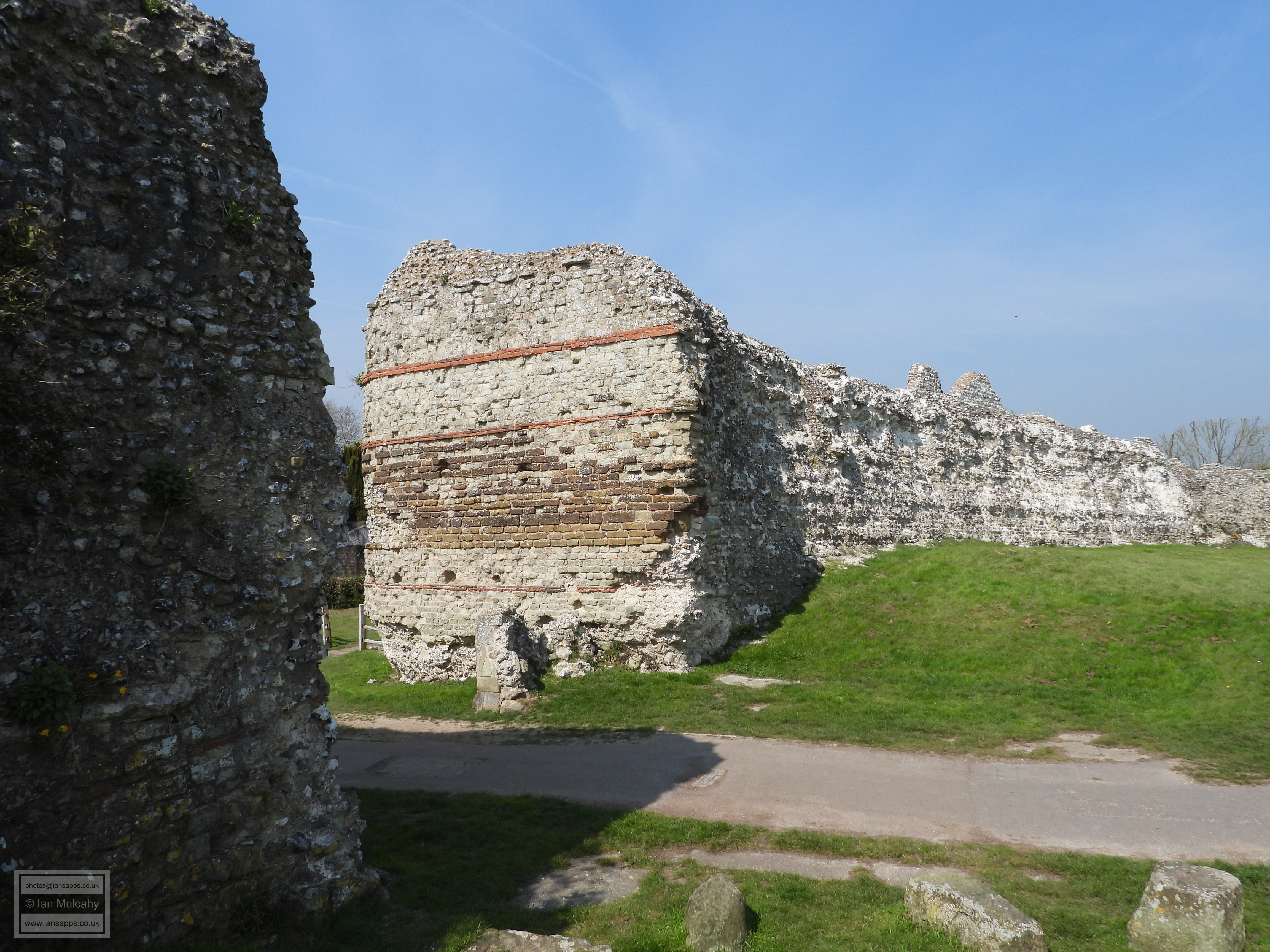
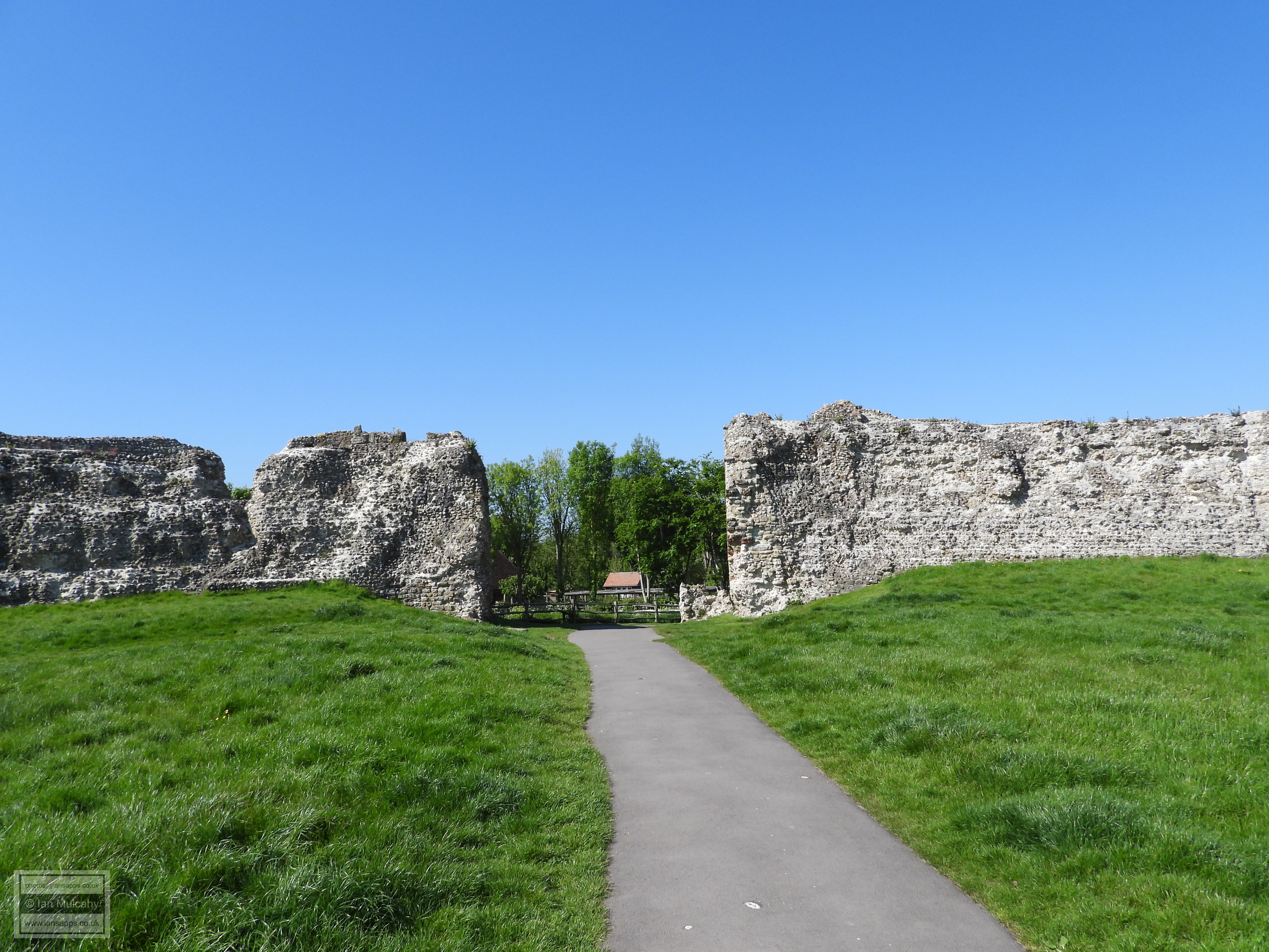
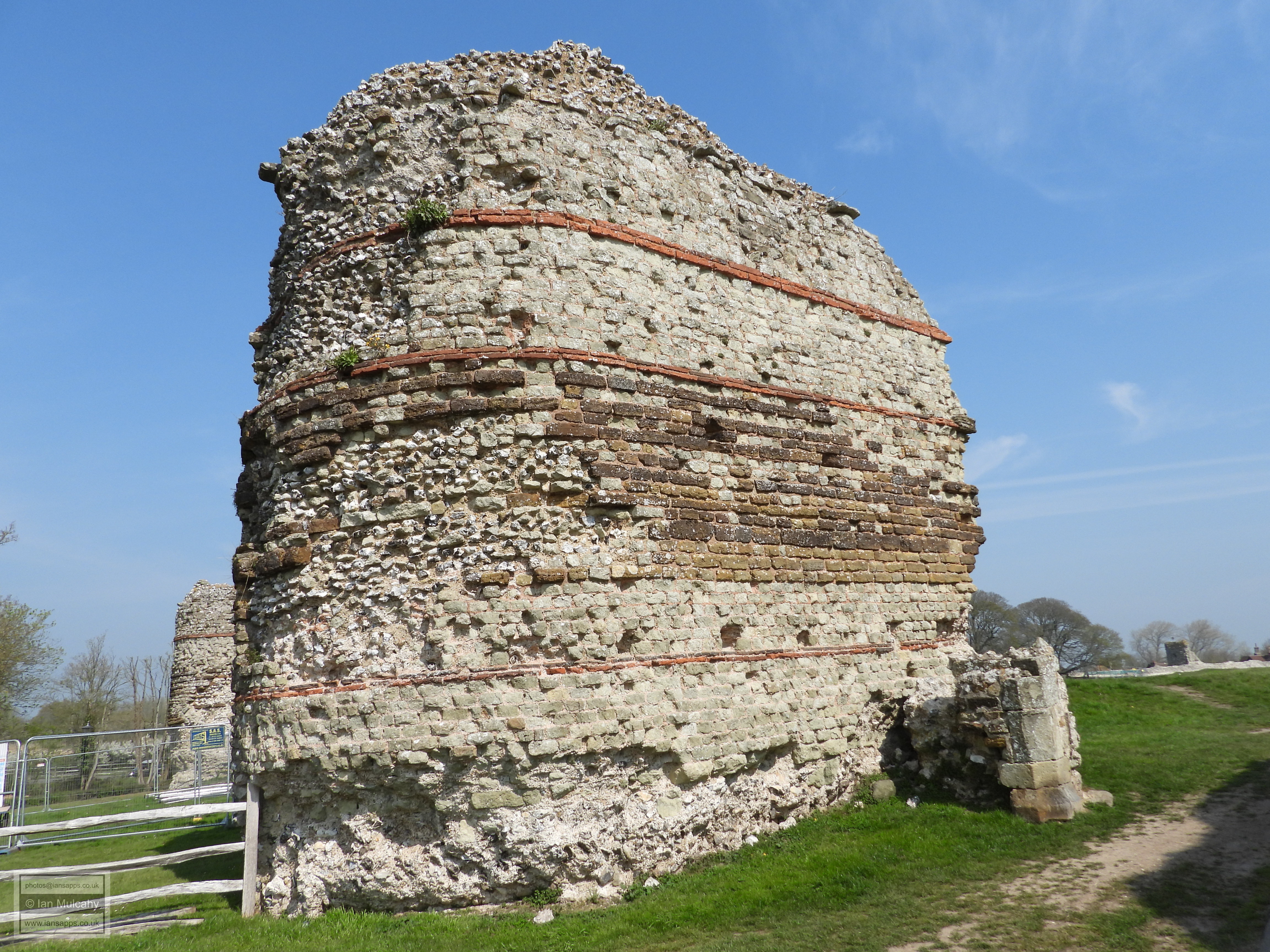
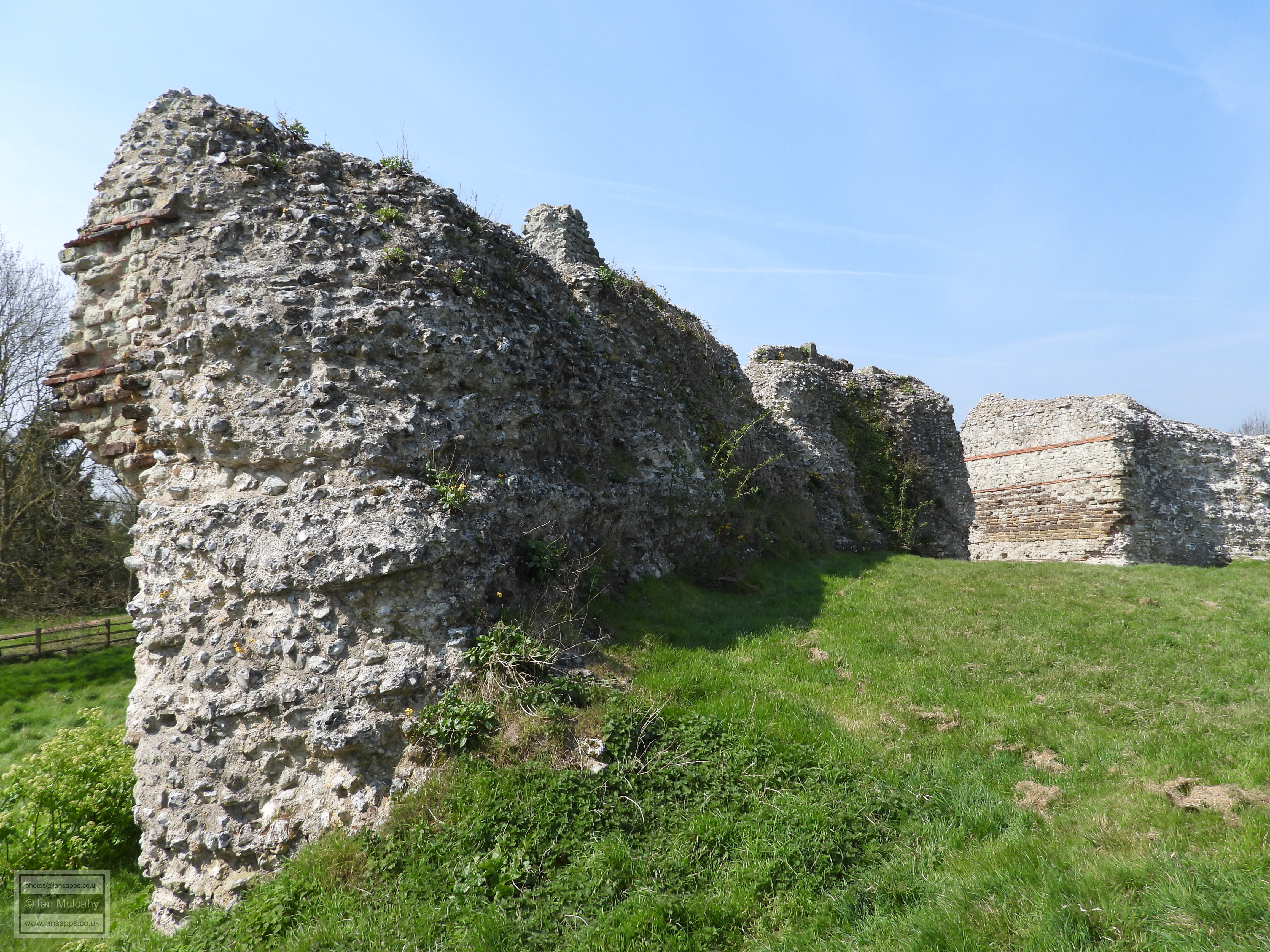
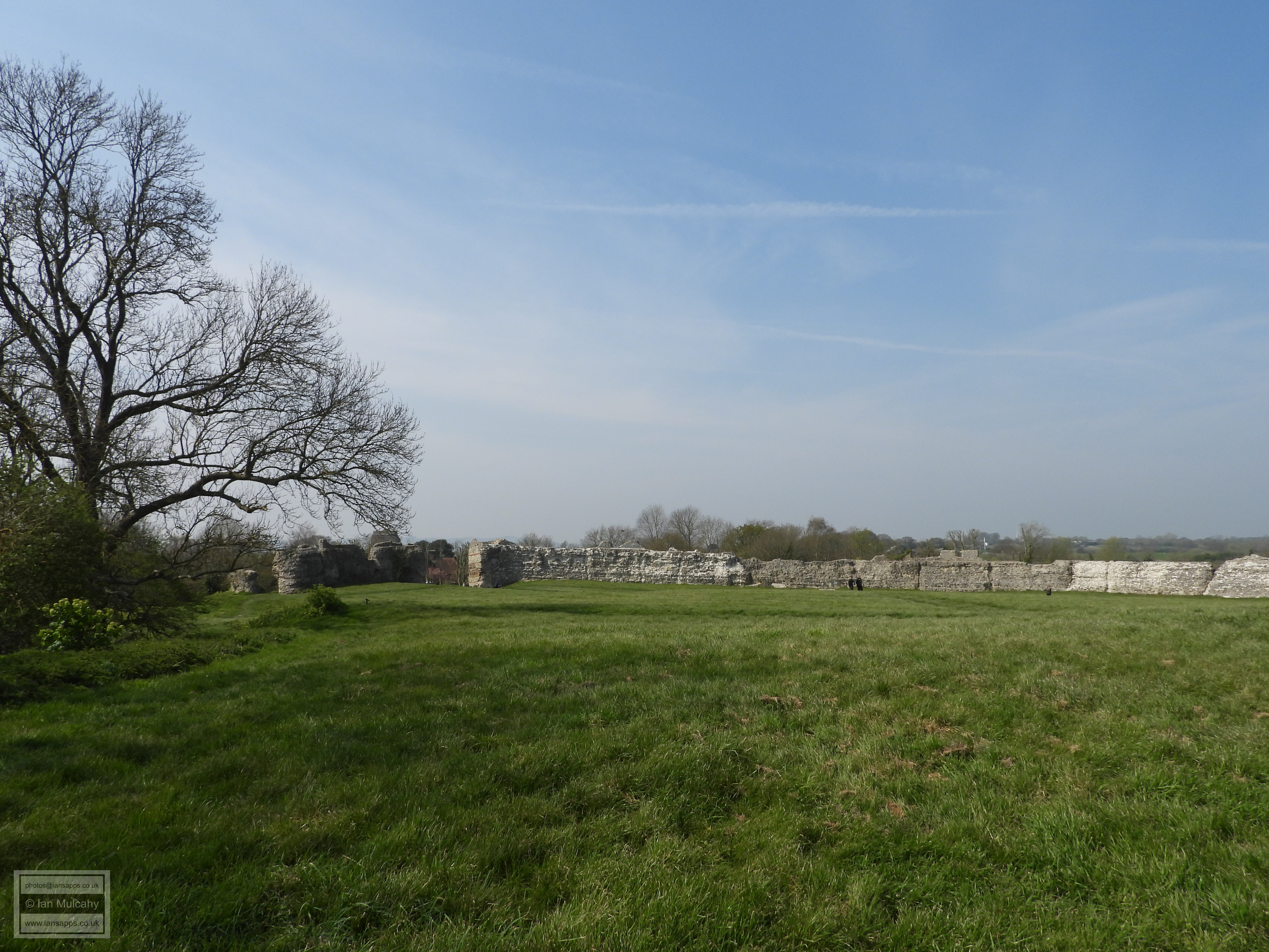
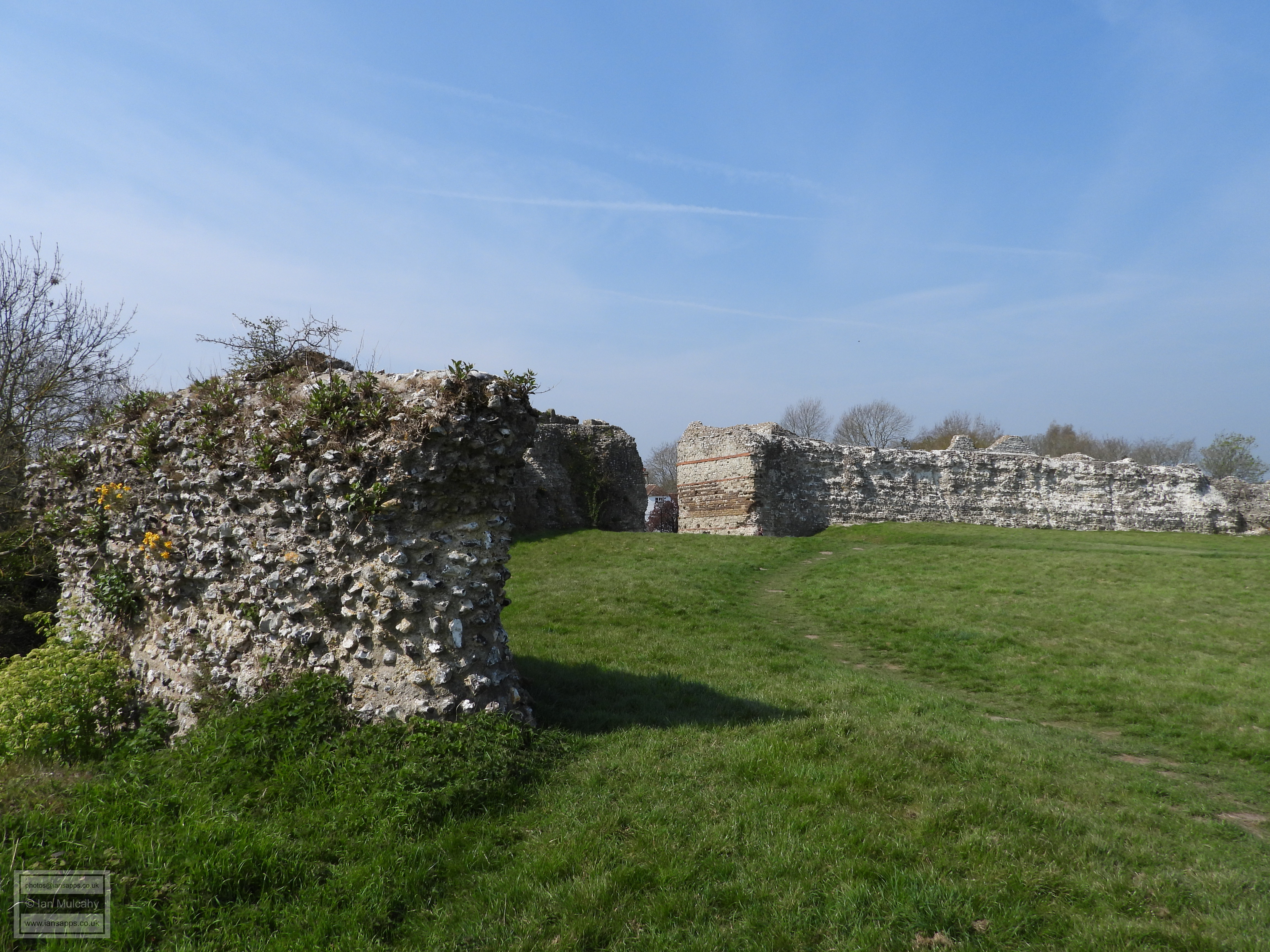
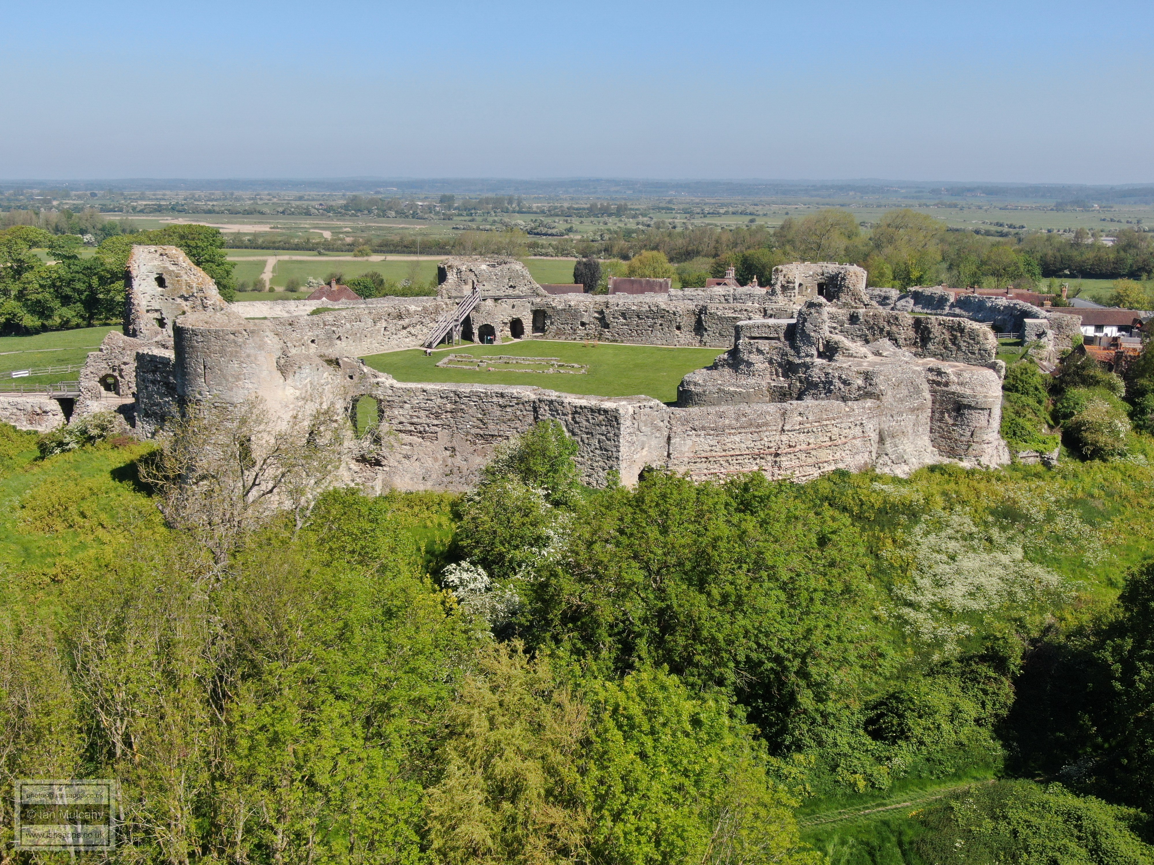
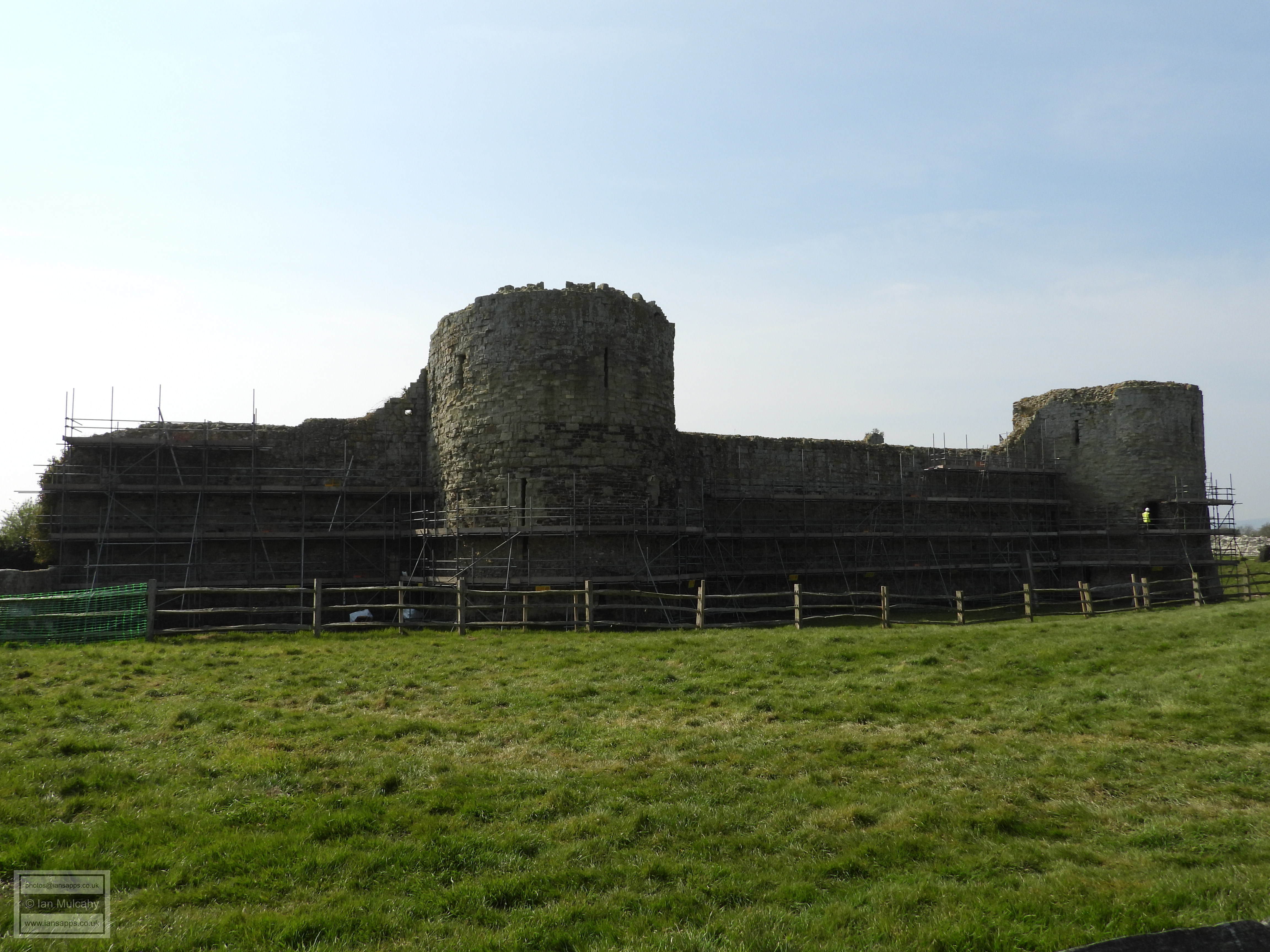
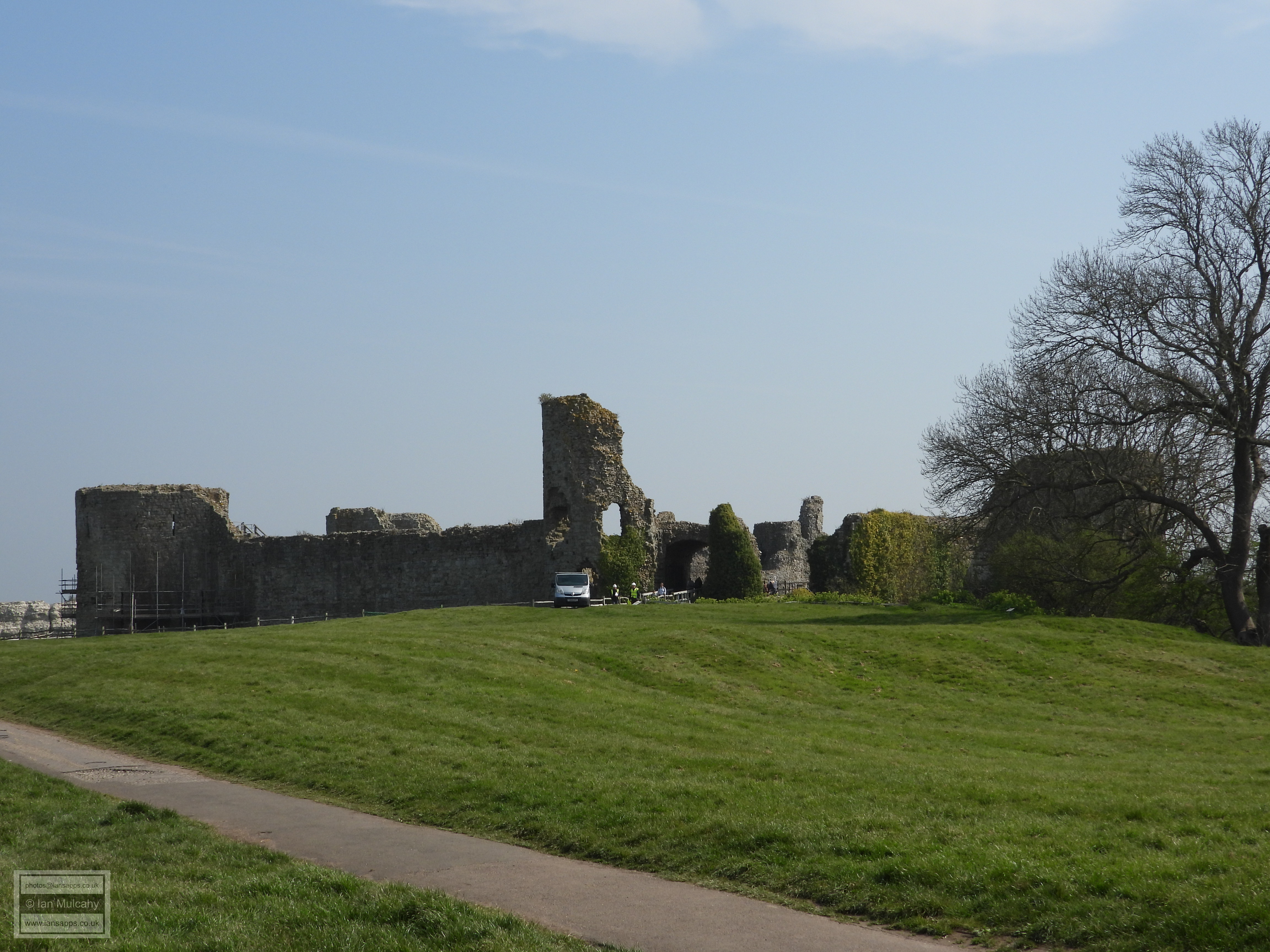
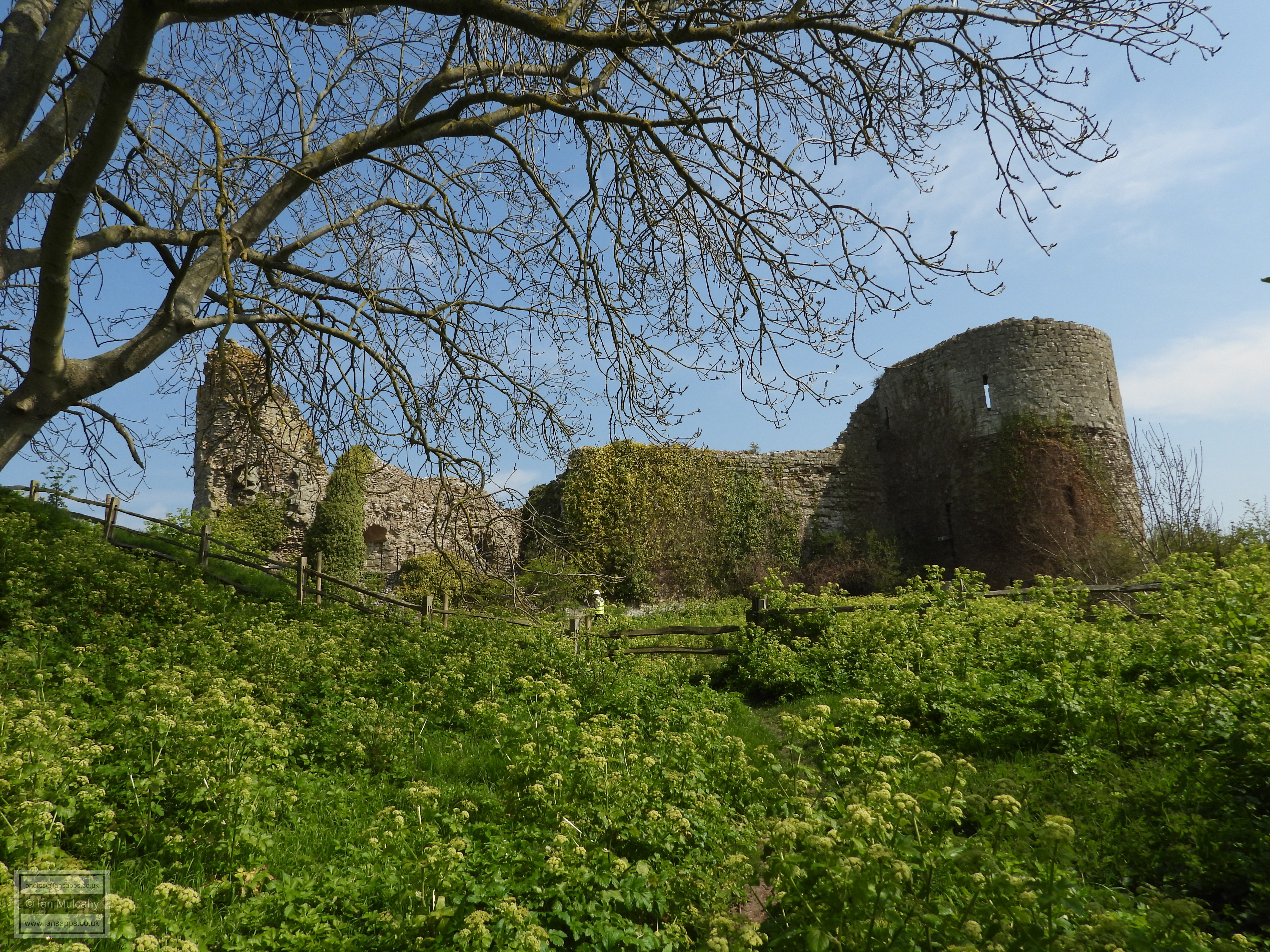
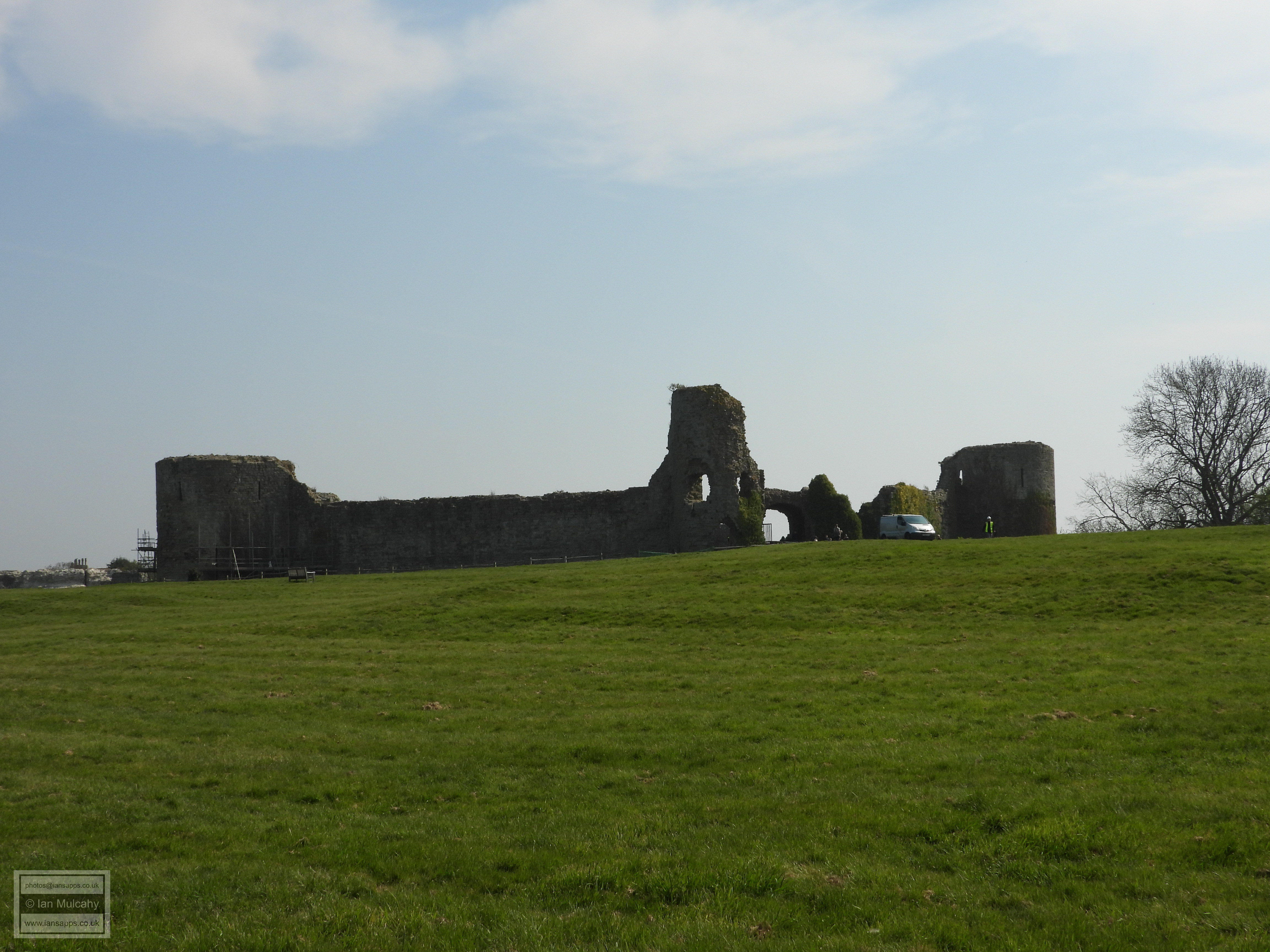
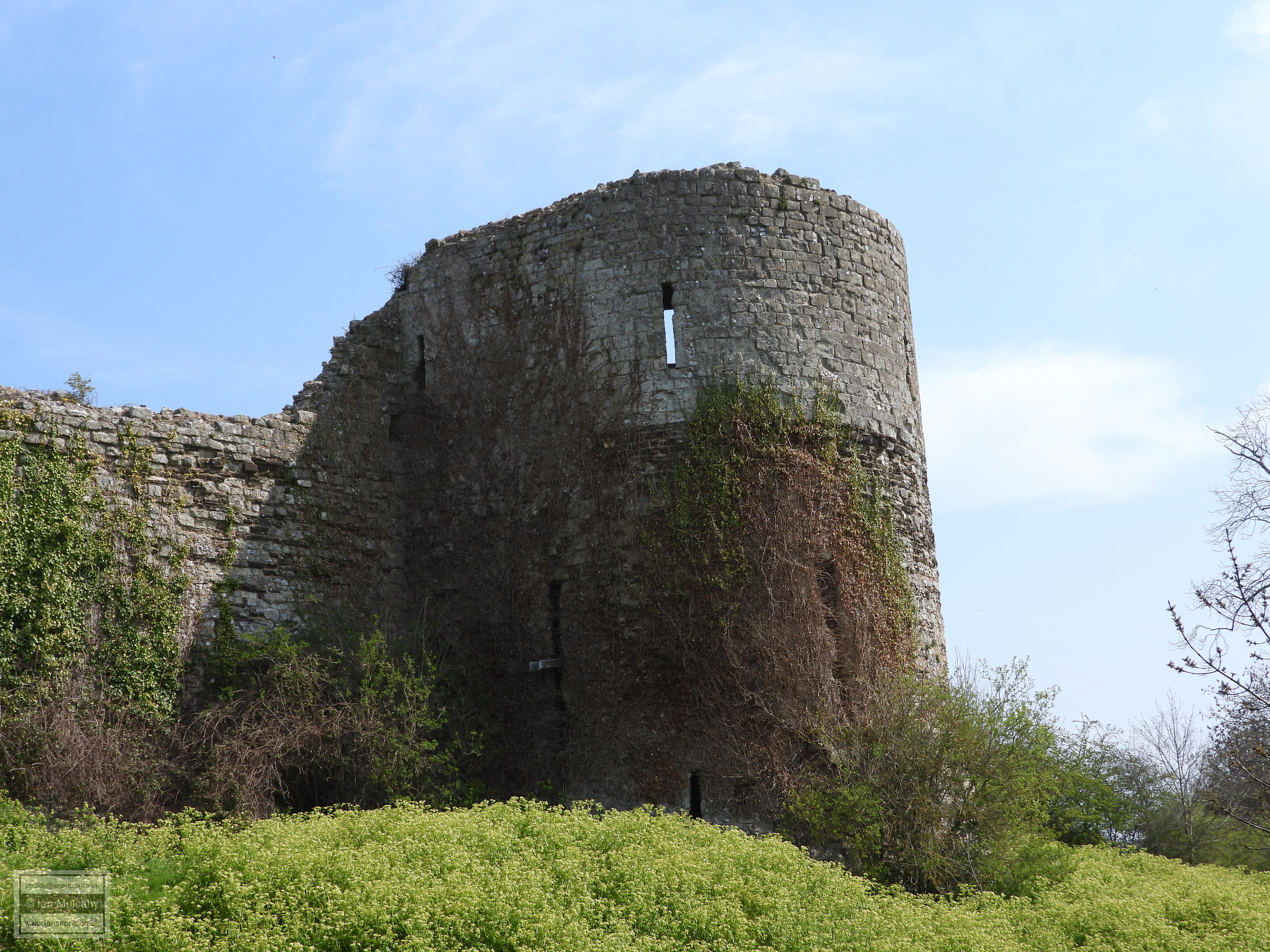
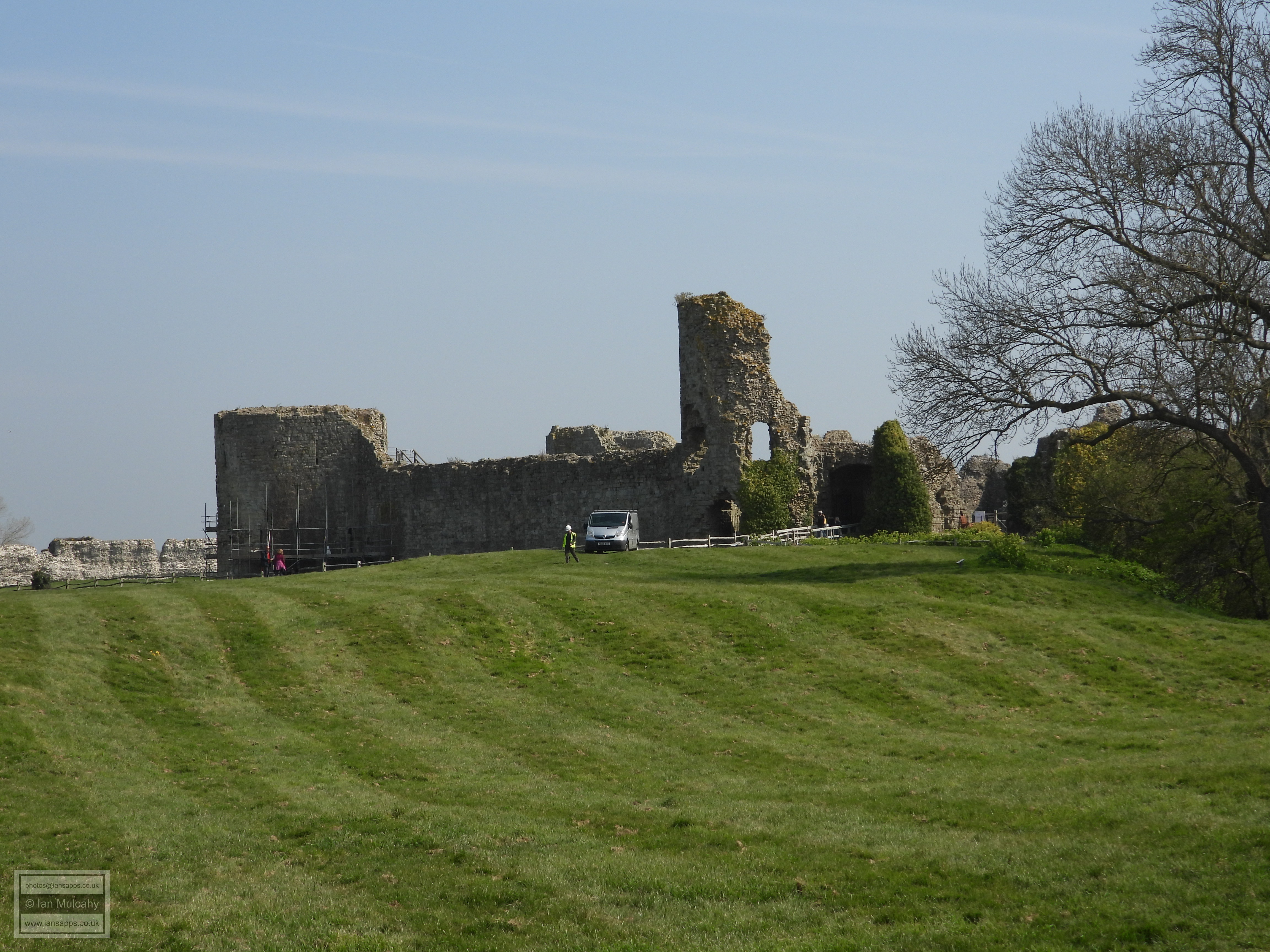
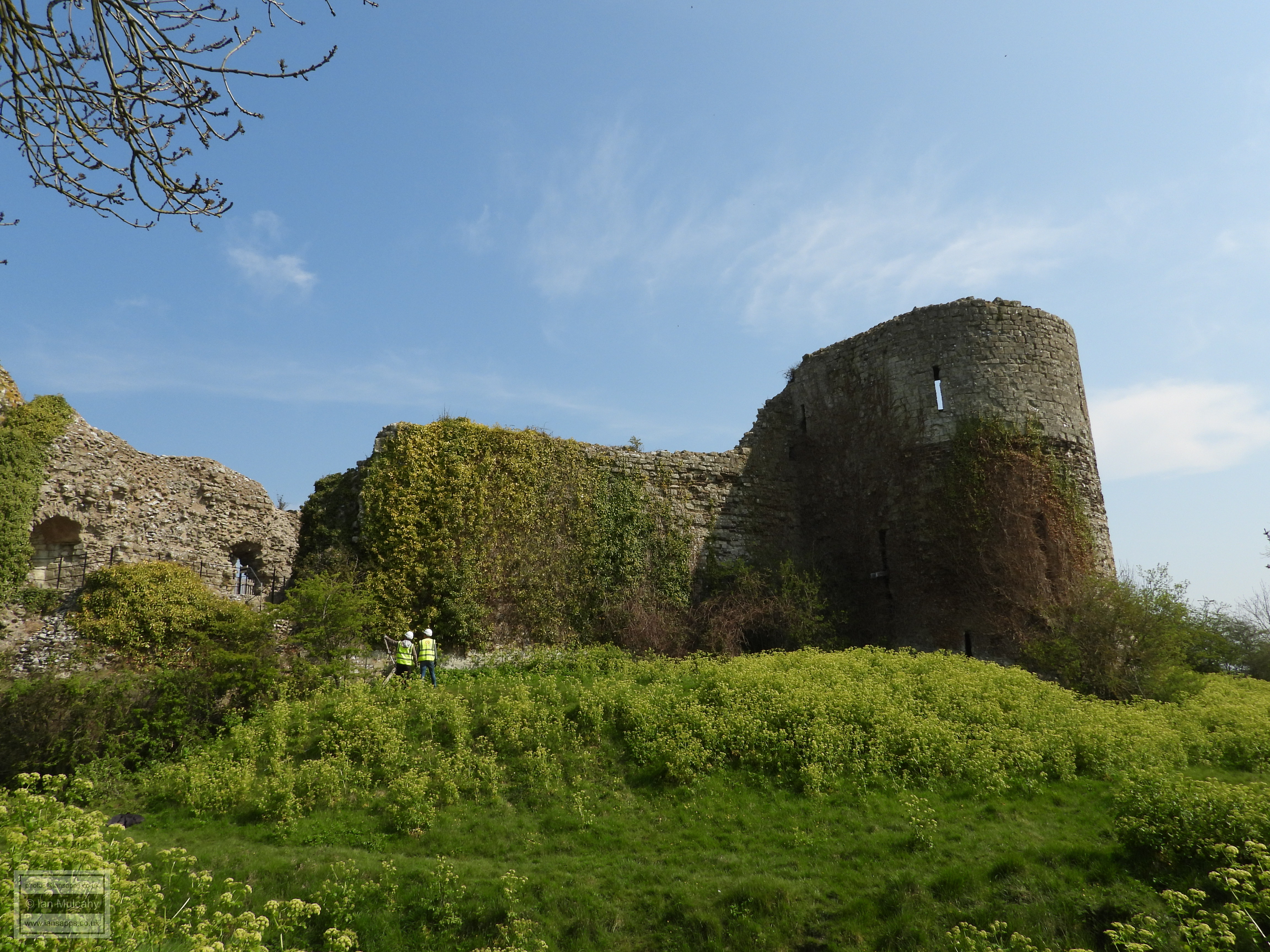
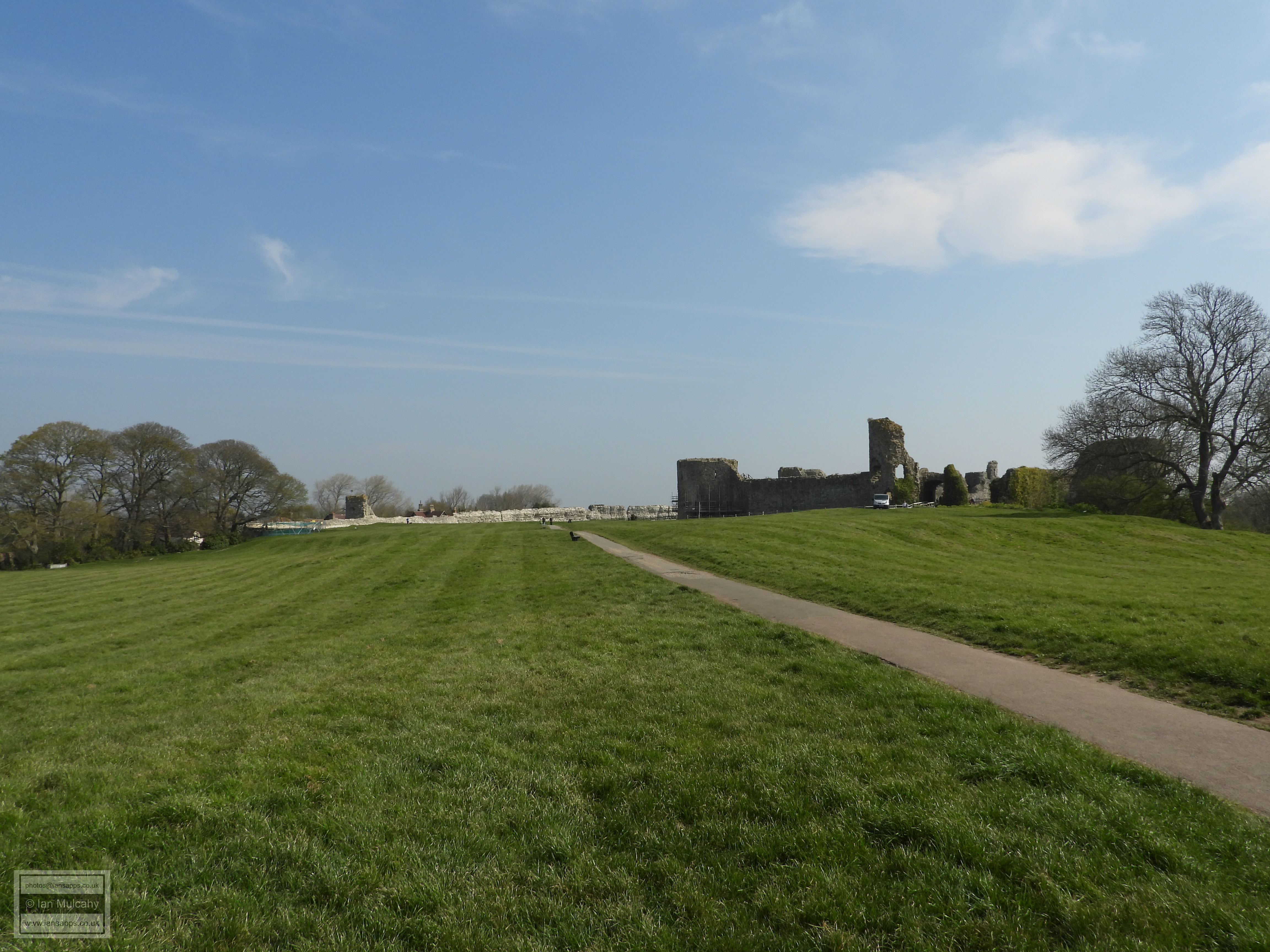
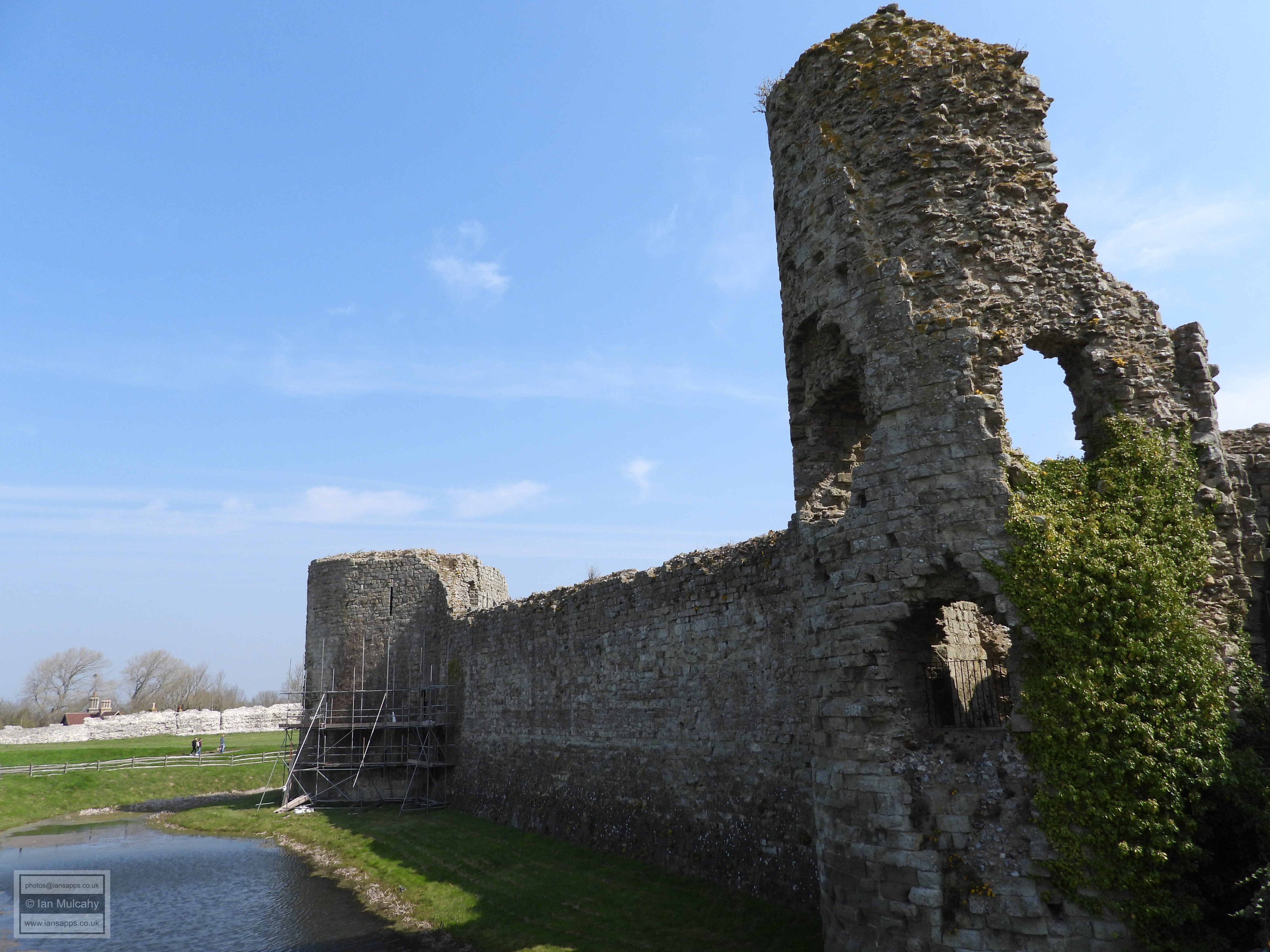
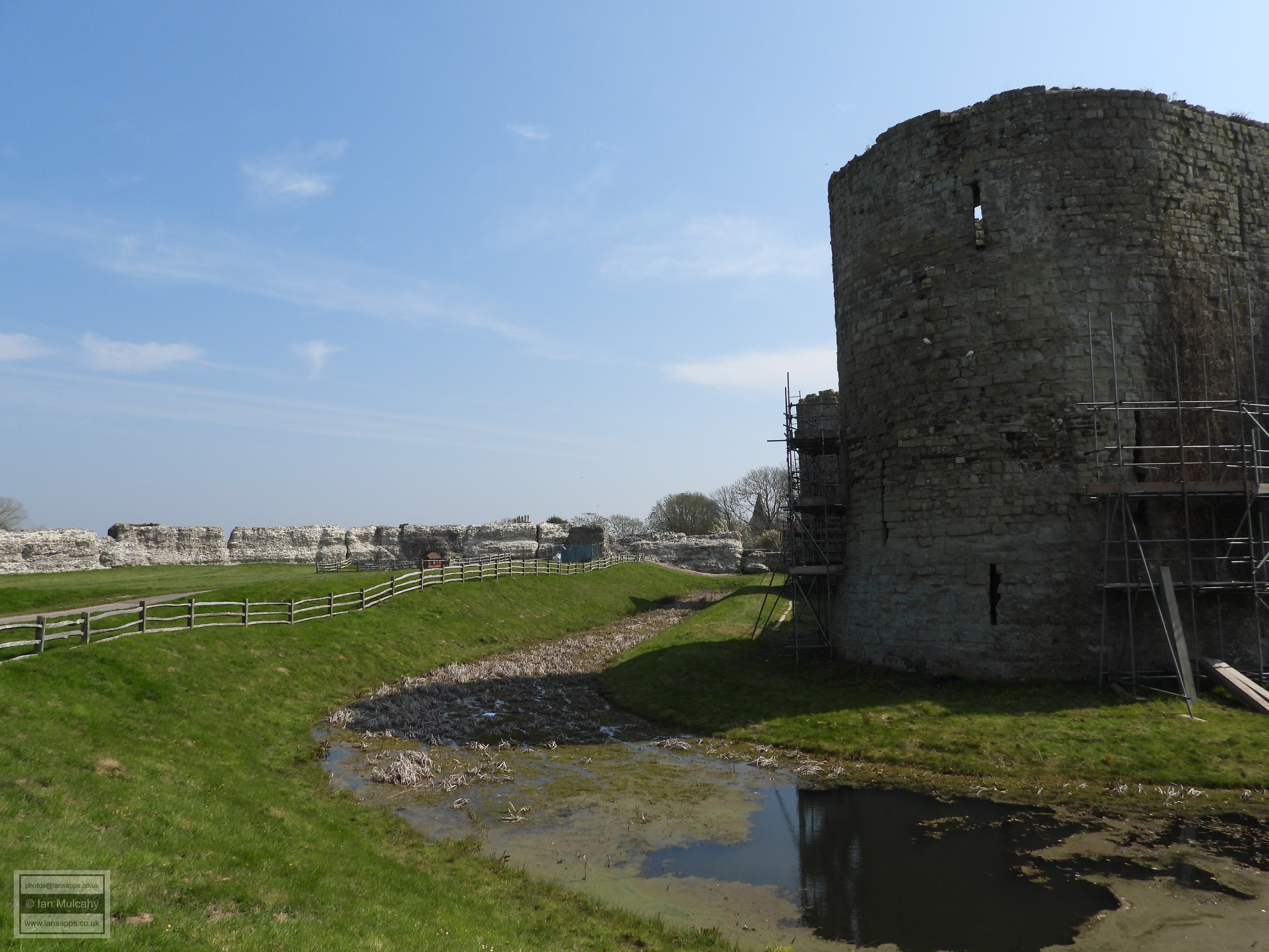
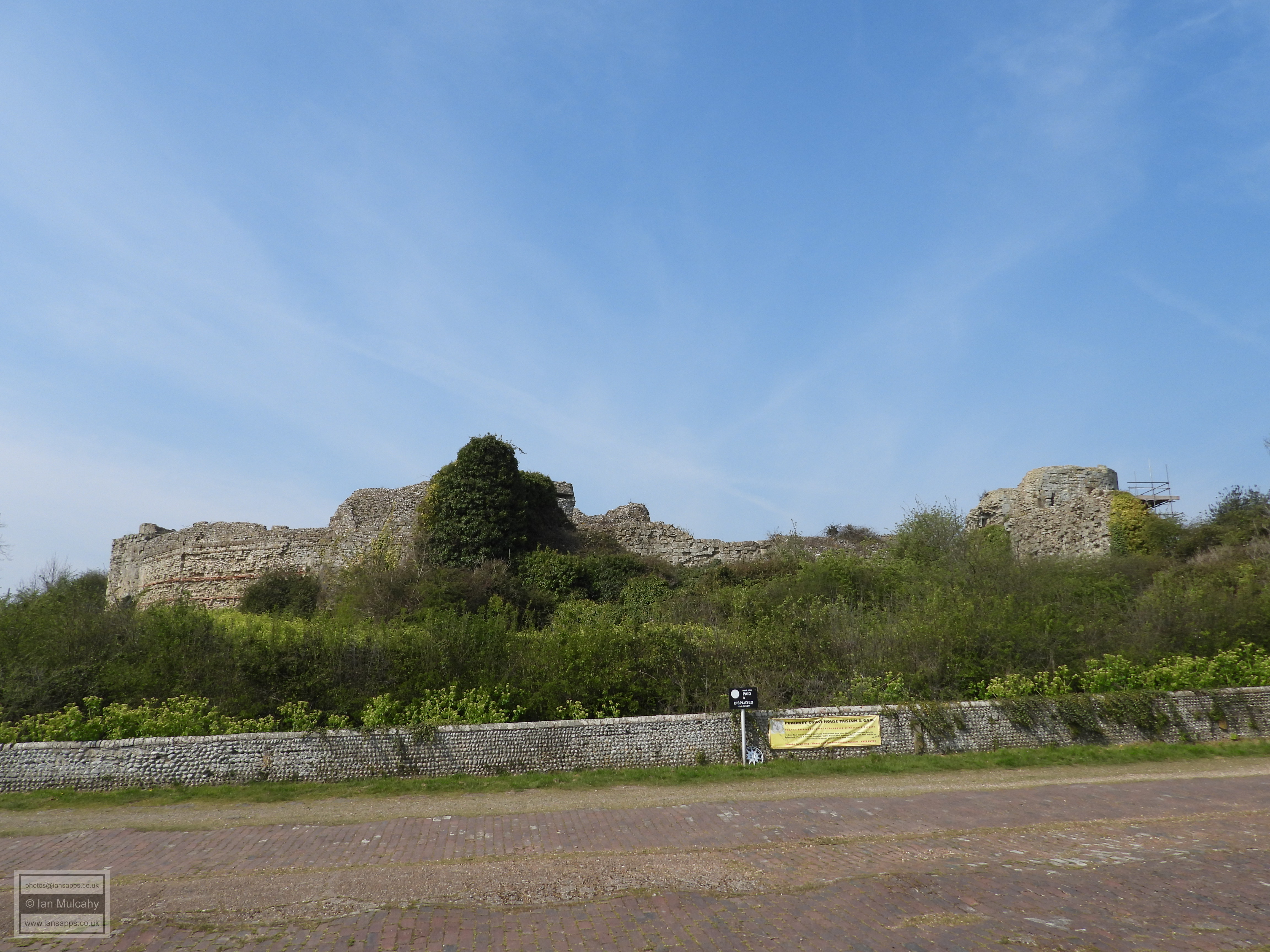
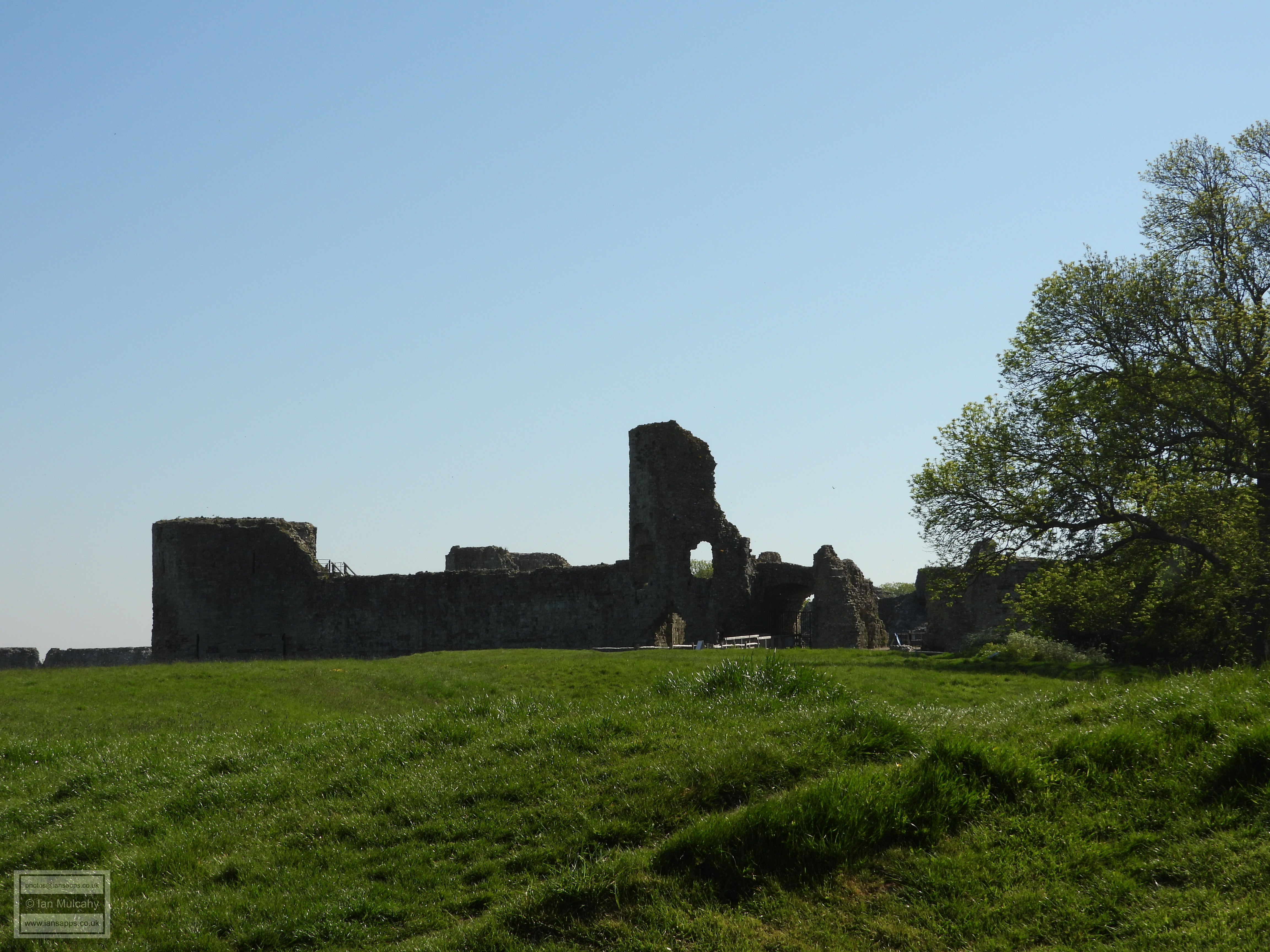
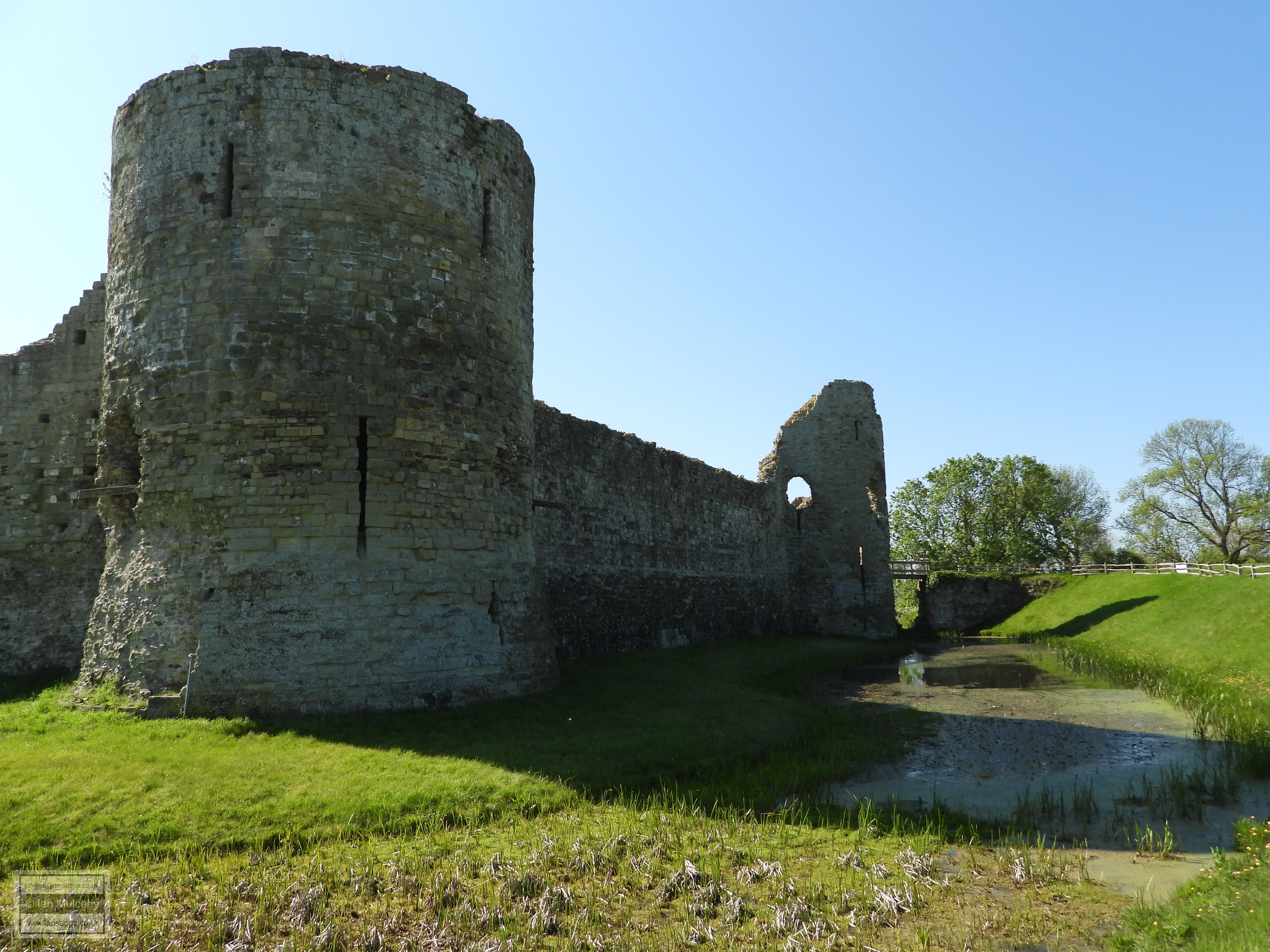
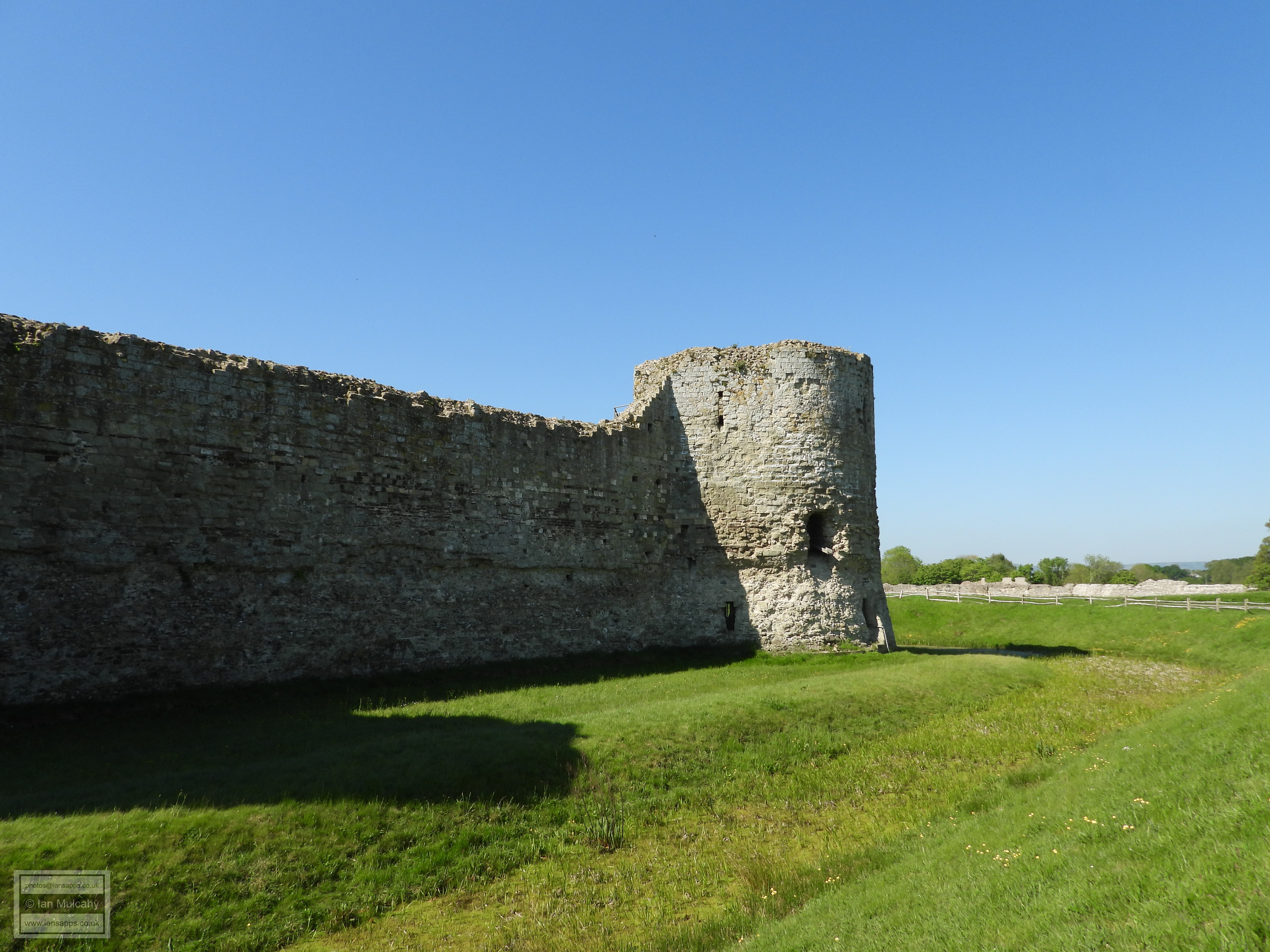
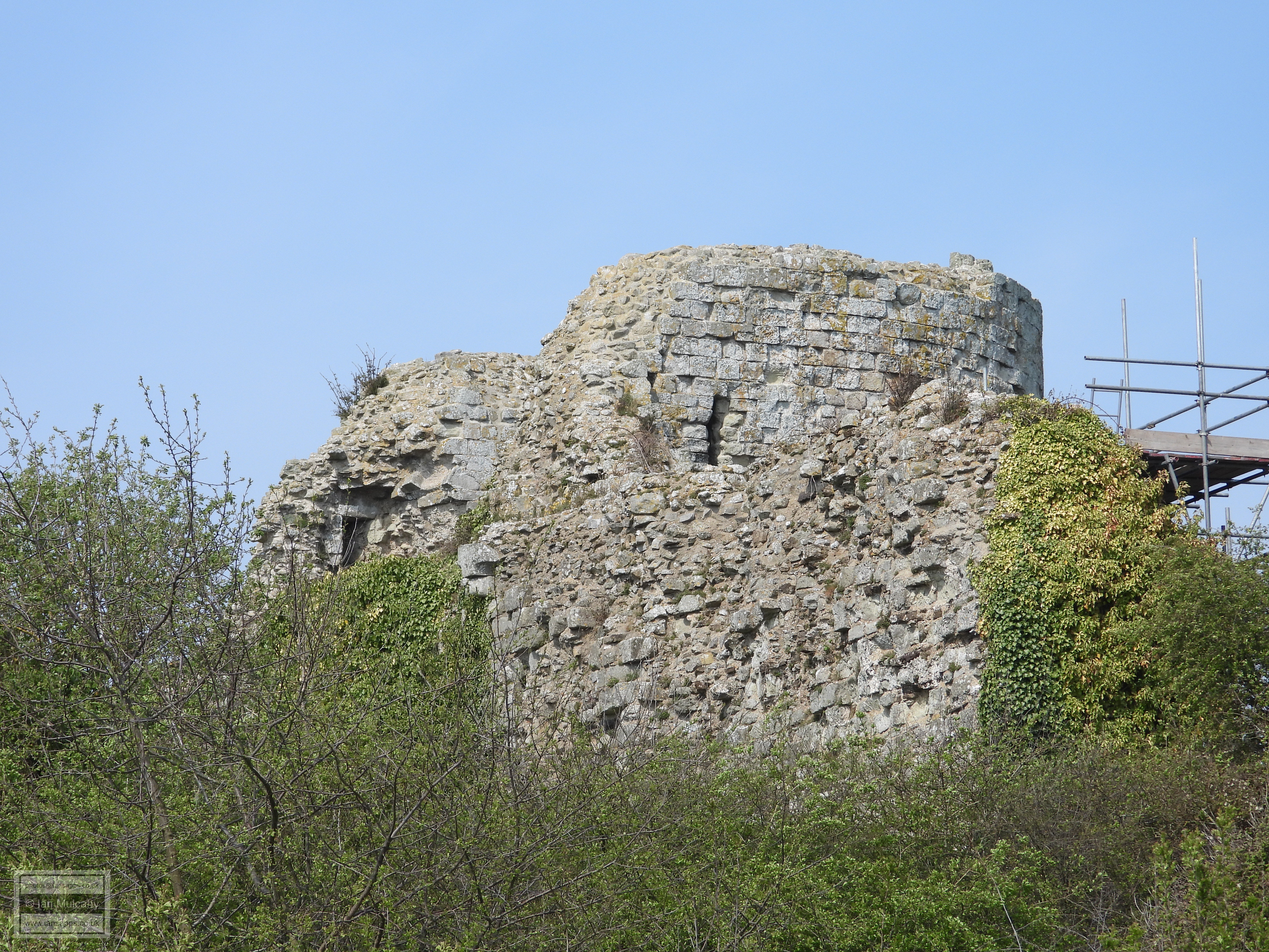
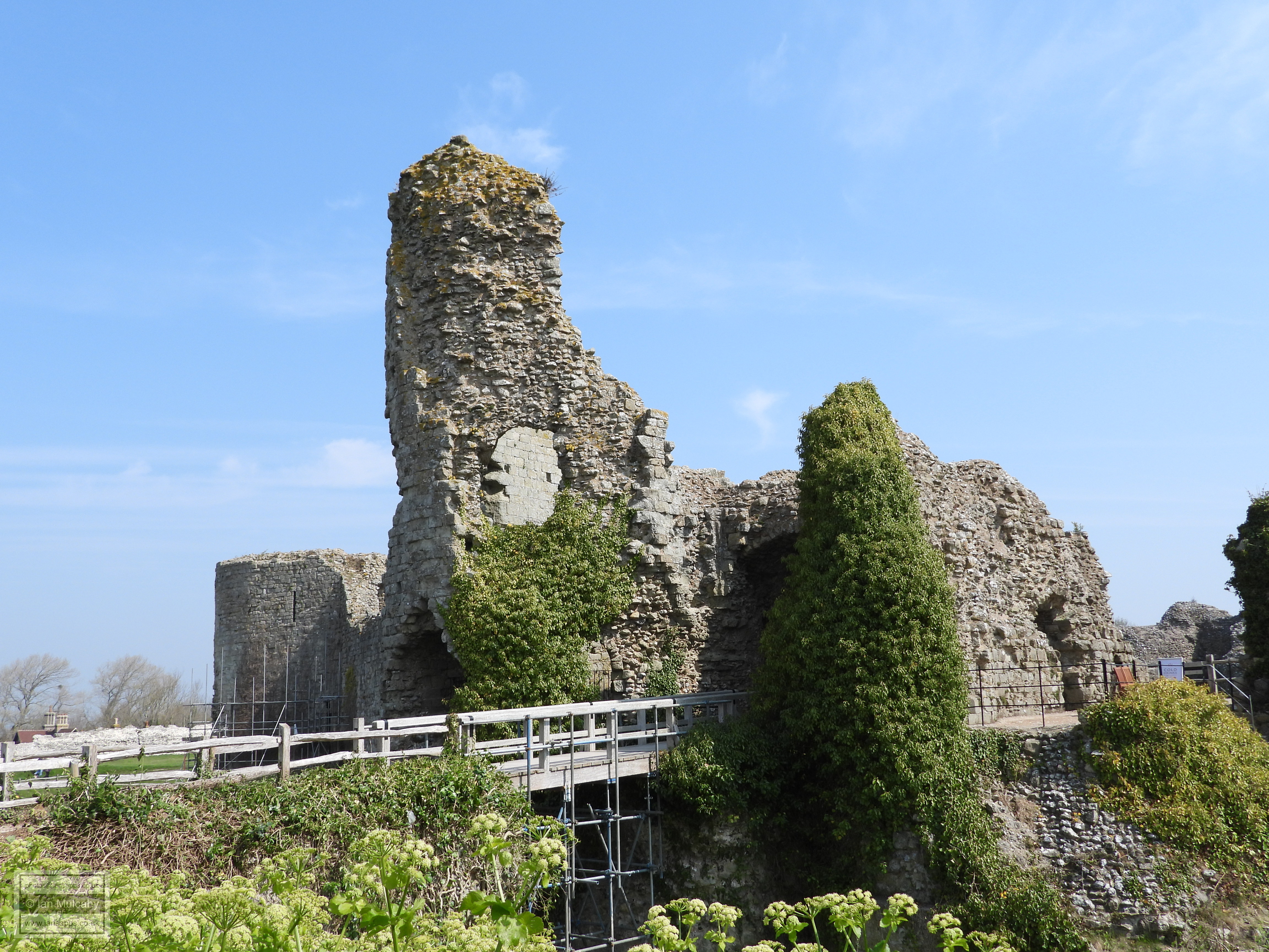
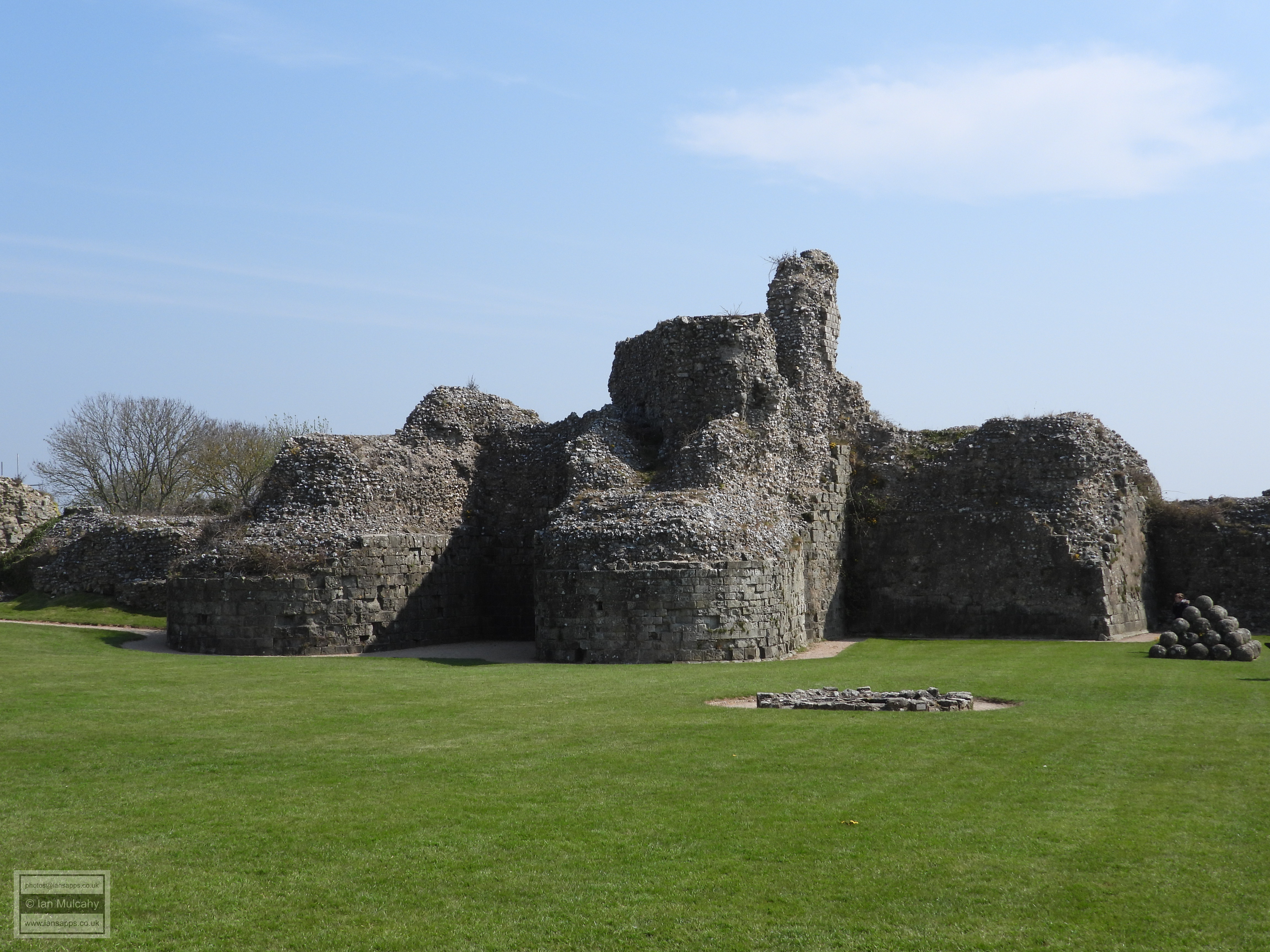
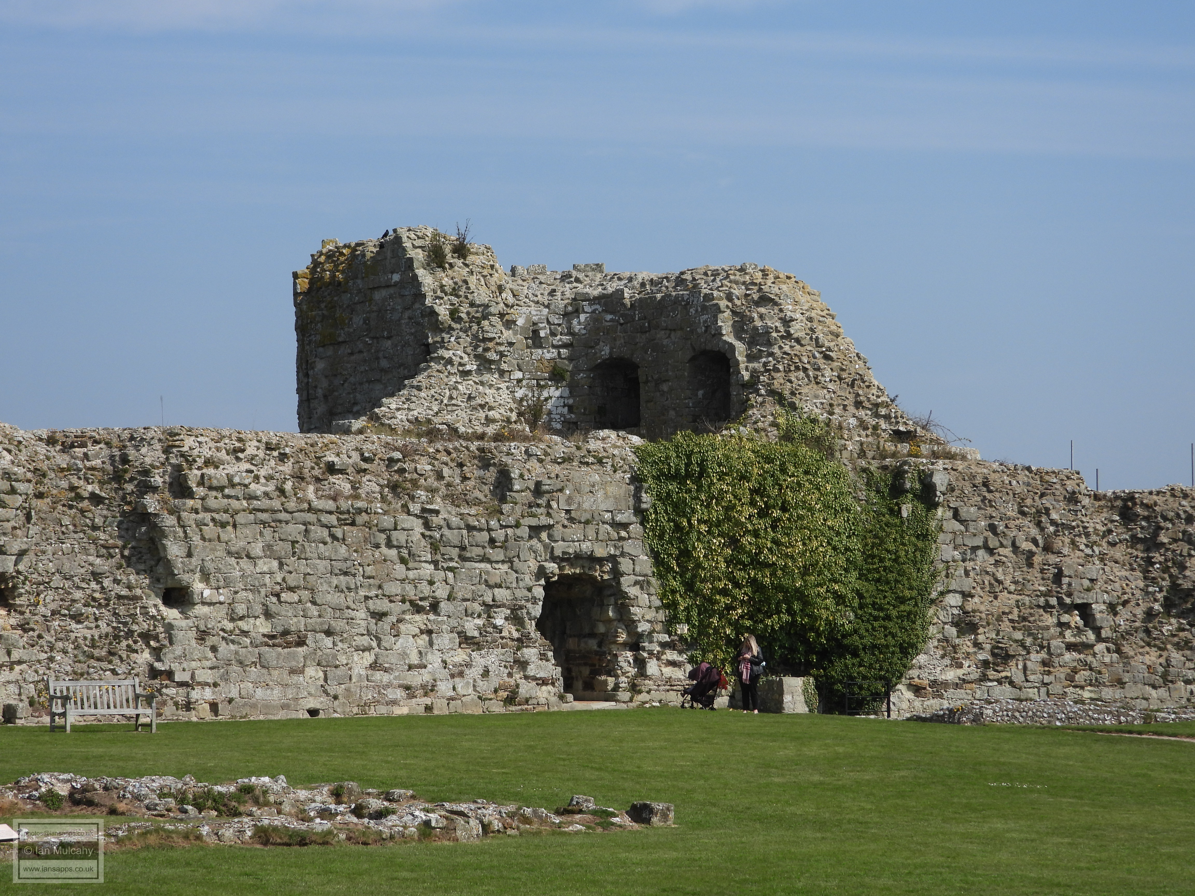
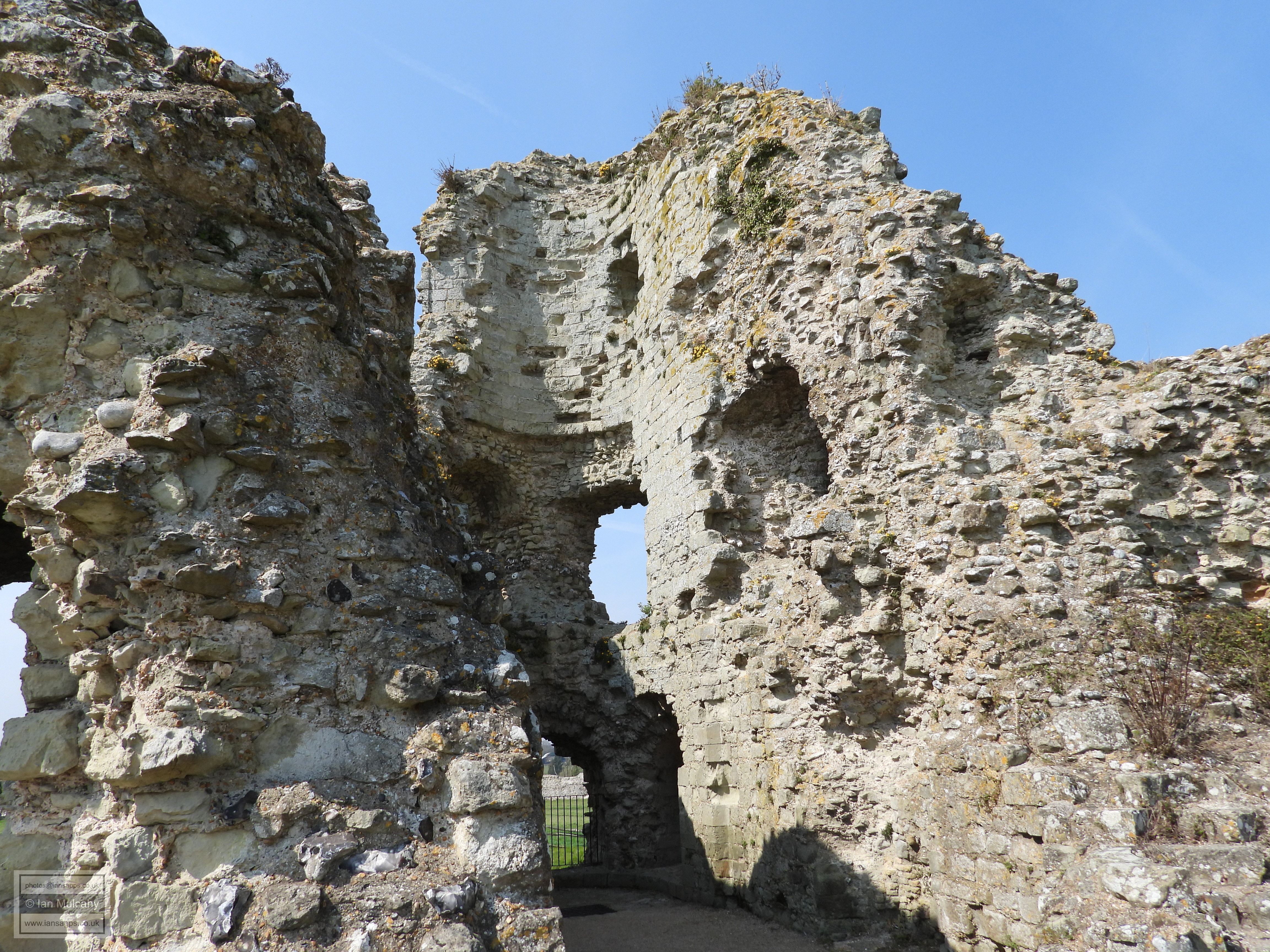
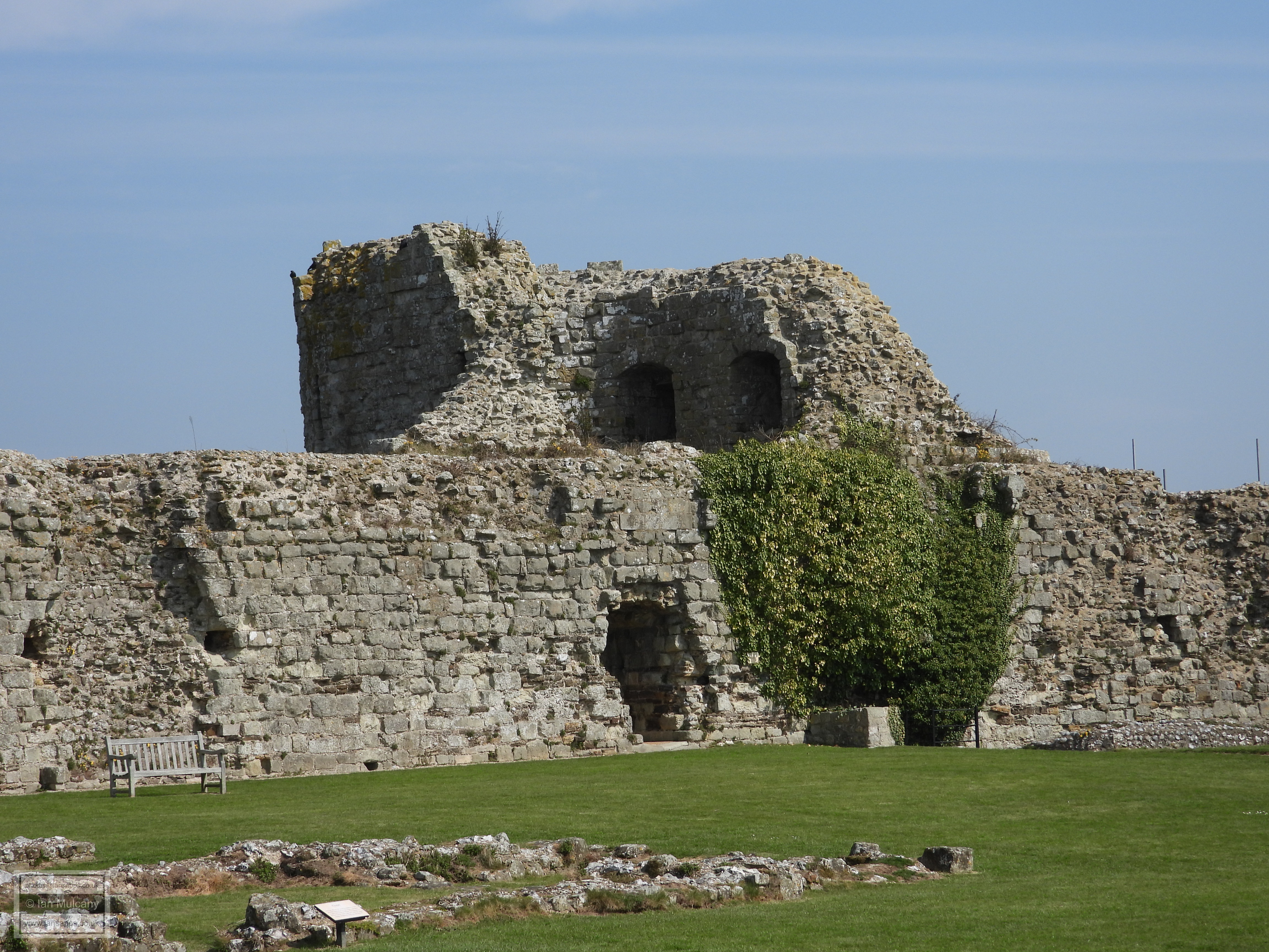
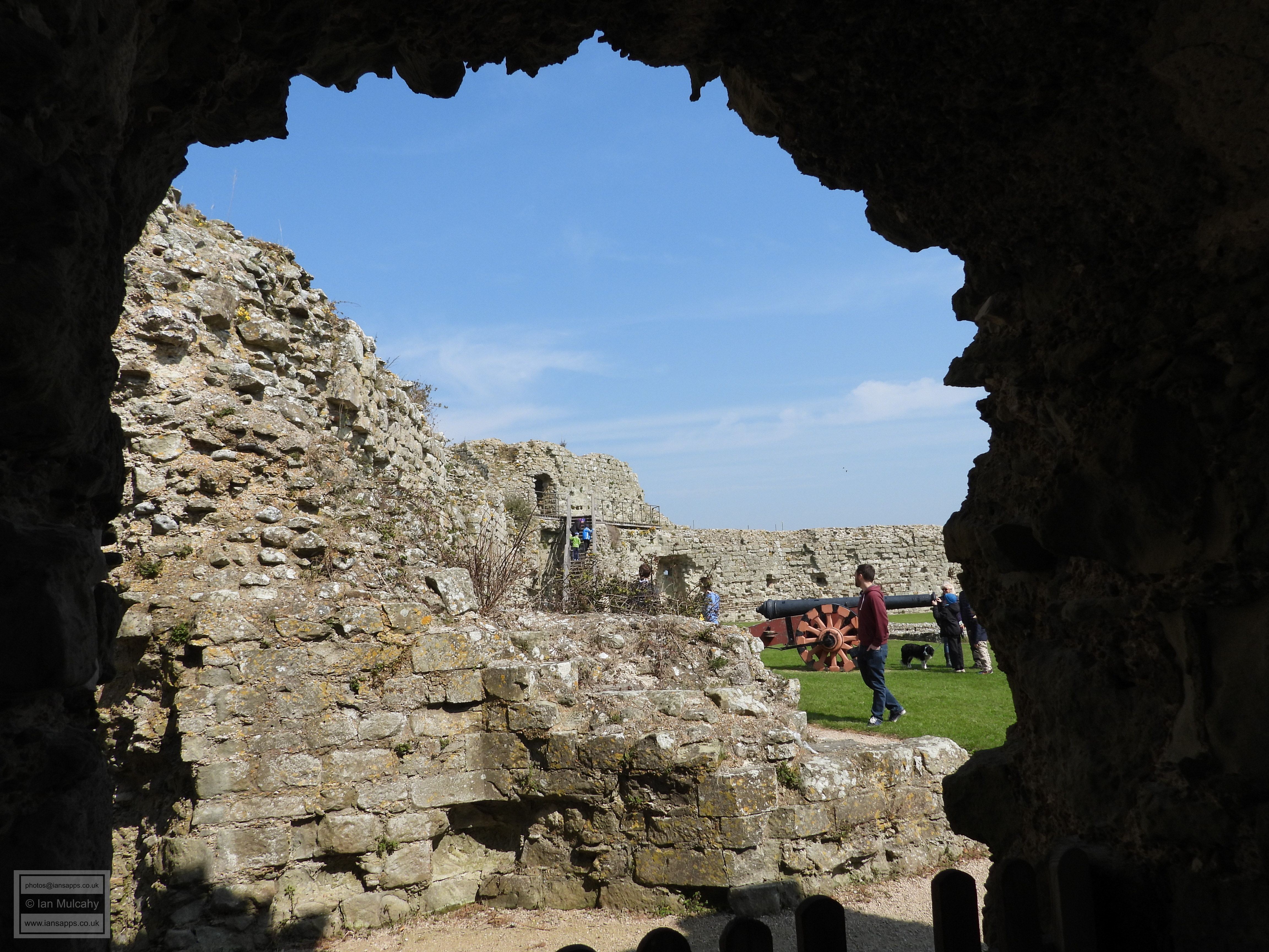
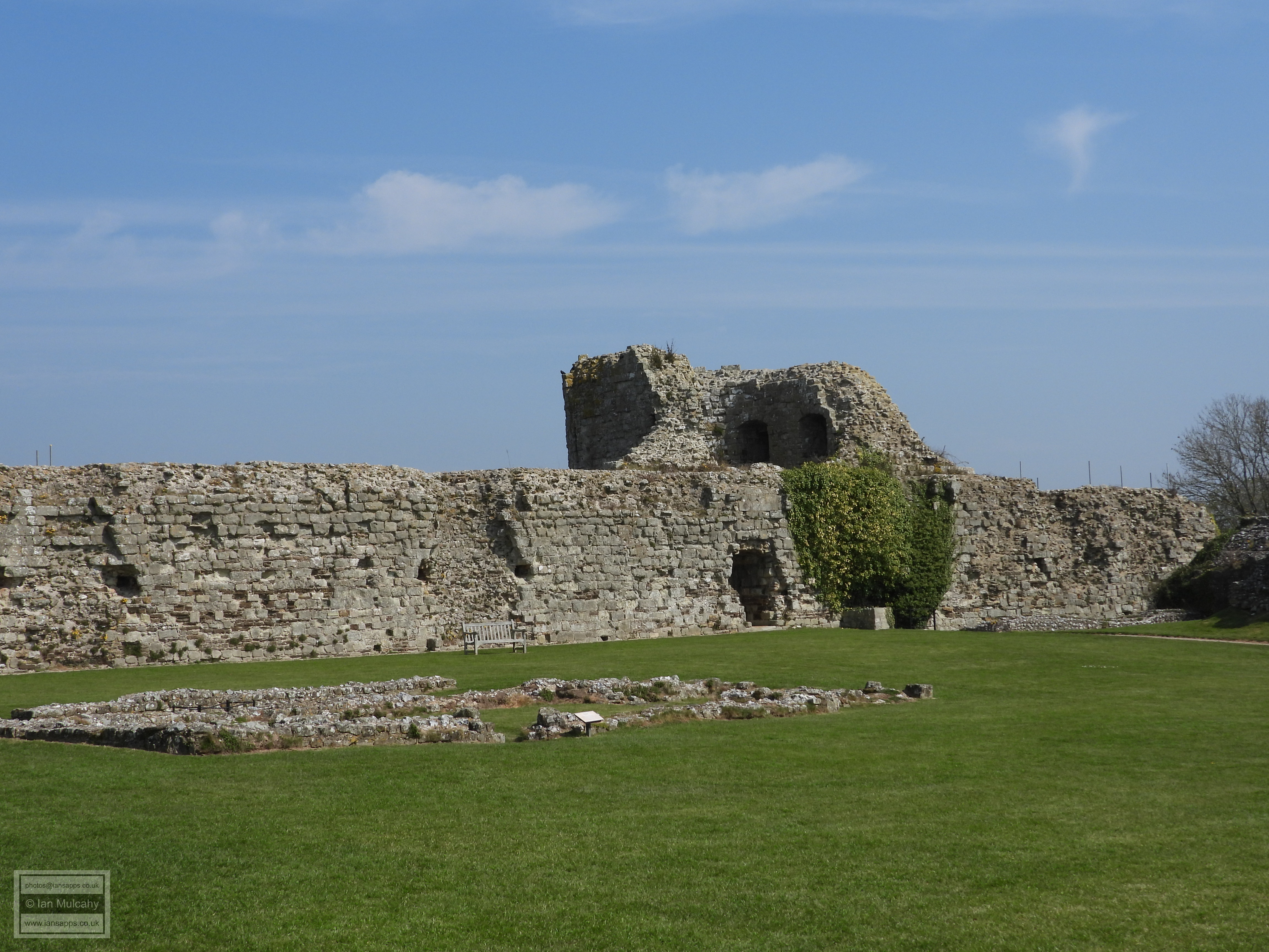
The enclosed area covers an area of roughly 10 acres (40,000 square metres) and is surrounded by a massive oval shaped curtain wall, rather than the standard square/rectangle shape of Roman forts, reflecting the shape of the spur on which it has been constructed. The curtain wall still stands to a height of over 8 metres in places, some 1.5 metres lower than the original height, and boasts a thickness of 4 metres. Numerous D shaped towers project outwards from the wall. There is a small gap in the northern section and almost all of the southern section, which would have adjoined the English Channel, has been lost due to land slippage, quite probably in advance of the Norman Conquest. The original facing stones are also missing having been stolen over the centuries for use in other building projects. Extant facing stones were revealed when archaeological excavations down to the foundations were carried out on part of the northern section of the wall in the early 20th century. Otherwise the masonry is largely intact and constitutes the largest walls and towers of any surviving Roman fort. The ground level inside the fort is considerably higher than that of the outside, making the walls look much lower than they actually are when the observer is stood inside. A full appreciation of the scale of the structure can be gained from outside of the enclosure.
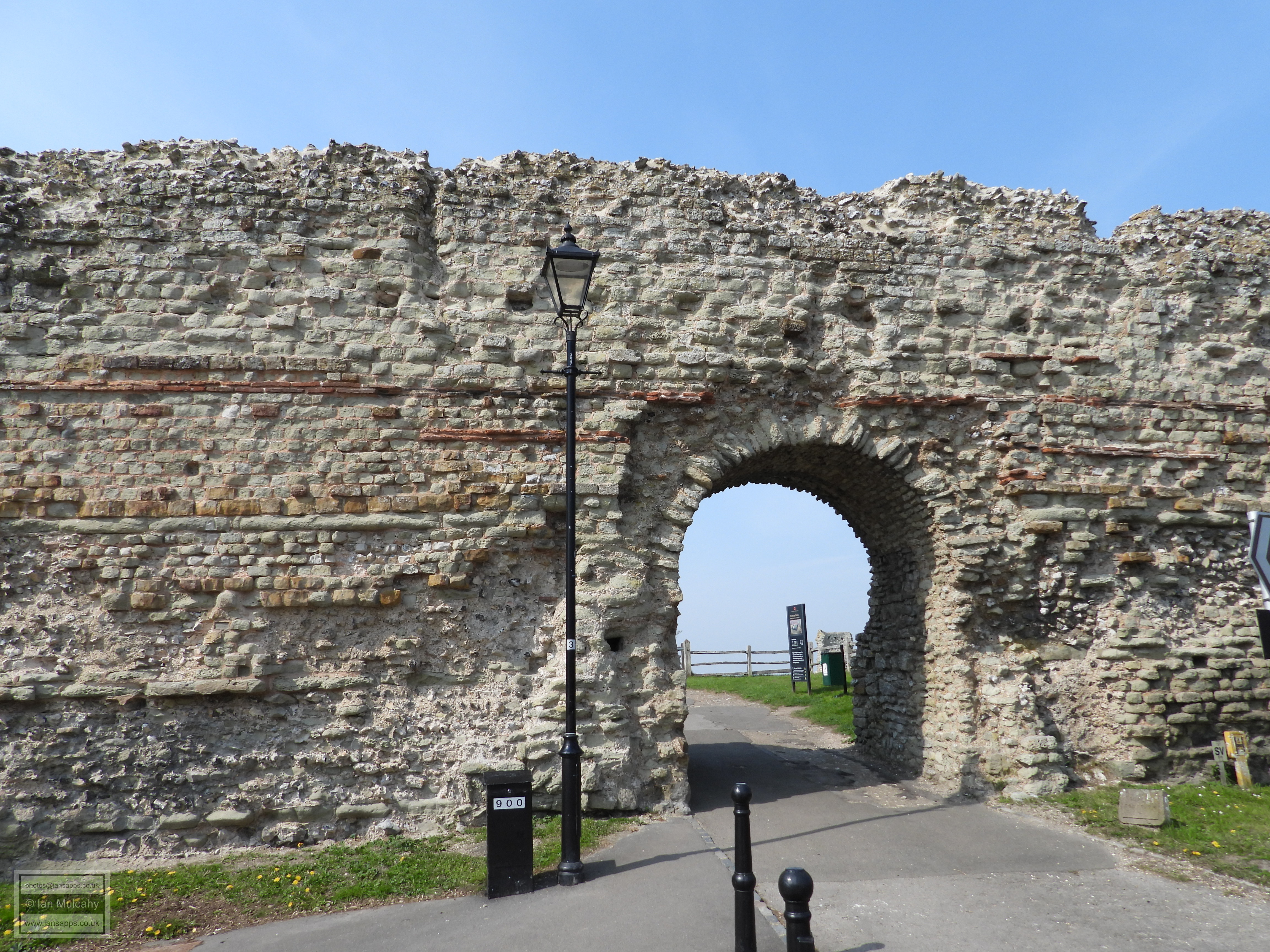
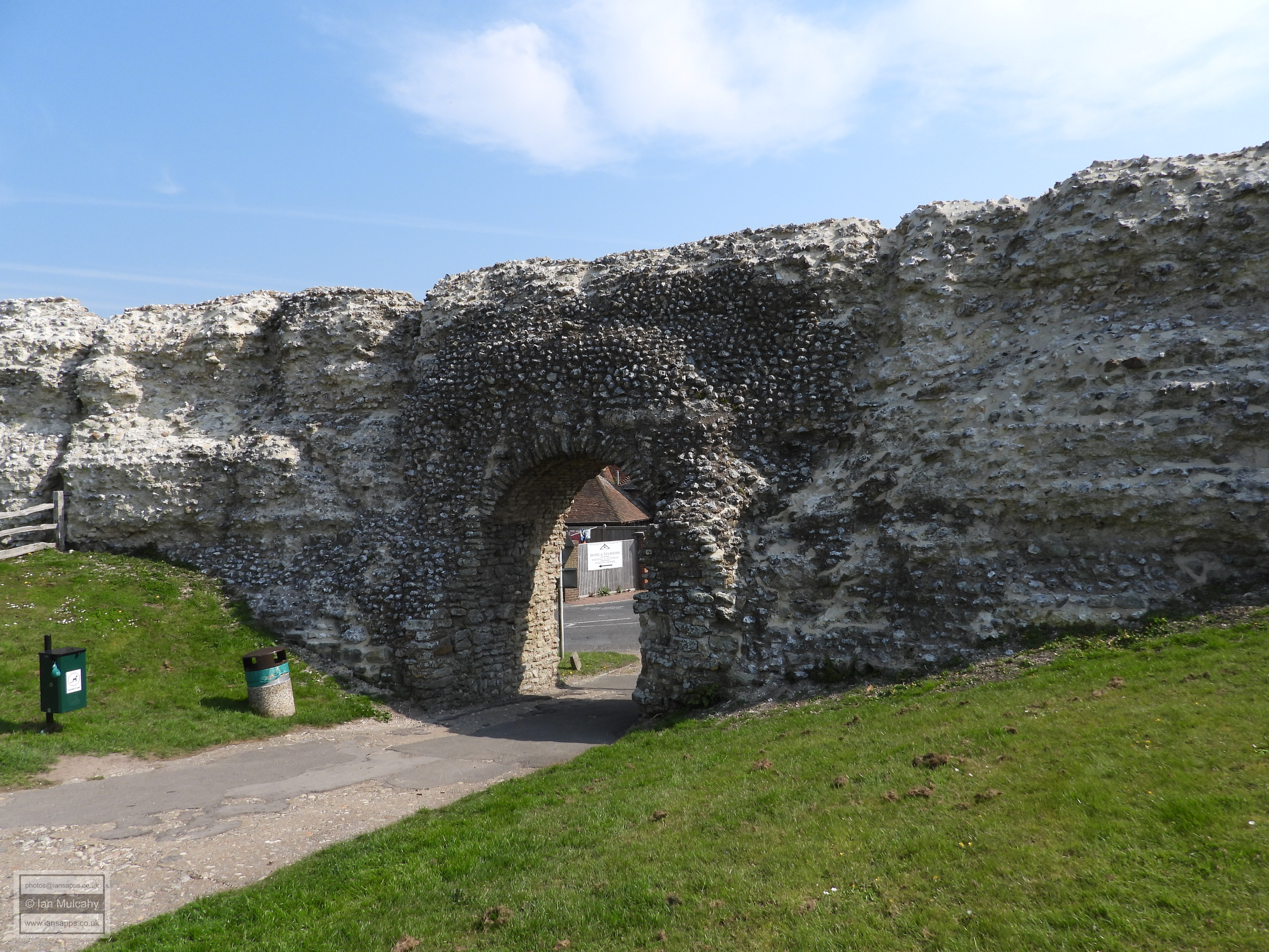
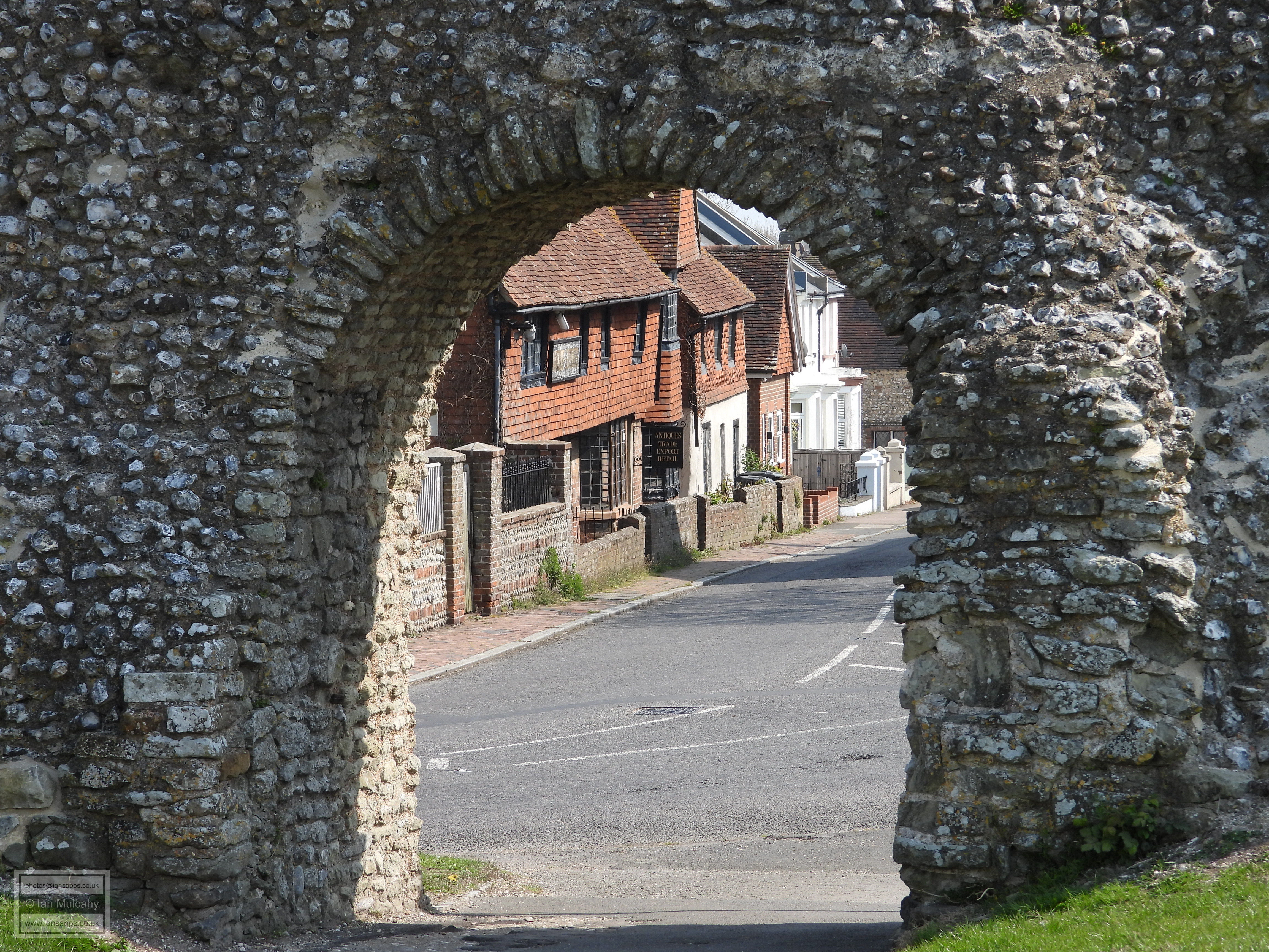
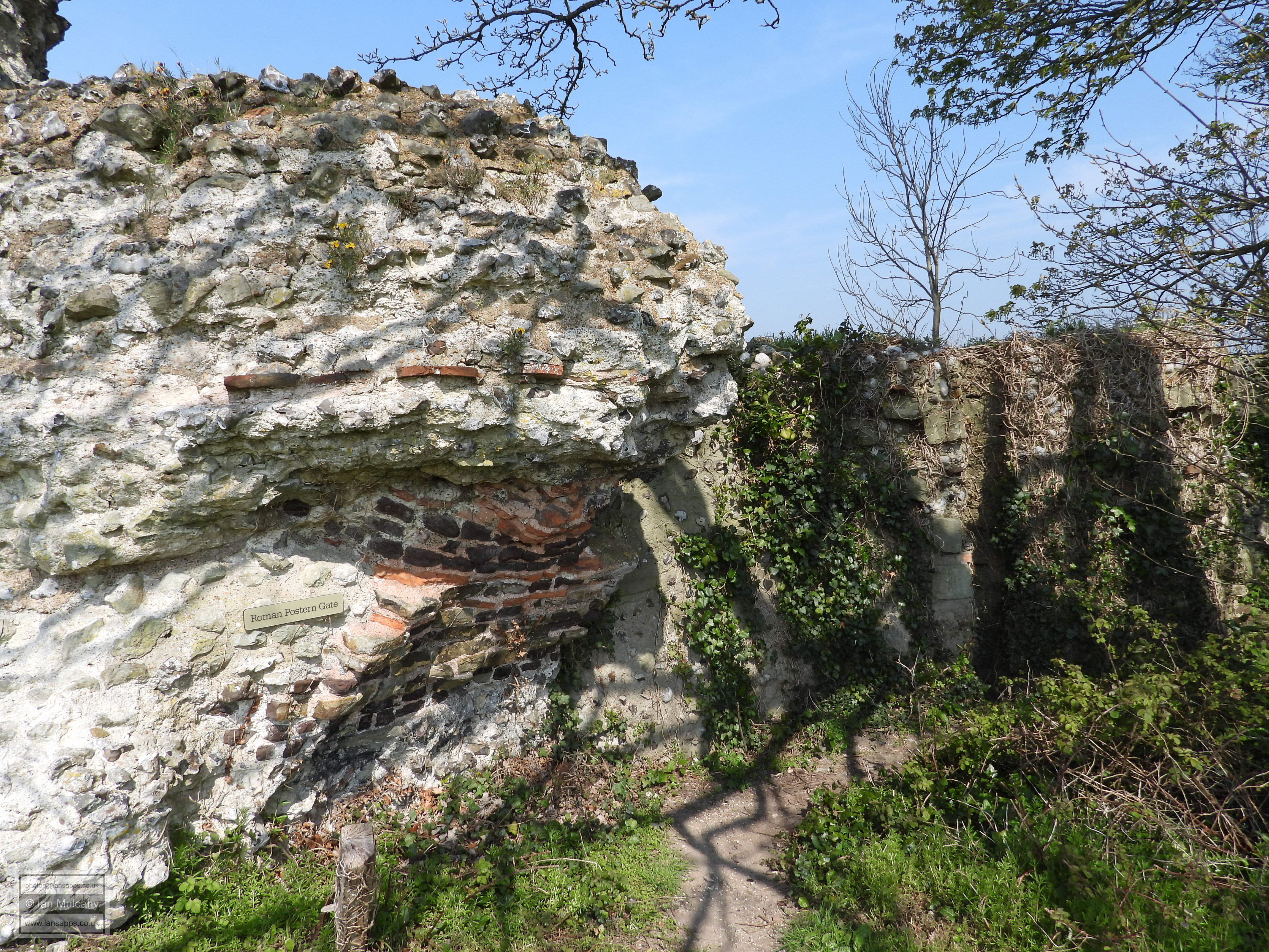
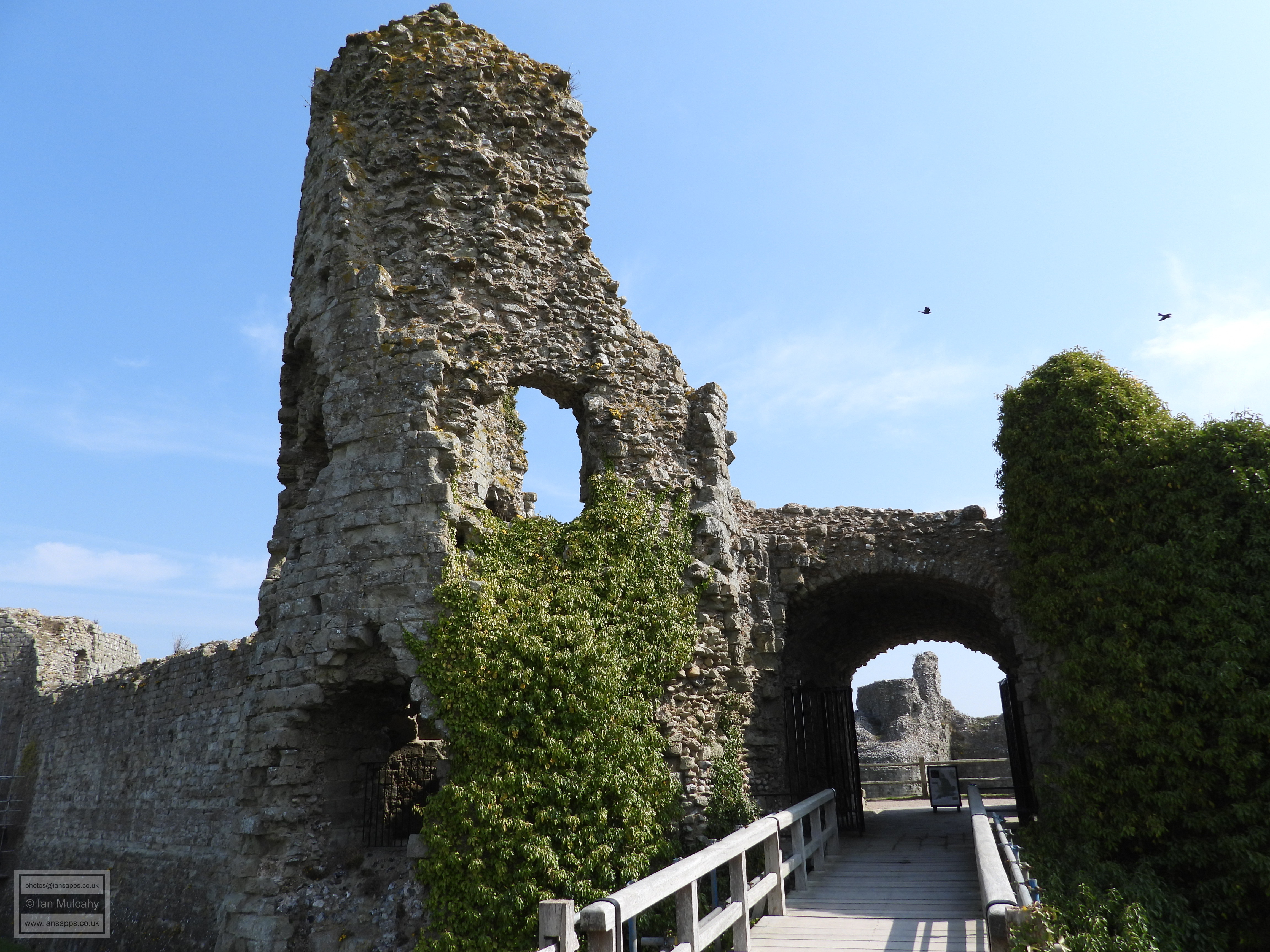
Access to the fort was via two main gates; one to the east and one to the west. The east gate, leading into the core of the village now, but onto the end of the spur and presumably the harbour at the time of construction, is a modest archway of almost three metres wide. The archway was refurbished by the Normans and again in the 19th century and this is clearly noticeable in the material used, though the design is unaltered. The west gate, the only land access to the fort which at the time was enclosed by the sea on its northern, eastern and southern sides, is somewhat grander, being over 9 metres wide and flanked by two, completely solid, round fronted bastions. In between the bastions, set back slightly, was a large rectangular gatehouse, providing an arched entrance of approximately 3 metres in width flanked by guard rooms, barely any of which survives. A 6 metre wide ditch, part of which is exposed, was also dug just outside the western end of the fort, joining the tidal estuary to the north with the English Channel to the south and so disconnecting the fort from the mainland. Close to the gap in the northern wall is another access point by way of a postern gate; a concealed access point which could be used covertly during a siege.
The strategic importance of Anderitum was such that it was also the base
for a Roman Naval Fleet known as the Classis Anderidaensis. The
assumption must be that these docked to the east of the castle at the
end of the spur, and this theory is substantiated by the discovery of a
13th century quay and an apparent stone sea wall just south of the
eastern end of the High Street during excavations at the Memorial Hall
between 1962 & 1966. It has also been suggested that the harbour may
have been a little way to the south west at the end of the Roman road in
the low area close to Pevensey and Westham Railway Station, but this
theory is a matter of conjecture as there is no physical evidence to
support this idea. Perhaps both locations hosted harbours.
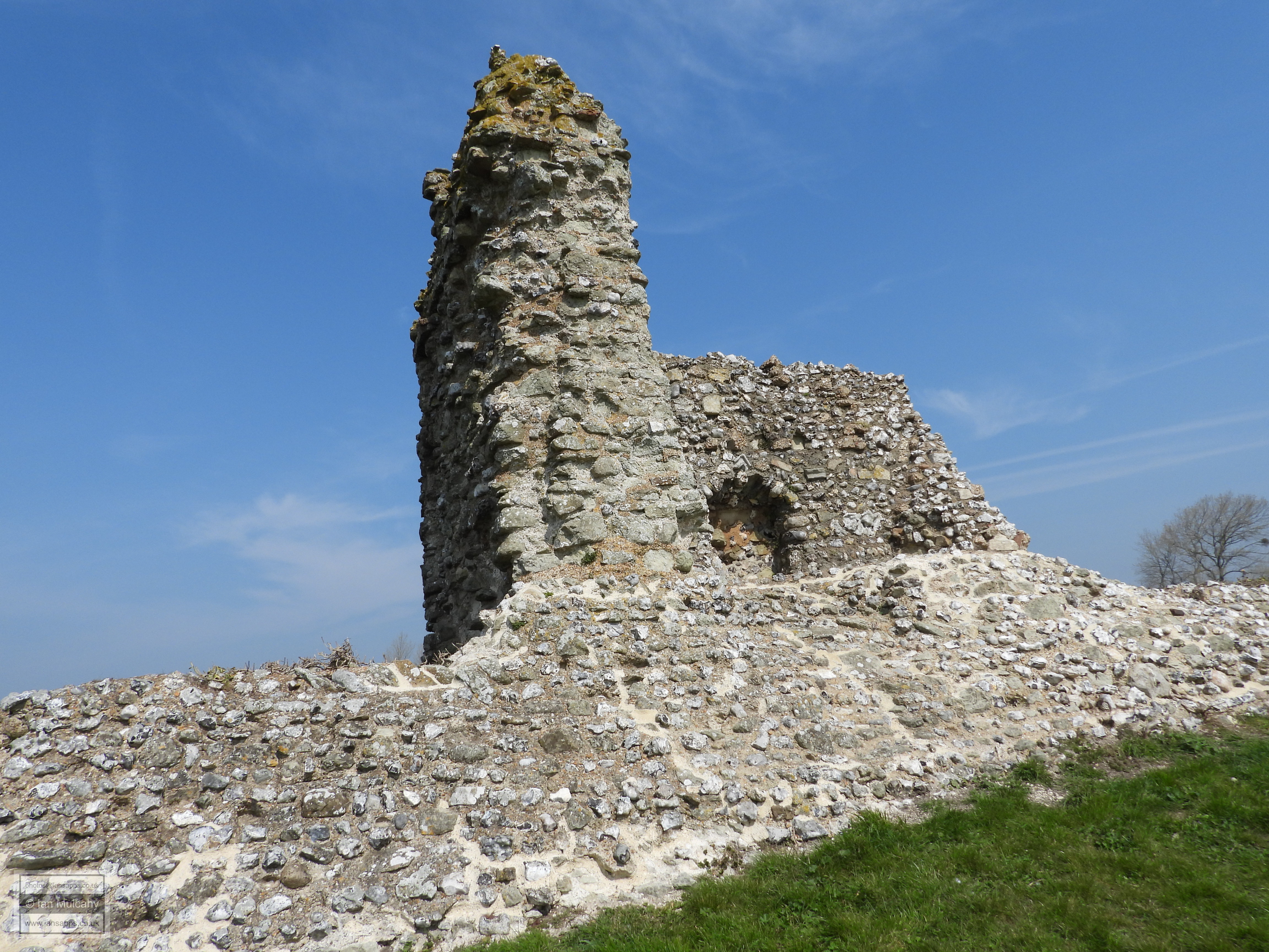
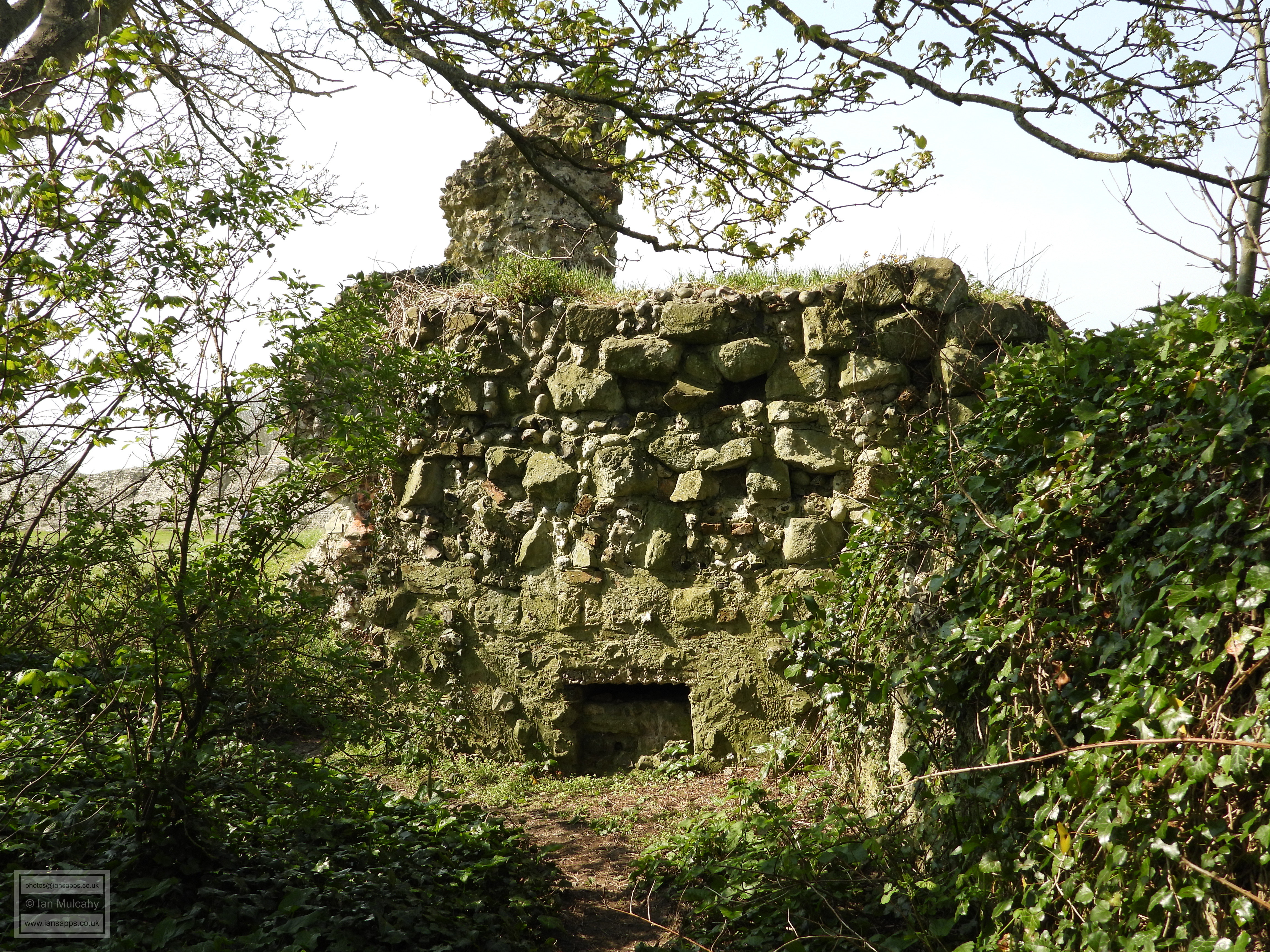
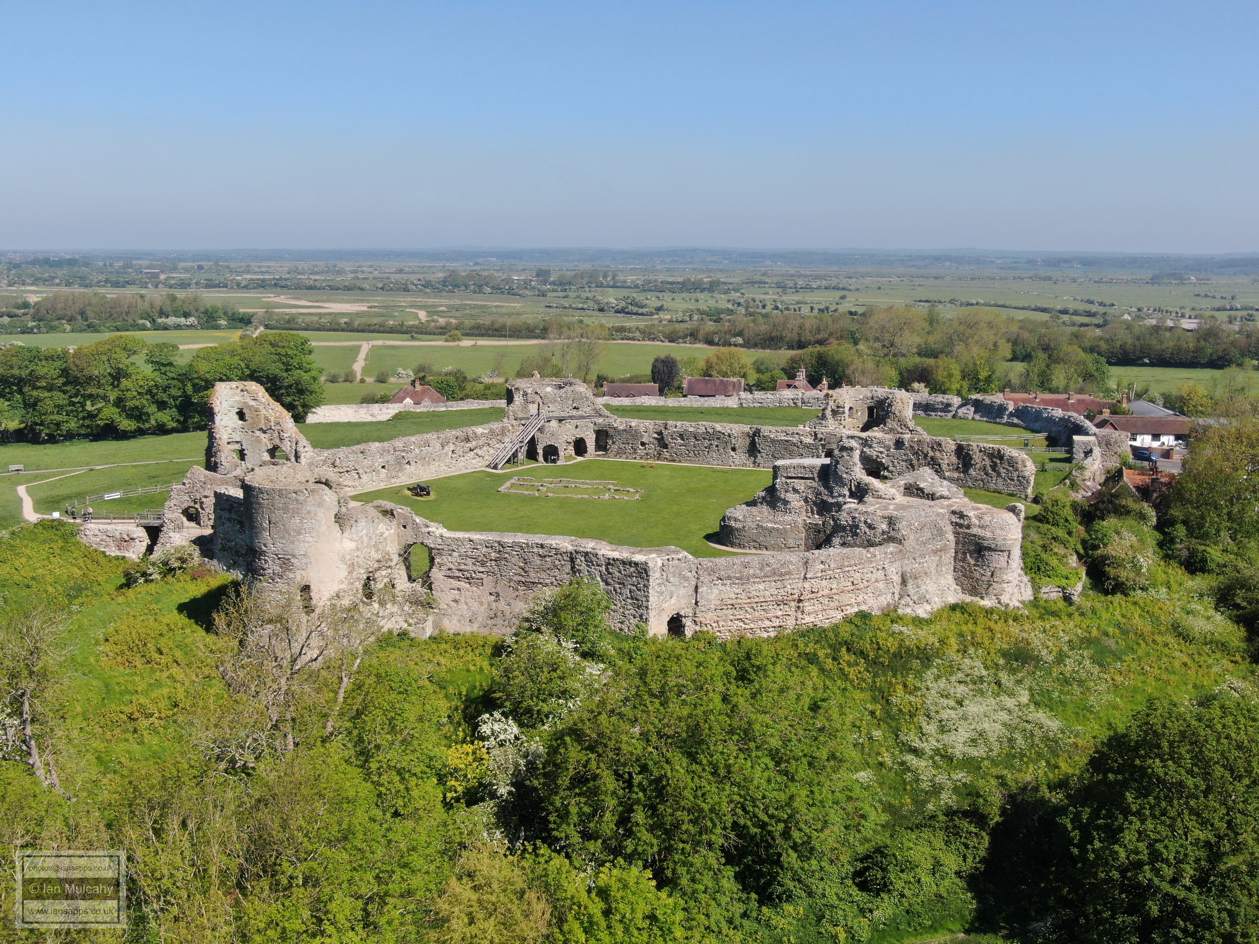
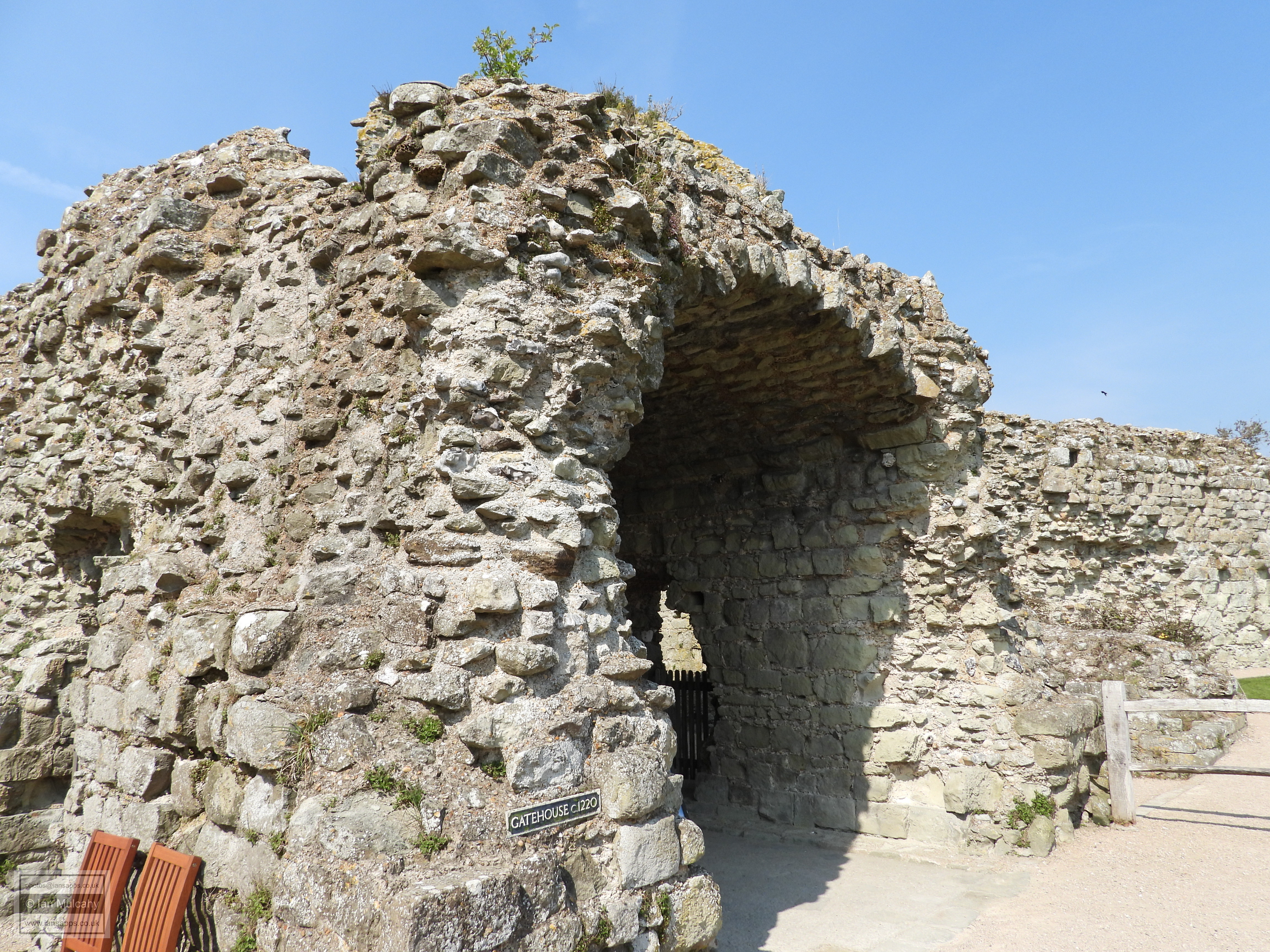
The most famous use of Pevensey Harbour occurred just before dawn on the morning of 28 September 1066 when an armada of up to 700 of ships sailed from Saint-Valery-sur-Somme in Northern France carrying an army of 10,000 men led by William, Duke of Normandy and landed here, immediately setting about repairing the Roman walls of Anderitum and constructing a defensive castle from earth and timber in the south eastern corner of the fort, surrounded by a deep and wide moat. Once Harold had been defeated on 14 October 1066 in the decisive battle of Hastings, the Normans set to work organising the administration of their new lands and divided Sussex into 6 thin administrative areas which ran from the coast in the south to the borders with Surrey and Kent in the north and these were known as ‘Rapes’. These rapes, one of which was Pevensey, were administered from, and protected by, their castles. The other Sussex rapes are, from west to east, Chichester, Arundel, Bramber, Lewes & Hastings. The timber structures were only temporary and in around 1100 a large stone keep was erected in the south east corner of the Norman inner bailey, of which ruined stumps of up to 30 feet high survive, along with a chapel towards the northern corner of which only the lower two or three courses of stones remain. A large stone gatehouse was added by 1220 and the rest of the inner baily was enclosed with masonry curtain walls and towers shortly afterwards, certainly by 1250. There are at least 7 fireplaces set into the inner walls of the curtain and these point to domestic buildings being constructed against the walls, though no trace of them survives.
In the 15th century, the castle was used as a prison, and notable inmates included Edward, Duke of York and grandson of Edward III, in 1405, James I of Scotland in 1415 and Joan of Navarre, widow of Henry IV, in 1419/20.
The medieval settlement at Pevensey has its origins in the middle Saxon period and it is probable that this was contained largely within the confines of the fort from the early 7th century onwards. Documentation from 1054 recording the lands of the Abbey Church of the Holy Trinity at Fécamp in Normandy (also the owners of Steyning in modern day West Sussex at the time) shows that the settlement contained 12 houses. Immediately prior to the conquest it is recorded that there were 52 households, though this had reduced to 27 by 1067, presumably as a result of the invasion and militarisation of Pevensey. The Domesday survey of 1086 records that the number of households had risen fourfold to 110, highlighting a significant settlement engaged in the administration of its eponymous rape which had almost certainly spilled out of the confines of the fort and onto the spur to the east and into the modern village of Westham to the west.
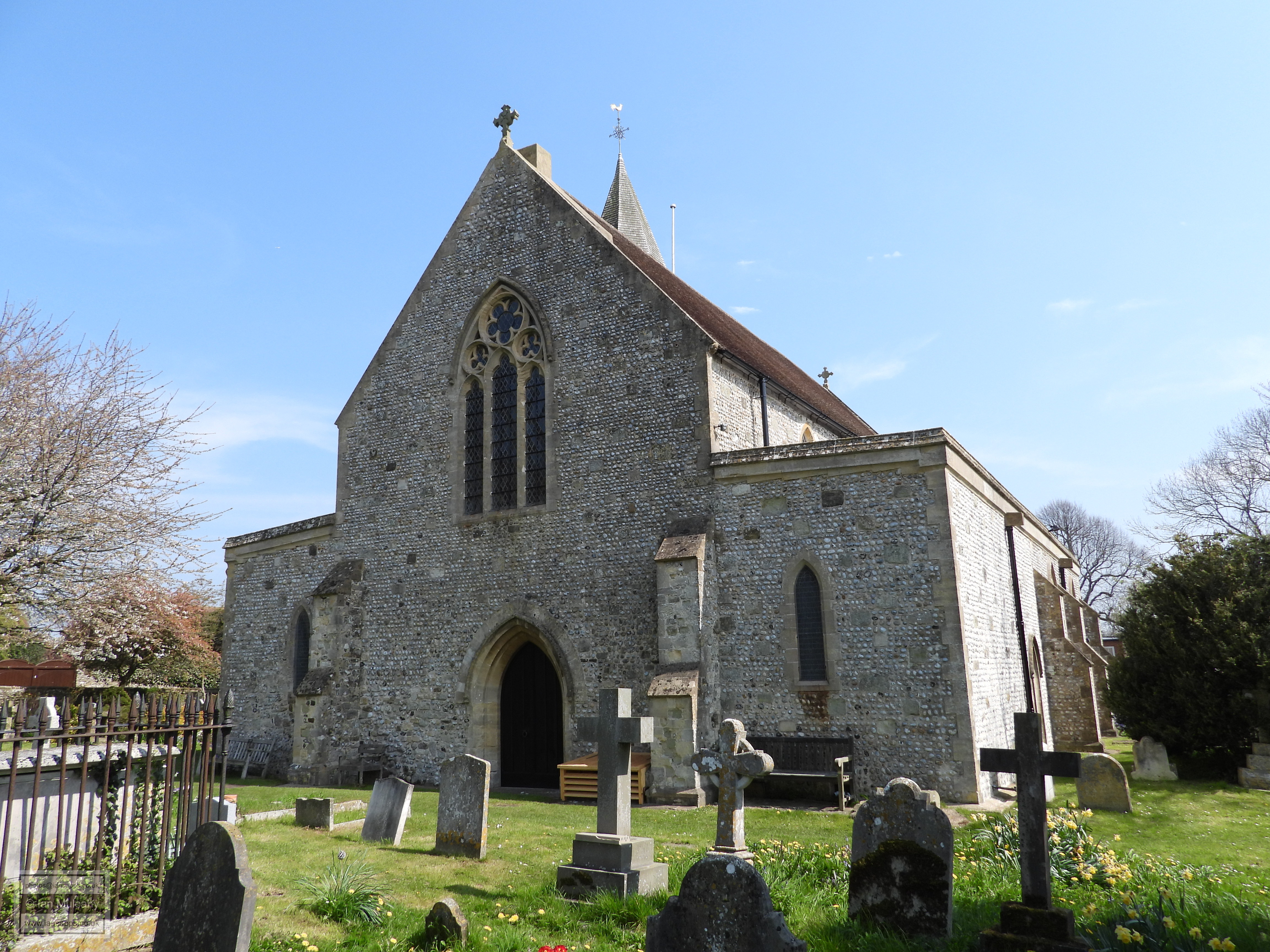
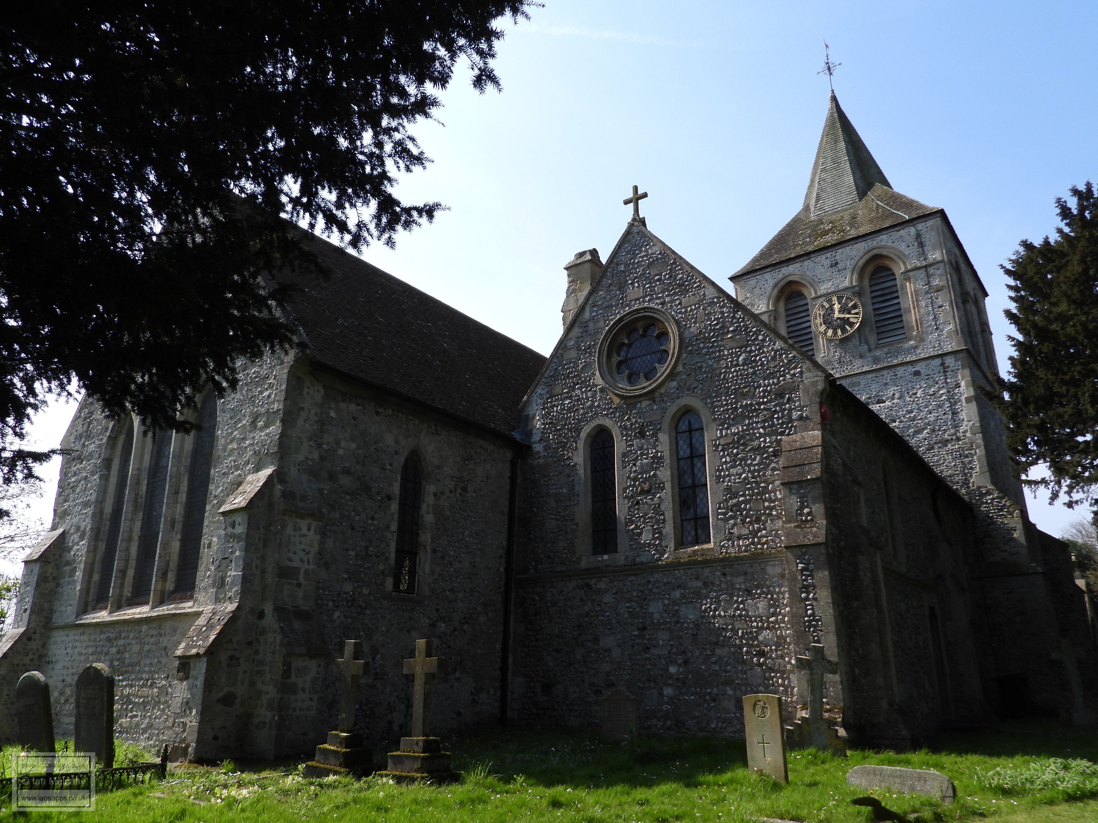
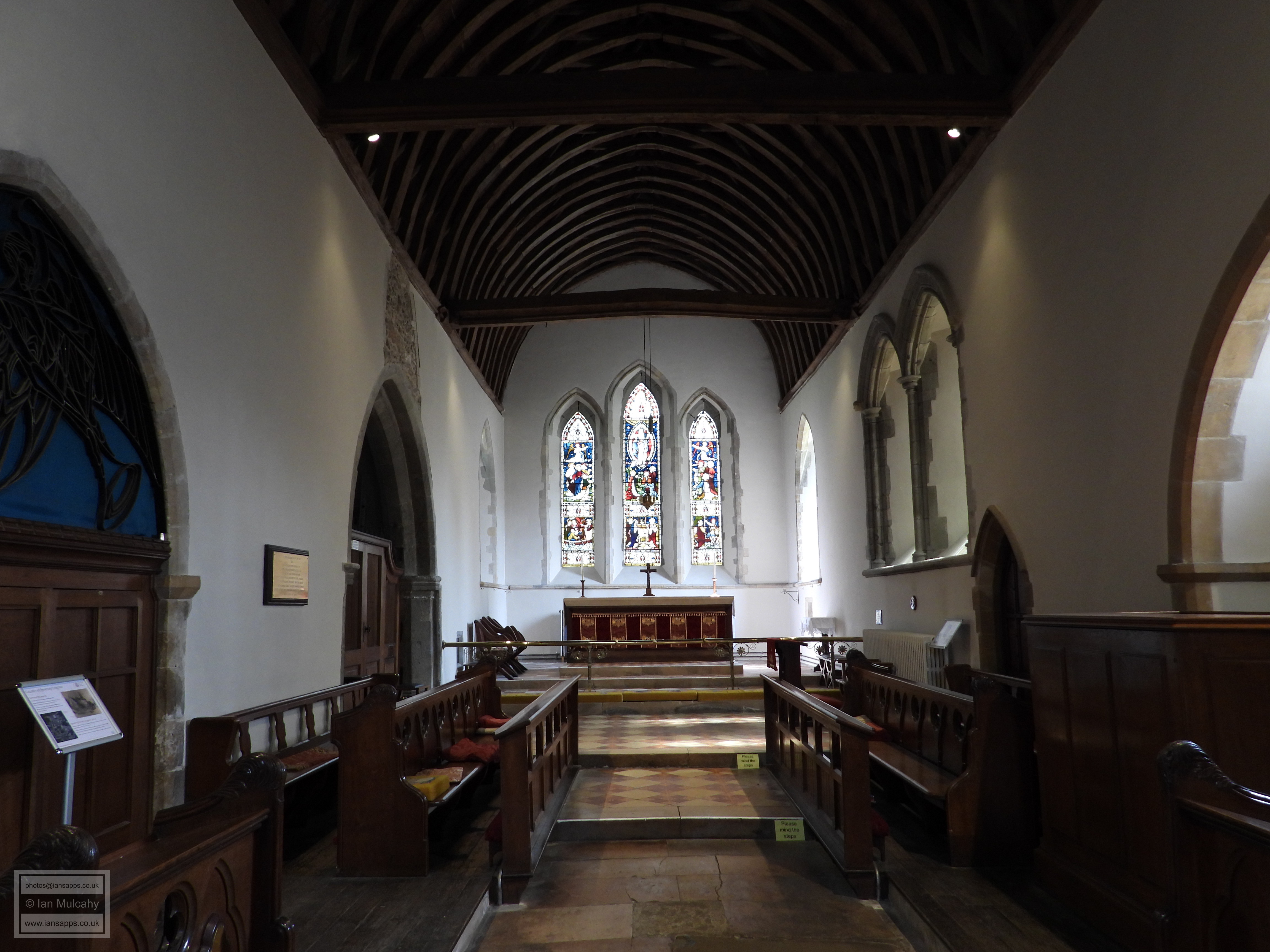
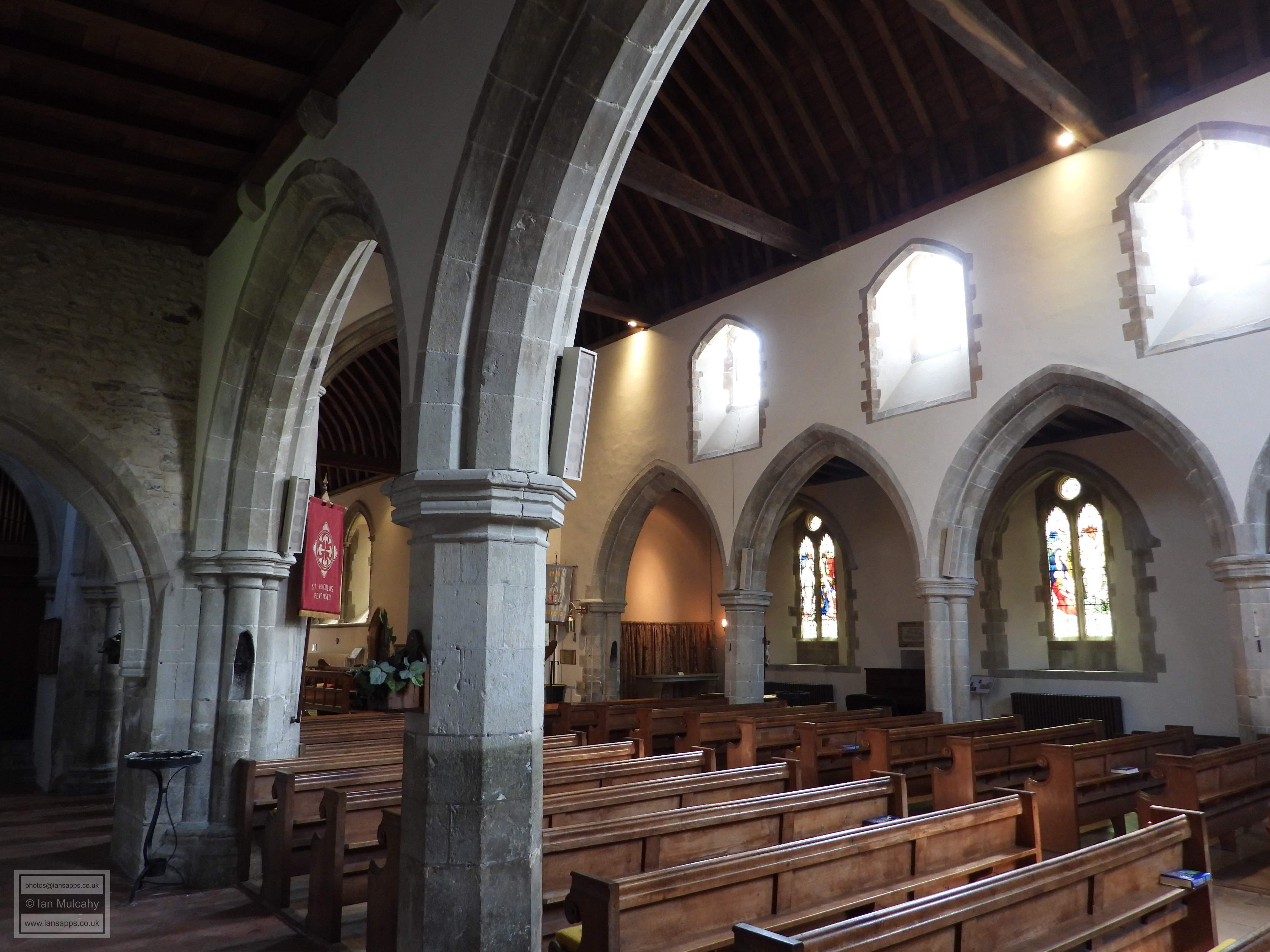
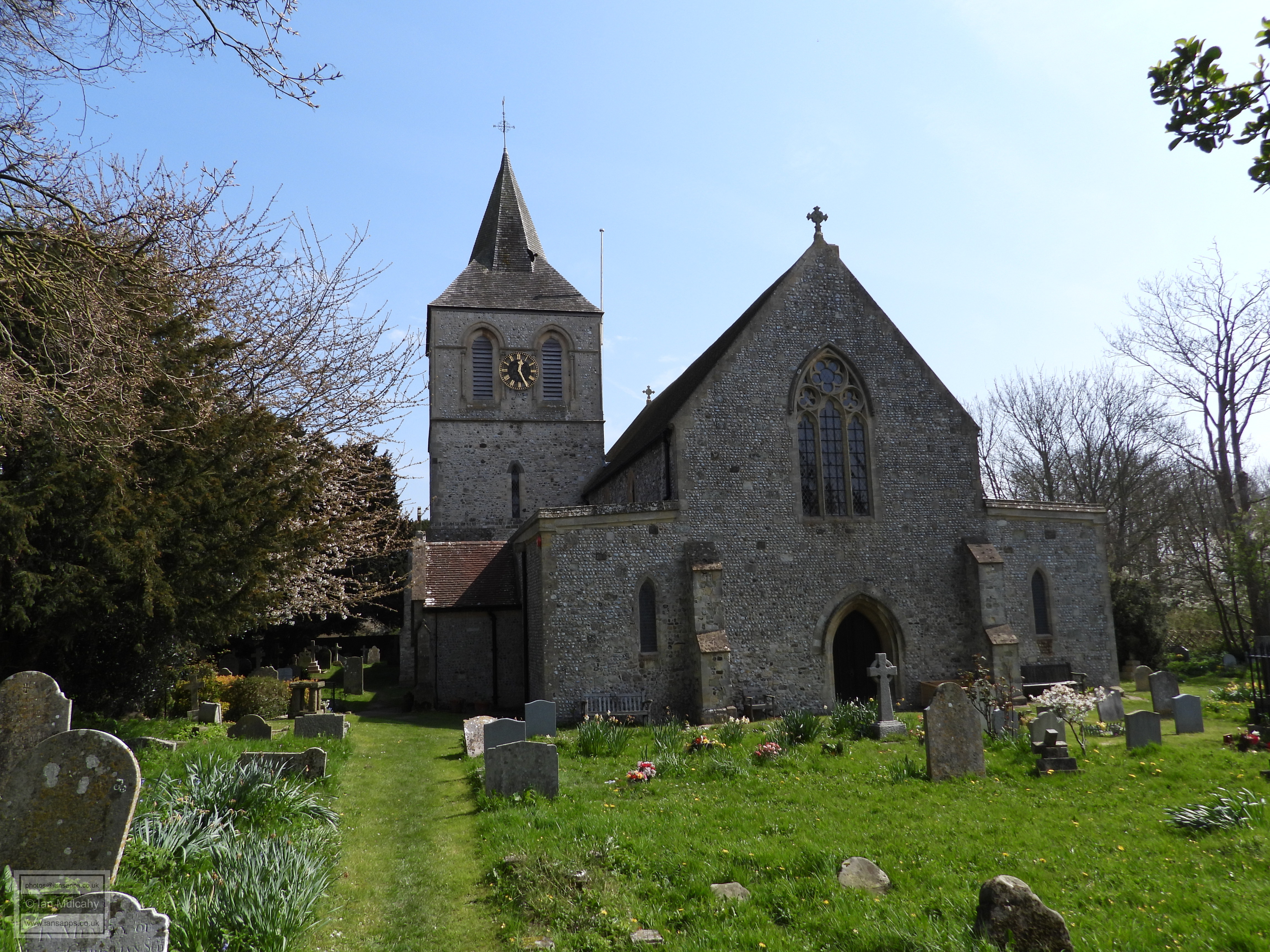
Outside of the fort, the church of St Nicolas was in documented
existence by 1100, though the size of the pre conquest settlement of
Pevensey means that there is almost no doubt that it was functional
long before this date, despite not being specifically mentioned in
Domesday. The church that can be seen today was mostly built in the
early to mid 13th century though two arches in the walls date to the
late 12th century and are believed to have been additions to the
original church which were incorporated into the new building. The
church fell into disrepair over the following 6 centuries and
restoration work was performed between 1875 and 1900.
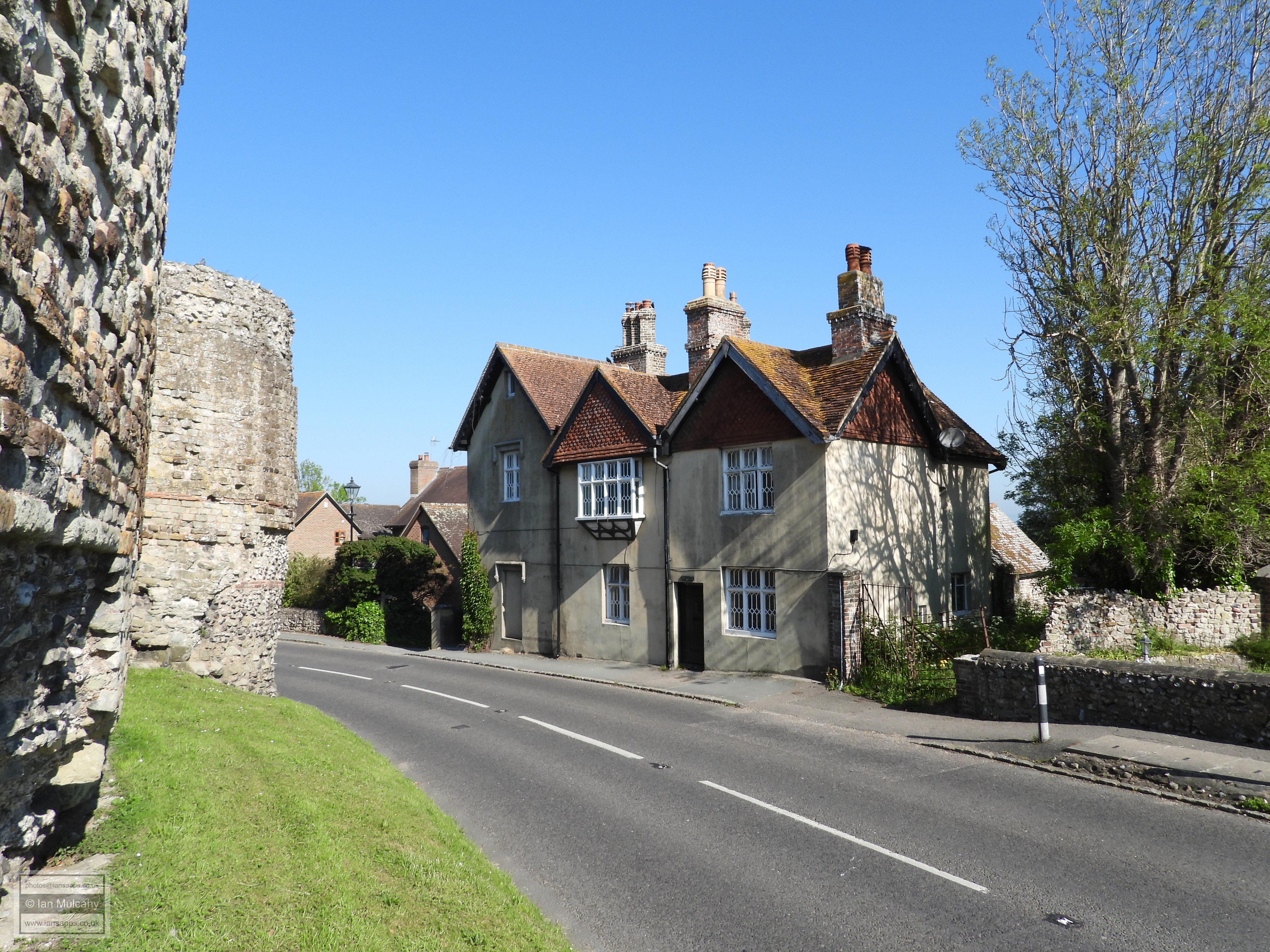
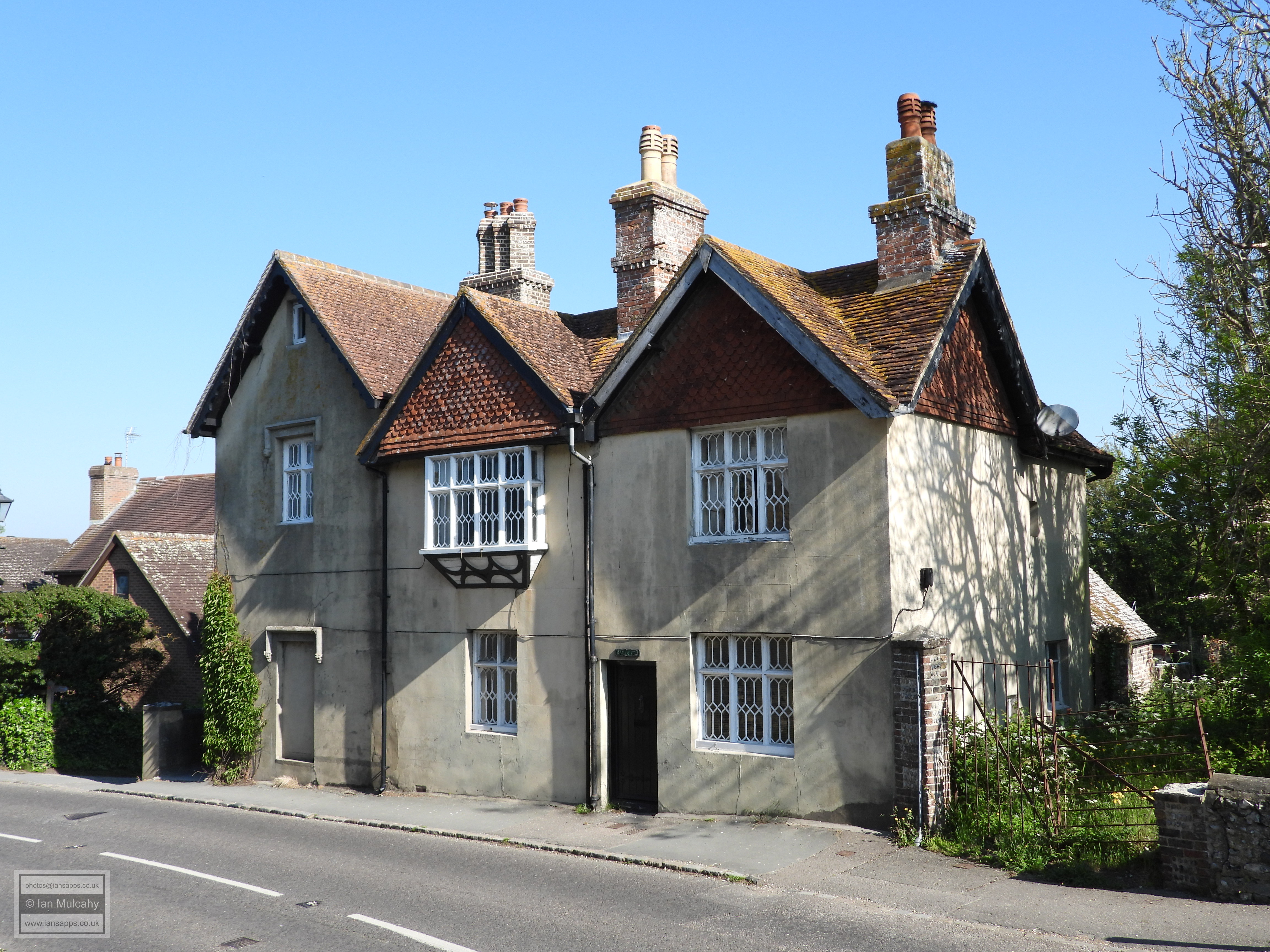
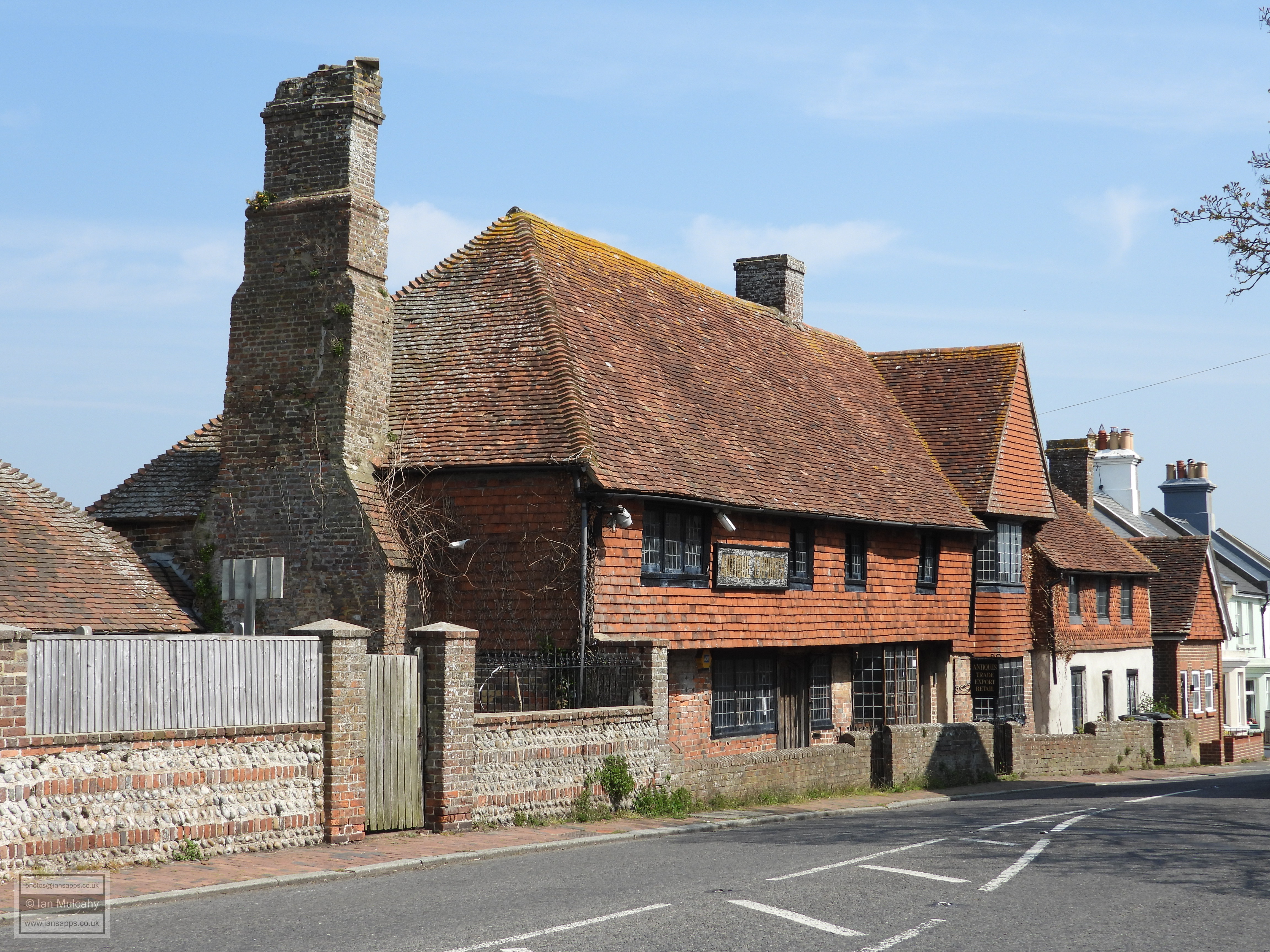
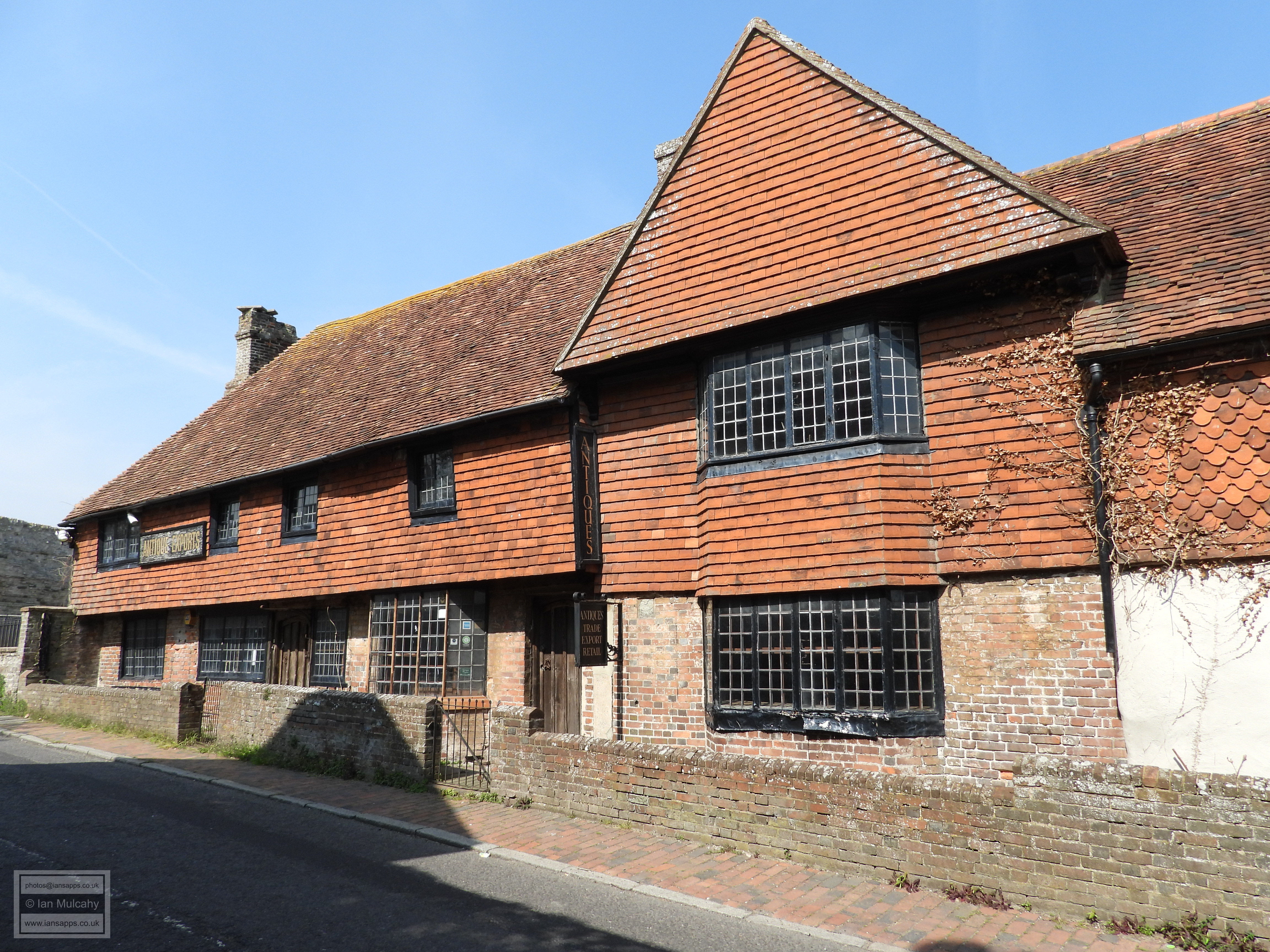
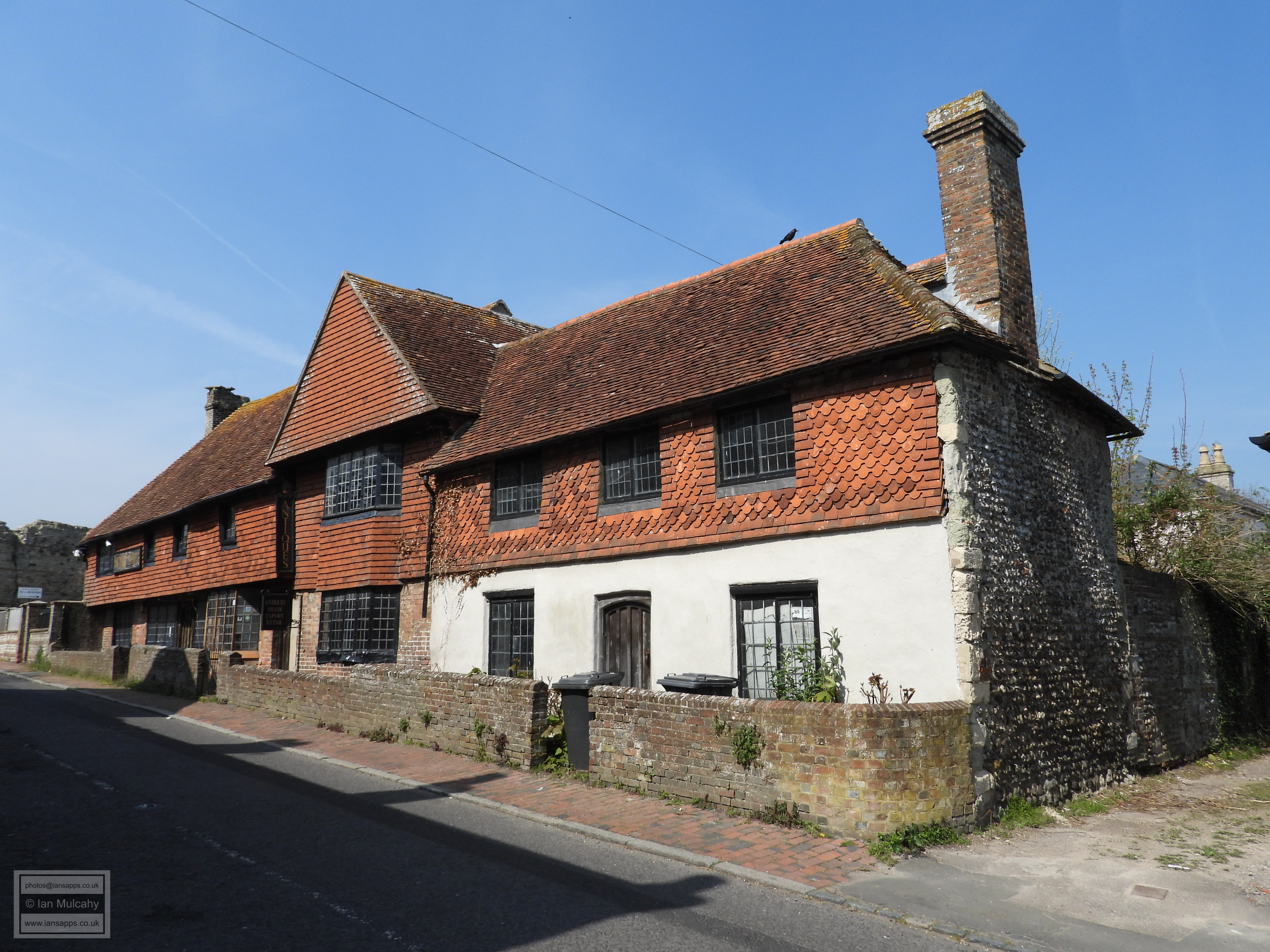
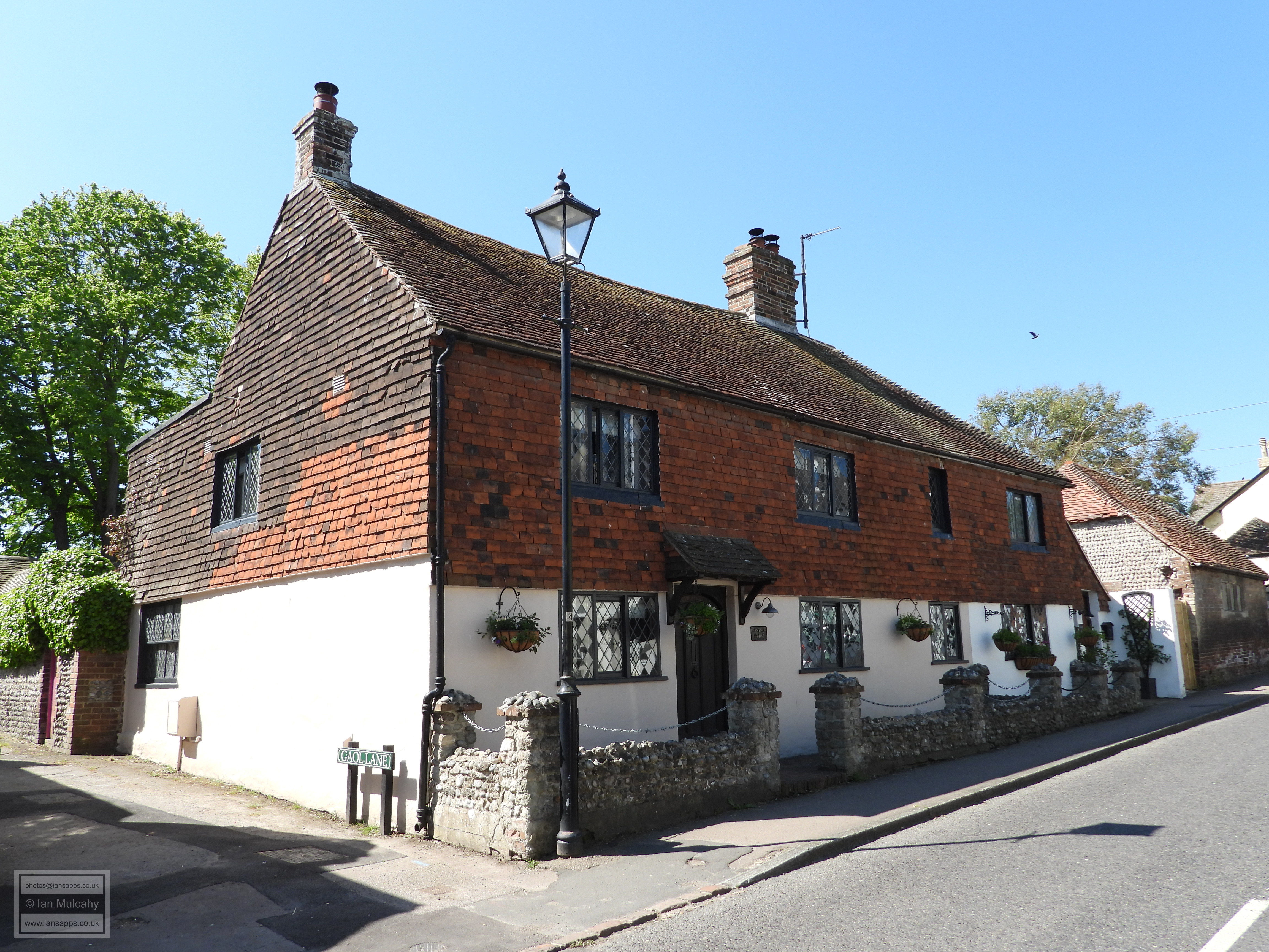
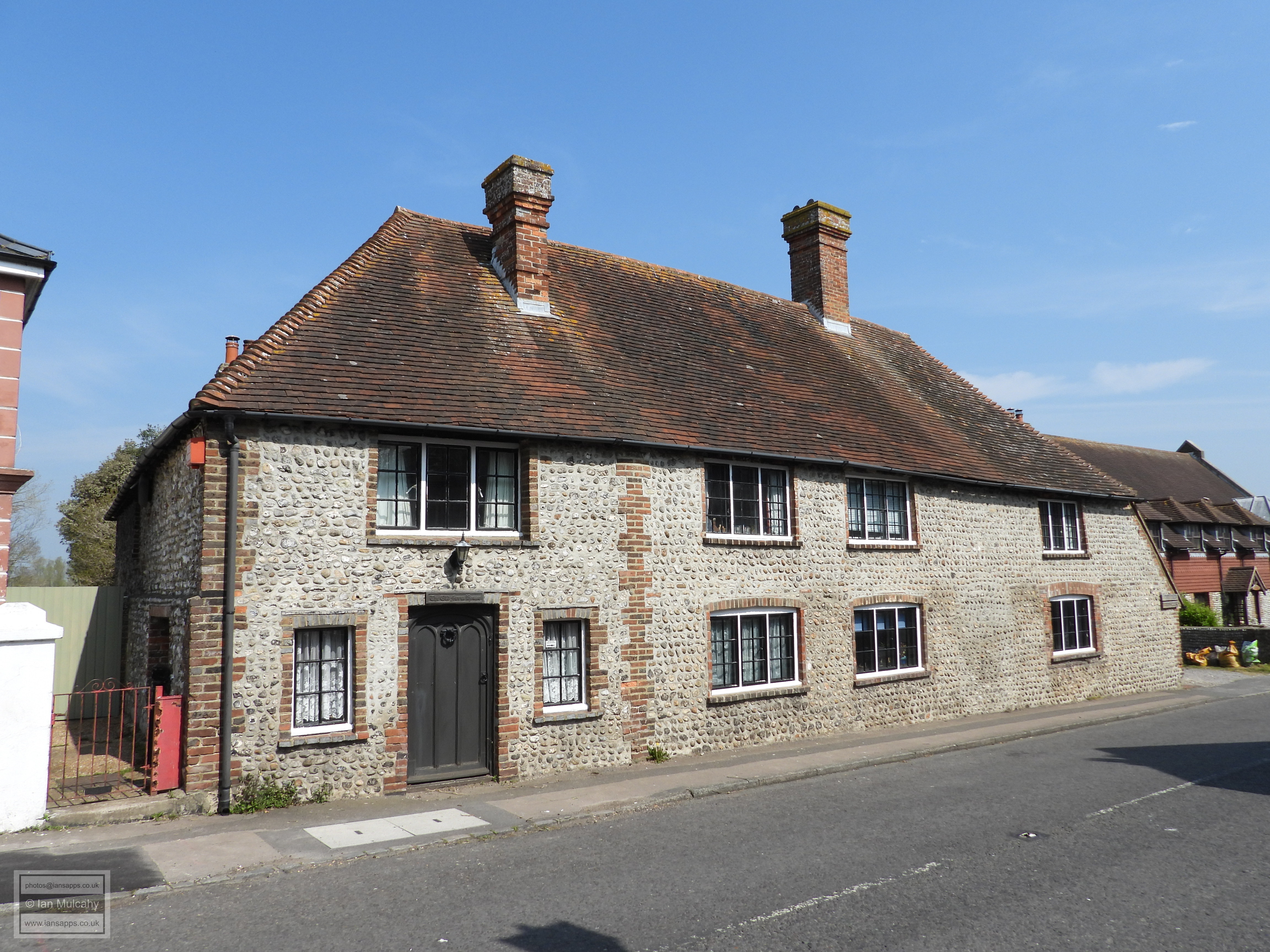
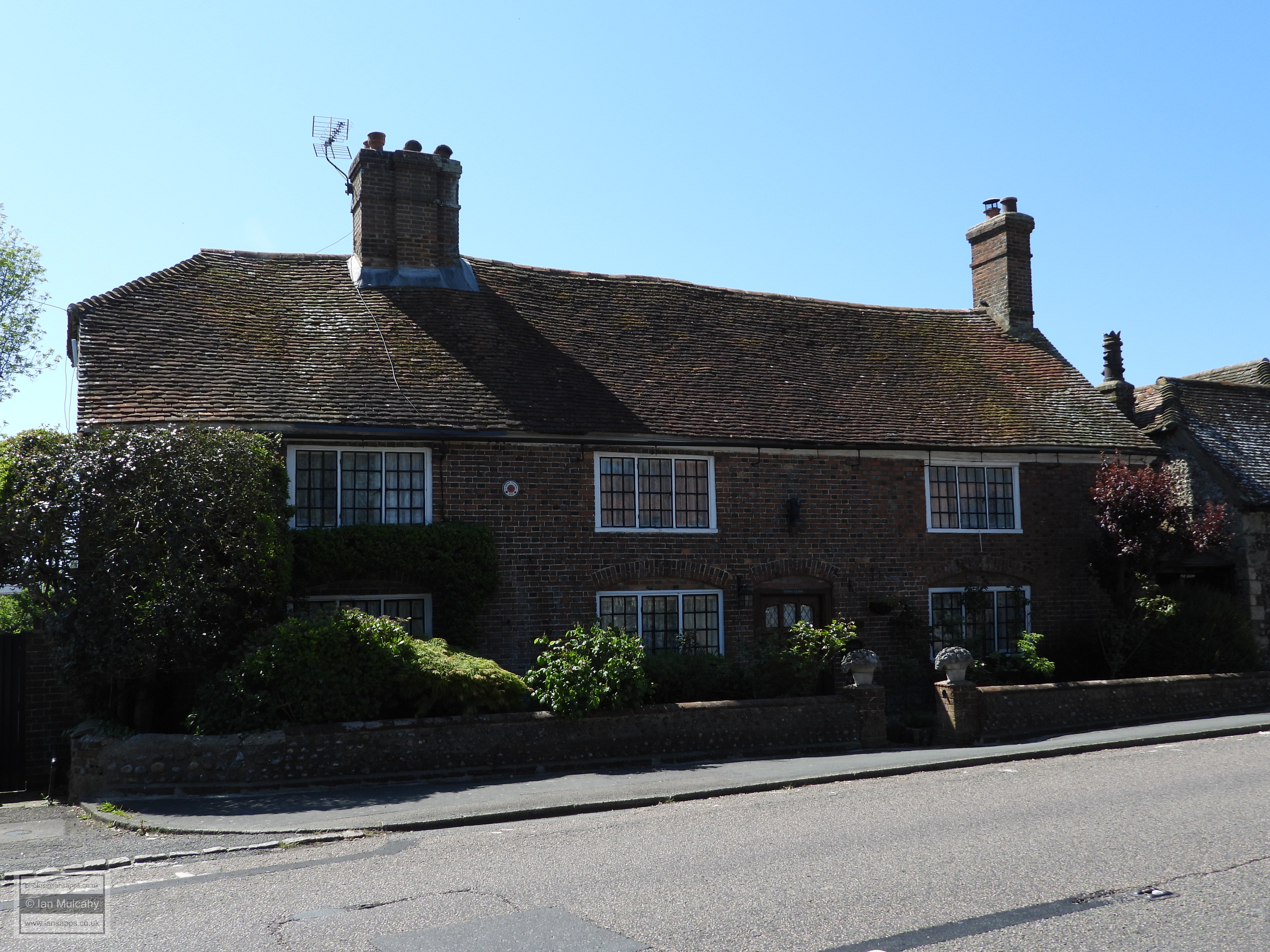
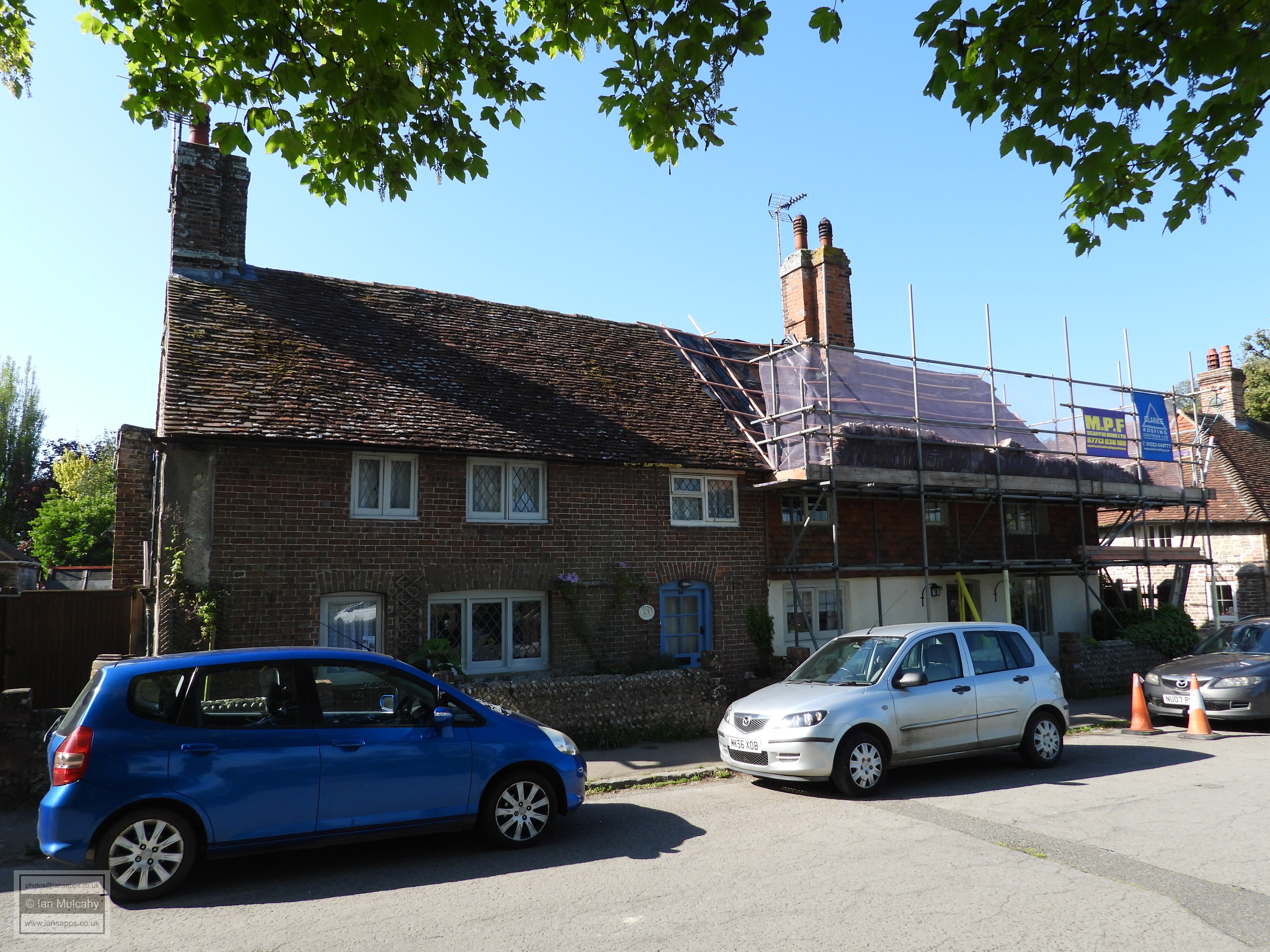
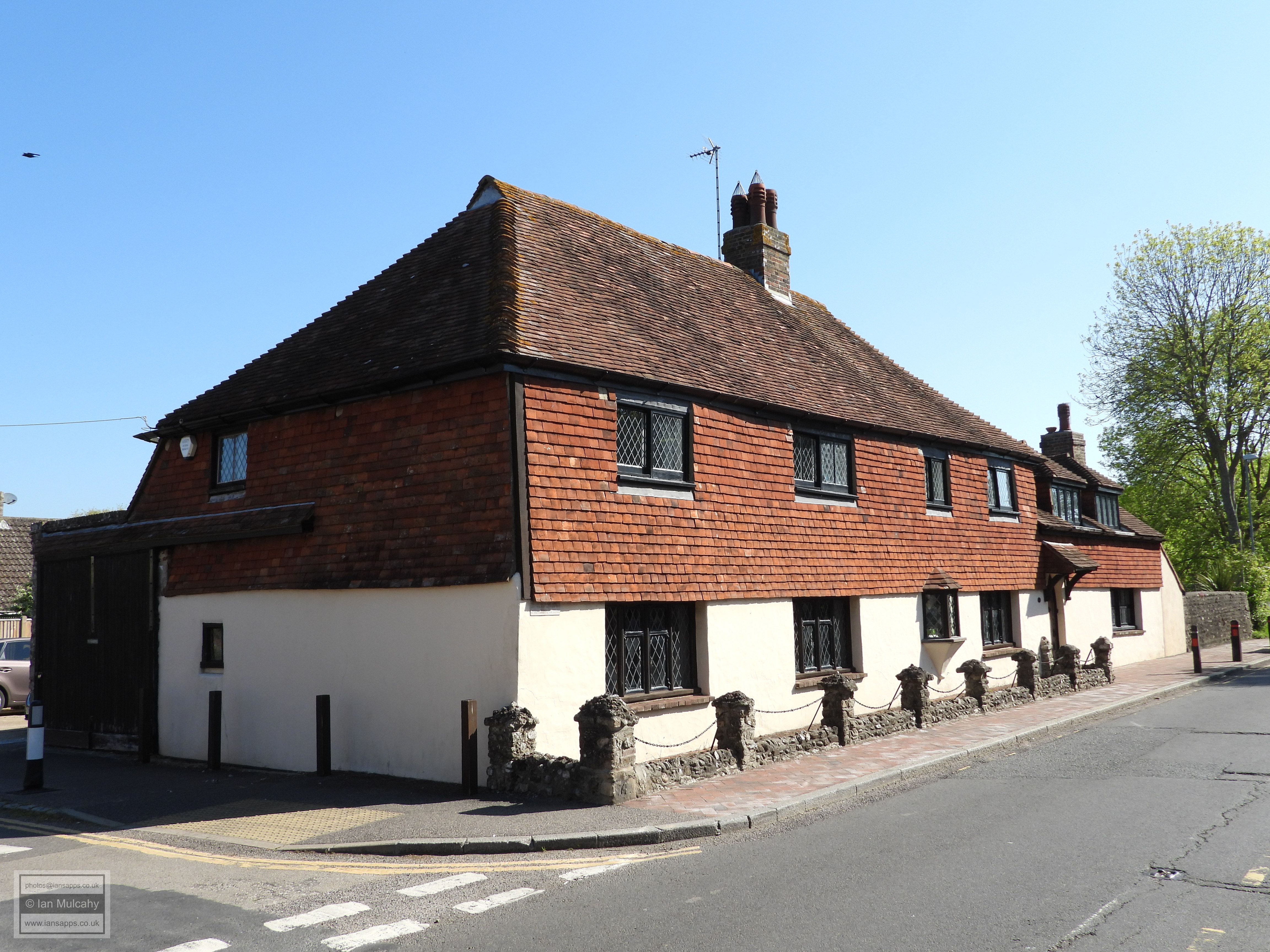
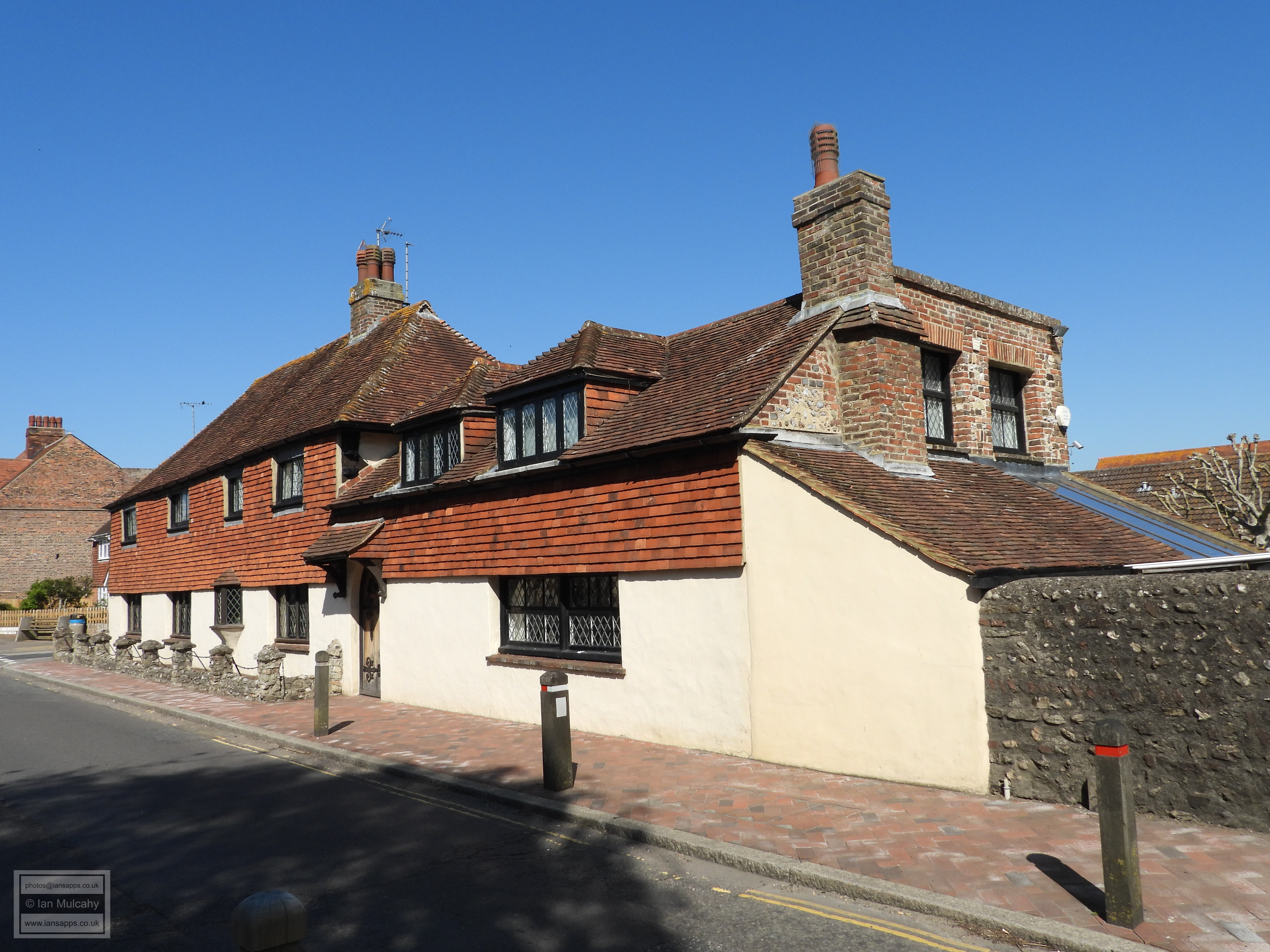
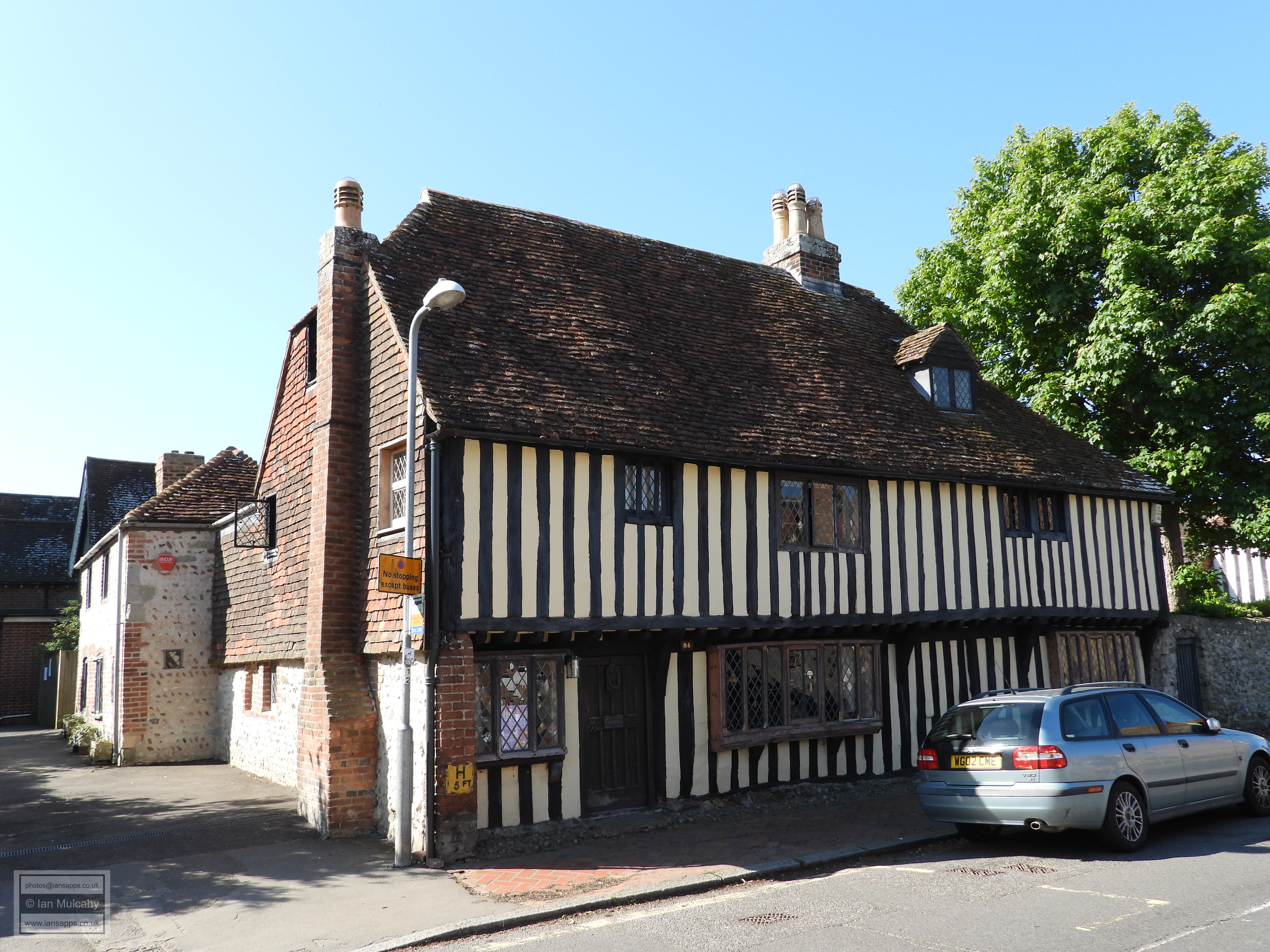
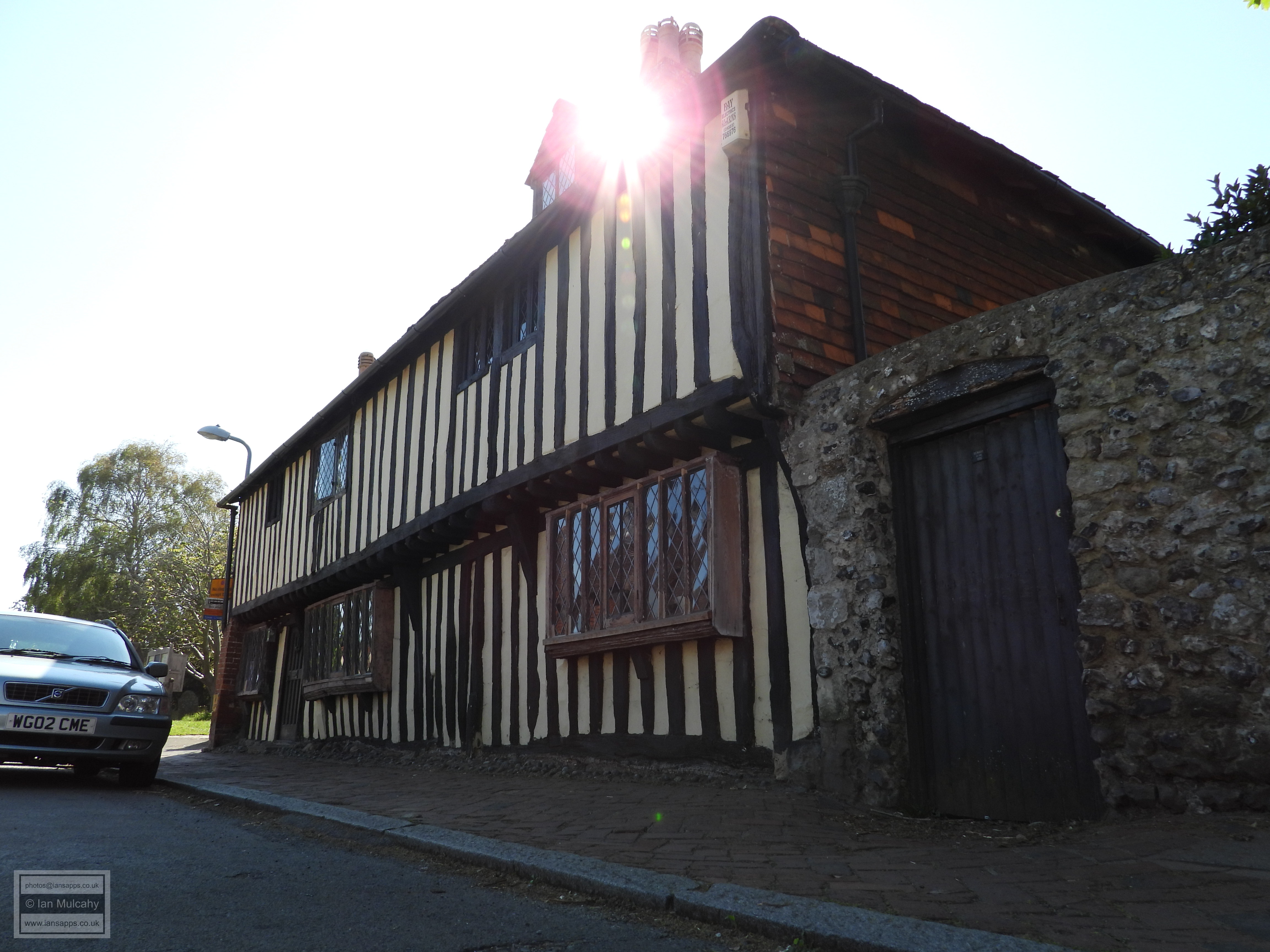
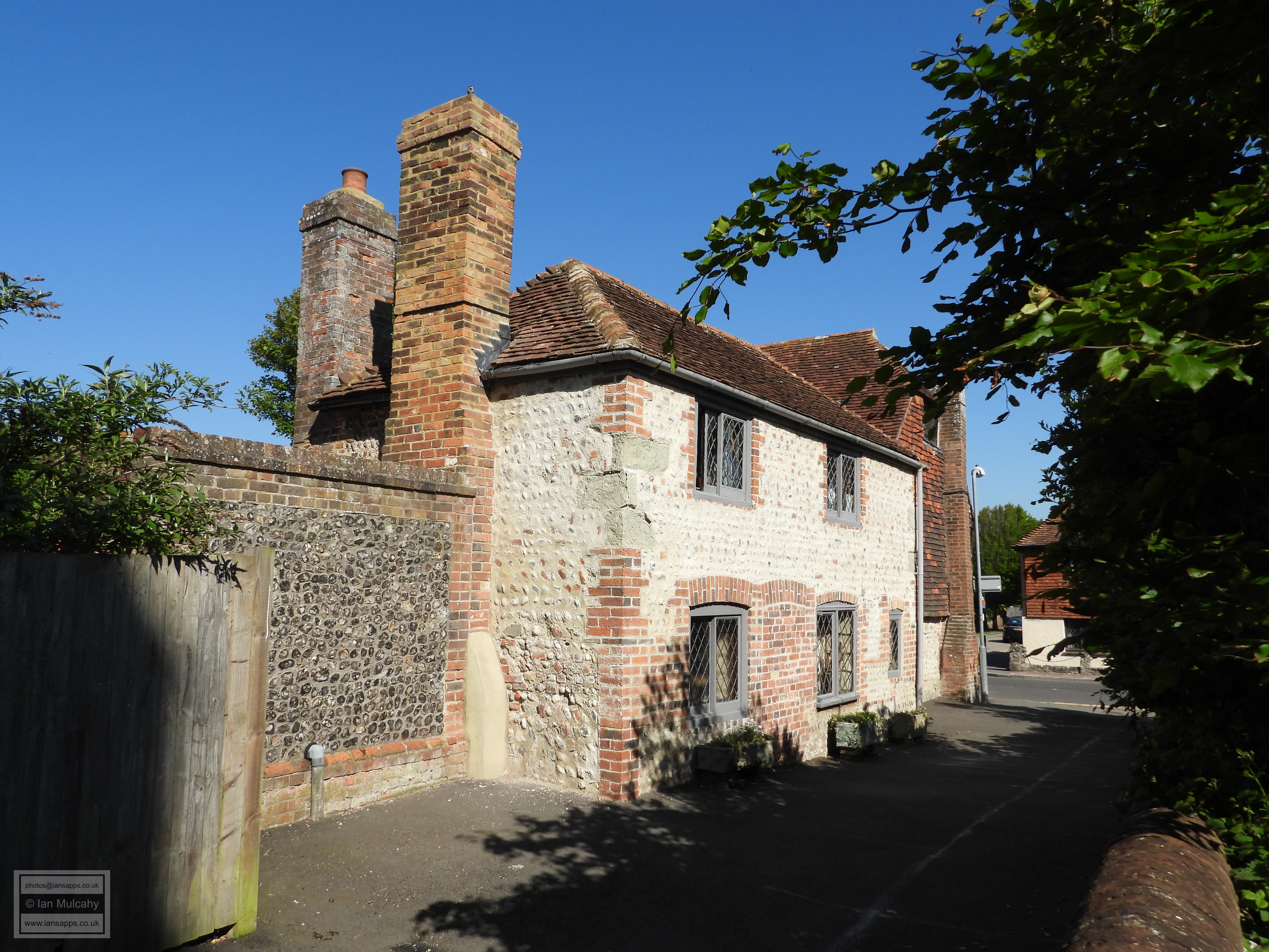
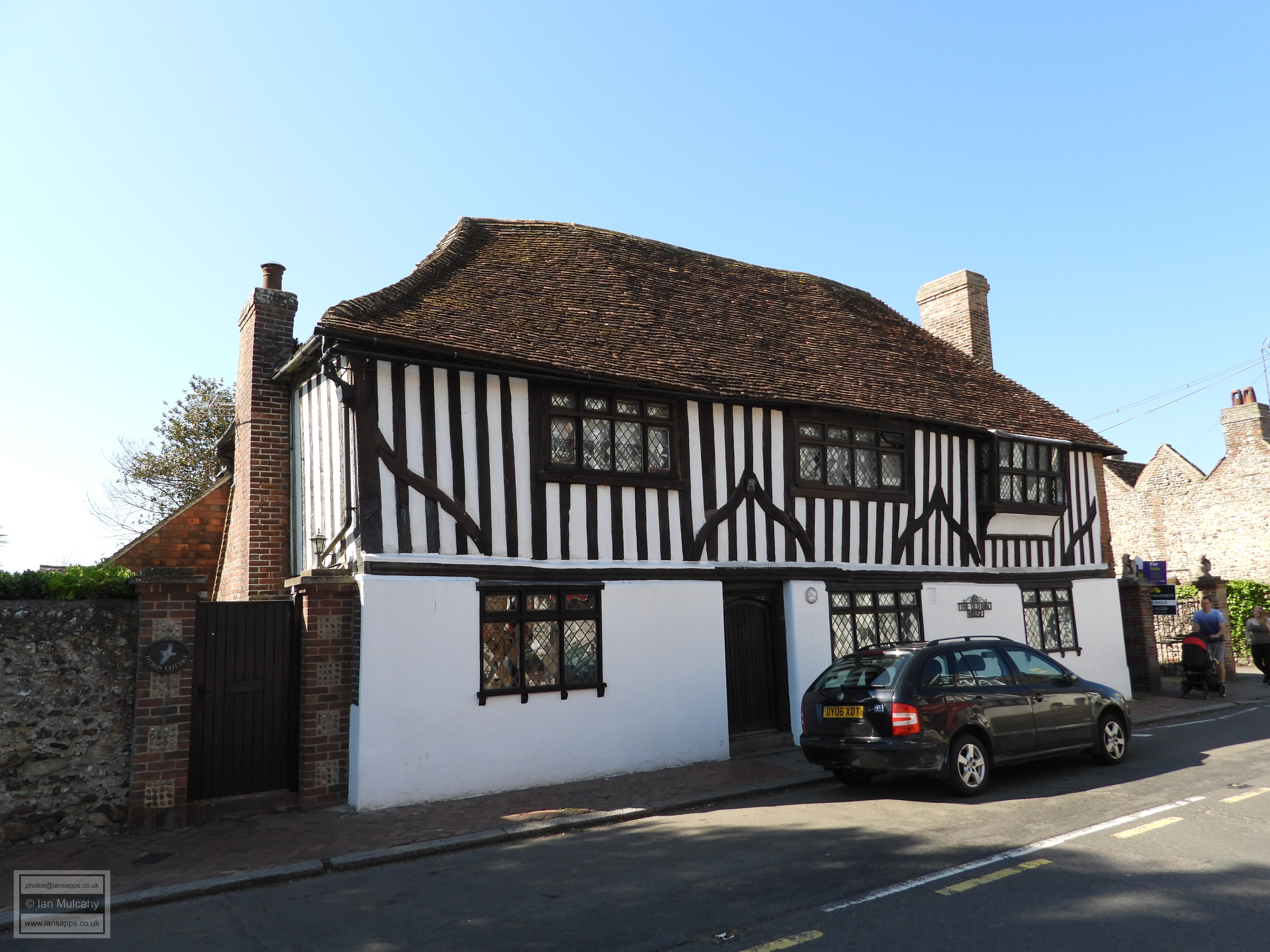
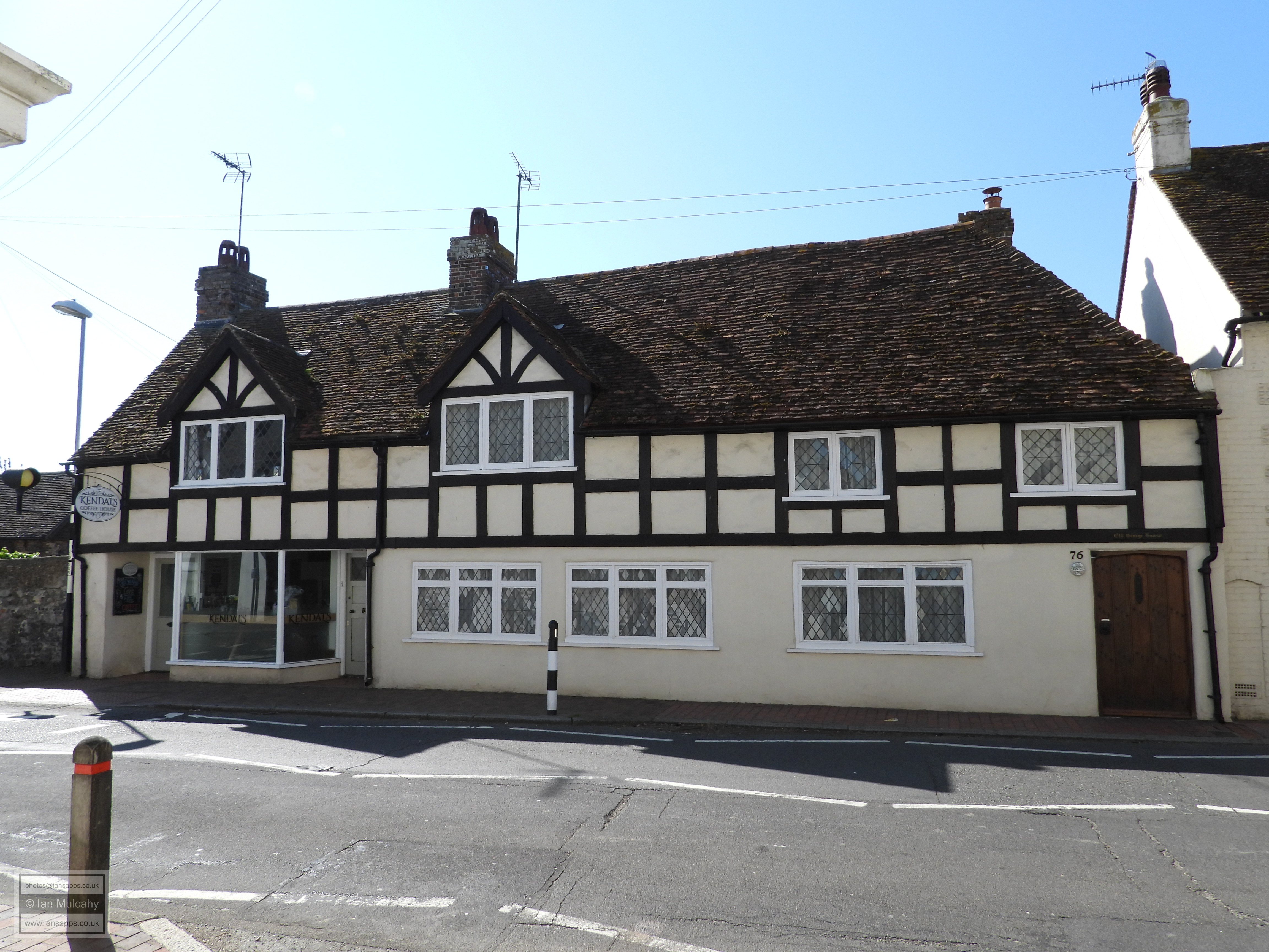
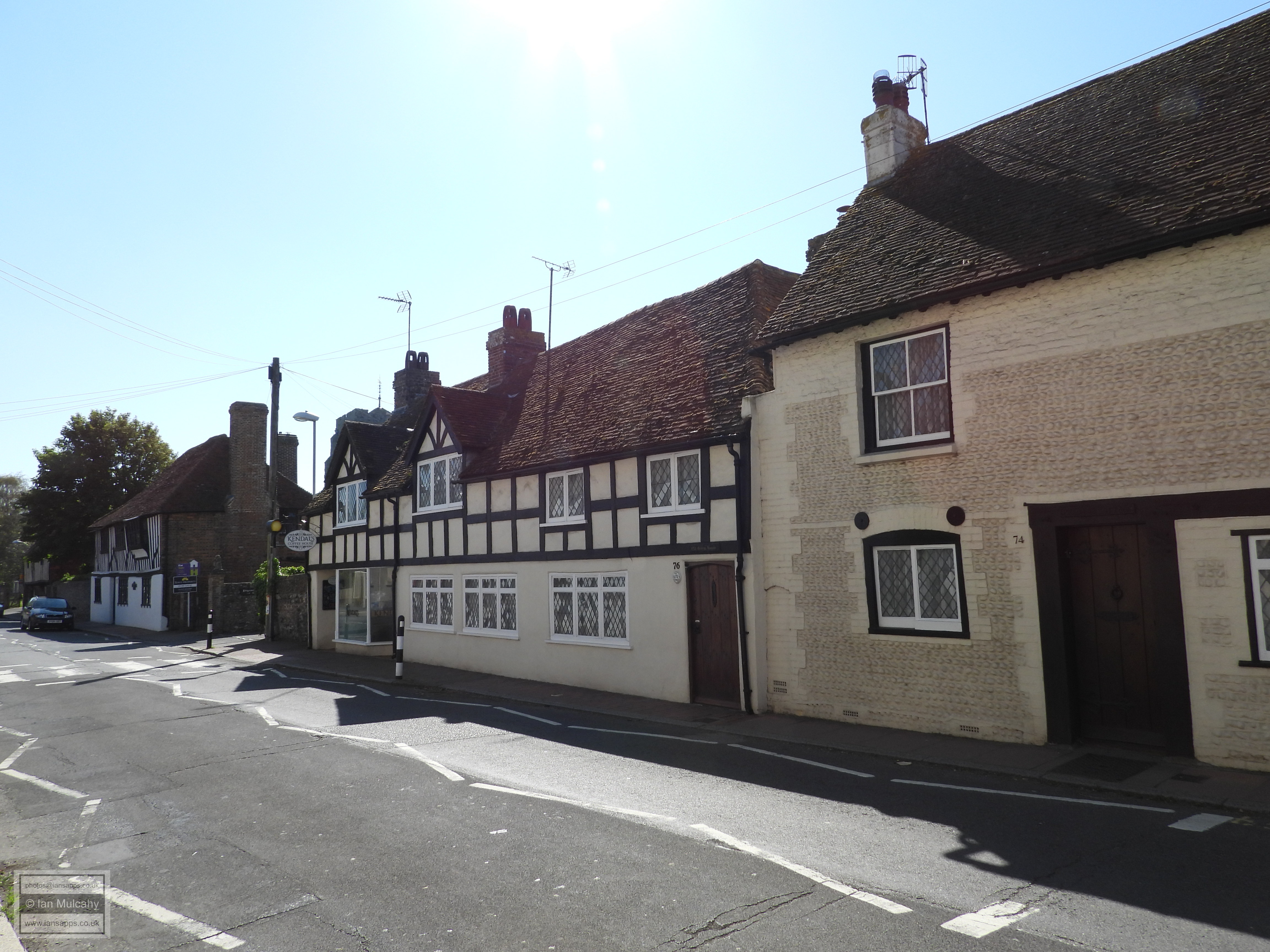
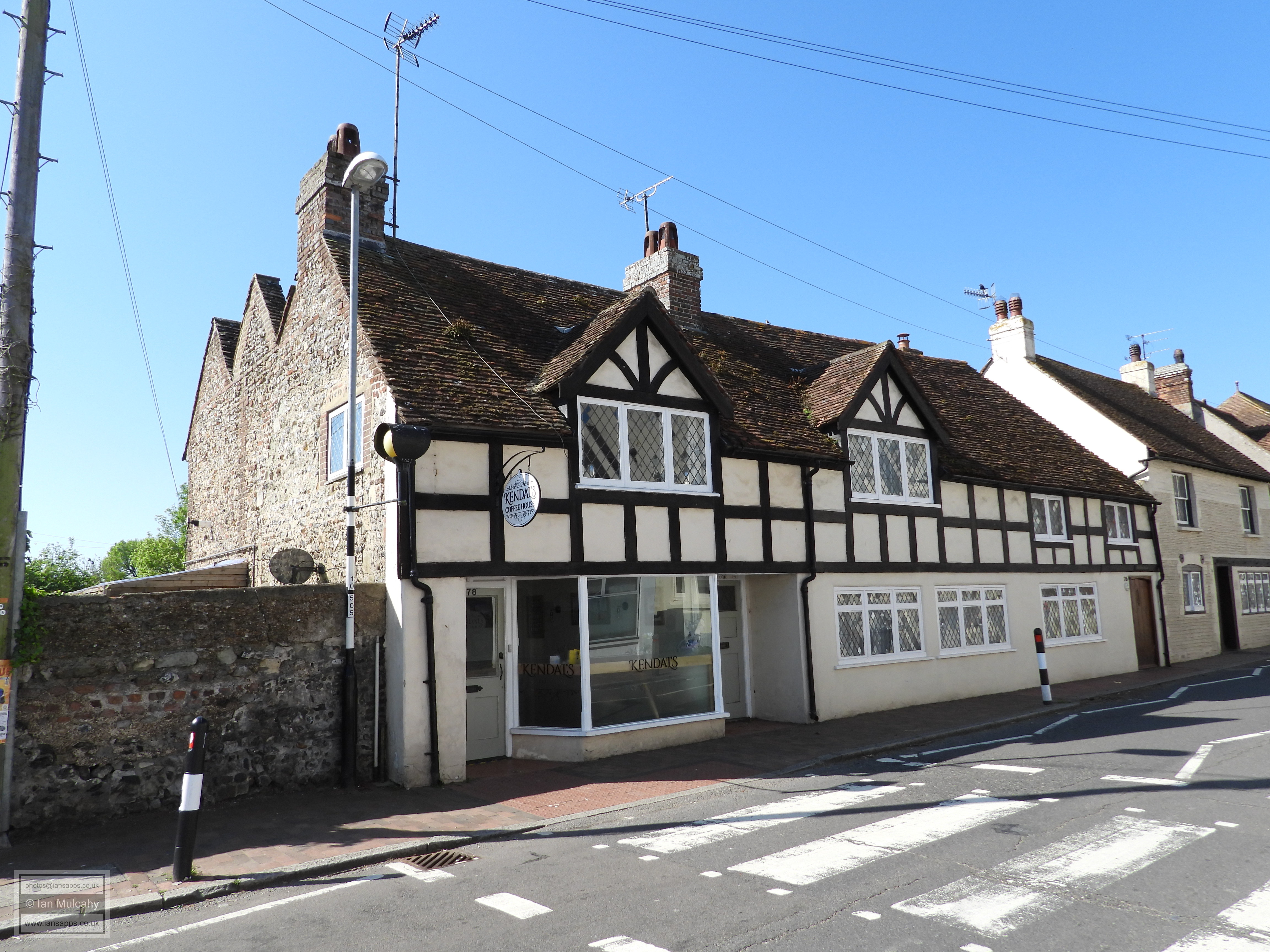
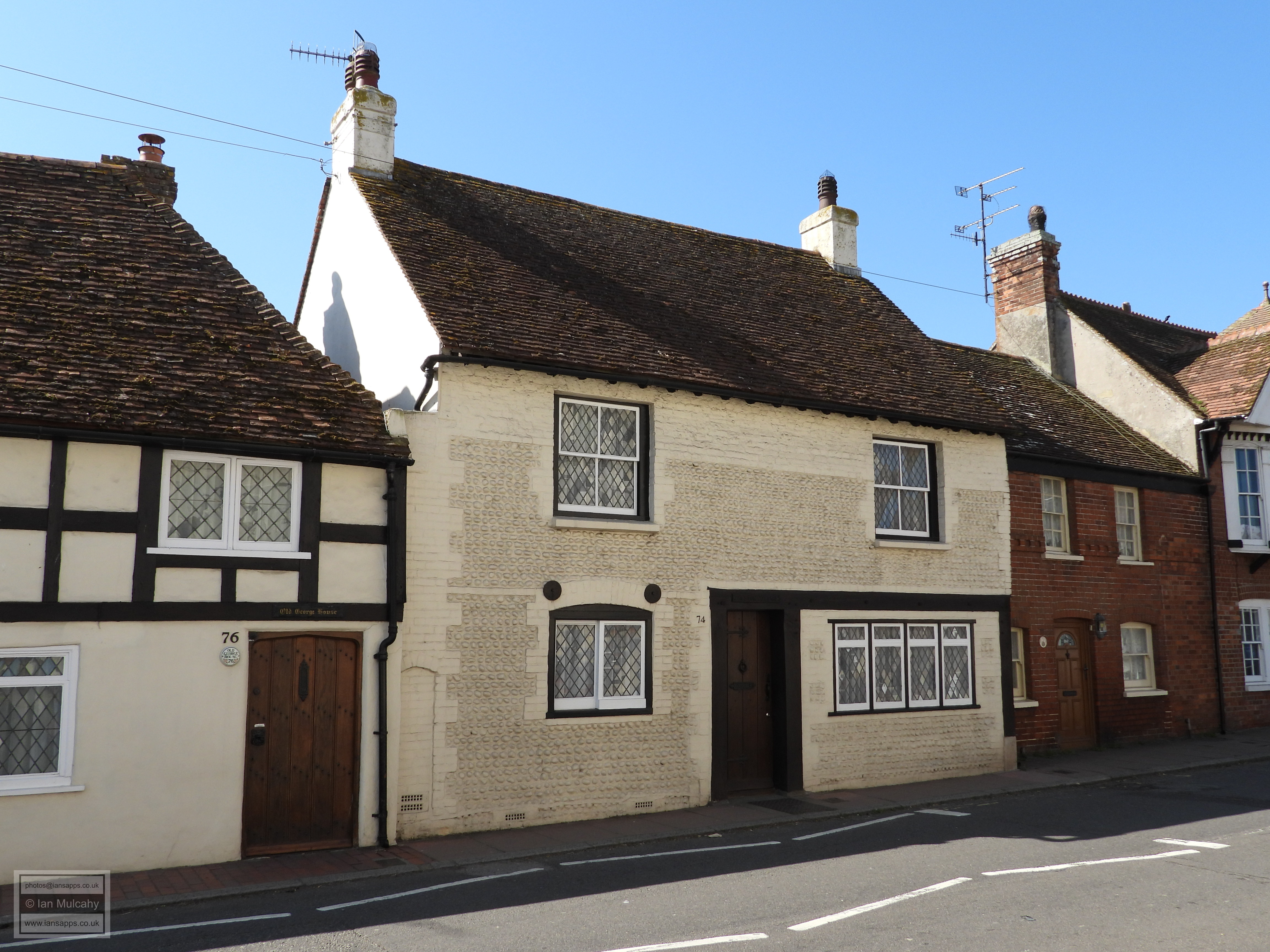
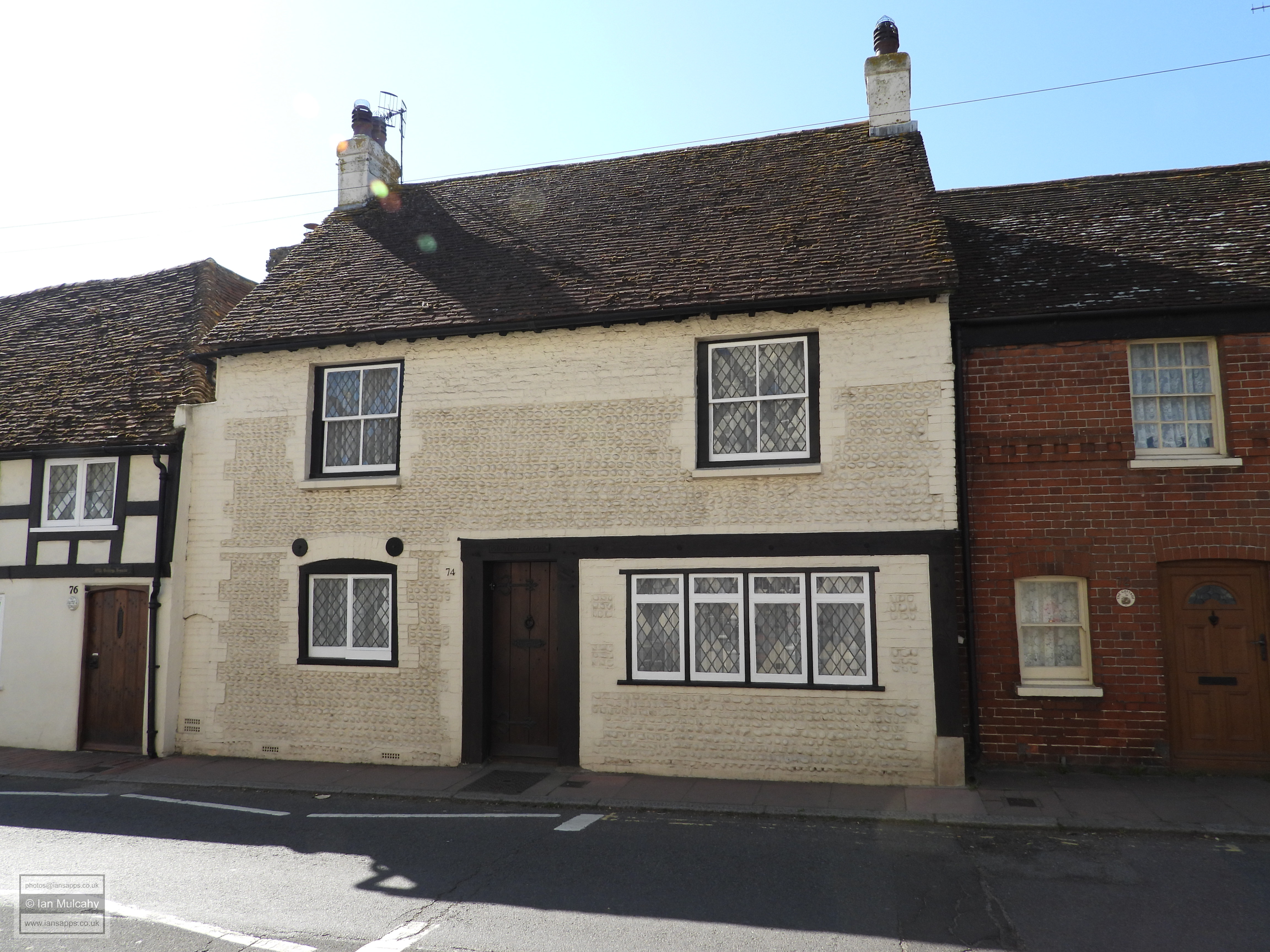
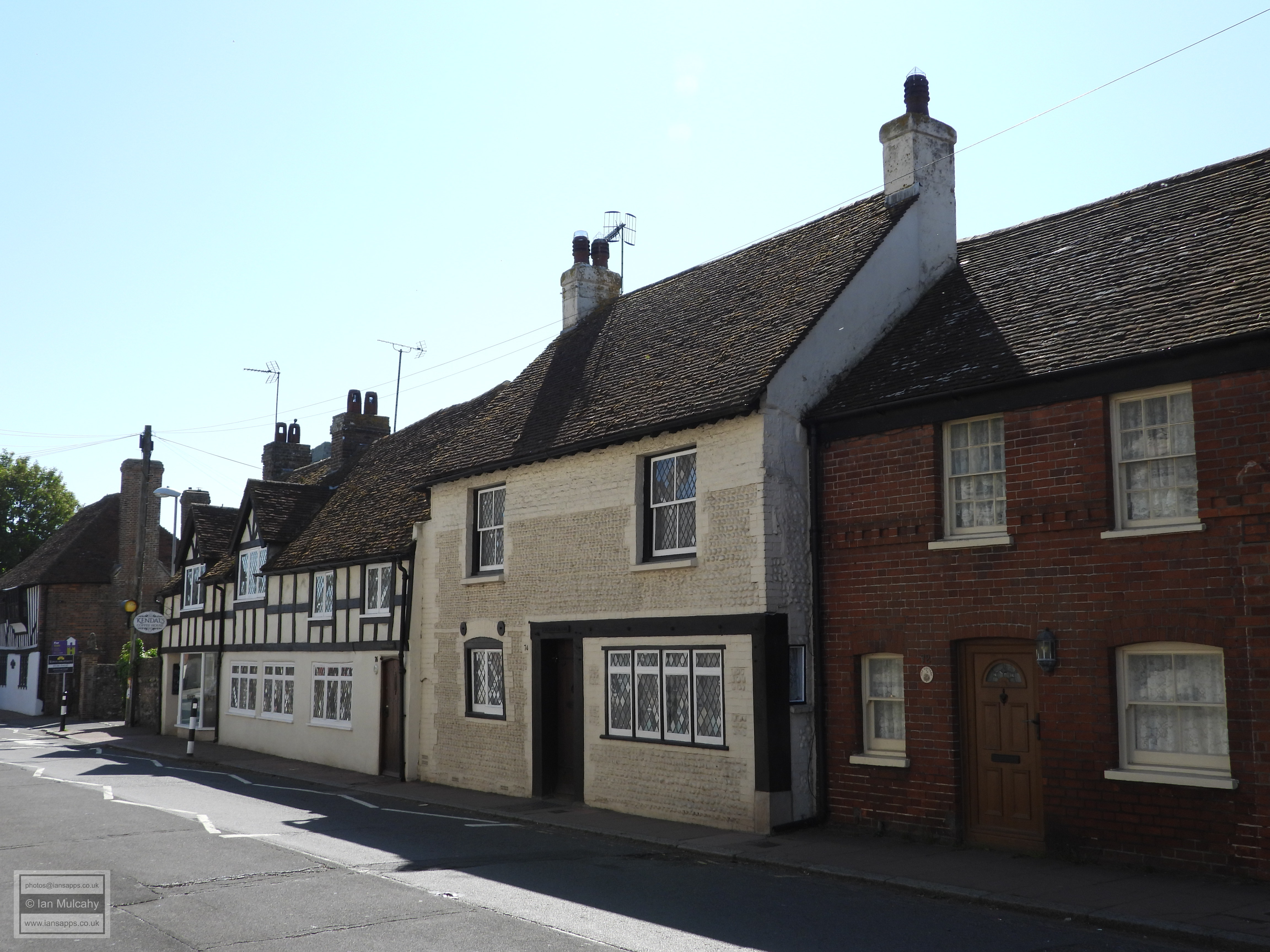
Excavations in the field to the south west of the church and to the east of the castle and car park in 2000 revealed a number of floor surfaces dating to the 12th and 13th century and excavations on the northern side of the High Street in 1993/4 revealed evidence of 11th and 12th century homes. There are 14 other listed buildings within the village and closest to the fort, overlooking the northern curtain wall, is Anderida House and Gable End, a relatively modern subdivided 3 storey building of c.1830. Amongst the oldest of the 14 buildings is The Old Mint House, a refronted timber framed structure with a continuous jetty, located just outside the east gate of Anderitum. The statutory listing, created in 1952 without full inspection, describes the house as an early 16th century structure, but several more modern sources suggest that the house was actually built in 1342. Formerly home to Andrew Borde, Court Physician to Henry VIII the house was once occupied by Edward VI and, in 1586, was the scene of a scandalous double murder when Thomas Dwight entered the property to find his mistress in bed with her lover and so promptly killed them both. The mistress had her tongue cut out and she bled to death whilst her lover was roasted alive over an open fire.
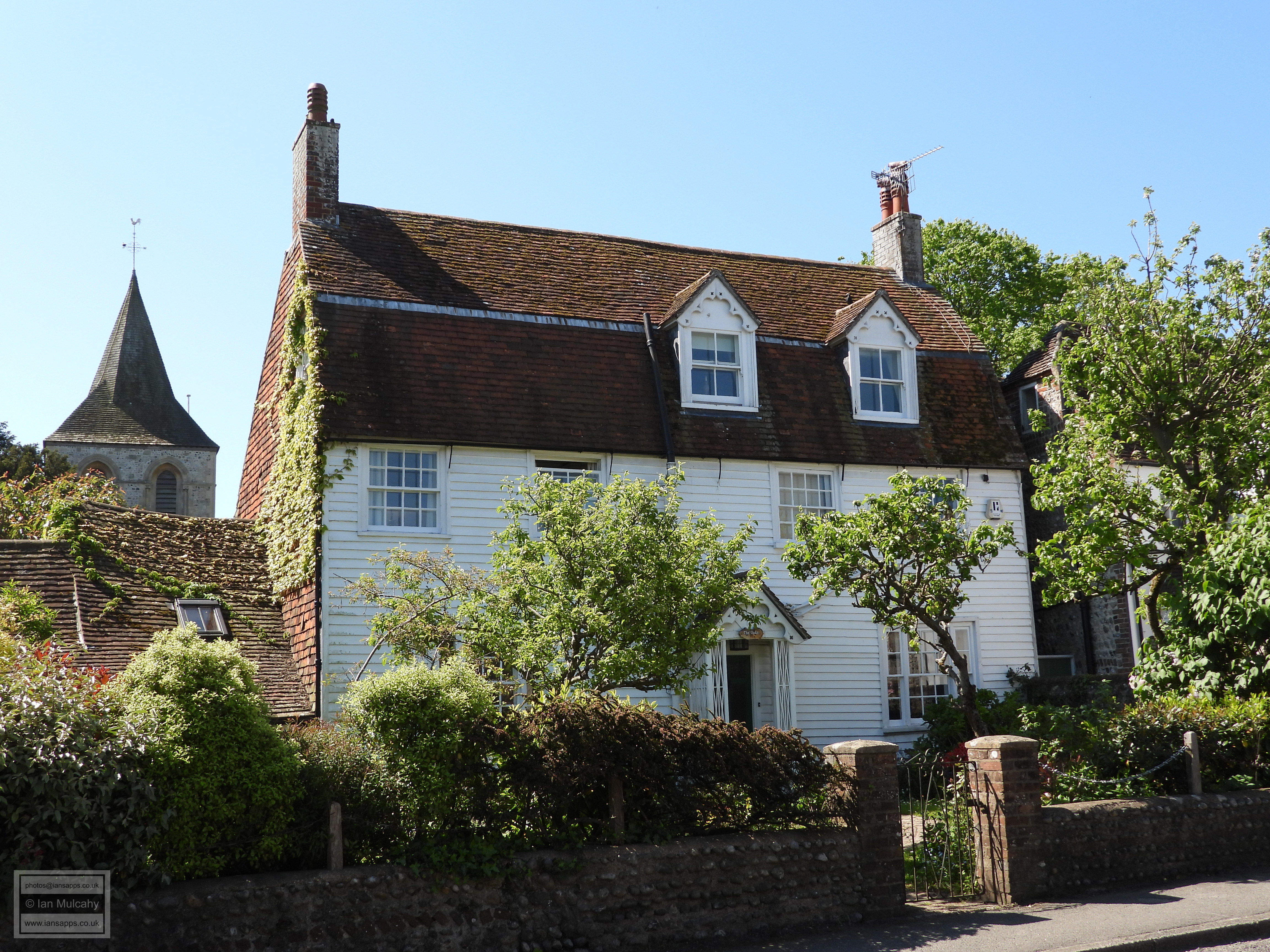
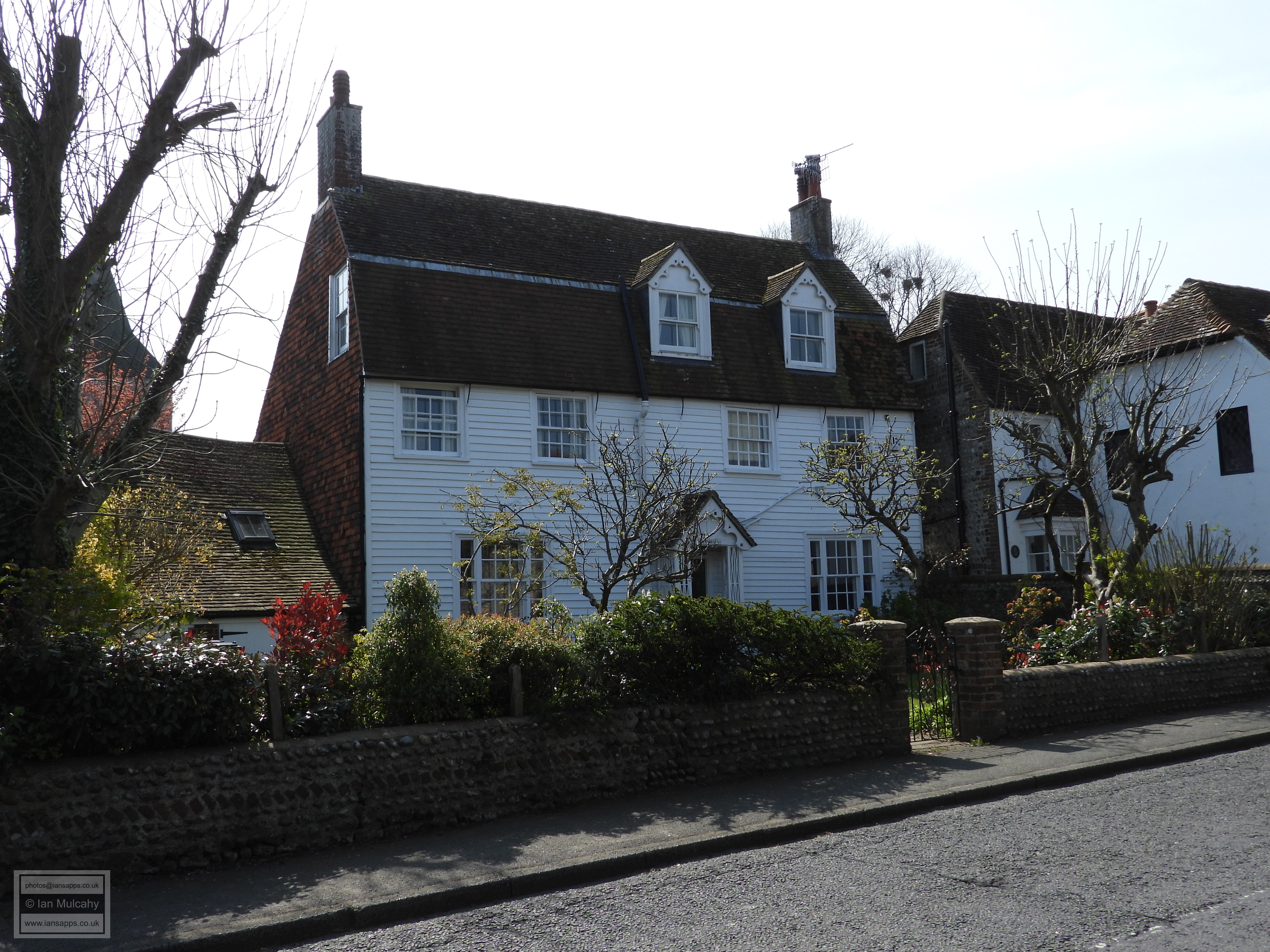
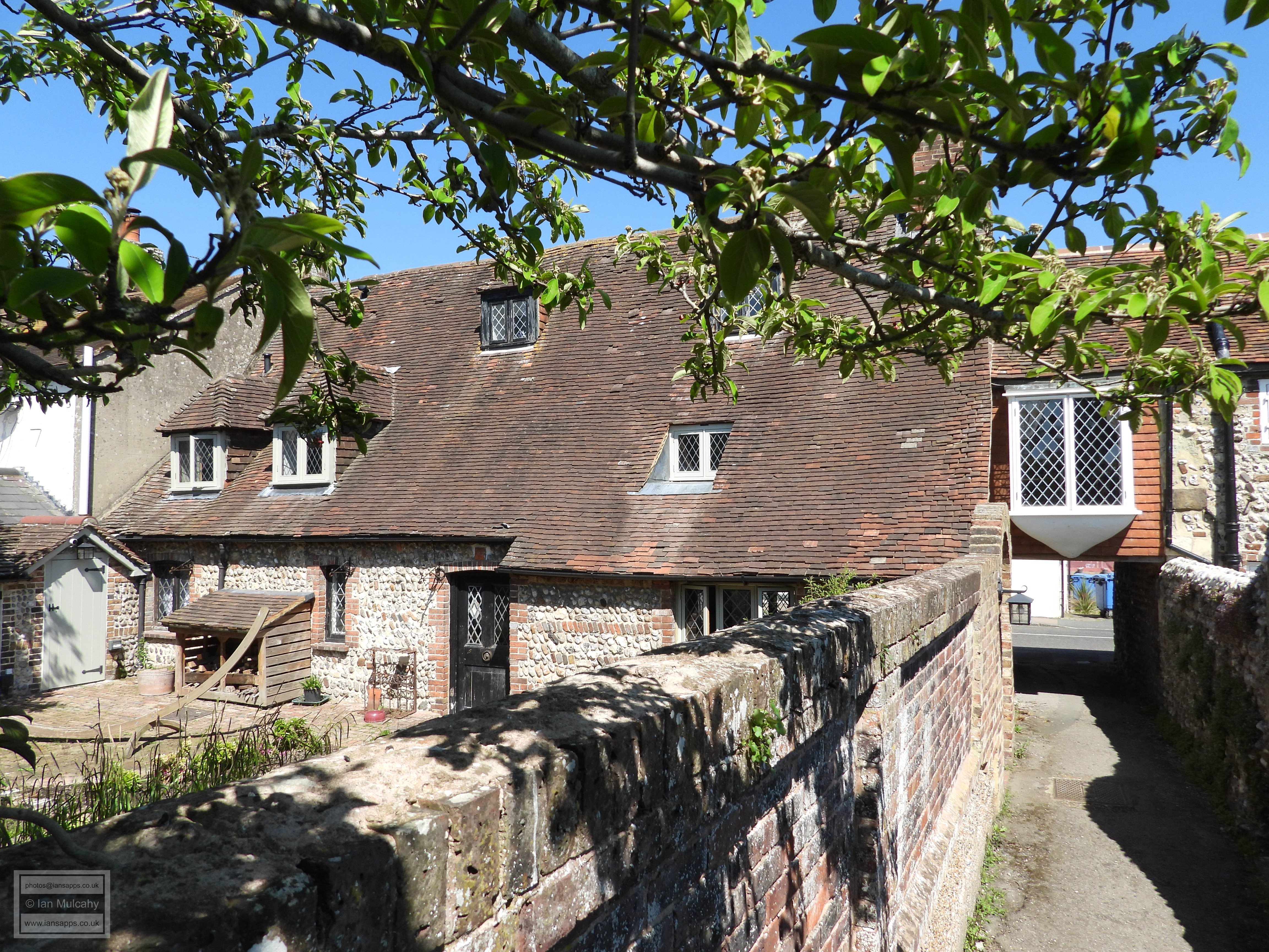
Less than 100 metres east and of a similar age is the purpose built (in stone) civic building known as The Court House which had a court room on the first floor with a lock up below. This building is now the village museum and is open to the public. To the west of The Court House, across Gaol Lane, is Court Lodge which dates from the 18th century or earlier and next door to the west is The Oaks, a large three storey weatherboarded house from 18th century. Opposite is The Old Farm House, a 17th century timber framed farm that was refaced in flint in the 19th century. It was close to here that the evidence of 11th and 12th century homes was discovered.
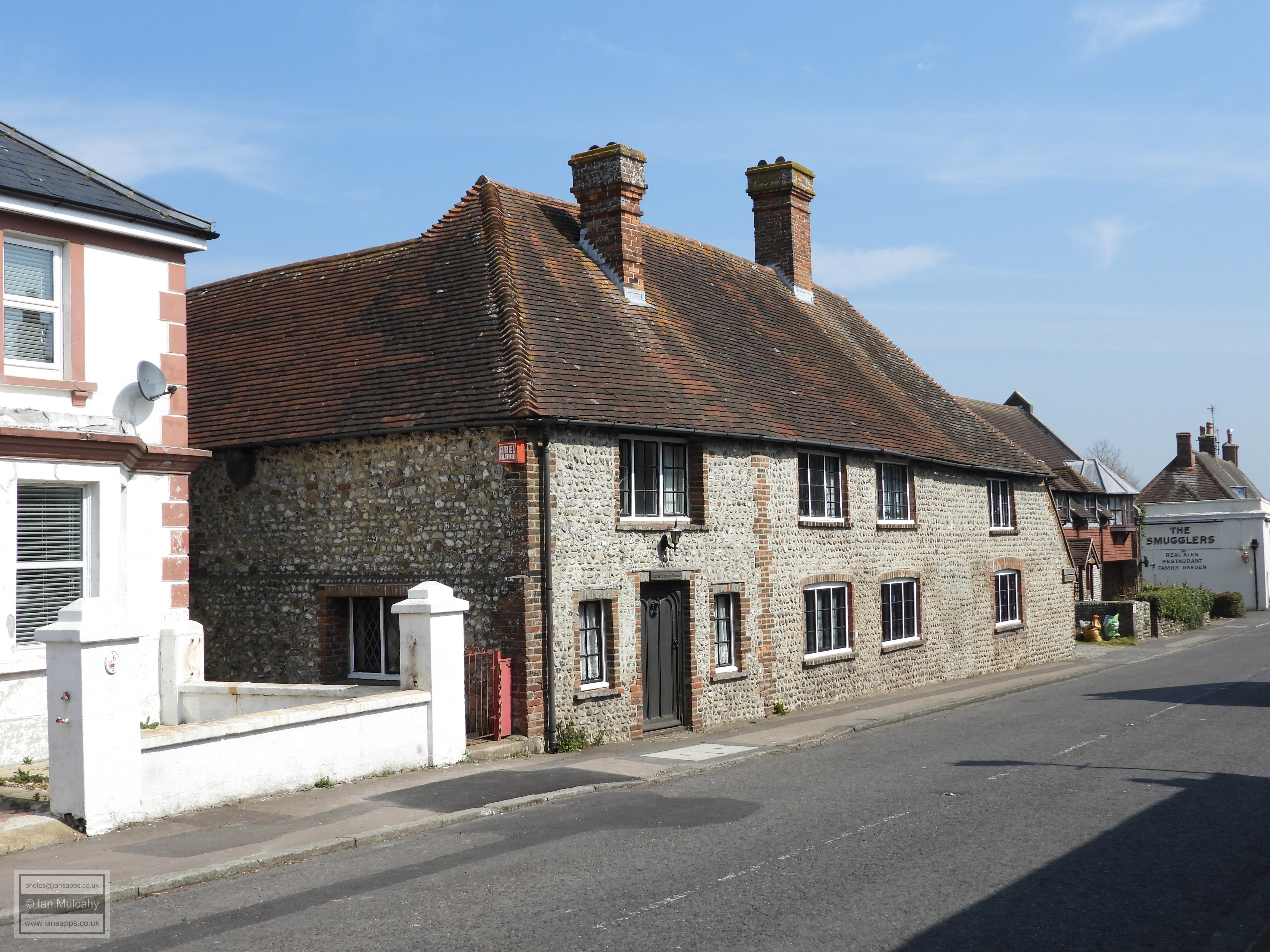
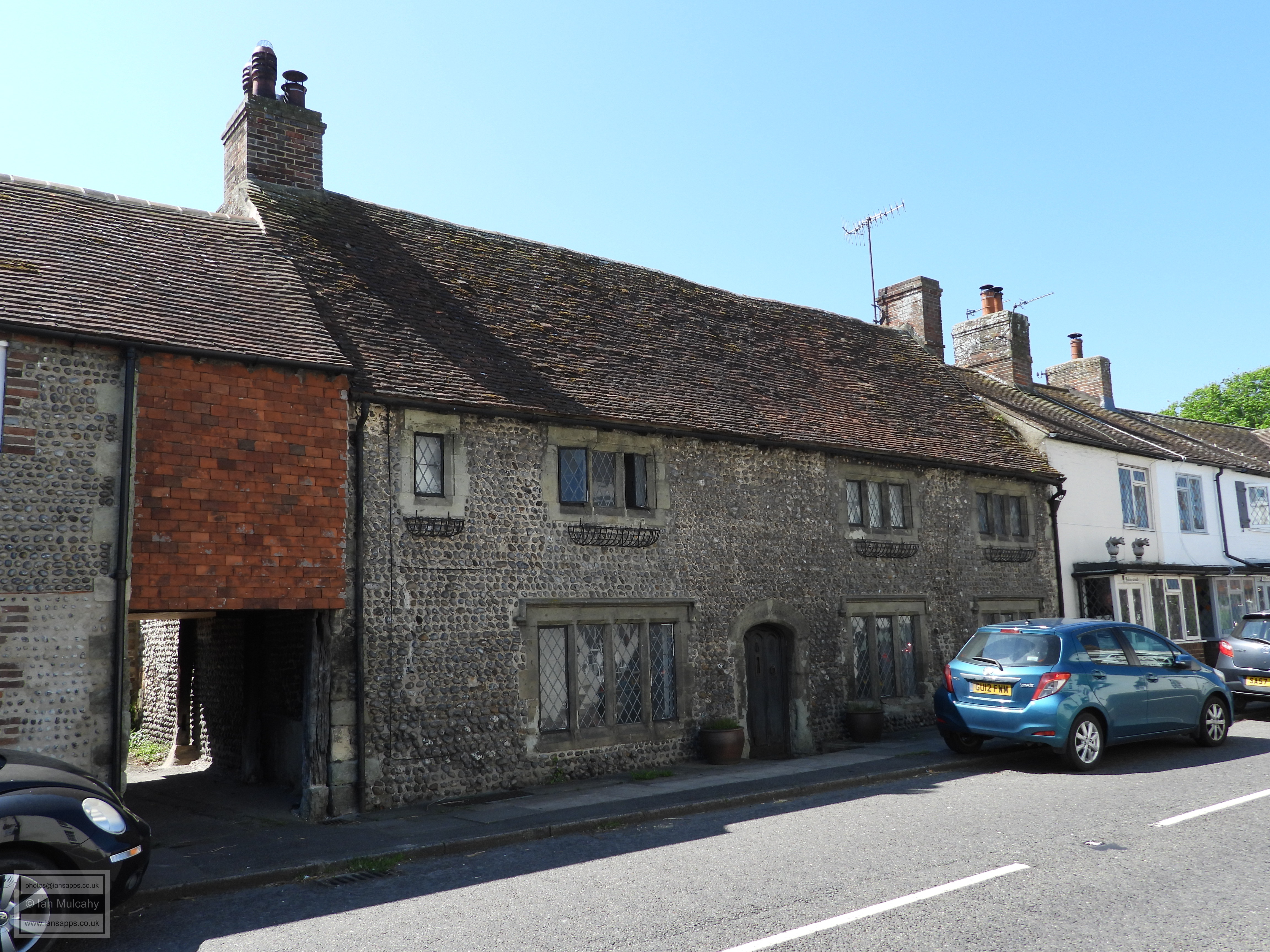
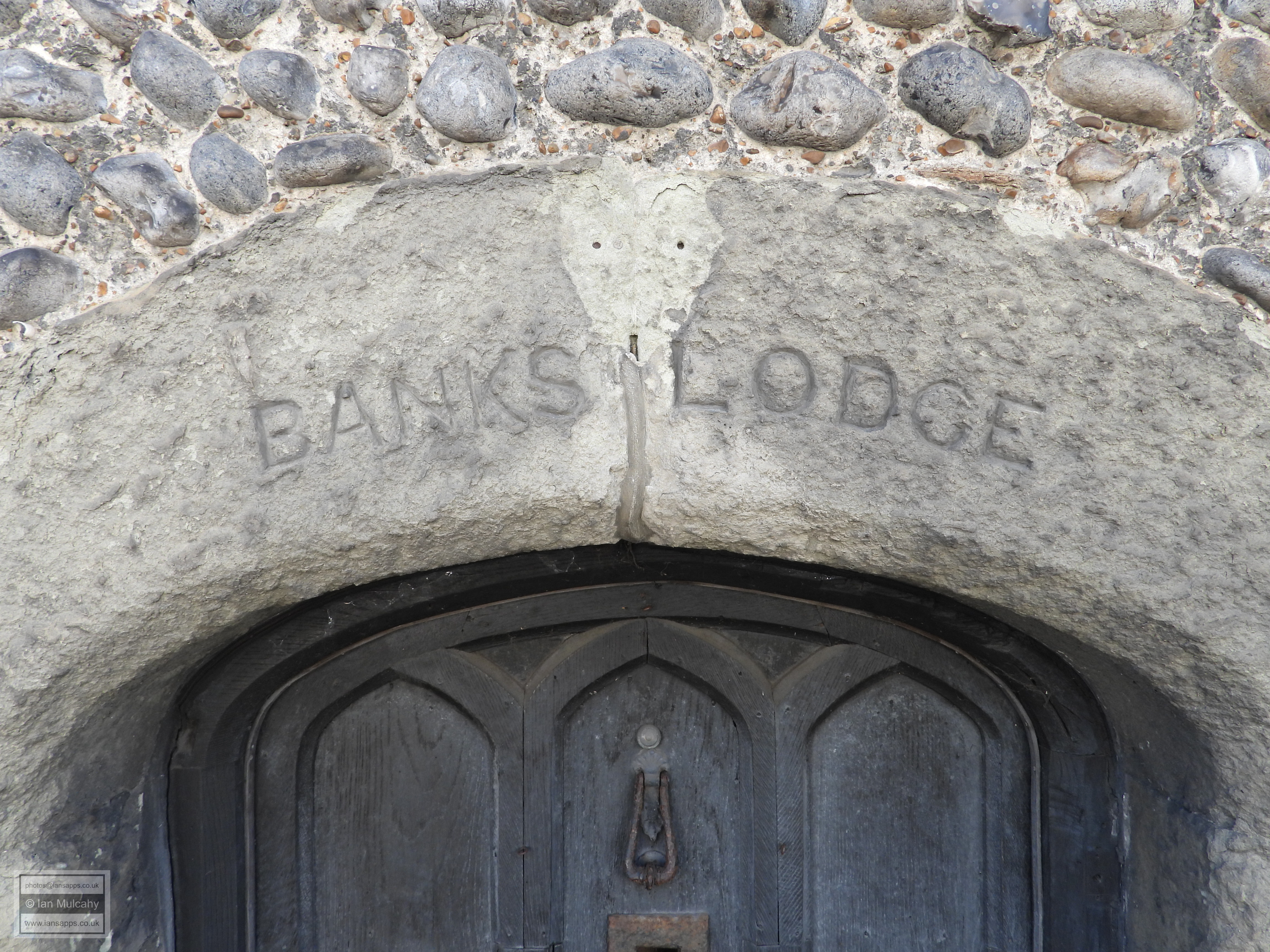
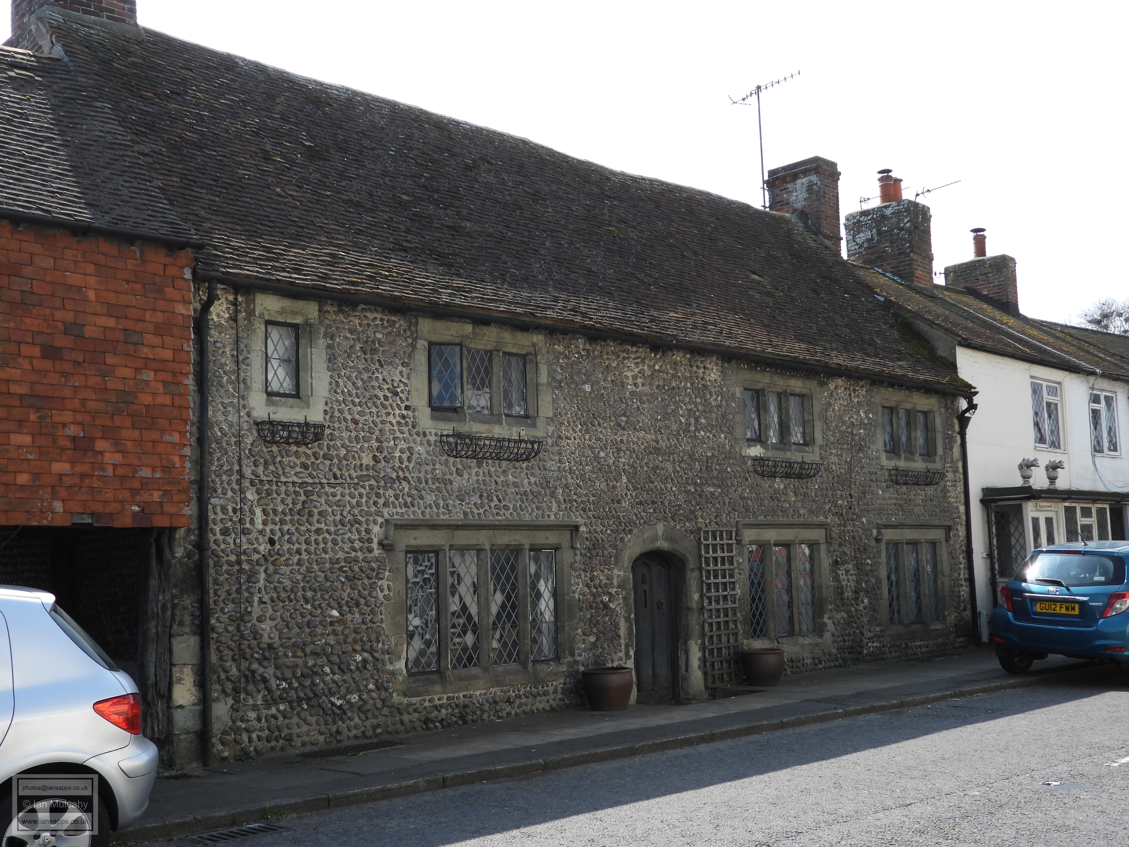
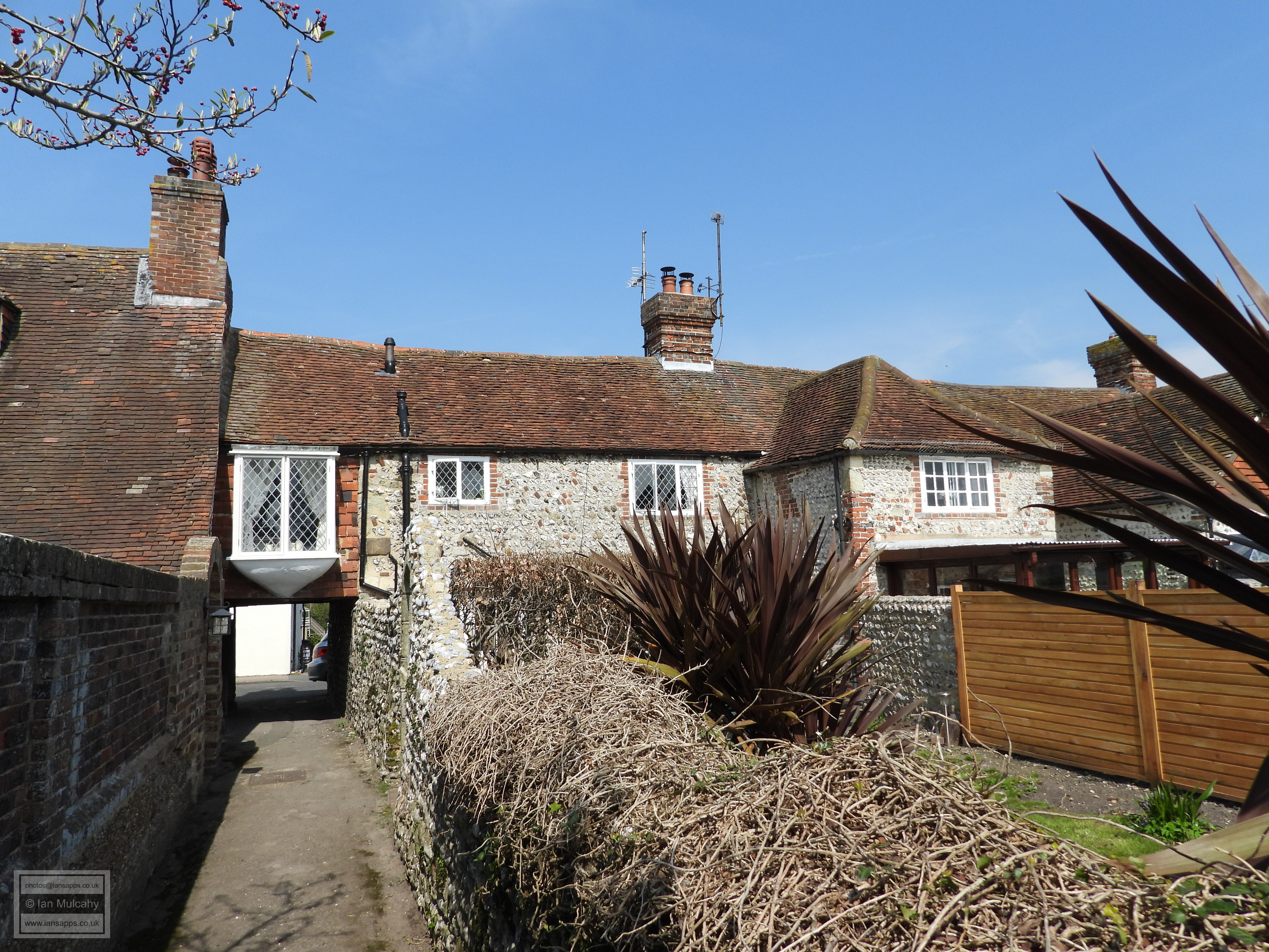
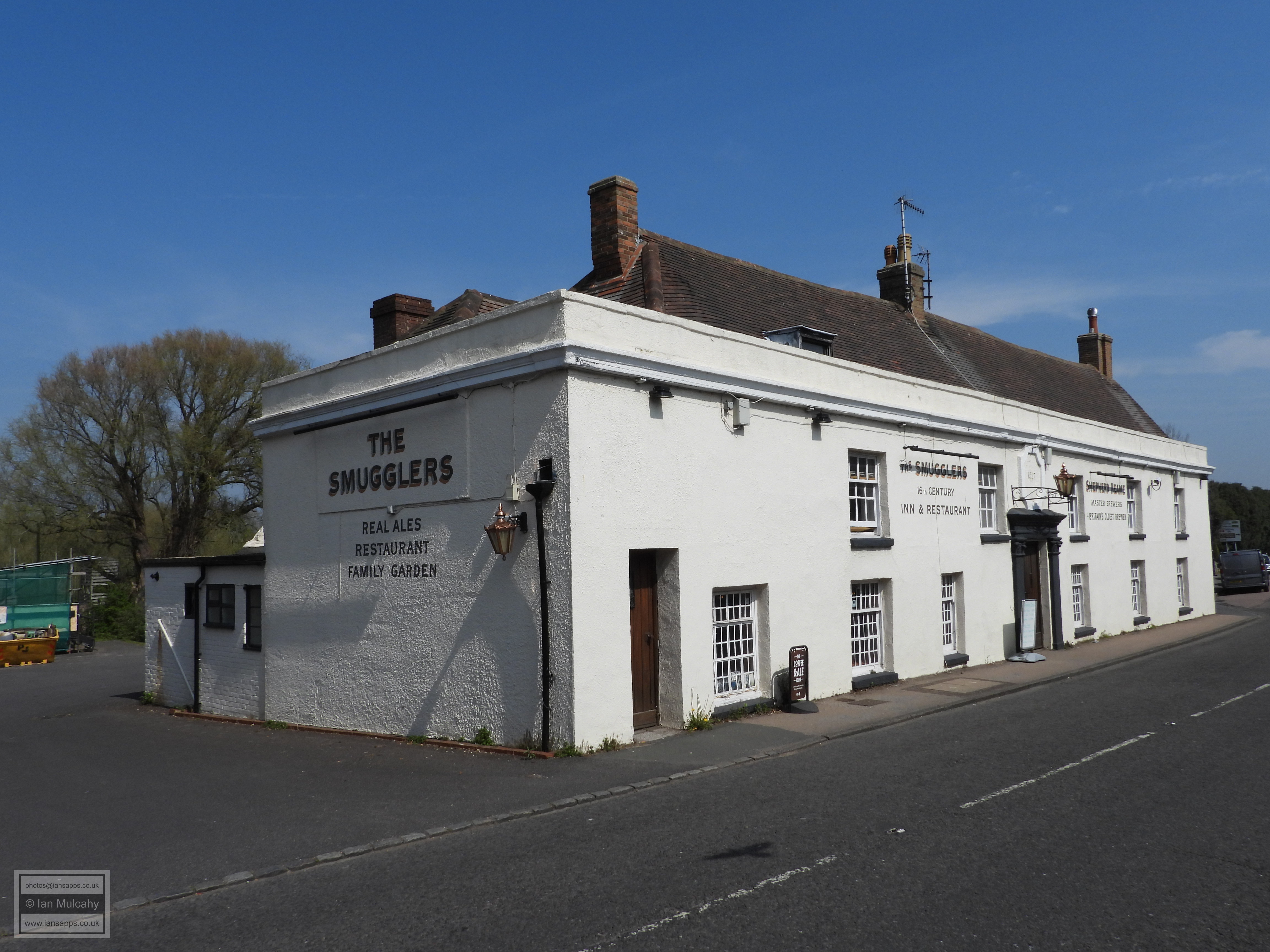
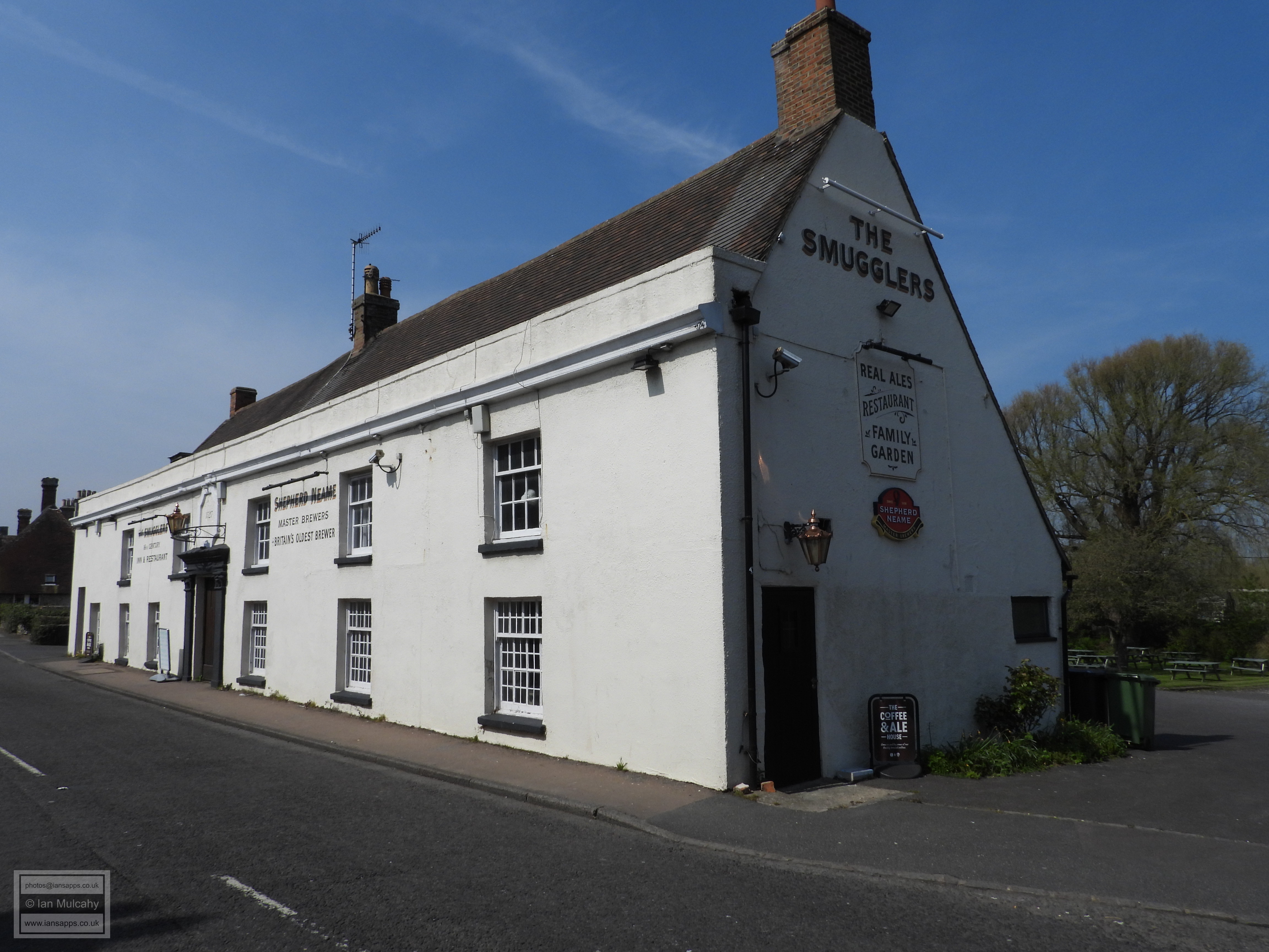
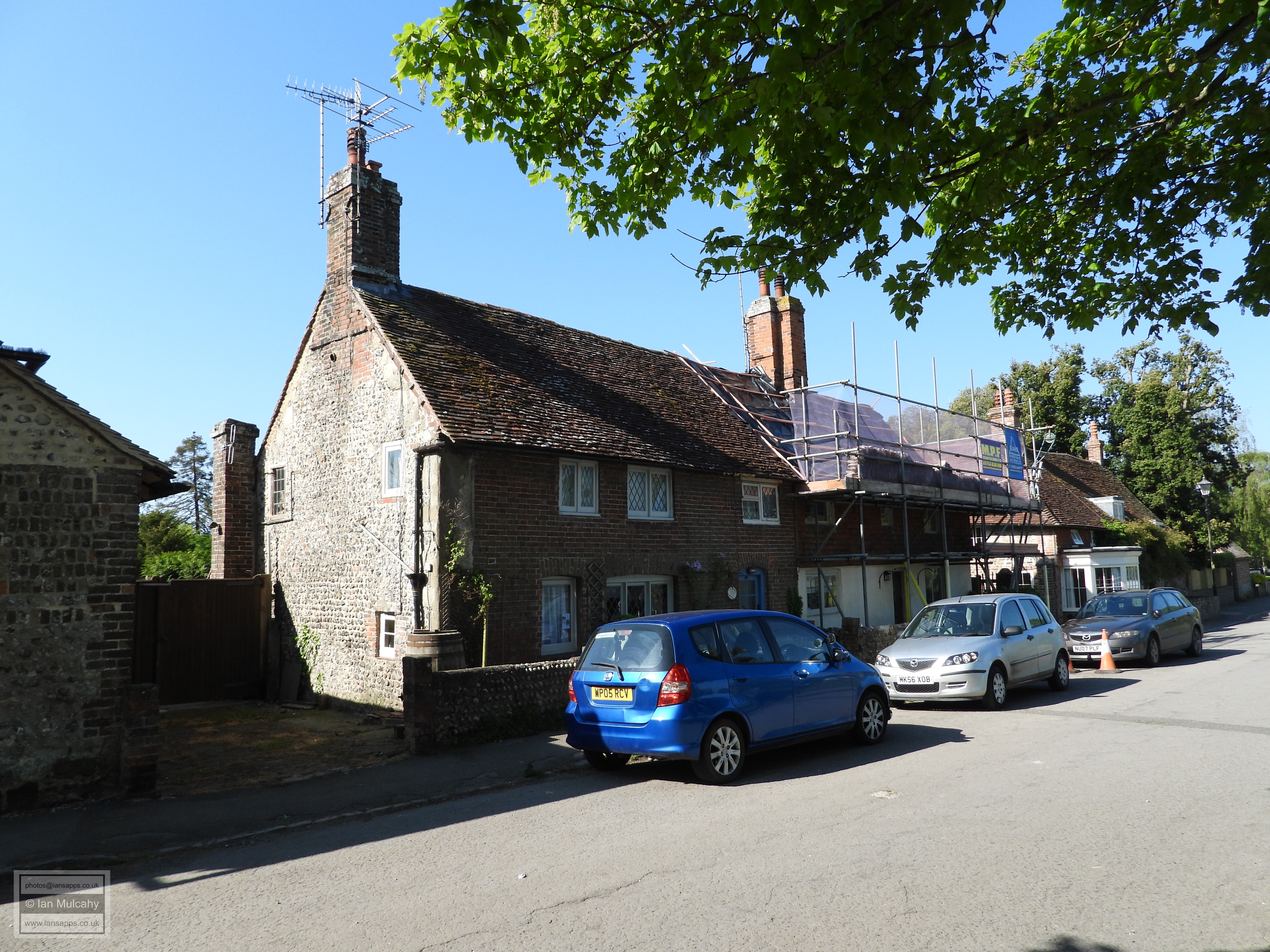
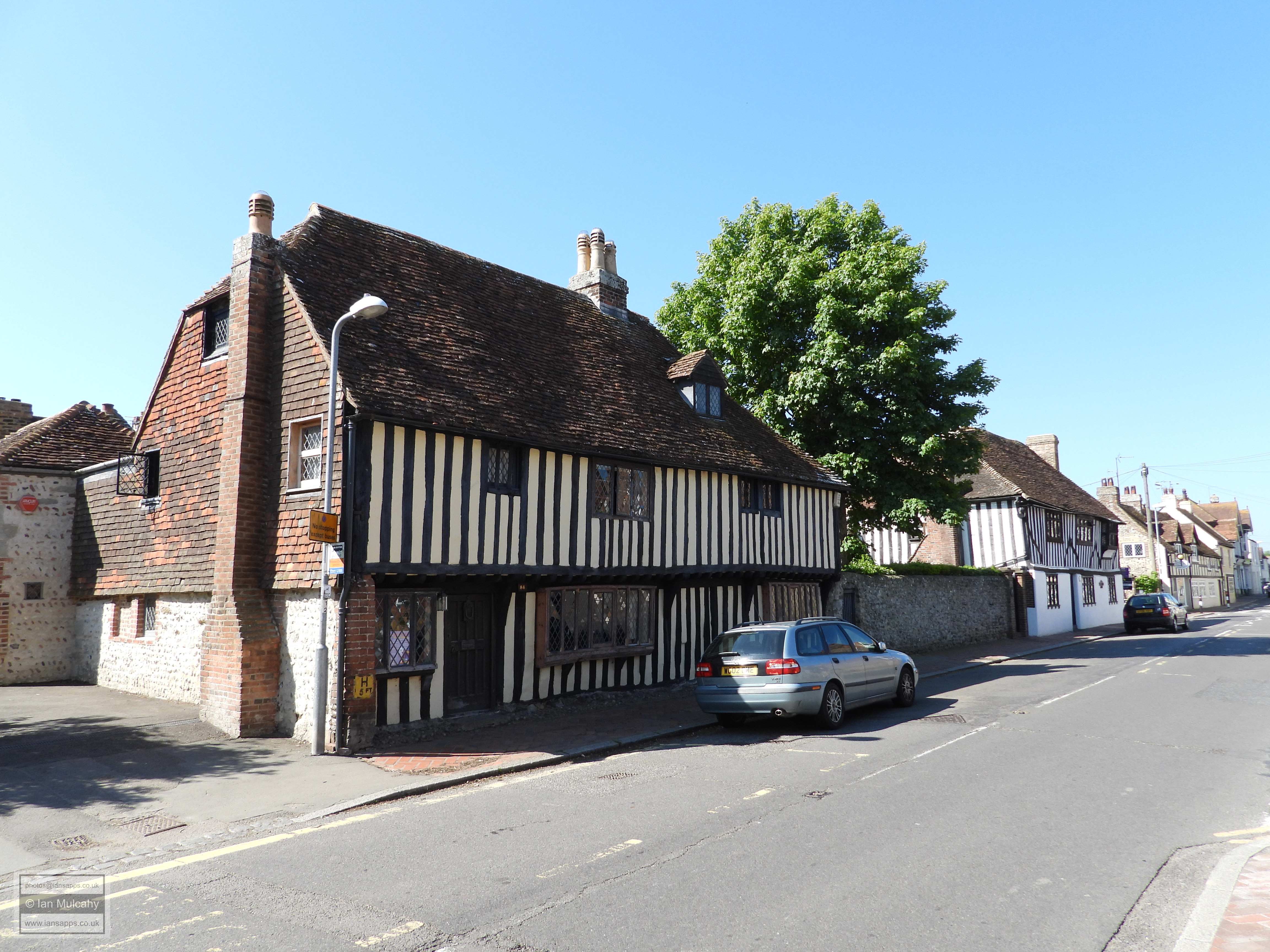
A further 70 metres east are Banks Lodge, a 16th century or earlier timber framed house and the adjacent Penthouse Cottage, another timber framed structure which dates to the 17th century or earlier. Both have been refaced in flint pebbles, though the timber framing is visible on Penthouse Cottage where it oversails the Twitten (path) leading to Church Lane. Opposite is The Smugglers Inn, a refaced 16th century timber framed pub, complete with a listed K6 Telephone Kiosk in its car park.
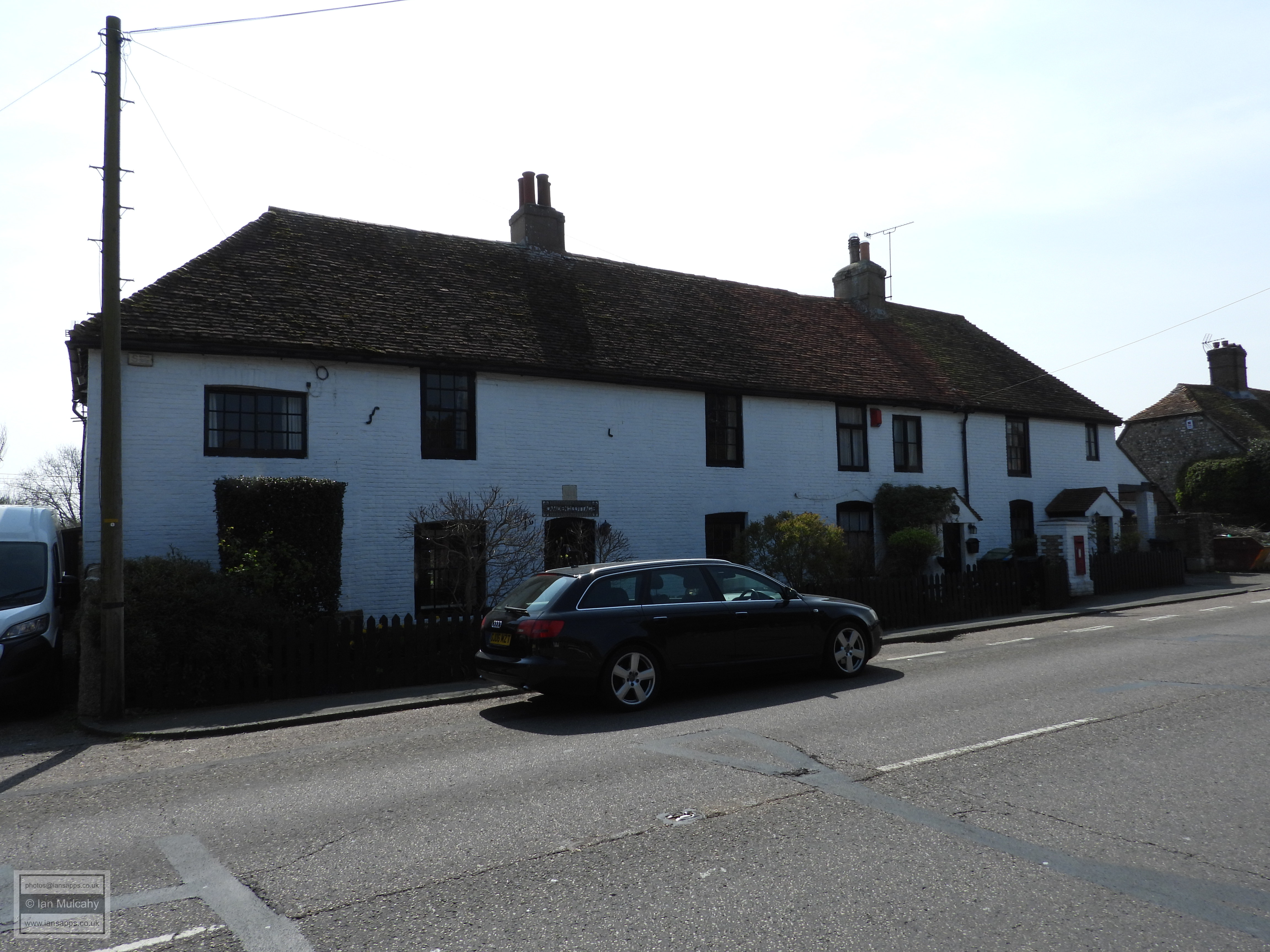
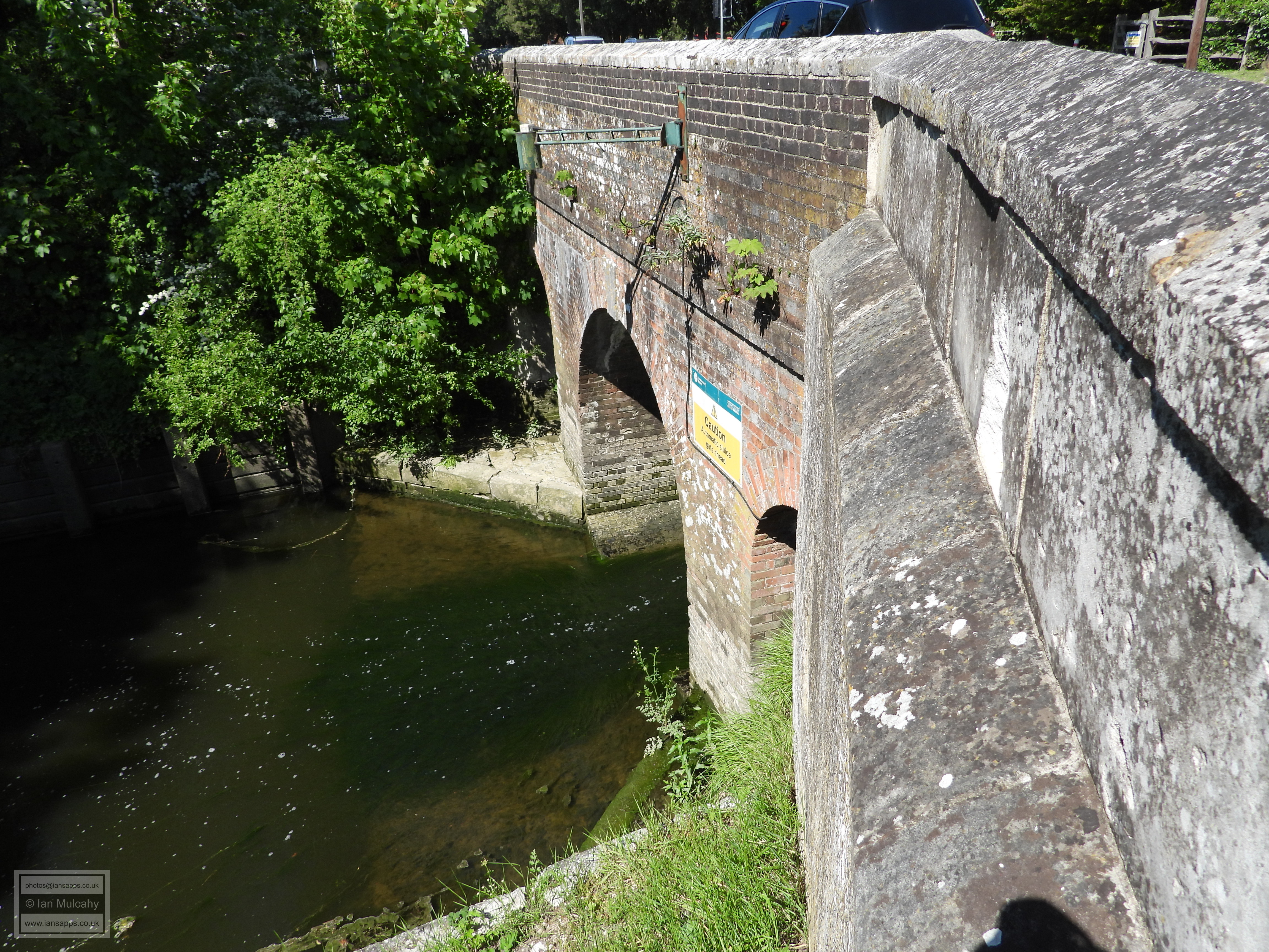
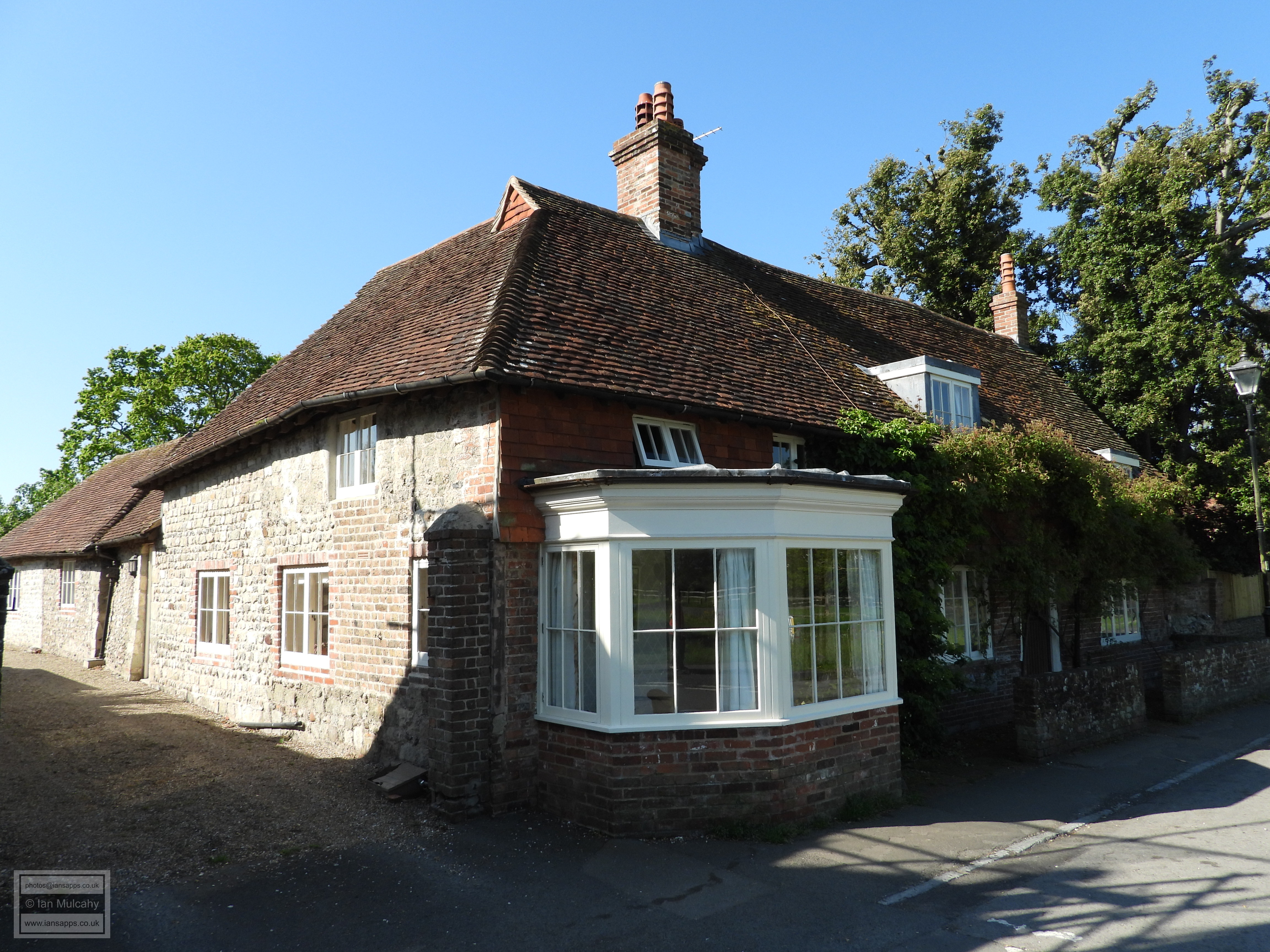
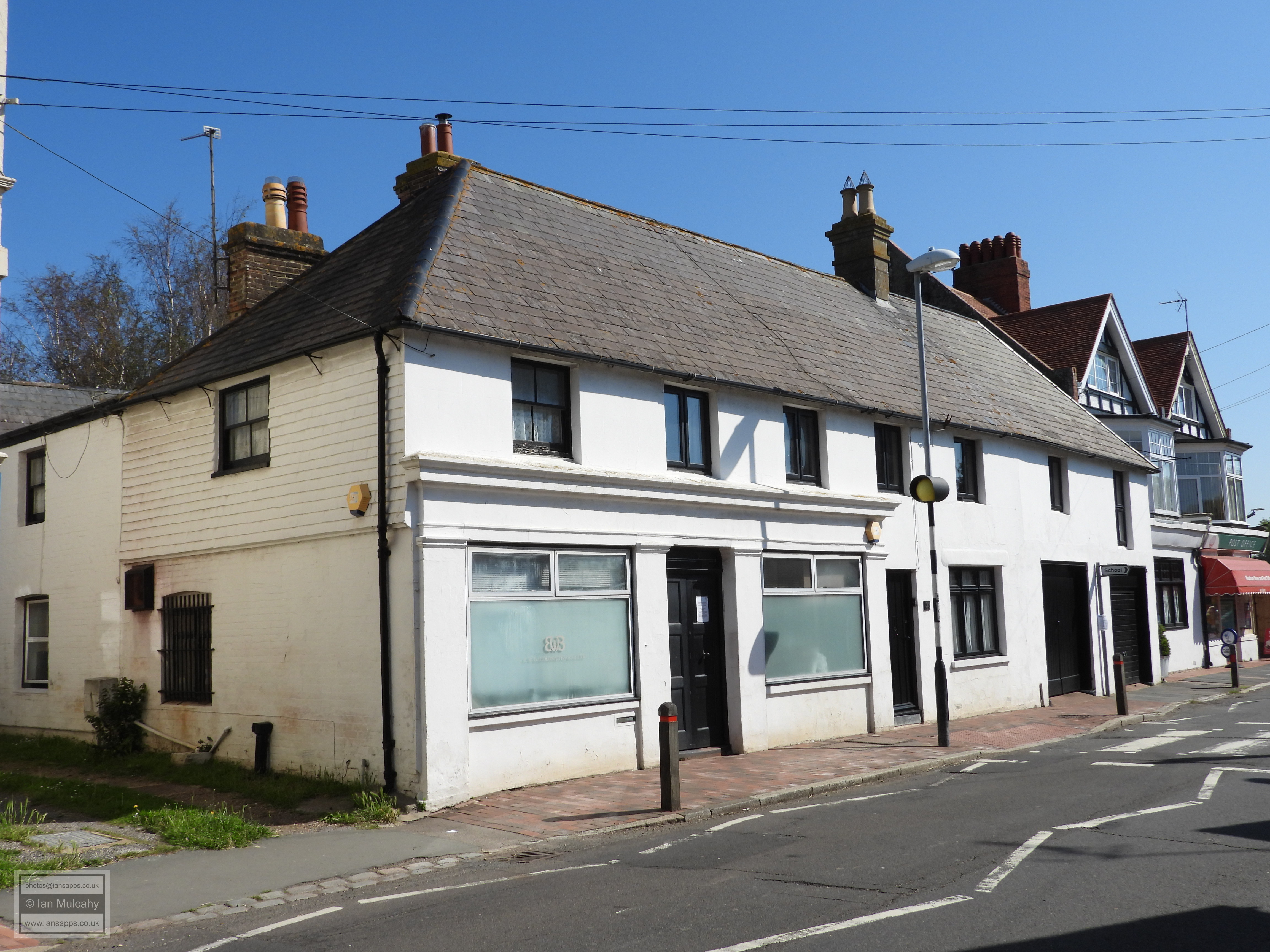
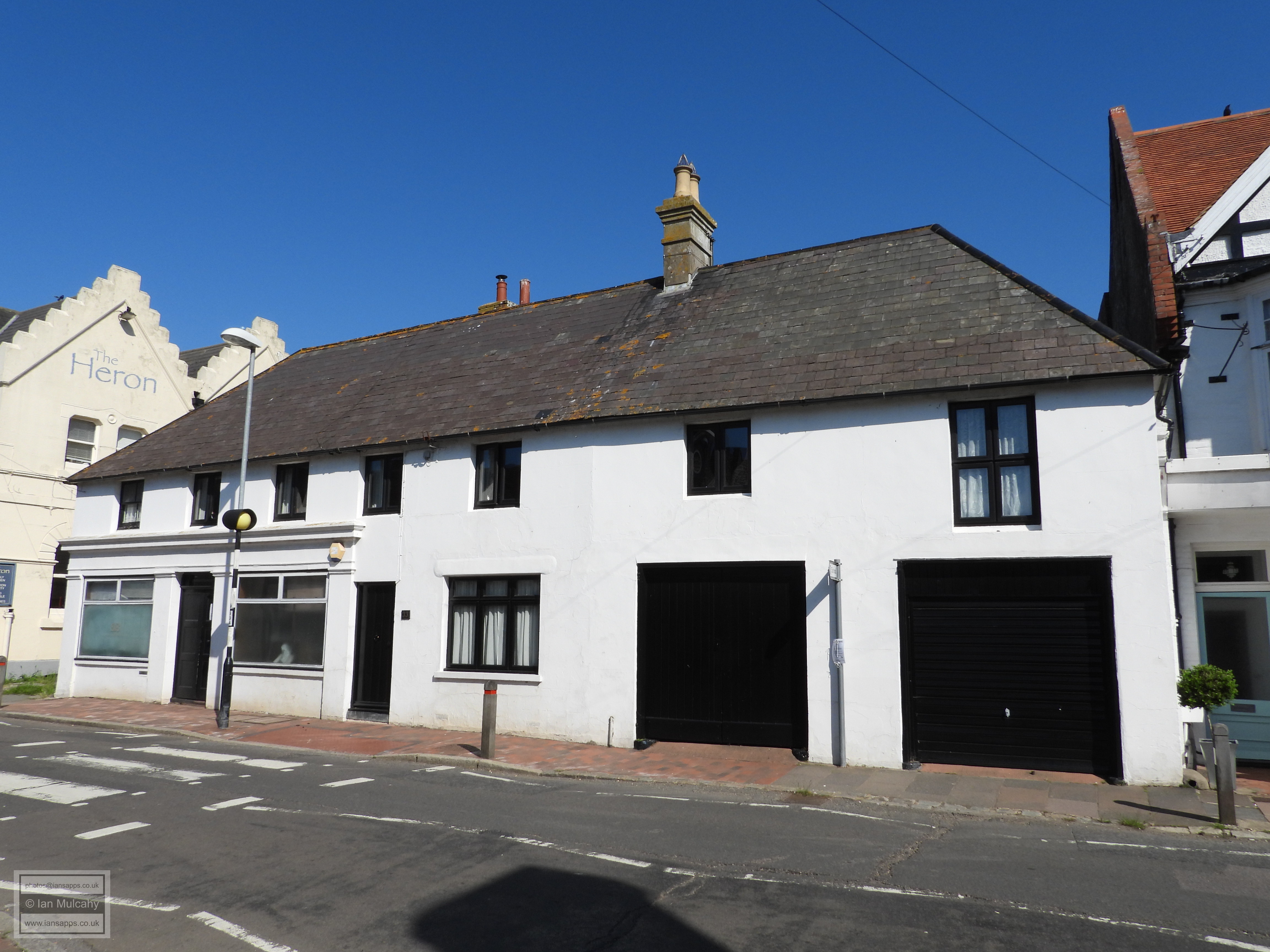
A little way west is the 17th century brick built Lyons Close, closely followed by the conjoined Camden Cottage and Post Office Cottage, a white painted brick building that can be dated precisely to 1717. At the very eastern end of the High Street and straddling the waterway known as Salt Haven is Pevensey Bridge, the oldest parts of which date back to 1675, though these are in the form of reused stone on the northern side of the bridge which was created in 1933 as part of a road widening scheme. The southern side of the bridge, as seen in the photograph, was built in 1816. East of the churchyard is the 17th century Vicarage, though this was substantially altered in the 19th century.
Just outside of the imposing west gate of the fort is the village of Westham, mentioned in the Domesday book as being a hamlet to the west of Pevensey Castle. The name derives from a geographical description, in relation to the fort, and ham, which is Saxon dialect for a piece of land surrounded with paling, wicker-work, etc. The village developed outside of the fort on the only land approach, presumably as a home to those who were not deemed important enough to live within the walls, but whose labour was required nonetheless.
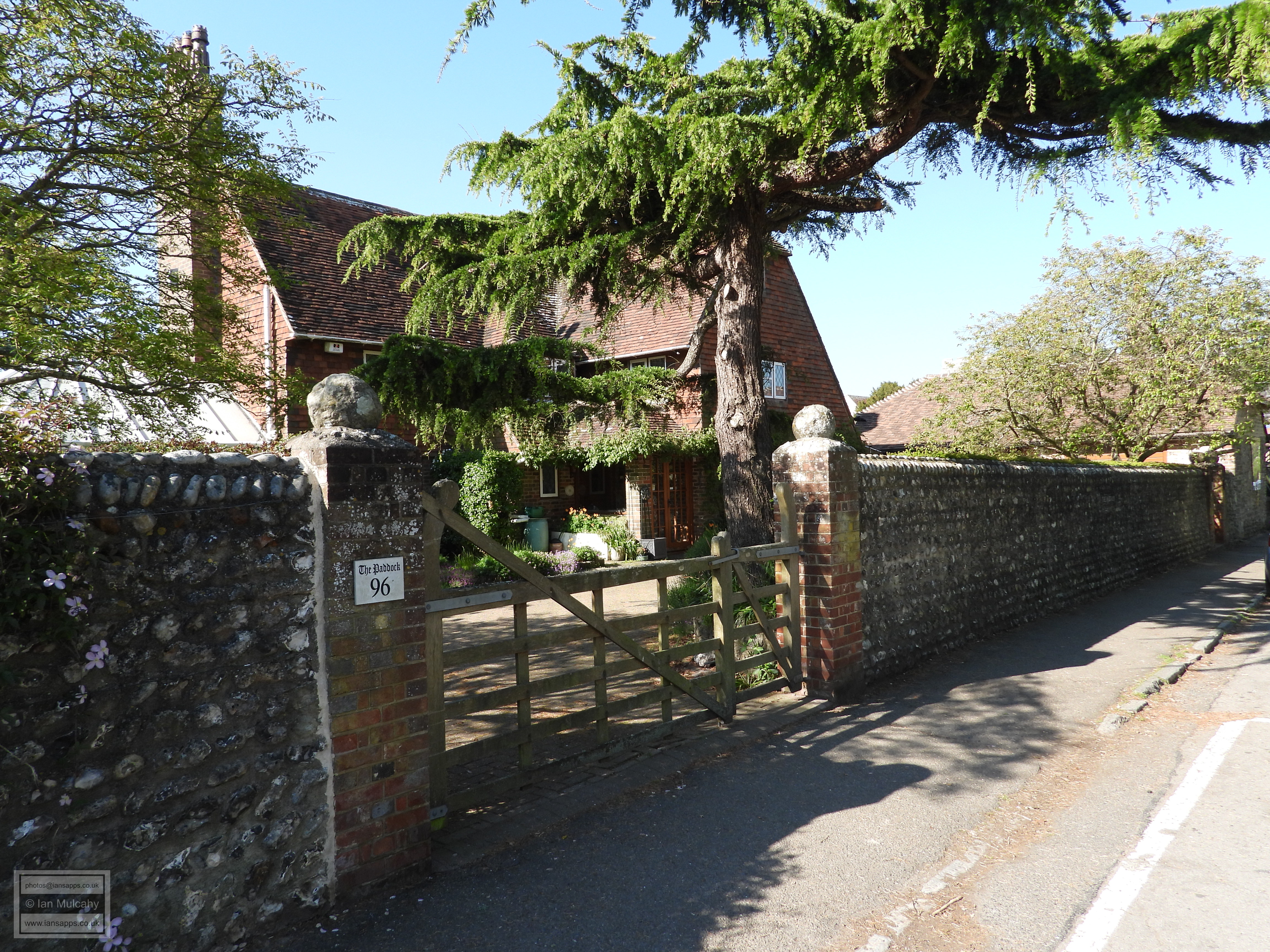
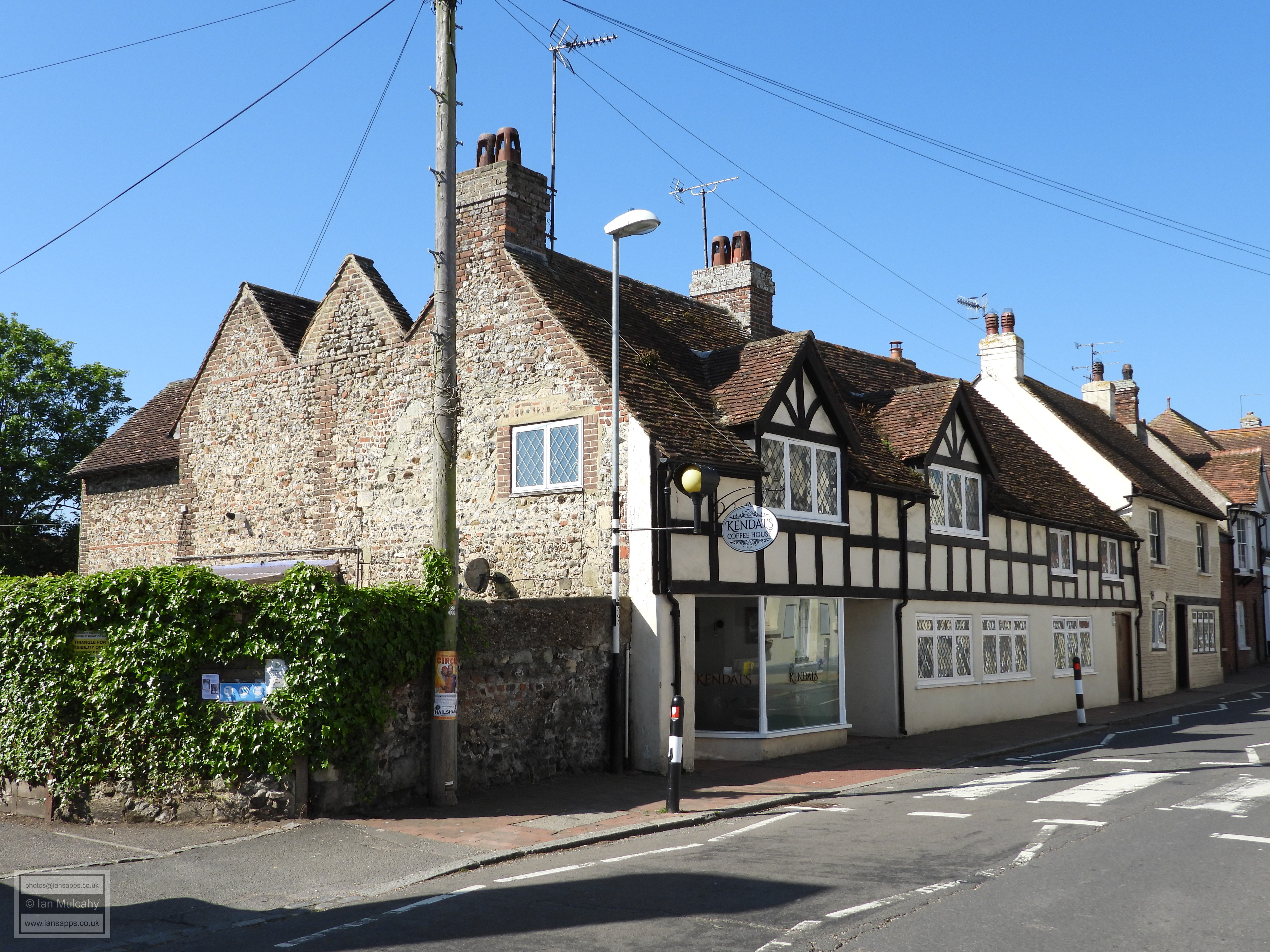
There are 12 listed buildings standing along the the quarter mile long High Street and the first of these, immediately outside of the west gate, is The Old Corner House, a large 17th century house which looks out over the 18th century flint built Western Garden Wall & Gate Piers of 96 High Street.
Facing out onto a small village green are the conjoined Grace Cottage & Laurel Cottage which presents an 18th century front to a building which is probably much older. On the other side of an access drive is Gleadon Cottage & The Castle Gallery, another building whose 18th century refronting conceals an older structure.
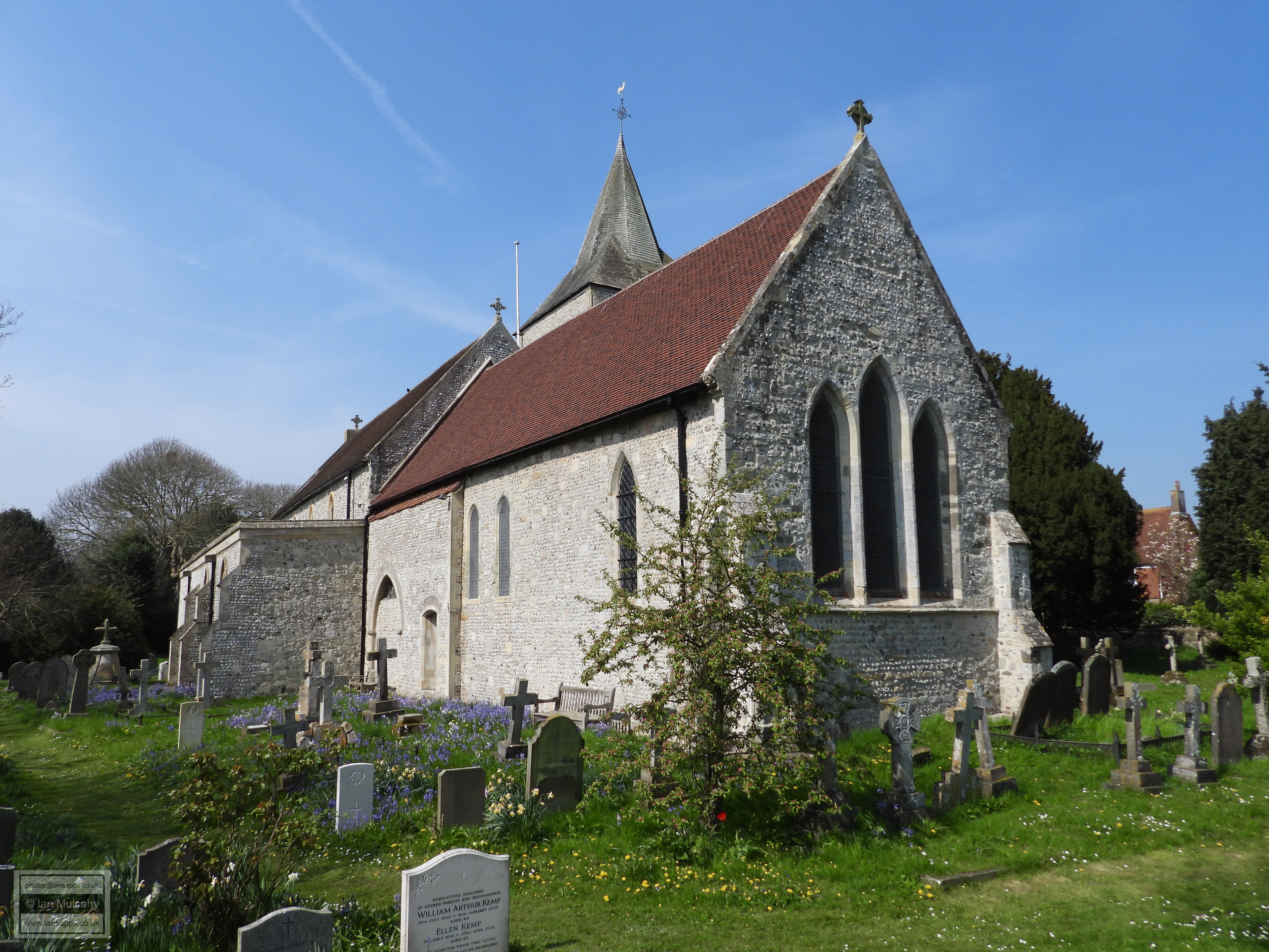
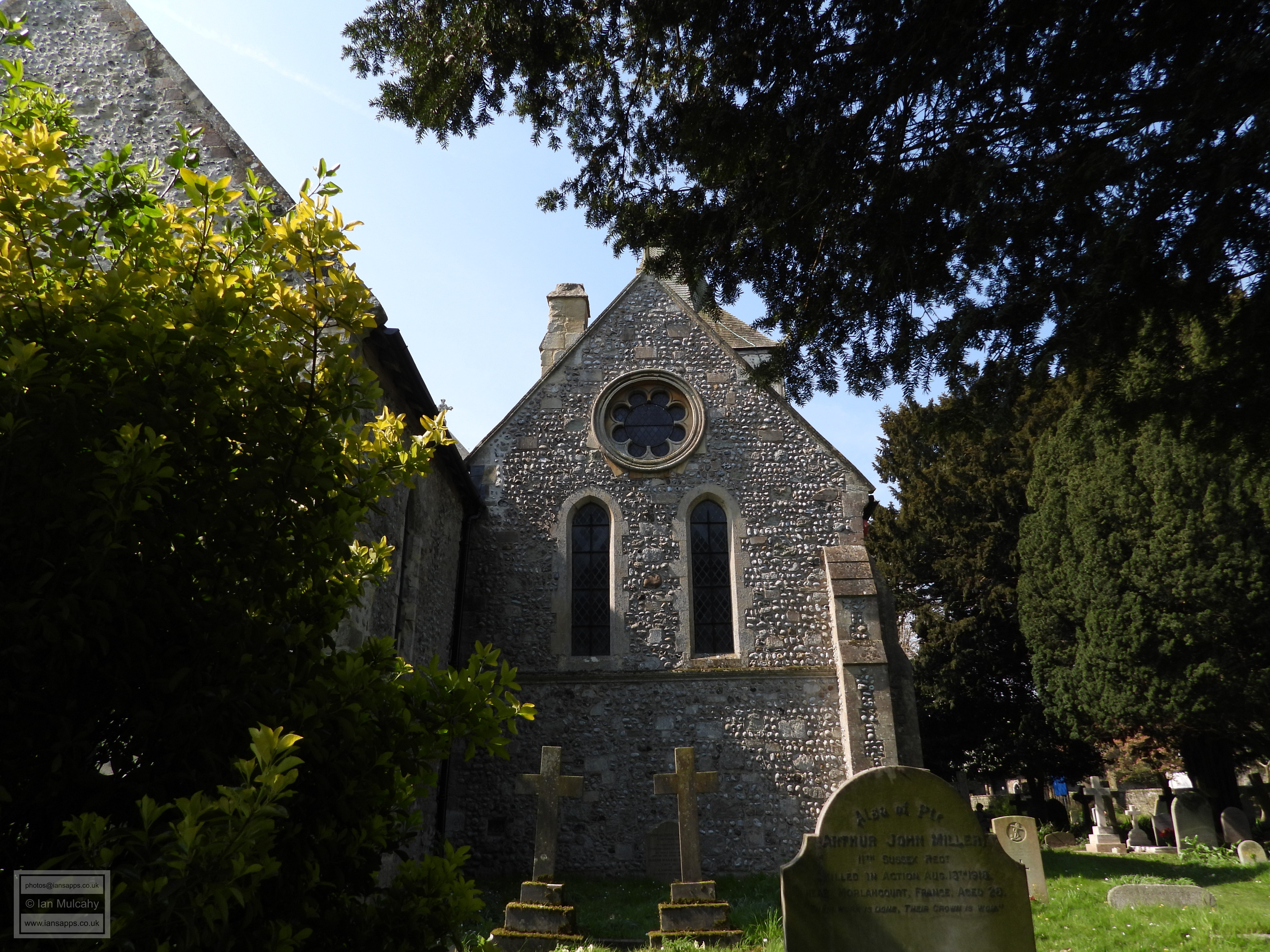
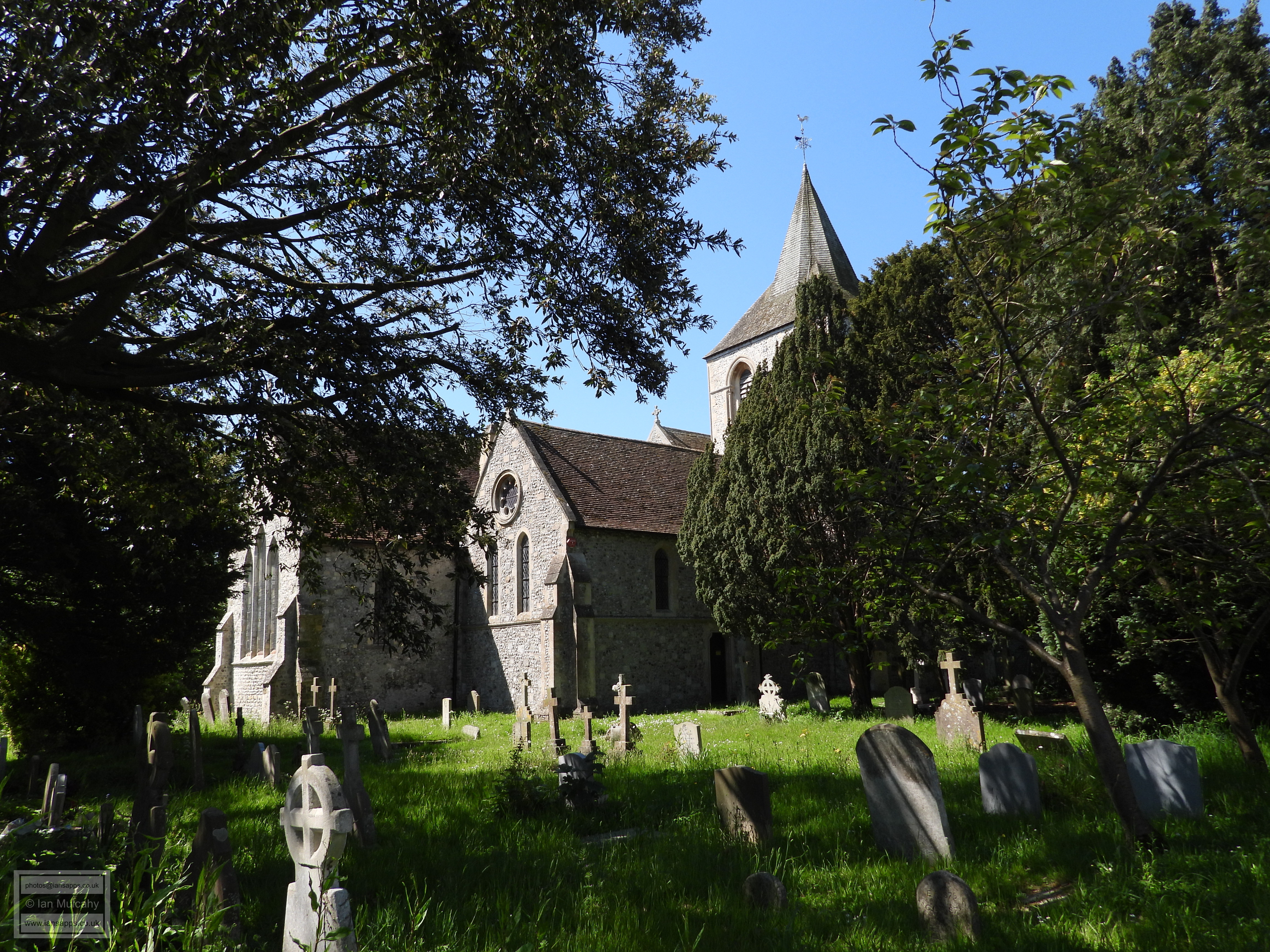
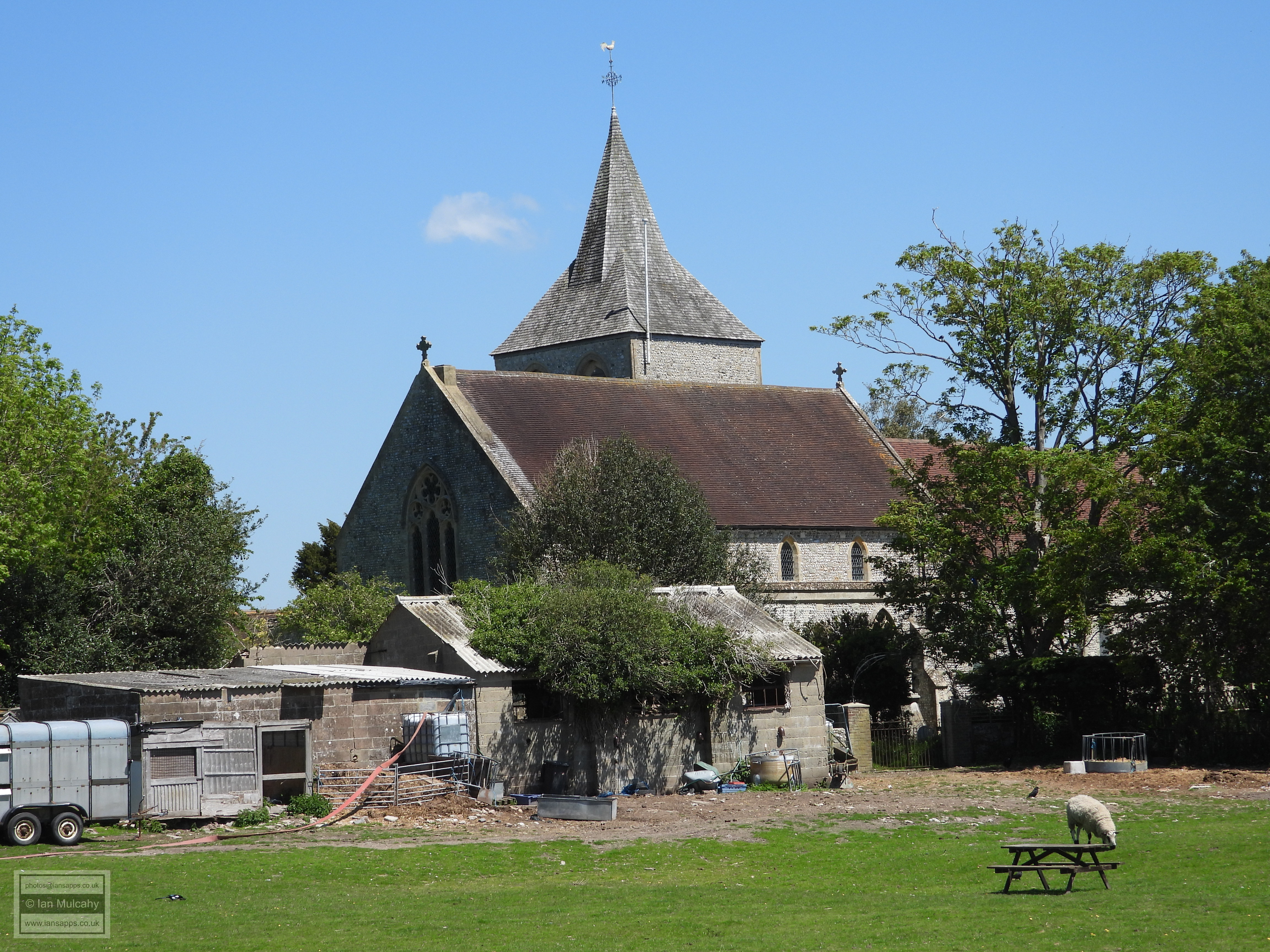
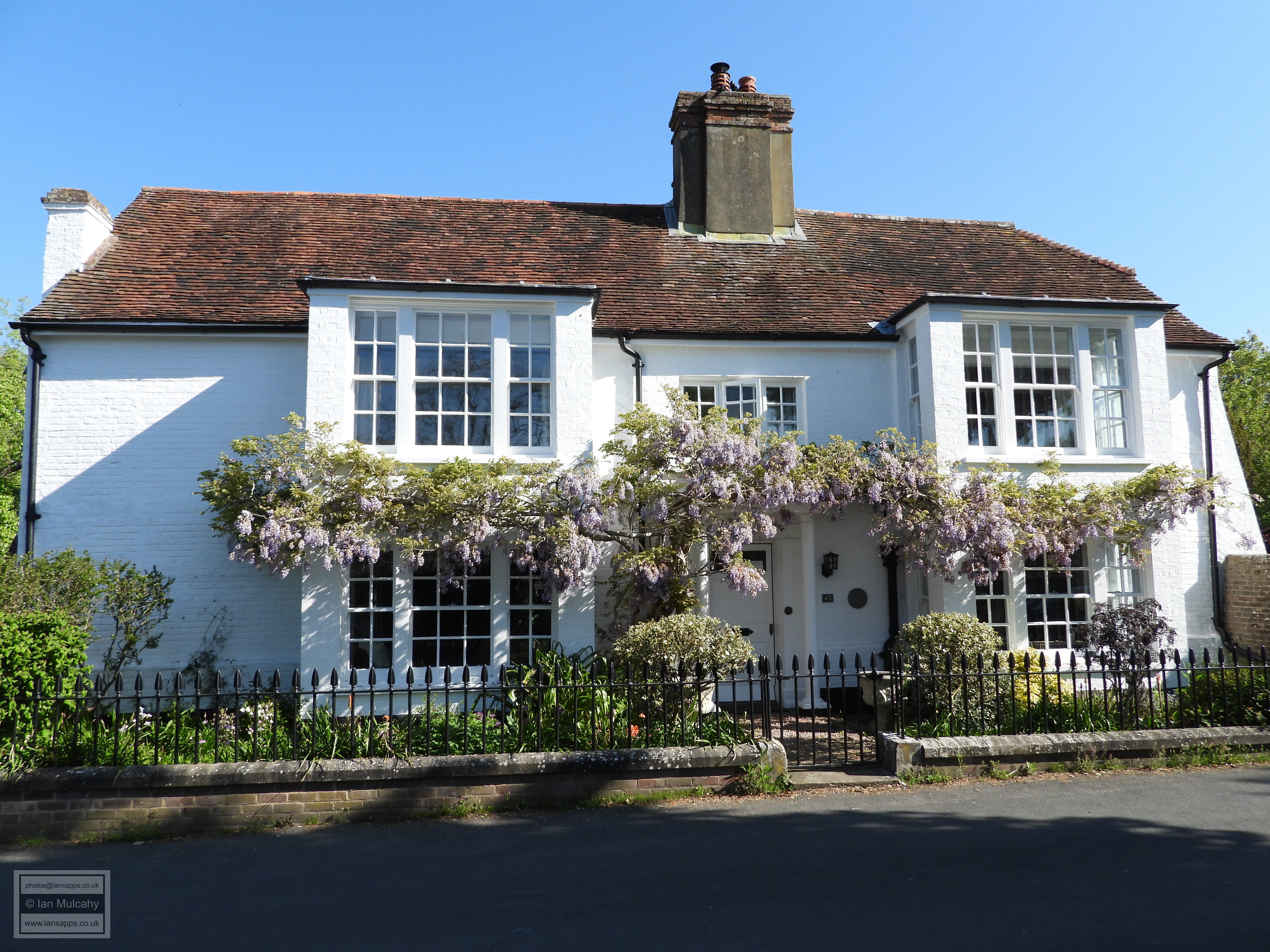
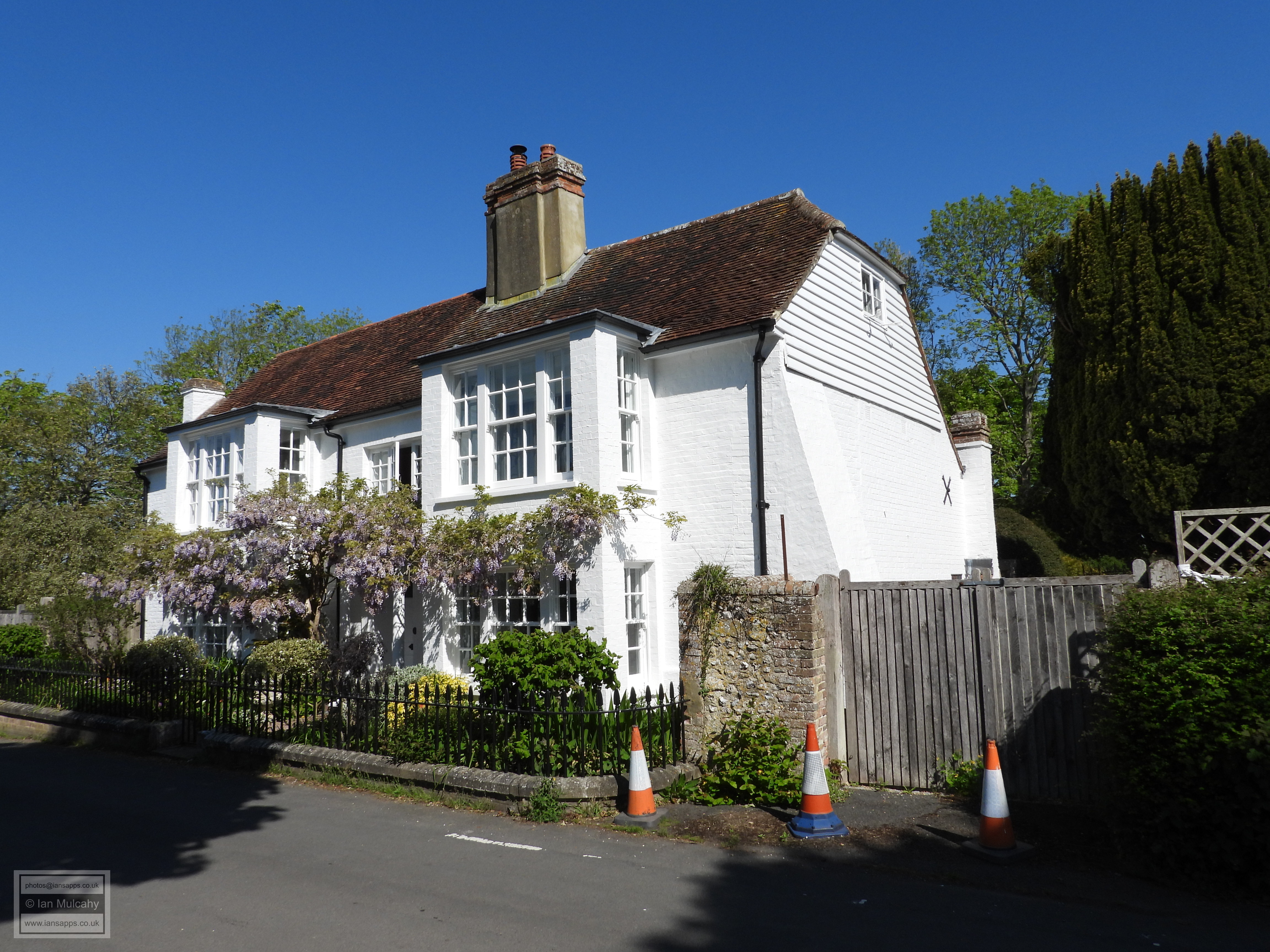
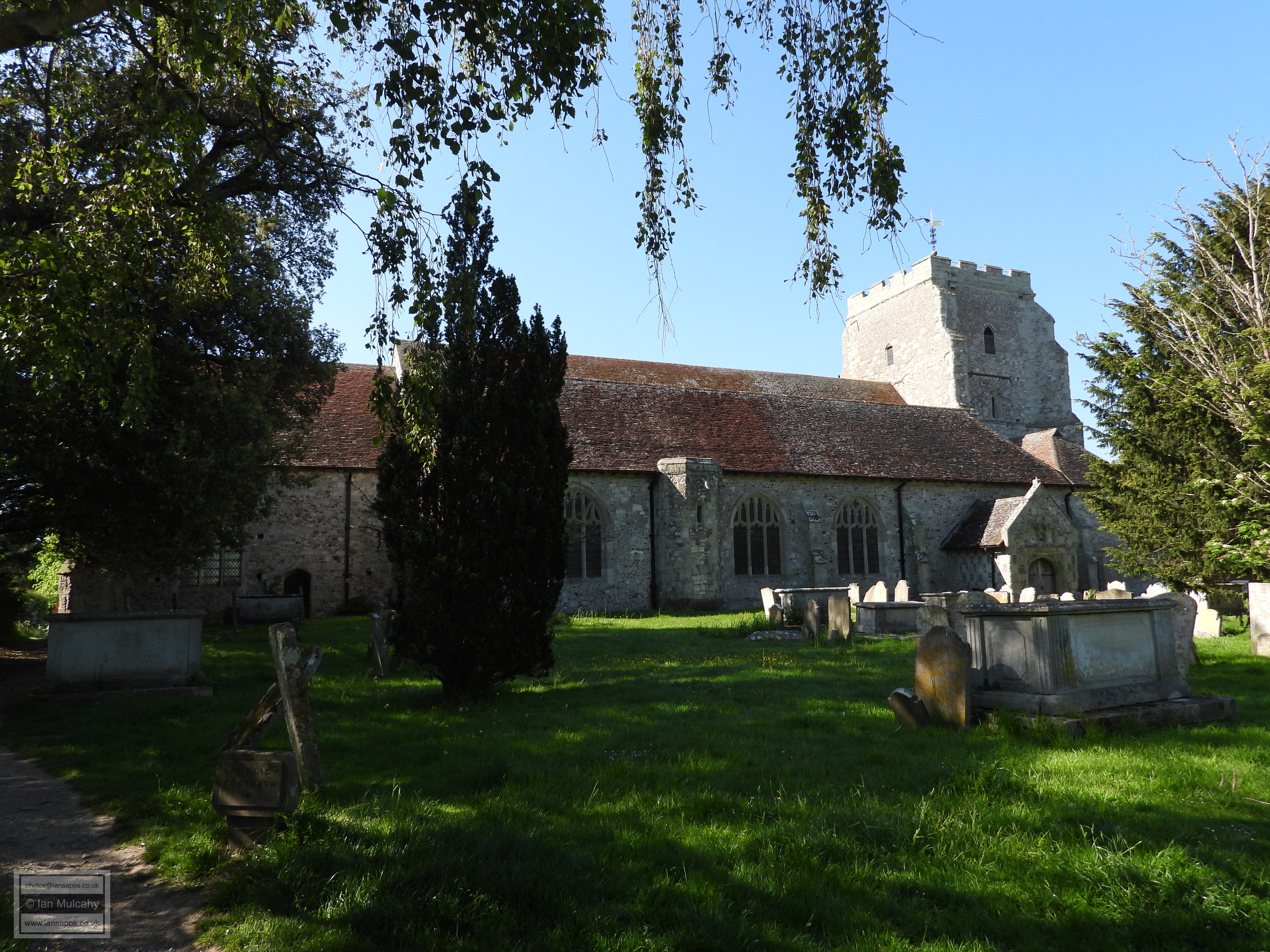
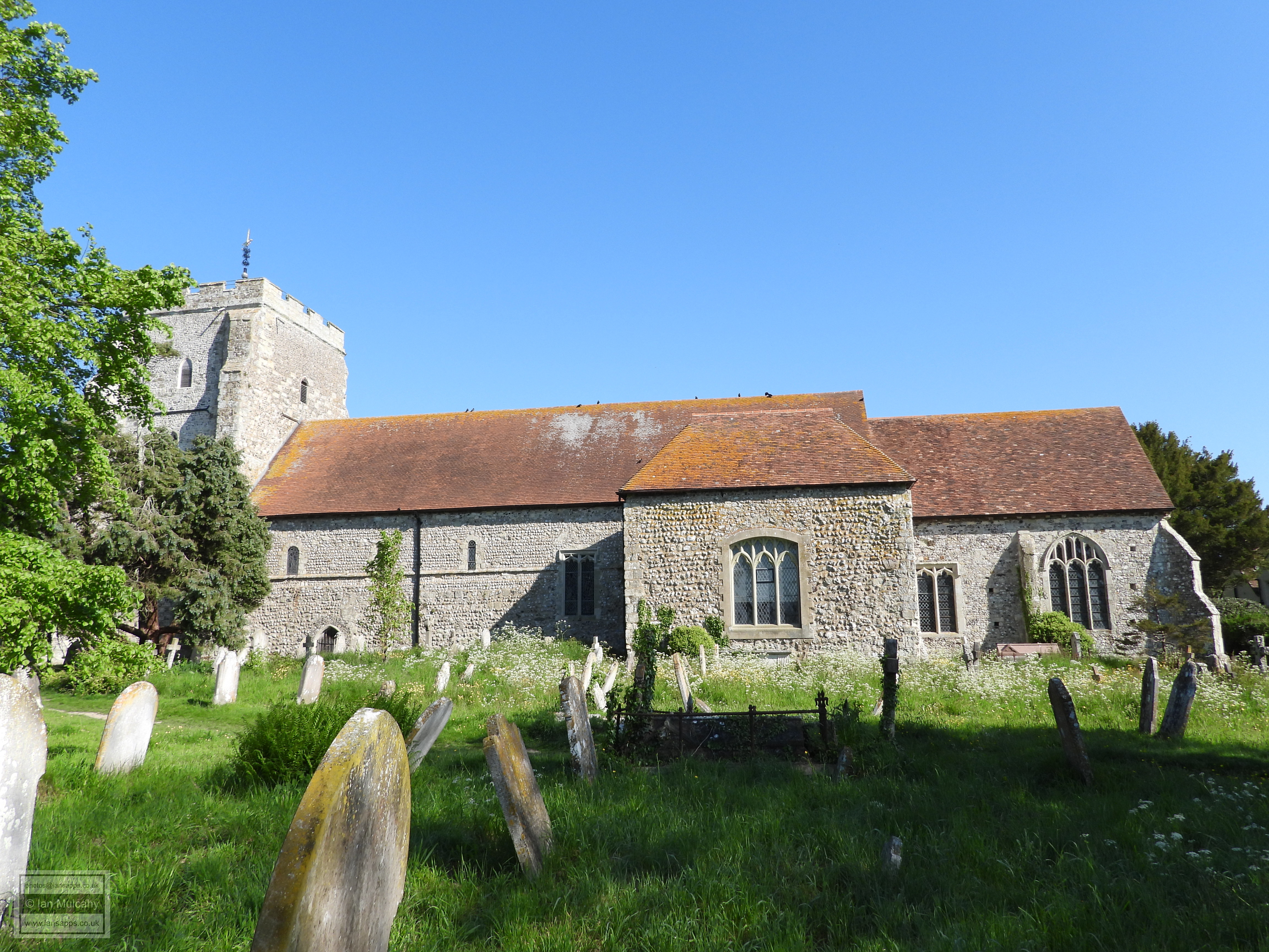
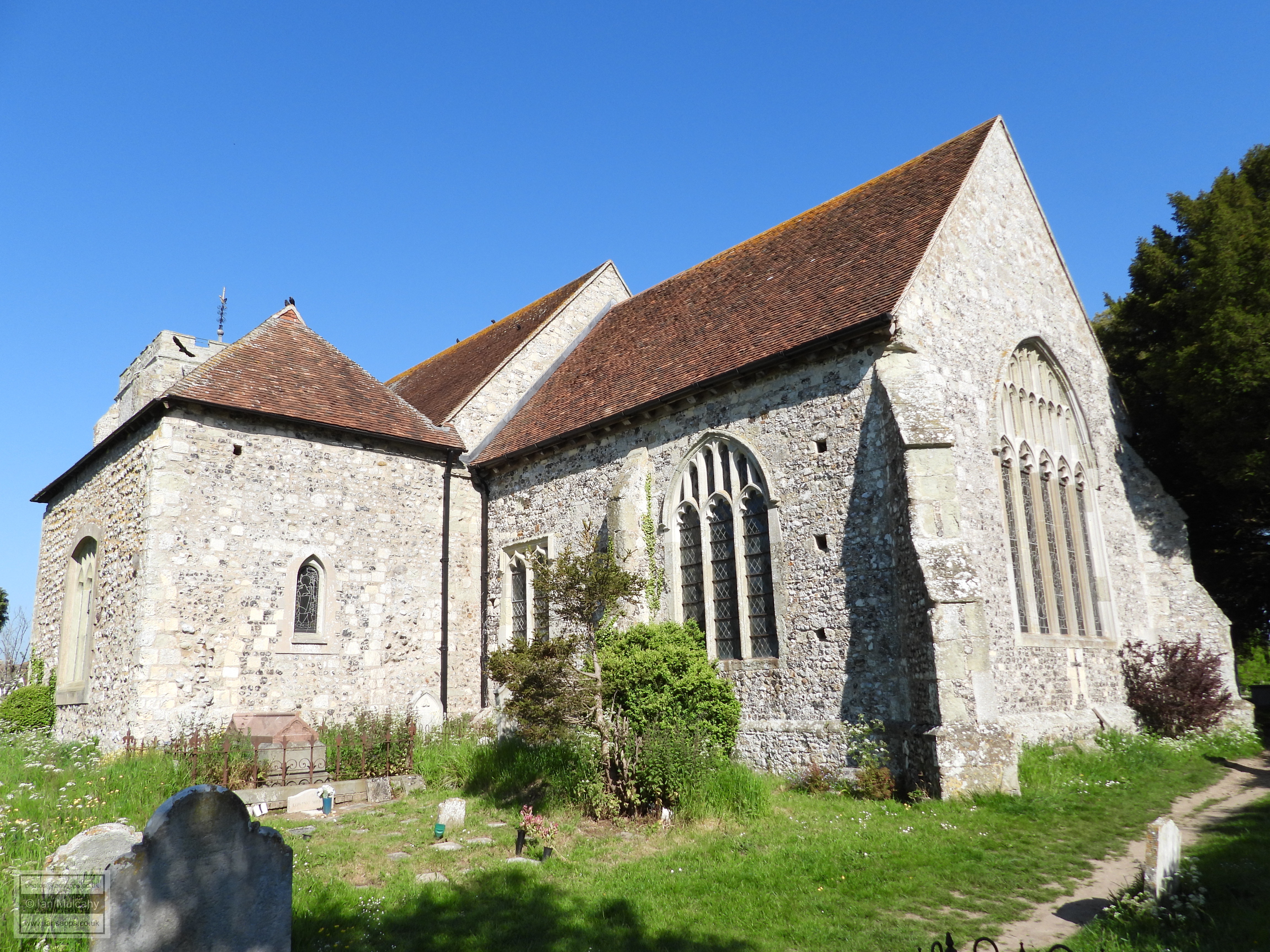
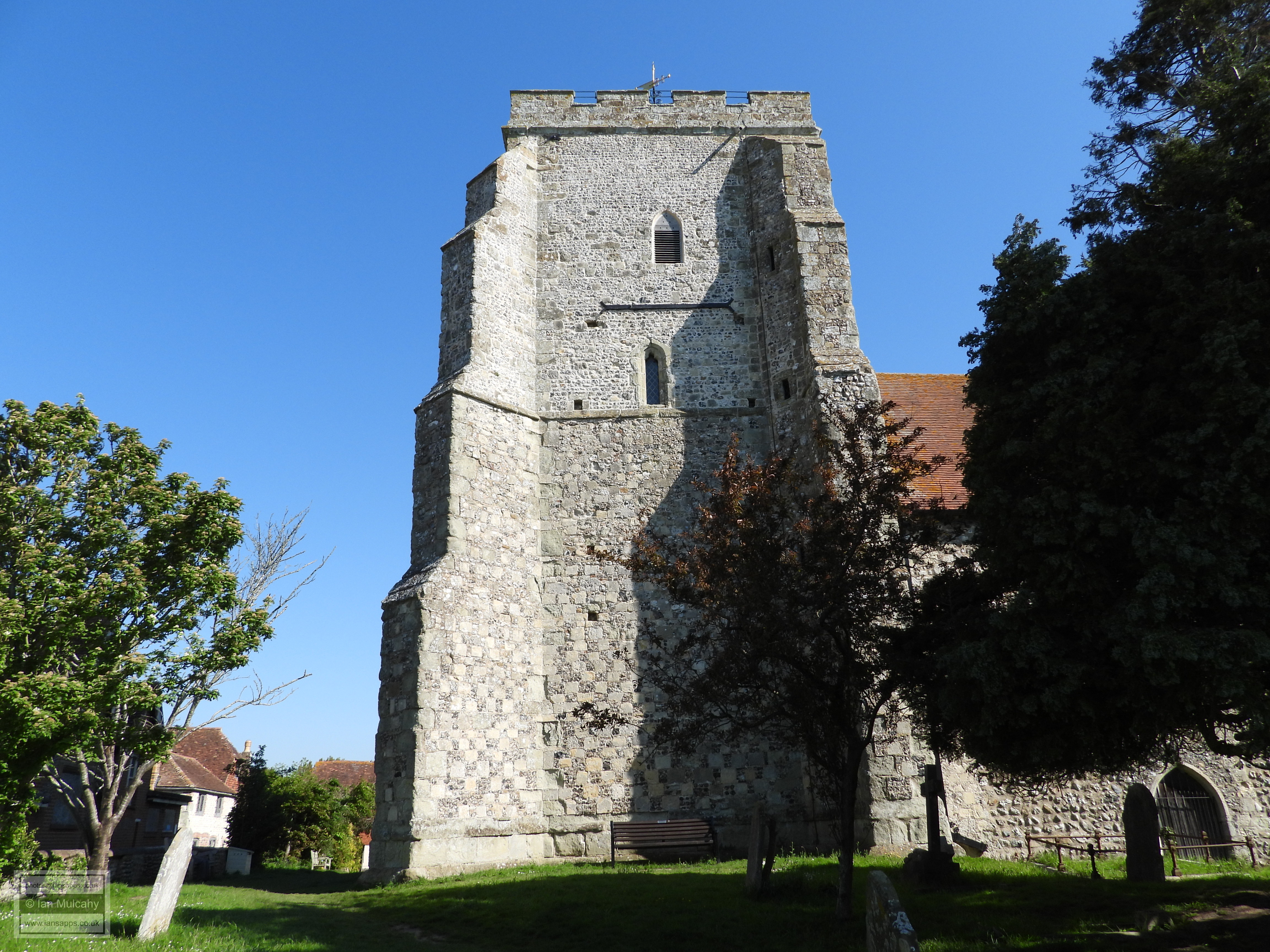
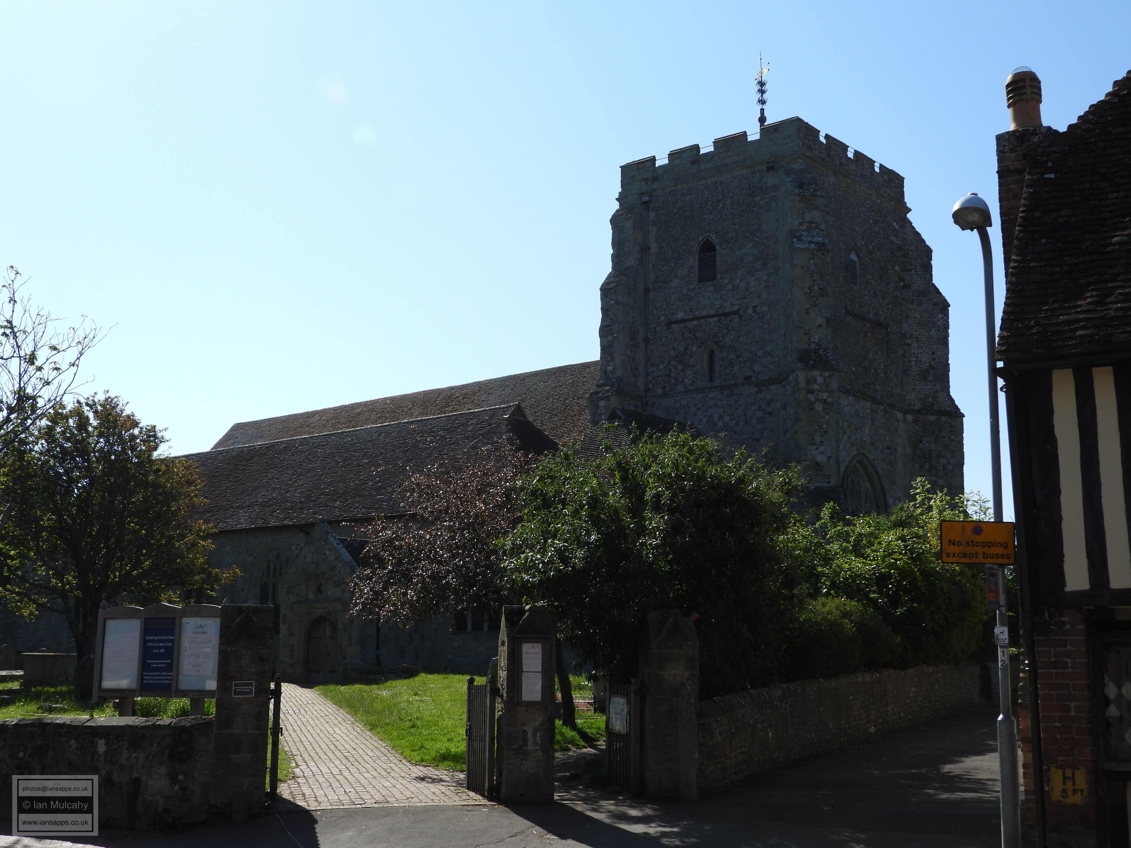
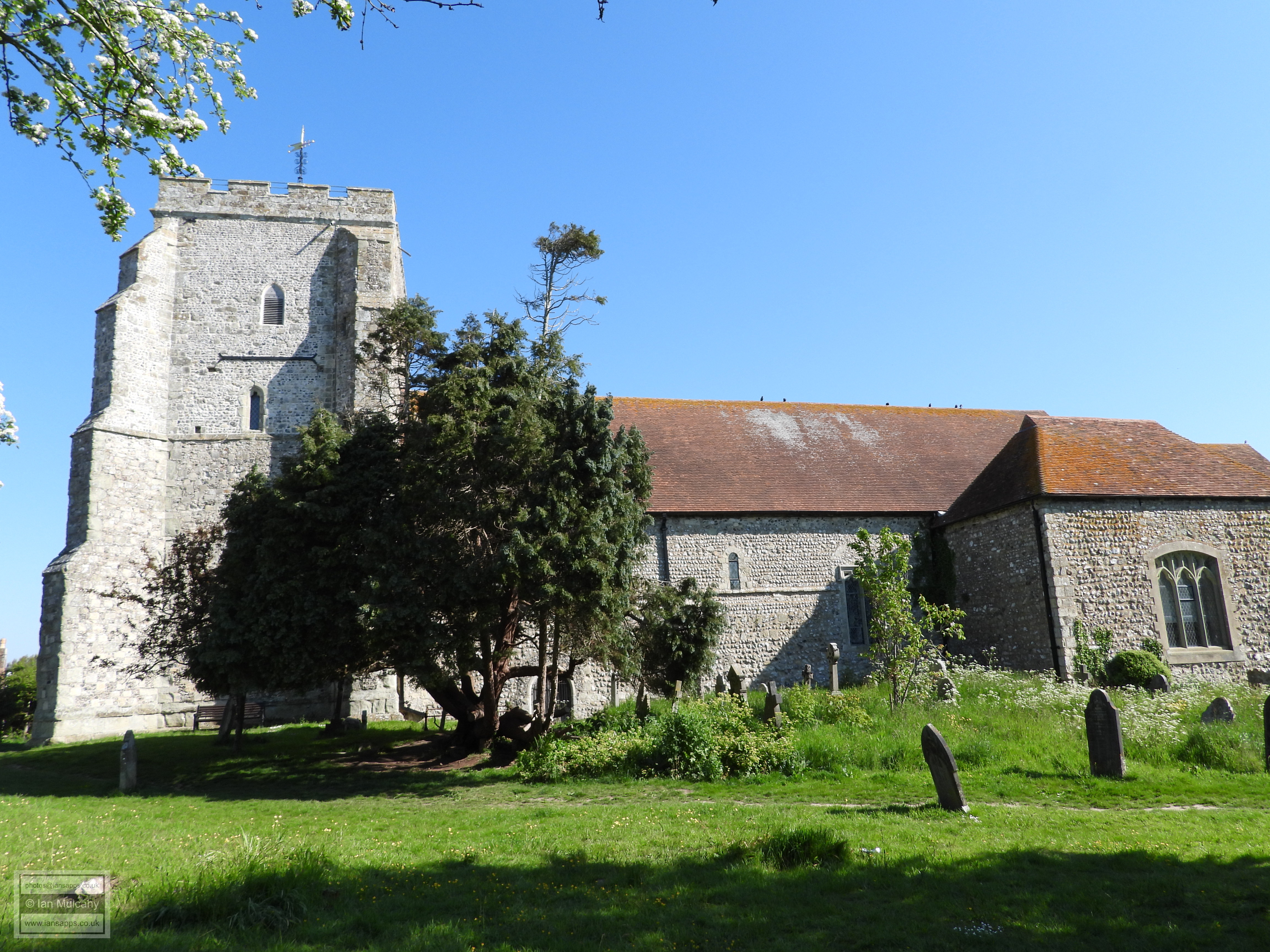
A little further west, set back from the point where the through road joins the High Street, is The Old Vicarage, a large 17th century house next to The Parish Church of St Mary. The earliest fabric of the church dates to the late 11th century and can be found in the transept and south aisle. Given the dating, the conclusion must be drawn that the building of the current church was started shortly after the Norman invasion though it is not known if this was when the church was founded or if it was built on the site of an older place of worship. The north aisle and tower were added in the late 14th century.
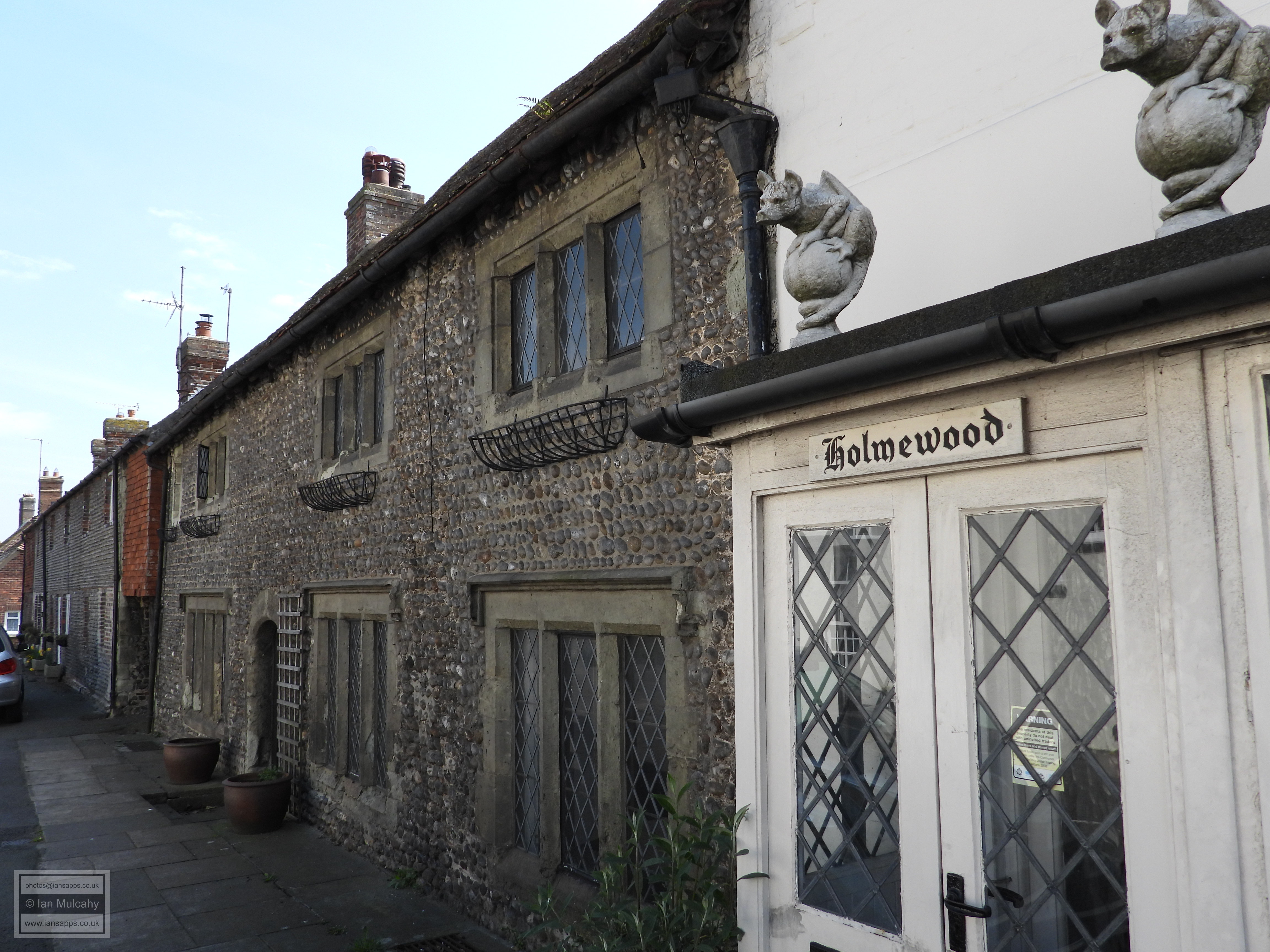
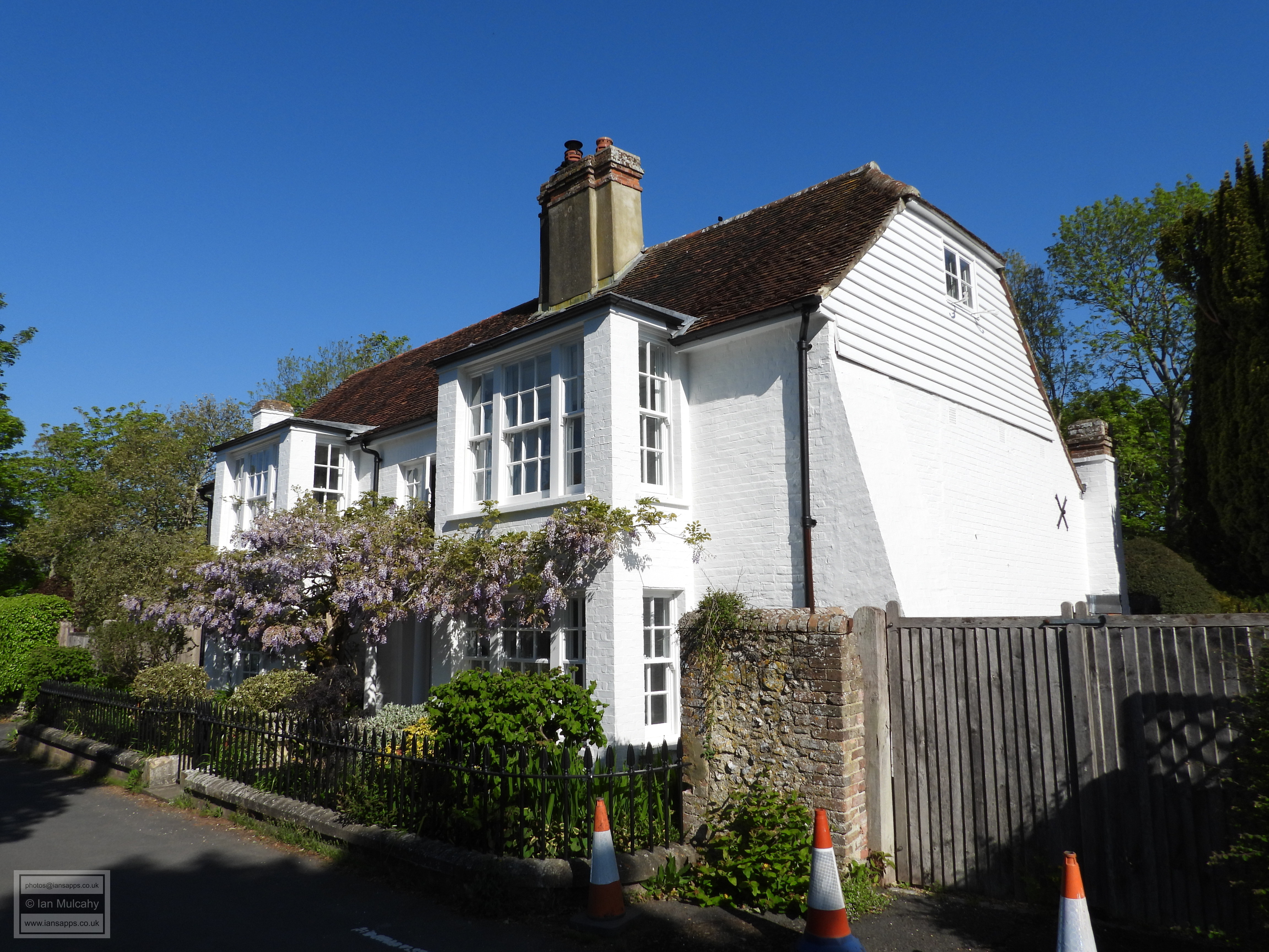
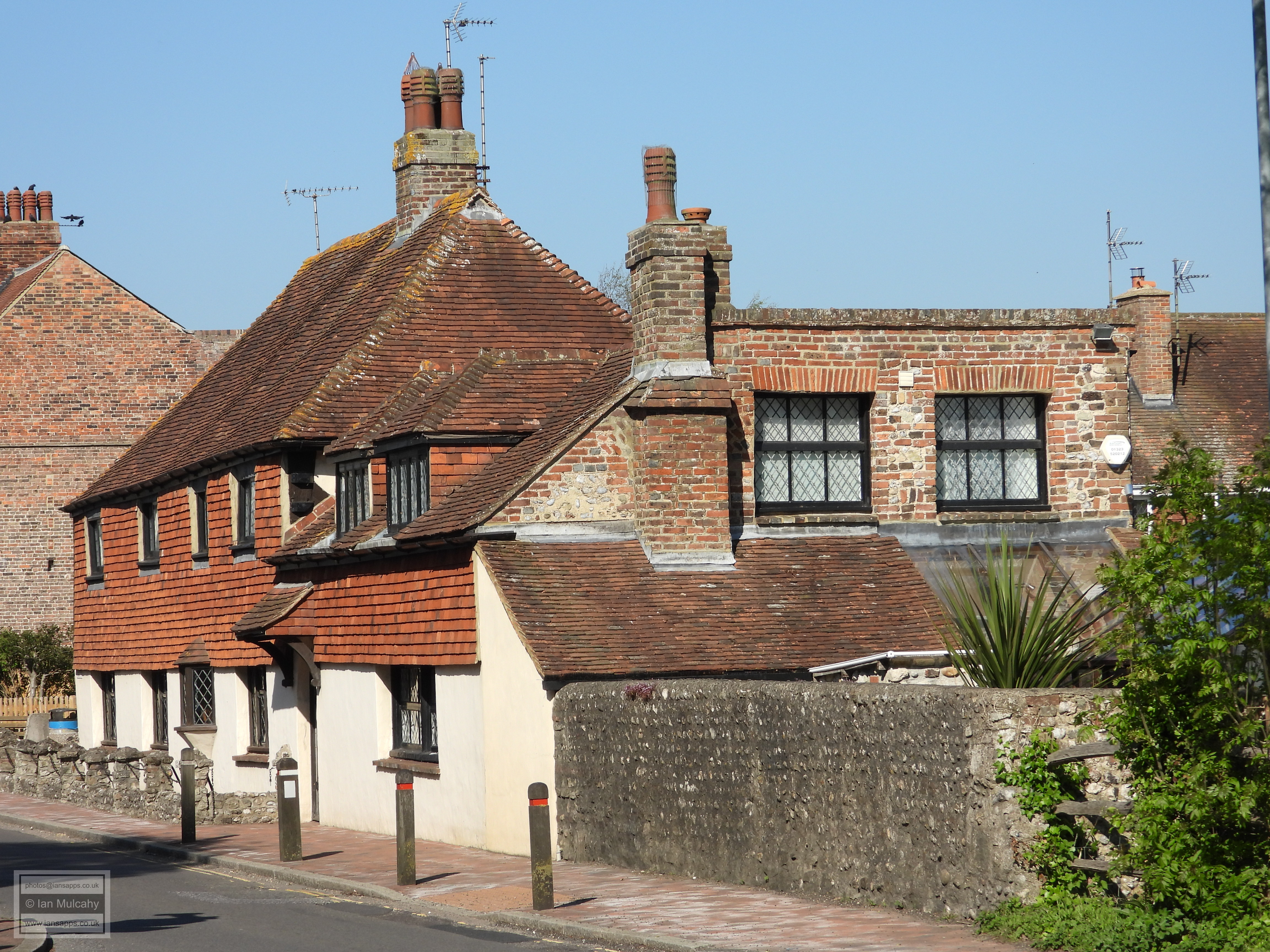
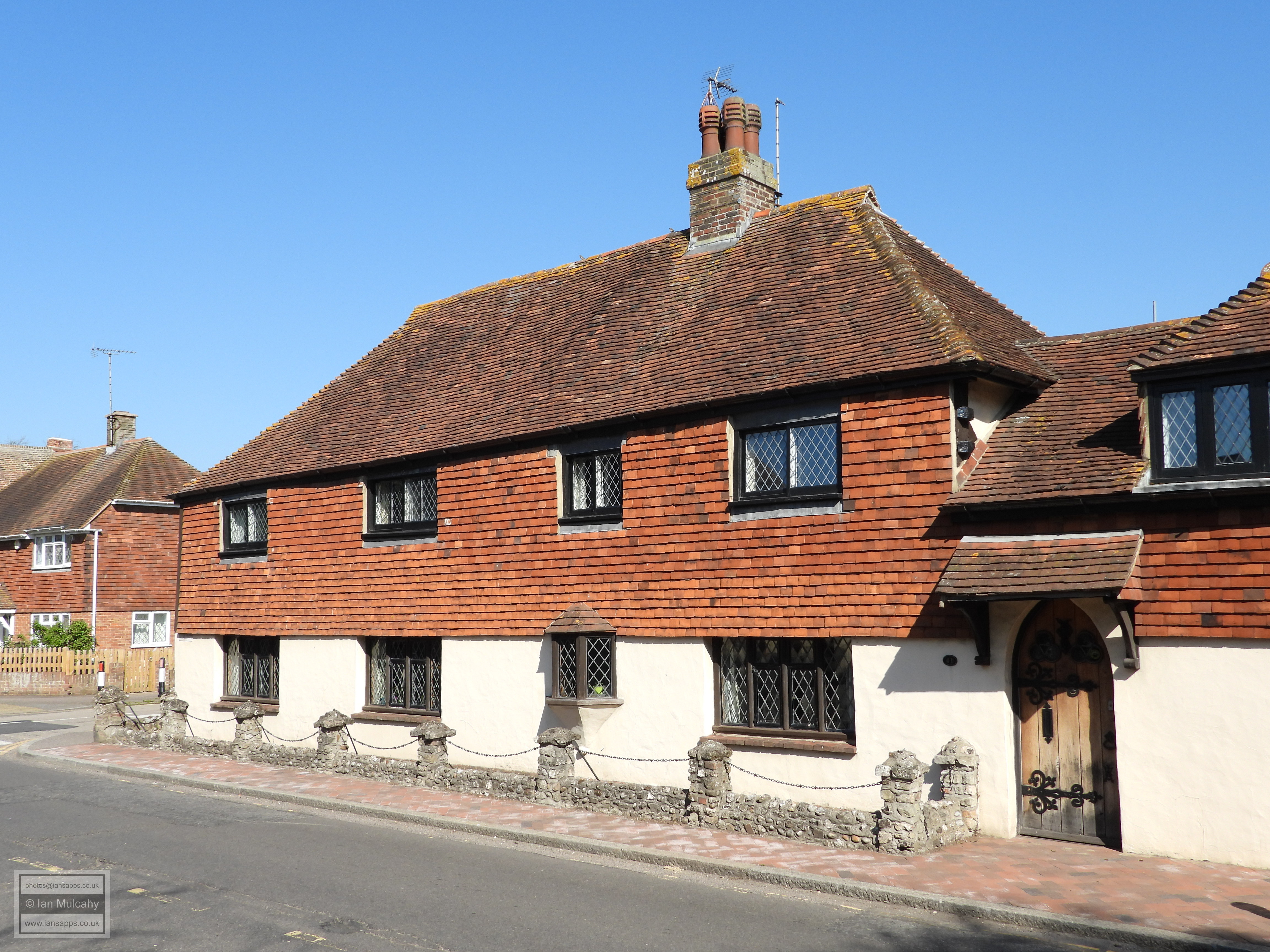
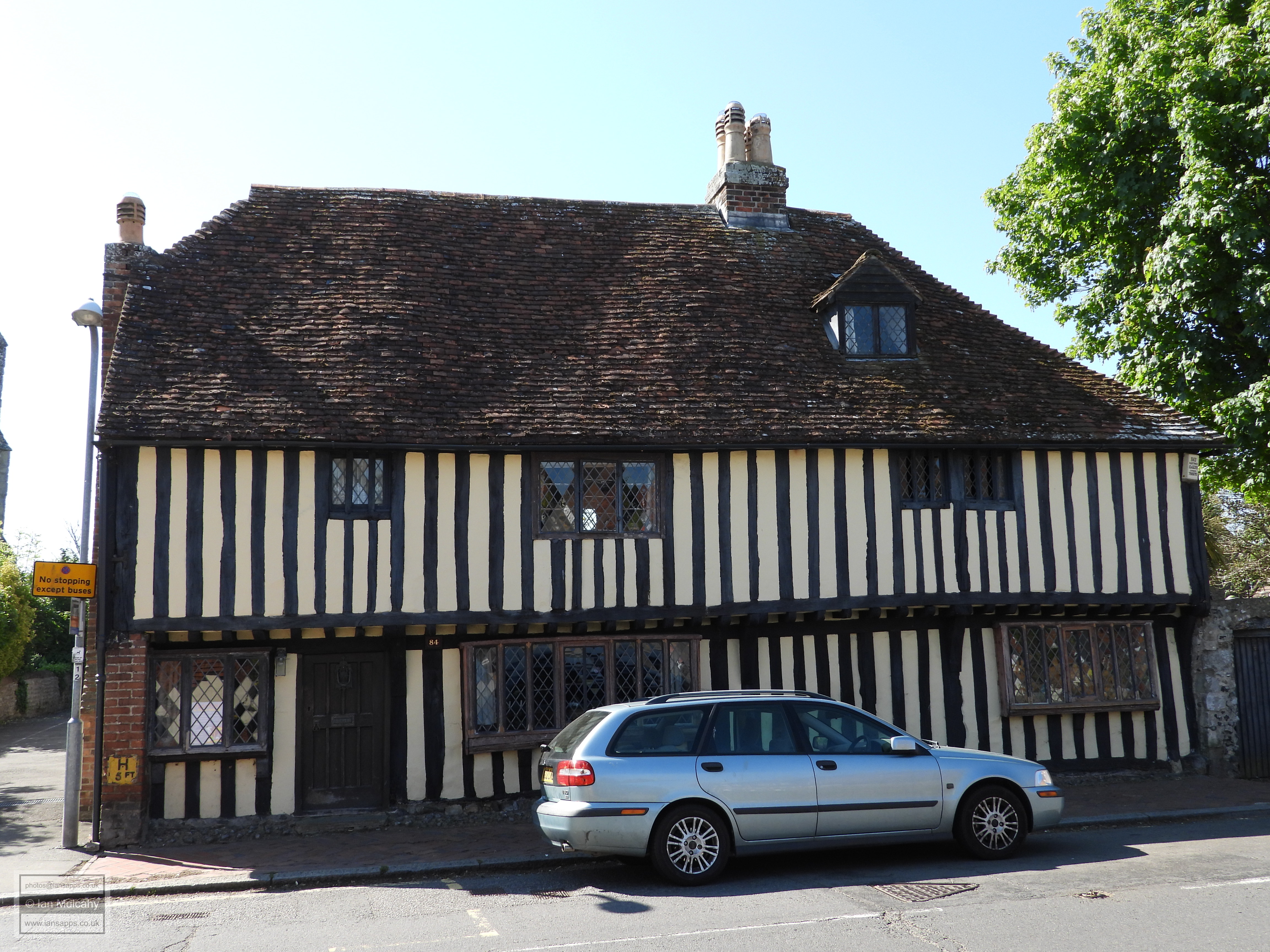
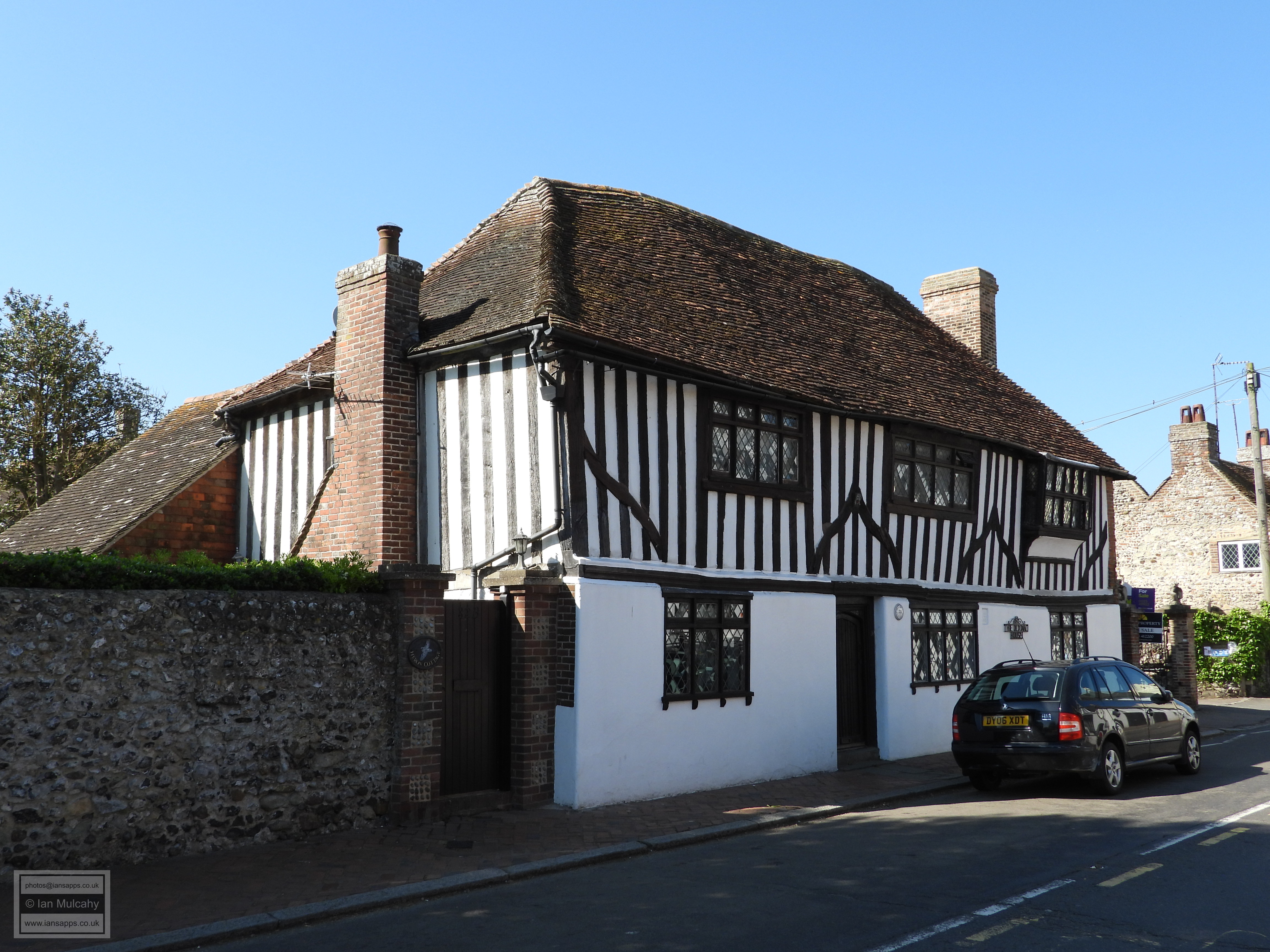
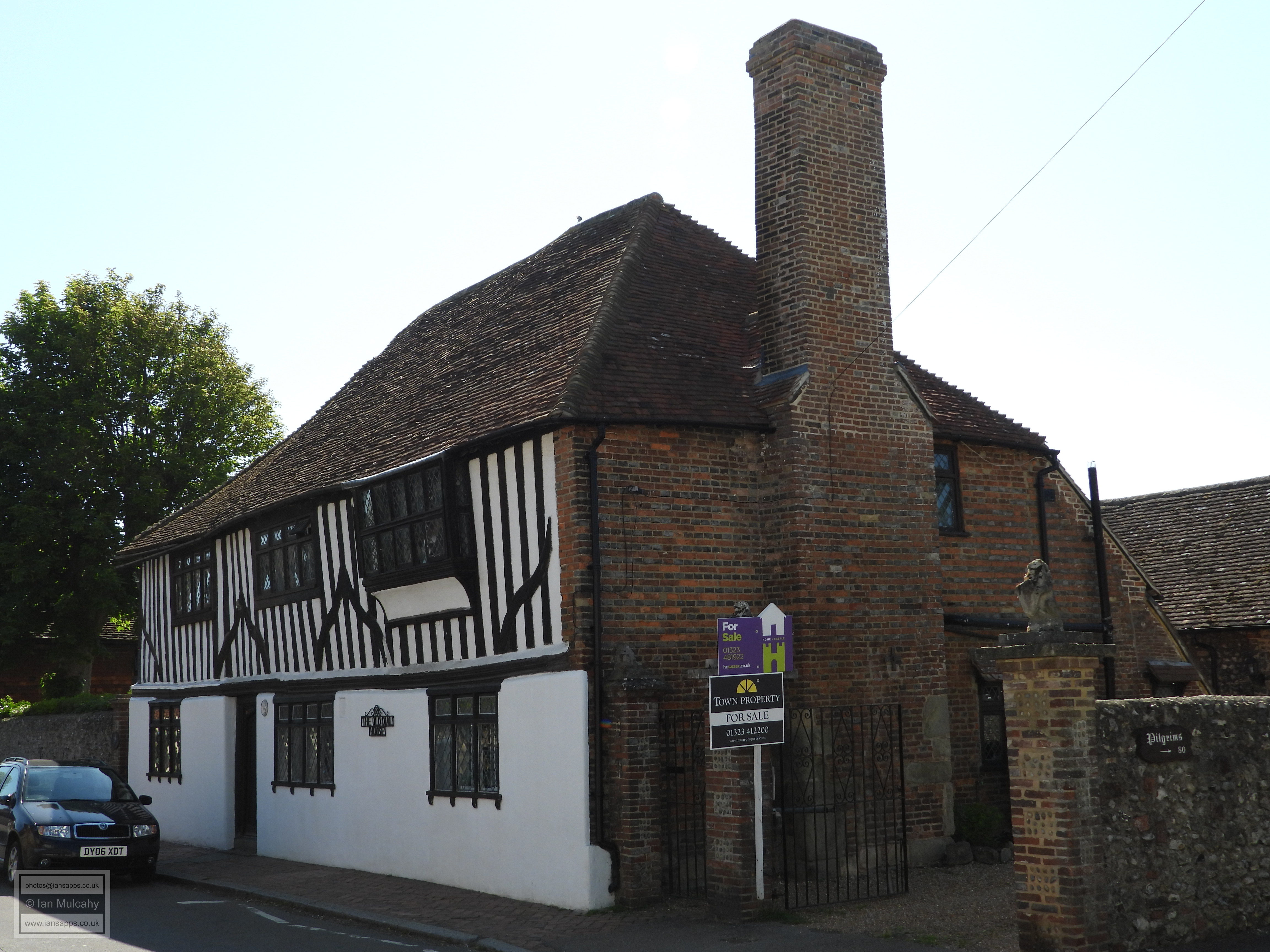
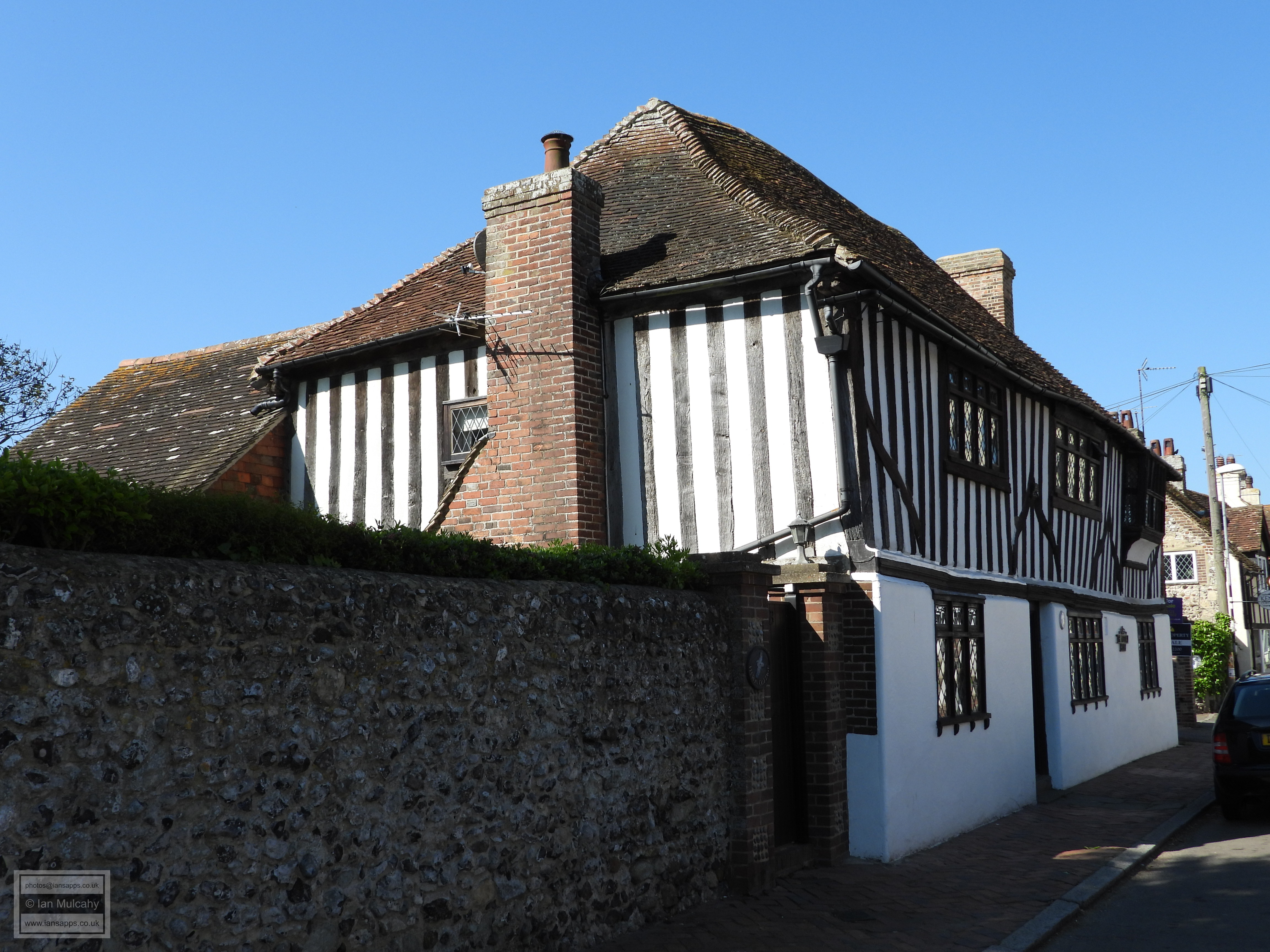
Opposite the western entrance to the churchyard is Tudor Court a refronted timber framed structure of the 17th century or earlier and adjacent to the churchyard is Old Oak House, a grade 2* listed 15th century timber framed house with a full length jetty. Amazingly, several of the windows have their original wooden mullions intact. 15 yards further to the west is The Dial House, another 2* listed 15th century timber framed house. The Dial House also had a full length jetty originally, but this has long since been underbuilt.
Next door, by address, is Old George House, a 17th century or older building. You'd be forgiven for thinking the building doesn't look very old as it has been refaced in stucco on the ground floor with imitation timber framing above. Conjoined to the west is Preston Cottage, a cottage of the early 1800s faced in painted cobbles and bricks. Opposite is Midland Bank, a large 18th century former bank, surprisingly enough, which is now a private residence.
Sources:
Text & photographs © Ian Mulcahy. Contact photos@iansapps.co.uk or visit my 'Use of my photographs' page for licensing queries (ground level photographs only). First published 10 Oct 2020. Updated 16 November 2021 |
pictures taken with and |