All CAA guidelines (in force at the time) were followed when taking
these photos.
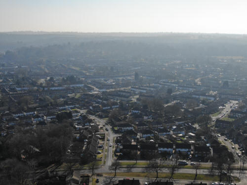
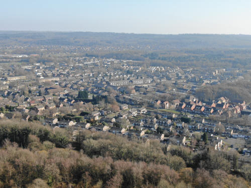
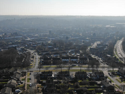
Looking northwards. Pembroke Park to the right, Telford Place & Denvale
just behind the railway line. Library, Kingsgate & College behind to the left.
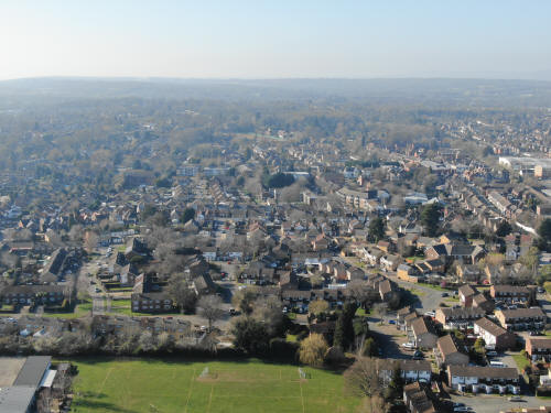
Looking southwards. Ringwood Close in the foreground, Tilgate behind, Southgate
Avenue right of centre with Southgate to the right.
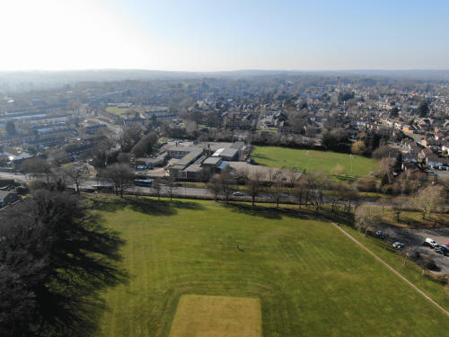
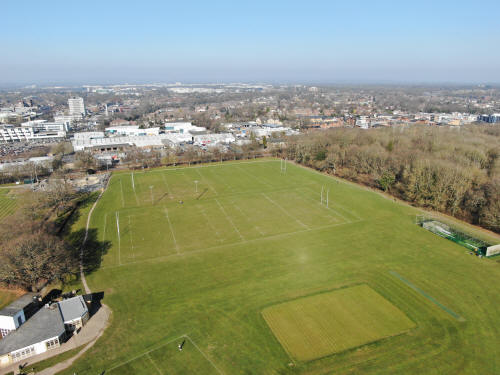
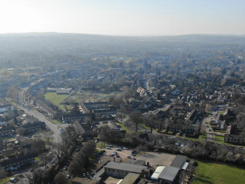
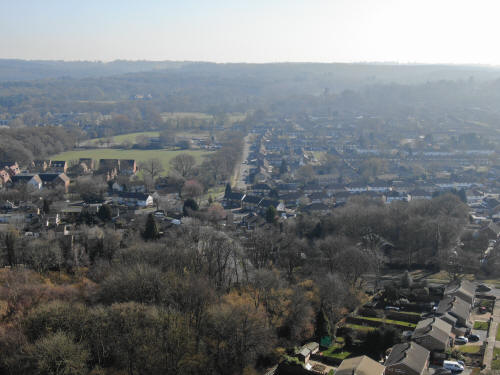
Looking westwards. St Francis school with Malthouse Road area a little way
behind. Southgate Drive to left of school. Caburn Heights top centre in front of
the hills
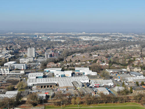
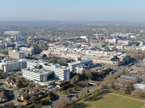
Looking north-west. Emerald Club in foreground. Arora Hotel, Overline House and
County Mall behind. Library & College to right. Asda and hospital left of
centre. Leith Hill in the haze.
Same view as before, but from a little higher.

Looking northwards. Pembroke Park to the right, Telford Place & Denvale
just behind the railway line. Library, Kingsgate & College behind to the left.
The Sandman hotel is visible at the end of the tree lined Northgate
Avenue which can be seen leading north-east from the college, with
Hazelwick school playing fields just to the right of the hotel. Astral
Towers is behind the college with the industrial estate to the right,
including the Virgin Holidays building. The hotel at Tushmore is on the
far left, behind B&Q & Stoner House.
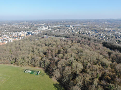
Looking north-east-east. Hawth Woods in the foreground, with the roof of The
Hawth Theatre visible above the trees. Pembroke Park is centre left with the
Harvester and Paymaster building at 45 degrees to it. Above Hawth Woods is the
northern end of Furnace Green, with the regimented lines of the Norwich Road
estate on the far right by the pylon and the water gardens are the wooded area
just to the left. Behind Furnace Green are the train sheds just south of Three
Bridges station. Maidenbower and Pound Hill are beyond.
Looking north-east with a bit of zoom. Hawth Woods and The Hawth are in the
foreground with Pembroke Park to the left. The Paymaster building is the centre
of the picture with Three Bridges Playing fields and Three Bridges Football Club
just to it's left. On full size image, you will see the tunnels outside Three
Bridges Station and the stations roof almost dead centre, just to the right of a
pylon. Just above and to the left of the tunnels are the two white 'shed's' on
the roof of Milton Mount flats.
Looking north-north-east. The Sandman hotel is almost dead centre with Three
Bridges Parade below and a little to the right. Close to the far right is the
roof of Hazelwick Tesco. To the left, a third of the way down the picture, are
Northgate Playing fields.
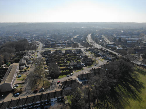
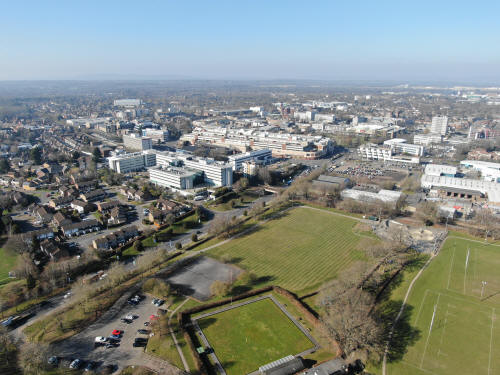
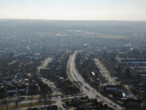
Looking north. Denvale in the foreground with the library, the college,
Kingsgate and the telephone exchange behind and to the left. Northgate playing
are right of centre. The industrial estate is beyond, with the airport beyond
that. The control tower is just left of centre on the airport line with the
Virgin Holidays building below and to the right and Astral Towers is the dark
building below and to the left of the control tower.
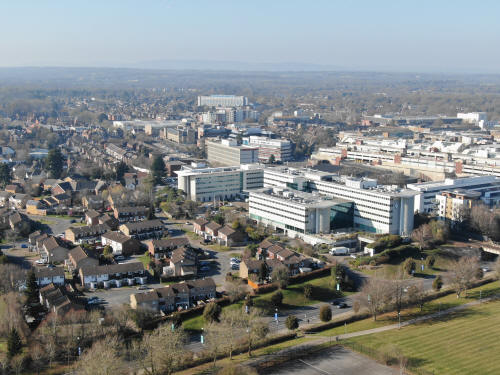
Looking north-west over the town centre, The Arora hotel is in the foreground
with the Mall taking centre stage behind and Queens Square behind that. In front
of the hospital are the new flats around the Ifield Road/Orchard Street
roundabout with Orchard Street car park to the right of these. Further right
still along this line are Morrisons and then the Leisure Park. The big cross
building to the right of Morrisons is Woodall Duckhams with the Town Hall on the
very far right. The Tower of St Johns Church can be seen in front of Orchard
Street Car Park.
A slight turn to the west from above brings in Asda, old West Green and East
Park. The railway line (and both bridges) can be traced and to the far left
close to the top is the bottom end of Goffs Park. Just to the left of Asda is
the signal box. Ewhurst Playing fields can also be seen, just above and to the
left of the hospital.
Looking west. In the dead centre of the picture is a bare green area, with green
fencing to the right. This is the site of the now demolished nursing home on
Goffs Park Road, which was built on the site of Pooh Corner stables. In the
foreground is part of St Francis school playing field with the estate containing
Beeches, Beechside etc. above and older Southgate behind. Asda can just be seen
on the far right with the railway line running just to the supermarkets left.
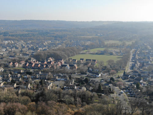
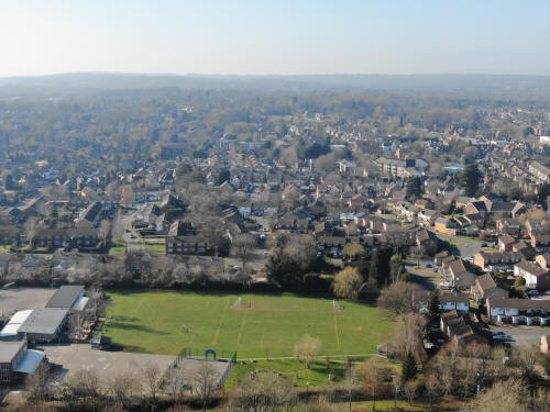
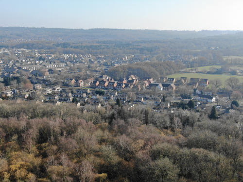
Looking south-west, Caburn heights and Hilltop primary can be seen in the centre
at the top of the populated area with the Chanctonbury Way area to the right.
The C shaped road to the left is Southgate Drive with the Brewer Road allotments
just to it's right. Malthouse Road runs almost up the middle of the photo, with
the distinctive Hospice roof visible towards the end.
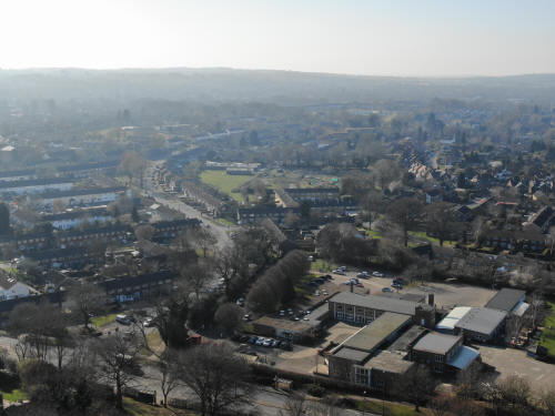
Looking south-south-west, unfortunately towards the sun, Southgate Avenue is the
road drawing attention and K2 & Thomas Bennett are visible above. To the left of
Southgate Avenue is the western end of Tilgate. The West Stand at the Broadfield
Stadium can just be seen to the right of the old Thomas Bennett site, now just a
large field.
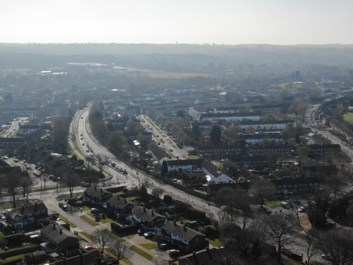
Looking due south, Hawth Avenue runs from right to left at the bottom of the
photograph, with a lot of Tilgate tucked in behind. At the top left, you can
just see Tilgate Lake.

Slightly to the left of the pervious one, the eastern side Tilgate fills the
bulk of the right of the photograph, with Loppets Road playing fields on the
left and Gainsborough Road playing fields above. Top centre is Tilgate Lake,
clearly sitting at a higher level than the residential area. This photograph is
a good illustration of why the dam at Tilgate needed to be repaired! The
buildings highest on the top left is the golf centre at Tilgate and the cutting
through the hills, above the golf centre, is where the M23 runs.
Another slight turn to the left shows Loppets Road and Gainsborough Road Playing
fields in the centre of the photo and the north and eastern ends of Furnace
Green to the left and below. The edges of Maidenbower are at the top left.
Looking South East, most of Furnace Green can be seen with the Parade on the far
left and the playing fields above. Beyond the railway line and below the hills
is Maidenbower.
Back to eastwards looking, Hawth Woods are in the foreground and The Hawth
Theatre is on the far left with the Paymaster building above it. Running across
the centre of the photo is the main London to Brighton railway line and the new
Siemens sheds. To the right is the Water Gardens and just to the right of that
is the tunnel from behind Norwich Road into Maidenbower, beyond the railway line
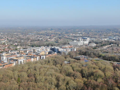
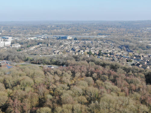
A lower zoomed in view northwards with the library in the centre.
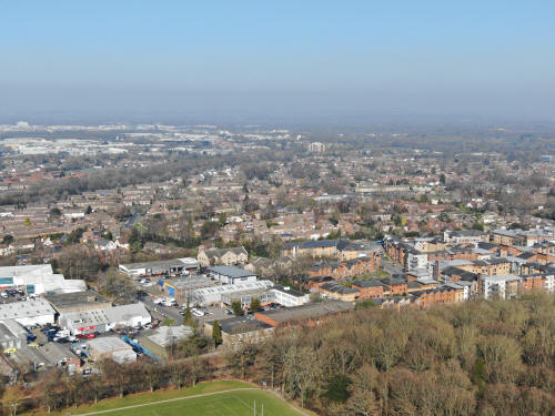
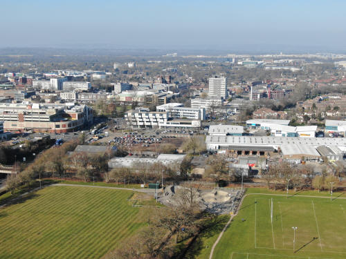
A lower view of the Arora, the Mall and the Town Centre.
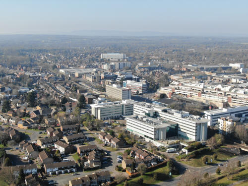
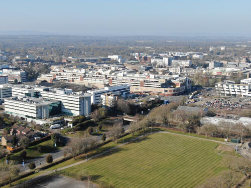
North-west facing, with the Arora in the foreground, Overline House behind and
the hospital in the middle. Asda is to the left of the hospital and Leith Hill
is in the hazy distance.
Looking westwards. St Francis school with Malthouse Road area a little
way behind.
Viewing south-west, straight up Southgate Drive.
South-west along Southgate Avenue. Thomas Bennett and K2 are just behind, with
the Broadfield Stadium just visible on the full size image.
Tilgate, with Hawth Avenue running across the middle of the lower half of the
photo.
Looking south, Loppets Road and Gainsborough Road Playing fields are to
the left.
Slight
turn to the left shows Loppets Road and Gainsborough Road Playing fields in the
centre of the photo and the north and eastern ends of Furnace Green to the left
and below.

Looking South East, Hawth Woods are in the foreground and the Parade is
in the middle with the playing fields above. To the left of and above the parade
is the lines of the Norwich Road estate with the tunnel into Maidenbower just to
the left. Beyond the railway line and below the hills is Maidenbower
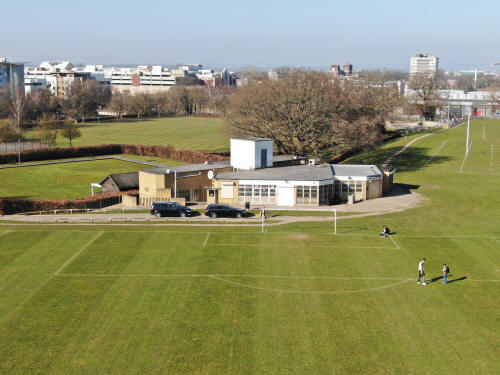
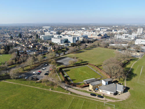
The Emerald Club
Text & photographs © Ian Mulcahy. Contact photos@iansapps.co.uk or visit my 'Use of my photographs' page for licensing queries (ground
level photographs only).


