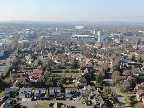
All CAA guidelines (in force at the time) were followed when taking
these photos.
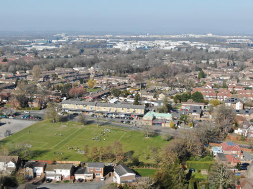
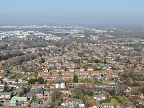
Looking north, Gales Drive parade in the lower centre, with Three Bridges
Primary playing fields below. The Crossways area of Three Bridges is just
behind, with the industrial estate and airport beyond.
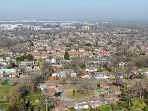
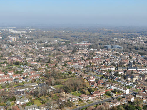
Looking north-eastwards across Three Bridges towards the Sandman Hotel
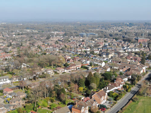
North-east-east across old Three Bridges. North Road runs from mid right towards
the top left. Three Bridges Road is cutting the bottom right corner.
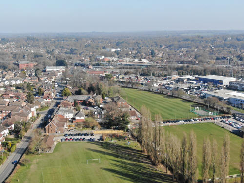
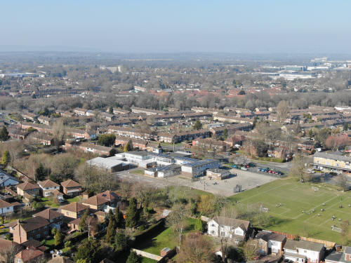
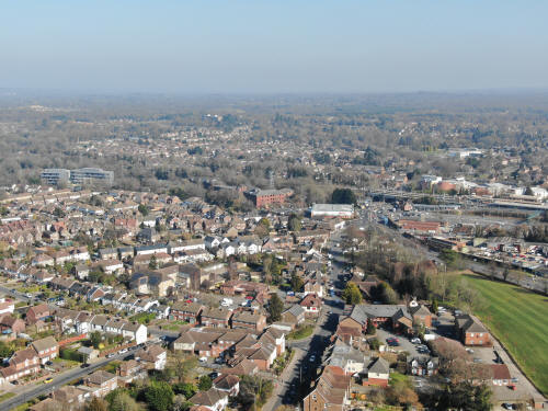
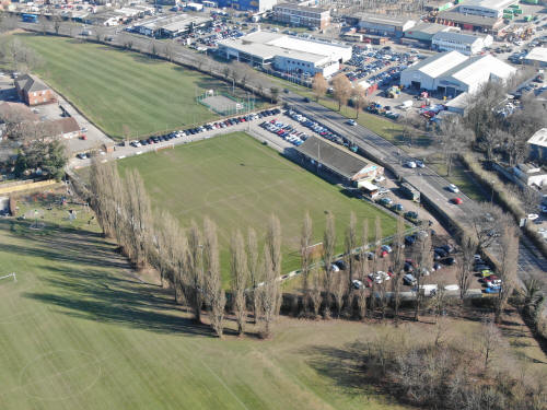
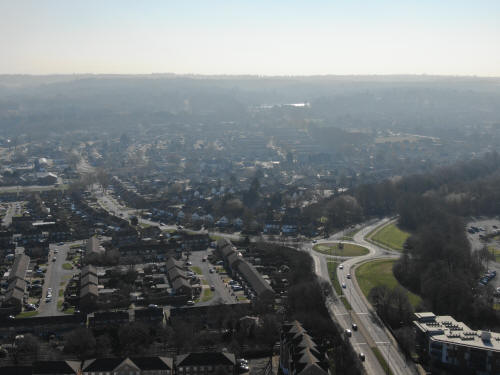
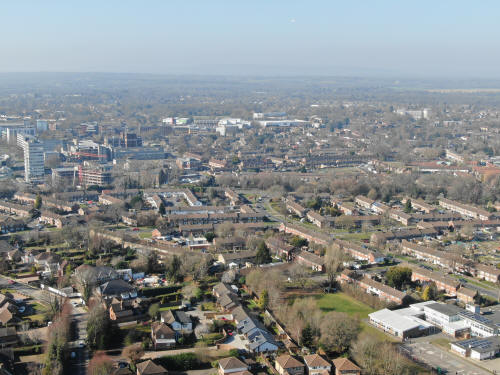
Looking east. Three Bridges FC bottom right, surrounded by the playing fields.
Three Bridges station and the tunnel are just above and left of centre with
Pound Hill behind. The large white building in the top right is the flats on the
southern side of Worth Corner. The long white building above and to the right of
the station is Pound Hill Infants school. Three Bridges Road runs up the photo
from the bottom left with Iceland just beyond the end.
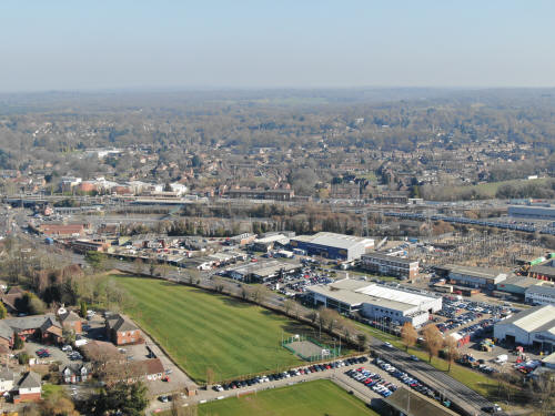
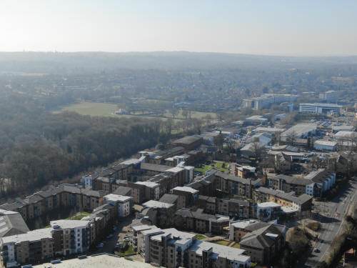
Looking south-east, Stephenson Way fills the bottom half of the picture with the
new railway yard behind and Pound Hill (to the left) and Maidenbower (to the
right) beyond, the neighborhoods separated by the line of trees marking the
Three Bridges to East Grinstead Railway line, now Worth Way.
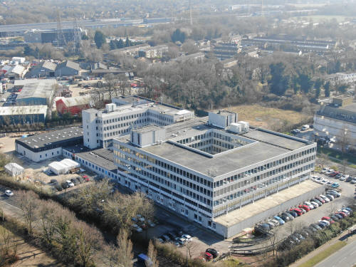
Sutherland House (Paymaster Generals)
Looking south along Hawth Avenue, with the Hawth roundabout and it's sculpture
in the centre, Furnace Green to the left and the Hawth car park to the right

Looking south-west over Pembroke Park, built on the site of the old Leisure
Centre. From left to right, The Hawth, Hawth Woods, Southgate Playing Fields,
Spindle Way estate and the Town centre are beyond. Haslett Avenue runs from the
bottom centre up the photo and to towards the right.
A slight turn to the west, Pembroke Park &
Southgate Playing Fields are to the left, Spindle Way estate is beyond
and the Arora Hotel can be seen just above the centre. The large white block
between the hotel & the Mall is Belmont House in Brunel Place. The Library is
just in front of the Mall with one of the college buildings on the far right. In
the foreground on the right are the houses between three Bridges Road & Haslett
Avenue. The eagle eyed will spot St Johns Church a little way behind the college
building.
Pointing due west, Three Bridges road meanders up the centre of the photo. The
Mall is on the left and all college buildings and the telephone exchange are
visible as your eyes can right. Beyond the centre college building and the
centre of town, the hospital can be seen in the distance.
Looking north-west, from left is Kingsgate car park, the college, Town Hall
multi storey, the telephone exchange, the Leisure Park & B&Q. On the far right
is the Crowne Plaza at Tushmore and in the foreground are Three Bridges &
Northgate, separated by the line of trees marking Northgate Avenue.
A slight turn northwards, Three Bridges Primary School is in the foreground with
Three Bridges & Northgate beyond, separated by the line of trees marking
Northgate Avenue. Just between the Crowne Plaza hotel and the centre of the
picture, just above the tree line is Northgate Parade. On the far left on the
same line as the hotel is B&Q. On the far right is part of the Industrial
Estate.
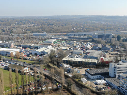
Now a bit higher, once again looking northwards over Three Bridges, Northgate,
the Industrial Estate and the airport in the distance. The field sin the centre
are Northgate Playing Fields.
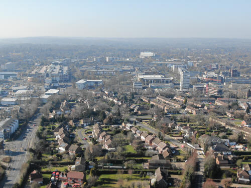
Just a slight turn to the right, The Maid Of Sussex is bottom left with most of
'new town' Three Bridges behind. To the right of centre is the Sandman Hotel
with Hazelwick School & playing fields to the right, with the floodlights of
Oakwood FC just visible behind the school field. Above and to the right of the
hotel, you can just see the globes of the sewage treatment works. To the top
left is the Industrial Estate.
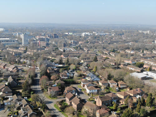
Now looking north-east,
the Sandman Hotel is on the far left near the top with Hazelwick School
& playing fields to the right followed by Tesco and the office buildings in
Hazelwick Avenue.
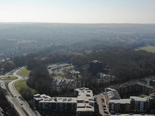
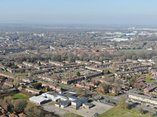
Looking east, the railway line runs across the centre of the photo with the
tunnels at Three Bridges station clearly visible, just above and to the right of
Iceland. A little way below the tunnels, next to the pylon, is the old Lodge for
the Tilgate Estate, more recently known as Barclays Bank.
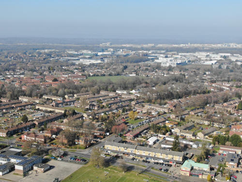
Looking south-east over Stephenson Way Industrial Area, the split of the railway
lines (between the Brighton line and the Horsham line) can be seen just behind,
with Knepp Close playing fields on the right in the centre. The eastern part of
Three Bridges playing fields can be seen in the foreground, with Jubilee Walk
running alongside to the left.
Three Bridges Football Club
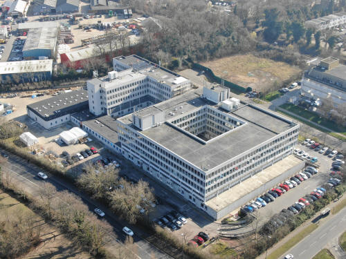
Sutherland House (Paymaster Generals Office)
Looking south-south-east, The new train sheds and railway are across the middle
of the picture with Maidenbower beyond. Waterlea adventure playground is below
the sheds, to the right.
Looking south across Furnace Green, the playing fields are visible high on the
left, tucked in front of the railway line. The old EDF building in Russell Way
is at the foot of the picture.
Looking south across Furnace Green again, the Hawth Roundabout is just below and
right of centre and Tilgate Lake can be shimmering in the distance (top centre).
Furnace Parade is on the far left of the photo, just above centre.
The Hawth, Hawth Woods and part of Pembroke Park. A corner of Southgate Playing
Fields are on the far right.
Looking south-west, Pembroke Park is in the foreground, Hawth Woods are to the
left with Southgate Playing Fields above. The Arora Hotel is right of centre
with Overline House on the far right.
Looking due west across the Town Centre.
Looking north-west, the Crowne Plaza is on the right of the picture, close to
the top with Langley Green behind and to the left. Three Bridges and Northgate
are in the foreground and the northern end of the Town Centre is on the left.
West Green playing fields are just behind the Leisure Parks multi storey car
park. Ewhurst Playing Fields are also just visible, a little way above the
buildings at the southern end of London Road
Three Bridges in the bottom half of the photo with Northgate beyond. At the top
of the photo, Langley Green is on the left and the Industrial Estate to the
right
Text & photographs © Ian Mulcahy. Contact photos@iansapps.co.uk or visit my 'Use of my photographs' page for licensing queries
(ground level photographs only).


