|
A low altitude view across Southgate West towards the Town Centre
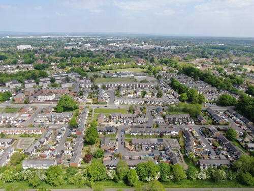
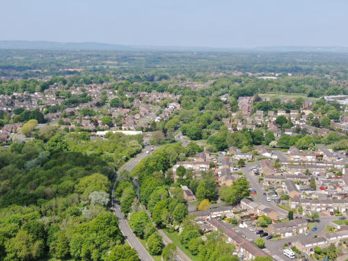
The same view as previously from full altitude (380ft). Most Town Centre
landmarks are visible, including the college, the hospital, Asda, Overline
House, the Aurora Hotel and County Mall.

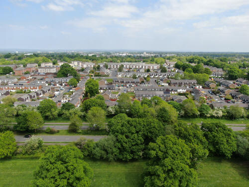
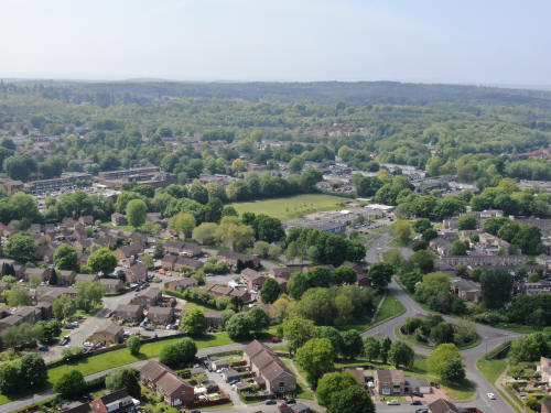
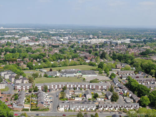
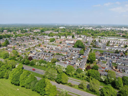
Southgate Doctors is in the centre of the picture, with the stadium roundabout
to the right. Thomas Bennett is on the far right. The white building at the top
left is the Paymaster building in Three Bridges.
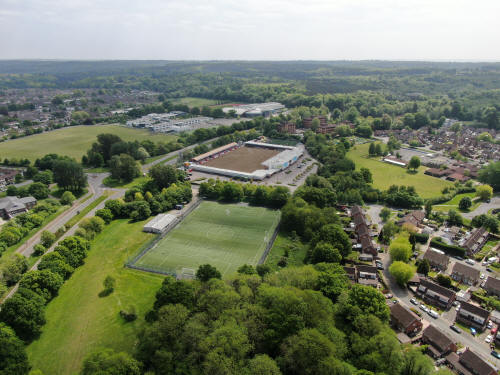
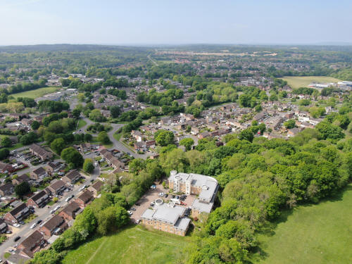
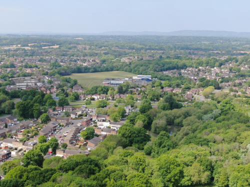
The Broadfield Stadium, with K2 beyond. Broadfield House is the white building
on the right just below the start of the woodland and forest.
A southerly view over Broadfield. The Coachmans Drive/Broadfield Drive
roundabout is on the left and the Barton is to the right of and above centre. In
the very top left is the new development at Pease Pottage, opposite the services
with Tolgate Hill just below and to the right of it.
Western view across Broadfield towards Bewbush, Kilnwood Vale & Horsham. The
road running vertically up the centre of the top third of the picture is the
A264 with Kilnwood Vale to the right and Bewbush below. The field on the far
right is the playing field at Holy Trinity. The building in the foreground is
the gated flats at the end of Rathlin Road.
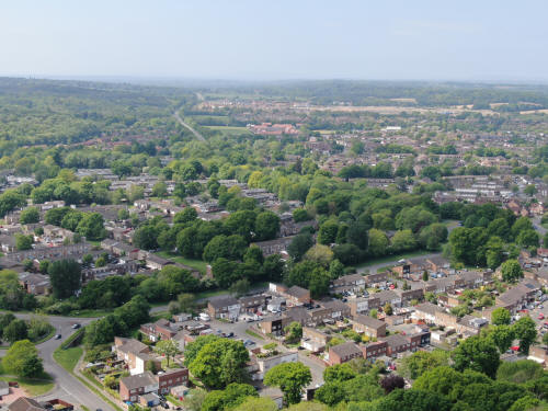
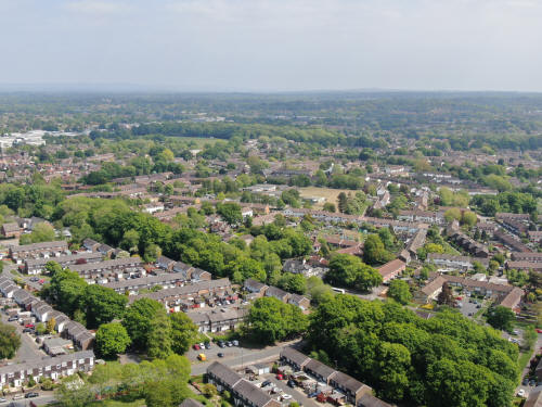
Southgate west is on the right and Cheals roundabout is just to the left of and
above centre. The white building towards the top and just right of centre is St
Wilfrids and the hospital is towards the top right.
No zoomed in, this is looking south over Broadfield. The Coachmans
Drive/Broadfield Drive roundabout is at the bottom and Tolgate Hill is top
right. Broadfield House is just to the left of centre.
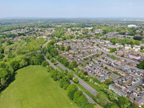
Another view across Broadfield. The Barton is on the far right of centre and the
radar at Cottesmore is just to the right of centre on the horizon. Enfield Road
is in the foreground.
The Barton is on the far left of centre and in the middle is Seymour Primary.
The roundabout towards the bottom right links Broadfield Drive with Seymour Road
and Rathlin Road.
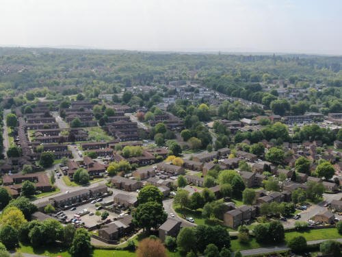
The roundabout is now bottom left and on the far right of centre is the
roundabout linking Broadfield Drive to the Horsham Road. In the top right
quarter is the southern half of Bewbush, with Kilnwood Vale beyond. The Horsham
Road runs vertically up the middle of the top half.
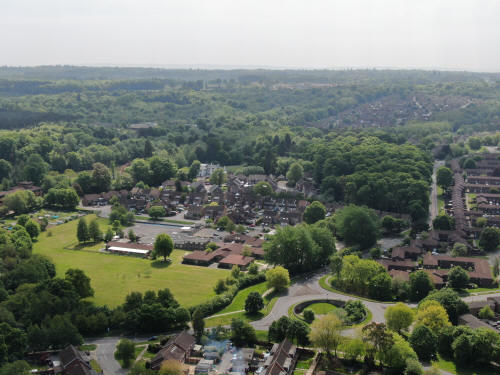
Holy Trinity school is in the centre with Woldhurstlea Woods and Gossops Green
beyond to the right and the northern half of Bewbush to the left. The area of
the Millpond can be seen a little way beyond the school playing fields along
with the path to the pond from the car park at the foot of Gossops Drive, though
the pond itself is not visible. Ifield West can be seen beyond that, marked by
the line of 4 or 5 tall narrow trees which grow next to the railway line. The
pond in the bottom right is that on Broadfield Brook opposite Cheals. Just
beyond the pond some cars are waiting at the traffic lights where Buckswood
Drive joins the Horsham Road.
Cheals roundabout i sin the centre of the picture with Southgate West in the
bottom right quarter and St Wilfrids just appearing on the far right, a little
above half way up. ICC, the white building beyond the trees to the left of St
Wilfrids, is also visible. Gossops Green is in the top left quarter and the
eagle eyed will, on full size, spot Ifield Church in the top right quarter, a
little to the right of centre.
The Hospital is clearly visible and Southgate West is in the foreground; Tesco
express just right of centre close to the bottom. On the far left is St Wilfrids
and just to the right of the school is the new development known as Newtimber
Close, next to the old British Legion. To the right of that, the roof of Goffs
Park House is just visible.
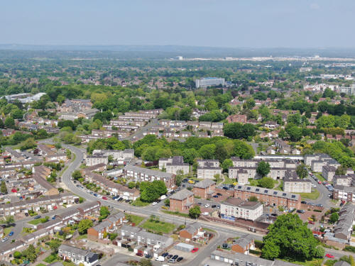
Darleydale, in Southgate West. Tesco Express is at the top of the picture.
Darleydale is on the right and Dovedale Crescent (and closes) on the left.
Cheals roundabout is at the top left and Downland Drive snakes across the top
right quarter.
Tesco's at Southgate West in the centre, with Darleydale below. The flats of
Hambleton Hill are behind followed by the terraces of Clayton Hill. Just below
the hospital, the tower of Masons Hall in Goffs Park Road can be seen. Asda is
in the top right corner.
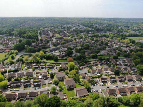
Hilltop Primary School is in the centre of the photo with Caburn Heights below
and town centre beyond.
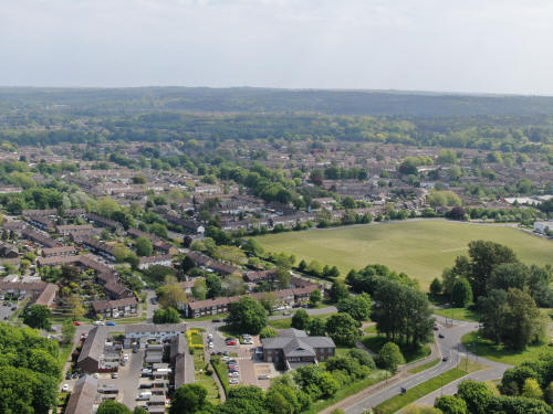
The Half Moon is just below centre, with Southgate beyond. Southgate Primary is
in the centre and Southgate playing fields and the Hawth Woods are above and to
the left. Behind the Hawth Woods is the white Paymaster building.
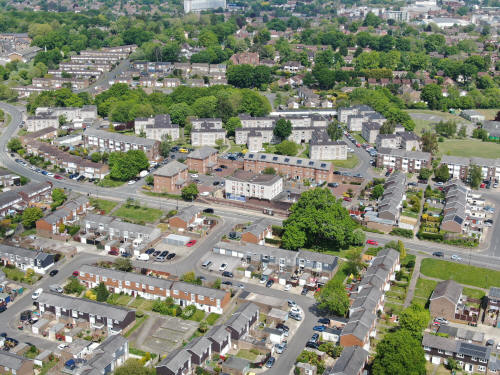
Southgate Surgery is at the bottom in the centre and Thomas Bennett playing
fields are to the right, with Tilgate beyond.
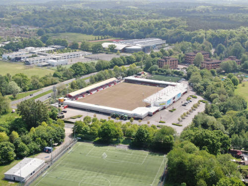
The Broadfield Stadium, with Thomas Bennett & K2 beyond.
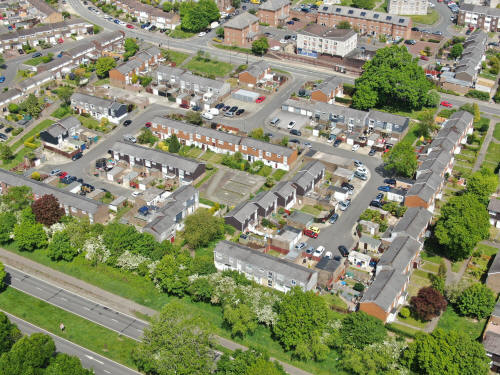
Southgate West
Text & photographs © Ian Mulcahy. Contact photos@iansapps.co.uk or visit my 'Use of my photographs' page for licensing queries (ground level photographs only).
|


