Crawley from the air
1920 to 1954
(Descriptions by Ian Mulcahy)
|
Please see the captions under each photo for help in getting your bearings. These have been put together using old maps, modern maps and modern aerial pictures (as well as a little bit of local knowledge) and I am confident that they are all correct, but if you disagree with anything then please contact me via Facebook, Twitter (see links bar above) or by e-mail to discuss and correct if necessary.
These photos have been sourced from https://www.britainfromabove.org.uk/. Please visit the site to view thousands more.
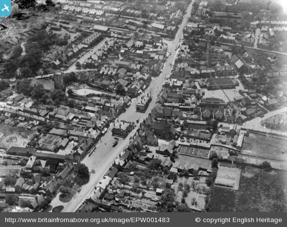
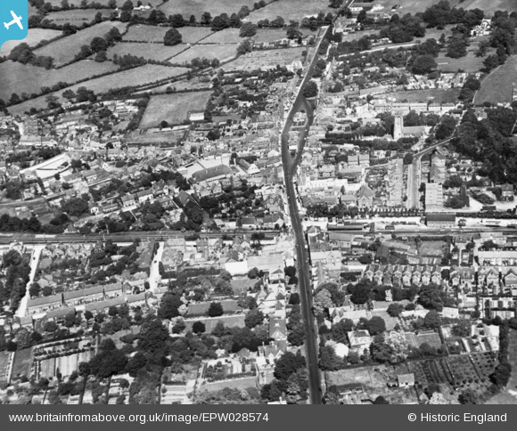
1920. 'The Square', in the High Street, is in the centre of the picture and we are looking southwards. St Johns is to the left and the railway line runs across the top of the photo. Ifield Road, Spencer's Road and Robinson Road are clearly visible to the right of the High Street.
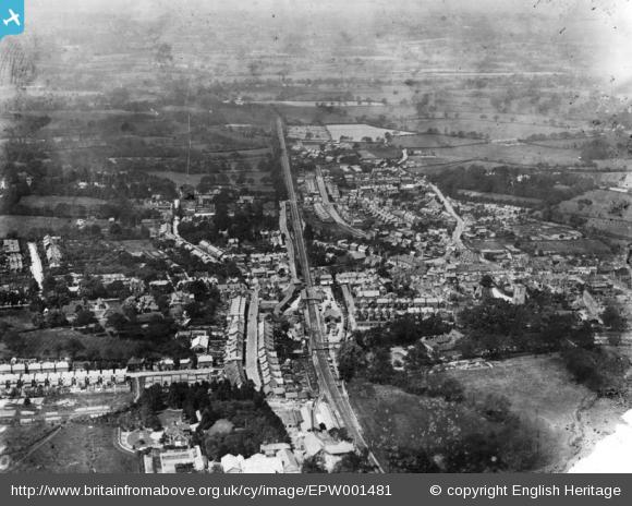
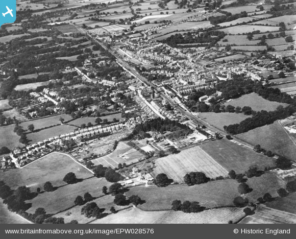
1920: This one looks west along the railway line towards Ifield. The Brighton Road level crossing (and original station) are roughly in the centre of the photograph. In the foreground, East Park runs parallel to the railway, set back a little, with Malthouse Road on the lower left. On the other side of the level crossing you can see Springfield Road running parallel to the railway. Goffs Park is beyond to the left and the Albany Road area of West Green to the right. You should be able to follow the High Street to the right of the level crossing and St Johns Church is visible. The road running into the distance from just above the church is Ifield Road.
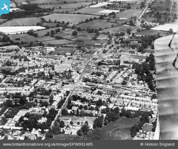
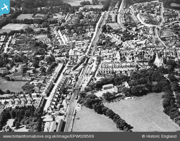
1920: Looking north here, the Brighton Road level crossing is in the centre of the photo with the station to it's right. The buildings of The Square can be seen in the middle of the High Street and St Johns Church to their right.
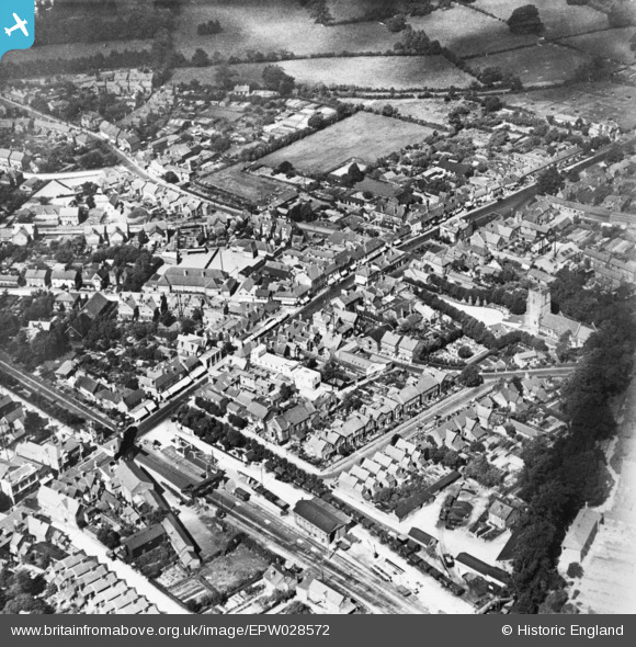
1929: Looking down on the High Street in a north westerly direction, The level crossing and station are in the foreground with Station Road leading to St Johns on the right. The British School and it's playground, in Robinson Road, is clear just to the left of the High Street. In the top right of the picture is the Temperance Hotel, at the time of this photo soon to be demolished to make way for The Embassy Cinema.
1929: Looking west along the railway line, the site of County Mall is at the bottom right of the photo (see a wider angle, below, from 1949) and St Johns is above. At the top right, Ifield Road heads off west with Spencer's Road, Victoria Road and Horsham Road all exiting left from it.
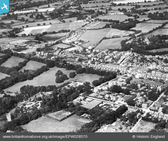
1929: To the right of centre is the Horsham Road level crossing and filling most of the bottom left is Goffs Park. In the bottom left corner is the tower at Masons hall, at the end of Goffs Park Road. Beyond the railway is the Albany Road area of West Green with Ifield Road heading up the centre of the top half the picture.
1929: Looking north, in the centre is the Horsham Road level crossing with West Green beyond. In the foreground, Goffs Park is to the left and Springfield Road/Newlands Road is to the right. St Peter's Church is towards the top in the centre.
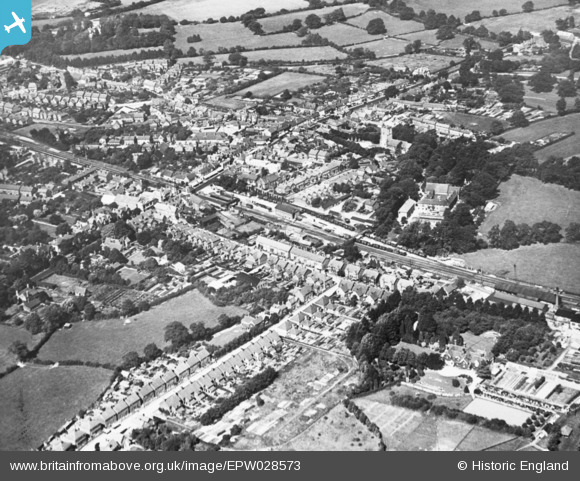
1929: Looking north west, the railway station is in the centre of the photo and the old Friary is to the right, surrounded by trees with St Johns behind it. In the foreground is Malthouse Road and East Park.
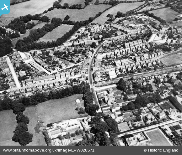
1929: Looking north up the High Street from above Brighton Road, with the level crossing in the centre of the photo.
1929: Looming north west across the town, the station and level crossing are just above centre. The field to the right with the diagonal row of trees across it is where County Mall now stands. On the left across the middle is Malthouse Road and in the centre towards the bottom is Malthouse Farm with what I believe to be Malthouse Meadow, a former home of Crawley Town FC just to the right against the railway line. In the top left is Goffs Park.
1947: Here we are looking north towards town along the Brighton Road. On the right of the picture, coming downwards and then bending round to join the Brighton Road is Malthouse Road, now complete when compared to the previous picture. Goffs Park Road is just visible on the left, if you follow the Brighton Road up slightly from the Malthouse Road junction. Going away from town, there is a dog leg on the London Road which is roughly where the Sun Inn stood and beyond that an apparent square, where the Crawley bypass joins the London road, is where Tushmore Roundabout now is. In the top left, the woods are Ewhurst Woods by what is now the Ifield Avenue roundabout. on the right of centre is again the field with the diagonal row of trees across it is where County Mall now stands.
1947: This is looking east down the railway line from roughly above Ifield Station. To the right is Goffs Park, with the Tower at Masons Hall on Goffs Park Road just visible on the far right and Goffs Park House just below it. Running top to bottom down the left of the photo is Ifield Road. Just in shot in the bottom left corner is Goffs Lane, though the junction with Ifield Road can't be seen. Just above centre is the Horsham Road level crossing and to the left of the railway is Spencer's Road and Albany Road.
1947: A similar view, but from a little further north, perhaps above the modern day ICC site. Goffs Park to the right and Ifield Road running into town up the centre of the picture. Spencer's Road and Albany Road can again be seen alongside the railway. The area with all the trees to the left of the photo is roughly where the hospital now stands.
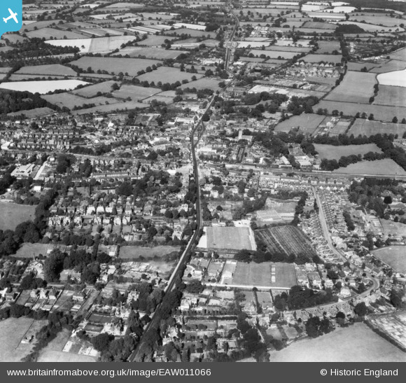
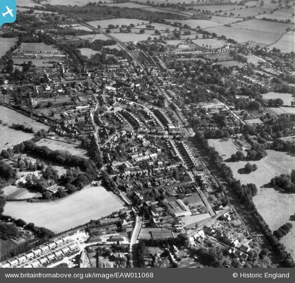
1949: This one looks west along the railway line towards Ifield. The Brighton Road level crossing (and original station) are roughly in the centre of the photograph. In the foreground, East Park runs parallel to the railway, set back a little, with Malthouse Road on the lower left. On the other side of the level crossing you can see Springfield Road running parallel to the railway. Goffs Park is beyond to the left and the Albany Road area of West Green to the right. You should be able to follow the High Street to the right of the level crossing and St Johns Church is visible. The road running into the distance from just above the church is Ifield Road, which has a roundabout junction with the A23 where the subway now is. The field in the foreground with the diagonal row of trees across it is where County Mall now stands, with the original Friary just above it. In the bottom right hand corner is 'the rec', now the Memorial Gardens.
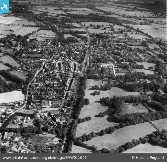
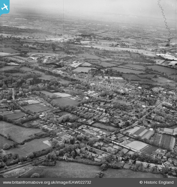
1949: Looking north west across town, from roughly where Tilgate Parade now stands. The main road from bottom left to top right is the Brighton Road and along the bottom right is Malthouse Road with Southgate Road just above. On the opposite side of the road between the two is Goffs Park Road and if you follow that you can see the tower at Masons Hall and the junction with the Horsham Road with Goffs Park behind. Running left to right about a quarter of the way down the photograph is the A23 with the Ifield Road roundabout just to the left of the centre. Beyond are the fields that would become Langley Green and new town Ifield. To the right of the photo is Victorian Southgate and West Green with the town centre barely making the photo on the far right.
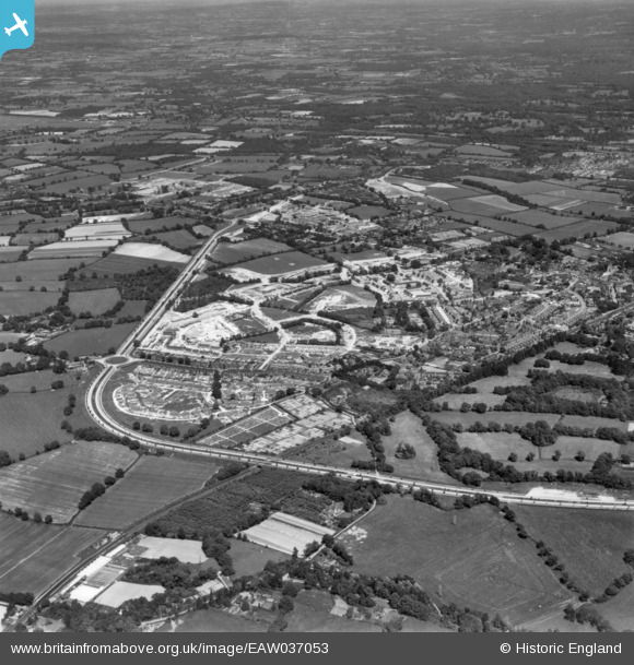
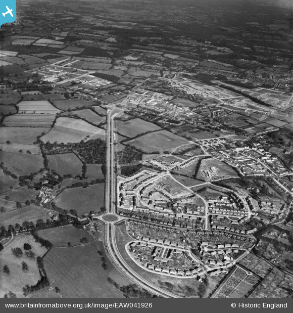
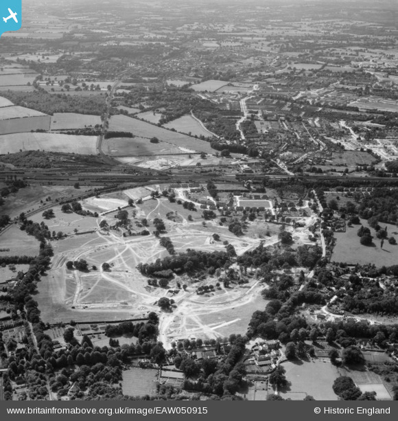
1951: The start of the new town. This is taken from roughly above Gossops Green shops and the most prominent feature is the stretch of the A23 from Cheals to Tushmore. The roundabout in the middle is at the end of Ifield Road, where there is now a subway. In the bottom left is Gossops Green Lane, which can be traced to the A23, crossing it and becoming Goffs Lane then crossing the railway (there used to be a level crossing where the footbridge now is) to the right of Snell Hatch cemetery. Towards the top of the A23 you can see it cutting through Ewhurst Woods. Look closely and the groundwork for Ifield Avenue has cut through the woods on the right of the bypass. To the right, new town West Green is being laid out. Above and to the left of the roundabout is Ewhurst Place. Just above Gossops Green Lane on the far left you can just see the nursery that was to the south of Ifield Station. To the right of Tushmore (the top end of the bypass) you can see Northgate also being laid out and above work is in progress at Manor Royal. Finally, in the top left hand corner you can see the grass landing strips at the fledging Gatwick airport.
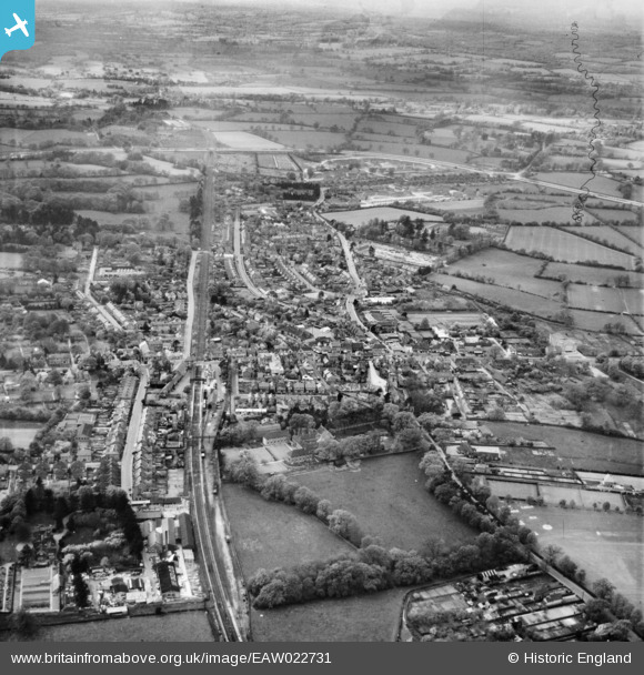
1951: Taken from roughly above Broadfield House, we are looking north across town. The fields in the foreground are what would become Southgate West and the road running from the bottom right corner up to the top centre is the Brighton Road/High Street/London Road. The railway line runs horizontally across the middle of the photo. In the bottom right corner is Hogshill farm and the track that would become Hunters Road. The road on the left is the 'new' Horsham Road with Goffs Park on the left and the tower at Masons Hall visible on the junction of the Horsham Road and Goffs Park Road. Like the last picture, you can see West Green, Northgate and Manor Royal being developed and right of centre at the top is the airfield at Gatwick. Just above the railway on the right is that field with the diagonal line of trees again - the site of County Mall - with the Rec, now the Memorial Gardens, just above.
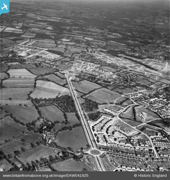
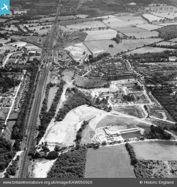
1951: A similar picture to that before the last and, again, the most prominent feature is the stretch of the A23 from Cheals to Tushmore. The roundabout in the middle is at the end of Ifield Road, where there is now a subway. In the bottom left corner is the level crossing at Ifield Station with the nursery, now The Croft, just above. Following the A23, on the far right is the old council works depot which is now Apple Green and the Premier Inn.
1951: Here we are looking north from above what is now Broadfield. The roundabout at the bottom is Cheals roundabout with the 'new' Horsham Road going up the picture towards the railway which runs across the centre of the picture. Above the roundabout is 'The Elms' and Goffs Park and to the right of the Horsham Road is Southgate West. In the centre of the photo is West Green, with the Town centre to the right. Gatwick is again conspicuous at the top and Ewhurst Place is visible just above the Ifield Road roundabout on the far left.
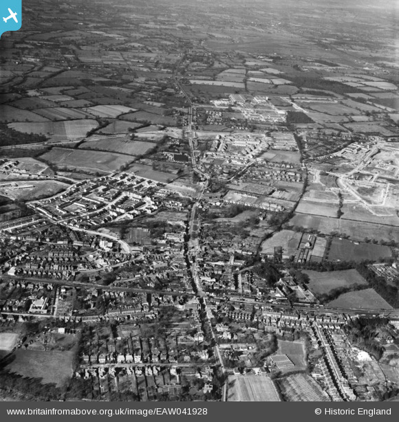
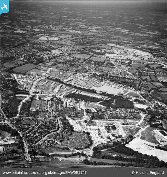
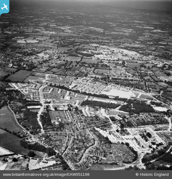
1952: Looking north along Brighton Road/High Street/London Road, the railway runs across the picture about a quarter of the way up. To the top right, Northgate and Manor Royal are taking shape and to the left, above the railway, the Town Barn Road area is recognisable. To the left of the dog leg in the London Road (centre pic) is Town mead, Crawley Towns home. The Town Centre remains pretty much unchanged from all the previous photos and below the railway line is old Southgate, with Malthouse Road running vertically to the right.
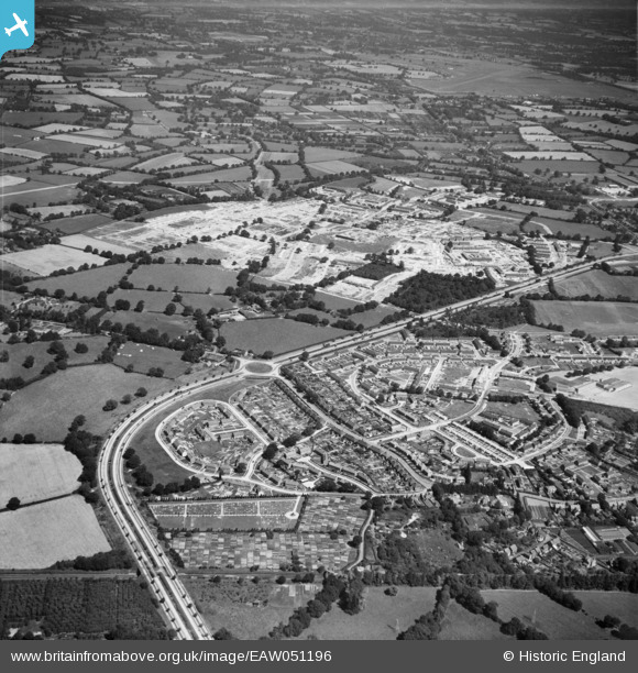
1952: The roundabout in the foreground is the old Ifield Road roundabout and shows the A23 heading up to what is now Tushmore Roundabout. Good progress is being made in West Green, to the right and Northgate beyond whilst the building to the left of the roundabout is Ewhurst Place, complete with its original driveway from The Mardens which is now the rear entrance to the car park at Ewhurst Playing Fields.
1952: A similar shot to the previous, but from a little further back. Snell Hatch cemetery and the allotments, now completely swallowed up by the cemetery, are visible in the bottom right.
1952: Goffs park to the bottom right, West green across the centre and Northgate and Manor Royal beyond.
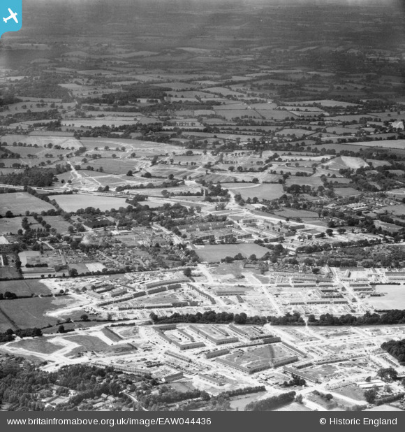
1952: This is looking north across what is rapidly becoming Northgate and New Town Three Bridges. The Tushmore Junction, as it was at the time, is on the left side just above centre and the road running horizontally across the bottom is Three Bridges Road. The line of trees running through the building site is Northgate Avenue with Woodfield Road running parallel just above. The unmistakable shape of Railey Road can be seen at the left end of Woodfield Road. In the background, the first factories on Manor Royal look to be nearing completion, with the APV building easily recognisable just above the small woods, most of which still remain just east of what is currently the Mazda dealership.
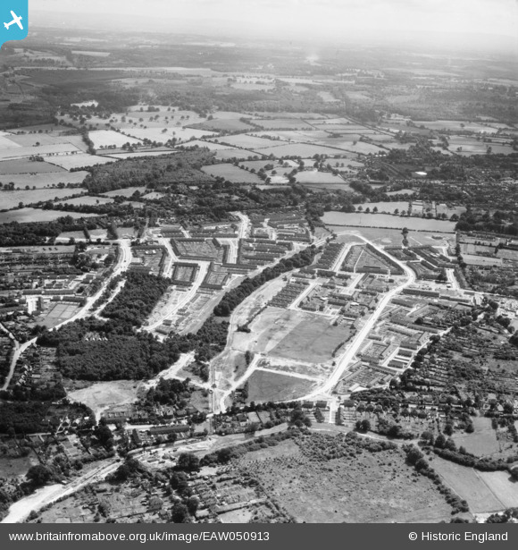
1952: This is looking north west across what would become Langley Green, taken roughly from above West Green. Ewhurst Woods are at the bottom of the picture and Sainsburys is now at the bottom right. Just right of the centre of the field is a triangular field, and the left side field below that is Cherry Lane Playing Fields. The large scar to the left of those fields is roughly where Stafford Road is now.
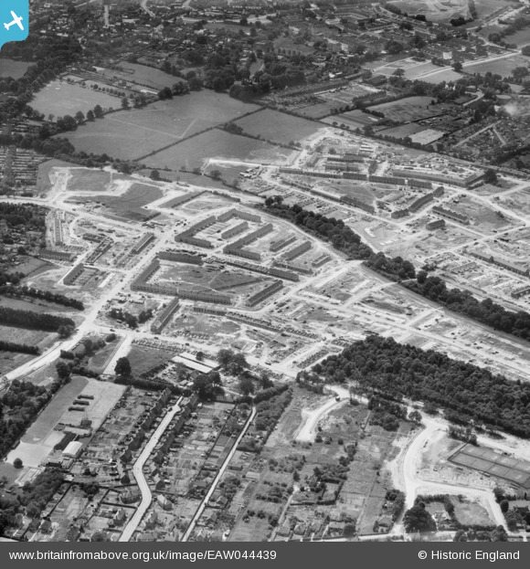
1952: Looking across Northgate. The line of trees on the right is Northgate Avenue with Three Bridges on the right and Northgate on the left. To the left of the trees, at the bottom, is the triangular shape of Railey Road and Woodfield Road. The houses i the bottom left corner are the end of Northgate Road and the fields in the foreground would later host the civic buildings - Town Hall, Library, Police Station, Telephone Exchange etc. The new houses closest to the bottom are Kilnmead.
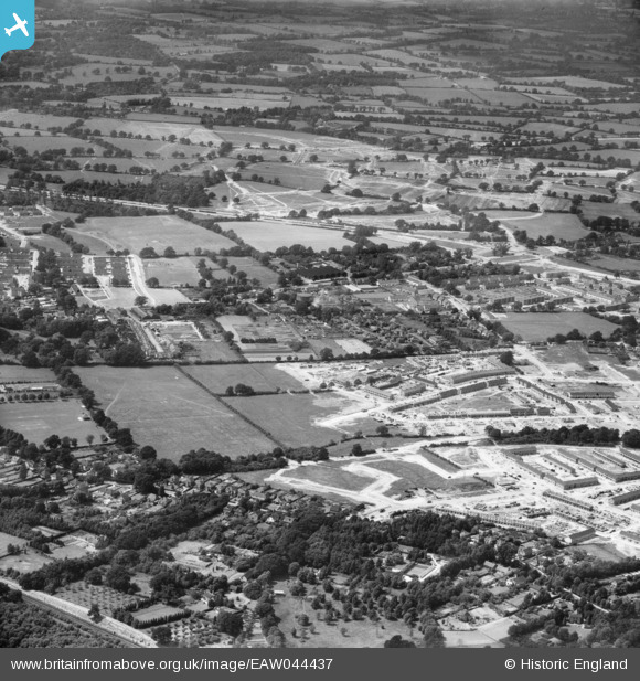
1952: A similar view to the previous, but with a slight shift to the right. The houses at the bottom right are in Three Bridges Road and above is the growing New Town Three Bridges. On the far right towards the centre the square shape of new houses is formed by Gales Drive to the bottom, Broomdashers Road to the right and top and Monksfield to the left. The line of trees up the centre is again Northgate Avenue with Northgate to the left.
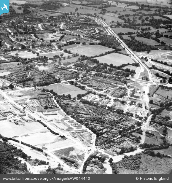
1952: A view north west across Three Bridges in the foreground and Northgate beyond the horizontal line of trees which is, again, Northgate Avenue.
1952: A similar view to the previous, but a bit to the left and further out. Across the middle of the picture, the A23 from Ifield Tushmore crosses horizontally with Ewhurst Wood to the left and what will become Ifield and Langley Green beyond. New West green and Northgate Road are below to the left. Three Bridges Road runs horizontally close to the bottom and right in the bottom left corner is a part of the railway line, roughly at the end of modern day Spindle Way.
1952: Another view of Northgate Avenue, Northgate and Three Bridges looking north. At the bottom i Three Bridges Road with the grounds of 'The Priors' below, now Spindle Way and the Commonwealth Drive estate.
1952: This one is looking south west and the familiar Northgate Avenue tree line runs diagonally from the right of the picture up towards the centre, with Northgate above and Three Bridges below. In the top left is the still undeveloped Town Centre with the field immediately below being 'The Rec' (Now the Memorial Gardens). Just below the centre on the far left, the road that appears and goes upwards and to the right to join Northgate Avenue is Gales Drive. The straight road with the step in it, coming up from the bottom of the picture towards the left is a half complete West Way (it now has a right fork too) and the thins straight path to it's right is Scallows Road. Forge Road is joining Crossways on the right.
1952: Looking south west here, from roughly above Hazelwick roundabout/Oakwood FC. On the right in the middle is the Tushmore Junction, now everybody's favourite roundabout. Follow the A23 up, through Ewhurst Woods and you will see the Ifield Road roundabout (now a subway). The dark triangle below the centre of the photograph is Green Lane & Hollybush Road. Northgate Avenue is at the bottom left, just above the trees. At the very top of the photo, just left of centre the are two white rectangles. These are part of the nursery that was behind platform two at Ifield Station and the little crescent to the right of them is the railway. Below the nursery, on the camera side of the A23, is Snell Hatch Cemetery. To the right of the nursery a thin line of trees, followed by a dense line of trees marks Ifield Drive & Tangmere Road, with the small cluster of houses just to the right being the 1930's houses in Rusper Road. Just above Ewhurst Woods (split by the A23 towards the top right) is Ewhurst Place, and everything above those woods and to the right of the A23 is what would become Ifield. Just to the right of Tushmore work can be seen progressing in the Maiden Lane area of Langley Green.
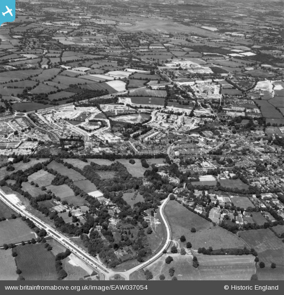
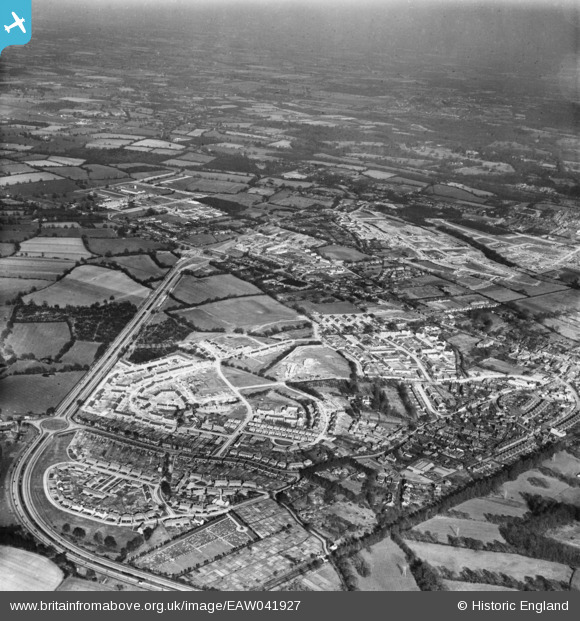
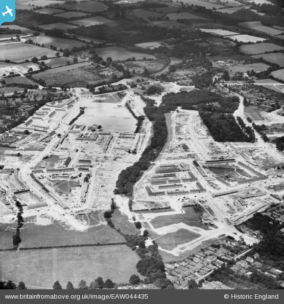
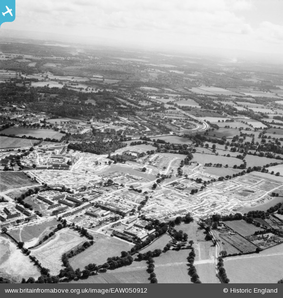
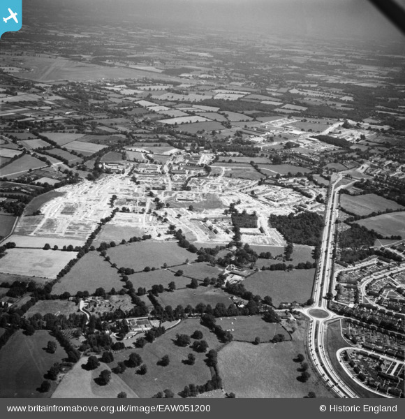
1953: Rapid progress in West Green, where the modern shape of the neighbourhood is now recognisable. The school can be easily to the right of centre. On the left, above the roundabout, work has started on Langley Green and progress seems to have been rapid in Northgate, to the right and just above centre, too. Gatwick is top left.
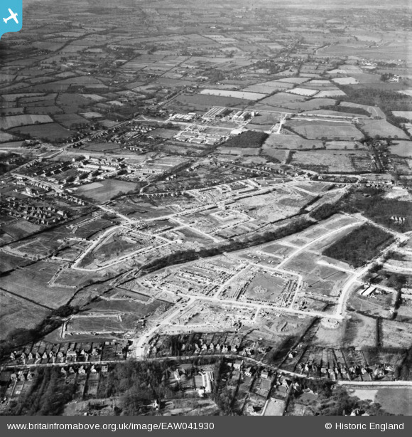
1953: Looking south eastwards across Langley Green from roughly above Poles Lane. The A23 runs across the middle of the picture before hooking off to its left just after the Ifield Road roundabout. Ewhurst Woods are just to the left of centre. Just below the woods is an untouched L shaped area and this is the area of the school. The straight line heading upwards to the left of this L is Swallow Road. and the thin line of trees to the far left of this still exist, running parallel to Maiden Lane behind the Noor Mosque on Langley Drive (the horizontal road just below). Below the L shape is the original roundabout at Langley Parade, which is yet to be built. Coming left from the roundabout is Martyrs Avenue. In the foreground, towards the left, is Cherry Lane fields with the 2 boot shaped fields just above being the adventure playground site and fields just behind. Most of the tree lines in those fields still exist. Cherry Lane runs diagonally alongside this field and you can see the square of Sycamore Close. Above the square is Juniper Road, running across to the right and joining Rushetts Road which is also clearly marked. Beyond Langley Green on the centre right of the picture is what would become Ifield, the consistent line of trees coming right from the roundabout marking what is now The Mardens, Friston Walk & Ifield Green.
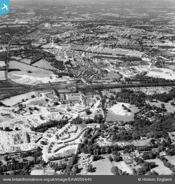
1953: This one is looking southwards across Northgate (to the right) and Three Bridges (to the left). On the right, close to the foot of the photograph, is the Green Lane & Hollybush Road triangle and the straight road to the left of that is Woodfield Road, with Northgate playing fields to the left of that. As usual, the line of trees up the middle of the picture is Northgate Avenue. The road on the left is Crossways, with North Road branching off to it's left and disappearing out of shot almost straight away. Towards the top left of the picture is Tilgate Lake and the woods midway between this and Three Bridges are Hawth Woods.
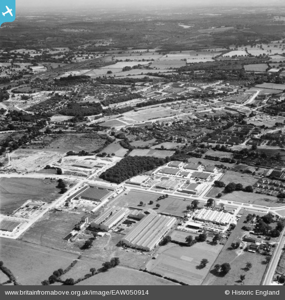
1953: Looking south from roughly above Gatwick Manor, in the central foreground is the not yet completed APV factory with Manor Royal (the road) just above. The Green Lane & Hollybush Road triangle can be seen just right of centre with the developing Northgate and Three Bridges beyond. Towards the top and on the right you will see Tilgate lake and Hawth woods can again be seen just above Three Bridges. Over on the left, towards the top, is Three Bridges Station and you'll notice the East Grinstead Line (now Worth Way) veering off left from the mainline.
1953: This photo looks west towards Three Bridges station (centre) across Pound Hill South (the 'castles' streets and Worth Road area). The London to Brighton mainline runs across the middle of the picture with the East Grinstead line branching off downwards on the left and the Horsham line branching upwards towards Crawley. The road coming out of the bottom of the centre and heading upwards and slightly right is Crawley Lane - the main road from Crawley to Worth and Turners Hill at the time - and it can be seen going underneath the railway with St Mary's Drive, which was built in the 1930's, to the right. Beyond the railway, Three Bridges Road heads off into Crawley (with Gales Drive being the wider road to the right)whilst Tilgate Drive (a better view of this appears in a picture further down) winds across the fields to the mansion and lake. The Tilgate Drive bridging of the railway can be seen between a line of trees perpendicular to, and each side of, the railway. Just above the bridge are Hawth Woods. Town Centre is towards the top of the picture and the developing Northgate and Three Bridges are to the right.
1953: Looking south down the railway line from roughly Oakwood Football Club. At the bottom of the photo, the southern building at Hazelwick School is mid construction and between this and the railway, Hazelwick Millpond has been filled. Running parallel and to the left of the railway is St Mary's Drive. The station should be quite clear, as are the branch lines to East Grinstead (to the left) and Horsham (to the right). Above the school, Hazelwick Avenue is being laid and above that, below 'old' Three Bridges is The Birches & Pondwood Road etc. area. Between Three Bridges Road and the railway it looks as though Stephenson Way industrial estate is being started (as well as the railway yard above this on the other side of the tracks) and to the right of this is a much clearer view of Tilgate Drive, which crosses the railway in the bunch of trees. At the very top of the picture towards the right, Tilgate Lake is visible. The woods on the far right, towards the top, are once again Hawth Woods. The field across the top half of the picture to the right of the railway are now Furnace Green and Tilgate.
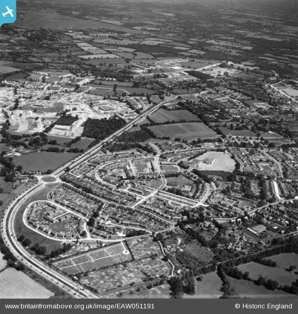
1953: Ifield Road roundabout is in the centre with West Green to the right. The loop of The Dingle, just to the right of the bypass bend, should be familiar to many, and Snell Hatch Cemetery is below this, most of which is still a patchwork of allotments at the time of the photograph. The semi circle in Ginhams Road is easily spotted too, midway between the cemetery and the school. Running across the bottom is the railway, with a slight strip of Goffs Park visible. On the far right, just below centre, is West Green School. Above the bypass is Langley Green in development and towards the top right is Gatwick.
1953: This photo is looking west and was taken from roughly above Worth Park. On the very bottom margin of the photo is the railway, with Three Bridges Station on the far left. In the bottom right corner, Hazelwick school is mid construction and on the left, Three Bridges Road heads off towards Crawley, but disappears out of shot just before half way up. Just to the right of Three Bridges Road is Gales Drive, coming off of North Road which runs horizontally across the whole picture. The by now familiar diagonal line of trees across just below centre is Northgate Avenue, with Northgate and then Langley Green beyond.
1953: A similar photo to the previous, taken from a little further west and a little further south. Tilgate Drive can now be seen bottom left and more of Three Bridges Road can be followed. We then look across Three Bridges, Northgate (after Northgate Avenue) and then Langley Green above. West Green is to the left of Langley Green. Above West Green are the still untouched fields that will become Ifield.
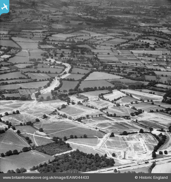
1953: The A23, with the Ifield Road roundabout, is on the left with Langley Green across the centre of the picture. Towards the bottom left corner is Deerswood (the now demolished house, rather than the school or the court) and I believe the little road above it is Little Paddocks.
1954: This is taken from roughly above Worth School looking over Pound Hill and Three Bridges. The Railway line is horizontal across the middle and Crawley Lane runs up the centre from the bottom to beat the railway. Worth Road is progress well to the left, but there is no Worth Park Avenue yet. St Mary's Drive can be seen just below the railway to the right of Crawley Lane. Worth Road can be seen breaking a line of trees which still exist, just west of Burleys Wood to the south and east of Pound Hill Parade to the north of Worth Road. The big bare patch to the right of that line was to become Moat Walk and Mount Close and Pound Hill Moat is just to the right of this area. Beyond the railway is the rest of town, previously covered on this page.
Text © Ian Mulcahy. Photographs courtesy of https://www.britainfromabove.org.uk/ Copyright acknowledged. |
|